WILLIAMSBRIDGE
The Bronx
Geographic Setting
Bounded by East 222nd Street to the north, Boston Road to the east, East Gun Hill Road to the south, and the Bronx River Parkway to the west, Williamsbridge lies in the heart of the northeast Bronx—a residential and historically rich neighborhood shaped by both its proximity to the Bronx River and its enduring sense of community. It forms part of the corridor connecting Wakefield to the north and Olinville to the south, with its long, tree-lined streets running east–west between major thoroughfares.
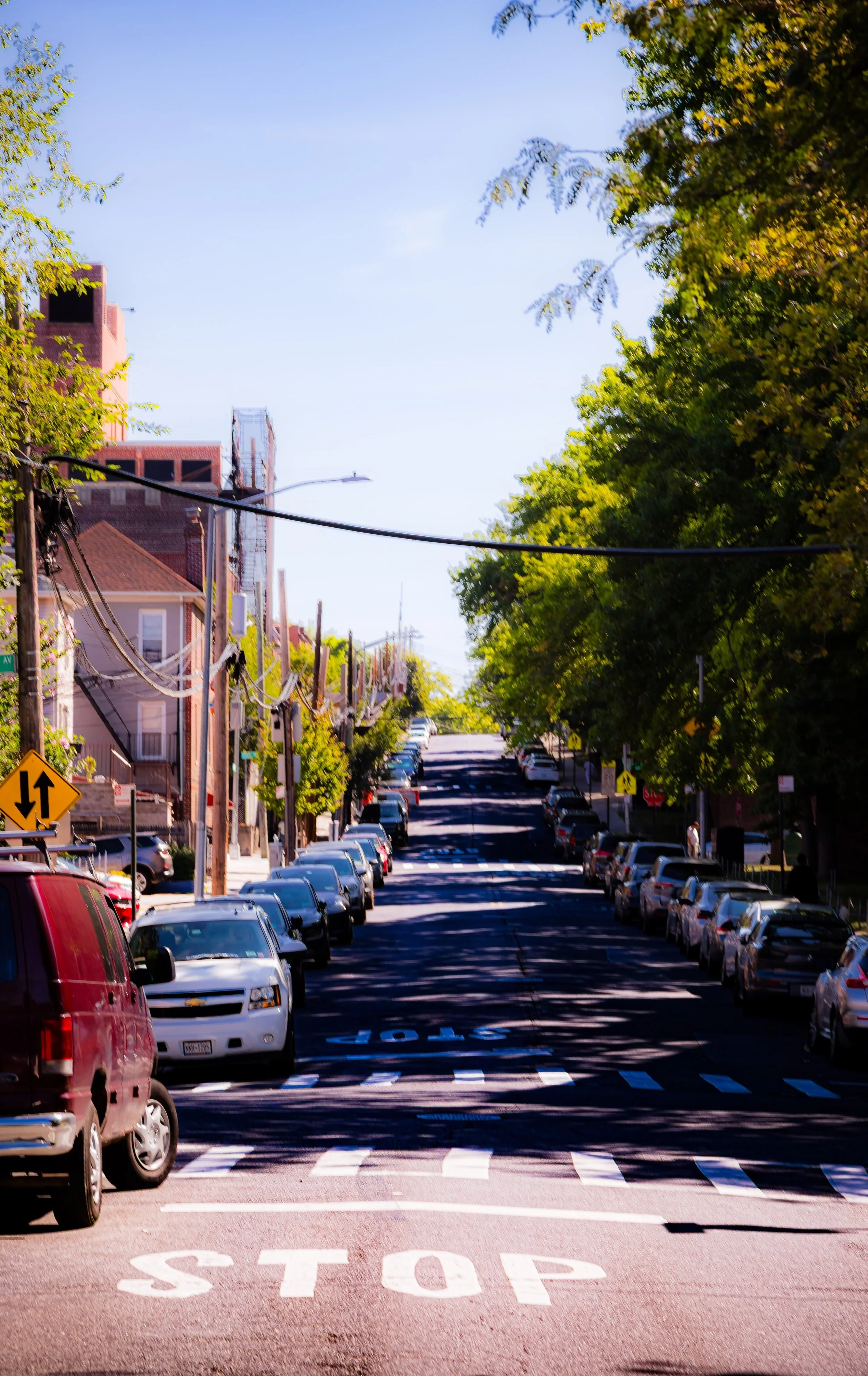
The area’s defining axes—White Plains Road, Boston Road, and Gun Hill Road—give the neighborhood its structure and vitality. White Plains Road, running north–south through its center, serves as a bustling commercial spine lined with bakeries, markets, barbershops, and restaurants that reflect the Bronx’s multicultural character. The 2 and 5 trains follow this route, with the Gun Hill Road and 219th Street stations providing direct access to Manhattan. The Bronx River Parkway and the nearby Bronx River Greenway frame the neighborhood’s western edge with green space and motion, offering both recreation and a reminder of the landscape that once defined the Bronx’s rural past.
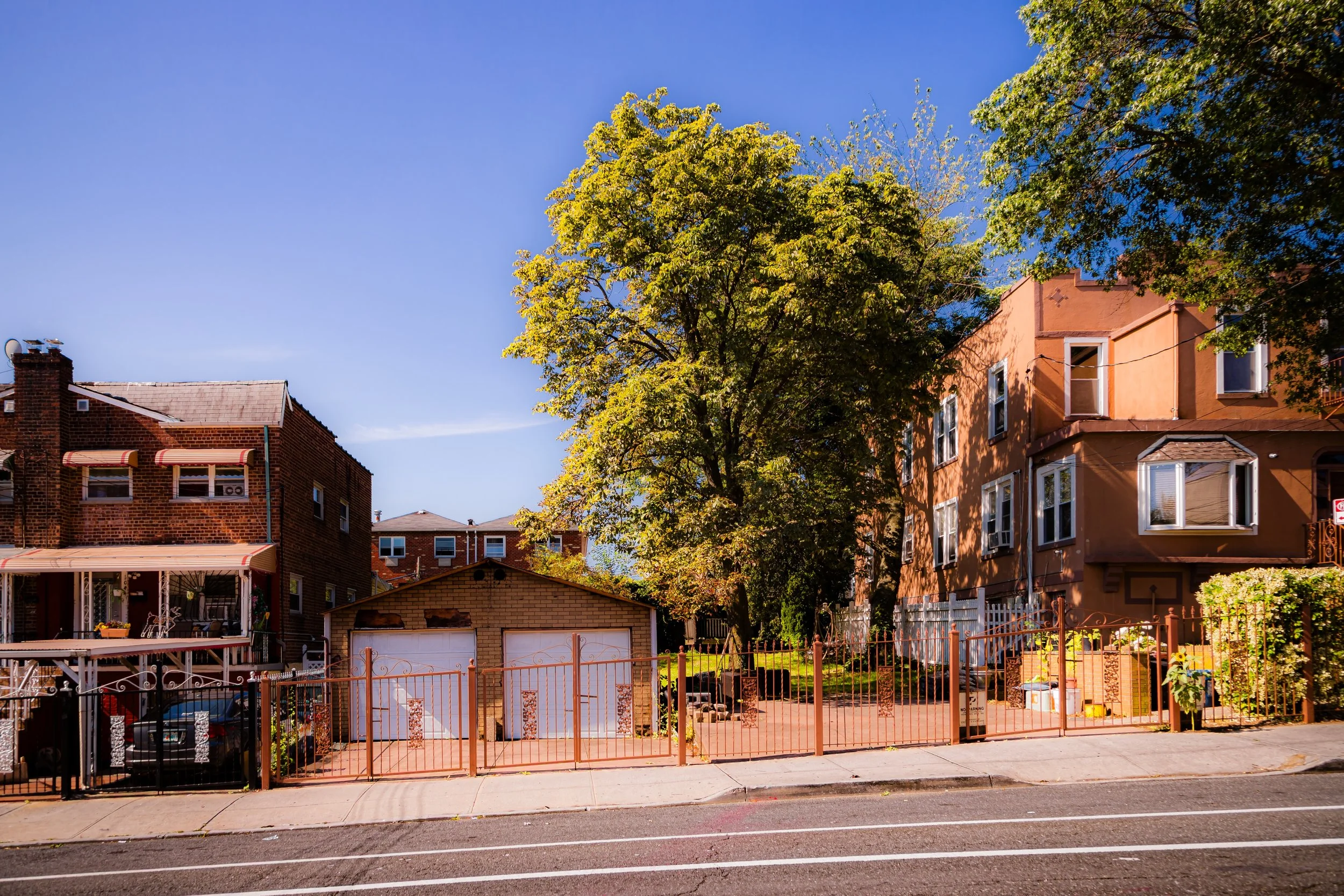
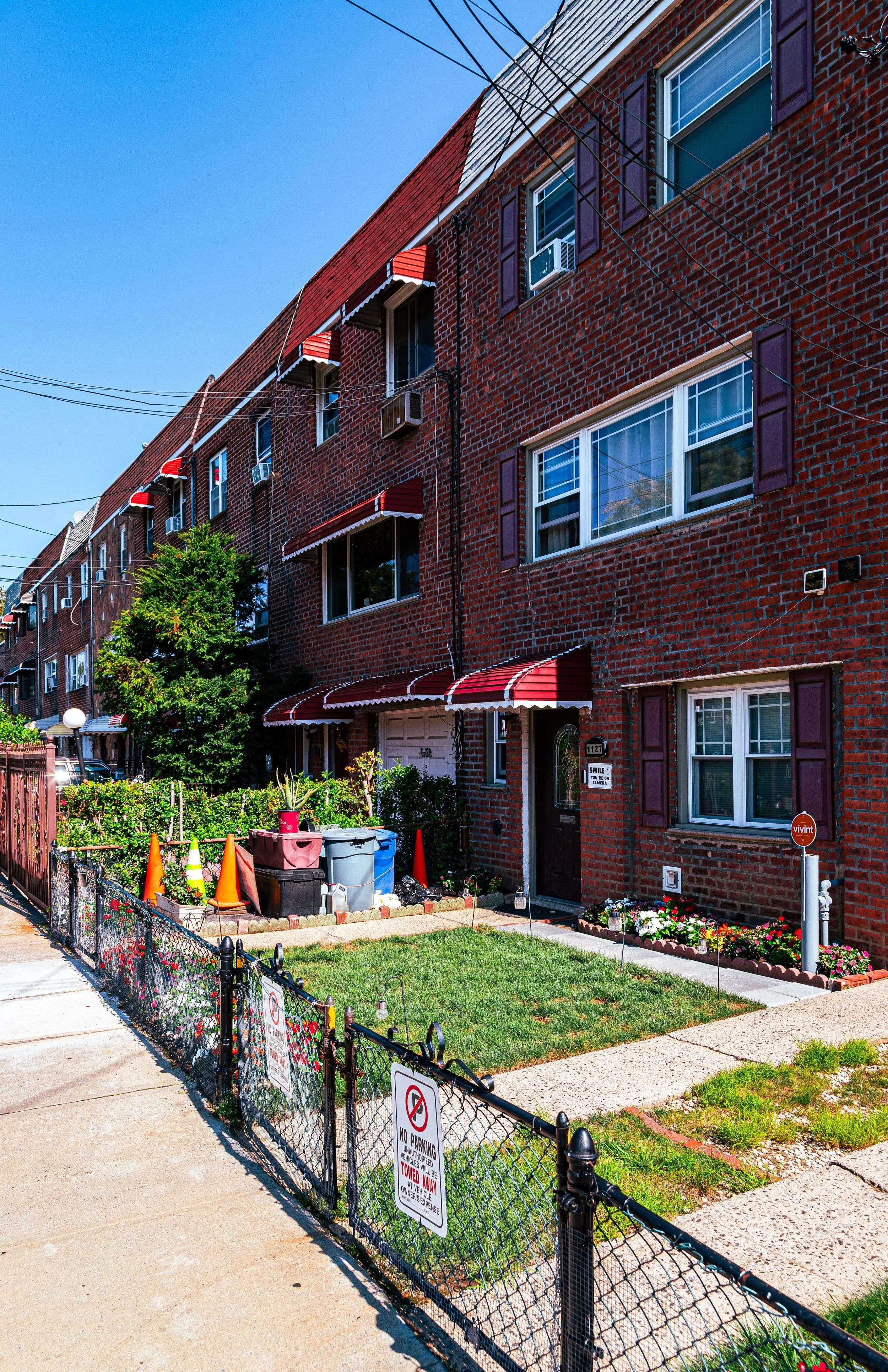
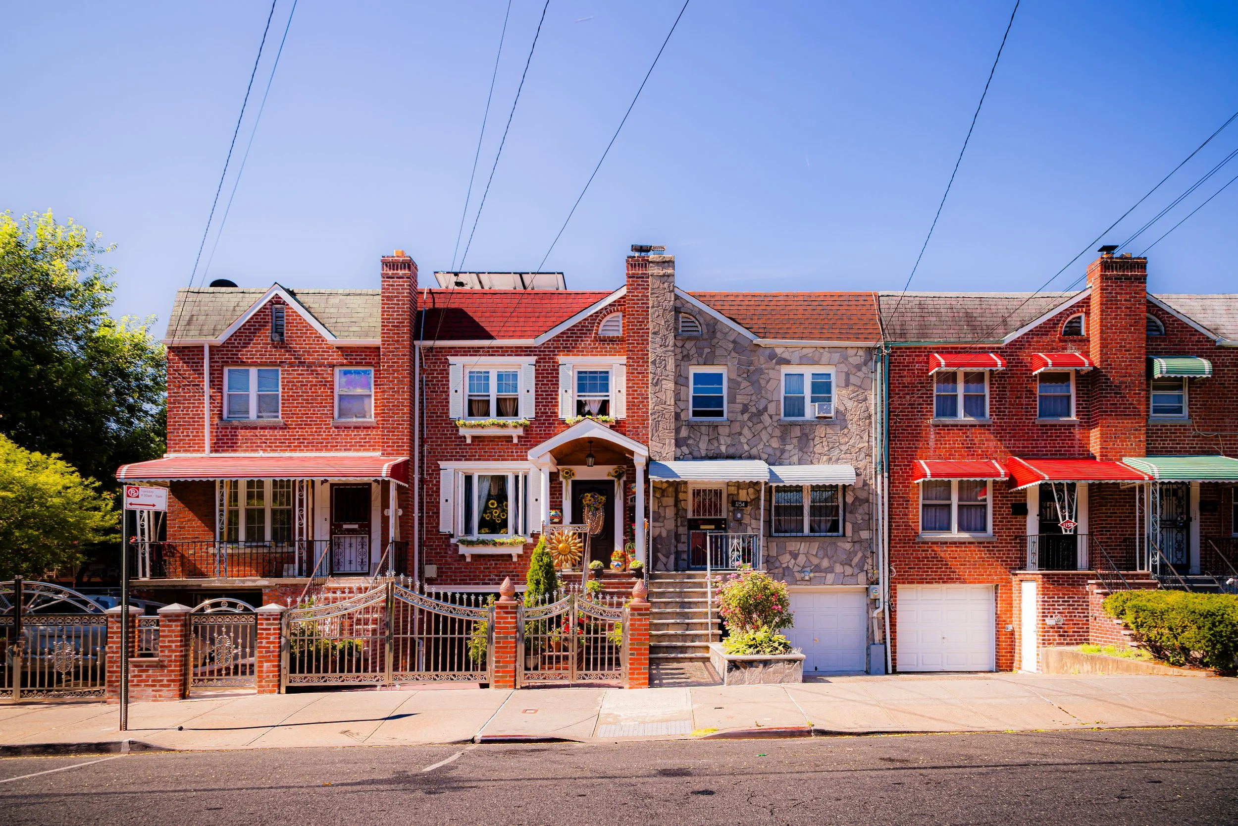
Williamsbridge today balances the quiet rhythm of a residential district—dominated by brick rowhouses, small apartment buildings, and two-family homes—with the energy of a transit-rich, culturally vibrant urban hub.
Etymology
The name “Williamsbridge” originates from a bridge built by the Williams family in the late 18th century, spanning the Bronx River and connecting what were then rural farmlands on either side. The Williams family—among the area’s earliest European settlers—owned extensive property along the river, and their bridge became a vital crossing point between the old Boston Post Road (now Boston Road) and the western Bronx.
By the mid-19th century, the surrounding district had adopted the name Williamsbridge, referring both to the physical bridge and the small hamlet that grew up around it. When the area urbanized in the early 20th century, the name endured—preserving the memory of one family’s literal connection across the Bronx River and symbolizing the neighborhood’s enduring role as a link between communities.
The Neighborhood
Origins through the 19th Century
Before urban development, the land that would become Williamsbridge was part of the Town of Westchester, an expanse of farmland and forest carved by the winding Bronx River. Indigenous Siwanoy Lenape communities once fished and hunted here, following the river’s fertile banks. In the 17th and 18th centuries, Dutch and English settlers cleared the land for agriculture, constructing mills along the river’s course and small roads leading to Boston Post Road and White Plains.
The Williams family established their homestead in the late 1700s, building a wooden bridge across the river to facilitate trade and travel. The crossing gave rise to a small rural settlement—complete with taverns, blacksmith shops, and stables—that served travelers moving between Manhattan and the northern counties.
By the mid-19th century, Williamsbridge had evolved into a modest farming and milling village, notable for its fertile soil and proximity to the Bronx River. The arrival of the New York and Harlem Railroad (1837) and later the Bronx and Pelham Parkway improvements in the 1870s brought increased accessibility, drawing both commuters and developers. When the area was annexed into New York City in 1874, it remained largely rural but poised for change, with large estates soon to be subdivided into residential tracts.
Early 20th Century: Urbanization and Community Formation
Williamsbridge’s transformation into a residential neighborhood accelerated in the early 20th century. The extension of the Interborough Rapid Transit (IRT) White Plains Road Line in 1917—today’s 2 and 5 trains—triggered a building boom, as new residents flocked to the area seeking affordable housing with direct access to Manhattan.
Developers constructed rows of two- and three-story brick houses, attached homes, and low-rise apartment buildings, many with decorative cornices and stoops that remain characteristic of the neighborhood today. The once-rural crossroads evolved into a thriving urban community centered on White Plains Road, which became lined with small businesses, groceries, and movie houses.
The population was initially composed of Italian-American, Irish, and Jewish families, many of whom moved from denser Bronx neighborhoods such as Morrisania and Melrose. Churches and civic institutions soon followed—St. Frances of Rome Church (founded 1927) and Public School 41 anchored local life, while social clubs and neighborhood associations promoted civic improvement. The neighborhood’s tree-lined streets and proximity to the newly completed Bronx River Parkway (opened 1925) made it a desirable residential district, balancing urban convenience with suburban calm.
Williamsbridge Video Coming Soon
Mid–Late 20th Century: Demographic Shifts and Urban Resilience
The post–World War II decades brought major demographic changes to Williamsbridge, mirroring trends across the Bronx. As many white middle-class families moved to Westchester and Long Island, African-American and Caribbean families—particularly from Jamaica, Barbados, Trinidad, and Grenada—moved in, drawn by the area’s solid housing and transit connections. By the 1960s, Williamsbridge had become one of the Bronx’s most stable and predominantly Black neighborhoods, known for its strong churches, civic engagement, and emphasis on education and homeownership.
The neighborhood weathered the urban crises of the 1970s with relative stability. While nearby districts experienced disinvestment and arson, Williamsbridge’s high rate of owner-occupancy and active block associations helped maintain its housing stock and community life. The Williamsbridge Oval Park, though technically just west in Norwood, served as a recreational anchor for nearby residents, while local churches—such as Grace Congregational Church and St. Frances of Rome—became centers of activism and cultural pride.
The 1980s and 1990s brought renewed challenges, including economic hardship and crime, but also community-driven revitalization. Residents and local organizations worked to restore housing, improve safety, and support youth programming. The result was a neighborhood that remained livable, rooted in faith, family, and self-reliance even during the Bronx’s hardest decades.
21st Century: Diversity, Renewal, and Continuity
In the 21st century, Williamsbridge has emerged as a model of Bronx resilience and quiet renewal. The neighborhood’s population is now a vibrant mix of Caribbean-American, African-American, Latino, West African, and South Asian residents, many of whom maintain the same commitment to homeownership and community that defined the area a century earlier.
Ongoing investment has improved both infrastructure and quality of life. White Plains Road continues to thrive as a commercial corridor, with small businesses reflecting global cultures—from Jamaican patties to Nigerian groceries and Dominican barbershops. Nearby, the Bronx River Greenway provides walking and cycling paths along the revitalized river, reconnecting residents with the natural landscape that gave the area its name.
The community remains closely knit, with block parties, church festivals, and civic meetings preserving the neighborhood’s traditional sense of local pride. Williamsbridge Oval Park, though just beyond its western border, continues to serve as a recreational and cultural gathering place, symbolizing the area’s enduring commitment to open space and family life.
Williamsbridge Photo Gallery
Spirit and Legacy
The spirit of Williamsbridge is one of perseverance, neighborliness, and quiet dignity. Born of a literal bridge across the Bronx River, the neighborhood has long embodied connection—between city and suburb, old and new, and among the many cultures that have called it home.
Its legacy is written in its architecture and atmosphere: the steady rows of brick homes, the laughter spilling from corner bakeries, and the hum of trains along White Plains Road. More than a name on a map, Williamsbridge represents a century of Bronx identity—where generations have worked, worshipped, and raised families amid change yet continuity.
New York City
Use this custom Google map to explore where every neighborhood in all five boroughs of New York City is located.
The Five Boroughs
One of New York City’s unique qualities is its organization in to 5 boroughs: Manhattan, Brooklyn, Queens, The Bronx, and Staten Island. These boroughs are part pragmatic administrative districts, and part vestiges of the region’s past. Each borough is an entire county in New York State - in fact, Brooklyn is, officially, Kings County, while Staten Island is, officially Richmond County. But that’s not the whole story …
Initially, New York City was located on the southern tip of Manhattan (now the Financial District) that was once the Dutch colony of New Amsterdam. Across the East River, another city was rising: Brooklyn. In time, the city planners realized that unification between the rapidly rising cities would create commercial and industrial opportunities - through streamlined administration of the region.
So powerful was the pull of unification between New York and Brooklyn that three more counties were pulled into the unification: The Bronx, Queens, and Staten Island. And on January 1, 1898, the City of New York unified two cities and three counties into one Greater City of New York - containing the five boroughs we know today.
But because each borough developed differently and distinctly until unification, their neighborhoods likewise uniquely developed. Today, there are nearly 390 neighborhoods, each with their own histories, cultures, cuisines, and personalities - and each with residents who are fiercely proud of their corner of The Big Apple.


