
BEDFORD-STUYVESANT
Brooklyn
Geographic Setting
Bounded by Classon Avenue to the west, Flushing Avenue to the north, and Broadway to the east (with its southern edge conventionally extending to Atlantic Avenue), Bedford–Stuyvesant—often affectionately known as Bed-Stuy—forms the historic and cultural heart of central Brooklyn. The neighborhood occupies a vast plateau between the industrial lowlands of Williamsburg and the residential expanses of Crown Heights, its streets laid in a classic 19th-century grid punctuated by brownstone rows, tree-lined avenues, and landmarks of faith and community.
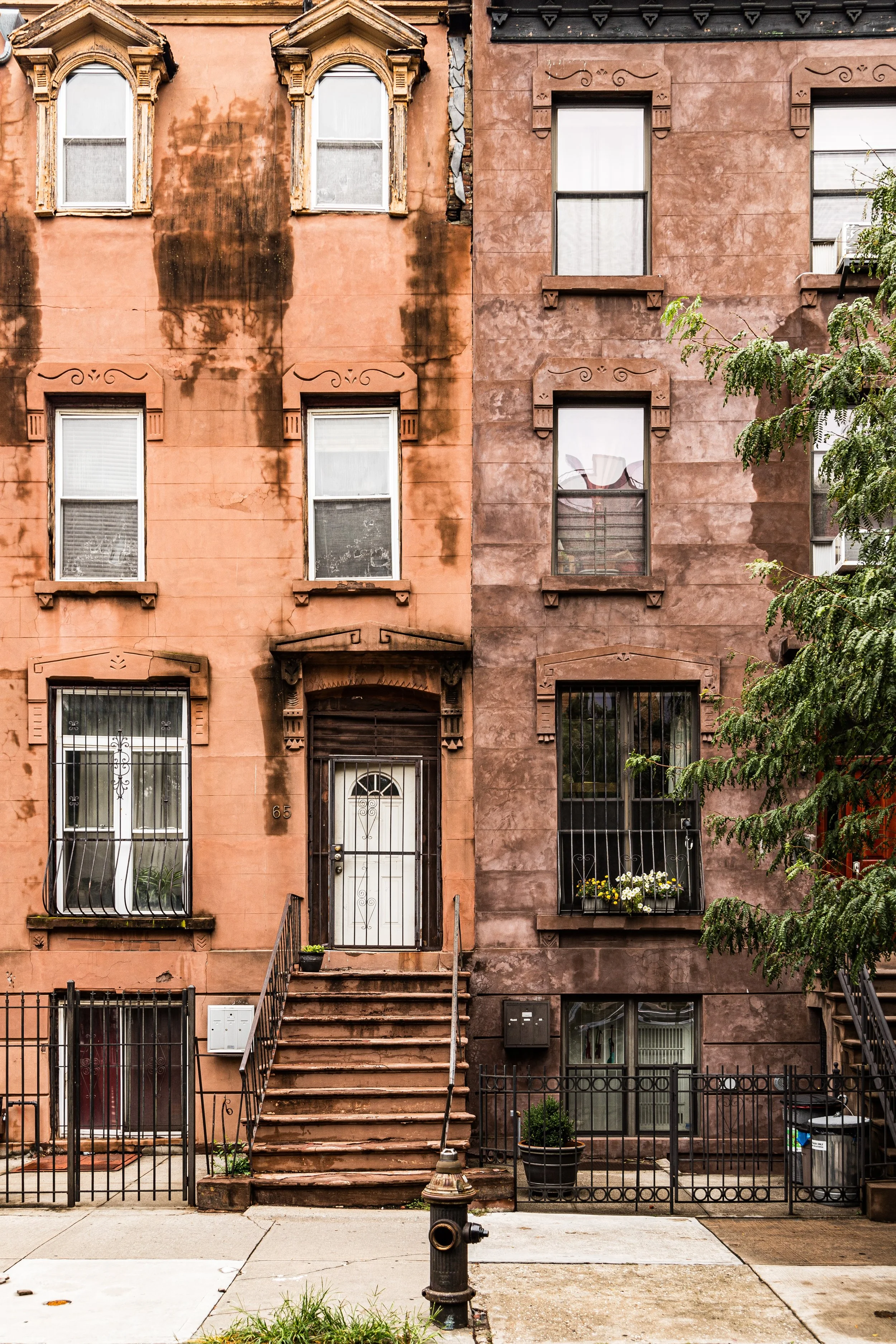
At its core, Bedford Avenue and Stuyvesant Avenue converge as the twin spines of the district, flanked by architectural splendor: rows of Italianate, Neo-Grec, and Romanesque Revival brownstones built between 1870 and 1910. Grand thoroughfares—Fulton Street, Nostrand Avenue, and Tompkins Avenue—carry the hum of daily life, while side streets reveal a quieter dignity, with stoops shaded by elms and churches rising at nearly every corner. The neighborhood’s scale, beauty, and civic energy make it both an architectural treasure and one of the most storied centers of African American life in the United States.
Etymology and Origins
Bedford–Stuyvesant’s dual name reflects its composite history: Bedford, once a colonial hamlet established in the 1660s as part of the old Town of Brooklyn, and Stuyvesant Heights, developed two centuries later and named after Peter Stuyvesant, the last Dutch Director-General of New Netherland. The fusion of these two adjacent districts—Bedford’s 18th-century farmlands and Stuyvesant’s 19th-century residential expansion—created the framework for the modern neighborhood.
By the mid-19th century, Bedford had become a commuter suburb, connected to downtown Brooklyn and Manhattan by stagecoach and later by trolley. Developers saw opportunity in its open tracts and high ground. The 1870s–1890s brought speculative building on an extraordinary scale: elegant brownstone and limestone rowhouses, many designed by Brooklyn’s leading architects, transformed the area into one of the city’s premier middle-class districts.
The Neighborhood
19th Century: The Brownstone Boom
Between 1870 and 1910, Bedford–Stuyvesant experienced one of the largest residential construction booms in American urban history. Row upon row of four-story brownstones rose between Fulton Street and Halsey Street, with variations of Italianate, Queen Anne, and Renaissance Revival styles creating a unified yet intricate architectural rhythm. Ornate cornices, carved lintels, and deep front stoops became neighborhood hallmarks.
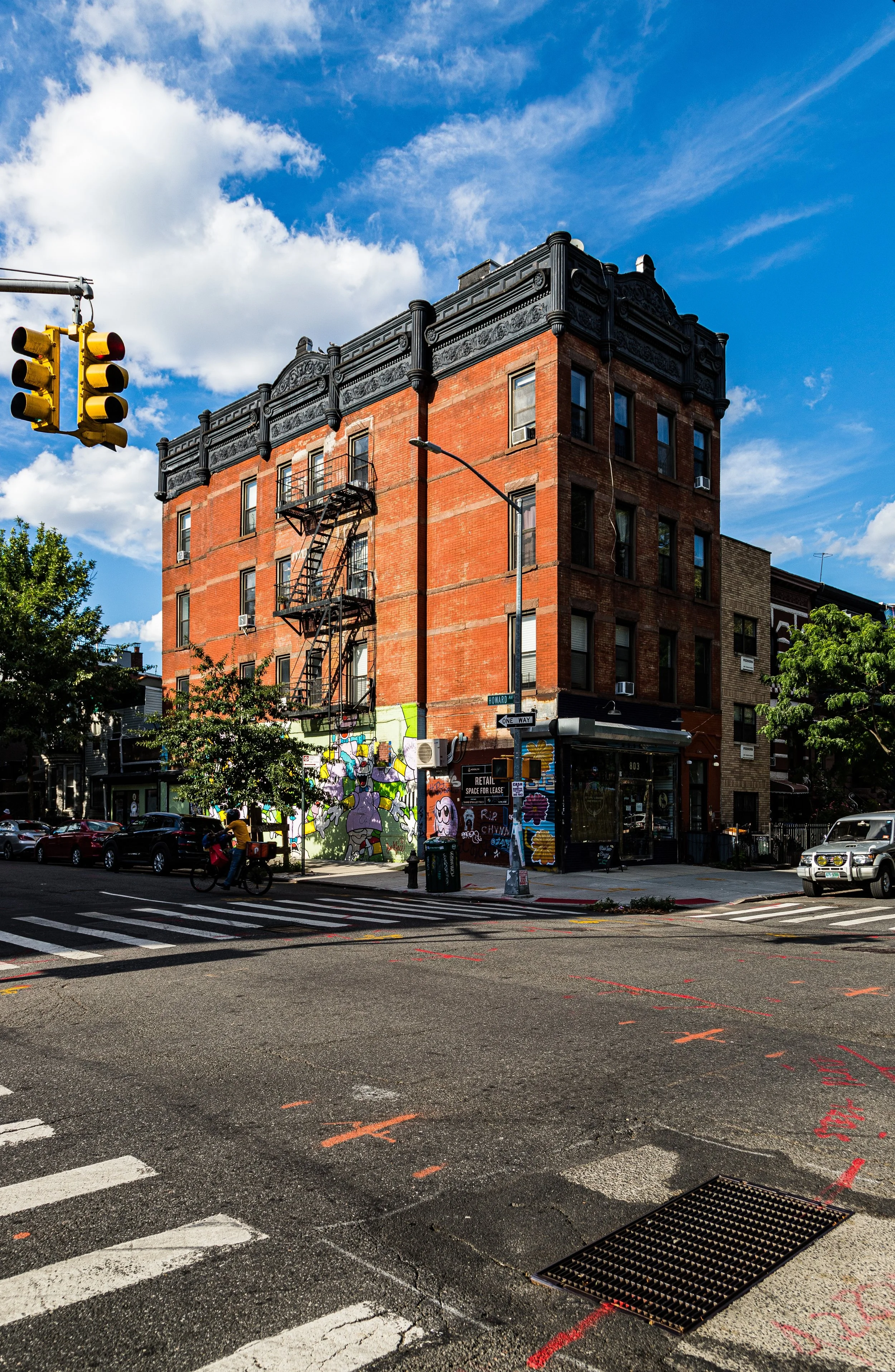
The extension of elevated railways—particularly along Fulton Street (1888) and Broadway (1889)—brought prosperity and easy access to downtown Brooklyn and the East River ferries. Wealthy merchants, lawyers, and civil servants settled here, and Bedford became known as the “Brooklyn West Side.” Churches such as Our Lady of Victory (1895) and St. Philip’s Episcopal (1899)—Brooklyn’s first Black Episcopal congregation—anchored both spiritual and civic life.
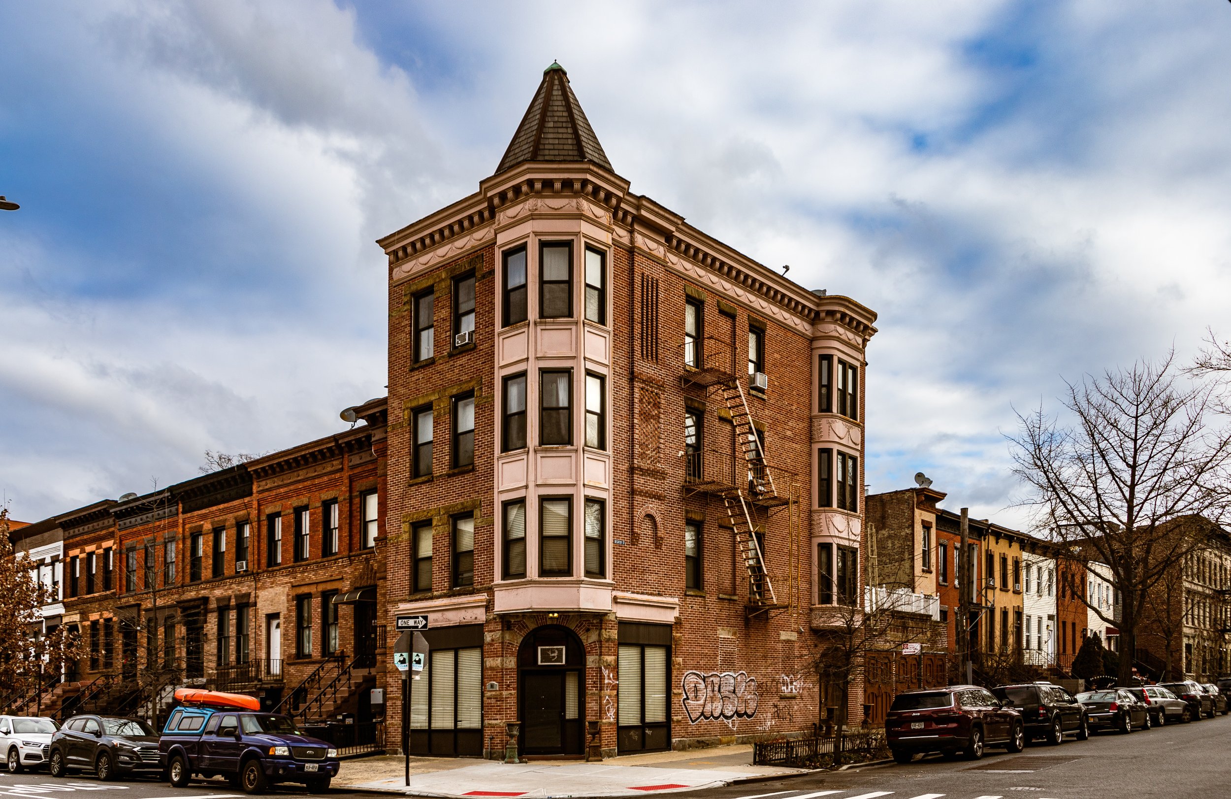
At the same time, developers marketed Stuyvesant Heights, east of Tompkins Avenue, as a more refined residential enclave, its broad boulevards lined with stone mansions and landscaped medians. Together, Bedford and Stuyvesant Heights embodied late Victorian urban grace—a vision of brownstone Brooklyn at its peak.
Early–Mid 20th Century: Migration, Culture, and Community
The early 20th century brought profound demographic shifts. The Great Migration of African Americans from the South, coupled with Caribbean immigration, reshaped Bedford–Stuyvesant’s identity. By the 1930s–1940s, as Harlem became crowded and rents rose, Black families moved south across the river to Bed-Stuy, drawn by affordable housing and strong church networks.
Though discriminatory lending practices and redlining by banks and realtors concentrated Black residents within the neighborhood’s boundaries, the community built a self-sustaining world. By 1950, Bed-Stuy was home to one of the largest African American populations in the nation—a crucible of music, enterprise, and activism. Institutions such as the YWCA on Tompkins Avenue, the Bethany Baptist Church, and the Magnolia Tree Earth Center became anchors of empowerment and education.
During this period, the neighborhood also endured economic decline. Many landlords abandoned properties; unemployment rose as manufacturing left Brooklyn. Yet amid hardship, culture thrived. Jazz legends like Lena Horne, Max Roach, and Thelonious Monk lived or performed here. Fulton Street storefronts buzzed with small businesses—record shops, bakeries, and haberdasheries—that formed the backbone of local pride.
Bedford-Stuyvesant Photographic Video
Late 20th Century: Activism and Renaissance
By the 1960s–1970s, Bedford–Stuyvesant had become synonymous with both the challenges and the resilience of urban America. Residents organized block associations, tenant unions, and social programs to counter neglect. Foremost among these efforts was the Bedford-Stuyvesant Restoration Corporation (founded 1967)—the nation’s first community development corporation—spearheaded by Robert F. Kennedy and local leaders. Its mission was transformative: to restore housing, create jobs, and channel public and private investment directly into the neighborhood.
Restoration Plaza, on Fulton Street, became both a literal and symbolic center—a hub for the arts, small business, and civic renewal. Murals, jazz festivals, and street fairs celebrated Black identity and urban self-determination. Despite continued struggles with poverty and disinvestment through the 1980s, Bed-Stuy nurtured one of the city’s strongest traditions of neighborhood activism. Its stoops, churches, and parks remained stages for cultural expression and community unity.
21st Century: Preservation and Change
In the 21st century, Bedford–Stuyvesant stands at the crossroads of preservation and transformation. Its brownstone blocks—long undervalued—have become some of New York’s most desirable historic streetscapes. Restoration of prewar homes, landmark designations, and renewed investment have revitalized the neighborhood, while the arrival of new residents has brought both opportunity and tension around affordability and identity.
Still, Bed-Stuy’s cultural core endures. The rhythms of Gospel Sundays, the aroma of Caribbean takeout along Nostrand Avenue, and the laughter from stoops on MacDonough Street testify to the neighborhood’s living continuity. Community gardens, block parties, and youth arts programs sustain its legacy of activism and creativity. Historic districts such as Stuyvesant Heights (designated 1971) and Bedford Corners (2015) protect its architectural patrimony, ensuring that the stone and brick eloquence of its past remains part of its future.
Bedford-Stuyvesant Photo Gallery
Spirit and Legacy
Bedford–Stuyvesant’s legacy is that of a neighborhood that built power from within. From its 19th-century brownstones to its 20th-century movements for equity and dignity, it embodies both the architectural beauty and the social conscience of Brooklyn itself. Here, artistry and activism share the same block; resilience and renaissance are not opposites, but constants.
New York City
Use this custom Google map to explore where every neighborhood in all five boroughs of New York City is located.
The Five Boroughs
One of New York City’s unique qualities is its organization in to 5 boroughs: Manhattan, Brooklyn, Queens, The Bronx, and Staten Island. These boroughs are part pragmatic administrative districts, and part vestiges of the region’s past. Each borough is an entire county in New York State - in fact, Brooklyn is, officially, Kings County, while Staten Island is, officially Richmond County. But that’s not the whole story …
Initially, New York City was located on the southern tip of Manhattan (now the Financial District) that was once the Dutch colony of New Amsterdam. Across the East River, another city was rising: Brooklyn. In time, the city planners realized that unification between the rapidly rising cities would create commercial and industrial opportunities - through streamlined administration of the region.
So powerful was the pull of unification between New York and Brooklyn that three more counties were pulled into the unification: The Bronx, Queens, and Staten Island. And on January 1, 1898, the City of New York unified two cities and three counties into one Greater City of New York - containing the five boroughs we know today.
But because each borough developed differently and distinctly until unification, their neighborhoods likewise uniquely developed. Today, there are nearly 390 neighborhoods, each with their own histories, cultures, cuisines, and personalities - and each with residents who are fiercely proud of their corner of The Big Apple.


