
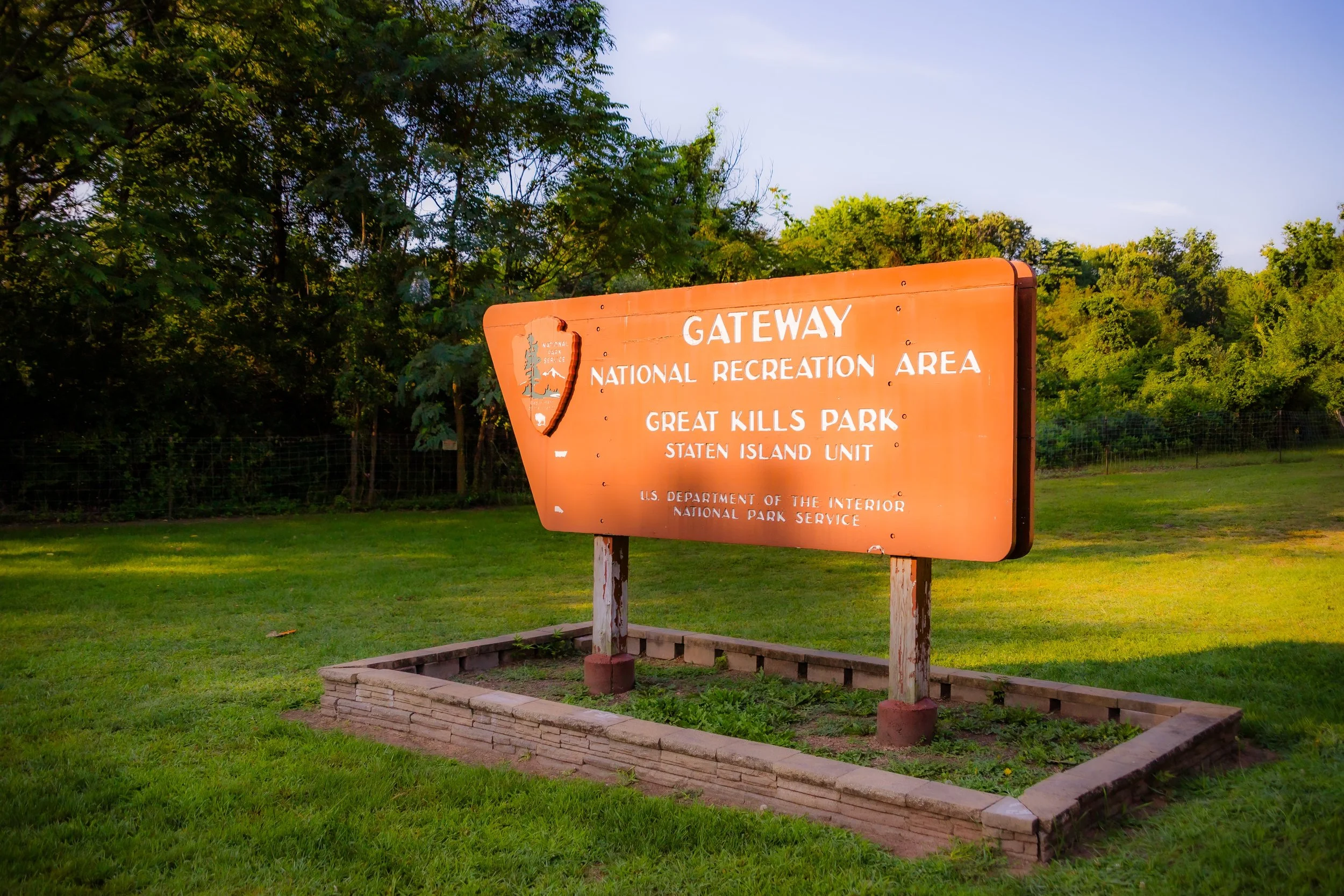
GREAT KILLS PARK
Staten Island
Geographic Setting
Great Kills Park spans nearly 580 acres along Staten Island’s southeastern shore, forming the southernmost section of Gateway National Recreation Area’s Staten Island Unit. Bounded by Hylan Boulevard to the northwest, New Creek and Oakwood Beach to the northeast, Raritan Bay to the south, and the Great Kills Harbor and Marina to the southwest, the park extends outward into the bay as a long, sandy peninsula enclosing Great Kills Harbor.
This varied landscape encompasses tidal salt marshes, sand dunes, maritime forests, open meadows, and wide beaches, all framed by sweeping views of Raritan Bay and the Atlantic horizon. The park’s interior features grasslands and nature trails, while its southern shoreline gives way to a four-mile stretch of sandy waterfront popular for swimming, boating, and fishing. The Great Kills Marina, located within the park, serves as a major recreational boating hub for Staten Island and the greater New York region. Together, land and sea make Great Kills Park a living expression of Staten Island’s coastal identity—a rare fusion of natural beauty, maritime heritage, and urban accessibility.
Etymology
The name Great Kills originates from the Dutch word “kill,” meaning “creek” or “channel,” reflecting the area’s network of tidal inlets that once cut through the southern shore. Early settlers used “Great Kills” to distinguish the wide, navigable waterways of this district from the smaller streams elsewhere on Staten Island. The park preserves this historic toponym, linking the modern recreation area to the geography that defined the island’s earliest life and commerce.
Within local lore, the name also evokes the area’s dual nature: both grand (“great”) in its sweeping bayfront vistas and intimately tied to the small channels (“kills”) that sustain its ecology.
The Neighborhood
Origins through the 19th Century: From Tidal Marsh to Maritime Village
Long before its designation as parkland, the area now comprising Great Kills Park formed part of a vast estuarine landscape at the mouth of Lemon Creek and New Creek, where freshwater met the tidal Raritan Bay. The Lenape peoples, Staten Island’s original inhabitants, fished and harvested shellfish along these shores for millennia. By the 17th and 18th centuries, European settlers established farms and small docks along the creeks, taking advantage of the fertile marshland and protected harbor.
Throughout the 1800s, Great Kills developed as a maritime village. Its deep, natural harbor became a center for oystering, clamming, and coastal shipping. Families such as the Poillons and Seguines operated farms and boatyards nearby, while small resorts and inns catered to summer visitors seeking escape from the city. The surrounding wetlands teemed with birdlife, and Lemon Creek supported one of the most productive oyster fisheries in New York Harbor.
By the late 19th century, Great Kills had become a modest seaside community served by the Staten Island Railway, which brought day-trippers from Manhattan to the beaches and boarding houses. The peninsula that would become Great Kills Park remained largely undeveloped, a mixture of dunes, grasses, and tidal flats used occasionally for grazing or shellfishing.
Early 20th Century: Park Planning and Coastal Development
The idea of transforming the Great Kills shoreline into a public park dates to the early 20th century, when New York City planners began acquiring coastal tracts for recreation and flood control. In 1929, under the guidance of Parks Commissioner Robert Moses, the city initiated plans for a major waterfront park that would provide access to Staten Island’s southeastern beaches. Land reclamation efforts began in the 1930s, filling marshland to create athletic fields, roads, and parking areas. The Works Progress Administration (WPA) aided in early construction, though large-scale development was delayed by World War II.
By the 1950s, Great Kills Park had become a favorite destination for Staten Islanders and Brooklyn families alike. Paved drives, picnic areas, and a marina drew visitors in summer months, while the wide beaches along Raritan Bay offered swimming and sunbathing. The park’s design emphasized automobile access, with long scenic roads and ample parking typical of midcentury recreational planning. At the same time, much of the interior remained open space—a landscape of dunes and wild grasses that retained the spirit of the shore before development.
Great Kills Park Video Coming Soon

Mid–Late 20th Century: Gateway to the Harbor
The most significant transformation came in 1972, when the park was incorporated into the newly created Gateway National Recreation Area, one of the first urban national parks in the United States. Under the management of the National Park Service, Great Kills Park became part of a larger network that included Fort Wadsworth, Miller Field, and Sandy Hook in New Jersey. This transition marked a shift from municipal recreation to national conservation, emphasizing ecological preservation alongside public use.
In the decades that followed, the park evolved as both natural habitat and recreation space. The Great Kills Marina, rebuilt and expanded in the 1970s, accommodated hundreds of boats, while fishing piers and boat launches welcomed sport anglers. Picnic groves, playgrounds, and ballfields attracted families, while the beaches remained popular with swimmers. Yet the park’s wild edges—its marshes and meadows—also became critical ecological zones, offering nesting grounds for ospreys, egrets, and herons.
Environmental challenges persisted, including coastal erosion, storm damage, and pollution in nearby waterways. The park’s low-lying terrain made it vulnerable to flooding and habitat loss, especially as urban runoff and development upstream altered hydrology. Nevertheless, community groups and conservationists began restoring wetlands and monitoring wildlife, laying the foundation for modern ecological stewardship.
21st Century: Renewal, Resilience, and Ecology
In the 21st century, Great Kills Park embodies both the promise and fragility of New York City’s coastal environment. The park’s open landscapes and harborfront views have gained new significance as the city confronts climate change and rising sea levels. Hurricane Sandy (2012) devastated parts of the park—destroying sections of the marina, eroding dunes, and flooding inland areas—but it also galvanized restoration efforts that continue today.
The National Park Service and local partners have focused on habitat restoration, shoreline stabilization, and sustainable recreation. The park’s salt marshes now serve as vital buffers against storm surge, while dune grass plantings and living shoreline projects help protect both wildlife and infrastructure. The Great Kills Park Environmental Restoration Plan, launched in collaboration with the U.S. Army Corps of Engineers, aims to rebuild native habitats, restore tidal flow, and enhance resilience in the face of future storms.
Public engagement remains central to the park’s renewal. Educational programs, birdwatching tours, and volunteer cleanup events foster community stewardship. The Harbor Estuary Program and Urban Park Rangers lead ecological walks that connect visitors to the area’s natural and maritime heritage. Recreational access has expanded to include biking trails, kayaking routes through the harbor, and seasonal events that highlight the park’s unique blend of wilderness and waterfront recreation.
Today, Great Kills Park stands not merely as a place of leisure but as a living classroom—a dynamic landscape where ecology, history, and public life intersect.
Great Kills Park Photo Gallery
Spirit and Legacy
The spirit of Great Kills Park lies in its dual identity: both a playground and a preserve, both a site of recreation and renewal. It embodies Staten Island’s deep connection to the sea—the tide-driven pulse that has shaped the borough’s identity since the first Lenape canoes and Dutch sloops plied these waters. Its sandy shores and sweeping vistas remind New Yorkers that even within their vast metropolis, the ocean is never far away.
The park’s legacy is one of resilience and reclamation. From marshland to recreation area, from storm-wracked coastline to restored habitat, Great Kills Park reflects the ongoing dialogue between nature and city. Its beaches and meadows stand as testaments to both human vision and ecological endurance.
New York City
Use this custom Google map to explore where every neighborhood in all five boroughs of New York City is located.
The Five Boroughs
One of New York City’s unique qualities is its organization in to 5 boroughs: Manhattan, Brooklyn, Queens, The Bronx, and Staten Island. These boroughs are part pragmatic administrative districts, and part vestiges of the region’s past. Each borough is an entire county in New York State - in fact, Brooklyn is, officially, Kings County, while Staten Island is, officially Richmond County. But that’s not the whole story …
Initially, New York City was located on the southern tip of Manhattan (now the Financial District) that was once the Dutch colony of New Amsterdam. Across the East River, another city was rising: Brooklyn. In time, the city planners realized that unification between the rapidly rising cities would create commercial and industrial opportunities - through streamlined administration of the region.
So powerful was the pull of unification between New York and Brooklyn that three more counties were pulled into the unification: The Bronx, Queens, and Staten Island. And on January 1, 1898, the City of New York unified two cities and three counties into one Greater City of New York - containing the five boroughs we know today.
But because each borough developed differently and distinctly until unification, their neighborhoods likewise uniquely developed. Today, there are nearly 390 neighborhoods, each with their own histories, cultures, cuisines, and personalities - and each with residents who are fiercely proud of their corner of The Big Apple.


