OCEAN BREEZE
Staten Island
Geographic Setting
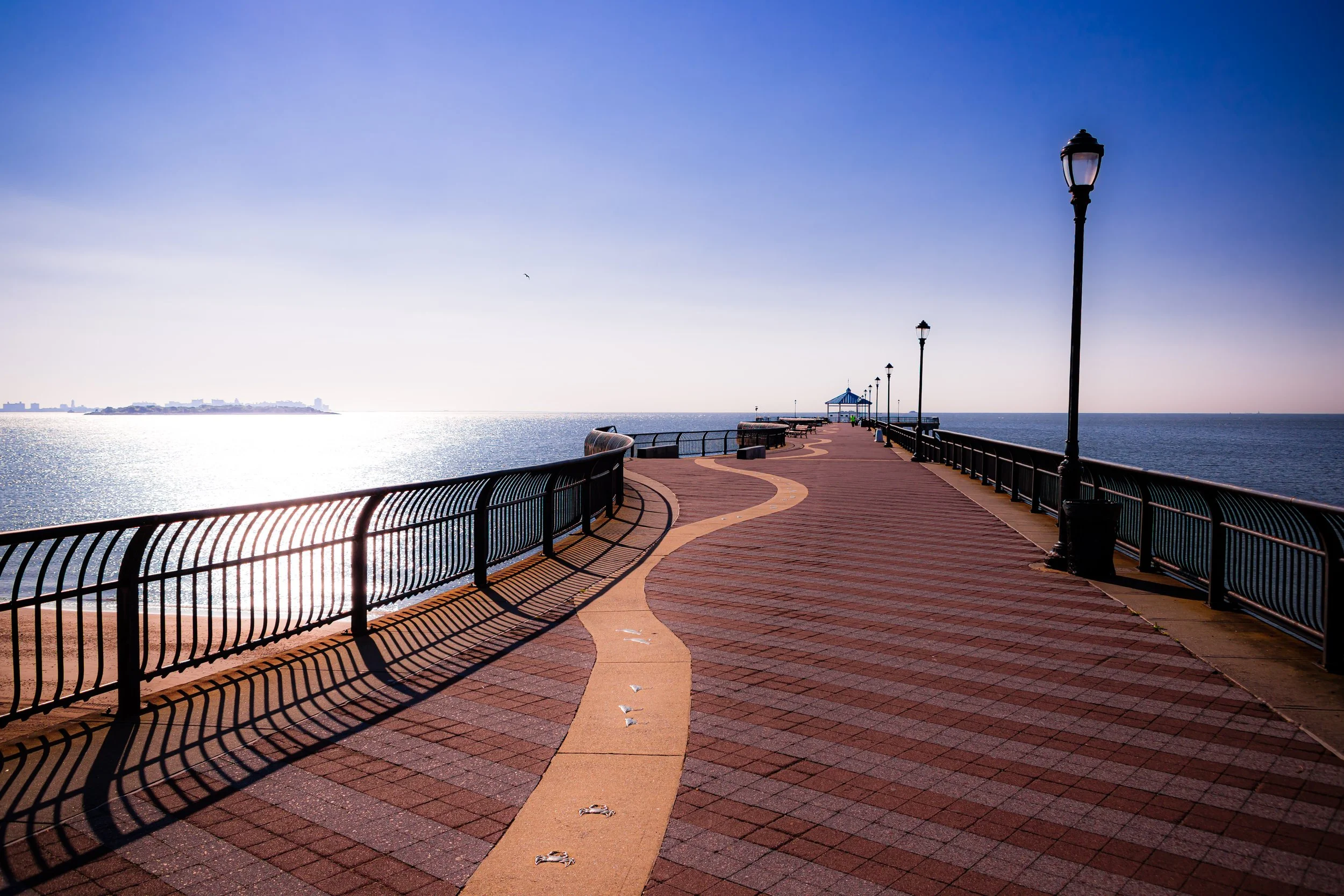
Ocean Breeze Park occupies a stretch of Staten Island’s southeastern shoreline between Midland Beach and South Beach, bounded roughly by Quintard Street and Mason Avenue to the west, Father Capodanno Boulevard to the north, Seaview Avenue and the Franklin D. Roosevelt Boardwalk to the east, and Sand Lane and New Creek to the south. The park’s 110 acres form a coastal plain of dunes, wetlands, and open athletic fields that bridge the line between natural ecosystem and urban recreation.
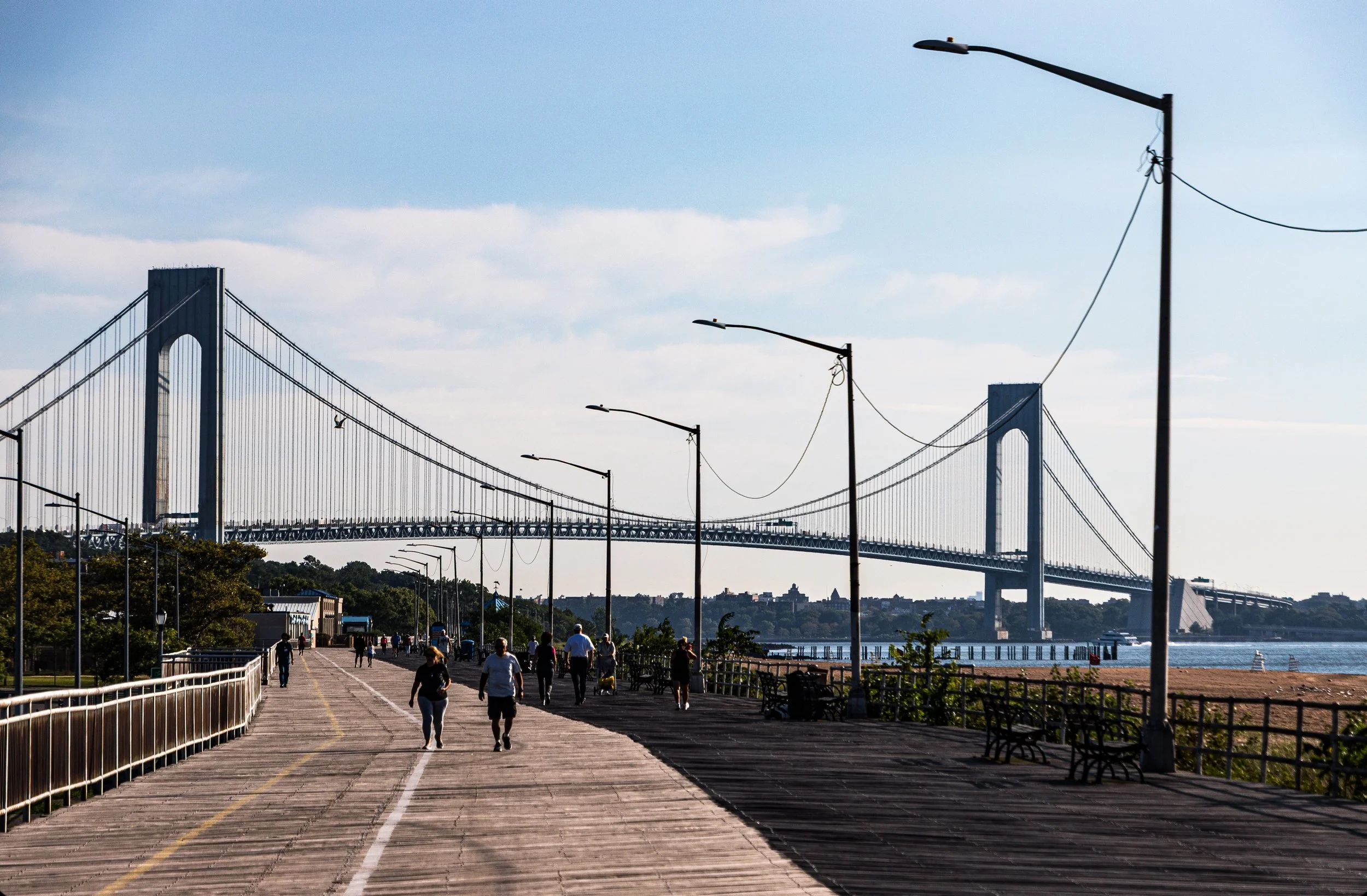
Facing the Lower New York Bay, the park commands expansive views toward the Verrazzano-Narrows Bridge and the Atlantic horizon beyond. Inland, the land gradually rises toward the neighborhoods of Midland Beach and Dongan Hills, while to the north it merges with the South Beach–Franklin D. Roosevelt Boardwalk, a 2.5-mile promenade dating to the 1930s. Together, these spaces compose one of New York City’s most significant coastal recreation corridors—part of a continuous waterfront stretching from Fort Wadsworth to Great Kills Park.
Within its bounds, Ocean Breeze Park embodies dual identities: a modern sports and community complex anchored by the Ocean Breeze Athletic Facility, and a sensitive ecological preserve of restored dunes and tidal wetlands that buffer the city from storm surge. It is both a place of endurance and renewal—an open-air testament to Staten Island’s long relationship with the sea.
Etymology
The name Ocean Breeze has been associated with this area since the early 20th century, when developers and civic boosters sought to evoke its seaside character and healthy maritime air. The phrase first appeared in land promotions for summer cottages and beach pavilions that dotted the Staten Island shore in the early 1900s. Over time, “Ocean Breeze” became shorthand for the coastal stretch east of Dongan Hills—a place where the salt wind carried both the promise of leisure and the perils of the sea.
When New York City formally established the park in the late 20th century, the name was retained as a nod to its natural setting and the cooling winds that sweep across the bay. Today, it captures both continuity and transformation—a landscape shaped by the same ocean breezes that once drew vacationers more than a century ago.
The Neighborhood
Origins through the 19th Century: From Wetlands to Seaside Village
Before its urbanization, the area now known as Ocean Breeze was a tidal marsh threaded by creeks that drained into the Lower Bay. For millennia, the Lenape people fished and harvested shellfish along these shores, relying on the rich estuarine ecosystems of the southern harbor. European settlers in the 17th and 18th centuries reclaimed portions of the marsh for salt hay and grazing land but left much of it undeveloped due to frequent flooding and the shifting shoreline.
By the mid-19th century, Staten Island’s eastern shore had begun to attract visitors seeking relief from Manhattan’s summer heat. Modest resorts and boarding houses appeared along South Beach and Midland Beach, while the land between them—today’s Ocean Breeze—remained semi-wild, with dunes, creeks, and patches of upland forest. Early maps refer to the area as part of Old Town Marsh or New Creek Meadows, indicating its transitional state between land and water.
As the 19th century drew to a close, the growing popularity of Staten Island’s beaches brought trolley lines and small amusement piers to nearby South Beach. The Ocean Breeze area, though less developed, provided open space for picnics, fishing, and seaside walks—a natural buffer between the denser resort strips and the quiet residential zones inland.
Early to Mid-20th Century: Seaside Recreation and Decline
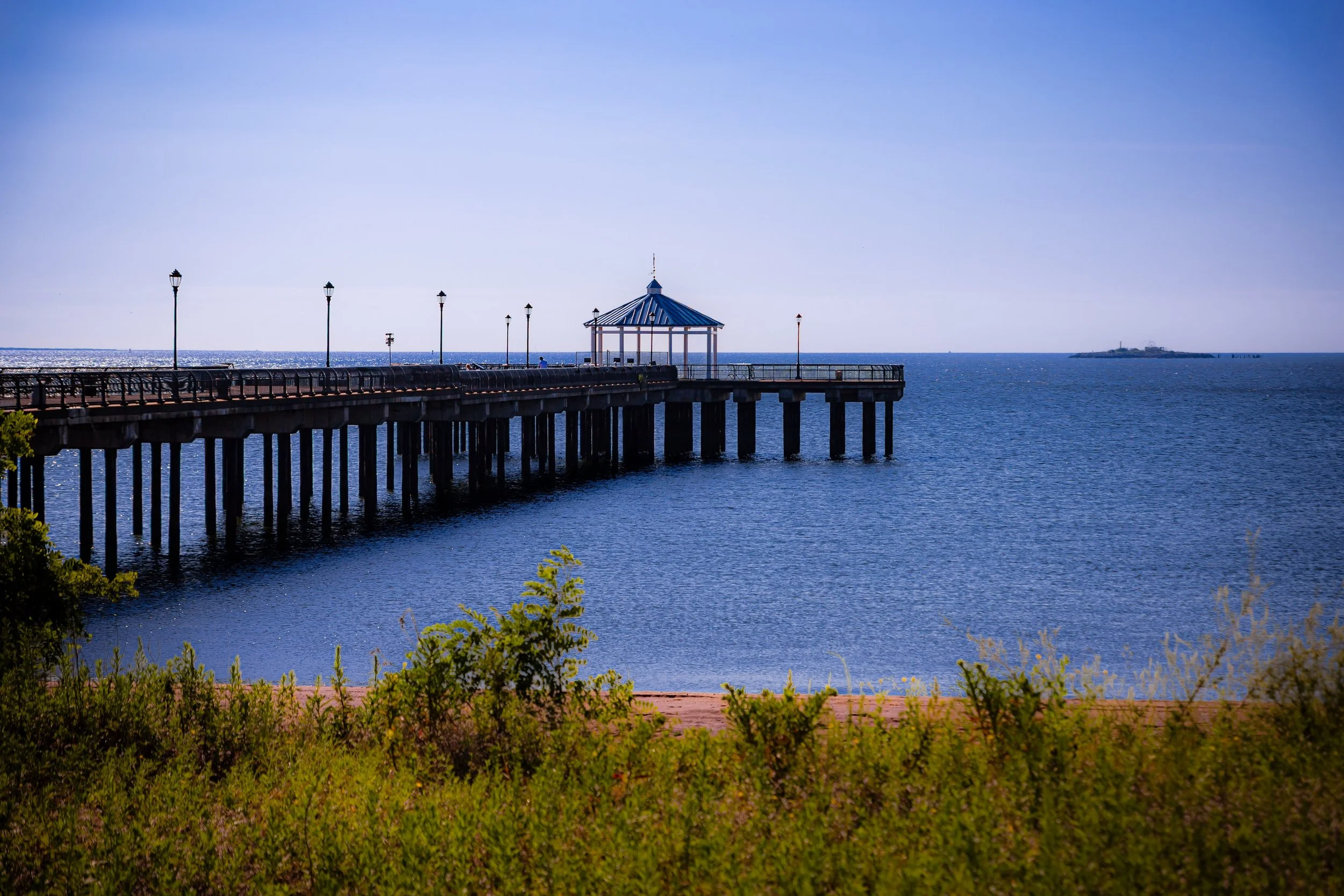
At the dawn of the 20th century, Ocean Breeze stood on the edge of urban transformation. The construction of the Franklin D. Roosevelt Boardwalk in the 1930s, part of the Works Progress Administration’s effort to modernize New York’s waterfronts, redefined the shoreline as a public recreational zone. The broad concrete promenade linked South Beach to Midland Beach and passed directly along the Ocean Breeze shoreline, inviting thousands of city residents to the sand each summer.
Despite its proximity to the boardwalk, Ocean Breeze itself remained relatively undeveloped—a patchwork of dunes and low meadows occasionally used for beach parking and small concessions. By the mid-century decades, however, shifting tides, storms, and neglect began to erode the shoreline. The amusement industry waned, leaving behind empty lots and deteriorating seawalls. In 1964, the opening of the Verrazzano-Narrows Bridge spurred renewed interest in Staten Island’s development, yet much of Ocean Breeze remained an underutilized expanse vulnerable to flooding.
Throughout the 1970s and 1980s, city planners and environmentalists recognized the area’s ecological importance as one of the last remaining natural dune and salt-marsh systems on the island’s East Shore. Plans began to take shape for a park that could integrate active recreation with wetland preservation—an idea that would gain urgency in the decades to follow.
Ocean Breeze Video Coming Soon
Late 20th Century: From Vacant Land to Park Vision
In 1999, the New York City Department of Parks & Recreation formally designated the Ocean Breeze site for park development as part of the broader revitalization of Staten Island’s East Shore. The vision was twofold: to restore the degraded wetlands and dunes that once protected the coast, and to create new recreational facilities for local communities.
The plan called for the construction of an indoor athletic complex, outdoor playing fields, and a network of walking trails and wildlife observation areas. At the same time, engineers and ecologists worked to regrade and restore the marshlands along New Creek, re-establishing natural tidal flow and planting native vegetation to reduce erosion and improve habitat diversity. The combination of recreation and restoration reflected a new philosophy of urban park design—one that saw ecological infrastructure and civic infrastructure as inseparable.
21st Century: Renewal, Resilience, and Athletic Achievement
The early 21st century saw Ocean Breeze Park transformed into one of Staten Island’s premier destinations for both sports and nature. The opening of the Ocean Breeze Athletic Complex in 2015 marked a milestone in the borough’s recreational history. Designed to meet international competition standards, the 135,000-square-foot facility features a hydraulically banked indoor track, fitness and training rooms, and panoramic views of the Atlantic. It quickly became home to regional and national track and field events, from youth leagues to NCAA championships, and serves as a year-round resource for Staten Islanders seeking world-class athletic opportunities close to home.
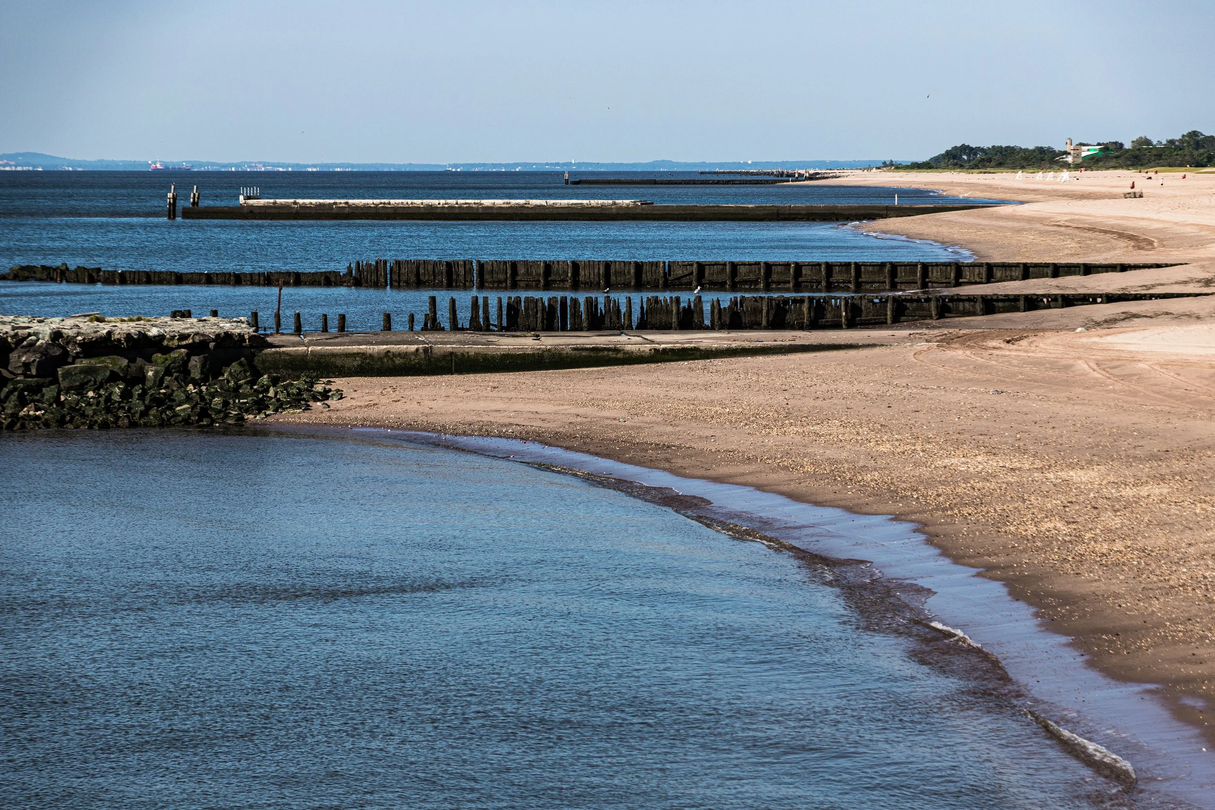
Beyond the walls of the athletic center, the surrounding park has blossomed into a model of urban ecological resilience. The Ocean Breeze Park Nature Preserve, encompassing over 130 acres of dunes, grasslands, and restored tidal wetlands, provides habitat for migratory birds, diamondback terrapins, and monarch butterflies. Boardwalk trails and observation platforms invite visitors to explore the landscape’s subtle beauty—its shifting sands, salt-tolerant plants, and the rhythmic pulse of the tides.
The devastation of Hurricane Sandy (2012), which inundated much of the East Shore, underscored the importance of this landscape. In the aftermath, Ocean Breeze Park became a focal point for coastal resilience efforts. Restoration projects strengthened dunes, improved drainage, and enhanced storm-surge protection not only for the park itself but also for surrounding neighborhoods. Today, Ocean Breeze serves as both a recreational refuge and a living experiment in climate adaptation, demonstrating how natural systems can defend and sustain urban communities.
Ocean Breeze Photo Gallery
Spirit and Legacy
The spirit of Ocean Breeze Park lies in balance—the meeting of nature and motion, land and sea, recreation and restoration. It is a place where the roar of ocean wind mingles with the cadence of runners’ footsteps, where marsh grasses sway beside steel and glass. Once a neglected stretch of shoreline, it now symbolizes the power of renewal: the city’s capacity to heal its landscapes and embrace the natural forces that shape them.
Its legacy endures not only in its athletic triumphs or ecological achievements but in the experience it offers—a living classroom of resilience where each tide writes a new chapter of coexistence. Ocean Breeze Park stands as proof that New York’s future depends on harmony with its coastlines, not conquest of them.
New York City
Use this custom Google map to explore where every neighborhood in all five boroughs of New York City is located.
The Five Boroughs
One of New York City’s unique qualities is its organization in to 5 boroughs: Manhattan, Brooklyn, Queens, The Bronx, and Staten Island. These boroughs are part pragmatic administrative districts, and part vestiges of the region’s past. Each borough is an entire county in New York State - in fact, Brooklyn is, officially, Kings County, while Staten Island is, officially Richmond County. But that’s not the whole story …
Initially, New York City was located on the southern tip of Manhattan (now the Financial District) that was once the Dutch colony of New Amsterdam. Across the East River, another city was rising: Brooklyn. In time, the city planners realized that unification between the rapidly rising cities would create commercial and industrial opportunities - through streamlined administration of the region.
So powerful was the pull of unification between New York and Brooklyn that three more counties were pulled into the unification: The Bronx, Queens, and Staten Island. And on January 1, 1898, the City of New York unified two cities and three counties into one Greater City of New York - containing the five boroughs we know today.
But because each borough developed differently and distinctly until unification, their neighborhoods likewise uniquely developed. Today, there are nearly 390 neighborhoods, each with their own histories, cultures, cuisines, and personalities - and each with residents who are fiercely proud of their corner of The Big Apple.


