VAN CORTLANDT VILLAGE
The Bronx
Geographic Setting
Bounded by Broadway to the west, Van Cortlandt Park to the north, the Jerome Park Reservoir to the east, Kingsbridge Terrace to the southeast, Albany Crescent to the south, and West 231st Street to the southwest, Van Cortlandt Village occupies one of the Bronx’s most elevated and scenic enclaves—a wooded, residential district perched between two of the borough’s most defining landmarks. Set on the ridge between the Harlem River Valley and the Mosholu basin, the neighborhood offers a rare combination of natural beauty, historic architecture, and small-town quietude within New York City’s northernmost borough.
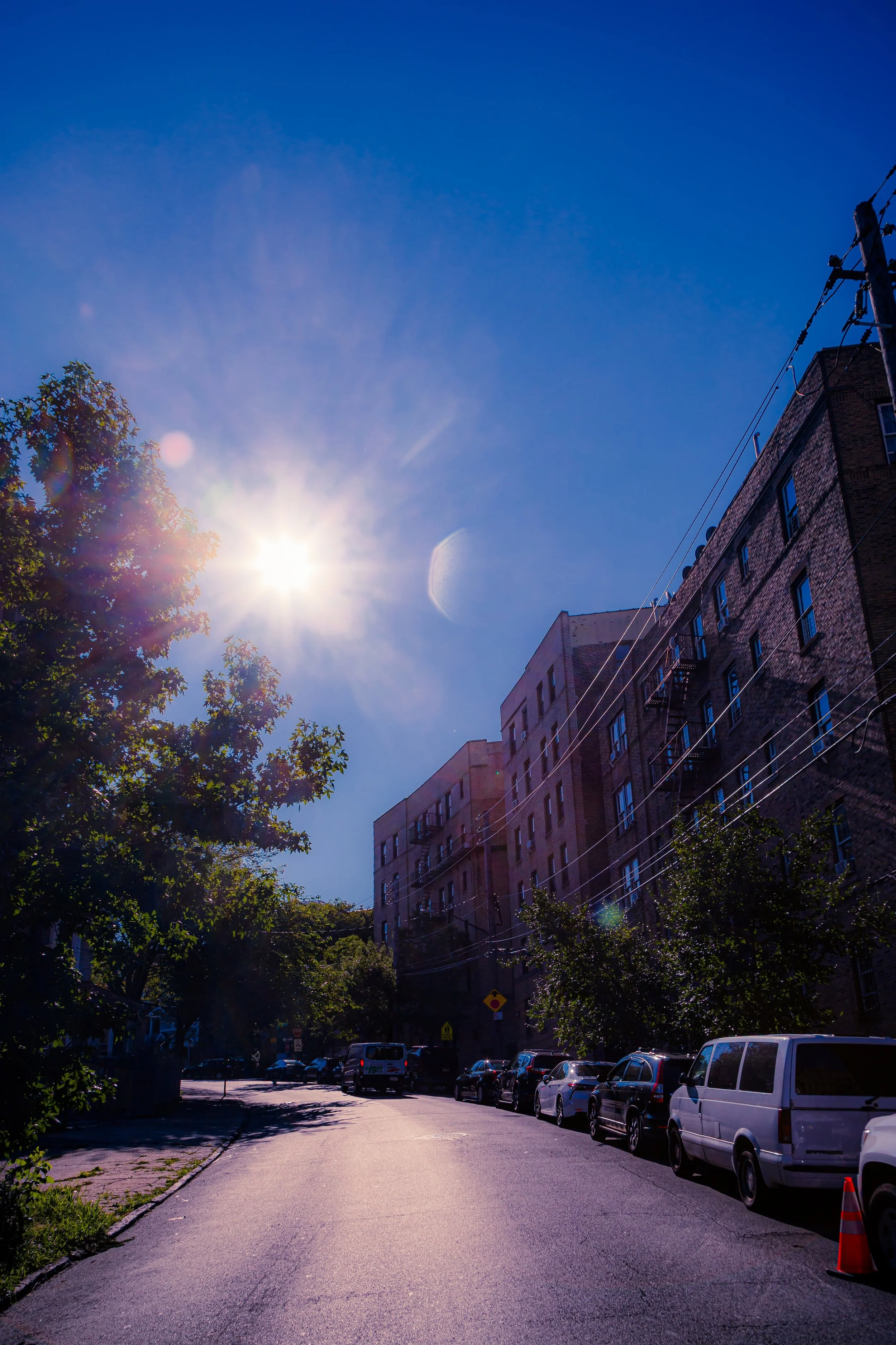
From the forested edge of Van Cortlandt Park, where trails wind beneath ancient oaks, to the tidy rows of tudor-style houses, brick apartment buildings, and prewar co-ops that line Sedgwick Avenue, Gale Place, and Hillman Avenue, the neighborhood’s layout reflects both its topography and its early-20th-century origins as a planned residential retreat. Mosholu Parkway and Sedgwick Avenue serve as its primary thoroughfares, linking the community to Kingsbridge Heights to the south and Riverdale to the west, while West 238th Street marks the neighborhood’s northern reach before giving way to the open expanse of Van Cortlandt Park.
The elevated views from the ridge—east to the shimmering waters of the Jerome Park Reservoir and west to the Palisades across the Hudson—make Van Cortlandt Village not merely a name but a description: a true village above the Bronx, nestled in greenery and history.
Etymology
The neighborhood takes its name from Van Cortlandt Park, itself named after the Van Cortlandt family, one of New York’s most influential colonial dynasties. The Van Cortlandts were 17th-century Dutch merchants and landowners whose vast estate encompassed much of today’s northwest Bronx, including the land that became the park. Their stone manor house, built in 1748 and preserved as the Van Cortlandt House Museum, stands at the heart of the park—a tangible reminder of the Bronx’s rural and aristocratic origins.
The addition of the word “Village” emerged in the early 20th century, when developers and residents sought to distinguish this residential pocket from the larger park and from the busier commercial corridors of Kingsbridge and Riverdale. The name reflected both scale and sentiment—a place apart, defined by its human proportions, garden-lined streets, and community cohesion.
The Neighborhood
Origins through the 19th Century
Before urbanization, the ridge that became Van Cortlandt Village was part of the Van Cortlandt estate, a tract of farmland, woodland, and marsh extending from the Harlem River to the Yonkers line. During the Revolutionary War, the area saw skirmishes between American and British forces, and its strategic elevation made it a key vantage point for both sides.
In the 19th century, the land remained largely pastoral, serving as part of the Van Cortlandt family’s wheat and dairy operations. The arrival of the New York Central Railroad and the development of Broadway as a major route northward in the mid-1800s brought gradual change, but the hills above remained relatively untouched. The creation of Van Cortlandt Park in 1888, following the consolidation of several estates into the city’s new park system, permanently preserved the area’s northern edge as public green space. The establishment of the Jerome Park Reservoir (1906) to the east likewise ensured that the ridge between the two would remain open and residential—a natural plateau framed by water and woods.
Early 20th Century: Planned Development and Suburban Aspiration
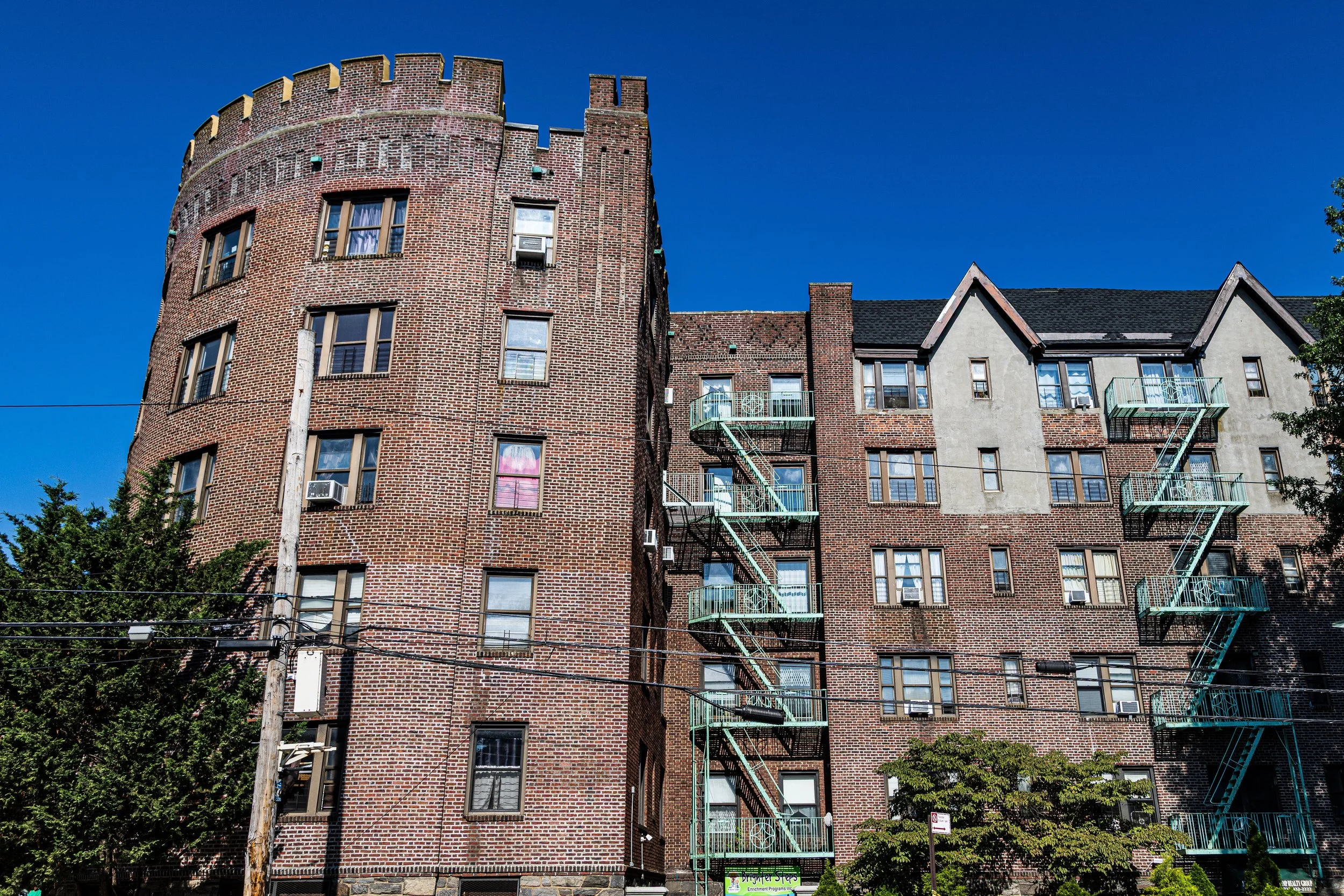
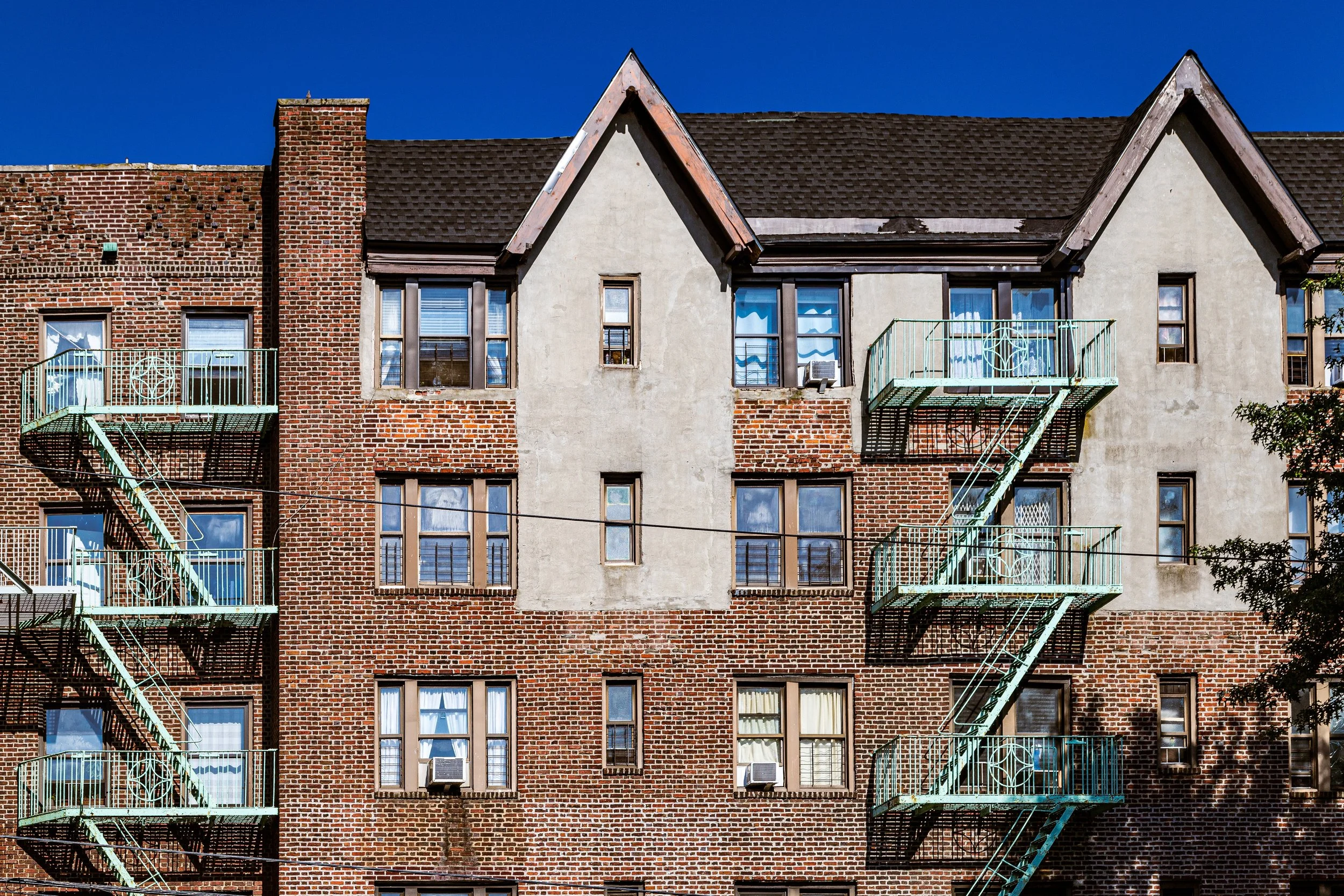
Van Cortlandt Village’s transformation into a residential neighborhood began in the 1920s and 1930s, when developers capitalized on its elevated terrain and proximity to parks to create a “garden suburb” within the city. Small, freestanding houses and tudor revival-style homes were built along Hillman Avenue, Orloff Avenue, and Sedgwick Avenue, many with sloping roofs, gables, and stone facades inspired by English country architecture.
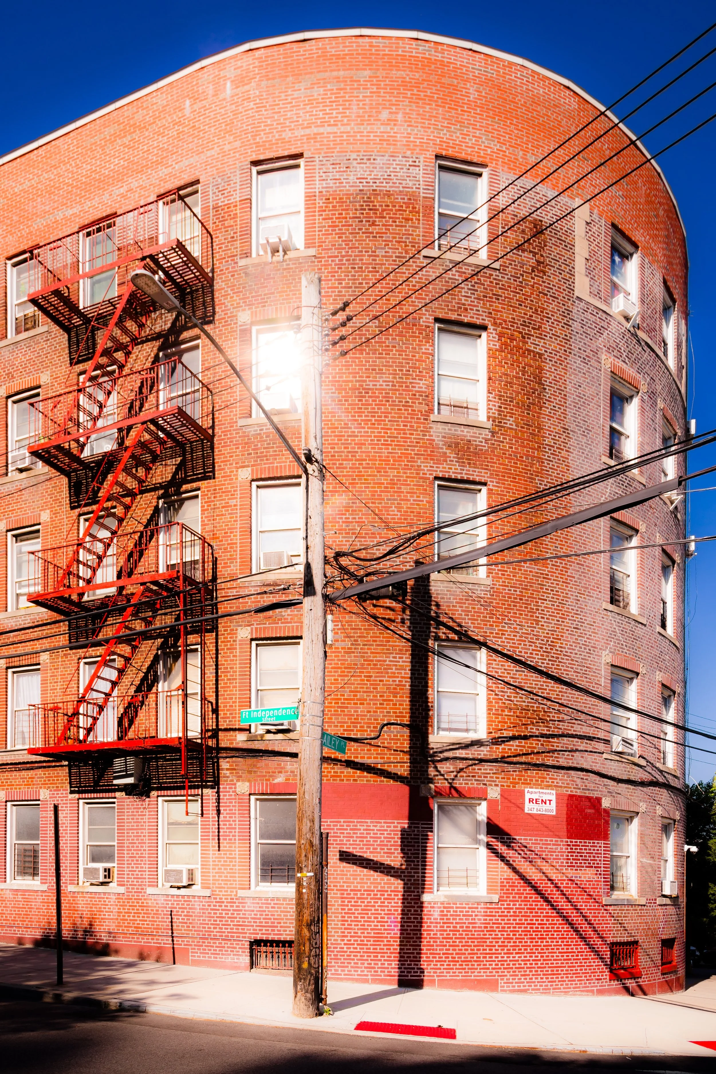
Simultaneously, prewar apartment houses arose along Van Cortlandt Avenue West, their brick façades adorned with decorative cornices and courtyards. The neighborhood’s layout—irregular and curvilinear rather than gridded—followed the natural topography, preserving sightlines and green buffers. This design sensibility distinguished Van Cortlandt Village from denser sections of the Bronx and contributed to its enduring character as a “village within the city.”
Institutions such as P.S. 95, St. John’s Roman Catholic Church, and the Amalgamated Houses (1927)—one of the first limited-equity cooperatives in the United States—anchored the area both socially and architecturally. Founded by members of the Amalgamated Clothing Workers of America, the cooperative’s design by Springsteen & Goldhammer embodied progressive ideals of affordable housing, community gardens, and cultural programming—a model that influenced cooperative housing across the city.
Van Cortlandt Village Video Coming Soon
Mid–Late 20th Century: Community Cohesion and Preservation
Throughout the 1950s–1980s, Van Cortlandt Village maintained its reputation as one of the Bronx’s most stable middle-class neighborhoods. The Henry Hudson Parkway (1937) and nearby subway lines (1 and 4 trains) provided easy access to Manhattan, while the park and reservoir offered open space rare in New York’s urban core.
The postwar years brought modest apartment buildings and additional co-ops, but the area’s scale and landscape remained largely unchanged. As other parts of the Bronx suffered from disinvestment and population loss, Van Cortlandt Village stood apart. Its high rate of homeownership, strong civic organizations, and abundance of natural surroundings shielded it from the urban crises that reshaped much of the borough.
Community activism flourished: residents organized through groups such as the Fort Independence Park Neighborhood Association and Amalgamated Housing Co-op Council, advocating for park maintenance, historic preservation, and affordable housing. The neighborhood’s unique combination of progressive planning and local engagement made it a bastion of urban stability during a time of upheaval.
21st Century: Renewal, Heritage, and Green Identity
In the 21st century, Van Cortlandt Village has retained its quiet, verdant character even as the Bronx experiences renewed investment and population growth. The neighborhood remains a blend of working- and middle-class homeowners, co-op residents, and a diverse demographic mix that includes Irish-, Jewish-, Hispanic-, African-American-, and South Asian-American families.
Efforts to preserve the neighborhood’s historic fabric have intensified. The Jerome Park Reservoir has undergone ecological improvements and limited public access restoration, while Van Cortlandt Park—the Bronx’s largest park—has seen revitalization projects including trail restoration, forest management, and the reopening of historic sites. Community groups continue to advocate for pedestrian safety and sustainable development that respects the area’s low-rise heritage.
The Amalgamated Housing Cooperative remains the moral and social heart of the neighborhood, celebrating nearly a century of continuous operation. Its legacy of cooperative ownership and mutual aid resonates deeply in an era of rising costs and urban transformation.
Van Cortlandt Village Photo Gallery
Spirit and Legacy
The spirit of Van Cortlandt Village lies in its harmony between nature, architecture, and community—a delicate balance rarely achieved in New York City. Its winding streets, leafy hills, and sturdy brick buildings testify to a century of thoughtful planning and shared stewardship.
Here, one can stand on Sedgwick Avenue and see both the shimmering expanse of the Jerome Park Reservoir and the forested ridge of Van Cortlandt Park, framed by sunlight and birdsong. The neighborhood’s enduring character is not accidental—it is the product of generations who have chosen care over expansion, and community over anonymity.
New York City
Use this custom Google map to explore where every neighborhood in all five boroughs of New York City is located.
The Five Boroughs
One of New York City’s unique qualities is its organization in to 5 boroughs: Manhattan, Brooklyn, Queens, The Bronx, and Staten Island. These boroughs are part pragmatic administrative districts, and part vestiges of the region’s past. Each borough is an entire county in New York State - in fact, Brooklyn is, officially, Kings County, while Staten Island is, officially Richmond County. But that’s not the whole story …
Initially, New York City was located on the southern tip of Manhattan (now the Financial District) that was once the Dutch colony of New Amsterdam. Across the East River, another city was rising: Brooklyn. In time, the city planners realized that unification between the rapidly rising cities would create commercial and industrial opportunities - through streamlined administration of the region.
So powerful was the pull of unification between New York and Brooklyn that three more counties were pulled into the unification: The Bronx, Queens, and Staten Island. And on January 1, 1898, the City of New York unified two cities and three counties into one Greater City of New York - containing the five boroughs we know today.
But because each borough developed differently and distinctly until unification, their neighborhoods likewise uniquely developed. Today, there are nearly 390 neighborhoods, each with their own histories, cultures, cuisines, and personalities - and each with residents who are fiercely proud of their corner of The Big Apple.


