
ROSEBANK
Staten Island
Geographic Setting
Bounded by Nautilus Street and Fingerboard Road to the southeast, the Staten Island Expressway to the south, and the Staten Island Railway to the west, Rosebank lies at the northeastern edge of Staten Island’s East Shore, where the island slopes gently toward the Upper New York Bay and the towering span of the Verrazzano-Narrows Bridge. This compact but historically rich neighborhood nestles between Fort Wadsworth to the east and Clifton to the west, forming one of Staten Island’s earliest and most culturally layered communities.
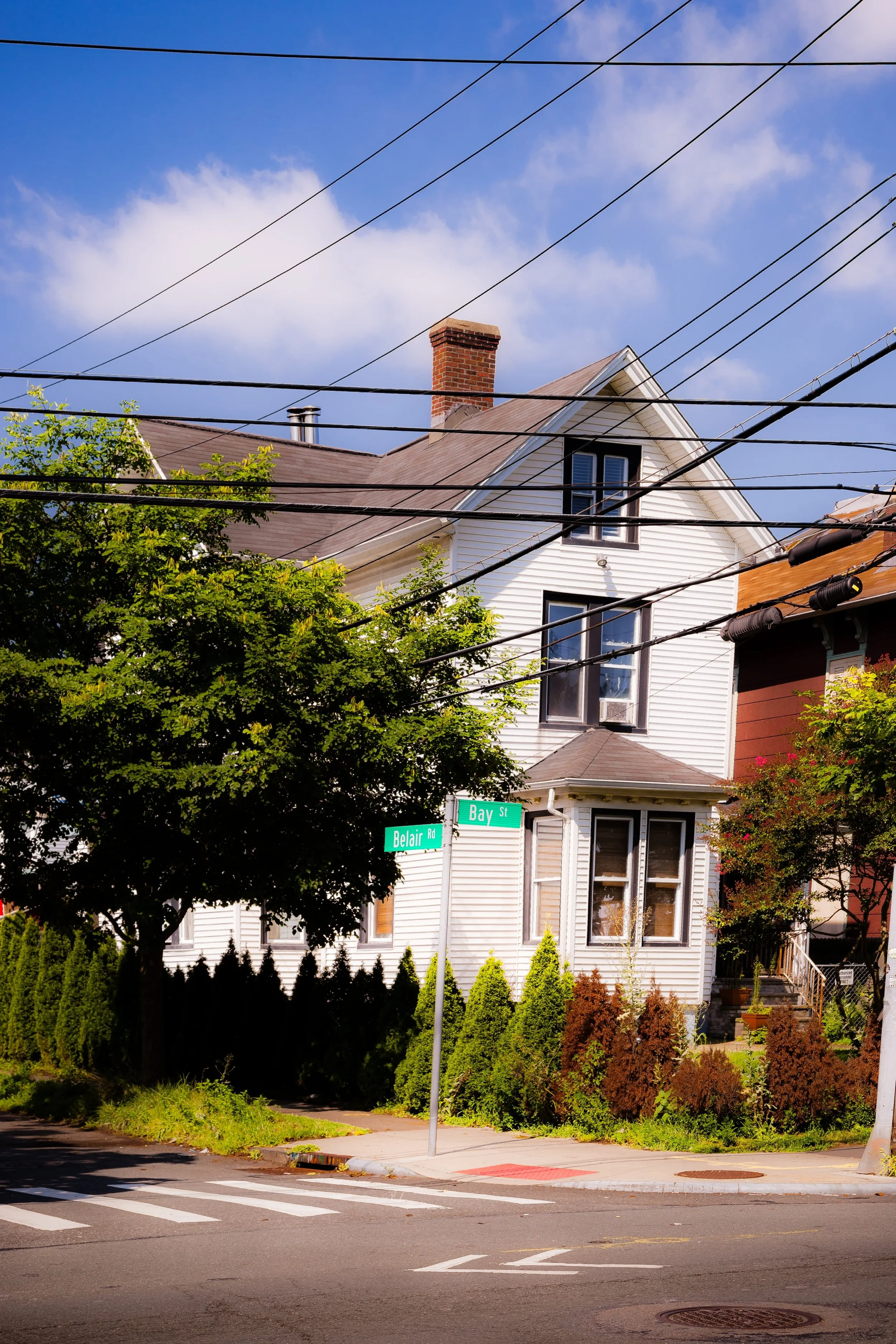
The terrain of Rosebank reflects both its maritime and residential character—narrow, winding streets descend from the elevated ridges near the expressway toward the low-lying flats along Bay Street, where the shoreline once hosted shipyards, ferry slips, and bustling waterfront industries. The Staten Island Railway’s Rosebank station, together with nearby bus routes, links the neighborhood seamlessly to St. George and the Staten Island Ferry. From many vantage points—backyards, stoops, and the slopes of Tompkins Avenue—residents enjoy striking views of the Narrows, where the harbor’s tides and the city skyline meet. Rosebank’s setting, at once intimate and panoramic, captures the essence of Staten Island’s North Shore: urban in texture, maritime in memory, and deeply rooted in community.
Etymology
The name Rosebank dates to the mid-19th century and likely derives from the wild rose bushes that once grew along its gentle bluffs overlooking the bay. The poetic “bank” referred both to the shoreline and to the elevated ridge that ran parallel to it. As the area evolved from farmland into a residential and industrial district, the name Rosebank symbolized the neighborhood’s balance between nature and settlement—a picturesque moniker for a working-class harbor community.
In the early years, it was sometimes called “Rose Bank” or “The Bank,” but by the late 1800s, the modern form had taken hold, appearing on real estate maps and railway timetables. The name’s enduring charm belies the neighborhood’s industrious past and reflects the pride of generations who have called this waterfront enclave home.
The Neighborhood
Origins through the 19th Century
The land that became Rosebank was originally part of large colonial estates granted in the 17th and 18th centuries to Dutch and English settlers who farmed the fertile coastal plain between Clifton and Fort Wadsworth. Its location—fronting the Narrows and within sight of New York Harbor—made it a key point of access for ferries, trading vessels, and later, for shipbuilding and maritime enterprises.
In the early 19th century, as Staten Island’s eastern shore developed, Rosebank emerged as a distinct hamlet along the old Richmond Turnpike (now Bay Street). The arrival of the Staten Island Railway in 1860 cemented its role as a working waterfront village. Docks, warehouses, and boatyards sprang up along the bay, while inland, narrow residential streets filled with small wood-frame houses for sailors, craftsmen, and dockworkers.
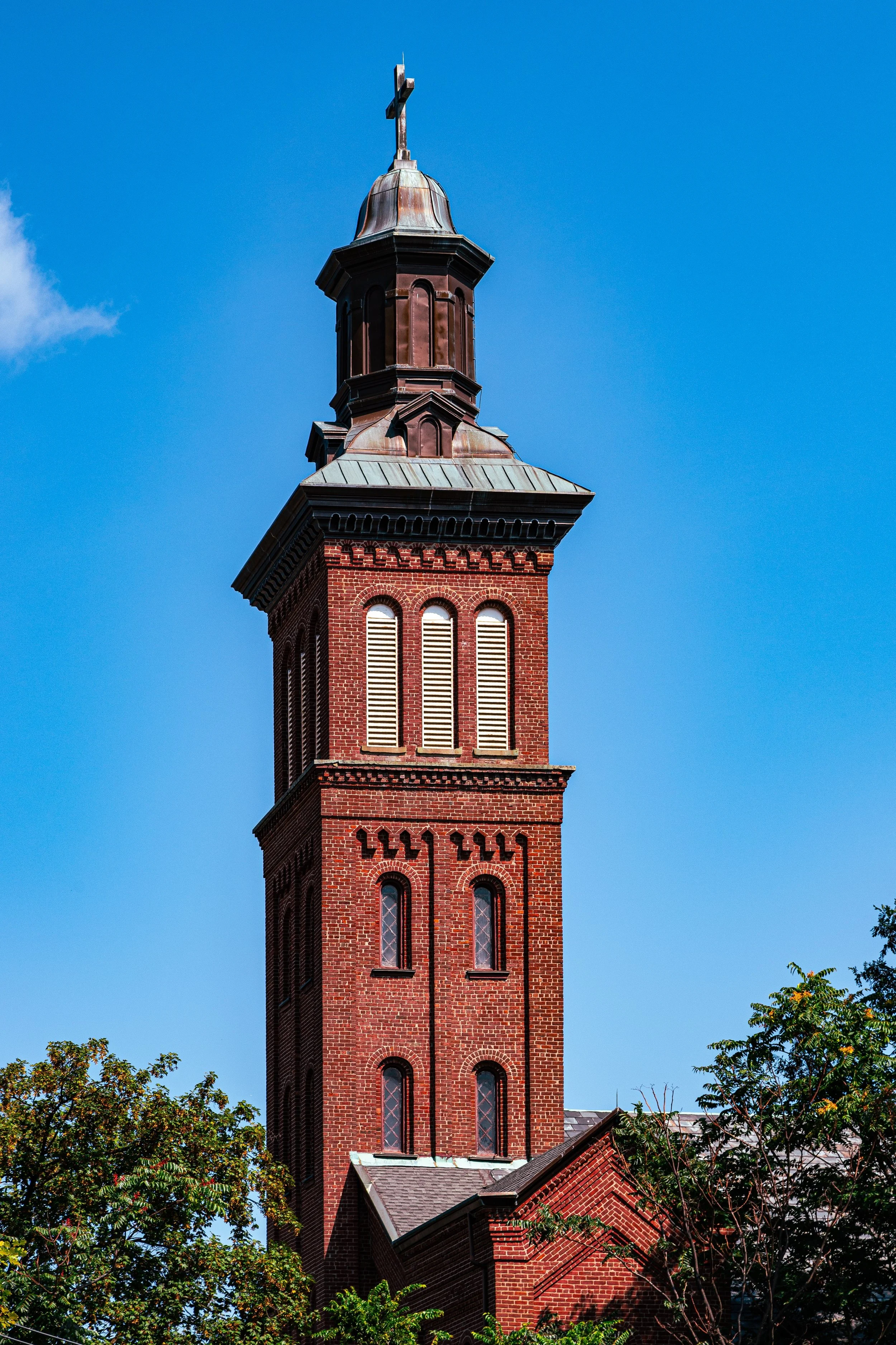
The neighborhood also became home to a vibrant immigrant population, particularly Italians from southern regions such as Sicily and Naples. By the 1880s, Rosebank was the heart of Staten Island’s Italian-American community, known for its close-knit families, neighborhood parades, and shared traditions. The founding of Our Lady of Mount Carmel Church (1882) marked a defining moment in this transformation—a parish built by Italian laborers that quickly became the social and spiritual anchor of the community. Its twin-spired church on St. Mary’s Avenue remains one of Staten Island’s most recognizable landmarks.
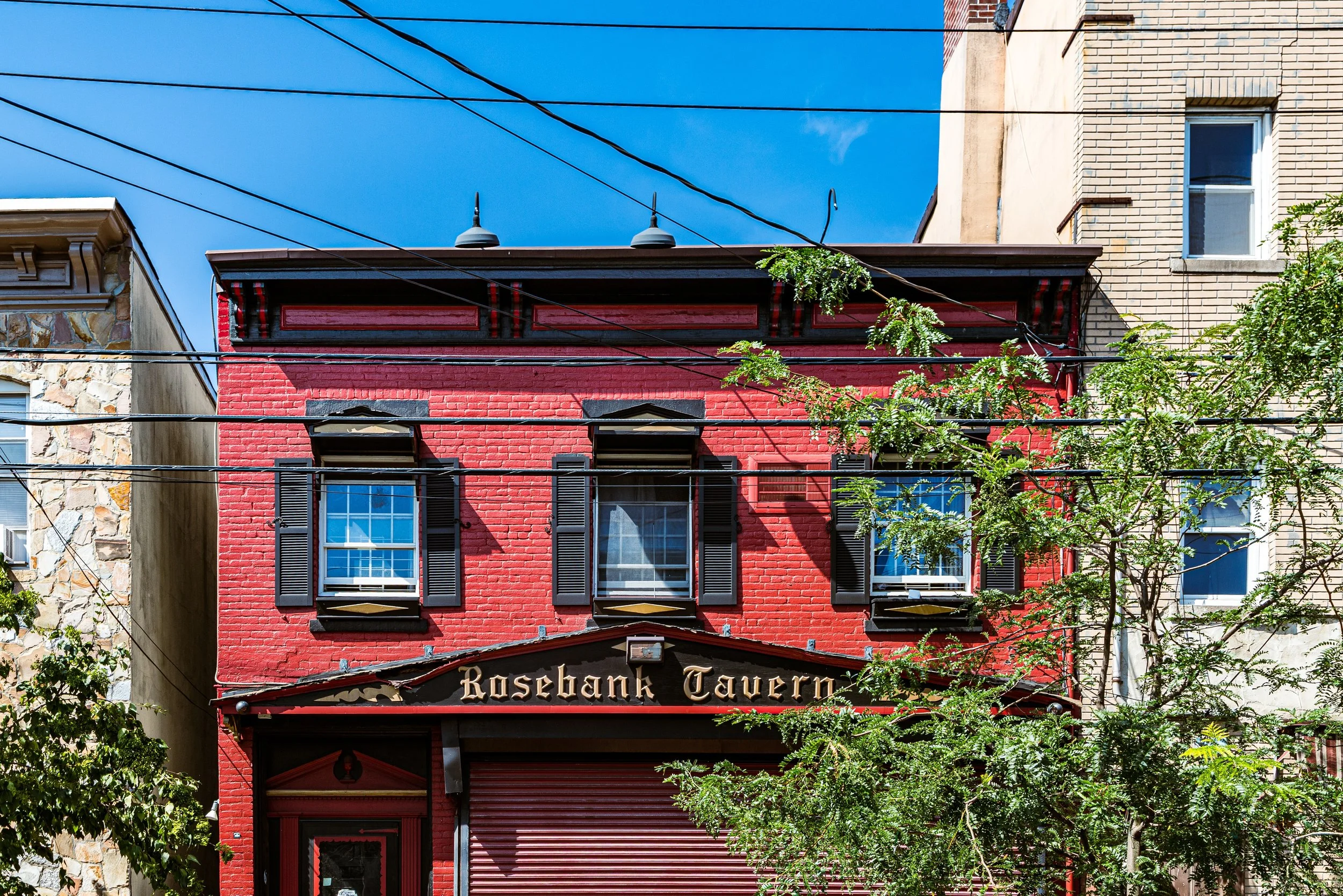
By the late 19th century, Rosebank was a bustling, self-sufficient village. Along Bay Street stood general stores, saloons, and coal yards; along Tompkins Avenue, a lively mix of homes and small factories; and on the waterfront, dry docks and ship repair facilities served the harbor’s constant flow of vessels. The scent of salt, tar, and iron defined its atmosphere—a neighborhood both hardworking and proud.
Early 20th Century: Maritime Enterprise and Immigrant Identity
In the early 20th century, Rosebank reached its industrial and cultural zenith. Shipyards, foundries, and marine supply businesses thrived along the waterfront, providing steady employment for local residents. The Lewis Nixon Shipyard, one of the most important on Staten Island, produced naval vessels and commercial ships during both World Wars.
At the same time, Rosebank’s immigrant character deepened. Waves of Italian newcomers arrived between 1900 and 1920, bringing with them traditions that would define the neighborhood’s identity for generations. Festivals in honor of saints—particularly the Feast of Our Lady of Mount Carmel—became major community events, filling the streets with music, processions, and food. The neighborhood’s narrow lanes echoed with the sound of Italian dialects, church bells, and children at play.
Despite its proximity to the harbor’s industry, Rosebank retained a village feel. Modest rowhouses and two-family homes stood alongside small gardens, grapevines, and shrines to the Madonna. The corner stores and bakeries along Bay Street became gathering places for generations of longshoremen and their families. The construction of the Verrazzano-Narrows Bridge (1959–64) forever altered the skyline, but even as the bridge’s concrete piers rose above the bay, Rosebank held fast to its small-scale rhythm.
Rosebank Video Coming Soon
Mid–Late 20th Century: Urban Change and Cultural Continuity
The mid-20th century brought both challenges and continuity. The decline of the shipping industry after World War II and the shift to containerized freight led to the closure of many waterfront businesses. By the 1960s and 1970s, some of Rosebank’s industrial lots lay dormant, and the once-busy docks grew quiet. Yet the neighborhood’s residential core remained intact.
The construction of the Staten Island Expressway reshaped Rosebank’s southern boundary, introducing new transportation arteries but also isolating the community from the island’s interior. Despite these disruptions, the neighborhood maintained a strong sense of identity through its churches, social clubs, and family networks. The Garibaldi-Meucci Museum, housed in the former home of inventor Antonio Meucci—who famously hosted Giuseppe Garibaldi, the Italian revolutionary, during his exile in the 1850s—became a beacon of cultural pride and a symbol of Staten Island’s Italian-American heritage.
Through the 1980s and 1990s, as Staten Island’s population grew, Rosebank attracted new residents seeking affordability and proximity to the ferry. Its streets filled with a mix of longtime families and newcomers from Latin America, Eastern Europe, and Asia, adding new threads to the community’s cultural tapestry. Renovations of older homes and small-scale infill development helped stabilize the housing stock while preserving the neighborhood’s historic fabric.
21st Century: Resilience and Renewal by the Narrows
In the 21st century, Rosebank remains a vibrant and evolving neighborhood defined by its maritime roots and working-class spirit. Though its waterfront industries have largely vanished, redevelopment initiatives and environmental restoration projects have begun to reimagine the shoreline for public use and ecological health. The Bay Street Corridor revitalization plan—linking St. George, Stapleton, and Rosebank—has brought investment in infrastructure, streetscapes, and housing while emphasizing preservation of local character.
Culturally, Rosebank continues to honor its heritage. The Garibaldi-Meucci Museum operates as both cultural center and educational hub, hosting exhibits and Italian-language programs. Our Lady of Mount Carmel Church remains a cornerstone of community life, its annual feast drawing residents from across the borough. Meanwhile, younger generations have opened new cafés, restaurants, and creative studios along Bay Street, blending the neighborhood’s Old World identity with new urban energy.
Demographically, Rosebank reflects Staten Island’s growing diversity: Italian-American families remain deeply rooted, while new arrivals from Mexico, the Caribbean, and Eastern Europe contribute to a dynamic mix of languages, foods, and traditions. The neighborhood’s proximity to the Verrazzano Bridge and Staten Island Ferry ensures its continued relevance, balancing accessibility with its intimate, almost village-like scale.
The surrounding green spaces—White Park, Fort Wadsworth, and the shoreline esplanade—offer respite and recreation, while restoration of nearby wetlands has reintroduced natural buffers along the Narrows. Rosebank today stands as a living testament to adaptation: a neighborhood that has weathered industrial shifts, immigration waves, and urban change without losing its soul.
Rosebank Photo Gallery
Spirit and Legacy
The spirit of Rosebank resides in its dual identity—both cosmopolitan and close-knit, industrial and domestic, old and new. It is a place where shipbuilders once hammered steel beside the same bay that now reflects the Verrazzano’s lights, where families trace their lineage to Sicilian villages yet welcome newcomers from every corner of the world.
Its legacy endures in the architecture of its homes, the scent of espresso drifting from its bakeries, and the annual rhythm of its feasts and processions. More than a neighborhood, Rosebank is a chronicle of Staten Island itself—its waves of immigration, its maritime labor, and its quiet persistence in the face of change.
New York City
Use this custom Google map to explore where every neighborhood in all five boroughs of New York City is located.
The Five Boroughs
One of New York City’s unique qualities is its organization in to 5 boroughs: Manhattan, Brooklyn, Queens, The Bronx, and Staten Island. These boroughs are part pragmatic administrative districts, and part vestiges of the region’s past. Each borough is an entire county in New York State - in fact, Brooklyn is, officially, Kings County, while Staten Island is, officially Richmond County. But that’s not the whole story …
Initially, New York City was located on the southern tip of Manhattan (now the Financial District) that was once the Dutch colony of New Amsterdam. Across the East River, another city was rising: Brooklyn. In time, the city planners realized that unification between the rapidly rising cities would create commercial and industrial opportunities - through streamlined administration of the region.
So powerful was the pull of unification between New York and Brooklyn that three more counties were pulled into the unification: The Bronx, Queens, and Staten Island. And on January 1, 1898, the City of New York unified two cities and three counties into one Greater City of New York - containing the five boroughs we know today.
But because each borough developed differently and distinctly until unification, their neighborhoods likewise uniquely developed. Today, there are nearly 390 neighborhoods, each with their own histories, cultures, cuisines, and personalities - and each with residents who are fiercely proud of their corner of The Big Apple.


