
COUNTRY CLUB
The Bronx
Geographic Setting
Bounded by Layton Avenue to the south, the Bruckner Expressway to the west, Pelham Bay Park to the north, and Eastchester Bay to the east, Country Club occupies one of the Bronx’s quietest and most residential peninsulas—a green, waterfront enclave tucked between Pelham Bay and Throgs Neck. Its position on the northeastern shore gives it the feeling of a small coastal town within New York City: tree-lined streets slope gently toward the bay, where private docks, inlets, and boathouses overlook the waters of Eastchester Bay and Pelham Bay Lagoon.
The neighborhood’s main arteries—Kennellworth Place, Burr Avenue, and Ampere Avenue—wind through blocks of detached homes, manicured gardens, and tidy cul-de-sacs. Layton Avenue forms a soft boundary to the south, beyond which lie the busier corridors of Middletown Road and Crosby Avenue, while to the north, the woodlands of Pelham Bay Park—New York City’s largest park—frame the horizon in green. To the west, the Bruckner Expressway separates Country Club from Pelham Bay proper, reinforcing its sense of seclusion. The result is a neighborhood that feels removed from the city’s bustle, yet remains deeply connected through nearby expressways, subway access at Pelham Bay Park Station, and the surrounding parkland.
Etymology
The name “Country Club” emerged in the early 20th century as a real estate marketing term designed to evoke suburban elegance and leisure. The moniker likely derived from the Pelham Country Club, established nearby in Westchester County in 1908, whose name carried associations of exclusivity, open space, and refinement. Developers used “Country Club” to attract upwardly mobile New Yorkers seeking the comfort of a seaside suburb within city limits—a place of lawns and porches rather than tenements and trolleys.
Ironically, the area never hosted an actual golf or country club of its own; instead, the “club” was metaphorical—a community of homeowners bound by shared aspirations of quiet domestic life along the bay.
The Neighborhood
Origins through the 19th Century
Before suburbanization, the land that became Country Club was part of the Pelham Bay tract, a rural coastal landscape of farms, salt meadows, and woodlands owned by families such as the Bartows and Pells. The Siwanoy, an Algonquian-speaking people, had long inhabited these shores, harvesting shellfish and navigating the bays by canoe. After the area’s annexation to New York City in 1895, its marshlands and estates were gradually parceled into residential tracts as the city expanded northward.
The creation of Pelham Bay Park in 1888 permanently preserved the vast natural expanse to the north, while leaving the adjacent shoreline open for modest development. In the early 1900s, as streetcar lines and later the IRT Pelham Line (1918) brought accessibility to this far corner of the Bronx, builders began to lay out small lots for single-family houses marketed under names like Country Club Estates and Pelham Bay Shores. The promise was clear: fresh air, water views, and tranquility only an hour from Manhattan.
Early 20th Century: A Seaside Suburb in the City
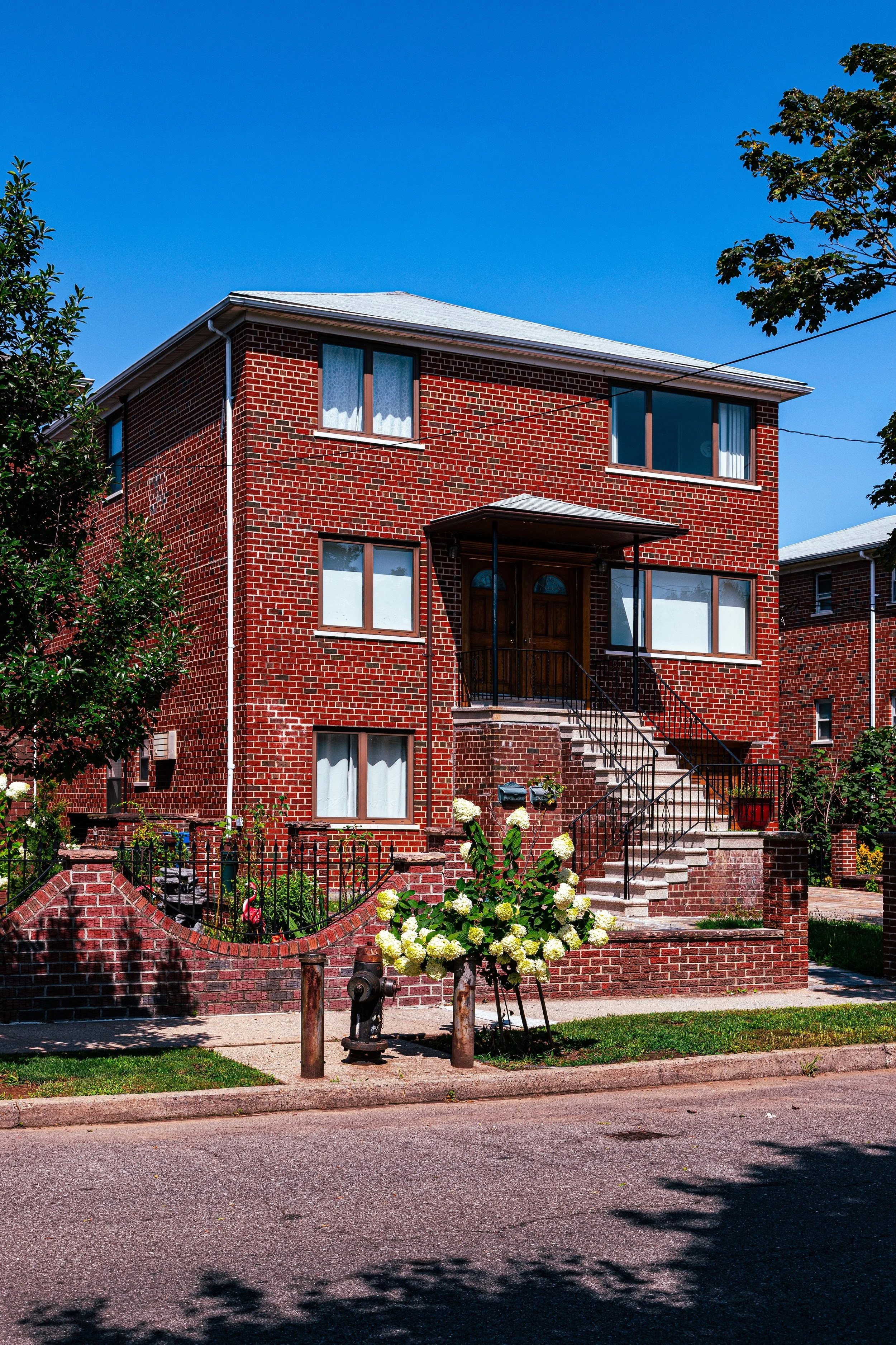
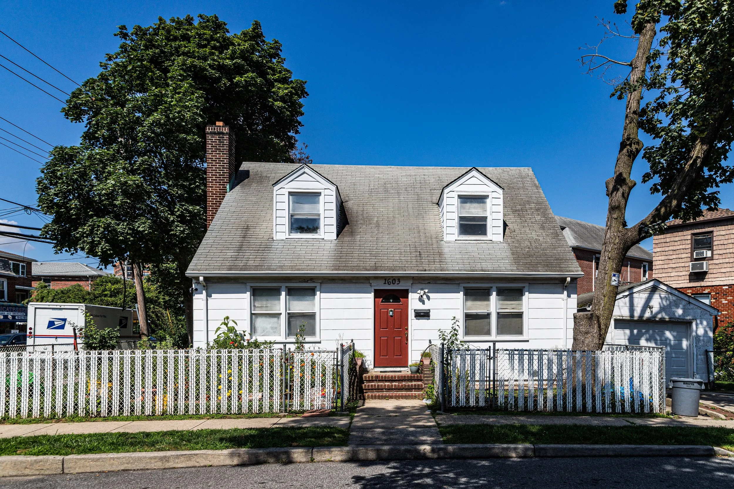
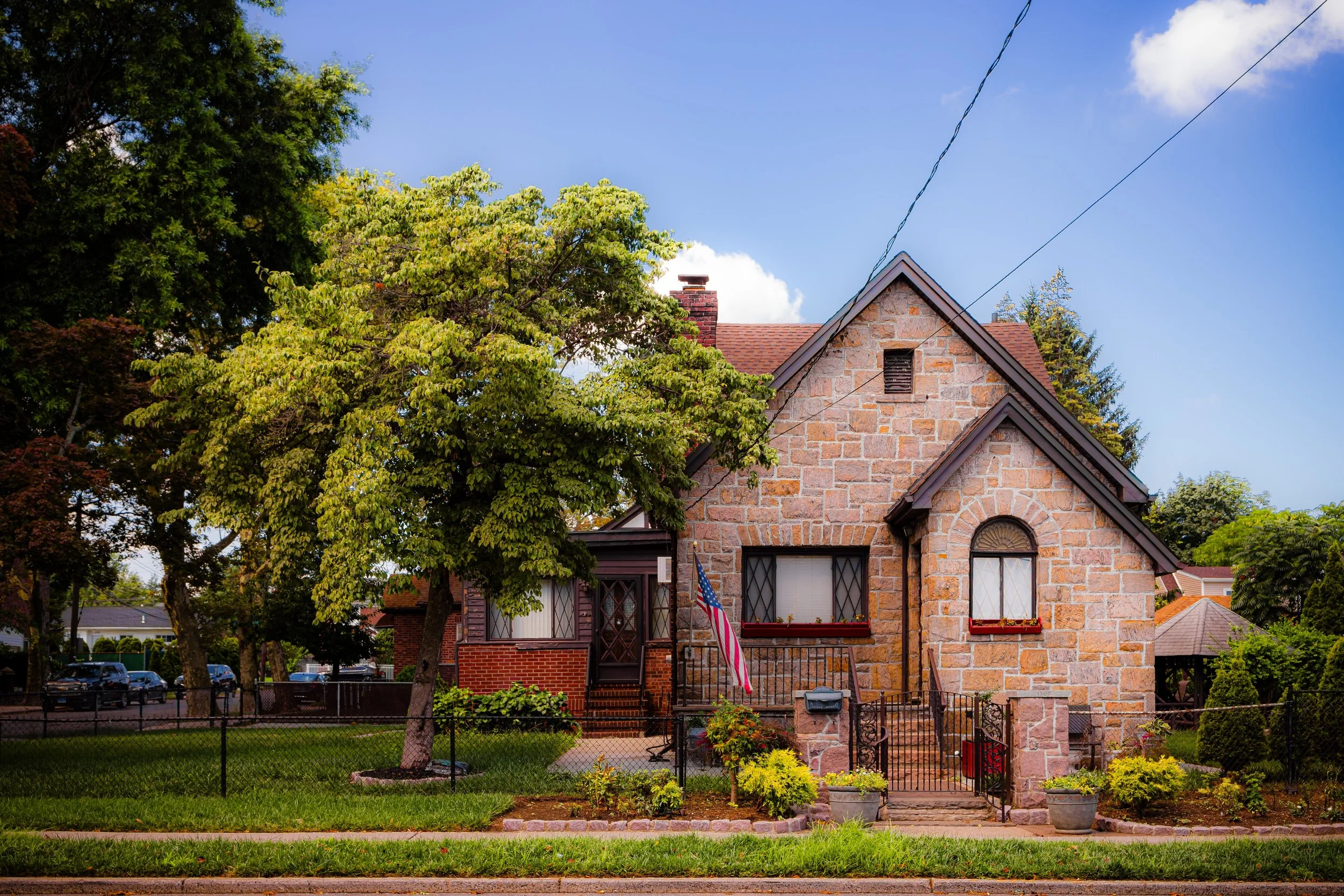
From the 1920s through the 1940s, Country Club evolved into a distinctive residential enclave defined by single-family homes, bungalows, and split-level houses, often owner-built and expanded over time. Many were brick or stucco structures with porches and pitched roofs, reminiscent of small-town America more than New York City. The proximity to Pelham Bay Park and Eastchester Bay gave the neighborhood a recreational flavor—residents boated, fished, and swam at informal beaches and docks along the shore.
During these decades, Country Club attracted a predominantly Italian-American middle class, many of whom were civil servants, police officers, and tradespeople seeking stability and space. Churches such as Our Lady of the Assumption Parish, founded in 1928, became spiritual and social anchors, hosting processions, feasts, and community gatherings that remain local traditions today. Small commercial strips along Burr Avenue and nearby Middletown Road provided bakeries, delis, and family-owned restaurants that strengthened the area’s close-knit feel.
By mid-century, Country Club was fully built out but retained a semi-rural atmosphere. Streets without sidewalks, ample yards, and limited public transportation reinforced its suburban identity within the Bronx.
Country Club Video Coming Soon
Mid–Late 20th Century: Preservation and Identity
Through the 1950s–1980s, while much of the Bronx experienced urban decline, Country Club remained remarkably stable. Its isolation—bordered by highways, water, and parkland—shielded it from the economic shocks that afflicted more central neighborhoods. The construction of the Bruckner Expressway in the 1960s created a definitive western boundary but also improved automobile access to Manhattan and Westchester.
Residents organized civic associations to maintain zoning protections that preserved low-density character. The Country Club Civic Association, founded mid-century, successfully lobbied against high-rise developments and championed neighborhood improvements. Its efforts ensured that the area’s signature features—detached homes, green yards, and bayfront views—remained intact even as the surrounding Bronx urbanized.
During these years, new immigrant families from Ireland, Italy, and Greece, later joined by Caribbean and Latin American households, sustained the area’s small-town flavor. Many homes passed from one generation to the next, reinforcing a sense of continuity rare in modern urban life.
21st Century: Waterfront Renewal and Quiet Resilience
In the 21st century, Country Club continues to embody a uniquely suburban enclave within New York City. While many other neighborhoods have densified, it retains its single-family zoning and quiet streets. Modest home renovations and new constructions have refreshed the housing stock, often blending traditional brick façades with modern touches. Pelham Bay Park’s trails and Orchard Beach’s promenade offer recreational outlets just minutes away, while the Eastchester Bay waterfront has seen environmental restoration projects that have reintroduced marshland vegetation and improved shoreline resilience.
The neighborhood remains predominantly homeowner-occupied, with civic pride expressed through immaculate gardens, block associations, and seasonal decorations. The Pelham Bay Bridge and Bruckner Interchange improvements have reduced congestion, and improved access to express buses and the 6 train at Pelham Bay Park Station links residents to the city while preserving the area’s serenity.
Demographically, Country Club reflects the Bronx’s evolving mosaic: long-established Italian-American families now live alongside professionals of Hispanic, Irish, Albanian, and Caribbean descent. Community events—from parish festivals to bayfront cleanups—sustain the neighborhood’s participatory spirit.
Country Club Photo Gallery
Spirit and Legacy
The spirit of Country Club lies in its quiet defiance of the city’s pace—a place where New York feels like a seaside town, and where the rhythm of life is measured not by subways or skyscrapers but by tides and neighborhood gatherings. Its enduring appeal rests in balance: suburban calm within urban reach, privacy without isolation, and history without stagnation.
New York City
Use this custom Google map to explore where every neighborhood in all five boroughs of New York City is located.
The Five Boroughs
One of New York City’s unique qualities is its organization in to 5 boroughs: Manhattan, Brooklyn, Queens, The Bronx, and Staten Island. These boroughs are part pragmatic administrative districts, and part vestiges of the region’s past. Each borough is an entire county in New York State - in fact, Brooklyn is, officially, Kings County, while Staten Island is, officially Richmond County. But that’s not the whole story …
Initially, New York City was located on the southern tip of Manhattan (now the Financial District) that was once the Dutch colony of New Amsterdam. Across the East River, another city was rising: Brooklyn. In time, the city planners realized that unification between the rapidly rising cities would create commercial and industrial opportunities - through streamlined administration of the region.
So powerful was the pull of unification between New York and Brooklyn that three more counties were pulled into the unification: The Bronx, Queens, and Staten Island. And on January 1, 1898, the City of New York unified two cities and three counties into one Greater City of New York - containing the five boroughs we know today.
But because each borough developed differently and distinctly until unification, their neighborhoods likewise uniquely developed. Today, there are nearly 390 neighborhoods, each with their own histories, cultures, cuisines, and personalities - and each with residents who are fiercely proud of their corner of The Big Apple.


