BAY TERRACE
Queens
Geographic Setting
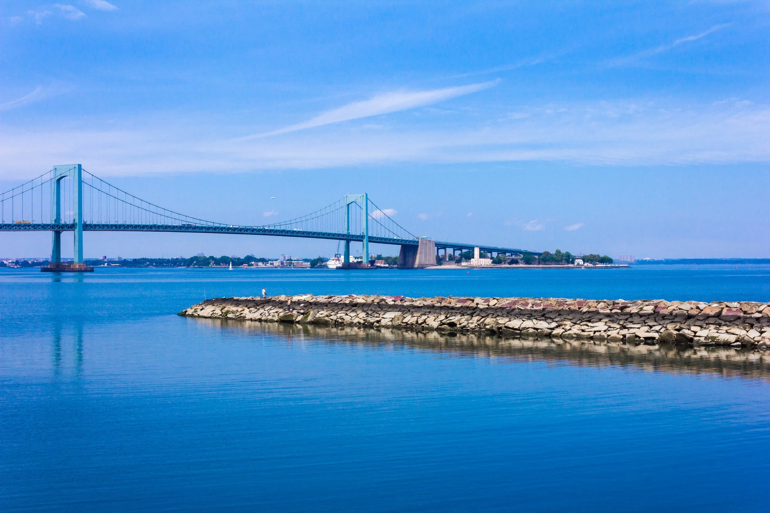
Bounded by 26th Avenue to the south, Utopia Parkway to the west, Little Bay to the north, and Little Neck Bay to the east, Bay Terrace occupies a distinctive waterfront plateau in northeastern Queens—a serene residential enclave that blends suburban calm with sweeping maritime vistas. Perched above the waters that separate Queens from the Bronx, Bay Terrace commands views of the Throgs Neck Bridge, the Clearview Expressway Viaduct, and the converging channels of Long Island Sound. Its landscape unfolds in graceful gradients: from quiet tree-lined crescents near 26th Avenue to open lawns and parkland descending toward the shoreline.
The neighborhood’s core is defined by the Bay Terrace Shopping Center along Bell Boulevard and the postwar garden apartment complexes that radiate outward from it, built during the mid-20th century to accommodate returning veterans and expanding families. Wide streets, green medians, and consistent building setbacks reflect the era’s modernist suburban planning ideals. The area is bounded by parklands—Little Bay Park, Fort Totten Park, and the Cross Island Parkway Greenway—which together create one of Queens’ most continuous stretches of waterfront recreation. With Bayside immediately to the south and Whitestone to the west, Bay Terrace forms both a literal and symbolic meeting point between urban density and coastal retreat.
Etymology and Origins
The name “Bay Terrace” emerged in the post–World War II era as part of the neighborhood’s modern suburban rebranding, though its landscape carries much older roots. The “Bay” references the adjacent Little Neck Bay and Little Bay, while “Terrace” evokes the elevated bluff upon which the community stands. Before its mid-century development, the land was part of the historic Bell family estate, which for generations encompassed much of northern Bayside and the adjacent shoreline. The Bell family, descendants of early English settlers in the Town of Flushing, maintained farms, meadows, and woodlots across this peninsula from the 18th century onward.
The Neighborhood
19th Century: Estates by the Water
In the 19th century, the area remained largely rural, characterized by small farms, tidal marshes, and summer estates owned by Manhattan merchants who prized its sea breezes and isolation. The arrival of the Long Island Rail Road’s Bayside Station (1866) and later the construction of the Clearview Expressway and Throgs Neck Bridge (both completed in the early 1960s) would transform this pastoral expanse into one of the borough’s most desirable residential enclaves.
During the late 1800s, the peninsula that would become Bay Terrace was part of the larger Bayside region, an area known for its genteel estates and horticultural farms. Wealthy families from Manhattan built summer homes overlooking the bay, taking advantage of the cool maritime air. The Bell, Lawrence, and Willets families owned much of the surrounding acreage, and remnants of their property lines can still be traced in today’s irregular street layout north of 26th Avenue.
While neighboring Bayside developed around the railroad, the far-northern waterfront remained sparsely settled, its open meadows occasionally used for grazing and small-scale agriculture. The shoreline was rich in oysters, clams, and fish, and local watermen operated small docks and boathouses along Little Bay. The absence of large-scale industry preserved the area’s natural beauty, setting the stage for its eventual suburban transformation.
Early–Mid 20th Century: From Farmland to Suburb
The early 20th century brought incremental change. The U.S. Army’s Fort Totten, established just west of the area in the late 19th century, provided a strategic military presence at the entrance to Long Island Sound and contributed to local employment. The surrounding farmland, however, remained undeveloped until the 1940s, when the construction of the Clearview Expressway (I-295) and Throgs Neck Bridge provided new vehicular access and redefined the peninsula’s relationship to the rest of New York City.
In the 1950s, the Cord Meyer Development Company—famous for creating Forest Hills Gardens—purchased much of the former Bell estate to build Bay Terrace at Bayside, a planned community of modern garden apartments, shopping facilities, and landscaped plazas. Construction began in 1952, marking one of Queens’ most ambitious postwar suburban projects. The Bay Terrace Shopping Center, opened in 1958, became its civic and commercial anchor, while nearby P.S. 169 and the Bay Terrace Community Center provided the educational and recreational infrastructure essential to a self-contained neighborhood.
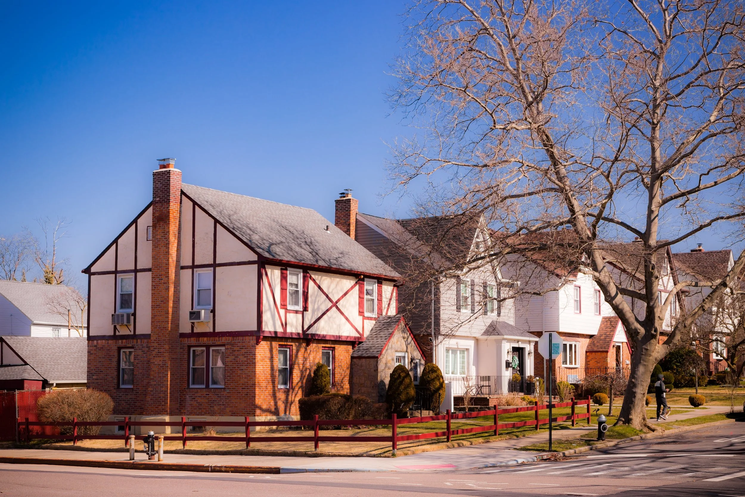
Architecturally, the development reflected the optimism of the era: brick apartment buildings with balconies, manicured courtyards, and ample parking lots designed for the car-owning middle class. Advertising of the time promised “country living within city limits,” and Bay Terrace’s location—minutes from the bridge to the Bronx yet surrounded by open sky and water—fulfilled that vision.
Bay Terrace Video Coming Soon
Late 20th Century: Growth, Preservation, and Community Identity
By the 1960s and 1970s, Bay Terrace had matured into a stable middle-class enclave. The Bay Terrace Cooperative Apartments, built during this period, offered ownership opportunities to longtime renters, further cementing community investment. The area’s social life centered around schools, civic associations, and the shopping center, whose movie theater, restaurants, and family-owned stores fostered a small-town atmosphere rare within New York’s borders.
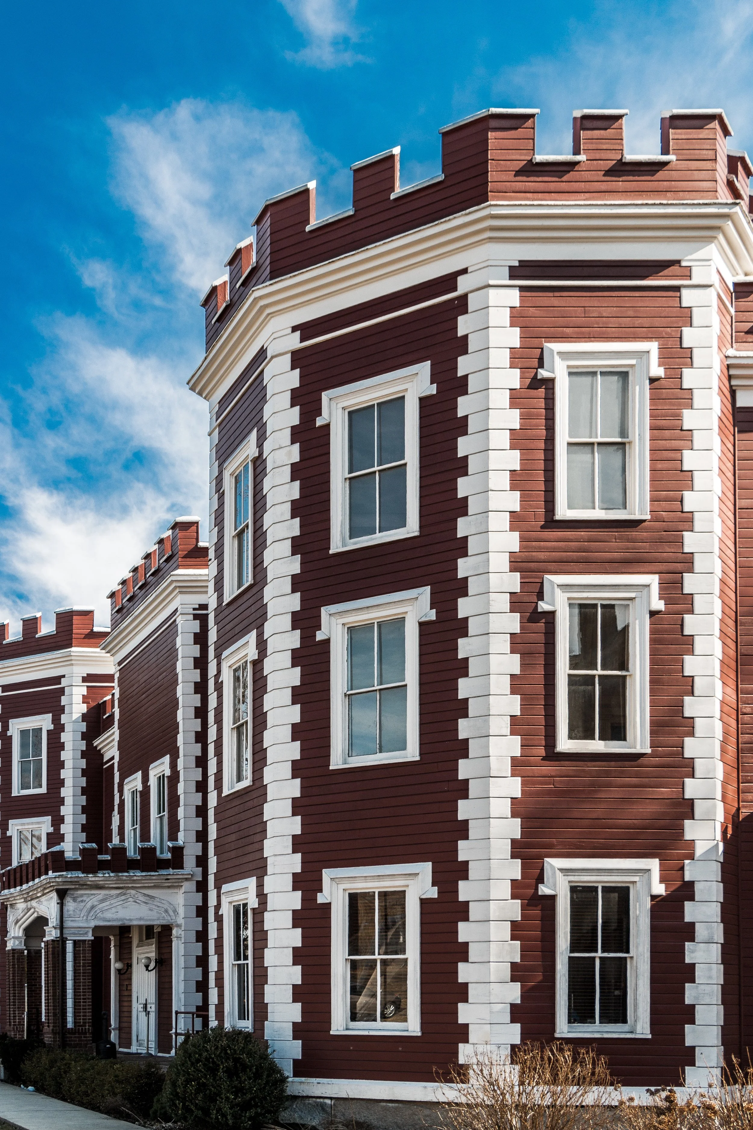
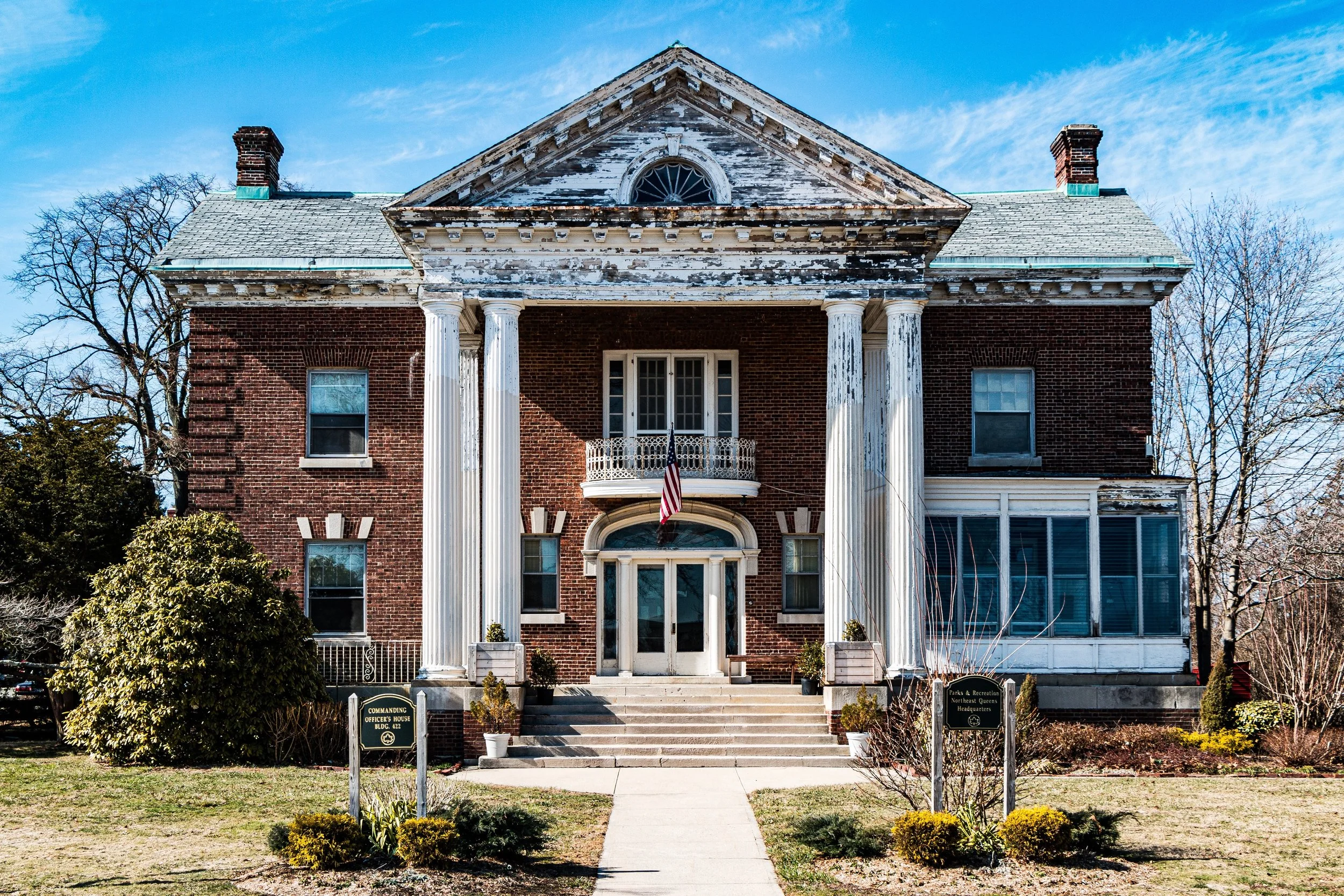
At the same time, Bay Terrace’s open spaces became a focal point for preservation efforts. The decommissioning of Fort Totten as an active military base in the 1970s prompted community advocacy to save its historic buildings and parklands from private redevelopment. These efforts ultimately led to the creation of Fort Totten Park, whose 149 acres now form one of the city’s most unique combinations of historic architecture, recreation, and natural shoreline. Little Bay Park, located at the base of the Throgs Neck Bridge, was also expanded and improved, offering waterfront trails, playgrounds, and views that make the northern edge of Bay Terrace a quiet haven within the metropolis.
21st Century: Renewal and Balance by the Bay
In the 2000s and 2010s, Bay Terrace entered a new phase of renewal, adapting to modern demands while retaining its mid-century suburban character. The Bay Terrace Shopping Center underwent major renovations, introducing national retailers alongside long-established local businesses, while the nearby Clearview Golf Course and Cross Island Parkway Greenway reinforced the area’s reputation for accessible recreation. Rising real estate values across Queens drew new residents—young professionals, families, and retirees—seeking tranquility, water views, and proximity to transit without sacrificing connection to the city.
Bay Terrace’s population today reflects the multicultural richness of Queens, though its physical environment remains distinct: broad lawns, co-ops, and condominiums bordered by parks and bayfront promenades. Civic groups such as the Bay Terrace Community Alliance continue to advocate for sustainable development, improved transit links, and the protection of waterfront vistas from overbuilding. The neighborhood’s careful balance between progress and preservation has allowed it to modernize without losing the spatial grace envisioned by its postwar planners.
Bay Terrace Photo Gallery
Spirit and Legacy
Bay Terrace stands as one of New York’s most enduring experiments in planned suburban living within city boundaries. Its evolution—from 19th-century farmland to postwar model community to 21st-century multicultural enclave—reflects the broader arc of Queens itself: aspiration, adaptation, and steady stewardship of place. The air still carries salt from the bay, the bridges still gleam in evening light, and the neighborhood’s identity remains tied to its view of the water—expansive, open, and quietly proud.
New York City
Use this custom Google map to explore where every neighborhood in all five boroughs of New York City is located.
The Five Boroughs
One of New York City’s unique qualities is its organization in to 5 boroughs: Manhattan, Brooklyn, Queens, The Bronx, and Staten Island. These boroughs are part pragmatic administrative districts, and part vestiges of the region’s past. Each borough is an entire county in New York State - in fact, Brooklyn is, officially, Kings County, while Staten Island is, officially Richmond County. But that’s not the whole story …
Initially, New York City was located on the southern tip of Manhattan (now the Financial District) that was once the Dutch colony of New Amsterdam. Across the East River, another city was rising: Brooklyn. In time, the city planners realized that unification between the rapidly rising cities would create commercial and industrial opportunities - through streamlined administration of the region.
So powerful was the pull of unification between New York and Brooklyn that three more counties were pulled into the unification: The Bronx, Queens, and Staten Island. And on January 1, 1898, the City of New York unified two cities and three counties into one Greater City of New York - containing the five boroughs we know today.
But because each borough developed differently and distinctly until unification, their neighborhoods likewise uniquely developed. Today, there are nearly 390 neighborhoods, each with their own histories, cultures, cuisines, and personalities - and each with residents who are fiercely proud of their corner of The Big Apple.


