UNIVERSITY HEIGHTS
The Bronx
Geographic Setting
Bounded by West Fordham Road to the north, Jerome Avenue to the east, West 179th Street to the south, and the Harlem River to the west, University Heights occupies one of the Bronx’s most striking landscapes—a steep, elevated plateau that rises dramatically from the Harlem River’s edge to the ridge along University Avenue. Set opposite Manhattan’s Washington Heights, the neighborhood takes its name from the academic institutions that historically crowned its hills, most notably New York University’s Bronx campus (now Bronx Community College).
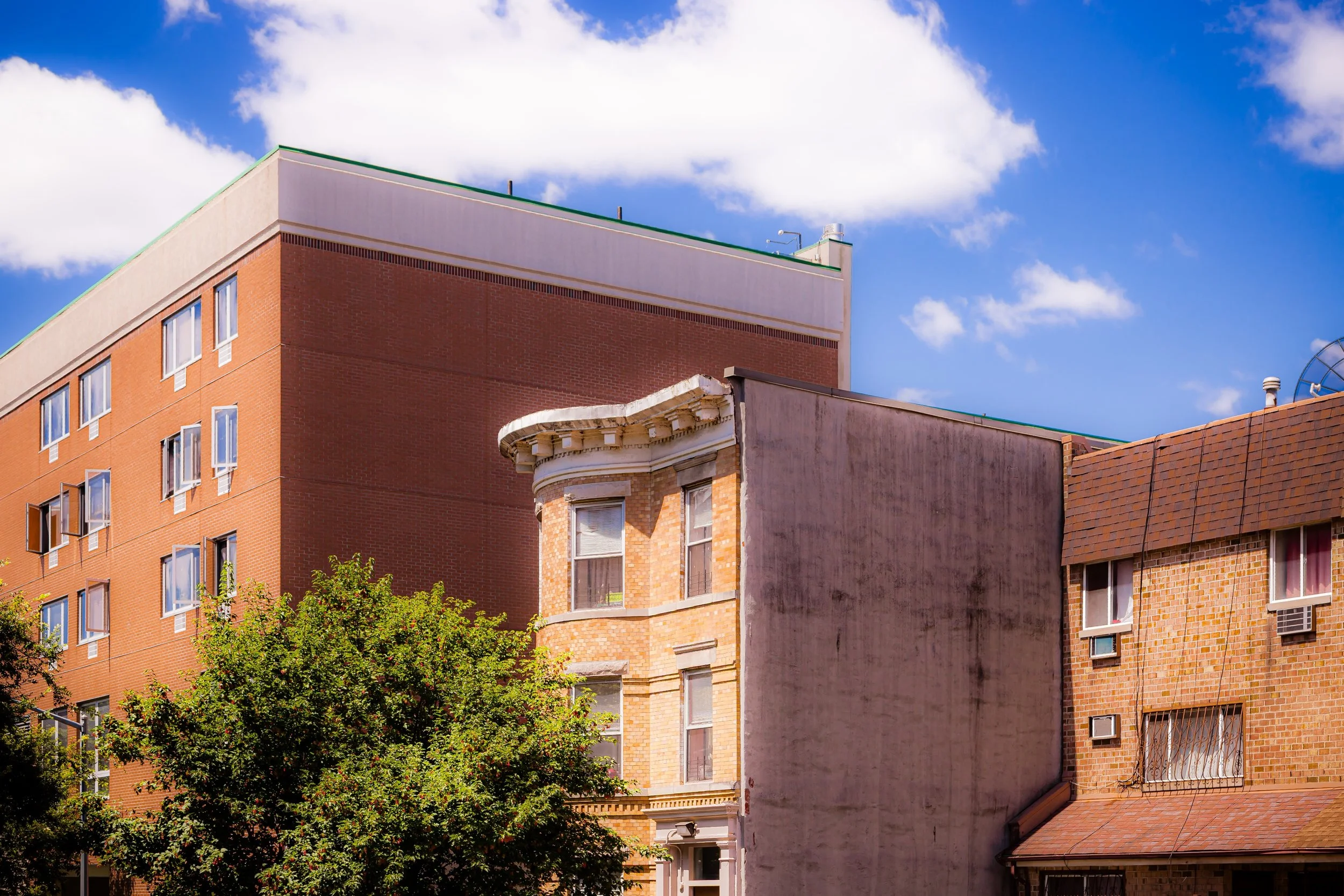
The neighborhood’s terrain shapes its rhythm: from the riverfront’s rail lines and the Major Deegan Expressway up to the residential heights above, streets such as Sedgwick Avenue, Andrews Avenue, and Davidson Avenue climb sharply, lined with prewar apartment houses, rowhouses, and art deco buildings characteristic of the Bronx’s 1920s–30s boom. Along Fordham Road, a major commercial corridor thrums with shops, buses, and street life, while the University Heights Bridge connects the neighborhood directly to West 207th Street in Manhattan, maintaining the cross-river relationship that has defined this section of the Bronx for over a century.
From its elevated vantage point, University Heights commands sweeping views of the Harlem River, the Manhattan skyline, and the green dome of the Hall of Fame for Great Americans, anchoring a community that has long blended education, architecture, and resilience.
Etymology
The name “University Heights” originated in 1894, when New York University relocated its undergraduate college from Washington Square to a new hilltop campus overlooking the Harlem River. The elevated terrain and the presence of the university lent the area its enduring name—“Heights” for the landform, and “University” for the institution that made it a center of learning in the Bronx.
The NYU campus quickly became a defining landmark, its neoclassical buildings and terraced lawns visible for miles. When the university sold the property in 1973 to the City University of New York, it was rechristened Bronx Community College, but the neighborhood’s name—and its scholarly associations—remained.
The Neighborhood
Origins through the 19th Century
Before its transformation into an educational enclave, the land that would become University Heights was part of the rural Morris estate, a vast tract of farmland and woodland extending from the Harlem River eastward toward the central Bronx. During the 18th and early 19th centuries, the area remained sparsely settled, its ridges offering commanding defensive positions during the Revolutionary War.
By the mid-19th century, as New York’s population expanded northward, the creation of Fordham Road and Kingsbridge Road opened the region to suburban development. The Hudson River Railroad and later the New York Central Railroad provided access to the Harlem River shore, while new bridges—especially the High Bridge (1848) and University Heights Bridge (1895)—linked the Bronx and Manhattan, accelerating residential growth.
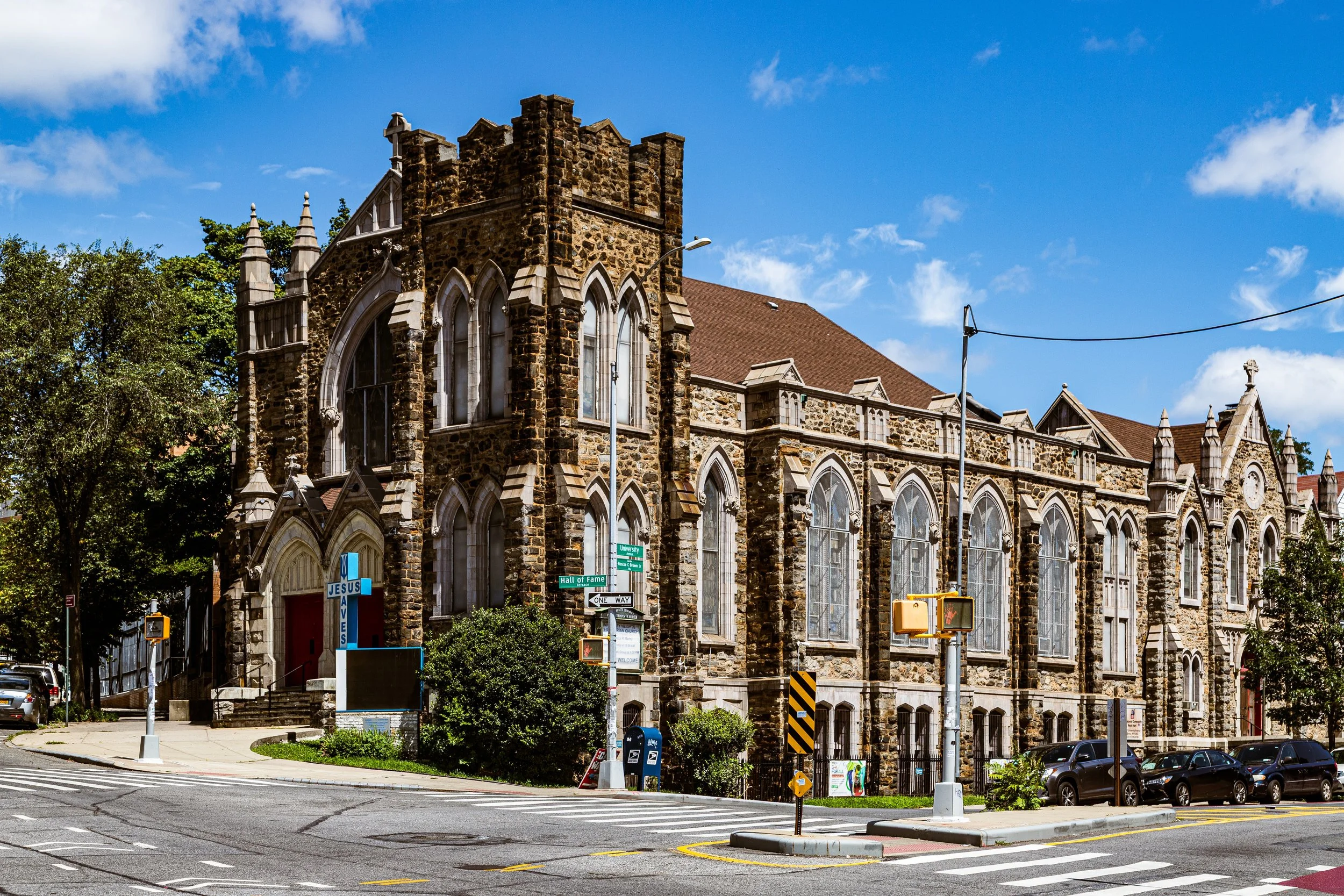
When NYU purchased a portion of the former Tibbetts Brook ridge in the 1890s, the university transformed the landscape. The celebrated architect Stanford White designed the original campus buildings—handsome, classical structures arranged around broad lawns overlooking the river. The most iconic of these, the Gould Memorial Library (1899), with its domed rotunda and marble colonnades, became both an architectural landmark and a visual symbol for the neighborhood that would take its name.
Early 20th Century: Urbanization and Cultural Formation
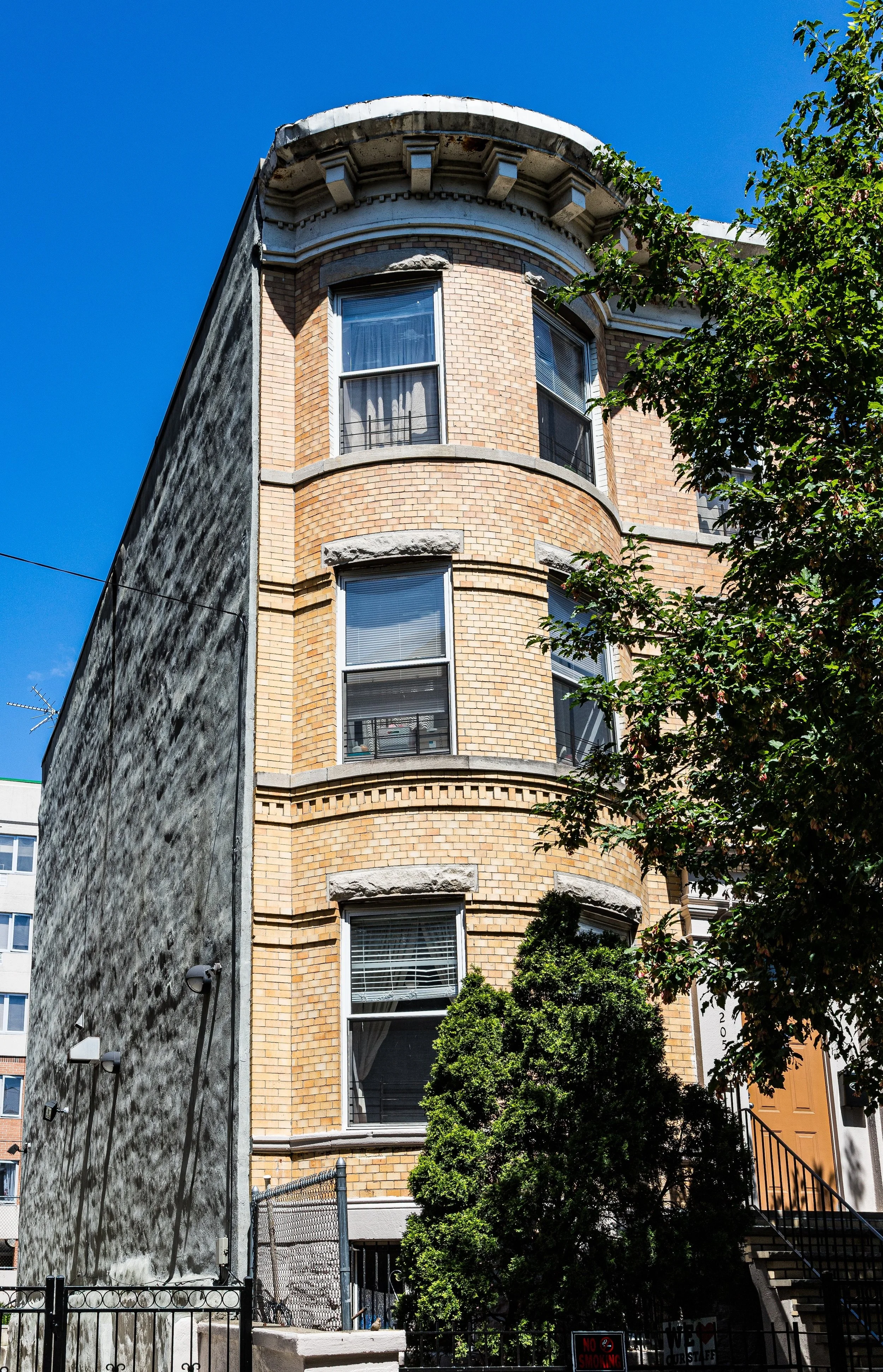
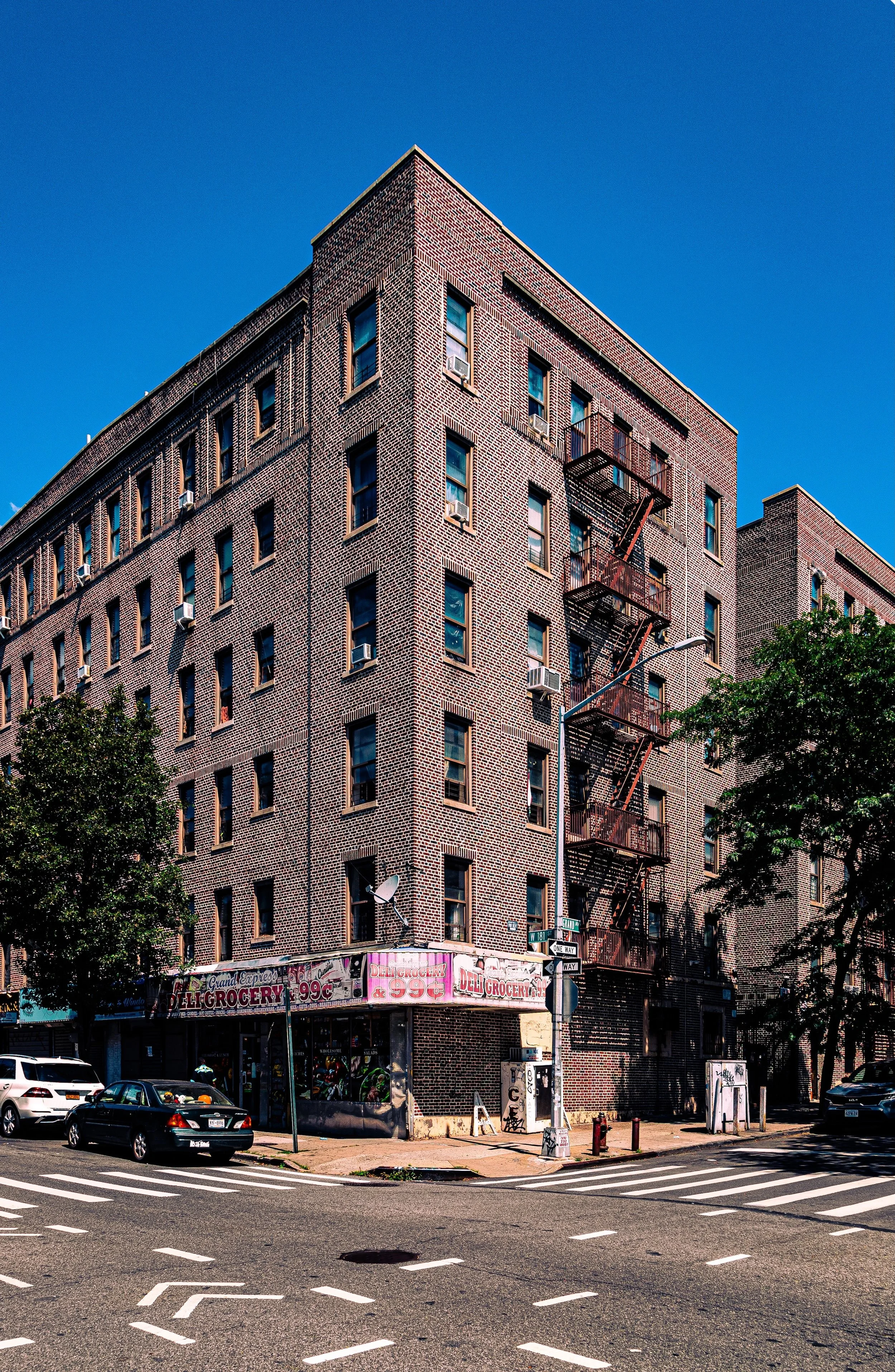
In the early 20th century, University Heights evolved from an academic enclave into a thriving residential district. The extension of the IRT Jerome Avenue Line (4 train) in 1917, with stations at 183rd Street and Fordham Road, brought waves of development—five- and six-story apartment houses, many with ornate terra cotta façades, rose along the hillsides, offering affordable housing to middle-class families.
The neighborhood’s proximity to educational institutions—NYU, the College of Mount St. Vincent, and DeWitt Clinton High School (relocated nearby in 1929)—made it a magnet for teachers, professionals, and immigrant families seeking stable community life. The streets filled with Irish, Jewish, and Italian-American residents, whose synagogues, churches, and civic halls became the backbone of neighborhood culture.
Commercial corridors emerged along Fordham Road and Jerome Avenue, connecting the area to the broader Bronx economy. Meanwhile, the Hall of Fame for Great Americans—an open-air colonnade honoring national figures—turned the NYU campus into both a tourist attraction and a civic monument, reinforcing the district’s intellectual aura.
University Heights Video Coming Soon
Mid–Late 20th Century: Transition and Turbulence
The mid-20th century brought both transformation and challenge. After World War II, many original residents moved to the suburbs, and new waves of migration reshaped University Heights. Puerto Rican families became the neighborhood’s dominant population by the 1960s, followed by Dominican, African-American, and later West African and Caribbean communities.
The sale of the NYU campus to CUNY’s Bronx Community College (1973) marked a symbolic transition—from elite academia to public education—reflecting the democratization of the Bronx itself. However, the same decades saw disinvestment and neglect as the South Bronx burned. Though University Heights suffered population loss, it fared better than many neighborhoods thanks to its institutional anchors, strong building stock, and community activism.
In the 1980s and 1990s, tenant associations, churches, and local organizations such as the University Neighborhood Housing Program (UNHP) and Fordham Bedford Housing Corporation led efforts to rehabilitate abandoned buildings, restore infrastructure, and preserve affordable housing. Their work transformed the neighborhood from a symbol of decline into one of recovery—a revival rooted in grassroots strength.
21st Century: Revitalization, Education, and Identity
In the 21st century, University Heights has reemerged as one of the Bronx’s most vibrant and intellectually grounded neighborhoods. The Bronx Community College campus, with its restored Gould Memorial Library and Hall of Fame, remains a commanding presence, both architecturally and educationally. The campus’s restoration projects—culminating in its 2012 designation as a National Historic Landmark—have reaffirmed its status as one of New York’s architectural treasures.
The neighborhood today is a mosaic of cultures: Dominican, Ghanaian, Nigerian, Puerto Rican, and Bangladeshi families form a dynamic civic fabric. Small businesses along University Avenue, Jerome Avenue, and Fordham Road offer a microcosm of global Bronx life—restaurants, markets, and shops echoing languages from across the Caribbean, Africa, and South Asia.
New investments in parks, affordable housing, and riverfront access have further improved quality of life. The Harlem River Greenway, currently expanding northward, promises to reconnect residents to the waterfront that once defined the area’s geography. Meanwhile, the academic energy of Bronx Community College and nearby institutions continues to animate the district, ensuring that the word “University” in its name remains both literal and symbolic.
University Heights Photo Gallery
Spirit and Legacy
The spirit of University Heights lies in its union of learning, endurance, and elevation—both topographical and human. Its steep streets tell a story of ascent: from farmland to university town, from decline to renewal, from isolation to vibrant diversity.
New York City
Use this custom Google map to explore where every neighborhood in all five boroughs of New York City is located.
The Five Boroughs
One of New York City’s unique qualities is its organization in to 5 boroughs: Manhattan, Brooklyn, Queens, The Bronx, and Staten Island. These boroughs are part pragmatic administrative districts, and part vestiges of the region’s past. Each borough is an entire county in New York State - in fact, Brooklyn is, officially, Kings County, while Staten Island is, officially Richmond County. But that’s not the whole story …
Initially, New York City was located on the southern tip of Manhattan (now the Financial District) that was once the Dutch colony of New Amsterdam. Across the East River, another city was rising: Brooklyn. In time, the city planners realized that unification between the rapidly rising cities would create commercial and industrial opportunities - through streamlined administration of the region.
So powerful was the pull of unification between New York and Brooklyn that three more counties were pulled into the unification: The Bronx, Queens, and Staten Island. And on January 1, 1898, the City of New York unified two cities and three counties into one Greater City of New York - containing the five boroughs we know today.
But because each borough developed differently and distinctly until unification, their neighborhoods likewise uniquely developed. Today, there are nearly 390 neighborhoods, each with their own histories, cultures, cuisines, and personalities - and each with residents who are fiercely proud of their corner of The Big Apple.


