BELMONT
The Bronx
Geographic Setting
Verified from your CityNeighborhoods.NYC MyMap, Belmont is bounded by Fordham Road to the north, Webster Avenue to the west, East 180th Street to the south, and Southern Boulevard / Bronx Park to the east. Within this tight rectangle, a compact grid—anchored by Arthur Avenue and East 187th Street—forms a walkable village set between two distinct edges: the rail-and-retail corridor of Webster Avenue to one side and the treed horizons of Bronx Park (with the Bronx Zoo just across Southern Boulevard) to the other. The rhythm of Belmont flows north–south along Arthur, east–west across E 187th, and outward to the pulse of Fordham Road, where students, shoppers, buses, and deliveries never quite let the sidewalks rest.
Etymology
The name “Belmont”—from the Italian bel monte (“beautiful hill”)—was adopted in the late 19th century when developers parceled the old Lorillard lands for a garden-suburb ideal beside the new parklands. Part poetry, part sales pitch, it invoked the neighborhood’s gentle rise west of Bronx Park and a promise of civility at the city’s edge. The word stuck not because it named a topographic summit but because it named an aspiration: a neighborhood where everyday life could feel a little elevated.
The Neighborhood
Origins
Before streets and stoops, this ground was part of the Lorillard family estate along the Bronx River. The family’s 1840 red-brick snuff mill—still standing inside the New York Botanical Garden—signals the area’s early industrial past, when mills and farms dotted a largely rural countryside. In the 1890s, creation of Bronx Park and the arrival of streetcars along Southern Boulevard and Fordham Road drew workers and tradesmen to new blocks being cut between Webster Avenue and the park. By the turn of the century, Italian laborers who helped build and service the zoo and parkway system were renting flats on Arthur Avenue, opening bakeries on E 187th, and laying the cultural foundation that would define Belmont for the next hundred years.
Early 20th Century: Market Streets and Parish Life
Between the 1910s and 1930s, Belmont matured into the Little Italy of the Bronx. The neighborhood’s economy and identity coalesced around Arthur Avenue, where pork stores, fishmongers, and bread ovens worked in concert like sections of an orchestra. On fair-weather mornings, produce stands bloomed along East 187th Street; by afternoon, schoolchildren queued for ices at corner candy stores while seamstresses leaned from tenement windows to trade gossip across Hughes and Crescent.
Faith and family were stitched tightly into the grid. Our Lady of Mount Carmel (at E 187th & Belmont Avenue) drew parishioners from blocks in every direction, anchoring feast days, processions, and the daily cadence of baptisms, weddings, and funerals. The city’s reform movement gave Belmont a civic anchor of another kind when Mayor LaGuardia opened the enclosed Arthur Avenue Retail Market in 1940, bringing butchers, cheesemongers, and greengrocers under one skylit roof. The market tempered winter’s bite, stabilized rents for vendors, and, crucially, kept the neighborhood’s food economy local and legible.
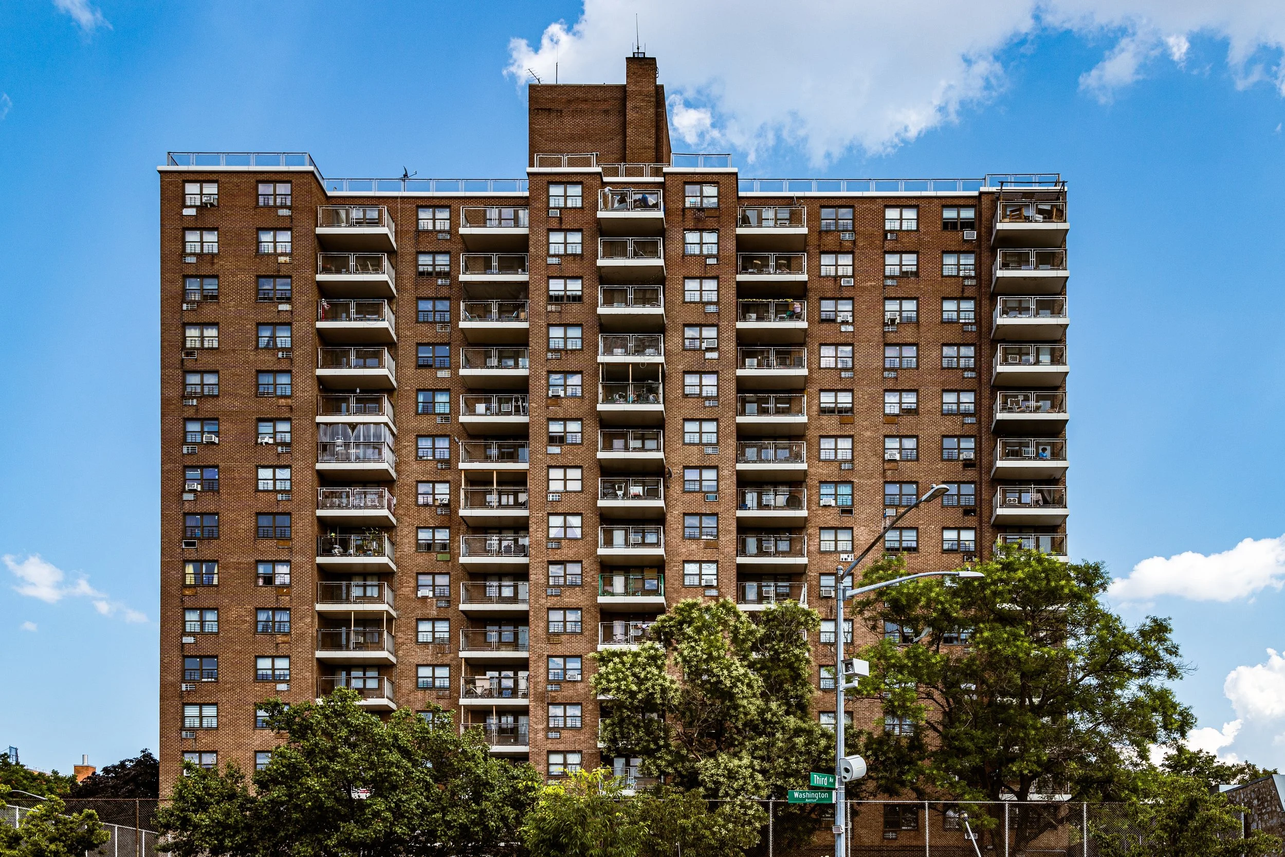
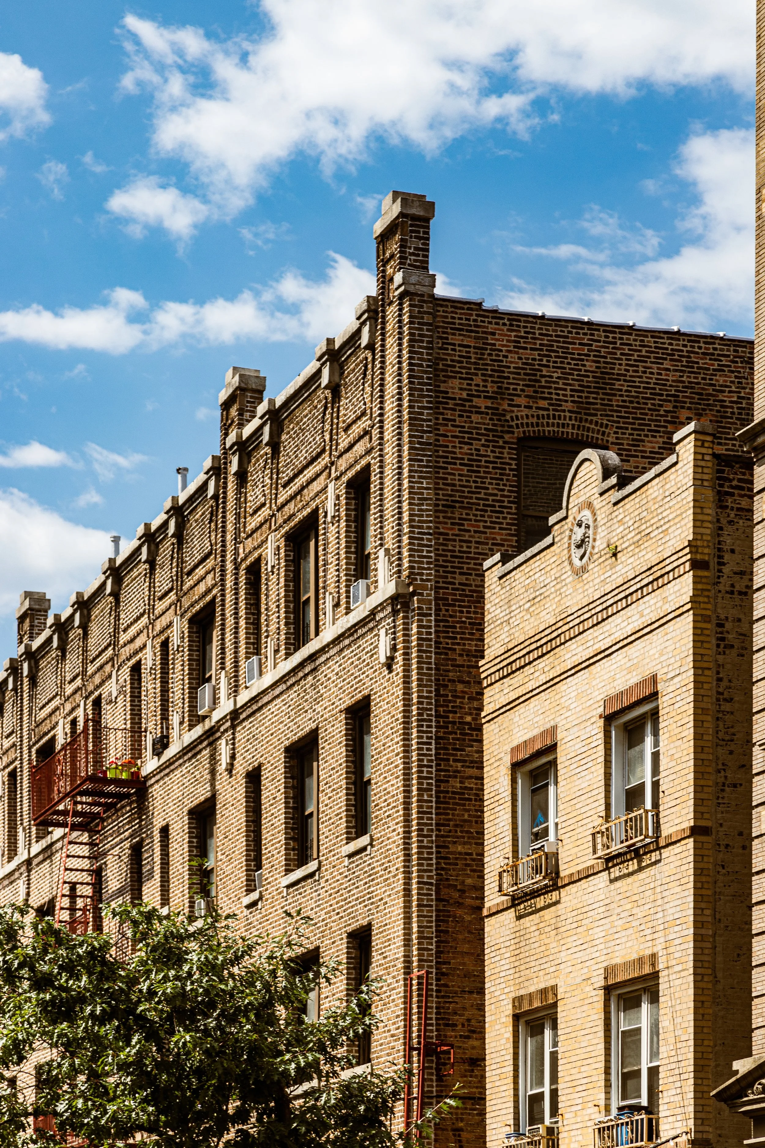
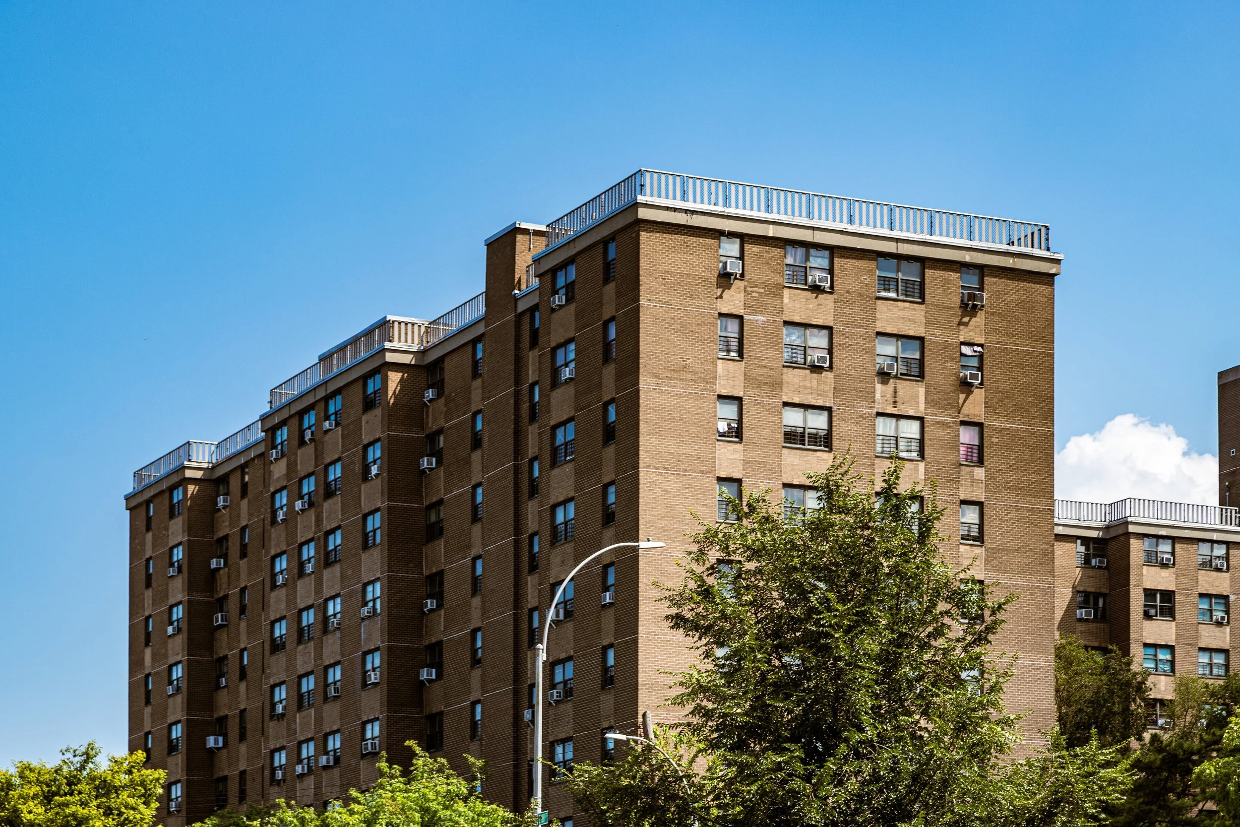
Residentially, five-story walk-ups rose along Bathgate, Hughes, and Crescent, while modest apartments over shops lined Arthur and E 187th. Webster Avenue delivered wholesale goods and rail access; Fordham Road connected Belmont to classrooms at Fordham University and to mass retail farther west; and the green edge along Southern Boulevard bled park air into the tenement courts—a daily reminder that the zoo and gardens were not just destinations but neighbors.
Belmont Video Coming Soon
Mid–Late 20th Century: Holding the Center
After World War II, second-generation Italian families began the suburban migration, yet Belmont’s center held. New Puerto Rican and Dominican residents took over storefronts and apartments, Albanian families opened cafés and social clubs, and the foodways endured because they were useful, not merely sentimental. On Saturdays, shoppers still moved counterclockwise from bakery to pork store to pasta shop; on Sundays, Mount Carmel still spilled parishioners onto E 187th beneath a scatter of banners and the smell of espresso.
When the Bronx staggered during the 1970s, Belmont avoided the worst. Three things helped: (1) its short supply chain—imports and perishables could move from Webster Avenue or Hunts Point to Arthur Avenue in minutes; (2) the civic spine of parish, merchants’ groups, and block associations that resisted abandonment; and (3) the soft pressure of parkland—Bronx Park filtering noise and offering relief across Southern Boulevard. Even as the elevated line came down and nearby corridors changed, Belmont’s boundedness—Fordham above, E 180th below, Webster and Southern as hard edges—helped the neighborhood police its own continuity.
21st Century: Tradition as a Working Practice
In our era, Belmont thrives by treating tradition as work, not display. Names that anchor the corridor—Borgatti’s, Madonia, Biancardi’s, Mike’s Deli, among others—share the street with Albanian grills, Mexican bakeries, and new trattorie like Zero Otto Nove. Students from Fordham rent on Hughes and Crescent; families cross Southern Boulevard for a zoo afternoon, then swing back through the Retail Market for dinner ingredients. The annual Ferragosto—recast as a neighborhood-wide harvest of food, music, and memory—fills Arthur Avenue with a polyglot crowd that looks precisely like the Bronx: layered, convivial, hungry.
Real estate pressure ebbs and flows, but the corridor’s muscle memory still favors small operators and skills you can smell: bread cooling on racks, fennel snapped at a counter, sausages looped by hand. That tangible craft is Belmont’s best bulwark against becoming a food court in period costume. And the map’s edges still matter. Fordham Road keeps the sidewalks lively; Webster Avenue supplies the back-of-house logistics; Southern Boulevard and Bronx Park keep lungs and tempers cooler than the traffic suggests; E 180th Street keeps the village scaled to feet, not fenders.
Belmont Photo Gallery
Spirit and Legacy
Belmont’s gift is continuity with porosity—a village that lets the city pass through without losing its center. Stand at Arthur Avenue near E 187th at dusk and you can read a century in five minutes: the bell from Mount Carmel, a delivery dolly rattling over bricks, a barista cracking a joke in Italian to a Dominican regular, kids chasing each other toward Southern Boulevard as the zoo’s treeline darkens. This is not a museum of “Old World” memory; it’s a living practice of neighborhood—bounded by Fordham, Webster, E 180th, and Southern—where food, faith, and work keep time for everyone who calls it home.
New York City
Use this custom Google map to explore where every neighborhood in all five boroughs of New York City is located.
The Five Boroughs
One of New York City’s unique qualities is its organization in to 5 boroughs: Manhattan, Brooklyn, Queens, The Bronx, and Staten Island. These boroughs are part pragmatic administrative districts, and part vestiges of the region’s past. Each borough is an entire county in New York State - in fact, Brooklyn is, officially, Kings County, while Staten Island is, officially Richmond County. But that’s not the whole story …
Initially, New York City was located on the southern tip of Manhattan (now the Financial District) that was once the Dutch colony of New Amsterdam. Across the East River, another city was rising: Brooklyn. In time, the city planners realized that unification between the rapidly rising cities would create commercial and industrial opportunities - through streamlined administration of the region.
So powerful was the pull of unification between New York and Brooklyn that three more counties were pulled into the unification: The Bronx, Queens, and Staten Island. And on January 1, 1898, the City of New York unified two cities and three counties into one Greater City of New York - containing the five boroughs we know today.
But because each borough developed differently and distinctly until unification, their neighborhoods likewise uniquely developed. Today, there are nearly 390 neighborhoods, each with their own histories, cultures, cuisines, and personalities - and each with residents who are fiercely proud of their corner of The Big Apple.


