
FOREST HILLS
Queens
Geographic Setting
Bounded by the Long Island Expressway to the north, the Grand Central Parkway to the east, Union Turnpike to the south, and a western boundary that follows Woodhaven Boulevard, Selfridge Street, 67th Avenue, and 102nd Street, Forest Hills occupies the geographic center of Queens—an elegant, tree-lined district that bridges the city’s urban density and its suburban calm. The neighborhood rises gently from the lowlands near Rego Park toward higher ground eastward, where rows of prewar co-ops and Tudor-style homes overlook the green expanse of Forest Park and the parkways beyond.
Distinct from but adjoining the private enclave of Forest Hills Gardens, this larger and more populous section of Forest Hills forms one of Queens’ most balanced residential landscapes. Its architecture—an artful blend of 1920s apartment houses, midcentury garden co-ops, and detached single-family homes—reflects successive waves of thoughtful urban planning. The neighborhood’s main arteries, Queens Boulevard and Austin Street, form its commercial core: a cosmopolitan corridor lined with boutiques, bakeries, restaurants, and cultural institutions. Beneath them, the E, F, M, and R subway lines connect Forest Hills directly to Midtown Manhattan, while the LIRR station at 71st Avenue/Continental Avenue offers swift rail access to Penn Station and Long Island.
To the south, Union Turnpike and Metropolitan Avenue trace the edges of Forest Park, providing both a natural buffer and a weekend playground for residents. The Grand Central Parkway, lined with mature trees, forms the neighborhood’s eastern limit—beyond which lie Kew Gardens Hills and Flushing Meadows–Corona Park.
Etymology and Origins
The name “Forest Hills” was coined in 1906 by the Cord Meyer Development Company, which purchased 600 acres of farmland from the Whitepot section of the old Town of Newtown. “Forest Hills” was chosen to evoke the area’s rolling terrain and wooded character, a deliberate attempt to market the new suburb as a bucolic retreat from the noise and congestion of Manhattan and Brooklyn. Before development, the land had been dotted with Dutch and English farms since the 1600s—Whitepot being the original colonial settlement that stretched roughly from present-day Rego Park to Forest Hills Gardens.
The opening of the Long Island Rail Road’s Forest Hills station in 1908 and the extension of Queens Boulevard soon after accelerated growth. The area north of the rail line developed as a planned middle- and upper-middle-class suburb, distinct from but complementary to the adjacent, privately designed Forest Hills Gardens to the south. Cord Meyer’s early developments emphasized landscaped streets, consistent architectural styles, and access to schools and transit—hallmarks of what would become one of Queens’ most desirable communities.
The Neighborhood
Early 20th Century: Suburban Ideal and Urban Growth
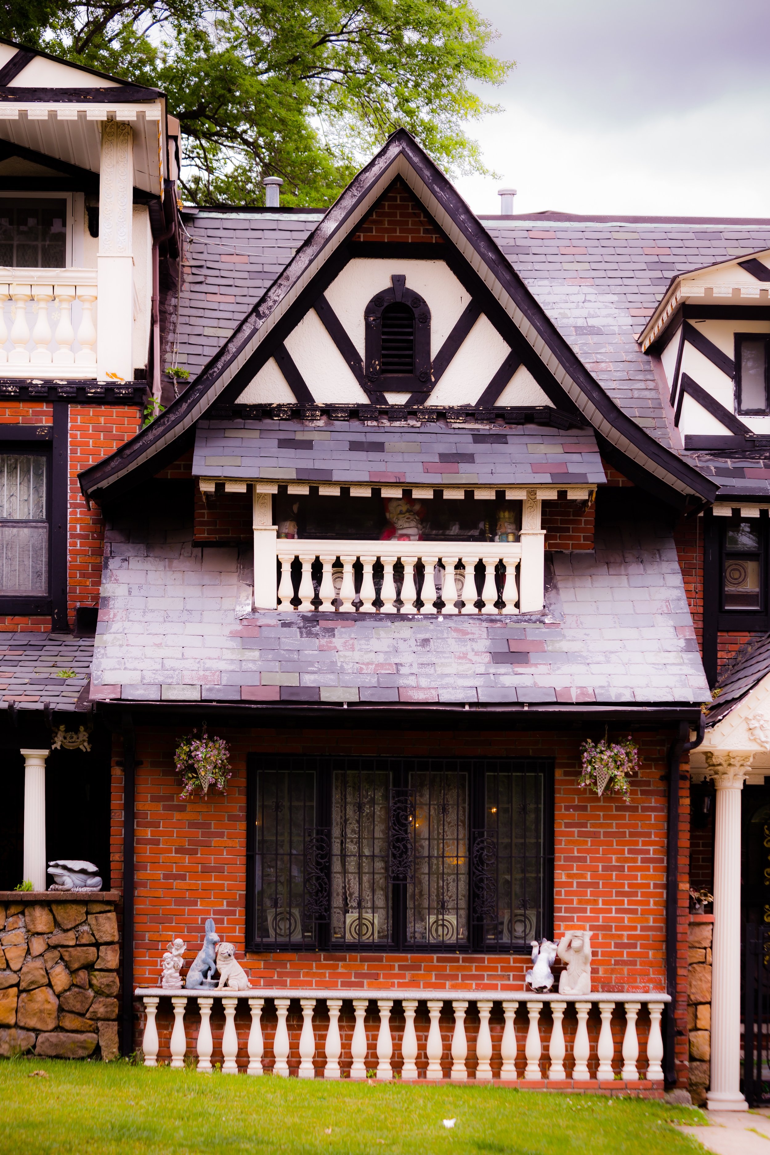
From 1910 through the 1930s, Forest Hills blossomed as a model of early 20th-century urban-suburban design. Wide avenues such as Yellowstone Boulevard and Ascan Avenue were lined with gracious brick apartment houses and semi-detached Tudor and Colonial Revival homes. Developers promoted the area’s “suburban convenience,” offering homeowners both tranquility and the amenities of city life.
The arrival of the IND subway (E and F lines) in 1936 transformed Forest Hills into a true commuter neighborhood, dramatically increasing accessibility to Manhattan. Elegant apartment buildings rose along Queens Boulevard, including the landmarked Forest Hills Inn Apartments, The Nebraska, and The Parker Towers, which embodied Art Deco and prewar grandeur.
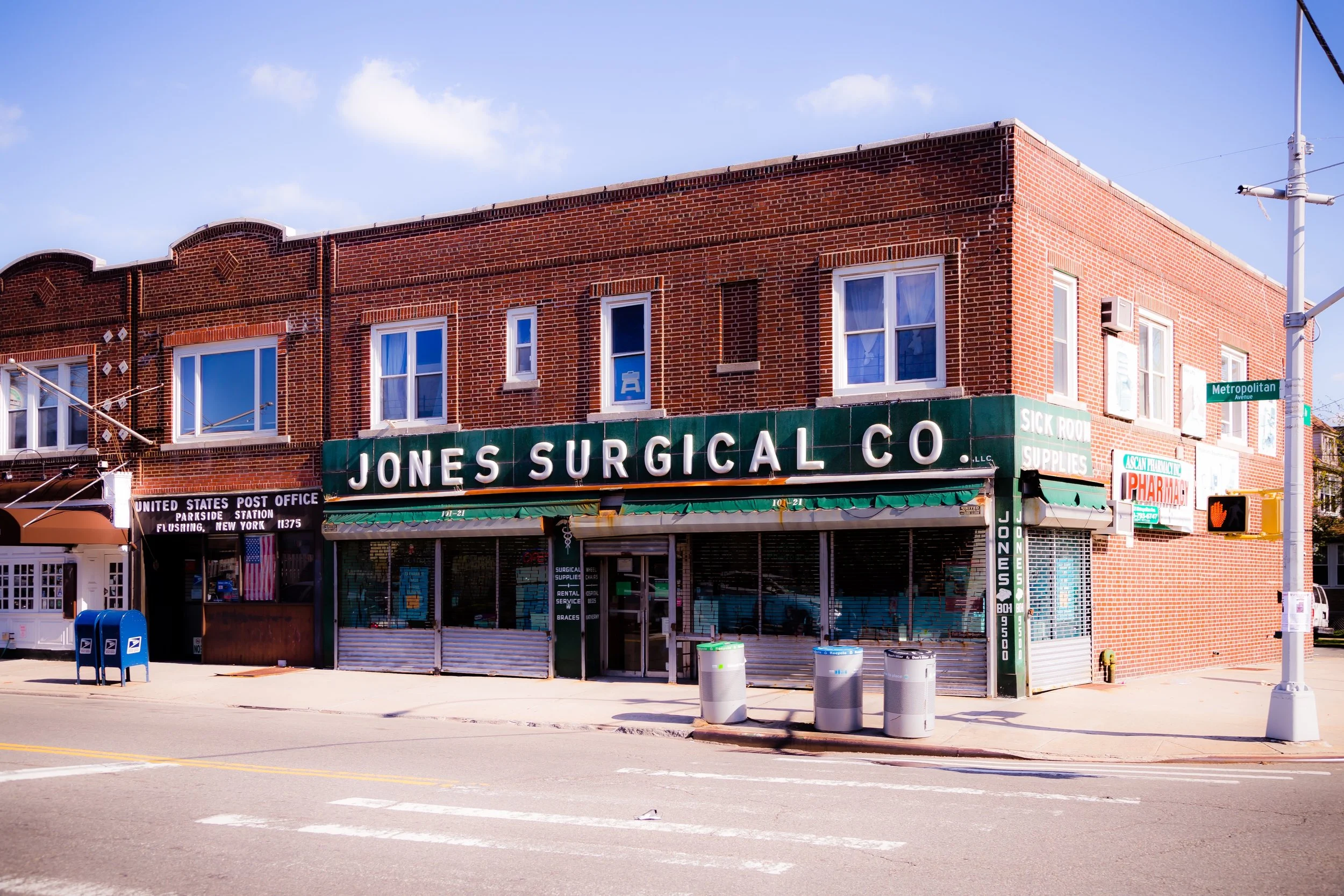
The neighborhood’s civic infrastructure matured during this period as well. Public School 101, Forest Hills High School, and the Forest Hills Jewish Center reflected both educational ambition and the community’s growing cultural diversity. Austin Street, once a quiet residential lane, evolved into the neighborhood’s main shopping and social corridor—lined with delicatessens, bakeries, and independent shops that gave Forest Hills its enduring village feel.
Mid-20th Century: Postwar Prosperity and Cultural Flourishing
The decades following World War II marked Forest Hills’ peak as one of Queens’ most prosperous and culturally vibrant neighborhoods. Returning veterans and new middle-class families filled the district’s co-ops and rowhouses, while nearby Forest Hills Gardens Stadium hosted tennis tournaments, concerts, and civic events that attracted national attention. The U.S. Open Tennis Championships were held here from 1915 until 1978, when they relocated to Flushing Meadows; in the same arena, the Beatles, Simon & Garfunkel, and Bob Dylan all performed, linking Forest Hills indelibly to American cultural history.
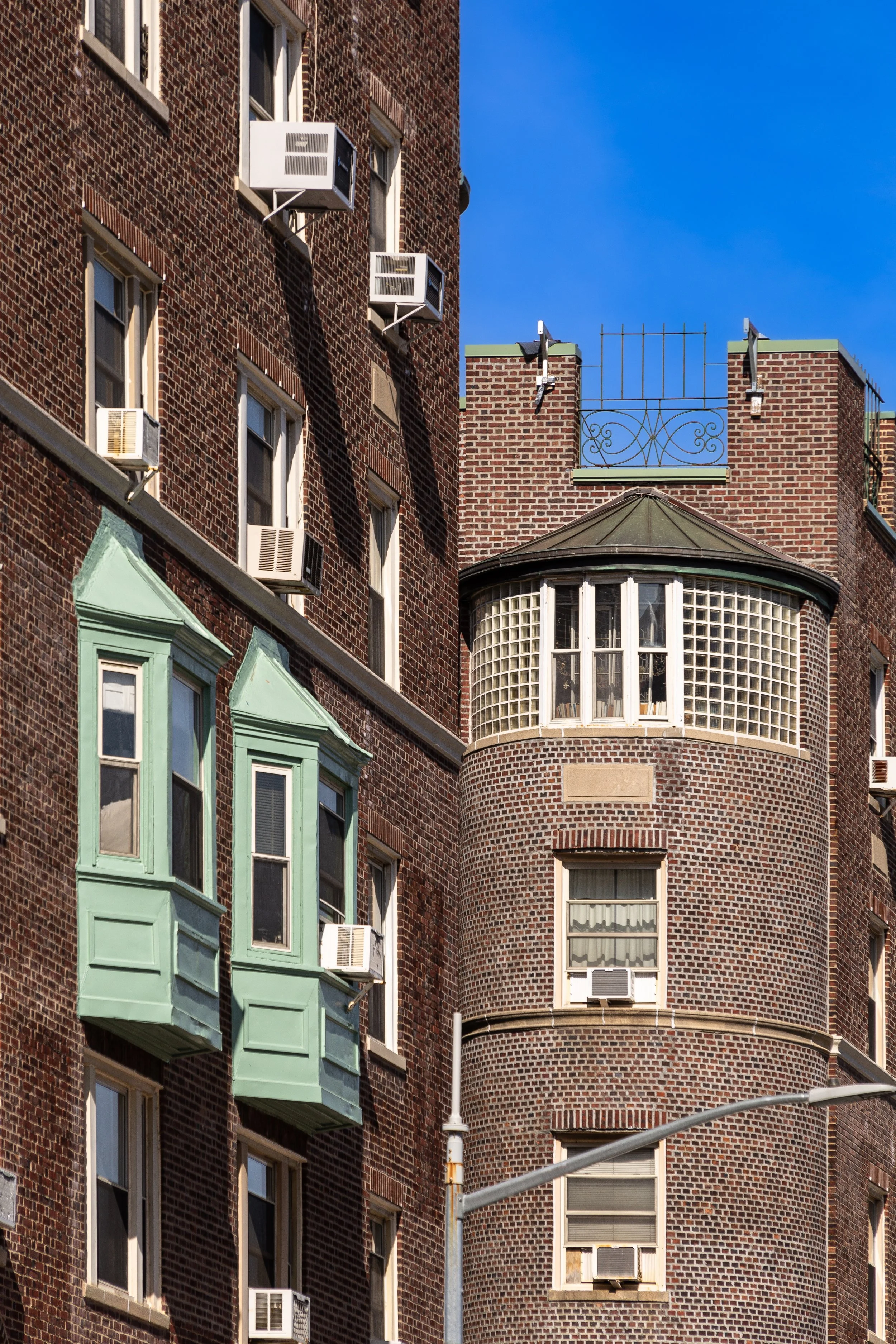
The neighborhood’s population remained largely European-American through the mid-20th century—Jewish, Italian, Irish, and Greek families forming the social backbone—but it retained an open, cosmopolitan air. Synagogues, churches, and civic clubs flourished, while the Forest Hills Women’s Club and Civic Association advocated for urban planning, green space, and historic preservation. The construction of The Birchwood Towers (1960s) introduced high-rise living to Queens Boulevard, symbolizing both progress and the tension between modernization and preservation.
Forest Hills Video Coming Soon
Late 20th Century: Diversity, Stability, and Redefinition
By the 1970s and 1980s, Forest Hills—like much of Queens—was changing demographically. As earlier generations moved eastward to Long Island, new waves of immigrants from Russia, Israel, China, Korea, and Latin America began settling in the neighborhood. These communities revitalized Austin Street and expanded the district’s culinary and cultural life. At the same time, Forest Hills retained a strong sense of continuity: many co-op boards and civic groups ensured architectural harmony and the preservation of its prewar charm.
The neighborhood also became known for its civic activism. The Forest Hills Co-op Wars of the 1970s, a series of debates over urban renewal and public housing near 108th Street, reflected citywide struggles over density and inclusion. Yet the community emerged with a renewed focus on balance—welcoming diversity while maintaining its residential character and livability.
21st Century: Renaissance and Modern Balance
In the 2000s and 2010s, Forest Hills entered a new era of quiet renaissance. Austin Street solidified its role as one of Queens’ premier shopping and dining destinations, blending old institutions—like Eddie’s Sweet Shop (founded 1925)—with modern cafés, bookstores, and international restaurants. The Forest Hills Stadium, restored and reopened in 2013, revived the area’s cultural legacy, once again hosting world-class performers beneath the summer sky.
The population today reflects Queens at its most cosmopolitan: Jewish and Italian old-timers living alongside Korean, Bukharian Jewish, Chinese, and South Asian families, as well as young professionals drawn by the neighborhood’s transit access and architectural beauty. Co-ops and condos along Queens Boulevard remain in high demand, while single-family homes near Yellowstone Boulevard and Ascan Avenue retain their stately calm.
Environmental and transportation initiatives, including expanded bike lanes, tree-planting, and transit improvements, have strengthened Forest Hills’ commitment to sustainable urban living. Schools, libraries, and parks remain central to its identity, particularly MacDonald Park and Forest Hills Playground, which host markets and community events year-round.
Forest Hills Photo Gallery
Spirit and Legacy
Forest Hills’ enduring appeal lies in its equilibrium—an urban village with the soul of a suburb, where tradition and modernity coexist in quiet harmony. Its streets, lined with prewar brick and flowering trees, embody the ideal of civic order and neighborhood pride that early planners envisioned more than a century ago.
New York City
Use this custom Google map to explore where every neighborhood in all five boroughs of New York City is located.
The Five Boroughs
One of New York City’s unique qualities is its organization in to 5 boroughs: Manhattan, Brooklyn, Queens, The Bronx, and Staten Island. These boroughs are part pragmatic administrative districts, and part vestiges of the region’s past. Each borough is an entire county in New York State - in fact, Brooklyn is, officially, Kings County, while Staten Island is, officially Richmond County. But that’s not the whole story …
Initially, New York City was located on the southern tip of Manhattan (now the Financial District) that was once the Dutch colony of New Amsterdam. Across the East River, another city was rising: Brooklyn. In time, the city planners realized that unification between the rapidly rising cities would create commercial and industrial opportunities - through streamlined administration of the region.
So powerful was the pull of unification between New York and Brooklyn that three more counties were pulled into the unification: The Bronx, Queens, and Staten Island. And on January 1, 1898, the City of New York unified two cities and three counties into one Greater City of New York - containing the five boroughs we know today.
But because each borough developed differently and distinctly until unification, their neighborhoods likewise uniquely developed. Today, there are nearly 390 neighborhoods, each with their own histories, cultures, cuisines, and personalities - and each with residents who are fiercely proud of their corner of The Big Apple.


