MANHATTAN BEACH
Brooklyn
Geographic Setting
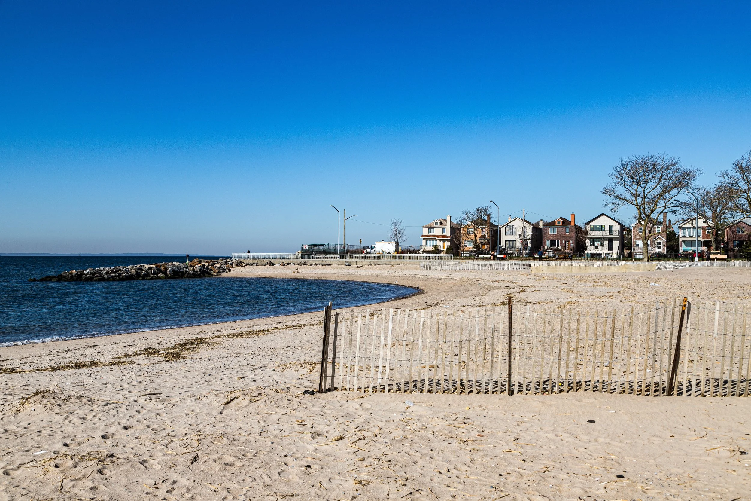
Bounded by West End Avenue to the west, Sheepshead Bay to the north, and the Atlantic Ocean to the south and east, Manhattan Beach occupies the far southeastern tip of Brooklyn—a tranquil peninsula defined by its shoreline, sea breezes, and rare sense of open sky. It is a neighborhood framed by water on nearly all sides: the narrow channel of Sheepshead Bay on one, the wide Atlantic horizon on the other. With its broad lawns, detached homes, and tree-shaded streets, Manhattan Beach feels distinctly apart from the city’s clamor—a seaside enclave where Brooklyn meets the ocean in calm dignity.
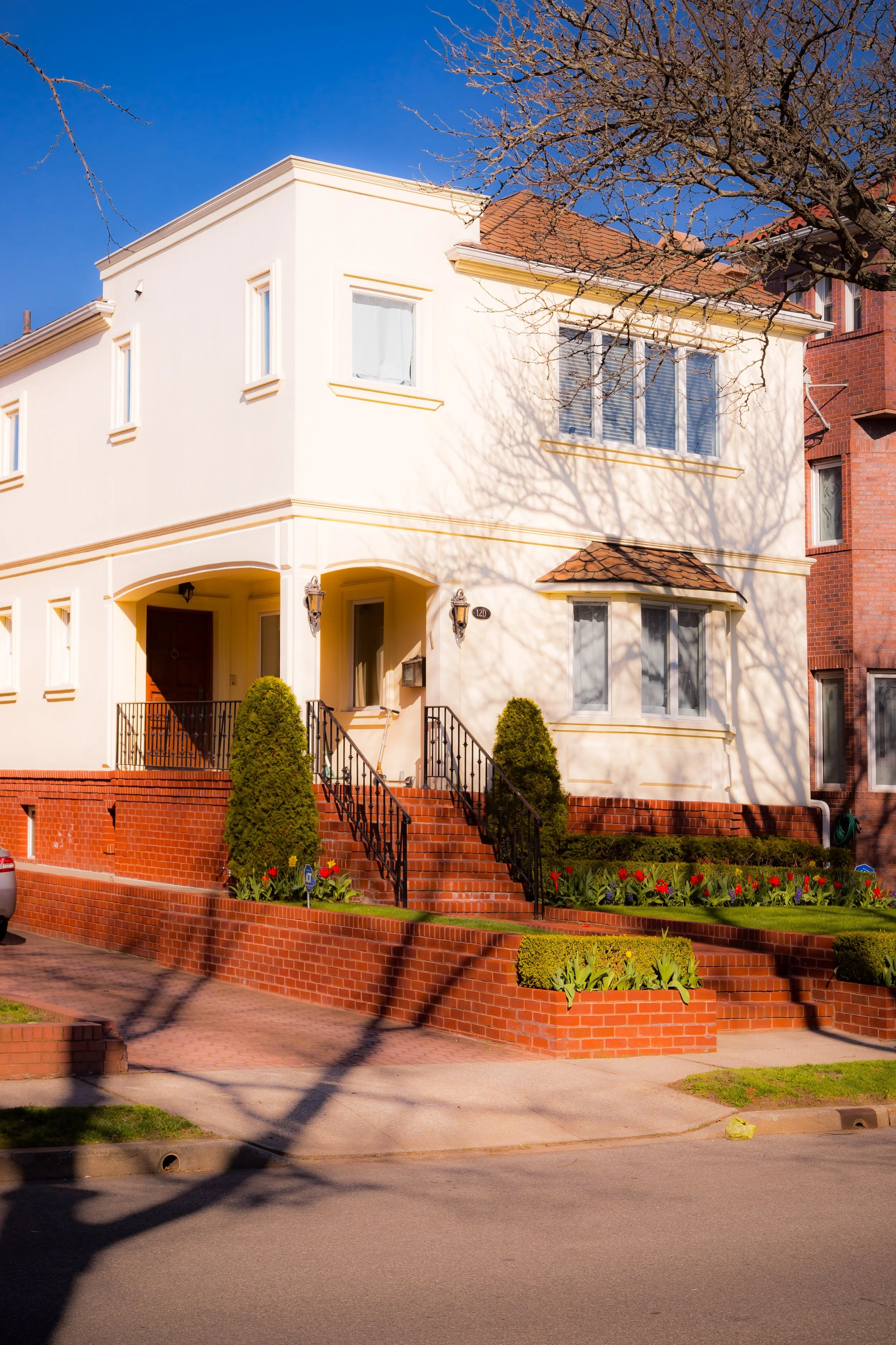
The neighborhood’s layout is deliberate and refined. A grid of Oriental Boulevard, Amherst Street, Exeter Street, and Shore Boulevard radiates outward toward the beach and bay, anchored by Manhattan Beach Park—a public waterfront promenade and bathing beach that attracts visitors each summer. Its streets are lined with detached brick and stucco houses, often Mediterranean or Colonial Revival in style, set back behind well-kept gardens. The sea’s nearness defines daily life: the smell of salt air, the cries of gulls, and the rhythm of waves along the shore.
Etymology and Origins
The name Manhattan Beach dates to the 1870s, when railroad magnate and resort developer Austin Corbin transformed this once-remote stretch of sand dunes into a luxurious seaside destination. The name was chosen as a marketing flourish—meant to evoke the glamour and familiarity of Manhattan itself, while offering Brooklynites and visitors “the Manhattan of the seaside.”
Before Corbin’s intervention, the area was part of the Town of Gravesend, settled by English colonists under Lady Deborah Moody in the 1640s. For centuries, it consisted of marshland, dunes, and fishing shacks, used seasonally by baymen and oystermen. The establishment of the Manhattan Beach Improvement Company (1877) marked its dramatic transformation from wilderness to resort.
The Neighborhood
19th Century: The Gilded-Age Seaside Resort
In 1877, Austin Corbin opened the Manhattan Beach Hotel, followed a year later by the even grander Oriental Hotel, both designed to cater to the elite of New York society. These vast wooden structures—complete with verandas, ballrooms, and gaslit pavilions—stood at the edge of the Atlantic, connected to the city by the Manhattan Beach Branch of the Long Island Rail Road. Corbin envisioned a genteel alternative to the rowdy amusements of nearby Coney Island, and he succeeded: Manhattan Beach became a magnet for the Gilded Age’s wealthy classes, hosting fireworks displays, orchestral concerts by John Philip Sousa, and elaborate seaside galas.
The beaches were immaculate, the hotels palatial, and the crowds refined. Yet Corbin’s vision was also exclusionary: he notoriously barred African Americans and Jewish guests from the resort, reflecting the social prejudices of the era. His “exclusive paradise by the sea” nonetheless shaped the landscape of southern Brooklyn—introducing paved roads, gas lighting, and the first organized beach facilities in the borough.
By the 1890s, as Brooklyn’s population grew and Coney Island’s democratic amusements flourished, the Manhattan Beach hotels began to lose their elite cachet. After World War I, both the Manhattan Beach Hotel and Oriental Hotel were demolished, and the area’s resort era faded into history.
Early–Mid 20th Century: From Resort to Residential Enclave
Following the decline of the hotels, the City of New York acquired much of the property, converting the land into Manhattan Beach Park (1917)—a public recreation area with promenades, bathhouses, and playgrounds. The remaining tracts were subdivided for residential use, giving rise to the neighborhood’s enduring character as a planned seaside community.
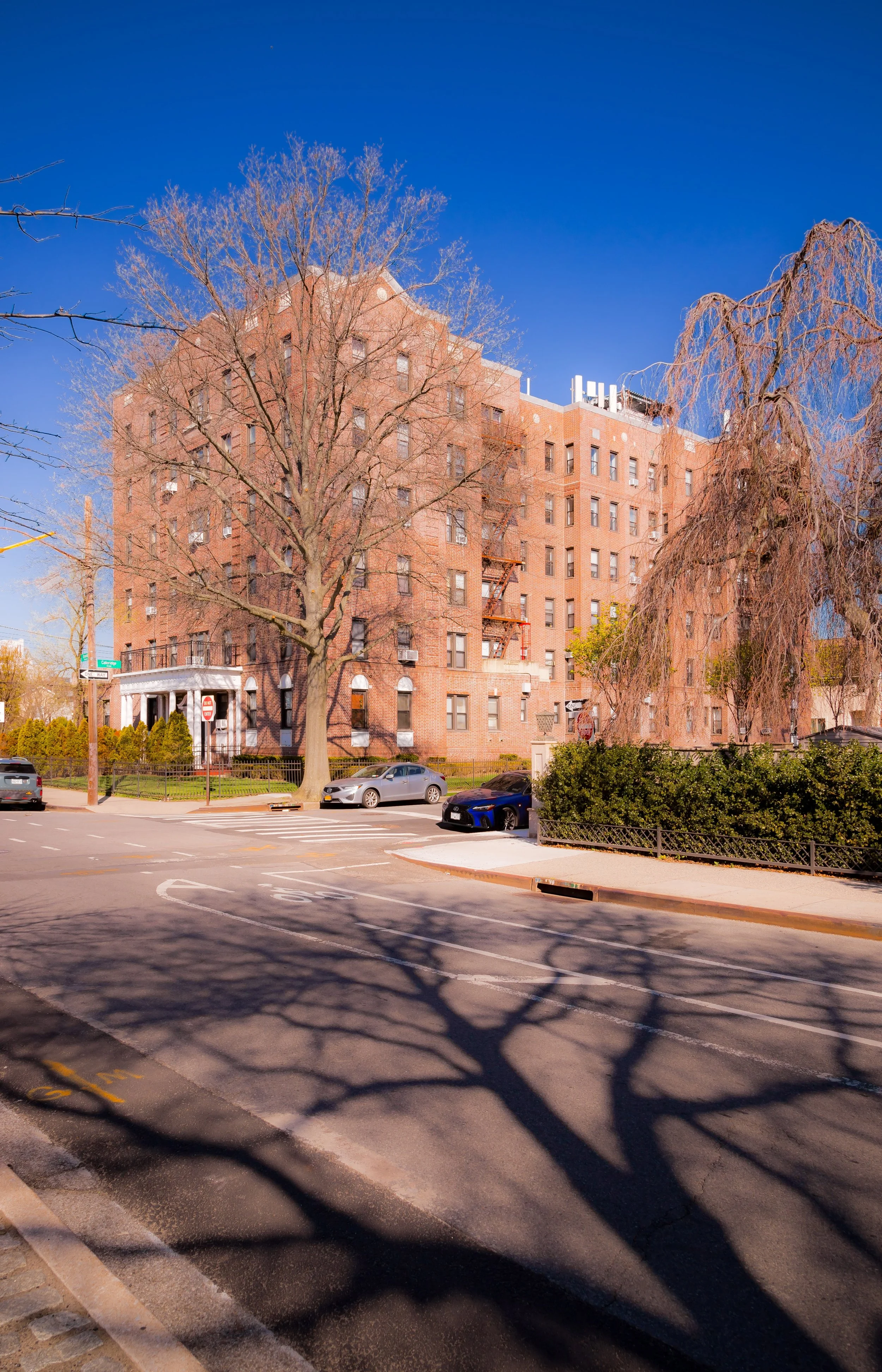
During the 1920s–1940s, developers constructed rows of single-family houses and low-rise apartment buildings, many in the Mediterranean Revival style that reflected the neighborhood’s coastal identity. Streets were landscaped with trees and sidewalks, and the shoreline was reinforced with seawalls and piers. The opening of the Sheepshead Bay subway station (B and Q lines) provided convenient access to Manhattan, transforming Manhattan Beach from an exclusive resort into a middle- and upper-middle-class residential district.
The Manhattan Beach Jewish Center, founded in 1931, quickly became a cornerstone of community life, reflecting the area’s new demographic composition as Jewish families moved from Brownsville, East New York, and Crown Heights. The Manhattan Beach Community Group (est. 1941) emerged as a strong civic association dedicated to maintaining the neighborhood’s safety, zoning integrity, and seaside environment.
Manhattan Beach Video Coming Soon
Late 20th Century: Quiet Stability and Cultural Life
By the 1950s–1970s, Manhattan Beach had matured into one of Brooklyn’s most stable and sought-after residential neighborhoods. Its atmosphere—peaceful, self-contained, and suburban in tone—stood in marked contrast to the city’s urban bustle. Generations of families maintained homes here, many with ties to Sheepshead Bay’s fishing docks, Brighton Beach’s boardwalk, or Coney Island’s businesses.
The neighborhood’s educational institutions, including P.S. 195, P.S. 225, and Kingsborough Community College (est. 1963)—built on the site of the former Manhattan Beach Air Force Station—anchored the community. The college, perched on a promontory overlooking the Atlantic, gave Manhattan Beach a distinctive civic presence and a steady stream of students who animated its cafés and parks.
The area’s relative isolation also helped preserve its low-rise scale. Strict zoning limited overdevelopment, while residents’ associations maintained the tree canopy and quiet streets. During this era, Manhattan Beach remained predominantly Jewish and Italian American, with a strong civic culture centered on the park, the synagogue, and neighborhood schools.
21st Century: Continuity by the Sea
In the 21st century, Manhattan Beach remains one of Brooklyn’s most tranquil coastal enclaves—its character shaped by affluence, diversity, and the enduring presence of the sea. The population has grown more international, with an influx of Russian, Ukrainian, and Central Asian families joining established communities. Elegant new homes have replaced some older cottages, often built in Mediterranean or modern styles, yet the area’s essential scale—detached homes on quiet streets—persists.
Manhattan Beach Park continues to draw visitors from across the borough, its wide sands and shady esplanade offering one of the city’s cleanest and calmest beaches. Summer weekends bring families picnicking under the sycamores, while winter mornings find the shore nearly deserted except for dog walkers and the cries of gulls. The nearby Kingsborough campus maintains public access to the waterfront, while civic groups like the Manhattan Beach Neighborhood Association advocate for environmental protection, flood resilience, and responsible development in the age of climate change.
The memory of the old resorts still lingers in the landscape—the curvature of Oriental Boulevard, the name of the Oriental Pavilion, and the faint echo of Sousa’s marches on the breeze.
Manhattan Beach Photo Gallery
Spirit and Legacy
Manhattan Beach’s legacy is one of evolution from exclusivity to community. Born as a Gilded Age seaside playground, it has matured into one of Brooklyn’s most serene residential neighborhoods, where the ocean’s presence defines both geography and spirit. It embodies the paradox of the borough itself: urbane yet peaceful, accessible yet secluded, shaped by waves of history as surely as by the tides that lap its shore.
New York City
Use this custom Google map to explore where every neighborhood in all five boroughs of New York City is located.
The Five Boroughs
One of New York City’s unique qualities is its organization in to 5 boroughs: Manhattan, Brooklyn, Queens, The Bronx, and Staten Island. These boroughs are part pragmatic administrative districts, and part vestiges of the region’s past. Each borough is an entire county in New York State - in fact, Brooklyn is, officially, Kings County, while Staten Island is, officially Richmond County. But that’s not the whole story …
Initially, New York City was located on the southern tip of Manhattan (now the Financial District) that was once the Dutch colony of New Amsterdam. Across the East River, another city was rising: Brooklyn. In time, the city planners realized that unification between the rapidly rising cities would create commercial and industrial opportunities - through streamlined administration of the region.
So powerful was the pull of unification between New York and Brooklyn that three more counties were pulled into the unification: The Bronx, Queens, and Staten Island. And on January 1, 1898, the City of New York unified two cities and three counties into one Greater City of New York - containing the five boroughs we know today.
But because each borough developed differently and distinctly until unification, their neighborhoods likewise uniquely developed. Today, there are nearly 390 neighborhoods, each with their own histories, cultures, cuisines, and personalities - and each with residents who are fiercely proud of their corner of The Big Apple.


