
GERRITSEN BEACH
Brooklyn
Geographic Setting
Bounded by Gerritsen Avenue to the east, Gerritsen Creek and Ralph Avenue to the west, Gerritsen Beach occupies a small peninsula projecting into the northern reaches of Jamaica Bay, a maritime enclave bordered by tidal waters, marshes, and parkland. To its north lies Marine Park, to its south the open bay where fishing boats and gulls trace the rhythms of tide and wind. Compact, insular, and unmistakably coastal in character, Gerritsen Beach stands apart from the urban grid of Brooklyn—a tight-knit village of modest homes, narrow lanes, and a distinct sense of identity that feels more New England fishing town than metropolis.
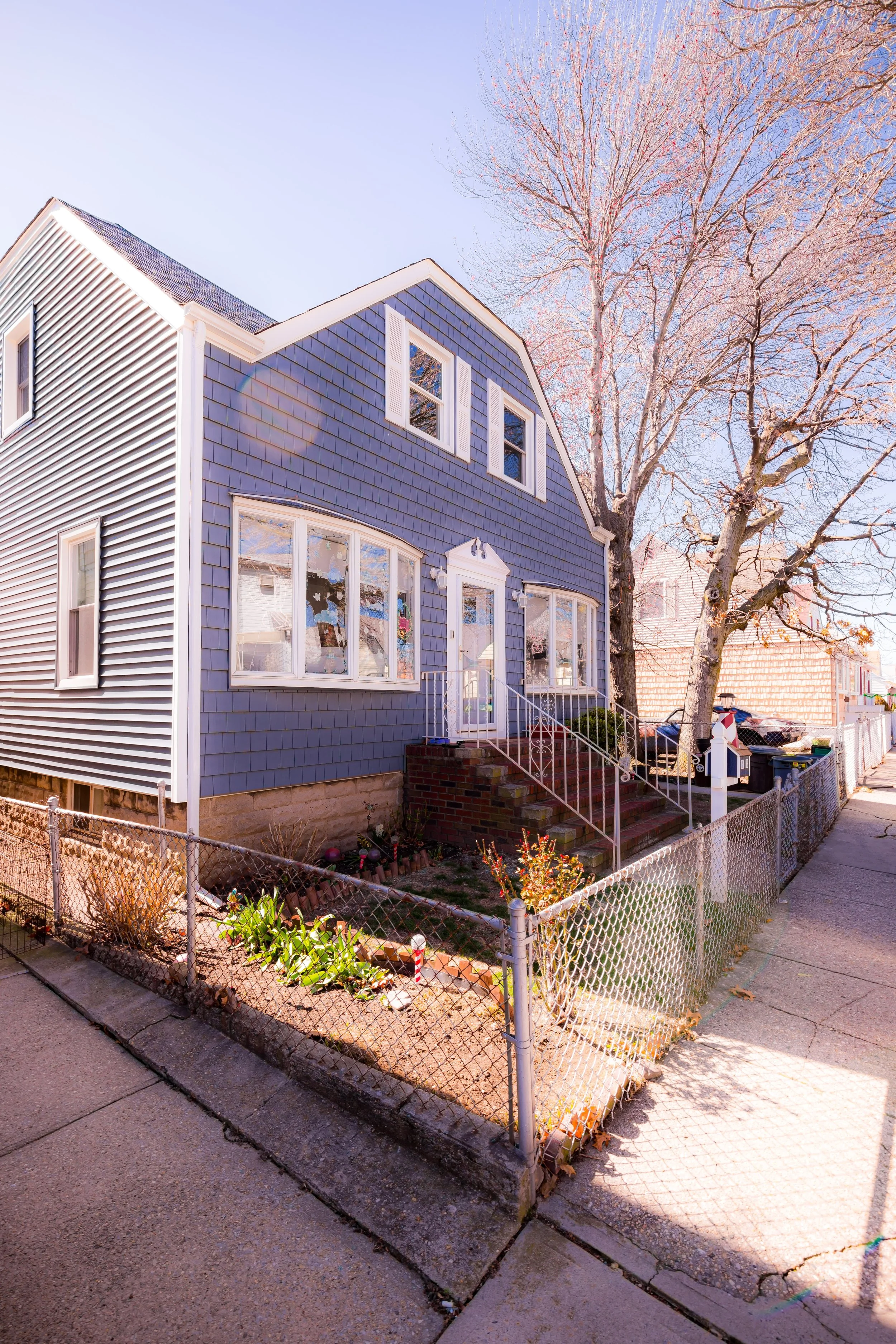
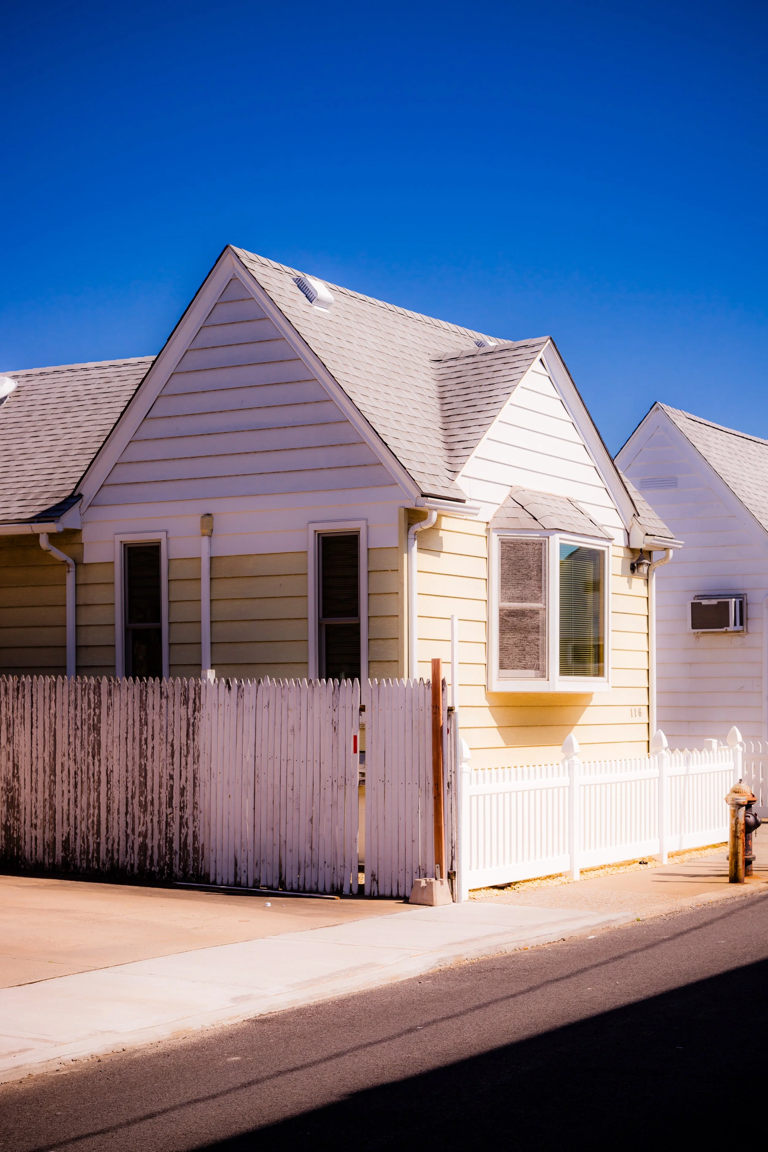
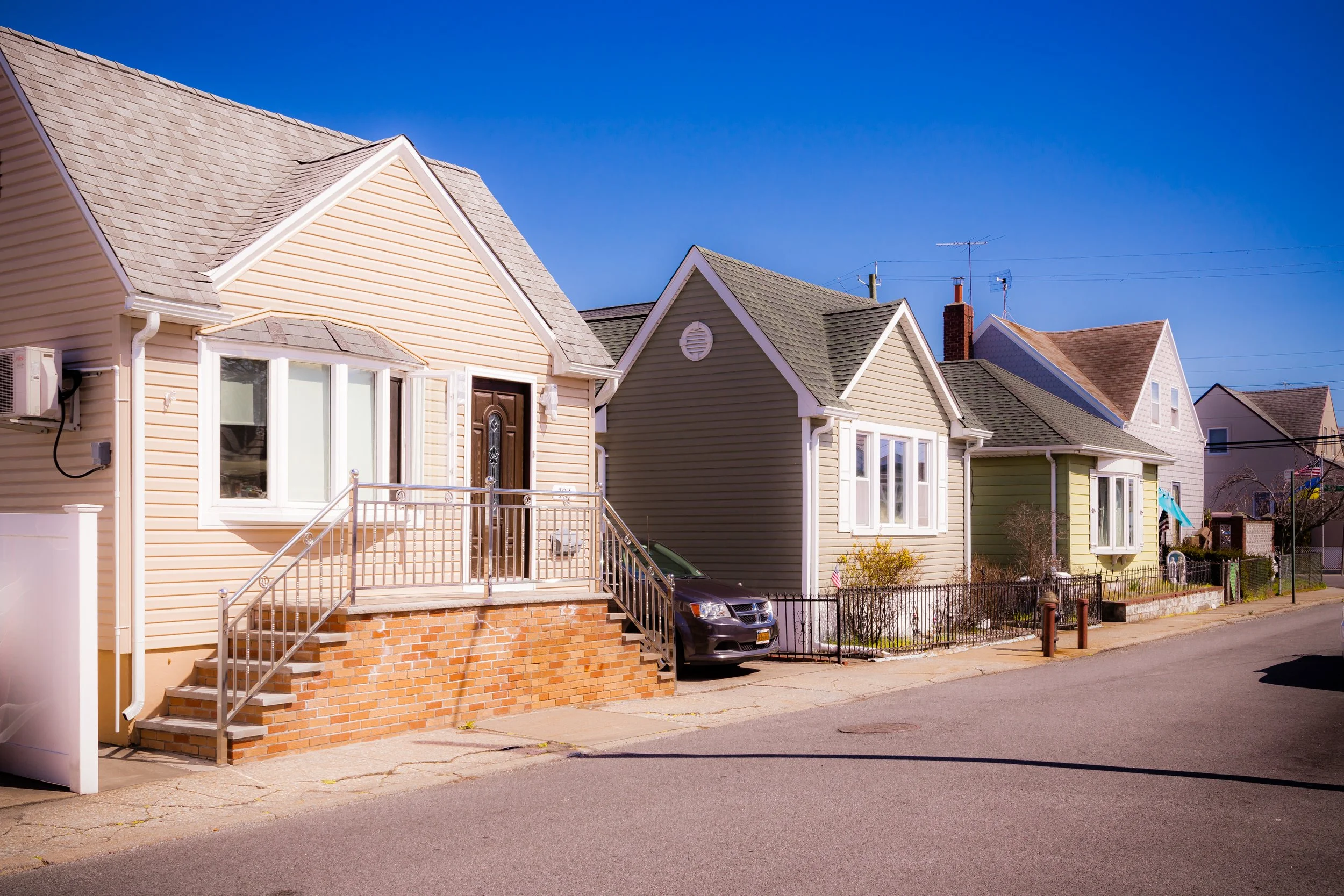
The neighborhood’s low-lying geography defines its form. Streets such as Devon Avenue, Noel Avenue, and Channel Avenue run parallel to the shore, while Gerritsen Avenue—its single arterial road—connects the peninsula to Marine Park and the broader city beyond. Along the waterfront, small docks and inlets cut into the marsh, and the air carries the briny scent of Jamaica Bay. Houses—mostly compact frame bungalows and two-story cottages built in the early to mid-20th century—line narrow streets often without sidewalks, testifying to Gerritsen Beach’s origins as a summer colony turned year-round community.
Etymology and Origins
Gerritsen Beach takes its name from the Gerritsen family, early Dutch settlers who established one of Brooklyn’s first mills on the nearby Gerritsen Creek in the 17th century. The Gerritsen Mill, originally constructed around 1645, operated for over two centuries, grinding grain and sawing lumber for the surrounding farming communities of Flatlands and Gravesend. The Gerritsens were among the region’s most prominent landholders, their estate stretching across what are now Marine Park, Mill Basin, and the Beach that bears their name.
The word “Gerritsen” thus links the neighborhood to Brooklyn’s colonial past—a lineage of Dutch agriculture and waterfront enterprise that predates the city itself. The mill, rebuilt several times, remained a landmark well into the 19th century before being destroyed by fire in 1935. Today, its foundations survive within the boundaries of Marine Park, a few hundred yards from the neighborhood’s northern edge.
The Neighborhood
18th–19th Century: Farmland and Marshland Frontier
Throughout the 18th and 19th centuries, the area that would become Gerritsen Beach remained largely undeveloped. Salt meadows, tidal creeks, and sand dunes dominated the landscape. The fertile uplands supported a scattering of farms, while the surrounding waters teemed with clams, oysters, and fish harvested by local watermen. Access was limited to sandy wagon tracks and boat landings; for much of its early history, the area was considered an outlying corner of Flatlands—valuable for its resources but too remote for settlement.
By the late 1800s, however, as Brooklyn’s population expanded and rail access improved, developers began to eye the waterfront for recreation. The same natural isolation that had discouraged farming now made the peninsula attractive as a seaside retreat.
Early 20th Century: A Summer Colony Takes Shape
Modern Gerritsen Beach was born in 1920, when developers from the Gerritsen Beach Estates Company subdivided the former meadows into small residential lots. Advertised as an affordable seaside resort for working-class families, the new community offered “bungalows by the bay” within city limits. Lots sold quickly to Irish and Italian families from East New York and Flatbush, many of whom built modest cottages and spent summers boating, fishing, and swimming in the calm waters of Gerritsen Creek.
The neighborhood’s narrow streets and compact lots—unusual for Brooklyn—reflected its origins as a seasonal colony rather than a formal urban subdivision. Homes were simple, often self-built, with wood siding and tin roofs. Unpaved roads and wooden bulkheads gave Gerritsen Beach the atmosphere of a coastal hamlet, while its residents relied on small local shops and the trolley line along Gerritsen Avenue for supplies.
During the Great Depression, many families converted their summer cottages into year-round homes, enclosing porches and installing furnaces. The tight-knit layout fostered an unusually strong sense of community; neighbors knew one another by name, and local volunteer groups provided essential services long before city agencies extended full infrastructure.
Gerritsen Beach Video Coming Soon
Mid 20th Century: From Bungalows to Neighborhood
By the 1940s and 1950s, Gerritsen Beach had become a permanent residential enclave. Streets were paved, sewers installed, and brick houses began to replace some of the original wood cottages. The community’s character remained predominantly Irish- and Italian-American, with a deep culture of volunteerism and civic pride. The founding of the Gerritsen Beach Volunteer Fire Department (1922)—one of New York City’s few remaining independent volunteer companies—symbolized the neighborhood’s self-reliant spirit.
Life in Gerritsen Beach during this period revolved around local institutions: Resurrection Roman Catholic Church, the Gerritsen Beach Property Owners Association, and the small public schools that served generations of residents. Fishing clubs and yacht clubs along the basin—such as the Gerritsen Beach Boat Club—embodied the neighborhood’s maritime roots.
Despite its distance from the city’s center, the area remained firmly blue-collar, home to firefighters, police officers, and civil servants. Its social fabric was defined by stability, shared labor, and an enduring attachment to the waterfront.
Late 20th Century: Stability and Isolation
Through the 1970s–1990s, Gerritsen Beach remained one of Brooklyn’s most insular neighborhoods. While nearby Marine Park and Sheepshead Bay diversified demographically, Gerritsen Beach retained its strong ethnic and familial continuity. Houses were passed down through generations; block parties, parades, and fundraisers filled the social calendar.
This insularity had both charm and cost: crime rates stayed low, and community cohesion remained exceptional, but the neighborhood was sometimes criticized for its resistance to change and its limited engagement with broader Brooklyn trends. Yet within its boundaries, residents found comfort in the familiar cadence of local life—morning jogs along Gerritsen Avenue, the sound of gulls and small outboard motors, and summer evenings spent by the bulkhead watching the tide.
21st Century: Resilience on the Water’s Edge
In the 21st century, Gerritsen Beach has faced both renewal and challenge. The neighborhood’s waterfront location, long a source of pride, made it especially vulnerable to flooding. Hurricane Sandy (2012) struck Gerritsen Beach hard, inundating homes and streets, damaging nearly every property in the low-lying southern section. Yet the recovery—largely led by local volunteers—became a defining chapter in the community’s history. Residents organized under groups such as Gerritsen Beach Cares, coordinating cleanup, rebuilding, and advocacy for improved flood protections.
Today, Gerritsen Beach remains primarily residential, its population increasingly mixed but still anchored by families with deep local roots. Post-Sandy reconstruction has produced elevated homes and new seawalls, but much of the old village character endures: low houses, narrow lanes, and a pace of life more akin to a coastal suburb than a New York neighborhood.
Along Gerritsen Avenue, small businesses—pizzerias, delis, and the neighborhood’s beloved Gerritsen Beach Library branch—sustain daily life. To the north, Marine Park’s salt marsh restoration area has become both a buffer and a refuge, drawing walkers, birders, and kayakers. On calm evenings, the sun sets across the creek, turning the water pink and gold.
Gerritsen Beach Photo Gallery
Spirit and Legacy
Gerritsen Beach’s legacy is one of resilience, independence, and maritime continuity. It is a community carved out of the sea, shaped by those who built their own homes, raised their own flags, and looked after one another when the tide rose. Its geography has always defined its destiny—isolated but self-sufficient, modest but proud.
New York City
Use this custom Google map to explore where every neighborhood in all five boroughs of New York City is located.
The Five Boroughs
One of New York City’s unique qualities is its organization in to 5 boroughs: Manhattan, Brooklyn, Queens, The Bronx, and Staten Island. These boroughs are part pragmatic administrative districts, and part vestiges of the region’s past. Each borough is an entire county in New York State - in fact, Brooklyn is, officially, Kings County, while Staten Island is, officially Richmond County. But that’s not the whole story …
Initially, New York City was located on the southern tip of Manhattan (now the Financial District) that was once the Dutch colony of New Amsterdam. Across the East River, another city was rising: Brooklyn. In time, the city planners realized that unification between the rapidly rising cities would create commercial and industrial opportunities - through streamlined administration of the region.
So powerful was the pull of unification between New York and Brooklyn that three more counties were pulled into the unification: The Bronx, Queens, and Staten Island. And on January 1, 1898, the City of New York unified two cities and three counties into one Greater City of New York - containing the five boroughs we know today.
But because each borough developed differently and distinctly until unification, their neighborhoods likewise uniquely developed. Today, there are nearly 390 neighborhoods, each with their own histories, cultures, cuisines, and personalities - and each with residents who are fiercely proud of their corner of The Big Apple.


