SEAGATE
Brooklyn
Geographic Setting
Perched at the far western tip of the Coney Island peninsula, Sea Gate is one of Brooklyn’s most singular neighborhoods — a private, gated seaside community bounded on three sides by water and on the fourth by the lively expanse of Coney Island itself. It is framed by the Atlantic Ocean to the south, the Narrows to the west, Gravesend Bay to the north, and West 37th Street to the east, beyond which the amusements and boardwalk of Coney Island begin. Its landscape of quiet lanes, seaside villas, and sandy beaches forms a world apart, both physically and psychologically — the last inhabited point before the city dissolves into open sea.
Etymology and Origins
The name Sea Gate is literal and evocative, describing both geography and aspiration. “Sea” speaks to the omnipresence of water; “Gate” to the guarded entrance that has defined the neighborhood since its founding. Established in 1892 by developer Alrick Man, Sea Gate was envisioned as a seaside resort colony for the well-to-do — a place of exclusivity, refinement, and ocean air at the edge of the metropolis.
The land on which Sea Gate stands was originally part of the Town of Gravesend, founded in 1643 by English settler Lady Deborah Moody. For centuries, it remained windswept dunes and salt meadows, occasionally used for fishing and grazing. By the 1870s, as Coney Island boomed into a public playground of amusements and bathhouses, its westernmost tip was purchased by investors seeking privacy rather than spectacle.
The Neighborhood
Late 19th Century: Founding the Private Seaside Colony
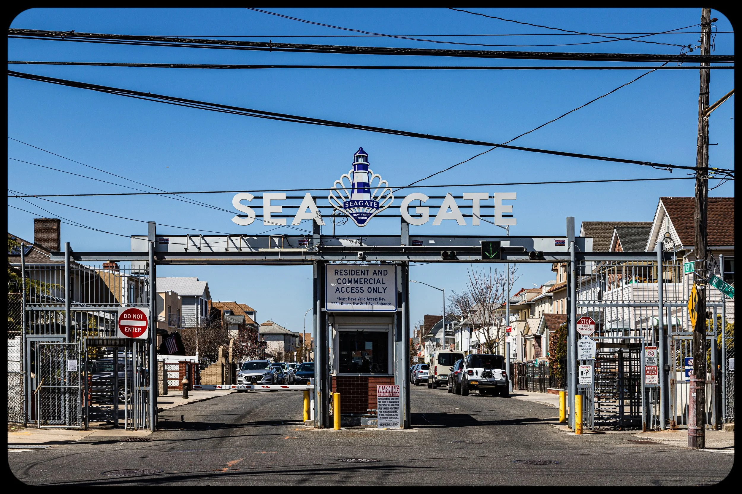
In 1892, the Sea Gate Association was incorporated, acquiring roughly ninety acres of land to create a gated residential enclave. The concept was novel: a private, self-governing community within New York City, complete with its own police force, maintenance crews, and restrictions on access. Streets were laid out with names like Neptune, Atlantic, and Surf, each designed to maximize ocean views and sea breezes.
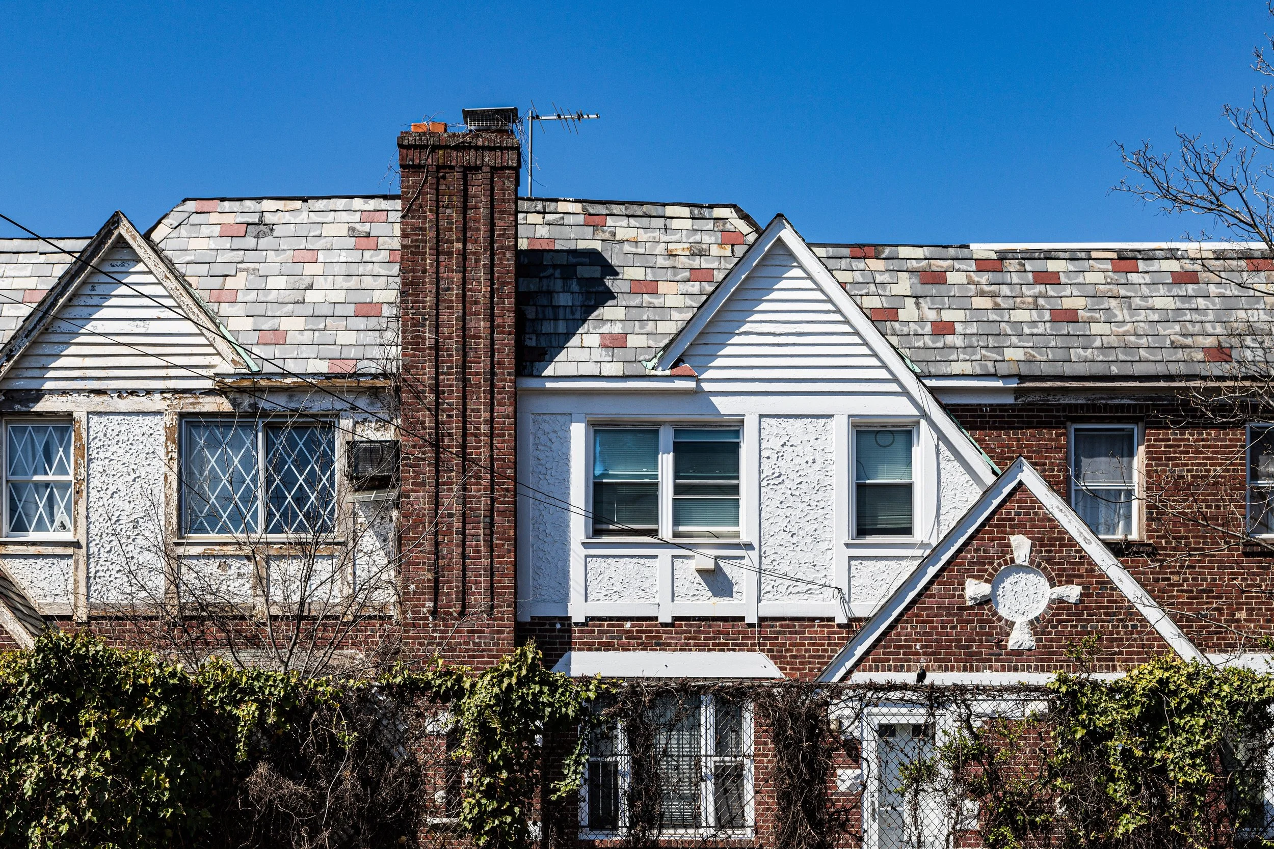
Architecturally, the early years saw a blend of Victorian, Queen Anne, and Colonial Revival styles. Large frame houses with wraparound porches and turrets rose along the bluffs overlooking the Narrows. Wealthy New Yorkers built summer homes here, attracted by the combination of privacy, ocean access, and proximity to Manhattan via ferry and rail.
Sea Gate’s physical seclusion was reinforced by geography: the peninsula narrowed to a point, accessible only by a single gatehouse at West 37th Street. Fences and guardhouses ensured that entry was limited to residents and guests — a feature that remains to this day.
Early 20th Century: Community and Continuity
By the early 1900s, Sea Gate had matured into a picturesque seaside village. Its residents were a mix of established professionals and entrepreneurs, including prominent Jewish, Italian, and Irish families who sought a quieter alternative to Coney Island’s bustle. The neighborhood maintained its own Sea Gate Police Department, firehouse, and beach club, fostering an atmosphere of order and civic pride.
The Coney Island Lighthouse, built in 1890 on the neighborhood’s westernmost bluff, became its defining landmark. For over four decades, it was tended by Ida Lewis’ successor, Katherine Walker, one of the few female lighthouse keepers in U.S. history, who became a local legend for rescuing shipwrecked sailors and guiding vessels safely into the Narrows.
Through the 1920s and 1930s, Sea Gate remained stable and exclusive, even as the rest of Coney Island evolved into a mass entertainment district. The West 37th Street Gatehouse, designed in Georgian Revival style, symbolized the community’s self-contained world — a threshold between the carnival of Surf Avenue and the calm of private beaches and gardens beyond.
Mid-20th Century: War, Change, and Renewal
World War II and the postwar years brought subtle but significant change. Many residents left for suburban Long Island, and some of the grandest Victorian homes were converted into year-round dwellings. The surrounding Coney Island area faced economic decline, but Sea Gate’s private governance allowed it to maintain order and services.
During the 1950s and 1960s, the neighborhood’s population diversified. Jewish families, many from nearby Brighton Beach and Borough Park, became the predominant residents, joined later by Italian- and Russian-American homeowners. The Sea Gate Beach Club, synagogue, and community association remained central to social life.
Despite its insularity, Sea Gate was not immune to broader urban challenges. The surrounding neighborhoods experienced rising poverty and disinvestment, and the area’s isolation sometimes brought tension. Yet the residents’ vigilance and civic organization kept the enclave stable, preserving its distinctive atmosphere.
Seagate Photo Gallery
Late 20th Century: Resilience at the Edge
In the late 20th century, Sea Gate found renewed vitality through restoration and generational change. Many older homes were renovated or replaced by new single-family residences, often Mediterranean or contemporary in style, reflecting the neighborhood’s continuing affluence. The Sea Gate Community Council expanded local engagement, coordinating maintenance, beach preservation, and neighborhood events.
The surrounding waters, however, posed ongoing challenges. Coastal storms and erosion threatened the shoreline, prompting city and federal projects to reinforce the dunes and rebuild the sea wall. Despite the physical vulnerability of its location, Sea Gate’s residents remained fiercely attached to their enclave — a balance of fragility and permanence that defined its character.
21st Century: Storm, Recovery, and Renewal
The defining event of recent memory was Hurricane Sandy in 2012, which struck Sea Gate with devastating force. The storm surge breached seawalls, flooded homes, and reshaped the coastline. Yet the aftermath revealed the neighborhood’s resilience. Residents rebuilt homes, restored beaches, and strengthened infrastructure with improved drainage, reinforced dunes, and modernized flood protections.
Today, Sea Gate remains a private community of roughly 850 homes — a mosaic of restored Victorians, mid-century houses, and contemporary villas. Its population is diverse, encompassing Jewish, Italian, Russian, Caribbean, and African-American families united by shared geography and civic stewardship. The Sea Gate Police Department, still operational, patrols the gates and beaches, preserving the quiet order envisioned in 1892.
Seagate Photo Gallery
Architecture and Atmosphere
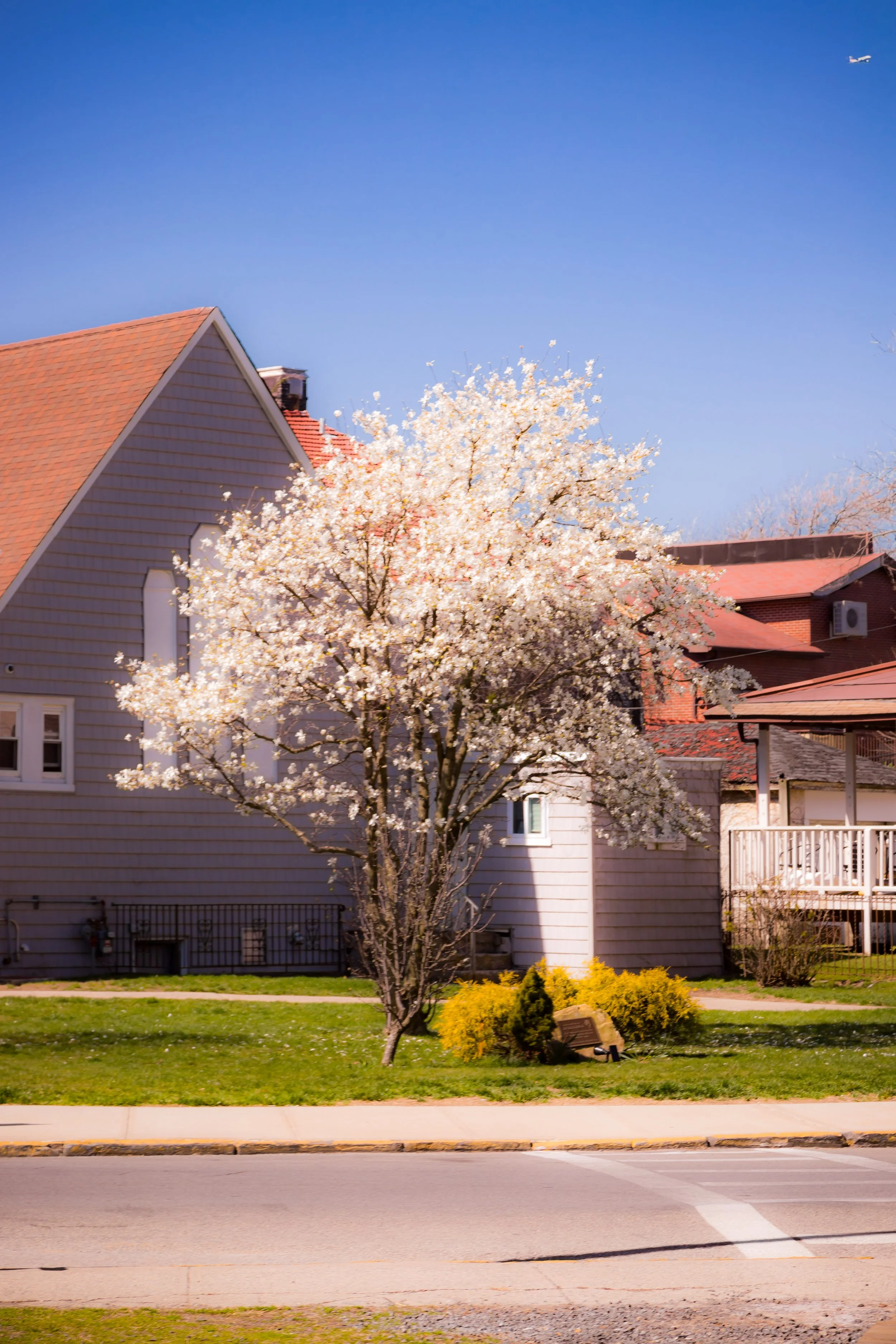
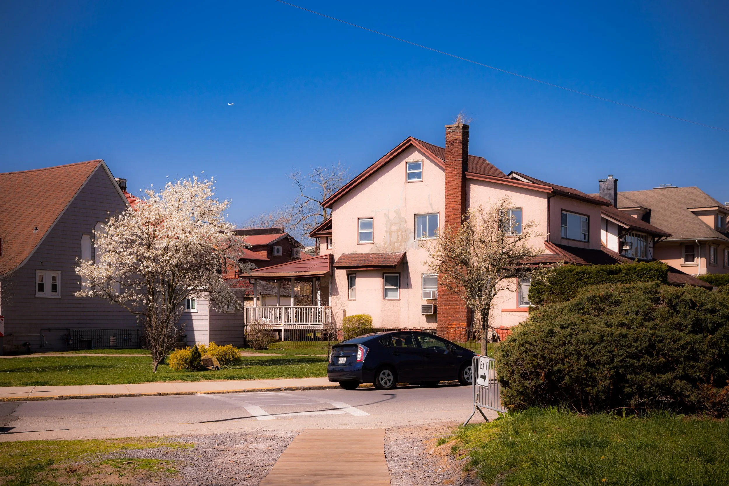
Architecturally, Sea Gate offers a rare panorama of Brooklyn’s seaside domestic design. Along Surf Avenue and Beach 43rd Street stand Victorian gables and shingled cottages from the 1890s; nearer the Narrows rise Mediterranean villas, brick colonials, and modern glass-faced homes with sweeping ocean views. The neighborhood’s winding roads, dunes, and oceanfront esplanades create a spatial rhythm closer to a coastal village than to an urban borough.
The atmosphere is tranquil and maritime. The cry of gulls, the sound of surf, and the distant sight of ships entering the harbor define its sensory palette. On summer evenings, the sun sets over Staten Island, gilding the lighthouse and casting long shadows across Neptune Avenue.
Spirit and Legacy
Sea Gate’s legacy is one of endurance and paradox — an island within a city, a sanctuary built on shifting sands. It stands as both a product of 19th-century exclusivity and a 21st-century model of self-sustaining community life.
New York City
Use this custom Google map to explore where every neighborhood in all five boroughs of New York City is located.
The Five Boroughs
One of New York City’s unique qualities is its organization in to 5 boroughs: Manhattan, Brooklyn, Queens, The Bronx, and Staten Island. These boroughs are part pragmatic administrative districts, and part vestiges of the region’s past. Each borough is an entire county in New York State - in fact, Brooklyn is, officially, Kings County, while Staten Island is, officially Richmond County. But that’s not the whole story …
Initially, New York City was located on the southern tip of Manhattan (now the Financial District) that was once the Dutch colony of New Amsterdam. Across the East River, another city was rising: Brooklyn. In time, the city planners realized that unification between the rapidly rising cities would create commercial and industrial opportunities - through streamlined administration of the region.
So powerful was the pull of unification between New York and Brooklyn that three more counties were pulled into the unification: The Bronx, Queens, and Staten Island. And on January 1, 1898, the City of New York unified two cities and three counties into one Greater City of New York - containing the five boroughs we know today.
But because each borough developed differently and distinctly until unification, their neighborhoods likewise uniquely developed. Today, there are nearly 390 neighborhoods, each with their own histories, cultures, cuisines, and personalities - and each with residents who are fiercely proud of their corner of The Big Apple.


