FORDHAM HEIGHTS
Geographic Setting
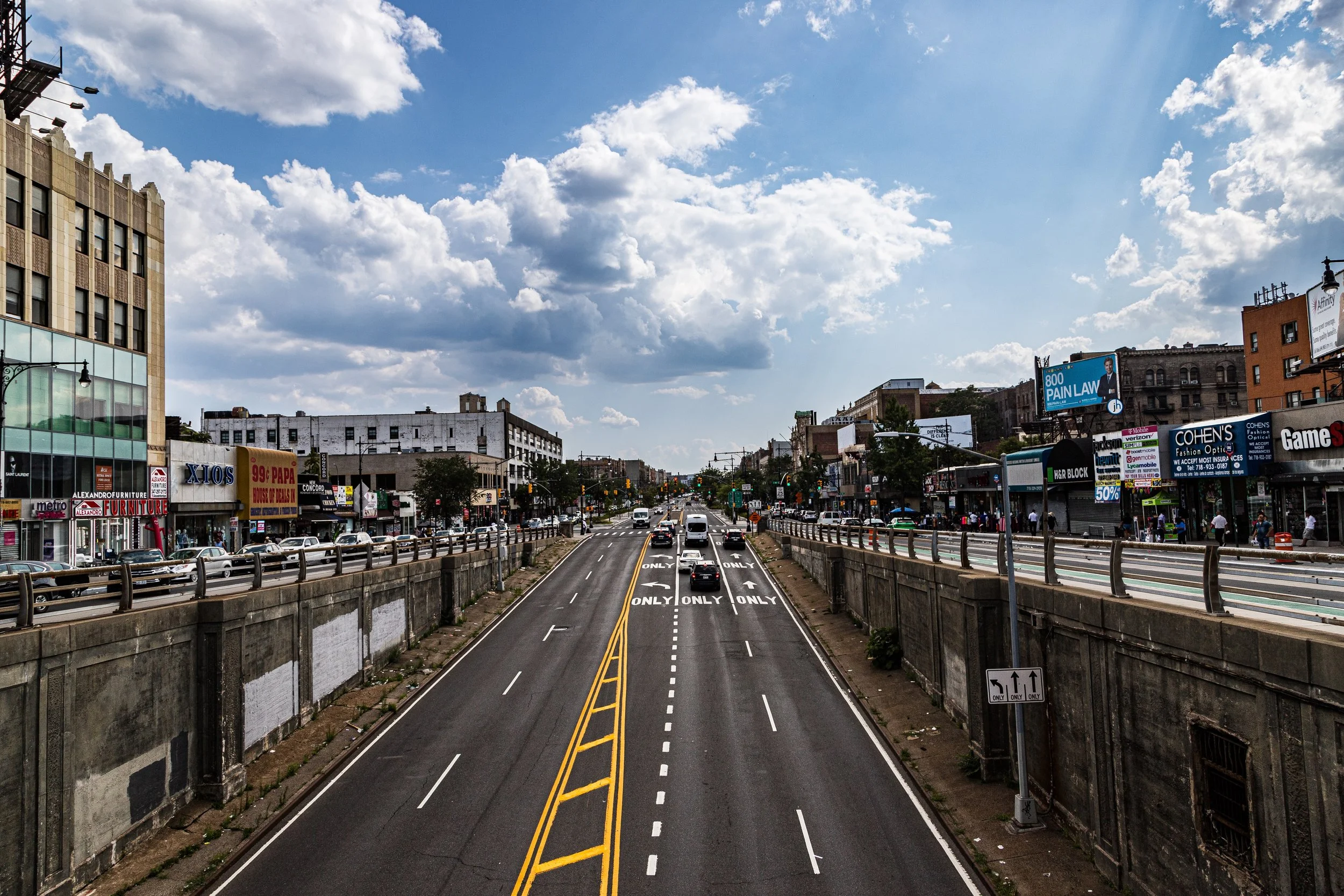
Bounded by Jerome Avenue to the west, Fordham Road to the north, Webster Avenue to the east, and East Burnside Avenue to the south, Fordham Heights occupies one of the Bronx’s most dynamic and densely populated uplands—an area perched between the historic campus of Fordham University and the bustling commercial corridors that define the heart of the central Bronx. Rising from the slopes east of the Grand Concourse and west of the Bronx River, Fordham Heights commands an elevated view over the surrounding borough, its gridded streets pulsing with the energy of markets, schools, and apartment life.
The neighborhood’s geography is defined by two key spines: Fordham Road, a vital east–west artery that connects the Harlem River to Bronx Park, and Jerome Avenue, which carries the elevated 4 train along its length. Within these borders, the urban fabric consists largely of six-story Art Deco apartment buildings, interspersed with prewar walk-ups, corner bodegas, and row houses that date back to the early 20th century. The density is balanced by pockets of civic architecture—schools, churches, and community centers—whose domes and spires rise above the street canyons. Just beyond its eastern edge, the greenery of Bronx Park offers a natural contrast to the neighborhood’s rhythmic density, underscoring the dual character that has long defined Fordham Heights: a crossroads of commerce and community perched on the ridge of the Bronx.
Etymology
The name “Fordham Heights” reflects both geography and heritage. “Fordham” derives from the English words ford (a shallow river crossing) and ham (home or settlement). The term was first used in 1666 by John Archer, an English settler who founded the village of Fordham near a crossing of the Bronx River. The “Heights” designation, added later, distinguishes this upland section from the broader Fordham area, emphasizing its position on the elevated plateau west of the Bronx River valley.
As the Bronx urbanized in the late 19th and early 20th centuries, “Fordham Heights” emerged as a descriptive name for the hilltop residential district south of Fordham Road, used in real estate advertisements and later by city planners to differentiate it from Fordham Manor and University Heights nearby.
The Neighborhood
Origins through the 19th Century
In the colonial era and through much of the 19th century, the land now known as Fordham Heights formed part of the rural township of West Farms, dotted with farmsteads, country estates, and small crossroads hamlets. The ridge between Jerome and Webster Avenues was prized for its breezes and elevation, offering a healthy refuge from the crowded quarters of Manhattan. The completion of the New York and Harlem Railroad (1840s) and later the Third Avenue Elevated Line made the area accessible, prompting early suburban development.
By the 1880s, the village of Fordham had grown into a transit-linked suburb, anchored by St. John’s College (renamed Fordham University in 1907) and the nearby Bronx Botanical Garden and Zoo. The area south of Fordham Road remained largely undeveloped until the turn of the century, when city annexation, new water infrastructure, and the extension of the Jerome Avenue elevated line (1917) spurred rapid residential construction.
Early 20th Century: Urban Expansion and Immigrant Foundations
Between 1900 and 1930, Fordham Heights transformed from farmland and open lots into one of the Bronx’s densest residential neighborhoods. Developers erected rows of five- and six-story apartment houses in Renaissance and Art Deco styles, catering to the borough’s booming middle- and working-class population. The area’s excellent transit connections—4 train on Jerome Avenue and Metro-North service along Webster Avenue—made it a magnet for upwardly mobile Jewish, Italian, and Irish families moving from Manhattan’s Lower East Side.
Fordham Road emerged as a commercial powerhouse, lined with department stores, theaters, and street vendors. Along University Avenue and Grand Concourse, elegant apartment buildings mirrored those of the Upper West Side, earning the Bronx its reputation as the “borough of homes and parks.” The intersection of Fordham Road and Grand Concourse became one of the city’s busiest retail hubs, while Jerome Avenue developed into a corridor of garages, workshops, and elevated train bustle.
Community life revolved around churches such as St. Nicholas of Tolentine (est. 1906), public schools, and small synagogues. The neighborhood’s sense of aspiration—its blend of affordability and urban sophistication—made Fordham Heights a destination for families seeking stability within reach of Manhattan’s opportunities.
Mid–Late 20th Century: Decline, Displacement, and Resilience
The mid-century decades brought both transformation and turmoil. As the Bronx’s demographics shifted after World War II, many of the area’s Jewish and Italian families relocated to the suburbs, replaced by African-American and Puerto Rican newcomers. Urban renewal projects and the construction of the Cross Bronx Expressway (1950s) disrupted nearby neighborhoods, sending waves of displaced residents into Fordham Heights.
The 1970s fiscal crisis dealt a heavy blow: neglect, arson, and disinvestment ravaged much of the Bronx. Yet Fordham Heights endured better than some neighboring districts due to its strong commercial base along Fordham Road and its proximity to major institutions. Churches and grassroots organizations—most notably Fordham Bedford Housing Corporation and UNHP (University Neighborhood Housing Program)—mobilized to rehabilitate abandoned buildings and support tenants.
By the 1980s and 1990s, waves of Caribbean and Latin American immigrants, including Dominicans, Jamaicans, and Ghanaians, revitalized the neighborhood. New restaurants, bodegas, and salons replaced shuttered storefronts, infusing Fordham Heights with renewed energy and cultural vibrancy.
21st Century: Diversity, Density, and Economic Revival
In the 21st century, Fordham Heights stands as one of the Bronx’s most bustling and diverse neighborhoods. The population—predominantly Dominican, Puerto Rican, West African, and Mexican—creates a rich cultural mosaic reflected in its food, music, and street life. Fordham Road remains one of New York City’s busiest shopping corridors, anchored by Fordham Plaza, a multimodal transit hub linking subways, buses, and Metro-North. The plaza’s recent redesign has introduced public seating, pedestrian zones, and open-air markets that knit together the commercial and residential fabric.
Community development organizations continue to invest in affordable housing and education, while the neighborhood’s dense architecture—much of it dating to the 1920s—undergoes gradual restoration. Nearby institutions such as Fordham University, Bronx Community College, and St. Barnabas Hospital provide employment and educational anchors, drawing students and workers into the neighborhood daily.
Despite challenges related to crowding, traffic, and housing affordability, Fordham Heights thrives as a microcosm of the Bronx’s rebirth: energetic, enterprising, and unshakably urban.
Spirit and Legacy
The spirit of Fordham Heights is one of endurance and reinvention. From its roots as a pastoral hilltop to its evolution as a teeming immigrant crossroads, the neighborhood has continually adapted to the city’s shifting tides while preserving its communal strength. Its streets hum with the sound of multiple languages, the aroma of empanadas, roti, and tamales wafting through the air, and the steady rhythm of vendors calling out along Fordham Road.
New York City
Use this custom Google map to explore where every neighborhood in all five boroughs of New York City is located.
The Five Boroughs
One of New York City’s unique qualities is its organization in to 5 boroughs: Manhattan, Brooklyn, Queens, The Bronx, and Staten Island. These boroughs are part pragmatic administrative districts, and part vestiges of the region’s past. Each borough is an entire county in New York State - in fact, Brooklyn is, officially, Kings County, while Staten Island is, officially Richmond County. But that’s not the whole story …
Initially, New York City was located on the southern tip of Manhattan (now the Financial District) that was once the Dutch colony of New Amsterdam. Across the East River, another city was rising: Brooklyn. In time, the city planners realized that unification between the rapidly rising cities would create commercial and industrial opportunities - through streamlined administration of the region.
So powerful was the pull of unification between New York and Brooklyn that three more counties were pulled into the unification: The Bronx, Queens, and Staten Island. And on January 1, 1898, the City of New York unified two cities and three counties into one Greater City of New York - containing the five boroughs we know today.
But because each borough developed differently and distinctly until unification, their neighborhoods likewise uniquely developed. Today, there are nearly 390 neighborhoods, each with their own histories, cultures, cuisines, and personalities - and each with residents who are fiercely proud of their corner of The Big Apple.
