
MORRIS PARK
The Bronx
Geographic Setting
Bounded by Stillwell Avenue and Eastchester Road to the east, Sackett Avenue to the southeast, Bronxdale Avenue to the southwest, the IRT 5 train line to the northwest, and Pelham Parkway to the north—with the area surrounding Indian Village carved out as its own enclave—Morris Park forms one of the Bronx’s most distinct and enduringly tight-knit neighborhoods. Set within the borough’s central-eastern plateau, it is defined by its broad residential streets, proud homeownership tradition, and a civic life that feels closer to a small town than to a metropolis of millions.
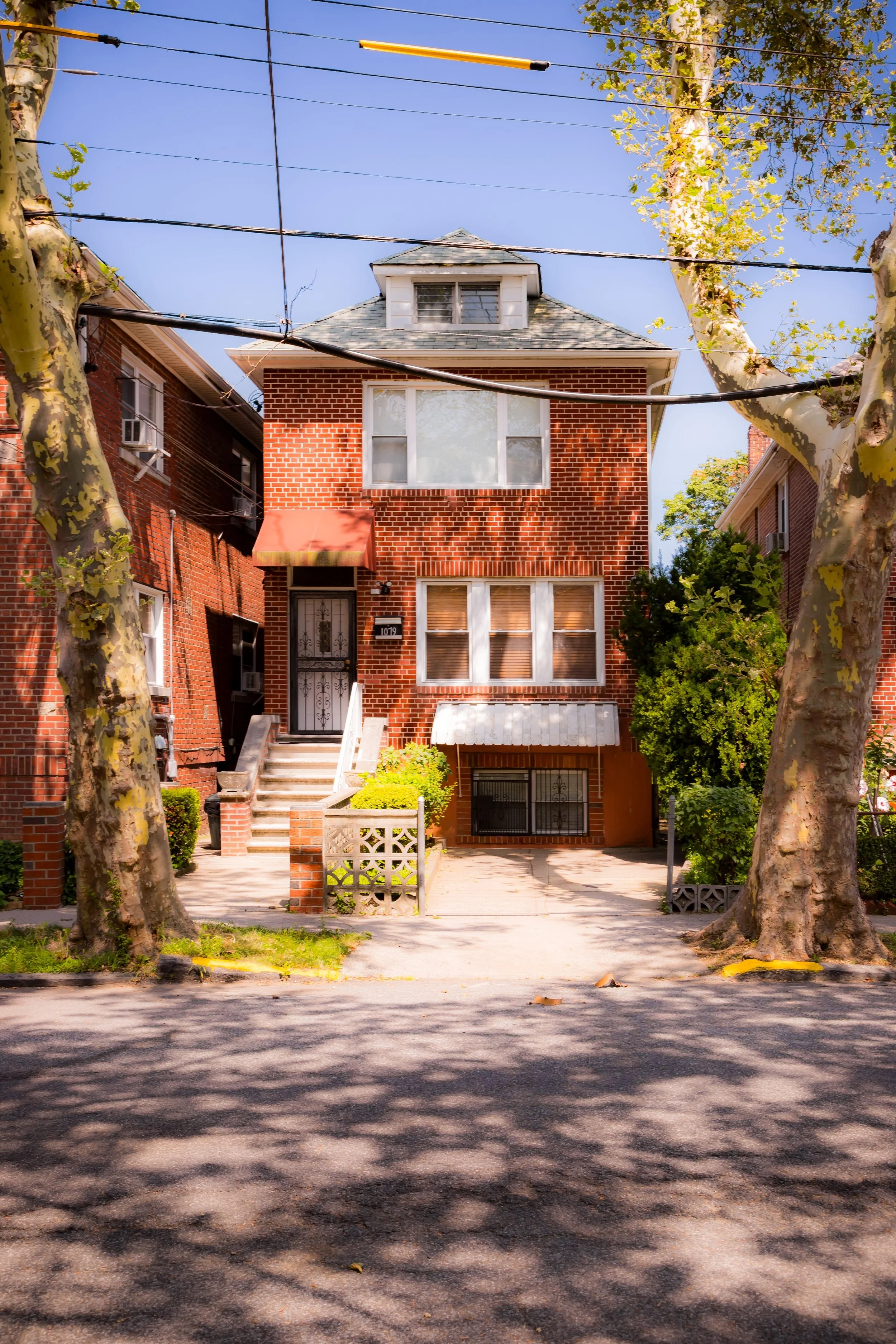
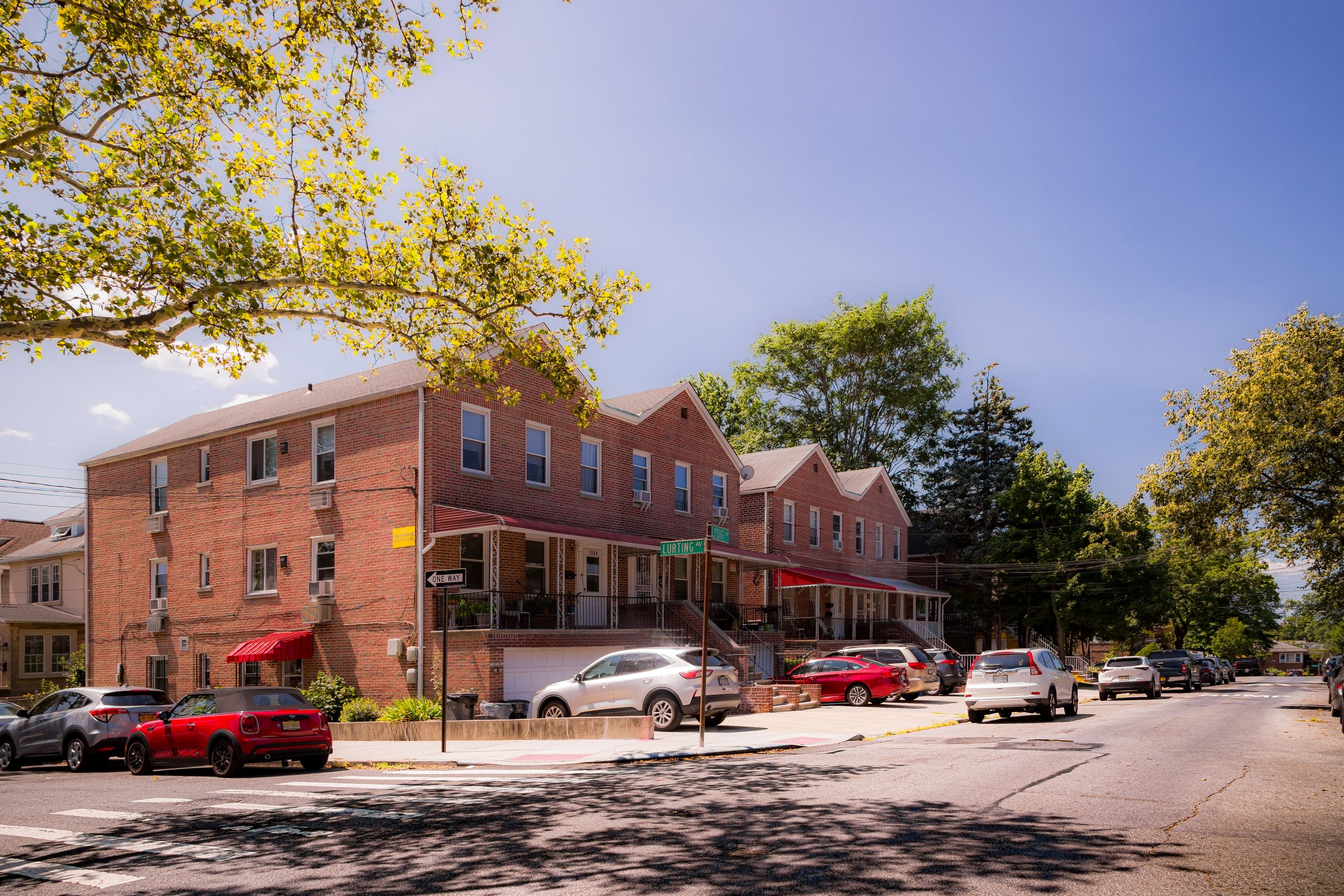
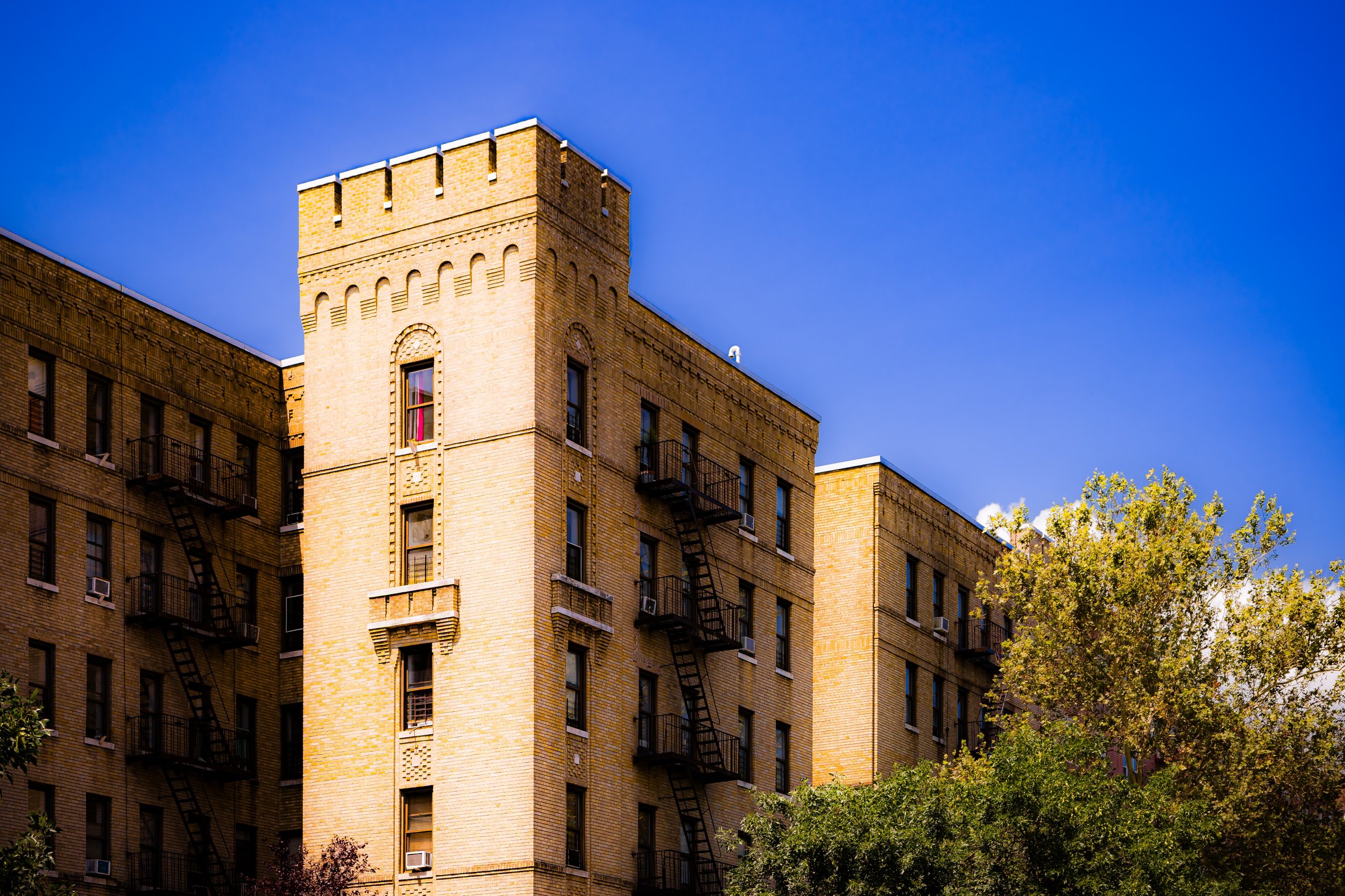
The neighborhood’s grid radiates southward from Morris Park Avenue, the central commercial corridor lined with bakeries, trattorias, barbershops, and family-owned businesses that have long served as its social backbone. To the north, Pelham Parkway provides a verdant border, a landscaped boulevard that connects Bronx Park to Pelham Bay Park; to the south and east, the parallel runs of Bronxdale Avenue and Eastchester Road delineate the residential core. The architecture is uniform yet charming—two-story brick homes, detached single-family houses, and low-rise apartment buildings, many built between the 1920s and 1940s, reflecting the area’s interwar expansion.
Flanked by institutions such as the Albert Einstein College of Medicine and Jacobi Medical Center, and dotted with parks and churches, Morris Park retains an atmosphere of quiet dignity—a neighborhood where flags hang from porches, neighbors greet one another by name, and the scent of Italian cooking drifts through open windows on summer evenings.
Etymology
The name “Morris Park” derives from the Morris Park Racecourse, a celebrated thoroughbred racetrack that once occupied much of the neighborhood’s land during the late 19th and early 20th centuries. The racecourse was built in 1889 by John A. Morris, a wealthy tobacco magnate and sportsman, who named it for himself. For nearly two decades, it was one of New York’s premier racing venues, hosting prestigious events such as the Belmont Stakes and drawing visitors from across the nation.
When the track closed in 1904, its name endured, affixed to the surrounding streets and ultimately to the residential neighborhood that replaced it. Thus, “Morris Park” stands as both a geographic and historical marker—a reminder of the days when the clatter of hooves and cheers of spectators filled the fields that are now lined with homes and corner cafés.
The Neighborhood
Origins through the 19th Century
Before the racecourse, the area that would become Morris Park was open farmland, part of the rural Town of Westchester annexed to New York City in 1895. Its gently rolling fields and proximity to Bronx Park made it attractive to developers even before full urbanization reached this part of the borough.
The transformation began with John A. Morris’s purchase of several hundred acres for his racetrack, which opened in 1889. The Morris Park Racecourse was state-of-the-art for its time—featuring grandstands, stables, and an elaborate clubhouse. It quickly became the social center of the sporting elite, rivaling Saratoga and Belmont. For fifteen years, it hosted major races and even early automobile competitions, drawing celebrities and dignitaries.
However, by 1904, a devastating fire and shifting interests in horse racing led to its closure. The property was subsequently sold and subdivided by real estate developers who saw opportunity in the newly annexed Bronx. The grid of streets laid across the former racetrack followed its elliptical shape—an echo of the track still visible today in the curvature of Morris Park Avenue and surrounding blocks.
Early 20th Century: From Racecourse to Residential Enclave
In the decades following the racetrack’s closure, Morris Park was reborn as a planned residential district catering to the growing middle class. The extension of the IRT White Plains Road Line (the 5 train) and the paving of Morris Park Avenue in the 1910s–1920s made the area accessible to commuters from Manhattan. Developers promoted it as “a garden suburb within city limits,” emphasizing tree-lined streets, modest homes, and proximity to both work and leisure.
During this period, the neighborhood’s identity took shape. Italian immigrants, many relocating from East Harlem and Belmont, became the dominant community, bringing with them traditions of family life, craftsmanship, and faith. Churches such as St. Clare of Assisi (founded 1929) and Our Lady of Solace (1903) became spiritual anchors, while civic organizations and social clubs reinforced neighborhood solidarity.
The arrival of the Morris Park Community Association in the mid-century formalized local engagement, ensuring that zoning, cleanliness, and safety remained community priorities. The area’s low-rise housing stock and pride in homeownership distinguished it from the denser tenement districts closer to the Harlem River.
Morris Park Video Coming Soon
Mid–Late 20th Century: Stability, Pride, and Preservation
While many Bronx neighborhoods underwent radical demographic and architectural shifts in the 1950s–1970s, Morris Park remained remarkably stable. Its strong social cohesion, high homeownership rates, and relative isolation from industrial corridors insulated it from the fires and disinvestment that devastated the South Bronx.
Throughout the postwar years, Morris Park retained its predominantly Italian-American character, becoming one of the Bronx’s best-known ethnic enclaves. Annual celebrations such as the Bronx Columbus Day Parade—which still marches along Morris Park Avenue—embodied neighborhood pride and continuity. Local businesses, from family-run pizzerias to bakeries like Conti’s Pastry Shoppe (established 1921), became beloved institutions.
The presence of Jacobi Medical Center (opened 1955) and the Albert Einstein College of Medicine (founded 1955) on the neighborhood’s eastern edge introduced a professional and academic element to the community, bringing doctors, nurses, and researchers who blended into the residential fabric. The balance of working-class roots and professional stability helped maintain Morris Park’s unique socioeconomic mix.
By the 1980s and 1990s, while much of the Bronx was rebuilding, Morris Park stood as an example of continuity—a place that had managed to preserve its architecture, its institutions, and its community spirit virtually intact.
21st Century: Continuity Amid Change
In the 21st century, Morris Park remains one of the Bronx’s most cohesive neighborhoods—its identity shaped by tradition, resilience, and a measured openness to change. Though still known for its Italian-American heritage, the area has become more diverse, welcoming Albanian, Filipino, Dominican, and South Asian families who contribute to the neighborhood’s evolving character while embracing its deep-rooted civic culture.
The Morris Park Community Association, still active, advocates for infrastructure improvements, neighborhood beautification, and public safety. The Bronx Columbus Day Parade continues to draw thousands each autumn, uniting generations under banners of heritage and civic pride. Meanwhile, nearby institutions—particularly the Einstein College of Medicine and Jacobi Hospital—remain major employers, ensuring economic vitality and steady foot traffic for local businesses.
The neighborhood’s architecture, largely unchanged for nearly a century, continues to define its appeal. Red-brick homes with manicured front gardens, American flags fluttering from porches, and the steady rhythm of small corner markets all reinforce Morris Park’s sense of place. Community events, church festivals, and neighborhood cleanups maintain a civic continuity that has become increasingly rare in modern urban life.
Morris Park Photo Gallery
Spirit and Legacy
The spirit of Morris Park is one of endurance through rootedness—a community that has grown not by reinvention but by refinement, preserving the best of its traditions while adapting to the future. Its curved avenues trace the ghost of a racetrack long vanished, yet the neighborhood’s sense of rhythm remains unmistakably alive: in the cadence of conversation at café tables, the laughter from block parties, and the scent of espresso and tomato sauce drifting through the air.
New York City
Use this custom Google map to explore where every neighborhood in all five boroughs of New York City is located.
The Five Boroughs
One of New York City’s unique qualities is its organization in to 5 boroughs: Manhattan, Brooklyn, Queens, The Bronx, and Staten Island. These boroughs are part pragmatic administrative districts, and part vestiges of the region’s past. Each borough is an entire county in New York State - in fact, Brooklyn is, officially, Kings County, while Staten Island is, officially Richmond County. But that’s not the whole story …
Initially, New York City was located on the southern tip of Manhattan (now the Financial District) that was once the Dutch colony of New Amsterdam. Across the East River, another city was rising: Brooklyn. In time, the city planners realized that unification between the rapidly rising cities would create commercial and industrial opportunities - through streamlined administration of the region.
So powerful was the pull of unification between New York and Brooklyn that three more counties were pulled into the unification: The Bronx, Queens, and Staten Island. And on January 1, 1898, the City of New York unified two cities and three counties into one Greater City of New York - containing the five boroughs we know today.
But because each borough developed differently and distinctly until unification, their neighborhoods likewise uniquely developed. Today, there are nearly 390 neighborhoods, each with their own histories, cultures, cuisines, and personalities - and each with residents who are fiercely proud of their corner of The Big Apple.


