
BOWERY
Manhattan
Geographic Setting
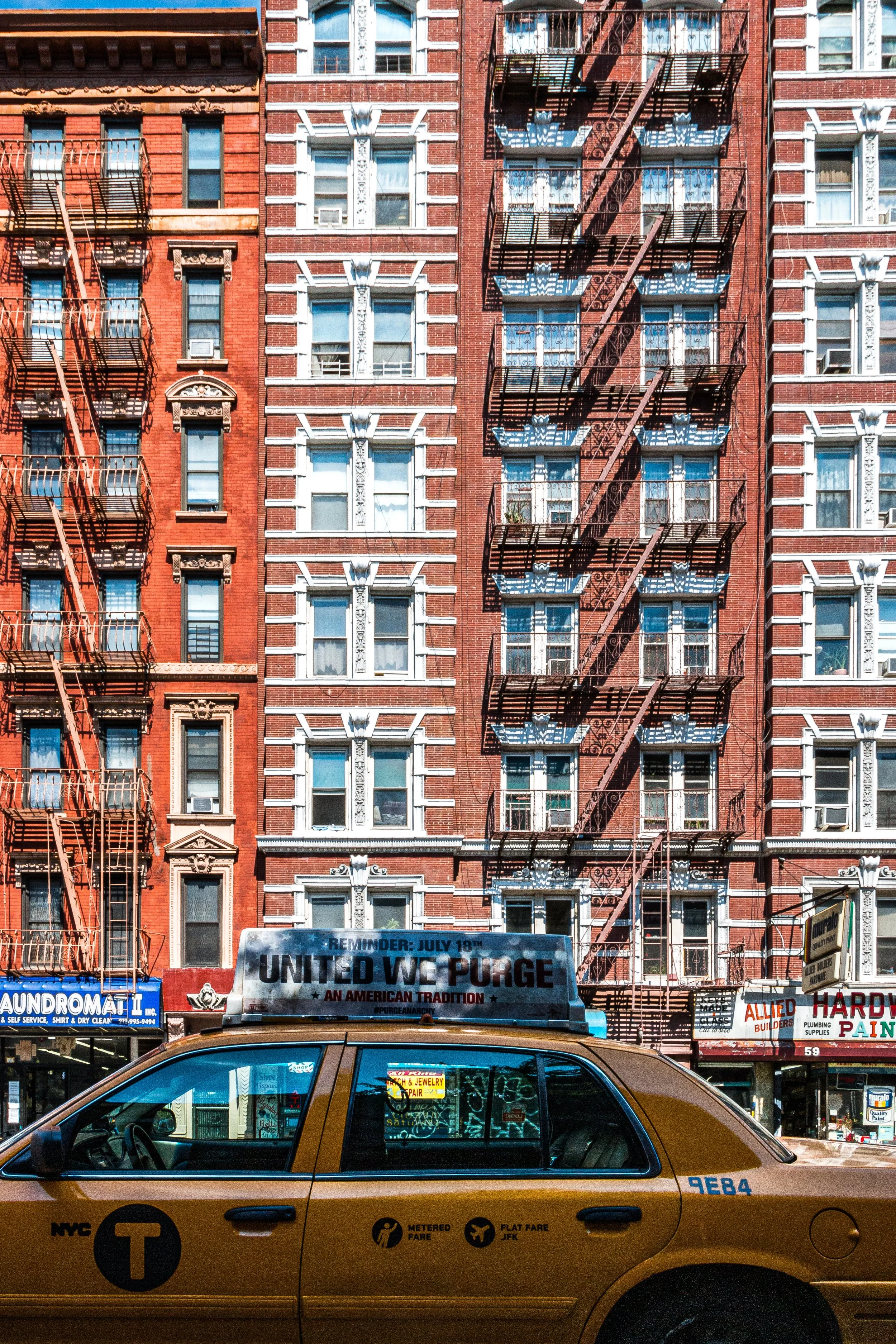
Running like a slender spine through Lower Manhattan, The Bowery stretches from Chatham Square in Chinatown north to Cooper Square near Astor Place, between Allen Street and Bowery (Lane), forming both a street and a district that bridges Chinatown, Little Italy, the Lower East Side, and the East Village. It is one of New York’s oldest thoroughfares — older even than Broadway — and one of its most symbolically charged. Along its length, a mosaic of histories coexists: Dutch farms, Gilded Age theaters, flophouses, punk clubs, and glass towers. Few streets in the city embody so many incarnations of urban life — from pastoral lane to skid row to cultural crucible — as the Bowery.
Etymology and Origins
The name Bowery comes from the Dutch word bouwerij, meaning “farm.” In the 17th century, when New Amsterdam was a walled settlement at the island’s southern tip, the Bowery Road led north from the city gate to the farmstead (Bouwerij) of Peter Stuyvesant, the last Dutch director-general. The path followed an old Lenape trail, connecting the harbor to the island’s interior.
For more than a century after its creation, the Bowery remained a rural road lined with orchards and taverns. Even after the British conquest in 1664, it remained the principal route to the countryside, passing through open fields, burial grounds, and gardens. The Stuyvesant family retained large holdings along its eastern flank, portions of which survive in the churchyard of St. Mark’s-in-the-Bowery, built in 1799 on the site of Stuyvesant’s family chapel.
The Neighborhood
18th–Early 19th Century: From Country Road to City Street
By the late 18th century, the Bowery’s rural charm began to yield to urban expansion. The construction of the Boston Post Road (connecting the city to New England) brought increased traffic, and taverns such as The Bull’s Head became popular with drovers and travelers. By 1811, the Commissioners’ Plan formalized the grid that would soon absorb the surrounding fields.
In the early 19th century, as the city expanded northward, the Bowery became one of New York’s premier entertainment districts. Elegant theaters, pleasure gardens, and music halls lined the street, catering to a cross-section of classes. The Bowery Theatre, opened in 1826, was among the largest in the nation, presenting everything from Shakespeare to melodrama. The street was lively by day and luminous by night, lit by some of the city’s first gas lamps.
Mid-19th Century: The People’s Broadway
By mid-century, the Bowery had earned the nickname “the People’s Broadway.” It was a bustling commercial artery lined with clothing shops, dance halls, dime museums, and saloons. Immigrant populations — first Irish and German, later Jewish and Italian — filled its side streets, giving rise to a boisterous, working-class culture.
The Bowery became synonymous with popular entertainment: vaudeville, burlesque, and minstrel shows flourished in venues such as Miner’s Bowery Theatre and The Old Concert Saloon. The word “Bowery” itself entered American slang, associated with swagger, humor, and streetwise flair. Songs, poems, and plays celebrated the “Bowery B’hoy,” the archetypal tough-but-romantic urban youth who embodied the rough vigor of 19th-century New York.
Yet the prosperity had shadows. The neighborhood’s density and poverty gave rise to crime and vice, and by the 1870s, as wealthier residents moved uptown, the Bowery began its long decline. Cheap lodging houses replaced theaters; missions replaced ballrooms. The once-grand boulevard of amusements became the city’s most notorious skid row.
Late 19th–Early 20th Century: Skid Row and Salvation
By the 1890s, the Bowery had become synonymous with destitution. Thousands of homeless men slept in doorways or in the 25-cent “flop houses” that lined the street. Saloons and soup kitchens did brisk business; newspapers called it “the last stop on the line.” Reformers and missionaries sought to reclaim the neighborhood’s moral and physical health.
The Bowery Mission, founded in 1879, became a beacon of charity amid despair, offering shelter, food, and spiritual renewal — a mission that continues to this day. At the same time, the Bowery retained a strange magnetism for writers and artists. Stephen Crane, Jacob Riis, and Walt Whitman all chronicled its human dramas, while photographers like Berenice Abbott captured its decaying beauty in the 1930s.
Despite its reputation, the Bowery remained commercially vital. Hardware stores, lighting suppliers, and restaurant equipment dealers flourished, turning the avenue into a workingman’s marketplace that sustained it through the Depression and beyond.
Bowery Photographic Video
Mid-20th Century: Endurance in the Shadows
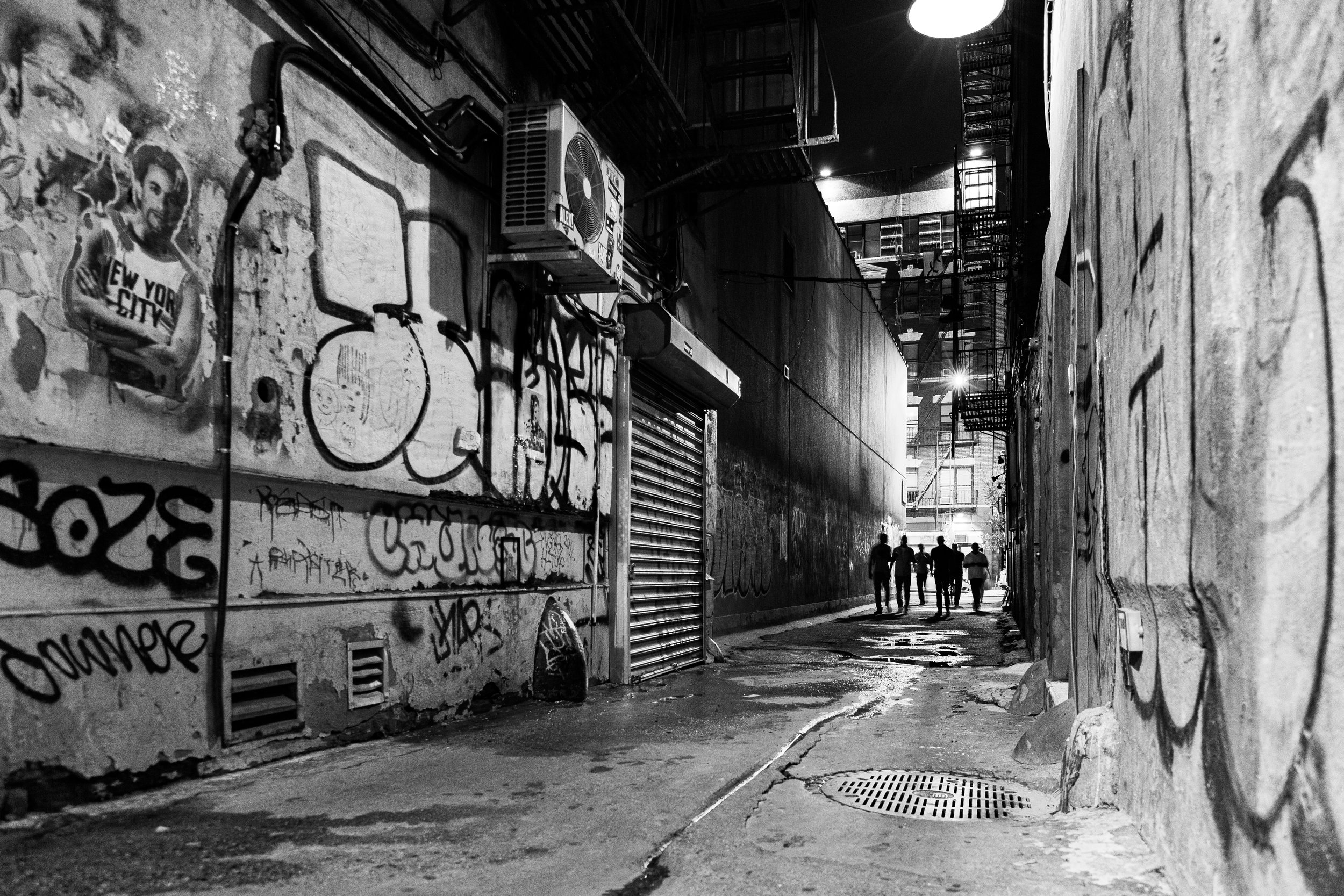
In the mid-20th century, the Bowery continued to embody the margins of Manhattan life. The elevated train that had darkened its skies since the 1870s was finally demolished in 1955, briefly restoring sunlight to the street. Yet poverty remained entrenched. Hotels with names like “The Sunshine” and “The Palace” housed thousands of men on the edge of survival.
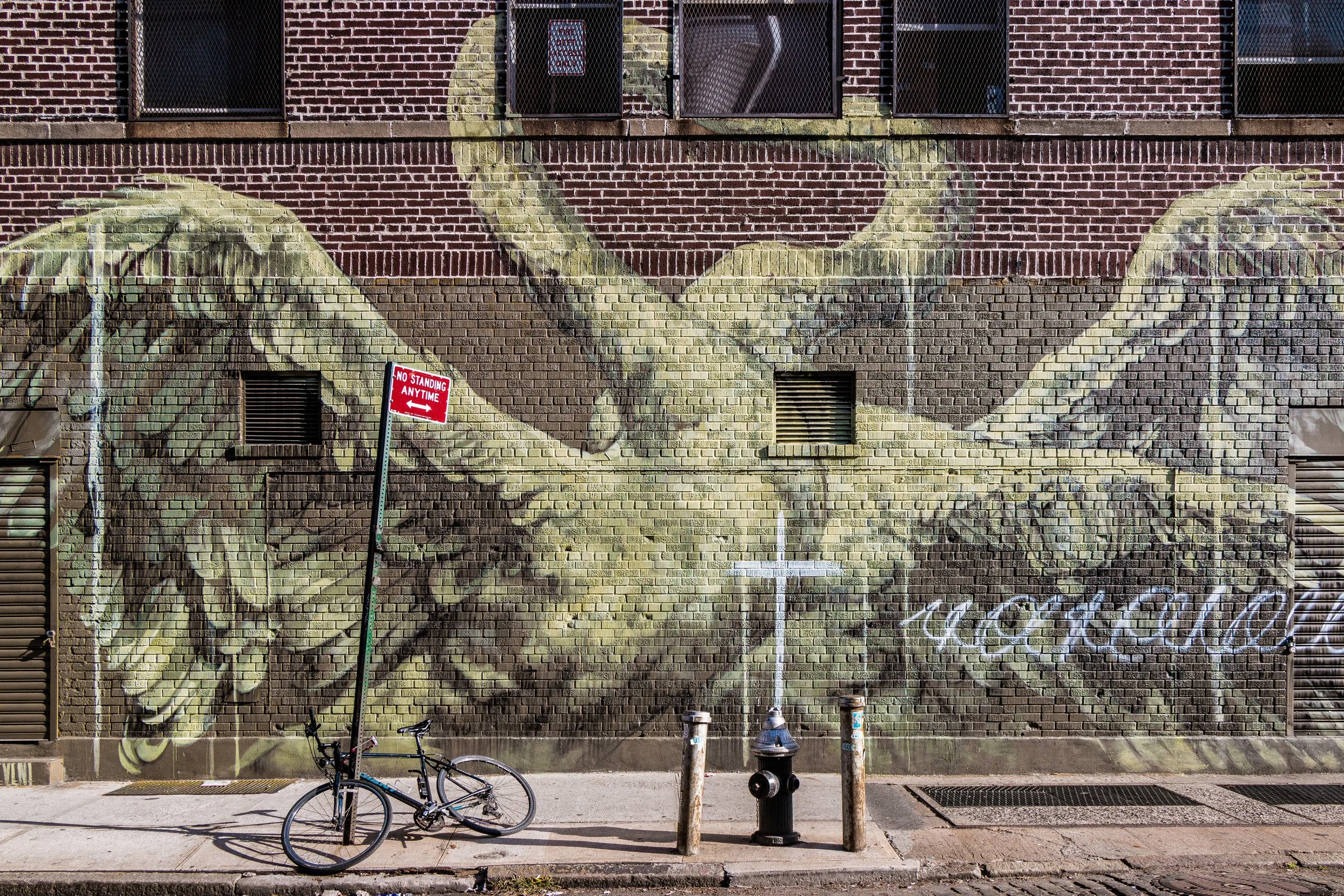
Still, even in its darkest decades, the Bowery retained a stubborn vitality. Its cheap rents attracted artists, musicians, and outsiders. Abstract Expressionists drank at McSorley’s Old Ale House, one of the city’s oldest taverns. The New Museum opened nearby in 1977, signaling the arrival of contemporary art amid decay. Most famously, CBGB, founded at 315 Bowery in 1973, became the birthplace of American punk rock — launching bands such as The Ramones, Talking Heads, and Patti Smith.
Late 20th–21st Century: Reinvention and Memory
By the late 1990s, the Bowery began its most dramatic transformation in over a century. The collapse of skid row coincided with a wave of gentrification sweeping through downtown. Vacant lots became boutique hotels and condominiums; the old lighting and restaurant supply shops gave way to galleries, bars, and luxury apartments.
The New Museum of Contemporary Art, designed by SANAA and opened in 2007, became the architectural symbol of the new Bowery — minimalist, vertical, and gleaming. Nearby, the Bowery Hotel and the CitizenM Tower reframed the street’s identity for a new generation of visitors.
Yet even amid renewal, traces of the old Bowery remain. The Bowery Mission still serves meals beneath the red brick façade that has stood since 1895. McSorley’s, founded in 1854, still pours ale in sawdust-floored simplicity. Graffiti, music, and memory still haunt the walls where the Ramones once played. The street’s paradox endures: a corridor of aspiration and abandonment, wealth and want, constantly remade but never erased.
Bowery Photo Gallery
Architecture and Atmosphere
Architecturally, the Bowery is a collage of centuries. Greek Revival townhouses, Italianate cast-iron buildings, Art Deco commercial blocks, and 21st-century glass towers jostle for attention along its length. Many façades still bear ghost signage from lighting stores and hardware suppliers. The scale remains intimate despite vertical incursions; the Bowery’s essential form — narrow, sunstruck, slightly crooked — persists.
The atmosphere is restless. Morning light catches the steel awnings of restaurant suppliers; by noon, tourists mix with longtime residents and mission workers. At night, music spills from bars and galleries, echoing the district’s endless cycle of creation and reinvention
Spirit and Legacy
The Bowery’s legacy is that of transformation — not merely of architecture, but of the human condition. From Stuyvesant’s farm road to immigrant artery, from skid row to cultural crucible, it has reflected the shifting soul of New York itself.
New York City
Use this custom Google map to explore where every neighborhood in all five boroughs of New York City is located.
The Five Boroughs
One of New York City’s unique qualities is its organization in to 5 boroughs: Manhattan, Brooklyn, Queens, The Bronx, and Staten Island. These boroughs are part pragmatic administrative districts, and part vestiges of the region’s past. Each borough is an entire county in New York State - in fact, Brooklyn is, officially, Kings County, while Staten Island is, officially Richmond County. But that’s not the whole story …
Initially, New York City was located on the southern tip of Manhattan (now the Financial District) that was once the Dutch colony of New Amsterdam. Across the East River, another city was rising: Brooklyn. In time, the city planners realized that unification between the rapidly rising cities would create commercial and industrial opportunities - through streamlined administration of the region.
So powerful was the pull of unification between New York and Brooklyn that three more counties were pulled into the unification: The Bronx, Queens, and Staten Island. And on January 1, 1898, the City of New York unified two cities and three counties into one Greater City of New York - containing the five boroughs we know today.
But because each borough developed differently and distinctly until unification, their neighborhoods likewise uniquely developed. Today, there are nearly 390 neighborhoods, each with their own histories, cultures, cuisines, and personalities - and each with residents who are fiercely proud of their corner of The Big Apple.


