BREEZY POINT
Queens
Geographic Setting
Occupying the far western tip of the Rockaway Peninsula, Breezy Point lies between the Atlantic Ocean to the south, Jamaica Bay to the north, Fort Tilden and Riis Park to the east, and the Rockaway Inlet—which separates it from Brooklyn’s Coney Island—to the west. It is the city’s outermost coastal community, a narrow finger of dunes and beachgrass reaching toward the open sea. From its windswept shores, one can see the sweep of the Verrazzano-Narrows Bridge to the northwest and the endless horizon of the Atlantic to the south—a setting that feels simultaneously within and beyond New York City.
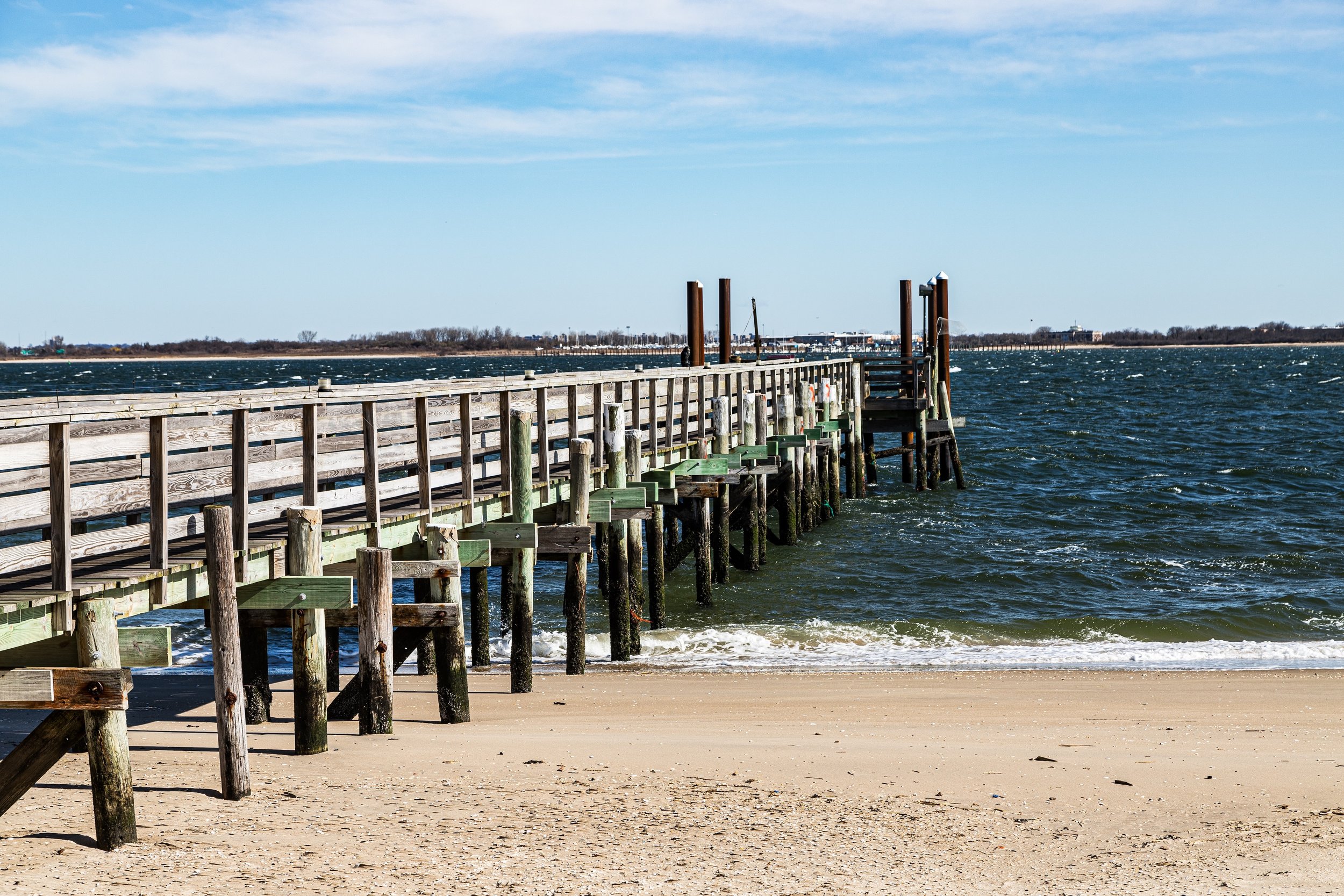
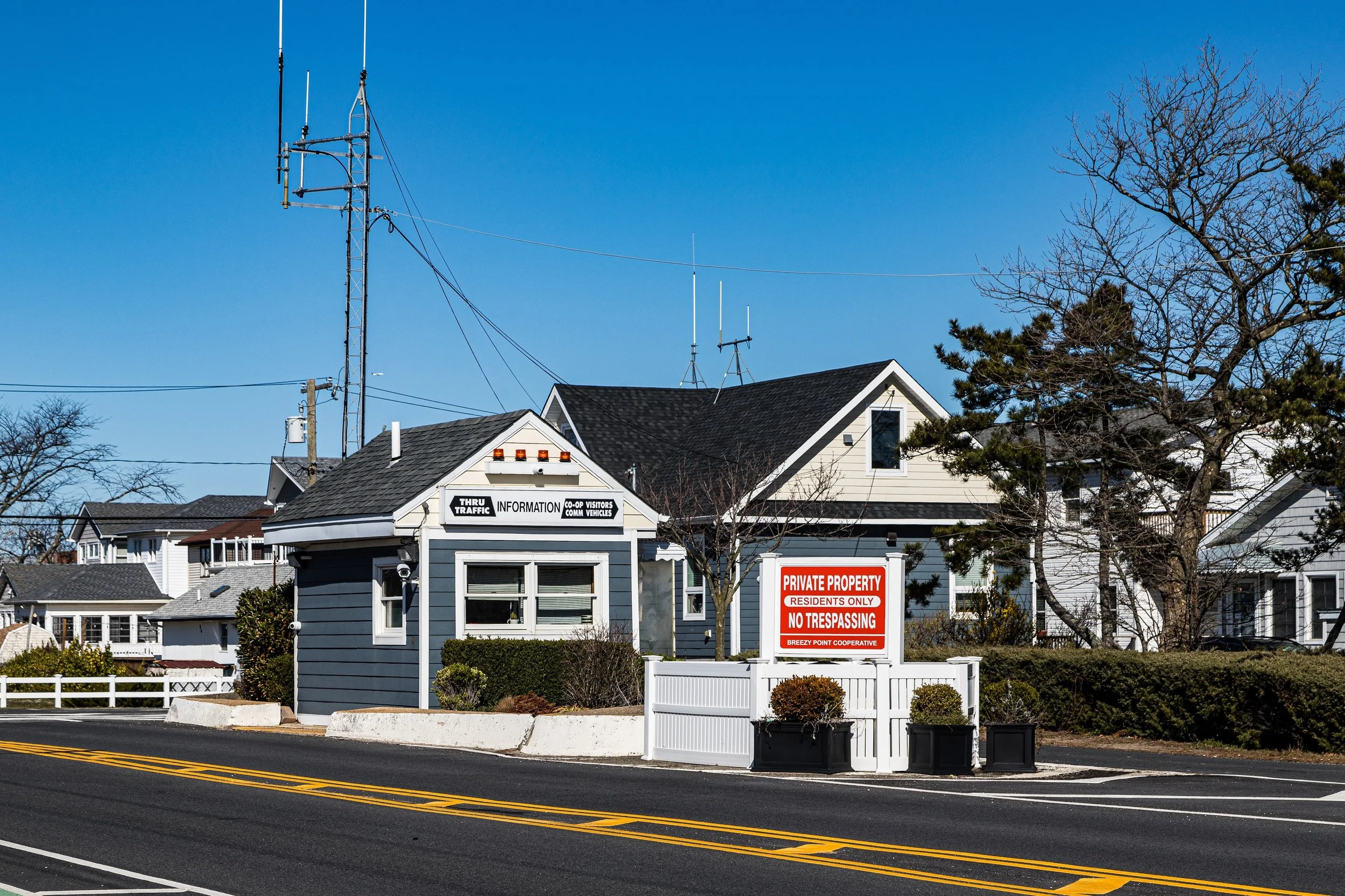
Breezy Point’s built environment reflects its singular geography. A gated cooperative community established on former summer bungalow colonies, it is composed primarily of low-rise, wood-framed homes, many rebuilt or raised in the wake of storms and floods. Sand roads, boardwalks, and grassy lanes replace sidewalks; the ocean and bay are never more than a few minutes’ walk away. Its boundaries encompass several smaller enclaves—Roxbury, Rockaway Point, and Silver Gull—each with its own clubhouse, marina, and beach access. To the east, Fort Tilden, a decommissioned military base turned national recreation area, provides a buffer of wild dunes and meadows, while to the west, the Breezy Point Jetty extends into the inlet, protecting the community from erosion while serving as a beloved local landmark.
Etymology and Origins
The name “Breezy Point” captures the essence of the place—an exposed, wind-swept point of land where ocean and bay breezes meet. The area was originally part of the Rockaway peninsula’s barrier beach system, inhabited for millennia by the Lenape people, who fished and harvested shellfish along its shores. European settlers in the 17th and 18th centuries used the land primarily for grazing and fishing, leaving its dunes largely untouched.
By the late 19th century, as New Yorkers discovered the Rockaways as a seaside escape, the western peninsula began to host small clusters of summer cottages and fishing shacks. In 1902, developer William Wainwright opened Breezy Point Pavilion, a seaside resort with bathing facilities, hotels, and cottages that drew middle-class vacationers from Brooklyn and Manhattan. The area’s isolation, accessible mainly by ferry or a long trek along the beach, lent it an almost rural atmosphere—a quality that endures even today.
The Neighborhood
Early 20th Century: Summer Colony to Seaside Village
The early 1900s saw Breezy Point evolve from resort to residential enclave. As transportation improved, families began leasing land and constructing small bungalows for summer use. In 1919, the Breezy Point Cooperative was formally established when residents pooled funds to purchase the property from the Wainwright estate. The co-op’s communal ownership model—one of the first of its kind in the city—gave members collective control over land use, infrastructure, and beach access, preserving the community’s low-rise, small-scale character even as the rest of the Rockaways urbanized.
During the interwar years, Breezy Point attracted predominantly Irish- and Italian-American families from Brooklyn, Queens, and the Bronx, many of them firefighters, police officers, and civil servants seeking an affordable retreat by the sea. By the 1930s, the area had become known as the “Irish Riviera,” a nickname that persists today. Wooden boardwalks and sandy lanes defined the neighborhood’s layout, with each cluster of bungalows centered around a clubhouse or community field.
Mid-20th Century: Isolation, Identity, and Continuity
When the rest of the Rockaways underwent urban renewal and large-scale housing development in the 1950s and 1960s, Breezy Point remained largely unchanged—its cooperative structure insulating it from outside speculation. The completion of the Marine Parkway–Gil Hodges Memorial Bridge (1937) connected the peninsula to Brooklyn, providing easier access but also reinforcing its geographic seclusion.
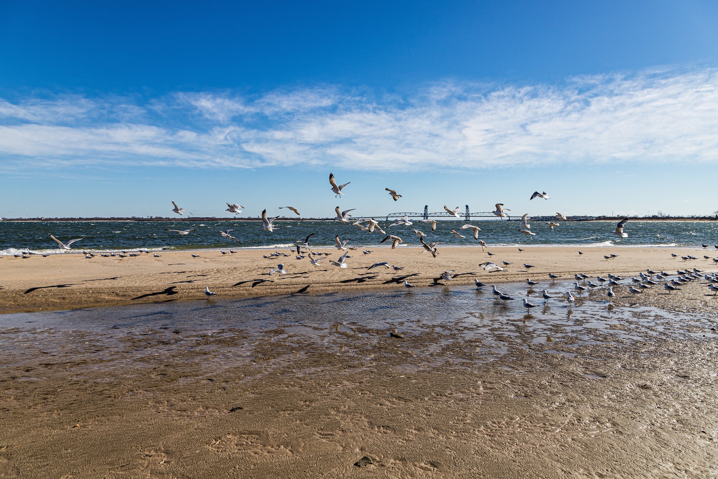
The federal government’s decision in 1972 to create the Gateway National Recreation Area placed Breezy Point within a vast protected coastal park system. Much of its surrounding land—dunes, marshes, and beaches—was transferred to the National Park Service, ensuring that no further large-scale development would encroach upon its fragile environment. Residents retained control of approximately 500 acres under the cooperative, while the remainder became part of Breezy Point Tip, a natural wildlife habitat known for migratory birds and nesting shore species like the piping plover.
Despite periodic conflicts over access, Breezy Point maintained its insular identity and tight-knit culture, anchored by volunteer fire companies, local parishes such as St. Thomas More Church, and annual traditions like beach parades and sports leagues.
Breezy Point Video Coming Soon
Late 20th–21st Century: Storms, Survival, and Renewal
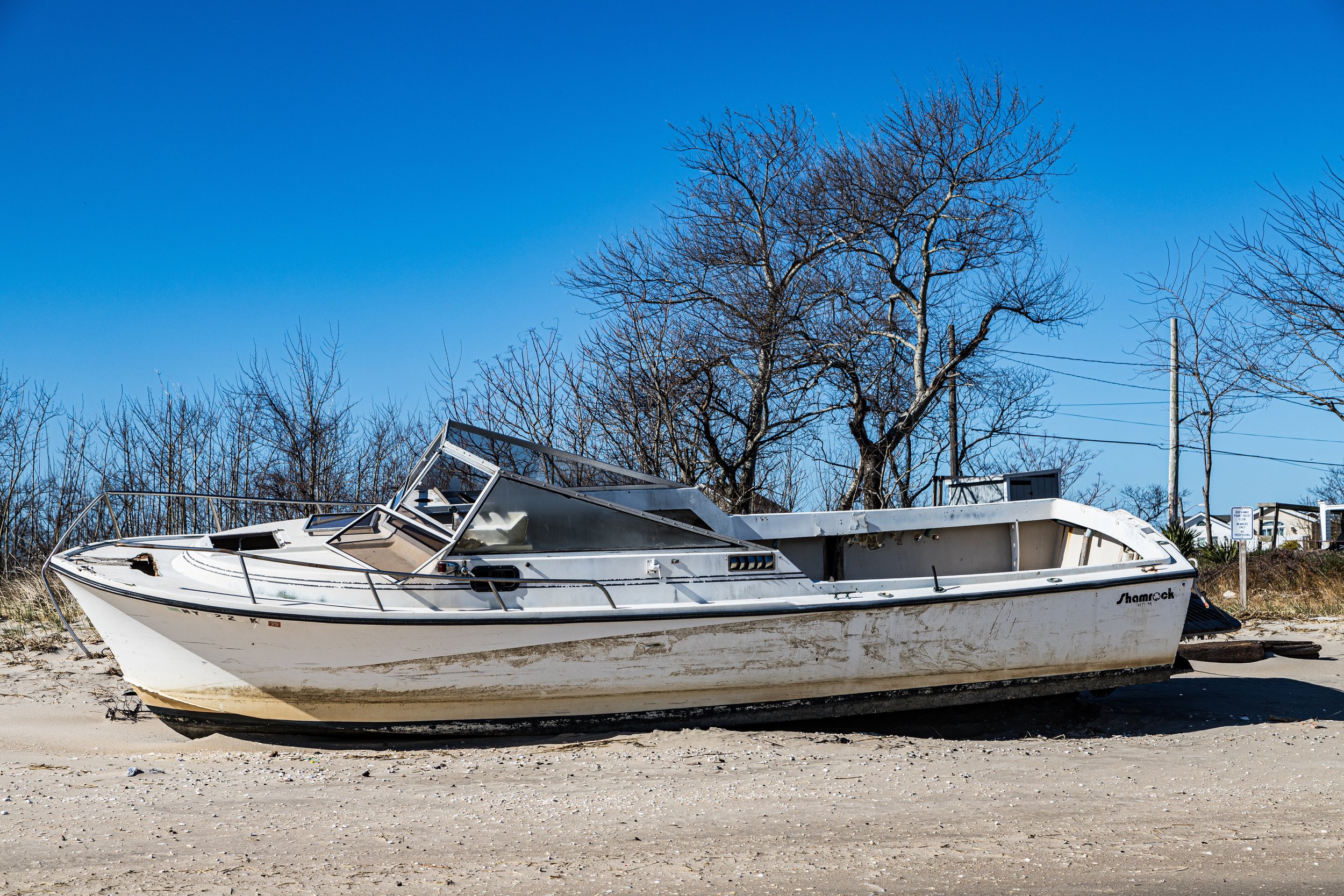
Breezy Point’s beauty has always been shadowed by vulnerability. The flat, sandy terrain leaves it highly exposed to tides, wind, and storm surge. Hurricanes and nor’easters repeatedly battered the community throughout the 20th century, but none more devastating than Hurricane Sandy in 2012. That night, a catastrophic fire—fueled by floodwaters and high winds—swept through the heart of Breezy Point, destroying more than 130 homes and damaging hundreds more. Images of burning houses surrounded by seawater became symbols of both loss and resilience.
In the aftermath, residents rebuilt with remarkable determination. Homes were elevated, dunes were reinforced, and cooperative infrastructure was modernized to meet new environmental standards. Federal and city aid supported flood-mitigation projects, while the community itself raised funds and organized volunteer efforts. Today, rebuilt houses—many raised on stilts—stand beside surviving bungalows, their pastel facades facing the ocean once again.
At the same time, Breezy Point has taken on renewed ecological significance. The surrounding Breezy Point Tip and Fort Tilden dunes form one of the largest contiguous natural beach habitats in New York City, vital for coastal wildlife and storm protection. Conservation initiatives, led by the National Park Service and local stewards, balance recreation with restoration, ensuring the area remains both livable and ecologically sound.
Breezy Point Photo Gallery
Spirit and Legacy
Breezy Point’s legacy is one of perseverance at the city’s edge—a community defined by salt air, sand, and solidarity. Its cooperative model, born a century ago, still governs daily life; its residents, many descendants of founding families, remain fiercely protective of their environment and way of life. Though sometimes perceived as insular, Breezy Point endures as a rare experiment in collective ownership and coastal stewardship within New York City’s boundaries.
New York City
Use this custom Google map to explore where every neighborhood in all five boroughs of New York City is located.
The Five Boroughs
One of New York City’s unique qualities is its organization in to 5 boroughs: Manhattan, Brooklyn, Queens, The Bronx, and Staten Island. These boroughs are part pragmatic administrative districts, and part vestiges of the region’s past. Each borough is an entire county in New York State - in fact, Brooklyn is, officially, Kings County, while Staten Island is, officially Richmond County. But that’s not the whole story …
Initially, New York City was located on the southern tip of Manhattan (now the Financial District) that was once the Dutch colony of New Amsterdam. Across the East River, another city was rising: Brooklyn. In time, the city planners realized that unification between the rapidly rising cities would create commercial and industrial opportunities - through streamlined administration of the region.
So powerful was the pull of unification between New York and Brooklyn that three more counties were pulled into the unification: The Bronx, Queens, and Staten Island. And on January 1, 1898, the City of New York unified two cities and three counties into one Greater City of New York - containing the five boroughs we know today.
But because each borough developed differently and distinctly until unification, their neighborhoods likewise uniquely developed. Today, there are nearly 390 neighborhoods, each with their own histories, cultures, cuisines, and personalities - and each with residents who are fiercely proud of their corner of The Big Apple.


