HOWARD BEACH
Queens
Geographic Setting
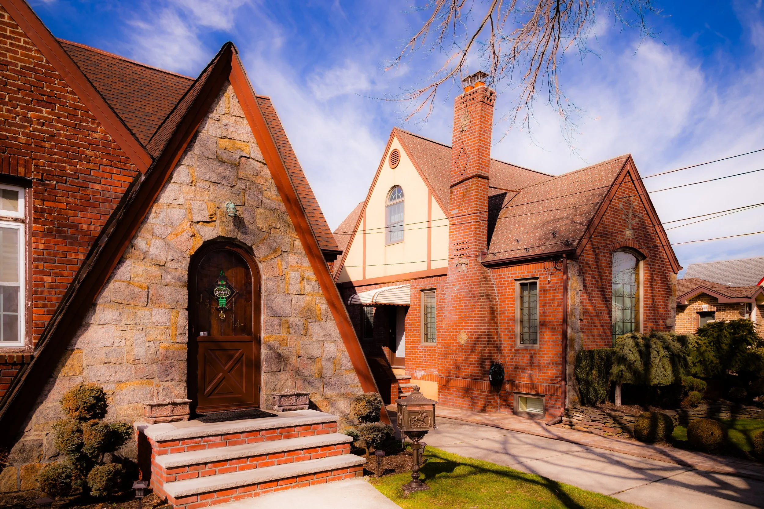
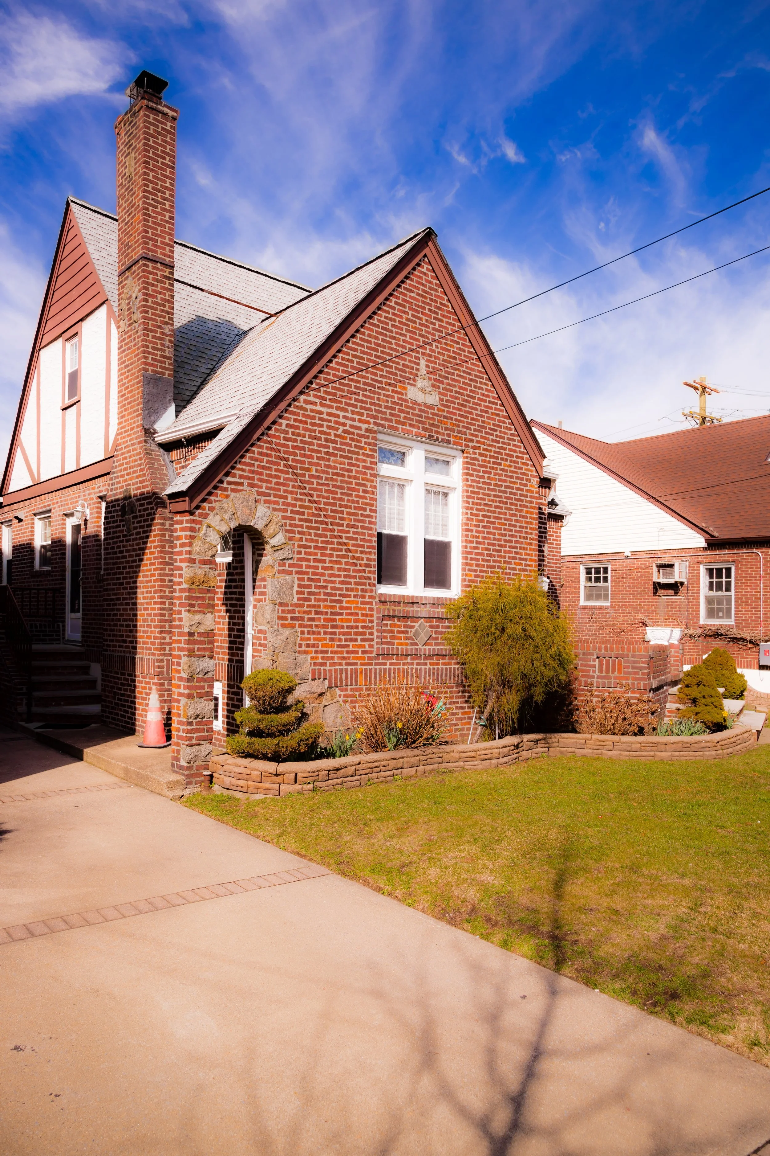
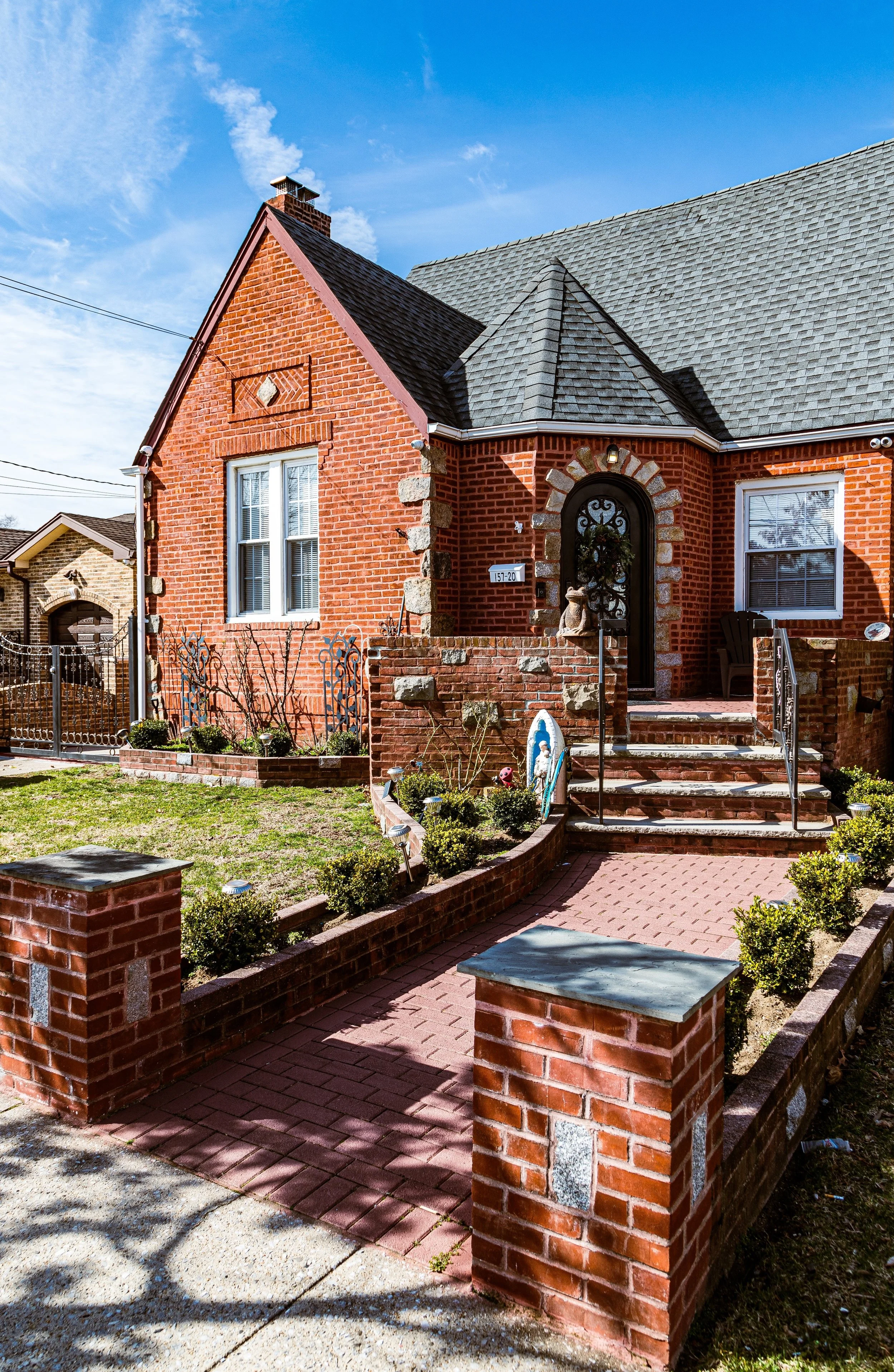
Bounded by the Belt Parkway to the north, Shellbank Basin and Jamaica Bay to the east, Jamaica to the south, and Spring Creek Park and the Brooklyn line to the west, Howard Beach is one of southern Queens’ signature waterfront neighborhoods—a low-lying, suburban community defined by canals, marinas, and the steady presence of the bay. Stretching across a broad expanse of reclaimed marshland between Brooklyn and the Rockaway Peninsula, the neighborhood is composed of several distinct sections: Old Howard Beach to the west, the New Howard Beach developments and Lindenwood to the north, and Hamilton Beach to the southeast. Together, they form a cohesive landscape of tidy homes, tree-lined streets, and waterways that give the area its unmistakable coastal identity.
The built environment of Howard Beach reflects its evolution from seaside resort to suburban enclave. Its main thoroughfares—Cross Bay Boulevard, Cohancy Street, and 104th Street—run southward toward the Joseph P. Addabbo Memorial Bridge, which links the neighborhood to the Rockaway Peninsula. Cross Bay Boulevard serves as the community’s central spine, lined with family-owned restaurants, bakeries, and small businesses that have defined its commercial character for decades. Alongside the bay, narrow canals cut inland between residential blocks, their wooden docks and motorboats evoking a lifestyle more akin to Long Island than urban New York. To the west, Spring Creek Park and the Jamaica Bay Wildlife Refuge provide open vistas of salt marshes, osprey nests, and tidal grasses—reminders of the natural ecosystem that once covered the entire area.
Etymology and Origins
The name “Howard Beach” dates to the early 20th century and derives from William J. Howard, a Brooklyn-based glove manufacturer who purchased large tracts of land along Jamaica Bay in the 1890s. Recognizing the area’s potential as a seaside retreat, Howard established a resort and bathing colony on what was then a sparsely populated stretch of marsh. Wooden piers, small hotels, and cottages were built along the shore, and the area soon gained popularity among working- and middle-class New Yorkers seeking coastal recreation.
In the 1910s and 1920s, the completion of Cross Bay Boulevard and Cross Bay Bridge linked the region to the rest of Queens and Brooklyn, transforming the isolated wetlands into accessible real estate. Developers began filling and dredging sections of the bay to create residential plots—land reclaimed from tidal flats and crisscrossed with artificial canals. By the 1930s, Howard Beach had become a hybrid community of summer bungalows and year-round homes, its grid following the contours of the shoreline and its identity firmly tied to the water.
The Neighborhood
Early–Mid 20th Century: From Resort to Residential Suburb
By the 1930s and 1940s, Howard Beach had transitioned from resort to residential district. The Great Depression curtailed its resort economy, but infrastructure improvements under Robert Moses—including the construction of the Belt Parkway (1930s)—made the area attractive to families seeking suburban living within city limits. The grid of Old Howard Beach, west of Cross Bay Boulevard, filled with modest single-family homes, while to the east, new canals and basins were dredged to accommodate waterfront development.
During this period, the neighborhood took on a distinctly suburban character: detached homes with driveways, small lawns, and private docks replaced many of the earlier summer cottages. Churches such as St. Helen’s Roman Catholic Church (est. 1920s) and civic associations provided social anchors, while P.S. 207 and local schools served the growing population of families. The combination of affordability, proximity to beaches, and access to Manhattan via the A train (Howard Beach–JFK Airport Station) cemented Howard Beach’s reputation as “the suburbs by the sea.”
Mid–Late 20th Century: Expansion and Identity
In the decades following World War II, Howard Beach experienced significant expansion and consolidation. The construction of New Howard Beach north of the Belt Parkway and the adjacent Lindenwood developments in the 1950s and 1960s extended the neighborhood’s reach onto newly filled land. These planned suburban-style communities featured split-level homes, garden apartments, and shopping centers such as Lindenwood Village, designed for the car-owning middle class. The proximity of Idlewild Airport (renamed JFK Airport in 1963) brought both convenience and challenges—noise and air traffic overhead—but the community’s strong civic networks and relative isolation helped preserve its small-town atmosphere.
Throughout the mid-20th century, Howard Beach became known for its stable, family-oriented population—predominantly Italian-American, Irish-American, and Jewish families—many of whom were civil servants, police officers, and city workers. The neighborhood’s identity revolved around its close-knit institutions: St. Helen’s Parish, the Howard Beach Kiwanis Club, and block associations that maintained the canals and coordinated civic improvements. Boating, fishing, and local festivals along Cross Bay Boulevard contributed to a strong sense of place.
The 1970s and 1980s brought challenges as New York City faced fiscal crises and racial tensions occasionally flared. A notorious racial incident in 1986 cast a temporary shadow over the community’s reputation, but residents and local leaders responded with renewed emphasis on inclusivity and civic outreach. Over the ensuing decades, gradual demographic diversification reshaped Howard Beach’s social landscape without erasing its traditional character.
Howard Beach Video Coming Soon
21st Century: Continuity, Resilience, and Renewal
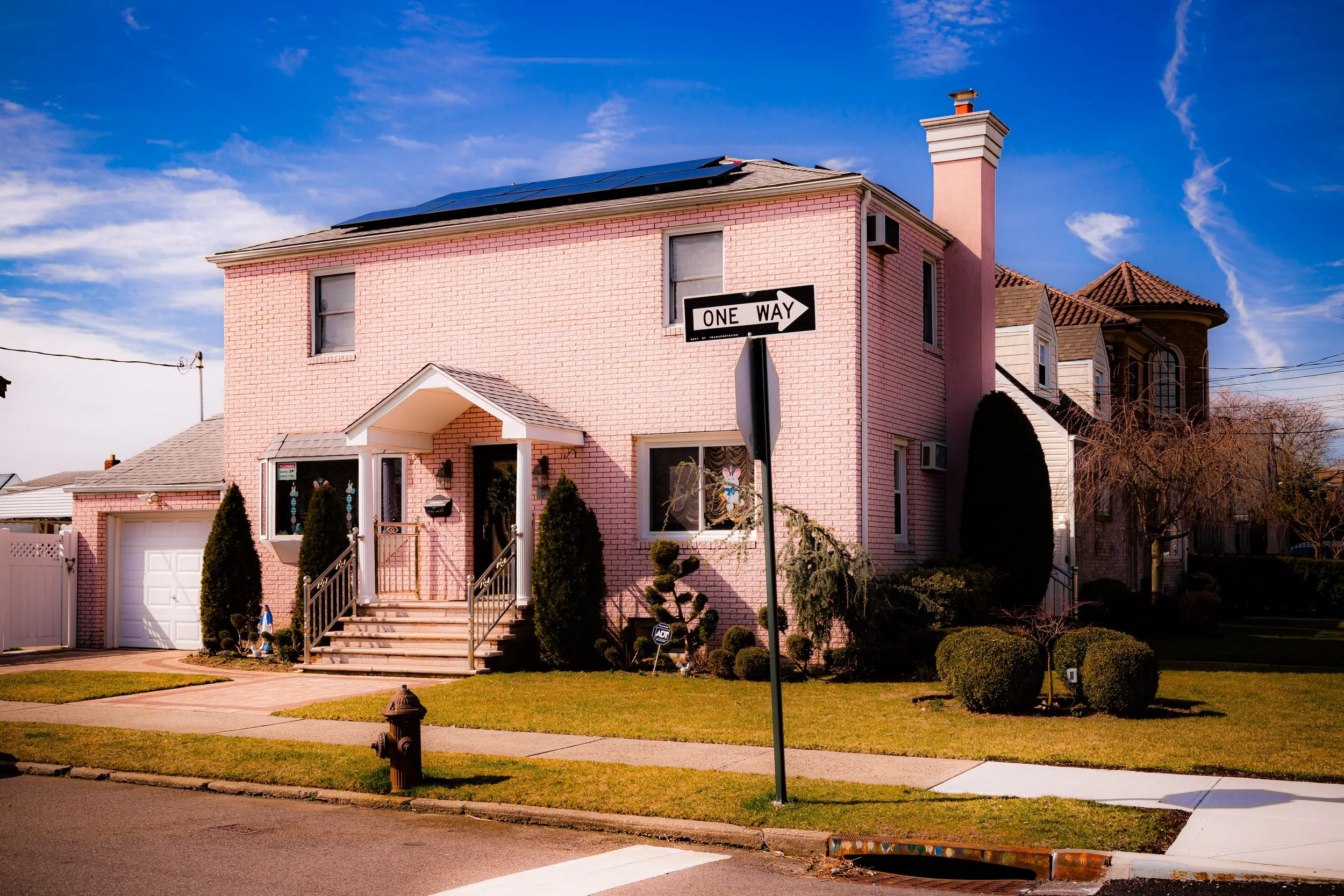
In the 21st century, Howard Beach stands as a symbol of both continuity and resilience. The neighborhood retains its low-rise, suburban character—rows of well-kept homes with gardens, driveways, and decorative stonework—yet it has become more diverse, with Italian-, Irish-, Jewish-, Caribbean-, and South Asian-American families living side by side. Local schools such as P.S. 146, P.S. 232, and M.S. 202 continue to serve as community anchors, and Frank M. Charles Memorial Park—a waterfront park facing Jamaica Bay—provides space for recreation, picnicking, and birdwatching.
However, life along the bay comes with vulnerability. Hurricane Sandy (2012) left an indelible mark on Howard Beach, flooding hundreds of homes and devastating waterfront areas. In the aftermath, residents rebuilt with characteristic determination, elevating houses, reinforcing bulkheads, and working with city and federal agencies to improve flood resiliency. Shoreline restoration projects and tidal wetland rehabilitation along Shellbank Basin and Spring Creek Park have since become part of the community’s adaptive landscape, blending environmental stewardship with preservation of its maritime identity.
Cross Bay Boulevard remains the neighborhood’s commercial and cultural axis, lined with Italian bakeries, pizzerias, family restaurants, and newer international eateries that reflect the changing face of Queens. Civic engagement remains high through organizations like the Howard Beach Lindenwood Civic Association, which continues to advocate for infrastructure maintenance, flood protection, and the protection of the community’s suburban quality of life.
Howard Beach Photo Gallery
Spirit and Legacy
Howard Beach’s legacy is inseparable from the water that defines it. Born from marshes and molded by human hands, it represents New York’s long tradition of turning nature into neighborhood—a place where city and sea meet in daily coexistence. Its canals, bulkheads, and bungalows tell the story of persistence: of families who have stayed for generations, rebuilding after storms and maintaining a uniquely maritime way of life within the borders of the city.
New York City
Use this custom Google map to explore where every neighborhood in all five boroughs of New York City is located.
The Five Boroughs
One of New York City’s unique qualities is its organization in to 5 boroughs: Manhattan, Brooklyn, Queens, The Bronx, and Staten Island. These boroughs are part pragmatic administrative districts, and part vestiges of the region’s past. Each borough is an entire county in New York State - in fact, Brooklyn is, officially, Kings County, while Staten Island is, officially Richmond County. But that’s not the whole story …
Initially, New York City was located on the southern tip of Manhattan (now the Financial District) that was once the Dutch colony of New Amsterdam. Across the East River, another city was rising: Brooklyn. In time, the city planners realized that unification between the rapidly rising cities would create commercial and industrial opportunities - through streamlined administration of the region.
So powerful was the pull of unification between New York and Brooklyn that three more counties were pulled into the unification: The Bronx, Queens, and Staten Island. And on January 1, 1898, the City of New York unified two cities and three counties into one Greater City of New York - containing the five boroughs we know today.
But because each borough developed differently and distinctly until unification, their neighborhoods likewise uniquely developed. Today, there are nearly 390 neighborhoods, each with their own histories, cultures, cuisines, and personalities - and each with residents who are fiercely proud of their corner of The Big Apple.


