BRIGHTON HEIGHTS
Staten Island
Geographic Setting
Bounded by Victory Boulevard to the southeast, Jersey Street to the southwest and west, Crescent Avenue to the northwest, Belmont Place to the northeast, and St. Marks Place to the east, Brighton Heights occupies one of the most historic and elevated sections of St. George on Staten Island’s North Shore. Rising from the harbor hills above Tompkinsville and New Brighton, the neighborhood commands sweeping views of New York Harbor, Lower Manhattan, and the Verrazzano-Narrows Bridge.
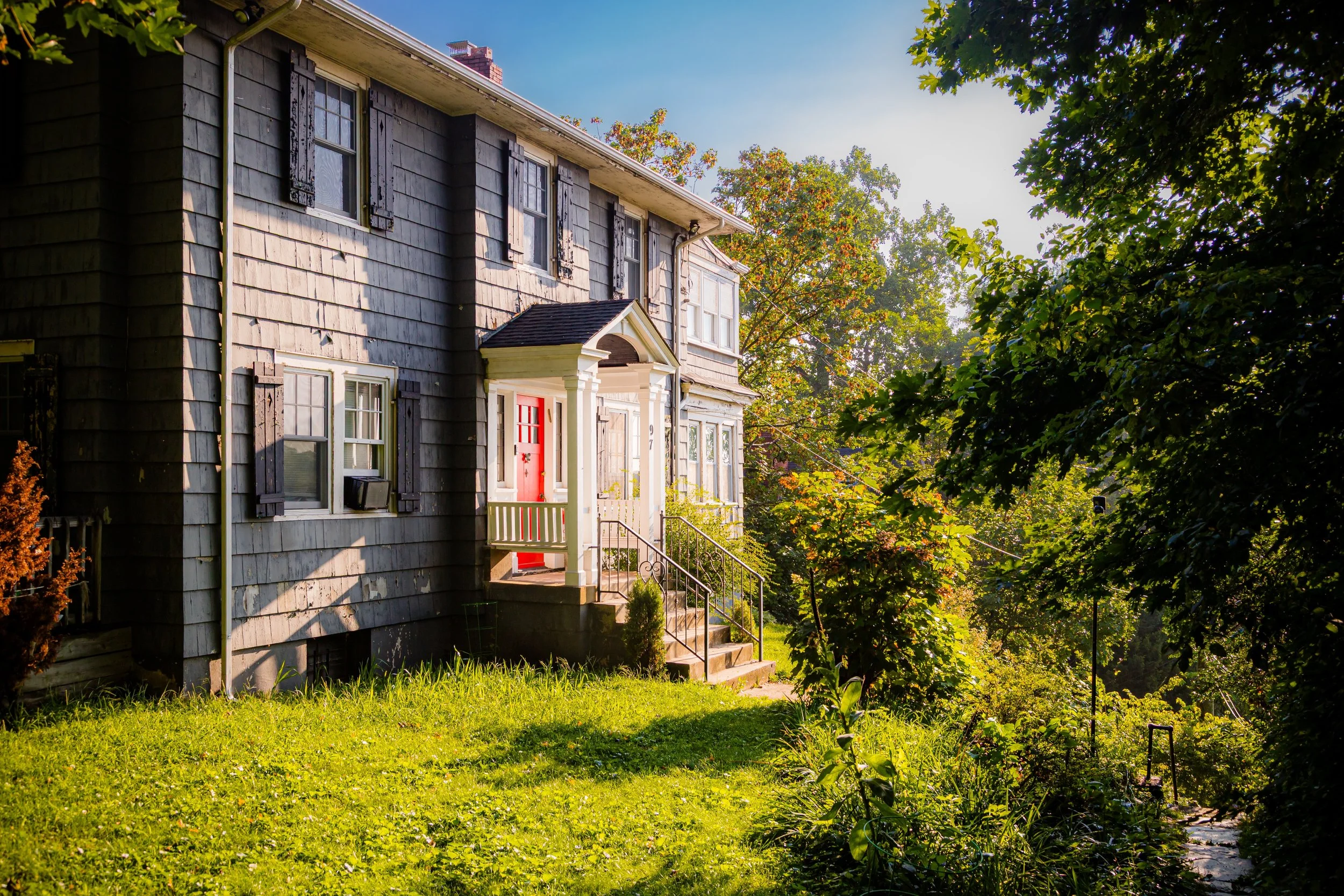
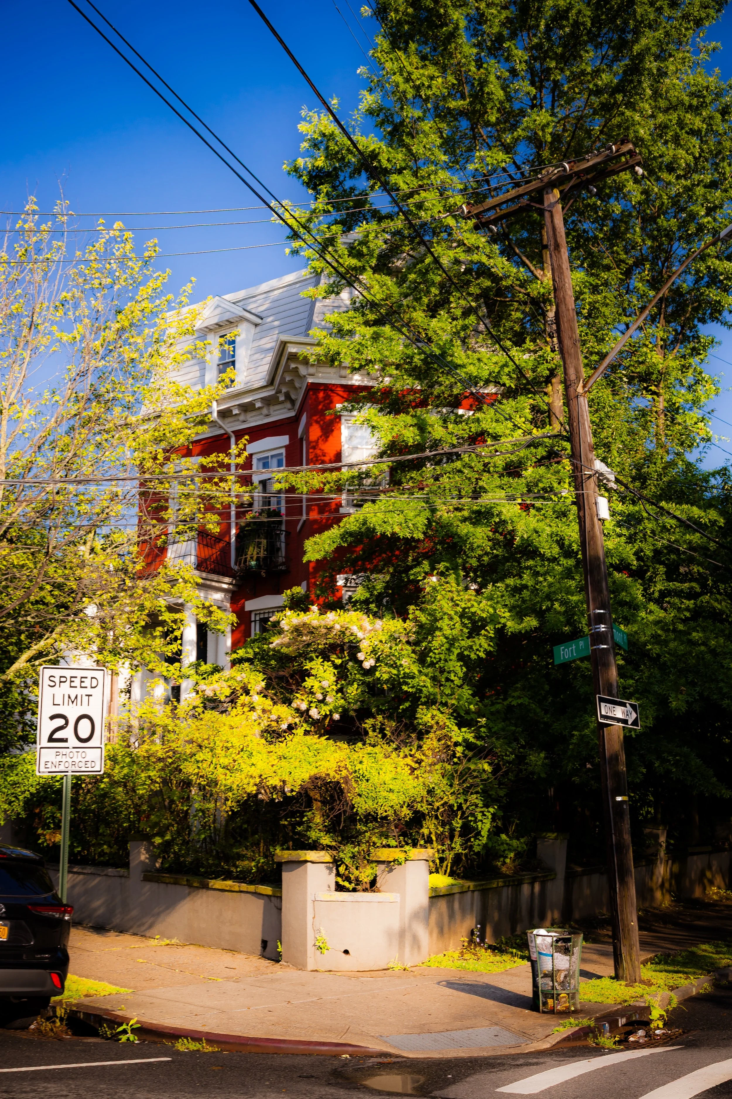
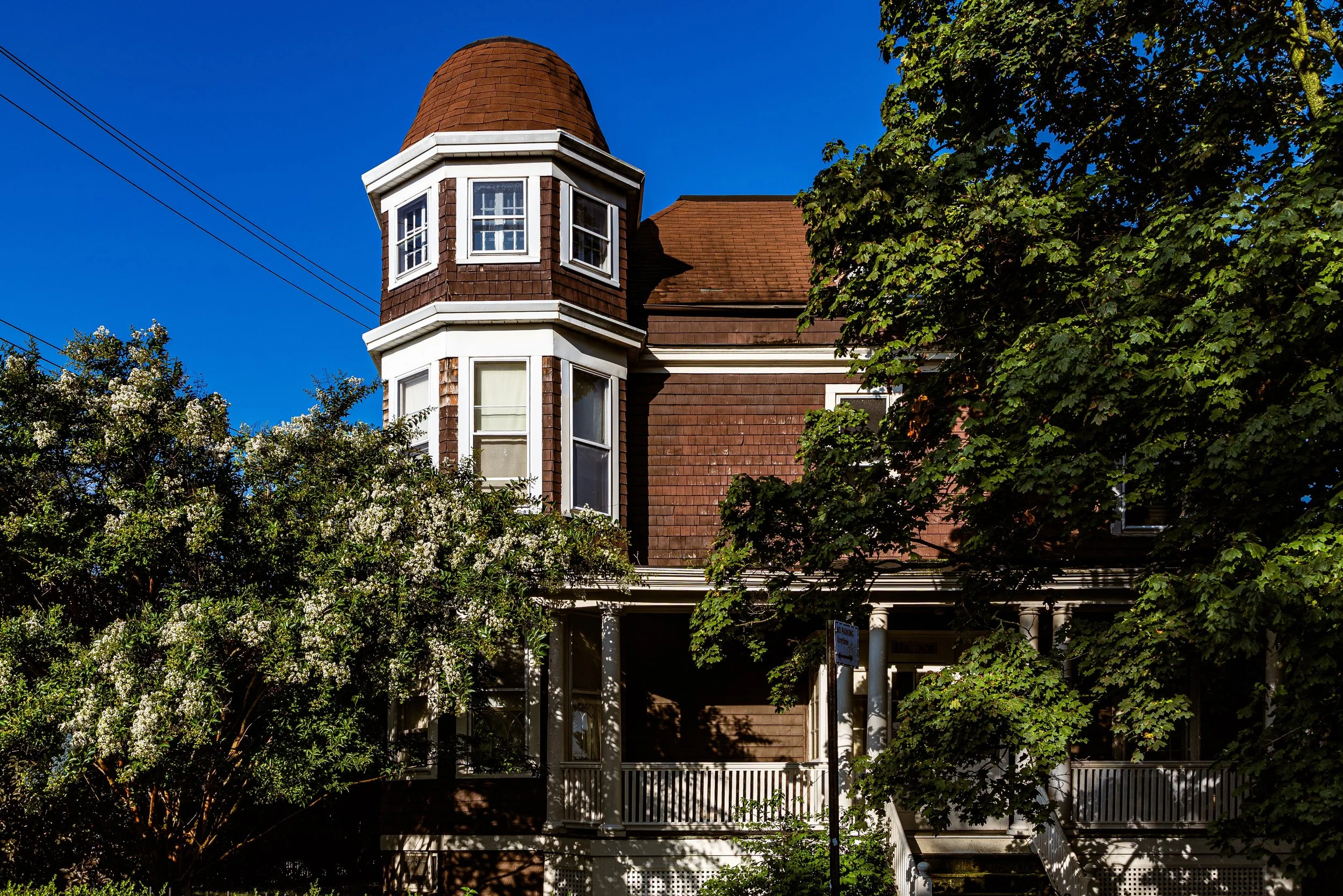
The area’s sloping topography gives Brighton Heights its name and character—a series of tree-shaded ridges lined with Victorian, Colonial Revival, and early 20th-century homes, many perched above stone terraces and retaining walls. Narrow streets like Bement Avenue, St. Marks Place, and Fort Place weave between architectural relics of Staten Island’s Gilded Age, while larger throughways such as Victory Boulevard and Jersey Street connect the hilltop enclave to the civic core of St. George and the Staten Island Ferry terminal less than a mile south.
Today, Brighton Heights retains an air of quiet distinction, bridging the borough’s urban North Shore and its leafy hill country—a microcosm of Staten Island’s evolution from maritime settlement to commuter suburb.
Etymology
The name “Brighton Heights” emerged in the mid-19th century, derived from Brighton, the famed English seaside resort town on the southern coast of England. Developers and local landowners adopted the name to evoke the same genteel charm and scenic allure that characterized its British namesake. The addition of “Heights” highlighted the area’s commanding elevation over New York Harbor—a natural vantage that once made it among the most desirable residential districts on the island.
By the late 1800s, “Brighton Heights” had become synonymous with refinement, healthful air, and panoramic views—qualities that drew affluent professionals and artists who built villas and estates on the slopes above St. George.
The Neighborhood
Origins through the 19th Century
Before its suburban development, the land that became Brighton Heights was part of the Duxbury, Van Name, and Britton estates, tracing back to the island’s early Dutch and English settlers in the 17th and 18th centuries. Its steep ridges and wooded knolls formed part of the natural landscape rising north of Richmond Terrace, overlooking the working harbor below.
In the early 19th century, as nearby New Brighton emerged as a planned seaside village (founded in 1836 by merchant Thomas E. Davis), the adjoining uplands began to attract attention for their cooler breezes and scenic vistas. The success of New Brighton inspired further land speculation, and by the 1850s, developers began marketing the higher ground as “Brighton Heights”—an elite enclave of villas and summer retreats for Manhattan merchants.
The opening of Victory Boulevard and improved ferry connections to Manhattan in the 1860s–1870s made the area increasingly accessible. Grand homes with wraparound porches and carriage drives appeared along St. Marks Place, Belmont Place, and Bement Avenue, many featuring ornamental gardens and harbor views. The neighborhood’s tree canopy—still lush today—was deliberately cultivated, lending the area a parklike appearance that mirrored contemporary suburban ideals.
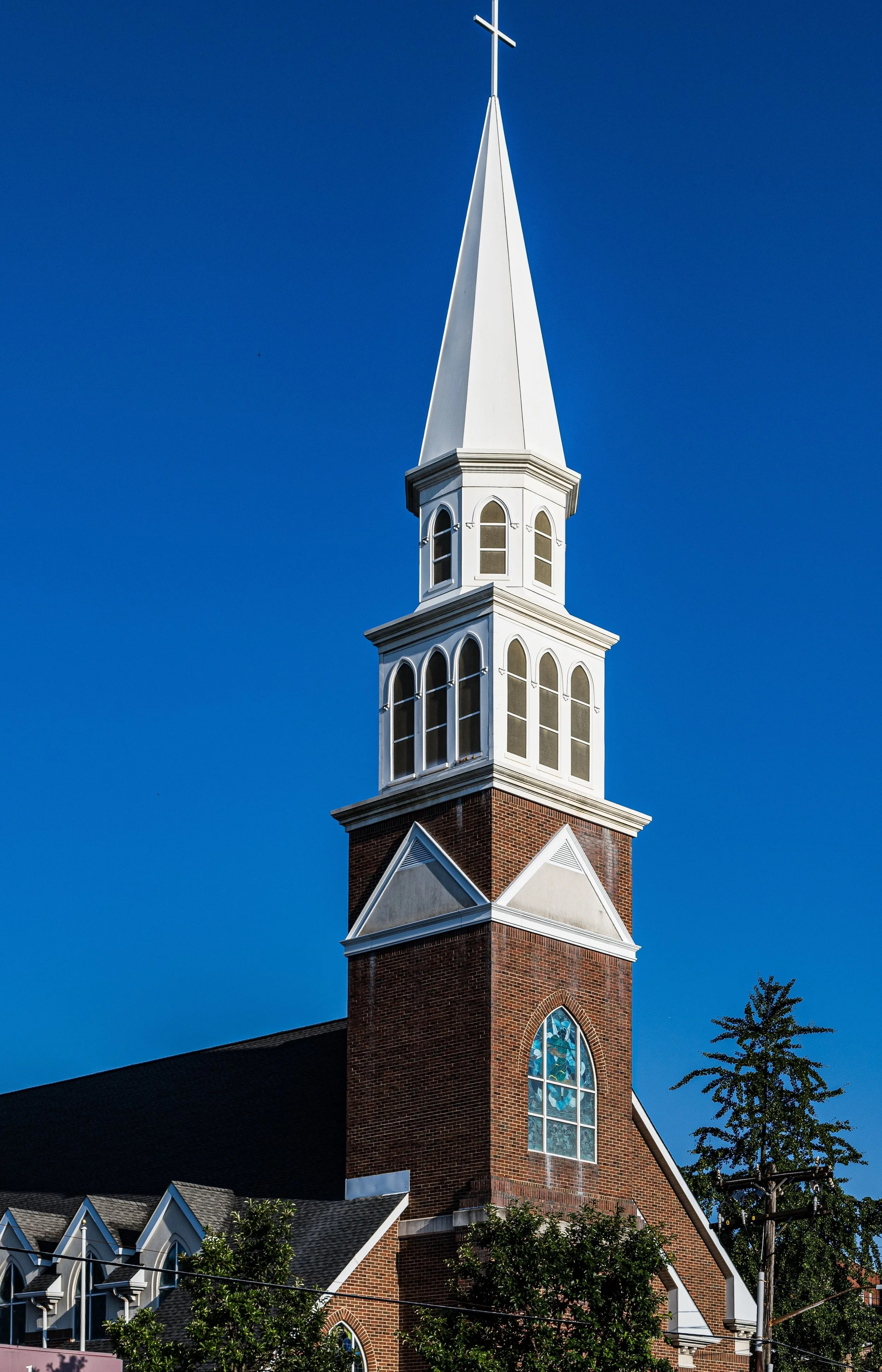
By the late 19th century, Brighton Heights was recognized as one of Staten Island’s most prestigious addresses, its residents drawn from the island’s mercantile and professional classes. The nearby Brighton Heights Reformed Church (founded 1866) became a focal point of community life, its hilltop spire visible from the waterfront below.
Early 20th Century: Transit, Architecture, and Community
The early 20th century brought a period of architectural richness and steady urbanization to Brighton Heights. As ferry service and trolley lines expanded, commuting to Manhattan became routine, attracting a growing middle class that favored the neighborhood’s balance of accessibility and charm.
Elegant homes in Colonial Revival, Queen Anne, and Tudor styles lined St. Marks Place and Bement Avenue, often built with distinctive porches, stained glass, and steep gables suited to the hillside terrain. Apartment houses and smaller multi-family dwellings began to appear closer to Jersey Street, reflecting the North Shore’s gradual urbanization. Yet the core of Brighton Heights remained residential and refined, its leafy streets preserving the quiet dignity of an older suburb.
Civic institutions flourished: the Brighton Heights Reformed Church, rebuilt after a fire in 1917, continued its role as a neighborhood anchor, while nearby schools and small parks served an increasingly diverse population. Community identity remained strong, bolstered by long-established families and newcomers drawn by the area’s proximity to St. George, which had become Staten Island’s administrative and transportation hub after the opening of the Borough Hall and Ferry Terminal in 1906.
Brighton Heights Video Coming Soon
Mid–Late 20th Century: Transition and Preservation
The mid-20th century brought social and physical transformation to Brighton Heights. As Staten Island evolved from a commuter retreat to an integral part of New York City, many of the neighborhood’s grandest estates were subdivided or replaced with smaller homes and apartment buildings. The construction of the Verrazzano-Narrows Bridge in 1964 accelerated development across the borough, increasing traffic along Victory Boulevard and reshaping the North Shore corridor.
Yet Brighton Heights maintained its distinctive character. Its steep topography discouraged large-scale redevelopment, preserving much of its historic fabric. The neighborhood’s architectural diversity—from Gothic churches to turn-of-the-century mansions and mid-century colonials—became a living record of Staten Island’s social evolution.
Through the 1970s–1990s, community activism helped stabilize the area. Residents advocated for historic preservation, cleaner streets, and safer parks, while local institutions like the Brighton Heights Reformed Church and the St. George Civic Association fostered neighborhood cohesion amid broader change.
21st Century: Continuity on the Hill
In the 21st century, Brighton Heights has reasserted itself as one of Staten Island’s most desirable and distinctive North Shore neighborhoods. Its elevated setting provides not only commanding views but also a palpable sense of separation from the bustle below—a hilltop village within the city.
Ongoing restoration of Victorian and prewar homes has revived the neighborhood’s historic charm, while small infill developments maintain its residential scale. Proximity to St. George’s cultural renaissance—including the Staten Island Ferry Terminal renovation, the Empire Outlets, and the Staten Island Museum—has drawn renewed attention to the area. Young families, artists, and professionals now join long-established residents in appreciating its blend of history, architecture, and greenery.
Civic pride remains strong: tree-planting initiatives, block beautification projects, and historical preservation efforts continue to define the community’s ethos. The Brighton Heights Reformed Church, still active after more than 150 years, stands as both landmark and symbol of endurance—its spire a familiar silhouette against the harbor skyline.
Brighton Heights Photo Gallery
Spirit and Legacy
The spirit of Brighton Heights is one of quiet elevation—in both geography and character. It embodies Staten Island’s North Shore ideal: a place where 19th-century refinement meets modern urban life, where history lingers on shaded porches and stone stairways leading down to the harbor.
Its legacy is written in the details: in the wrought-iron fences of St. Marks Place, in the harbor winds that sweep across Victory Boulevard, and in the interwoven stories of those who built, preserved, and reimagined this hillside haven over generations.
New York City
Use this custom Google map to explore where every neighborhood in all five boroughs of New York City is located.
The Five Boroughs
One of New York City’s unique qualities is its organization in to 5 boroughs: Manhattan, Brooklyn, Queens, The Bronx, and Staten Island. These boroughs are part pragmatic administrative districts, and part vestiges of the region’s past. Each borough is an entire county in New York State - in fact, Brooklyn is, officially, Kings County, while Staten Island is, officially Richmond County. But that’s not the whole story …
Initially, New York City was located on the southern tip of Manhattan (now the Financial District) that was once the Dutch colony of New Amsterdam. Across the East River, another city was rising: Brooklyn. In time, the city planners realized that unification between the rapidly rising cities would create commercial and industrial opportunities - through streamlined administration of the region.
So powerful was the pull of unification between New York and Brooklyn that three more counties were pulled into the unification: The Bronx, Queens, and Staten Island. And on January 1, 1898, the City of New York unified two cities and three counties into one Greater City of New York - containing the five boroughs we know today.
But because each borough developed differently and distinctly until unification, their neighborhoods likewise uniquely developed. Today, there are nearly 390 neighborhoods, each with their own histories, cultures, cuisines, and personalities - and each with residents who are fiercely proud of their corner of The Big Apple.


