ALLERTON
The Bronx
Geographic Setting
Bounded by Williamsbridge Road to the east, Waring Avenue to the south, Bronx Park East to the west, and Arnow Avenue to the north, Allerton lies at the northeastern heart of the Bronx—an enduring residential neighborhood defined by its ordered grid, low-rise architecture, and quiet civic rhythm. It bridges the green expanse of Bronx Park to the west with the commercial vitality of White Plains Road to the east, forming a pocket of stability amid the Bronx’s ever-changing urban landscape.
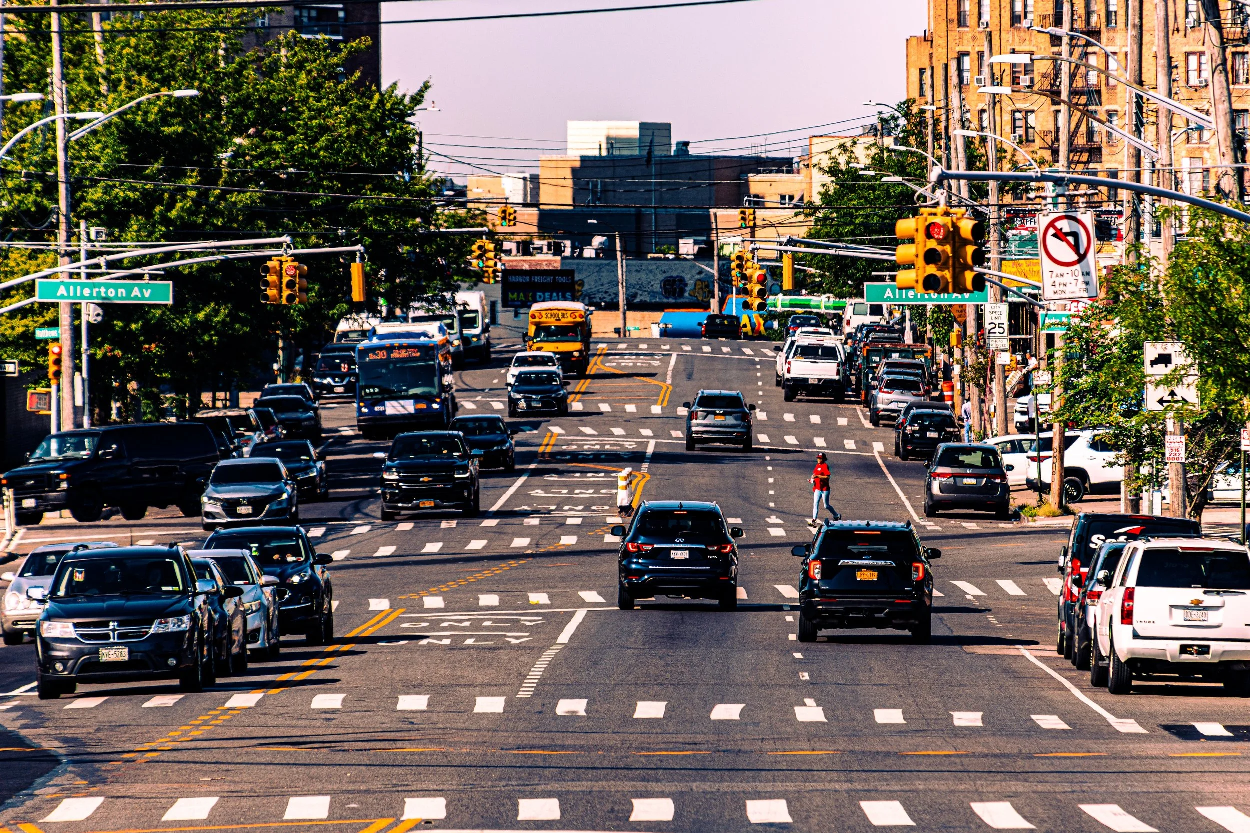
At its center runs Allerton Avenue, the neighborhood’s main east–west artery and namesake. The avenue connects the wooded calm of Bronx Park East to the bustle of Williamsbridge Road, threading through a patchwork of apartment houses, corner stores, and family-run bakeries. To the south, Waring Avenue and Pelham Parkway offer cross-town links, while White Plains Road—with its elevated 2 and 5 trains—anchors the community in motion, carrying generations of commuters to and from Manhattan. The rhythm of daily life in Allerton unfolds between these thoroughfares: along the stoops, under the train trestles, and through the storefronts that have served as the neighborhood’s living record for more than a century.
Etymology
The name “Allerton” derives from the Allerton family, prominent 19th-century landowners whose farmland once stretched across what is now the northeastern Bronx. The family’s name, of English origin, is believed to trace back to Allerton, a village in Yorkshire, meaning “the town of the alder trees.” The name first appeared locally in connection with Allerton Avenue, the road that cut across their holdings and served as a boundary line between scattered farms and the woodlands adjoining Bronx Park.
Over time, the name extended beyond the roadway itself, becoming synonymous with the surrounding neighborhood. Much like nearby Williamsbridge and Morris Park, “Allerton” came to represent both a physical place and a community identity—anchored by the avenue that bore the family’s name and, eventually, by the generations who settled along it.
The Neighborhood
Origins
Before the turn of the 20th century, the land that would become Allerton was part of the rural Town of Westchester, annexed into New York City in 1895. It was a landscape of farms, orchards, and meadows, where the Bronx River defined the western edge and wagon roads connected isolated homesteads to the markets of Williamsbridge and Morrisania. The completion of Bronx Park in the 1890s—home to the Bronx Zoo and the New York Botanical Garden—brought city investment and paved the way for suburban development across the surrounding countryside.
The first signs of transformation came with the construction of the New York, Westchester & Boston Railway (NYW&B) in the early 20th century, offering fast commuter service north and south through the Bronx. Its route, later replaced by the IRT White Plains Road Line, laid the foundations for modern Allerton. By the 1910s, real estate speculators advertised “country homes in the Bronx” along Allerton Avenue, promising fresh air and easy access to Manhattan. The farmland was quickly subdivided into lots for two-family houses, small apartment buildings, and storefronts—a pattern that would define the neighborhood’s character for the next hundred years.
Early 20th Century: From Farmland to Neighborhood
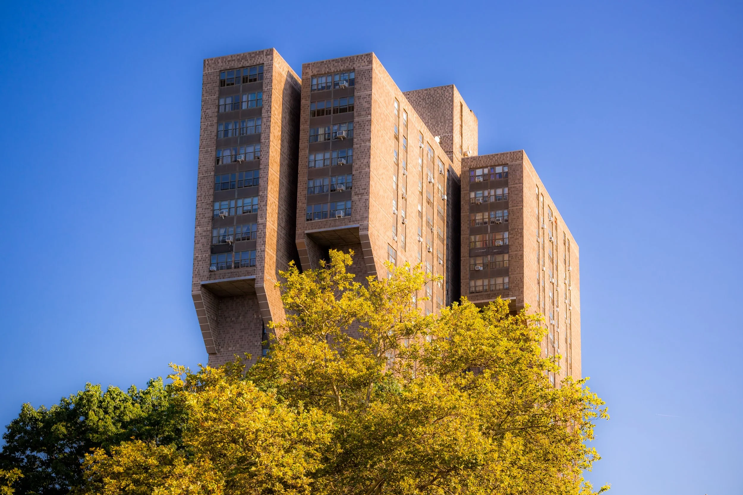
Between 1910 and 1930, Allerton transformed from open countryside into a cohesive residential district. The arrival of the IRT 2 and 5 trains along White Plains Road—its elevated tracks now a defining landmark—connected the area to the city’s labor and manufacturing centers. Developers laid out rows of brick two-family homes and Art Deco apartment houses, while Allerton Avenue became the main commercial thoroughfare linking the community from east to west.
The first residents were predominantly Italian, Jewish, and Irish immigrants, drawn by the promise of affordable housing and access to steady work. On Allerton Avenue, kosher delis stood beside Italian bakeries, and tailors and shoemakers ran small workshops beneath apartments. Williamsbridge Road, to the east, became a second corridor of daily life—lined with groceries, hardware stores, and cafés that served both Allerton and neighboring Pelham Parkway.
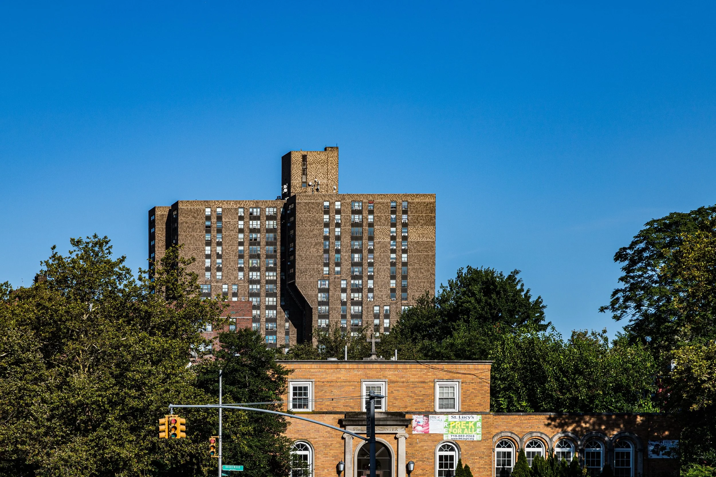
Faith and education anchored the growing neighborhood. The construction of St. Lucy’s Roman Catholic Church in 1927 along Bronx Park East, with its grotto modeled after the shrine of Lourdes, became a point of local pride and a spiritual home for Italian-American families. Schools such as P.S. 89 and civic groups like the Allerton Improvement Association emerged to organize the young community and advocate for infrastructure and parks. The western boundary at Bronx Park East—with its leafy walking paths and proximity to the Bronx Zoo—gave Allerton both a recreational resource and a lasting sense of openness within the dense Bronx grid.
Allerton Video Coming Soon
Mid-20th Century: Stability and Strength
By the 1940s and 1950s, Allerton had matured into a model of middle-class stability. Families owned or rented in the same small homes and apartments for decades, and local merchants along Allerton Avenue and White Plains Road thrived on steady, neighborhood-based business. The Allerton branch of the New York Public Library, opened mid-century, became a civic hub where residents gathered for readings and community meetings.
The atmosphere of the time was one of familiarity and constancy. White Plains Road bustled with bakeries, butchers, and department stores; Allerton Avenue was lined with pizzerias, luncheonettes, and stationery shops; and the elevated trains carried students, workers, and shoppers alike. Bronx Park East remained the neighborhood’s natural retreat—its proximity reinforcing the “urban village” feel that had always distinguished Allerton from denser Bronx neighborhoods.
As other parts of the Bronx struggled during the 1970s, Allerton’s small scale, high rate of homeownership, and strong community institutions insulated it from the worst of the borough’s decline. Residents maintained their properties, organized block associations, and looked after one another. Though some demographic shifts were beginning, the neighborhood’s core identity as a hard-working, tight-knit enclave held firm.
Late 20th–21st Century: Diversity and Renewal
From the 1980s onward, Allerton entered a new chapter—one of demographic renewal and quiet resilience. As older Italian and Jewish families moved to the suburbs, new immigrants from the Caribbean, Latin America, West Africa, South Asia, and Eastern Europe began to arrive. The transformation was gradual, organic, and ultimately harmonious: Dominican restaurants opened beside long-established pizzerias, Bangladeshi markets replaced corner groceries, and Caribbean bakeries filled the air with the scent of spice and sugar.
Through it all, Allerton Avenue remained the symbolic and commercial heart of the neighborhood. Its small storefronts—barbershops, laundromats, and family-run eateries—form a living timeline of the Bronx itself, reflecting waves of migration while preserving a sense of continuity. White Plains Road, under the hum of the elevated trains, continues to serve as a bustling artery of movement and exchange, while Williamsbridge Road connects the area to the broader economic and cultural life of the Northeast Bronx.
Landmarks such as St. Lucy’s Church, Allerton Library, and the parkland along Bronx Park East still anchor the community, offering places of gathering and respite. The park’s trails and ballfields remain a defining feature, giving residents a green edge rarely found in such an urban setting. On summer evenings, families picnic beneath its trees while the faint sound of subway trains fades into the distance—a juxtaposition that captures Allerton’s blend of tranquility and connectivity.
Today, Allerton stands as a microcosm of the Bronx itself: resilient, multicultural, and grounded in the everyday work of community life.
Allerton Photo Gallery
Spirit and Legacy
The enduring spirit of Allerton lies in its balance between change and steadfastness. It has never been a place of spectacle or upheaval, but rather of endurance—an enclave that evolves through quiet adaptation and the care of those who call it home. Its architecture, institutions, and streetscape preserve the memory of its immigrant past, while its people embody the future of a borough constantly in motion.
New York City
Use this custom Google map to explore where every neighborhood in all five boroughs of New York City is located.
The Five Boroughs
One of New York City’s unique qualities is its organization in to 5 boroughs: Manhattan, Brooklyn, Queens, The Bronx, and Staten Island. These boroughs are part pragmatic administrative districts, and part vestiges of the region’s past. Each borough is an entire county in New York State - in fact, Brooklyn is, officially, Kings County, while Staten Island is, officially Richmond County. But that’s not the whole story …
Initially, New York City was located on the southern tip of Manhattan (now the Financial District) that was once the Dutch colony of New Amsterdam. Across the East River, another city was rising: Brooklyn. In time, the city planners realized that unification between the rapidly rising cities would create commercial and industrial opportunities - through streamlined administration of the region.
So powerful was the pull of unification between New York and Brooklyn that three more counties were pulled into the unification: The Bronx, Queens, and Staten Island. And on January 1, 1898, the City of New York unified two cities and three counties into one Greater City of New York - containing the five boroughs we know today.
But because each borough developed differently and distinctly until unification, their neighborhoods likewise uniquely developed. Today, there are nearly 390 neighborhoods, each with their own histories, cultures, cuisines, and personalities - and each with residents who are fiercely proud of their corner of The Big Apple.


