
HAMILTON HEIGHTS
Manhattan
Geographic Setting
Perched along the western bluff of Upper Manhattan, Hamilton Heights stretches from 135th Street to 155th Street, between Riverside Drive and St. Nicholas and Amsterdam Avenues. Overlooking the Hudson River, this neighborhood is defined by elevation — both literal and cultural. Its leafy streets, stone townhouses, and commanding views have made it one of the city’s most architecturally distinguished and historically resonant districts. Bordered by Harlem to the south and Washington Heights to the north, Hamilton Heights serves as a bridge between eras — from the 18th-century country estates of the city’s founders to the vibrant, diverse community that thrives here today.
Etymology and Origins
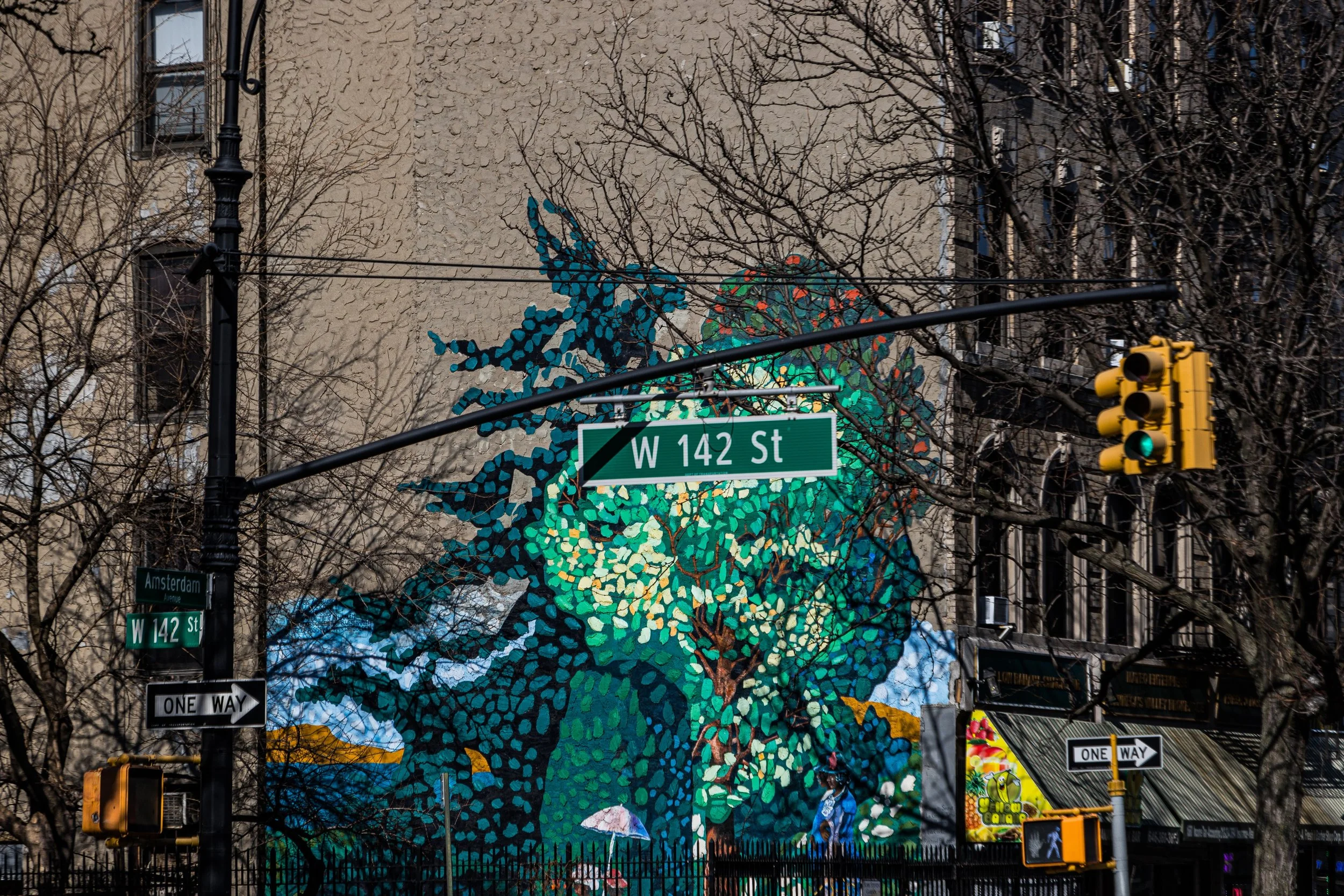
The neighborhood takes its name from Alexander Hamilton, Founding Father and first Secretary of the Treasury, who in 1800 built his country estate, The Grange, on a rise near what is now 141st Street and Convent Avenue. Hamilton called his home “The Grange” after his grandfather’s Scottish estate, and the surrounding land soon came to be known as Hamilton Heights.
The area was, at that time, a pastoral expanse of rolling hills, forests, and farmland. The Lenape had long fished and hunted along the nearby Hudson, and Dutch settlers in the 1600s established small farms under the Nieuw Haarlem charter. For most of the 18th and early 19th centuries, the Heights remained rural — a respite from the growing bustle of the city to the south.
The Neighborhood
18th–19th Centuries: Estates and Elevation
During the Revolutionary War, the bluffs of Hamilton Heights formed part of the American defensive line stretching from Fort Washington to the north down to Harlem Heights. The area’s elevation made it a natural stronghold — its ridges offering sweeping command of the river and valley below.
After the war, Hamilton acquired 32 acres here and built The Grange, a neoclassical mansion designed by John McComb Jr., who also co-designed New York’s City Hall. Completed in 1802, it was Hamilton’s only home and his refuge from the political fray. From its columned portico, he could gaze west toward the Palisades and east toward Harlem’s fields — an ideal of republican domesticity framed by nature.
Following Hamilton’s death in 1804, the property remained in private hands for decades. As Manhattan urbanized, developers slowly subdivided the old estates into residential lots. By the late 19th century, the extension of Eighth Avenue (Frederick Douglass Boulevard) and the construction of elevated rail lines opened the Heights to new residents seeking fresh air and affordable luxury.
Late 19th–Early 20th Century: The Gilded Age in Stone
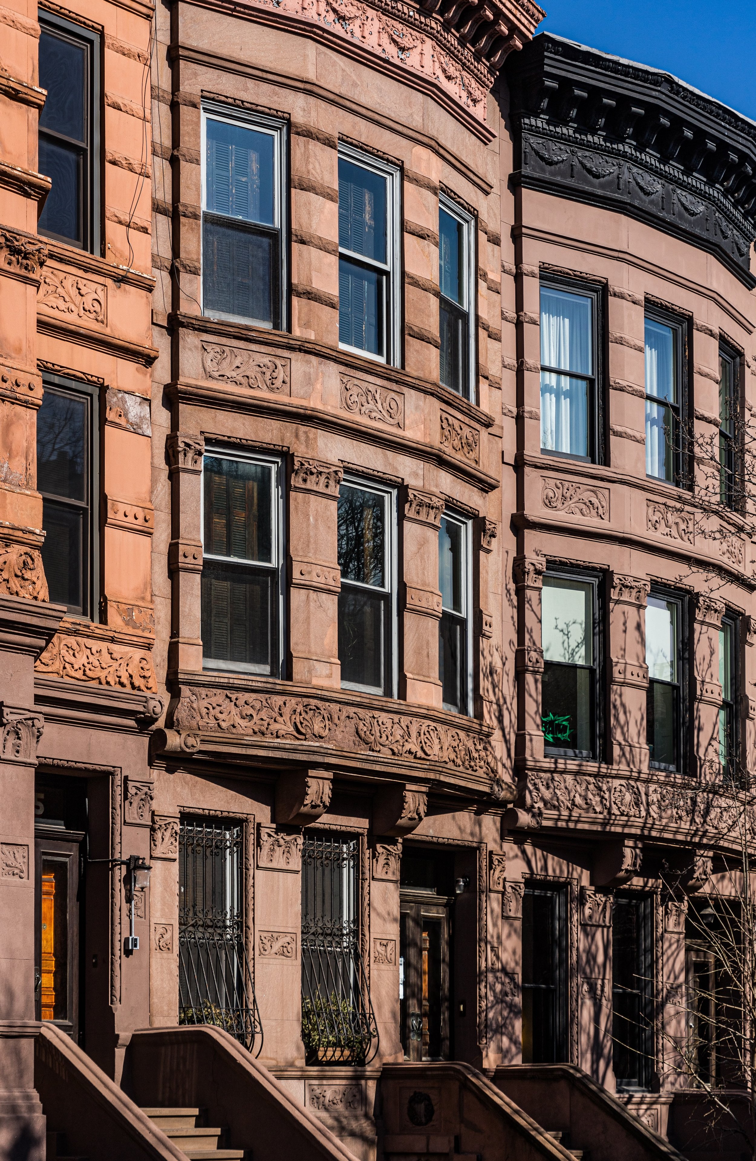
From the 1880s through the 1910s, Hamilton Heights blossomed into one of New York’s most elegant residential quarters. Architects such as Clarence True, William Dewey, and James E. Ware designed rows of limestone and brownstone townhouses, many in the Renaissance Revival, Romanesque, and Queen Anne styles. Their façades, adorned with carved lintels, turrets, and bay windows, reflected a turn-of-the-century ideal: urban living infused with the grace of suburban design.
Convent Avenue, named for the nearby Convent of the Sacred Heart (later the campus of City College of New York), became the district’s grand boulevard. Families of lawyers, merchants, and educators settled here, forming a socially aspirational enclave akin to the brownstone belts of Brooklyn Heights or Park Slope.
The completion of City College’s Gothic Revival campus at 138th Street in 1907 further solidified Hamilton Heights as a bastion of education and architecture. Designed by George B. Post, its turrets and courtyards of gray schist earned it the nickname “the Harvard of the Proletariat.”
Mid-20th Century: Harlem’s Northern Expansion and Cultural Continuity
By the 1920s and 1930s, Harlem’s vibrant African-American community began expanding northward into Hamilton Heights, drawn by its spacious apartments and stately homes. The neighborhood became an integral part of the Harlem Renaissance’s second wave — home to professionals, artists, and civic leaders who carried Harlem’s cultural flame uptown.
During these decades, Hamilton Heights retained its architectural grandeur even as its demographics evolved. The Sugar Hill section to the northeast — once home to figures like W.E.B. Du Bois, Duke Ellington, and Thurgood Marshall — became synonymous with Black excellence and achievement. Churches, fraternal lodges, and civic associations flourished, creating a self-sustaining ecosystem of pride and progress.
By the postwar era, Hamilton Heights was a firmly established middle-class neighborhood, known for its strong community institutions and deep sense of continuity.
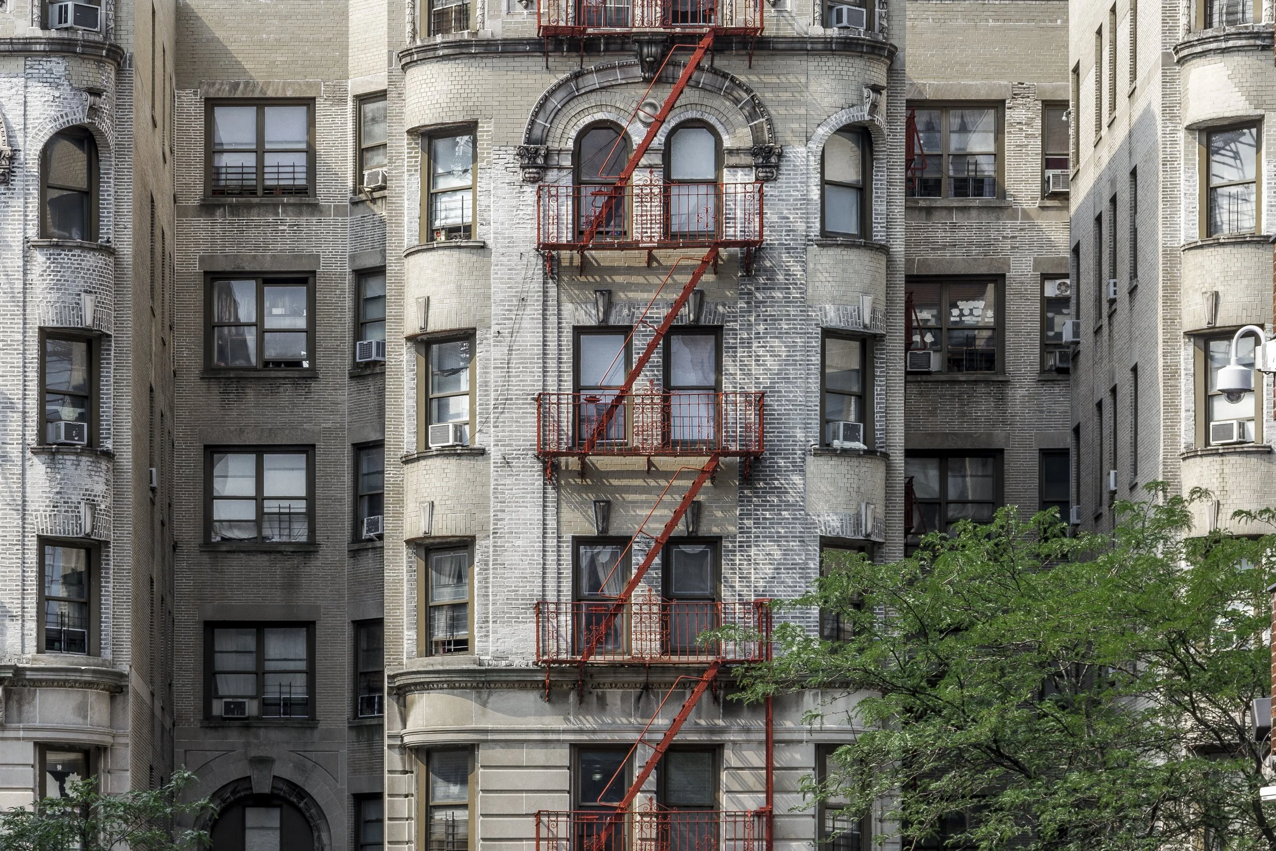
Hamilton Heights Photographic Tour
.Late 20th Century: Challenges and Renewal
Like much of northern Manhattan, Hamilton Heights faced hardship in the 1960s and 1970s as economic decline, redlining, and disinvestment took their toll. Many buildings fell into disrepair, and property abandonment became widespread. Yet even in these difficult years, the neighborhood’s civic strength never collapsed.
Block associations, churches, and grassroots groups organized cleanups, tenant advocacy, and restoration efforts. The area’s architectural beauty — so many intact rows of brownstones and prewar apartments — became a source of hope and organizing power. In 1974, much of Hamilton Heights was designated a New York City Historic District, recognizing its unmatched concentration of turn-of-the-century residential architecture.
By the 1980s and 1990s, a wave of rehabilitation and reinvestment began. Longtime residents restored homes, while new arrivals — drawn by affordability and craftsmanship — joined the effort. The neighborhood’s schools and cultural institutions, including City College and the Dance Theatre of Harlem, anchored its revival.
21st Century: A Neighborhood in Balance
In the new millennium, Hamilton Heights has reemerged as one of Manhattan’s most admired and stable residential districts. Its brownstones, once neglected, now gleam with restored cornices and wrought-iron fences. Cafés, bookstores, and small restaurants line Amsterdam and Broadway, while parks like Riverbank State Park and St. Nicholas Park offer sweeping views and gathering spaces.
The neighborhood’s demographic diversity remains one of its strengths — a mix of families with deep roots in Harlem, Dominican newcomers, students, and professionals. The rhythm of the streets feels balanced: lively but not frenetic, neighborly yet urban.
Hamilton Heights Photo Gallery
Architecture and Atmosphere
Architecturally, Hamilton Heights is a textbook of late 19th-century urban beauty. Its brownstones and limestone rowhouses form rhythmic, painterly streetscapes. Along Convent Avenue and Hamilton Terrace, the streets dip and rise like a city built upon music, their façades alive with craftsmanship. City College’s Gothic towers, visible from many vantage points, crown the skyline like a stone acropolis.
The atmosphere is serene yet animated — mornings filled with schoolchildren walking to class beneath sycamores; evenings marked by the scent of food from Dominican kitchens and the sound of jazz drifting from open windows. From the heights above Riverside Drive, the Hudson shimmers at sunset — the same view Hamilton himself once called “a reminder of providence.”
Spirit and Legacy
Hamilton Heights’ legacy is continuity through transformation. From the estate of a Founding Father to a Gilded Age enclave, from Harlem Renaissance stronghold to 21st-century renaissance, it has remained a neighborhood where history and progress live in harmony.
New York City
Use this custom Google map to explore where every neighborhood in all five boroughs of New York City is located.
The Five Boroughs
One of New York City’s unique qualities is its organization in to 5 boroughs: Manhattan, Brooklyn, Queens, The Bronx, and Staten Island. These boroughs are part pragmatic administrative districts, and part vestiges of the region’s past. Each borough is an entire county in New York State - in fact, Brooklyn is, officially, Kings County, while Staten Island is, officially Richmond County. But that’s not the whole story …
Initially, New York City was located on the southern tip of Manhattan (now the Financial District) that was once the Dutch colony of New Amsterdam. Across the East River, another city was rising: Brooklyn. In time, the city planners realized that unification between the rapidly rising cities would create commercial and industrial opportunities - through streamlined administration of the region.
So powerful was the pull of unification between New York and Brooklyn that three more counties were pulled into the unification: The Bronx, Queens, and Staten Island. And on January 1, 1898, the City of New York unified two cities and three counties into one Greater City of New York - containing the five boroughs we know today.
But because each borough developed differently and distinctly until unification, their neighborhoods likewise uniquely developed. Today, there are nearly 390 neighborhoods, each with their own histories, cultures, cuisines, and personalities - and each with residents who are fiercely proud of their corner of The Big Apple.


