QUEENSORO HILL
Queens
Geographic Setting
Queensboro Hill is a distinct residential sub-section of Flushing, defined by its physical elevation and its enclosure by massive infrastructure. While the surrounding areas of Downtown Flushing and Kew Gardens Hills are defined by intense commercial activity, Queensboro Hill remains a primarily residential "island."
The boundaries are precise and contribute significantly to the neighborhood's character:
The Western Border: The Van Wyck Expressway (I-678) creates a hard industrial edge, separating the neighborhood from the sprawling greenery of Flushing Meadows-Corona Park.
The Northern Border: Kissena Corridor Park, a narrow strip of parkland that connects Flushing Meadows to Kissena Park, provides a lush, natural buffer against the density of Downtown Flushing.
The Eastern Border: 164th Street serves as the transition point into the more sprawling suburban grids of Fresh Meadows and Hillcrest.
The Southern Border: Defined by the Long Island Expressway (I-495) and Melbourne Avenue, this boundary is characterized by the constant hum of New York City’s most vital artery, isolating the neighborhood from Kew Gardens Hills to the south.
Geologically, the "Hill" is part of the terminal moraine of the Wisconsin Glacier. This elevated topography offered early settlers a vantage point over the marshy lowlands of the Flushing River, a feature that still defines the neighborhood's streetscapes today, with many roads sloping gently upward toward the center of the district.
Etymology and Origins
The name "Queensboro Hill" is a linguistic relic of the early 20th century. During the late 1800s, the area was largely referred to as "South Flushing" or simply as part of the vast nursery lands owned by the Parsons family (famous for the Parsons Nursery).
The shift to "Queensboro Hill" coincided with the construction and 1909 opening of the Queensboro Bridge. This monumental engineering feat catalyzed a rebranding effort across the borough. Developers sought to link their properties to the bridge's promise of easy access to Manhattan. By adding "Hill" to the name, real estate agents in the 1910s and 20s sought to emphasize the area's drainage and "healthful air," contrasting it with the perceived dampness of the Flushing waterfront.
The Neighborhood
Early 20th Century: From Nurseries to Neighborhoods
At the turn of the century, the land that would become Queensboro Hill was a patchwork of horticultural history. The area was renowned for its flora; the Parsons and Kissena nurseries introduced many exotic species to North America from this very soil.
However, the 1920s brought the "Subway Boom." When the IRT Flushing Line (now the 7 train) reached Main Street in 1928, it transformed the surrounding farmland into a goldmine. While the commercial core grew around the subway terminus, Queensboro Hill was plotted for residential use. Small developers bought up the former nursery plots, laying out the grid of streets we see today. During this era, the neighborhood was marketed to the burgeoning middle class—first-generation Americans moving out of crowded tenements in the Lower East Side and Brooklyn in search of a "bit of green."
Mid 20th Century: The Era of Infrastructure
The mid-20th century was perhaps the most transformative period for Queensboro Hill, as Robert Moses’ vision for a car-centric New York began to take shape.
Long Island Expressway - 1950s - Created a southern "wall," providing high-speed access to Long Island and Manhattan.
Van Wyck Expressway - 1960s - Linked the neighborhood to Idlewild (JFK) Airport, but cut off direct pedestrian access to the park.
NY Hospital Queens - 1950s - Established a major economic and employment anchor on Main Street.
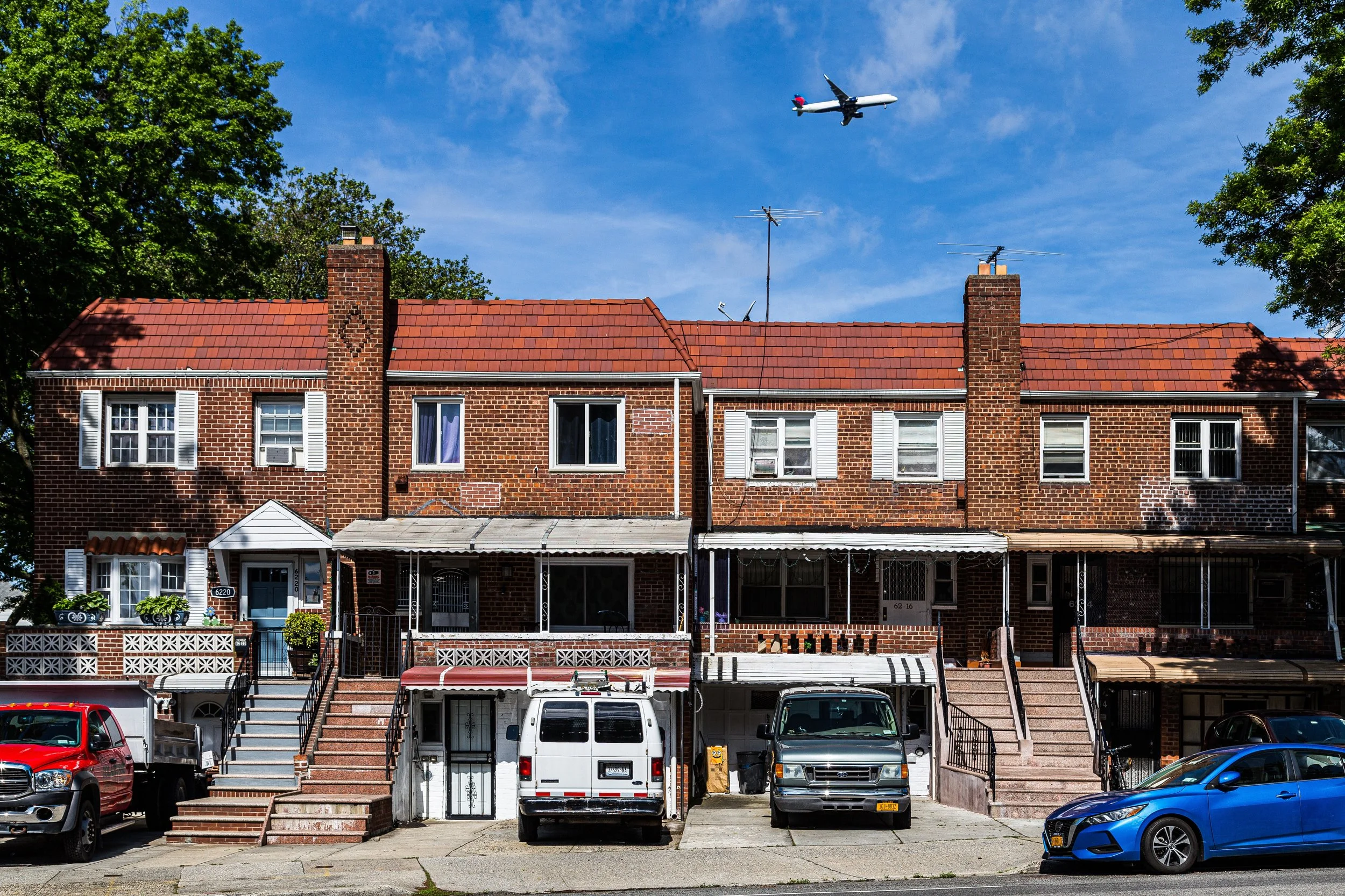
The 1939 and 1964 World’s Fairs, held just across the Van Wyck in Flushing Meadows, brought international attention and improved infrastructure to the area’s periphery. This period saw a massive wave of construction, specifically brick Cape Cods and high-ranch homes. These houses were built to accommodate the "Baby Boom" families, offering basements, garages, and small backyards—the quintessential mid-century American Dream within city limits.
Late 20th Century: A Global Crossroads
By the 1970s, the original European-immigrant populations (predominantly Jewish, Italian, and Irish) began to age or move further into the suburbs of Nassau County. This "succession" led to the arrival of new immigrant groups, mirroring the broader transformation of Queens.
In the 1980s and 90s, Queensboro Hill became a primary destination for families from China, Korea, and Taiwan, as well as a significant Hispanic and South Asian population. Unlike other neighborhoods that experienced "white flight" and subsequent decline, Queensboro Hill remained economically stable. The proximity to the hospital—renamed NewYork-Presbyterian Queens—and the growth of Queens College turned the neighborhood into a hub for medical professionals and educators.
The atmosphere during this time was one of "quiet integration." Neighbors might speak different languages, but they were united by a shared commitment to homeownership and local education, notably around P.S. 164 (Queens Valley) and John Bowne High School.
Queensboro Hill Video
Community Contribution:
Late 20th Century: A Global Crossroads
By the 1970s, the original European-immigrant populations (predominantly Jewish, Italian, and Irish) began to age or move further into the suburbs of Nassau County. This "succession" led to the arrival of new immigrant groups, mirroring the broader transformation of Queens.
In the 1980s and 90s, Queensboro Hill became a primary destination for families from China, Korea, and Taiwan, as well as a significant Hispanic and South Asian population. Unlike other neighborhoods that experienced "white flight" and subsequent decline, Queensboro Hill remained economically stable. The proximity to the hospital—renamed NewYork-Presbyterian Queens—and the growth of Queens College turned the neighborhood into a hub for medical professionals and educators.
The atmosphere during this time was one of "quiet integration." Neighbors might speak different languages, but they were united by a shared commitment to homeownership and local education, notably around P.S. 164 (Queens Valley) and John Bowne High School.
21st Century: Expansion and "Mansionization"
In the current century, Queensboro Hill is facing the same pressures as much of Western Queens: a lack of space and rising land values. This has led to the phenomenon of "mansionization."
As property values have skyrocketed, many of the modest post-war bungalows have been demolished. In their place, owners are building large, multi-generational homes that utilize nearly the entire footprint of the lot. This reflects a cultural shift toward multi-generational living, where grandparents, parents, and children all reside under one roof.
The 21st century has also seen the neighborhood become a culinary and cultural destination by proxy. While the neighborhood itself remains quiet, the northern border along Kissena Corridor Park has seen the expansion of the Queens Botanical Garden, which serves as the "Front Yard" of Queensboro Hill.
Queensboro Hill Photo Gallery
Architecture & Atmosphere
The architectural DNA of Queensboro Hill is a study in evolution. Walking through the neighborhood, one experiences a "layered" history:
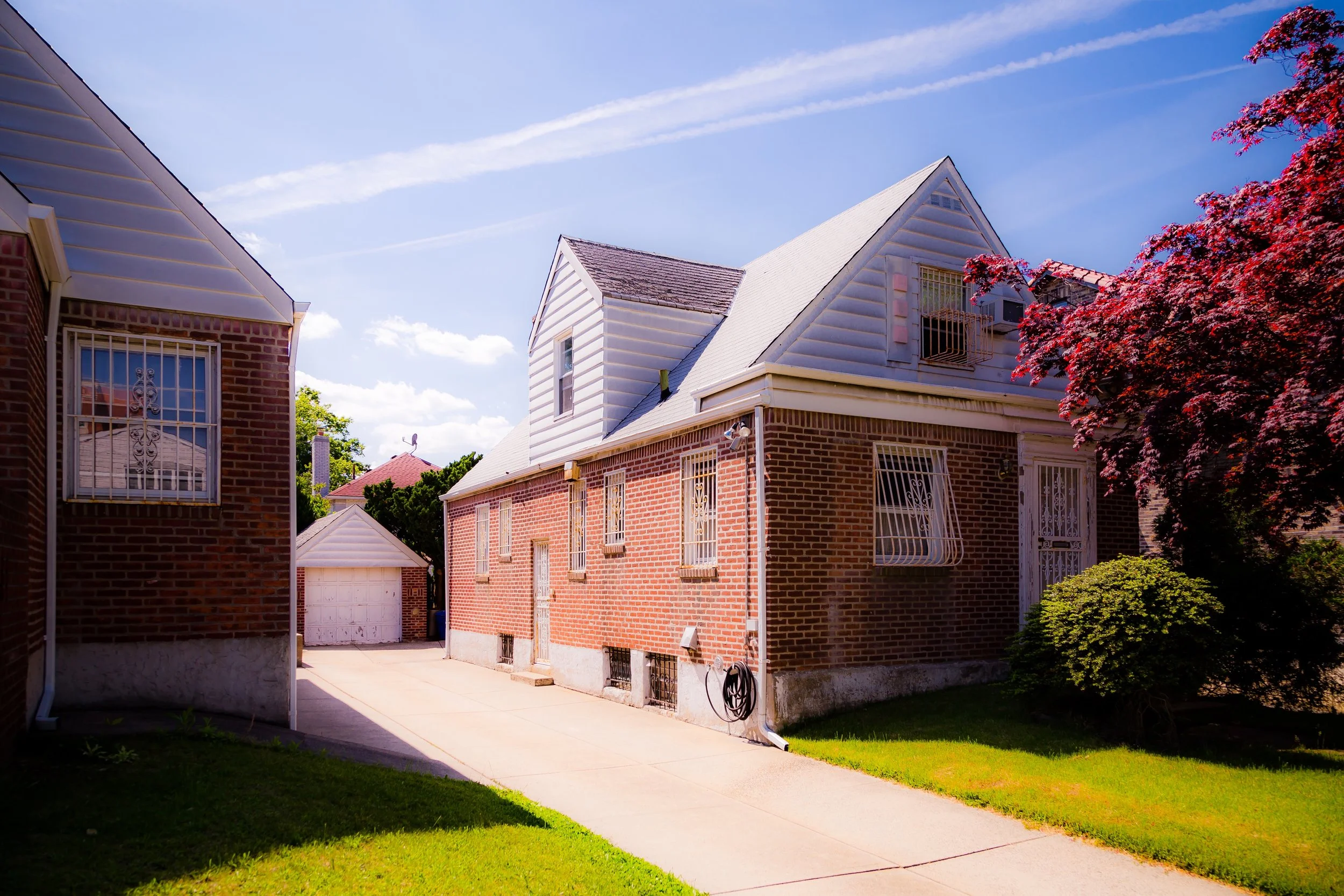
The Post-War Core: Sturdy, red-brick semi-detached houses and detached Cape Cods with dormer windows.
The Institutional Anchors: The massive, modern glass and steel expansions of NewYork-Presbyterian Queens contrast sharply with the modest homes nearby.
The Modern Era: Grand residences featuring granite facades, wrought-iron fences, and Mediterranean-style balconies.
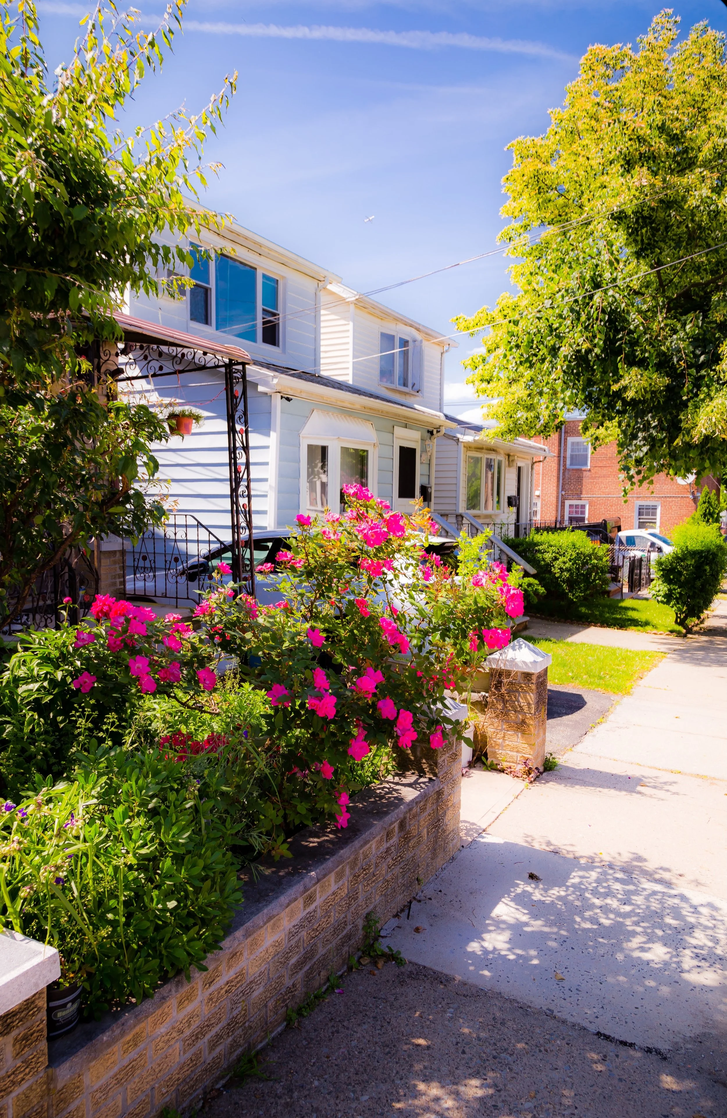
Despite being flanked by the LIE and the Van Wyck, the interior streets of Queensboro Hill are surprisingly tranquil. The "Hill" creates a natural sound barrier against some of the traffic noise. There is a palpable sense of pride in the landscaping; even the smallest yards are often meticulously tended, a subtle nod to the neighborhood's history as a nursery hub.
Spirit & Legacy
The spirit of Queensboro Hill is defined by persistence. It is a neighborhood that refused to be swallowed by the highways that surround it or the commercial sprawl of Downtown Flushing to its north.
It represents the "Middle of Queens"—a place that is neither fully urban nor fully suburban. Its legacy is found in its role as a stable ladder for immigrant success. For over a century, Queensboro Hill has provided a quiet, elevated place for families to catch their breath while remaining connected to the frantic energy of New York City. It remains a testament to the idea that a neighborhood can be "bounded" by concrete and steel, yet remain deeply rooted in its community and its soil.
New York City
Use this custom Google map to explore where every neighborhood in all five boroughs of New York City is located.
The Five Boroughs
One of New York City’s unique qualities is its organization in to 5 boroughs: Manhattan, Brooklyn, Queens, The Bronx, and Staten Island. These boroughs are part pragmatic administrative districts, and part vestiges of the region’s past. Each borough is an entire county in New York State - in fact, Brooklyn is, officially, Kings County, while Staten Island is, officially Richmond County. But that’s not the whole story …
Initially, New York City was located on the southern tip of Manhattan (now the Financial District) that was once the Dutch colony of New Amsterdam. Across the East River, another city was rising: Brooklyn. In time, the city planners realized that unification between the rapidly rising cities would create commercial and industrial opportunities - through streamlined administration of the region.
So powerful was the pull of unification between New York and Brooklyn that three more counties were pulled into the unification: The Bronx, Queens, and Staten Island. And on January 1, 1898, the City of New York unified two cities and three counties into one Greater City of New York - containing the five boroughs we know today.
But because each borough developed differently and distinctly until unification, their neighborhoods likewise uniquely developed. Today, there are nearly 390 neighborhoods, each with their own histories, cultures, cuisines, and personalities - and each with residents who are fiercely proud of their corner of The Big Apple.


