CITY LINE
Brooklyn
Geographic Setting
Bounded by Atlantic Avenue to the north, Conduit Boulevard to the south, Euclid Avenue to the west, and the Queens borough line to the east, City Line forms a narrow but distinct pocket at Brooklyn’s easternmost edge—where the borough gives way to Ozone Park, Queens. Though often overshadowed by its larger neighbors, East New York and Cypress Hills, City Line has its own deep history as a place of crossing and continuity: a residential enclave shaped by transit, migration, and the quiet, enduring rhythms of working-class life.
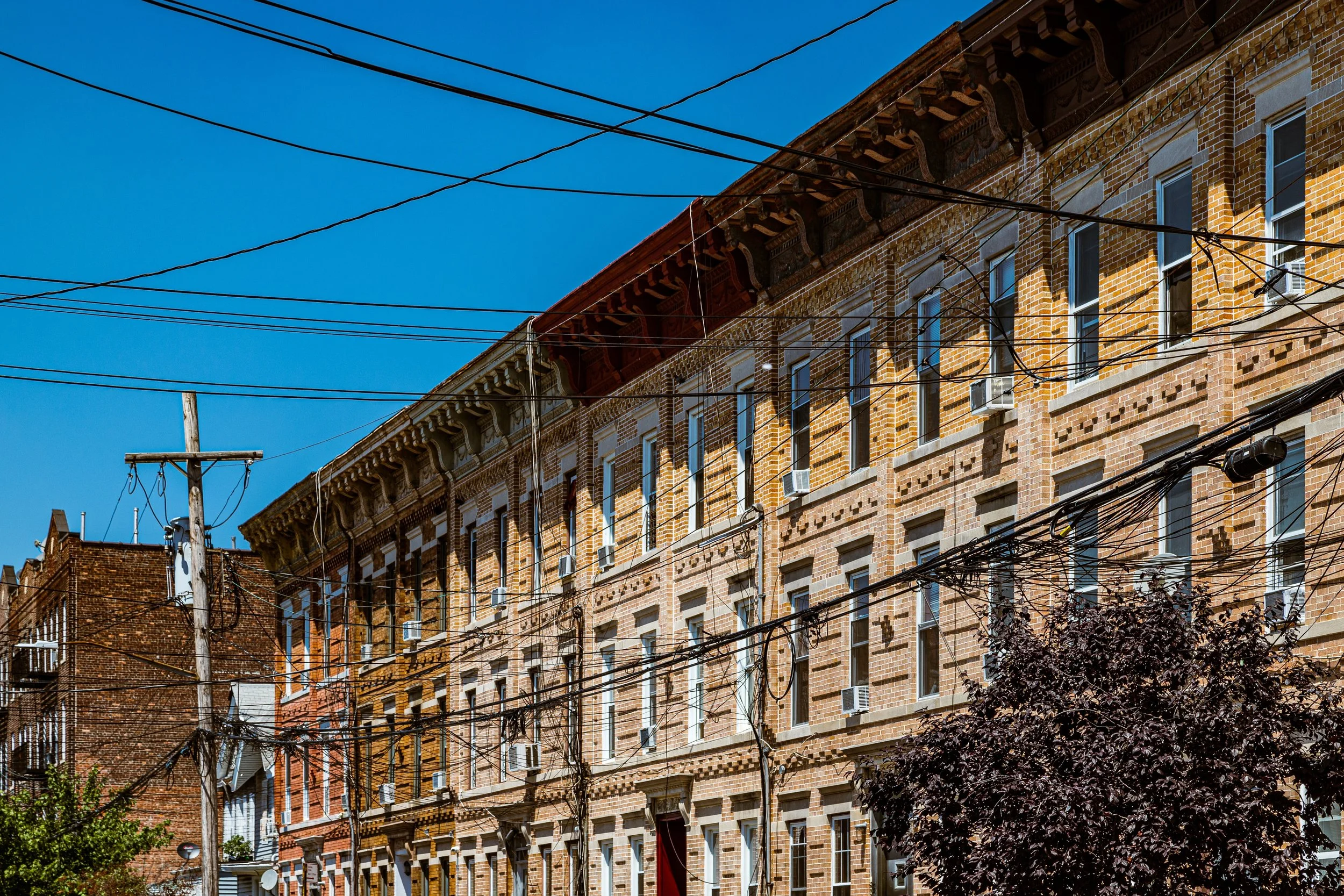
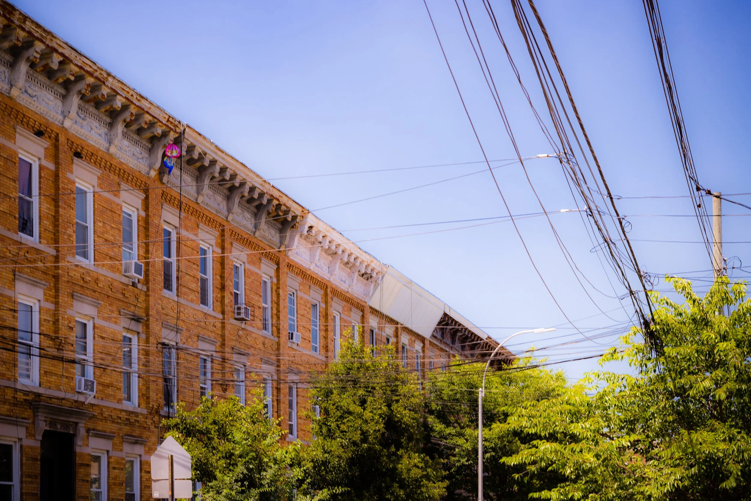
The neighborhood’s geography is almost symbolic—it literally straddles the border of New York City’s two largest boroughs, with its main commercial spine, Liberty Avenue, serving as both a boundary and a bridge between Brooklyn and Queens. The elevated A train line runs directly above Liberty, linking City Line with downtown Brooklyn and Lower Manhattan, while side streets like Lincoln, Belmont, and Pitkin Avenues unfold in rows of attached brick houses and small apartment buildings, many built in the 1920s and 1930s. The district’s modest scale, interlaced with churches, schools, and corner stores, has preserved its sense of community even as the city around it has transformed.
Etymology and Origins
The name “City Line” emerged in the late 19th century, originally designating the boundary between the City of Brooklyn and Queens County, decades before the 1898 consolidation that unified the five boroughs into Greater New York. To 19th-century residents, living at the “City Line” meant being on the literal edge of the city—the last stop before rural Queens.
This area developed later than most of Brooklyn, remaining farmland well into the 1880s. Early maps show scattered homesteads, small truck farms, and family-owned nurseries that thrived on the fertile soils of the Jamaica plain. The construction of Atlantic Avenue and later Conduit Avenue, which carried water from the old Ridgewood Reservoir to the city’s aqueduct system, brought both infrastructure and identity. “City Line” became not just a geographical term, but a local name for the small settlement that grew around the eastern terminus of the Fulton Street elevated railway (today’s A train).
The Neighborhood
19th Century: From Farmland to Frontier
In the 1870s–1890s, as the Brooklyn city limits expanded eastward, the area that would become City Line began transitioning from rural to residential. The Long Island Rail Road’s Atlantic Branch and the Fulton elevated made the region accessible to clerks and tradesmen seeking inexpensive housing beyond the crowded core of East New York. Wooden cottages and two-story frame houses began appearing along Belmont Avenue, Lincoln Avenue, and Wyona Street, interspersed with fields and stables.
Small industries, such as wagon works, brickyards, and dairies, clustered along Atlantic Avenue. Churches and schools soon followed: St. Sylvester’s Roman Catholic Church (established 1903) became an anchor for the growing Irish and Italian immigrant community, while German and Polish families built social halls and benevolent societies nearby.
By the turn of the century, City Line had achieved a modest self-sufficiency—quiet streets, a few shops along Liberty Avenue, and a reputation as a pleasant workingman’s district perched on the city’s eastern border.
Early–Mid 20th Century: Transit and Transition
The extension of the subway—specifically the IND Fulton Street Line (1936)—transformed City Line from an edge-of-town settlement into a fully integrated urban neighborhood. The elevated A train, still visible today, brought commuters from Lower Manhattan directly to the heart of the district. The population grew quickly, with new brick rowhouses and small apartment buildings replacing older wooden homes. The community was a mosaic of Italian, Irish, and Jewish families, many with relatives working in city agencies, factories, or local retail trades.
Liberty Avenue blossomed into a bustling corridor of bakeries, hardware stores, and luncheonettes. Nearby, Conduit Boulevard—built atop the former Brooklyn Water Works aqueduct—became part of the Belt Parkway system, connecting the neighborhood to the expanding outer borough road network. Despite its proximity to industry and infrastructure, City Line retained a distinctly residential feel, its low-rise profile and family-owned businesses giving it the air of a small town tucked inside the metropolis.
After World War II, suburban migration and the decline of nearby manufacturing began to reshape the neighborhood. Middle-class white families gradually moved to Queens or Long Island, while new waves of Caribbean and African American residents, displaced by urban renewal projects in central Brooklyn and lower Manhattan, found affordable homes here. By the 1970s, City Line had become one of the most diverse corners of Brooklyn—a crossroads of old-timers and newcomers negotiating change at the edge of the borough.
City Line Photographic Video
Late 20th Century: Immigration and Identity
From the 1980s onward, immigration redefined City Line yet again. Guyanese, Trinidadian, Jamaican, Haitian, and later Bangladeshi and West African families transformed Liberty Avenue into a vibrant cultural corridor. Small groceries stocked with Caribbean produce, halal butchers, sari shops, and roti bakeries replaced older Italian delicatessens and diners.
Despite economic challenges—particularly during New York’s fiscal crisis in the 1970s and early 1980s—City Line remained stable compared to neighboring East New York, which suffered heavy disinvestment and arson. Community groups such as the United Community Centers and East New York Urban Youth Corps extended their outreach here, promoting tenant rights and youth programs. The neighborhood’s churches and mosques, notably St. Sylvester’s and the Masjid Al-Mamoor, became vital centers of civic life and immigrant support.
By the 1990s, City Line’s reputation had shifted from anonymity to vitality: a small, cohesive district defined by family, faith, and cultural pride. Its tidy blocks and accessible transit made it one of the few areas in Brooklyn where homeownership remained within reach for working-class New Yorkers.
21st Century: Diversity and Continuity at the Edge
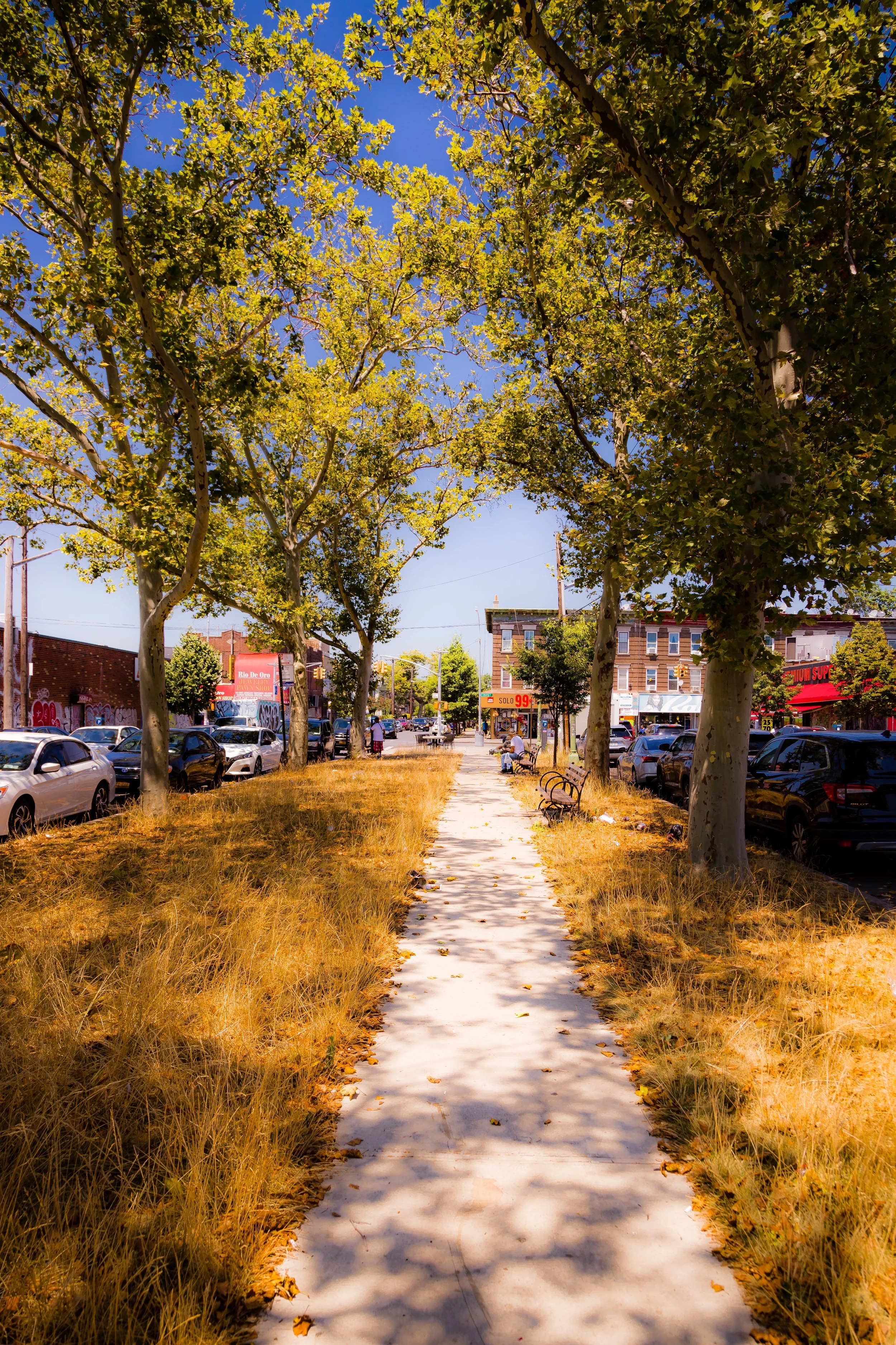
In the 21st century, City Line continues to embody the living border between Brooklyn and Queens—a district where languages, cuisines, and histories overlap within a few blocks. Liberty Avenue, once a sleepy trolley route, now hums with Caribbean, South Asian, and Latino commerce: doubles and jerk chicken vendors beside roti cafés, sari boutiques, and West Indian markets heavy with the scent of spice and mango.
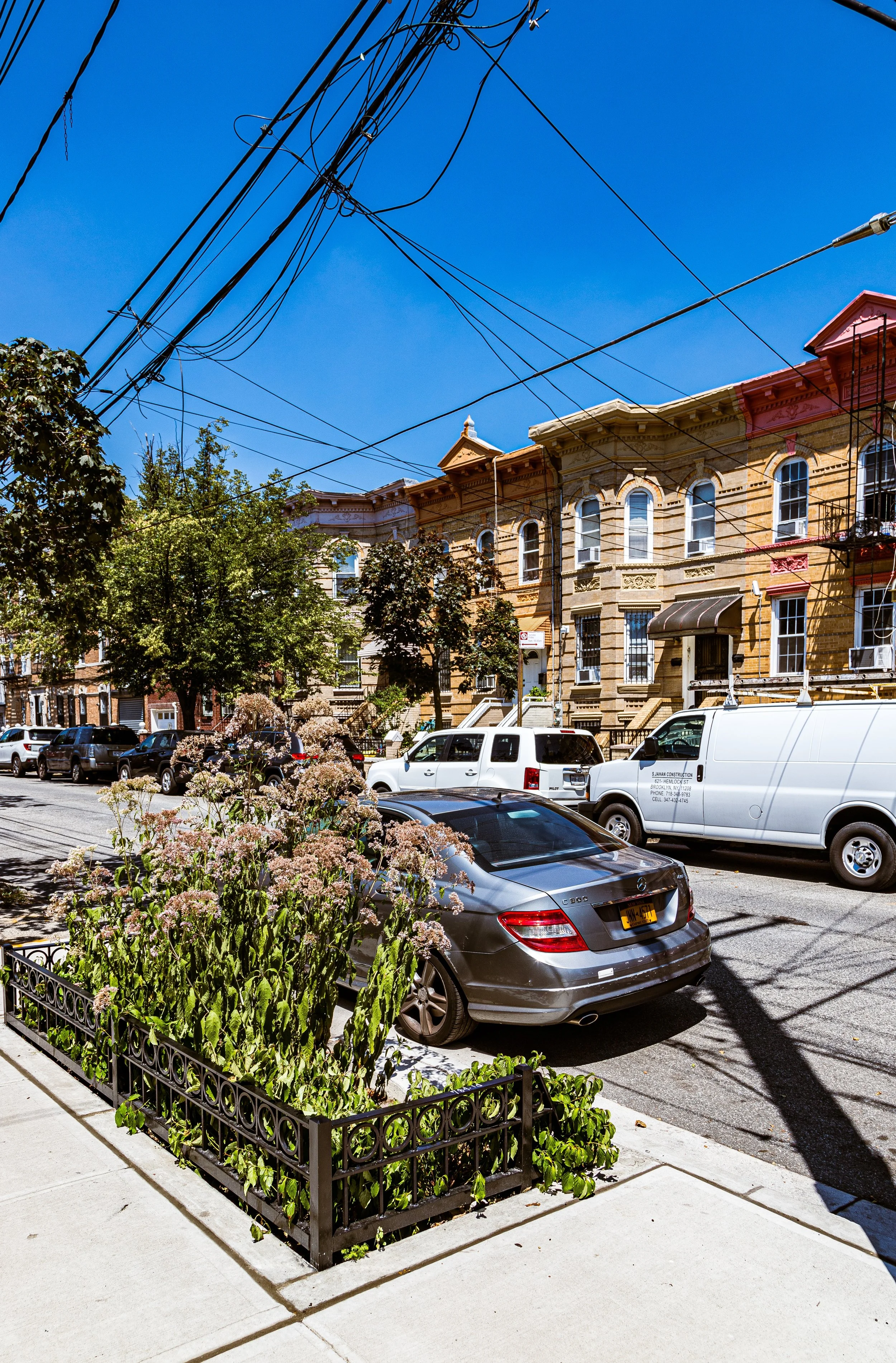
The neighborhood’s architecture remains modest but well-kept—brick two-family homes with decorative cornices, pastel-painted façades, and tiny front gardens that recall its working-class origins. New investment has arrived in the form of small condominium developments near Euclid Avenue, yet City Line has largely preserved its low-rise, residential character. City Line Park, George Gershwin Junior High, and local civic organizations foster a sense of community continuity.
Proximity to major arteries—the Belt Parkway, Conduit Boulevard, and A train—keeps the neighborhood connected while also reinforcing its liminal identity: neither fully East New York nor Queens, but its own enclave where borders blur into belonging.
City Line Photo Gallery
Spirit and Legacy
City Line’s legacy is that of New York’s quiet frontier—a neighborhood that has always stood at the city’s edge yet remained firmly of it. From farmland to streetcar suburb, from immigrant settlement to multicultural crossroads, it reflects the city’s perpetual motion and renewal. Its strength lies in modesty: well-tended houses, small businesses passed through generations, and a communal rhythm that values everyday stability over spectacle.
New York City
Use this custom Google map to explore where every neighborhood in all five boroughs of New York City is located.
The Five Boroughs
One of New York City’s unique qualities is its organization in to 5 boroughs: Manhattan, Brooklyn, Queens, The Bronx, and Staten Island. These boroughs are part pragmatic administrative districts, and part vestiges of the region’s past. Each borough is an entire county in New York State - in fact, Brooklyn is, officially, Kings County, while Staten Island is, officially Richmond County. But that’s not the whole story …
Initially, New York City was located on the southern tip of Manhattan (now the Financial District) that was once the Dutch colony of New Amsterdam. Across the East River, another city was rising: Brooklyn. In time, the city planners realized that unification between the rapidly rising cities would create commercial and industrial opportunities - through streamlined administration of the region.
So powerful was the pull of unification between New York and Brooklyn that three more counties were pulled into the unification: The Bronx, Queens, and Staten Island. And on January 1, 1898, the City of New York unified two cities and three counties into one Greater City of New York - containing the five boroughs we know today.
But because each borough developed differently and distinctly until unification, their neighborhoods likewise uniquely developed. Today, there are nearly 390 neighborhoods, each with their own histories, cultures, cuisines, and personalities - and each with residents who are fiercely proud of their corner of The Big Apple.


