
OAKLAND GARDENS
Queens
Neighborhood Profile
A hilly and prestigious residential neighborhood in Northeast Queens, Oakland Gardens is renowned for its expansive green spaces and high-performing schools. Defined by its mix of garden apartments and stately single-family homes, the area offers a tranquil, park-like lifestyle centered around the scenic trails and athletic fields of Alley Pond and Cunningham Parks.
Geographic Setting
Bounded by the Vanderbilt Motor Parkway to the south, Cunningham Park to the west, the Long Island Expressway east to Springfield Boulevard, and 46th Avenue to the north, Oakland Gardens occupies a gently rolling plateau in eastern Queens—a verdant, residential enclave that blends postwar suburban design with the green legacy of the borough’s park system. Nestled between Bayside to the north and Hollis Hills to the south, the neighborhood is defined by its orderly streets, mid-century architecture, and its proximity to the open landscapes of Cunningham Park, one of Queens’ largest green spaces.
Oakland Gardens’ physical character reflects the vision of a mid-20th-century suburban ideal brought within city limits. Broad avenues such as Springfield Boulevard and Francis Lewis Boulevard form its commercial and transit spines, while residential lanes like 223rd Street, Horace Harding Expressway, and 46th Avenue weave through quiet rows of brick Tudors, Cape Cods, ranch-style homes, and garden co-ops. The neighborhood’s elevation—sloping gently toward Alley Pond Park and the Creedmoor Psychiatric Center grounds—offers a rare sense of space and air within urban New York.
Civic life centers on local schools, playgrounds, and the tree-lined buffers of Cunningham Park, whose athletic fields, bike paths, and wooded trails give Oakland Gardens a distinctively pastoral character. Though linked to Manhattan by express buses and highways, the neighborhood feels worlds apart—a pocket of calm, community, and greenery on the city’s eastern edge.
Etymology and Origins
The name “Oakland Gardens” evokes both its natural and suburban heritage. “Oakland” derives from the area’s historic Oakland Golf Club, a private course founded in 1896 that once covered much of what is now Cunningham Park and the surrounding residential blocks. The “Gardens” suffix was added in the 1940s and 1950s by developers seeking to convey the area’s planned, landscaped aesthetic—part of a broader postwar trend across Queens that produced neighborhoods such as Kew Gardens Hills, Forest Hills Gardens, and Briarwood.
Before development, the land was part of the Town of Flushing and consisted of farms, meadows, and wooded tracts feeding into the headwaters of Alley Creek. The old Vanderbilt Motor Parkway, built in 1908 as America’s first concrete highway for automobile racing, bisected this rural landscape. By the 1930s, as automobile travel and parkway construction reshaped eastern Queens, the area around the decommissioned Motor Parkway became a target for suburban-style housing. The construction of the Long Island Expressway (1950s) and the opening of Cunningham Park (1936) under Parks Commissioner Robert Moses transformed the region, making it accessible and livable for a new generation of middle-class New Yorkers seeking homeownership in green surroundings.
The Neighborhood
Mid-20th Century: The Suburban Ideal in the Cit
Oakland Gardens’ defining era came in the decades after World War II, when the last open parcels of eastern Queens were converted into housing. The development of Bell Apartments (later known as Oakland Gardens Apartments) in the early 1950s introduced modern garden-style co-ops—low-rise brick buildings surrounded by lawns, trees, and courtyards that provided affordable living for veterans and young families.
Single-family home construction flourished along Springfield Boulevard, 46th Avenue, and the side streets bordering Cunningham Park, where builders favored compact lots with private driveways and detached garages. The architectural vocabulary—Tudor-inspired brickwork, colonial shutters, and low, horizontal ranch roofs—embodied the optimism of postwar suburban life.
The Long Island Expressway, opened through the neighborhood in 1958, linked residents directly to Midtown Manhattan and Nassau County, making Oakland Gardens a model for the “city-suburb” lifestyle. Schools such as P.S. 203 (Oakland Gardens School), Cardozo High School (founded 1967), and J.H.S. 74 Nathaniel Hawthorne became community anchors, while nearby St. Gregory the Great Church and School fostered the area’s spiritual and civic life.
By the late 1950s, Oakland Gardens was fully established as a middle-class enclave—quiet, green, and family-oriented, a place where city employees, teachers, and professionals could own homes and raise children without leaving New York City.
Late 20th Century: Maturity and Multicultural Transformation
Through the 1960s, 1970s, and 1980s, Oakland Gardens matured into one of Queens’ most stable neighborhoods. While other parts of the city faced urban decline, this section of Bayside remained secure, buoyed by its high homeownership rate and proximity to parks and reputable schools. Civic organizations such as the Bayside Hills Civic Association and Community Board 11 actively preserved the area’s residential zoning and low density.
During the 1980s and 1990s, the neighborhood experienced a gradual demographic transformation, mirroring Queens’ broader diversity. Jewish-American, Italian-American, and Irish-American families who had settled here in the 1950s were joined by Korean-American, Chinese-American, and South Asian residents, who revitalized local businesses and introduced new cultural layers to the community. Korean grocers and bakeries appeared along Springfield Boulevard, while nearby Northern Boulevard developed into one of New York’s most vibrant pan-Asian corridors.
Despite increased population diversity, Oakland Gardens retained its suburban tone—quiet blocks, manicured lawns, and a culture of civic involvement. Parks and recreation remained central: families played baseball and soccer in Cunningham Park, cyclists traced the Motor Parkway Trail, and local concerts and community fairs kept neighborhood traditions alive.
Oakland Gardens Video Coming Soon

21st Century: Diversity and Renewal
In recent decades, Oakland Gardens has welcomed new populations while maintaining its calm suburban identity. Immigrant families from Korea, China, and South Asia have revitalized the neighborhood, opening new eateries and businesses along Springfield Boulevard and Horace Harding Expressway. Co-ops and condominiums have undergone renovations, while detached homes have been modernized yet still conform to the neighborhood’s low-rise scale.
Efforts to preserve green space continue to define local life: Alley Pond Park has been expanded and restored, with new walking trails, playgrounds, and environmental programs. The neighborhood’s tree-lined streets, safe reputation, and proximity to major highways keep it attractive to professionals and families seeking a peaceful refuge within city limits.
Oakland Gardens today is emblematic of Queens’ balance between tradition and transformation—cosmopolitan yet self-contained, metropolitan yet unmistakably suburban.
Oakland Gardens Photo Gallery
Through The Lens
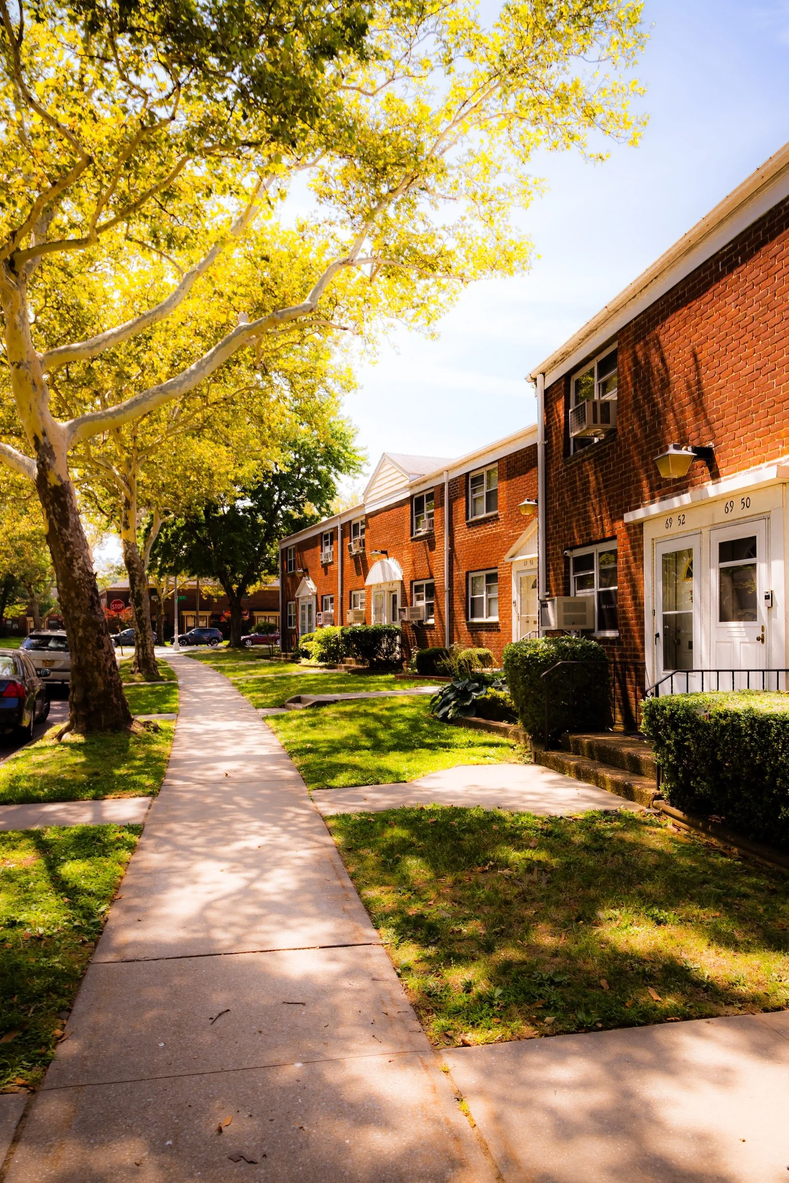
A Legacy of Planned Community The visual character of Oakland Gardens is defined by its massive, mid-century garden apartment complexes, which represent a legacy of organized, communal living within a park-like setting. During my 2023 documentation, I focused on how these sprawling developments maintain a sense of human scale through thoughtful landscaping and open public spaces.
Photographer's Insight:
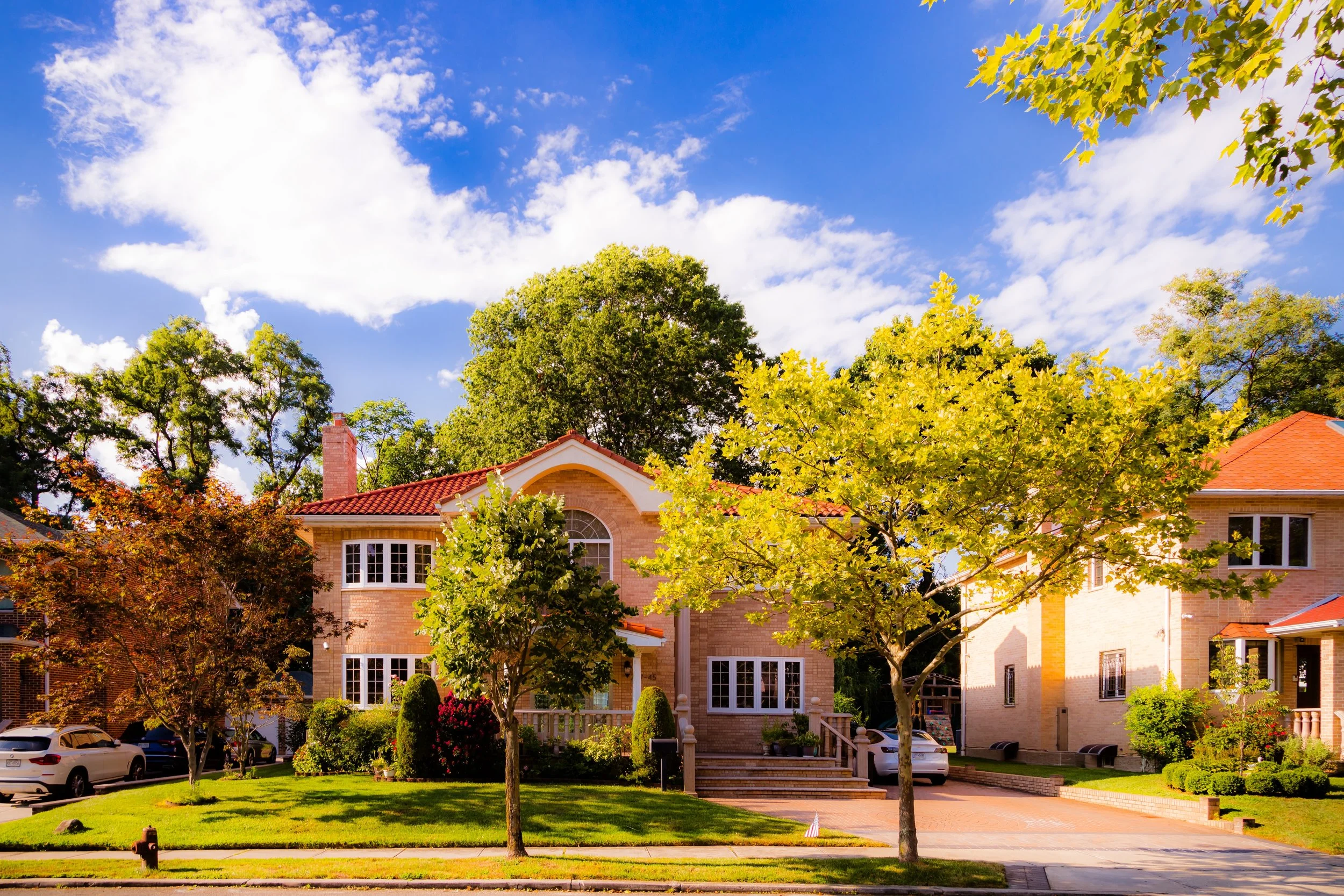
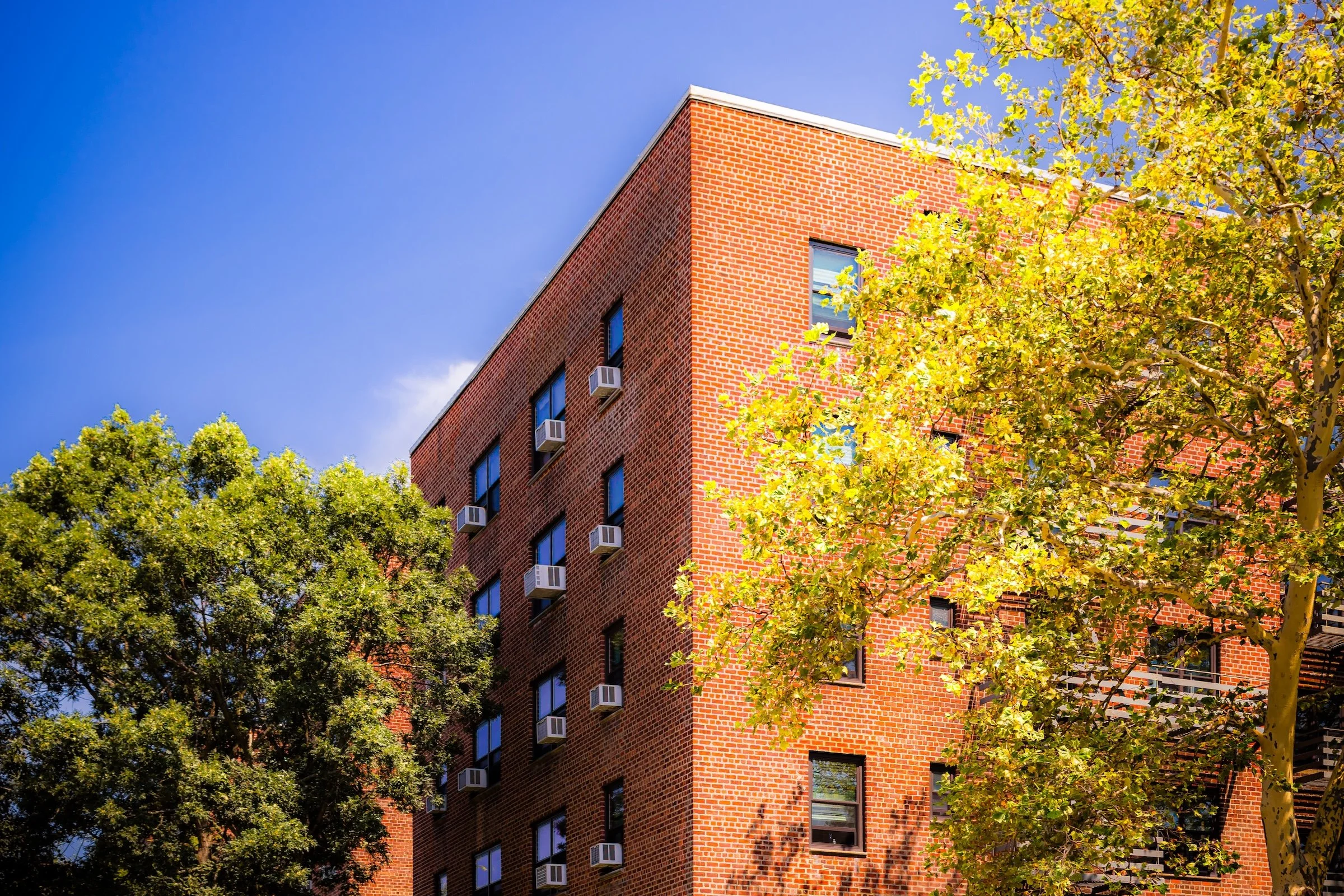
The Bookends of the Day: Because this neighborhood marked both the beginning and end of my tour, I was able to document the shifting light across the brickwork. The high, nearly noon sun in “Brick Corner” creates a brilliant saturation in the red brick and the yellowing leaves of the sycamores, emphasizing the neighborhood's warmth and maturity.
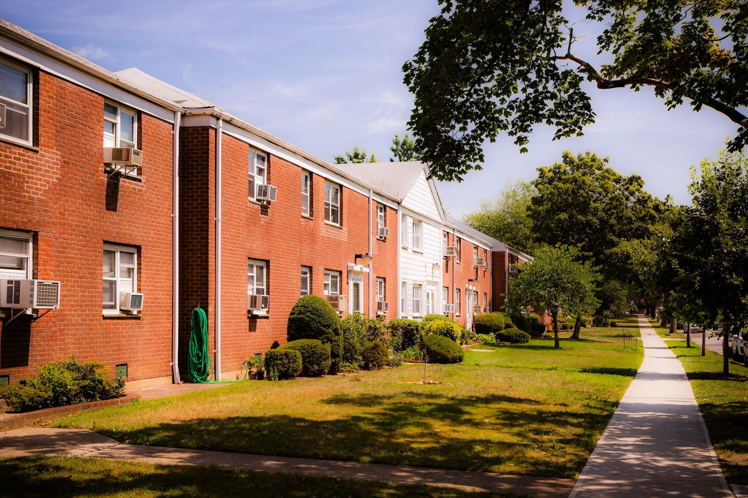
Organized Greenery: I sought to capture the "Windsor Oaks" and "Windsor Park" spirit through their communal gardens. In “Windsor Oaks,” the bright white hydrangeas and layered stone flowerbeds serve as a soft visual entry point to the sturdy, two-story brick residences behind them, illustrating a legacy of suburban pride.
The Geometry of the Streetscape: I documented the rhythmic intersections of the complex (as seen in “Playground Sidewalk”), where the serpentine curves of the cobblestone-accented sidewalks contrast with the rigid lines of the basketball courts and housing blocks. The long, stretching shadows of the late-morning sun provide a graphic depth to these walkways, highlighting the neighborhood's quiet, well-ordered atmosphere (see “Oakland Gardens Sidewalk”).
Spirit and Legacy
Oakland Gardens embodies the promise of postwar Queens: a landscape where open air, ownership, and community coexist with proximity to the city’s core. Its parks, schools, and garden apartments form a living heritage of mid-century optimism, still functioning as designed—a place for families to flourish amid green surroundings.
Oakland Gardens Field Notes
-
Field Note: August 5, 2023 | 07:57 AM – 11:52 AM
Conditions: 72°F | Humidity: 75%
The day began with a soft, summer moisture still clinging to the glacial kettles of Alley Pond Park. The peak morning humidity saturated the greens of the "Tallest Tree" trail, providing a lush, tranquil atmosphere before the heat of the day fully arrived.
Oakland Gardens served as both the starting point and the final destination of today's journey, completing a sprawling loop through the borough. While the northern edges of the neighborhood offer truly pastoral escapes, this trek focused on the architectural scale of the Windsor Park and Bell Park Gardens apartment complexes. I was struck by the mid-day sun reflecting off the expansive red-brick facades (see “Brick Corner”) and the meticulous landscaping that provides a lush, communal framework for these residential blocks (see “Windsor Oaks”).
Other neighborhoods visited:
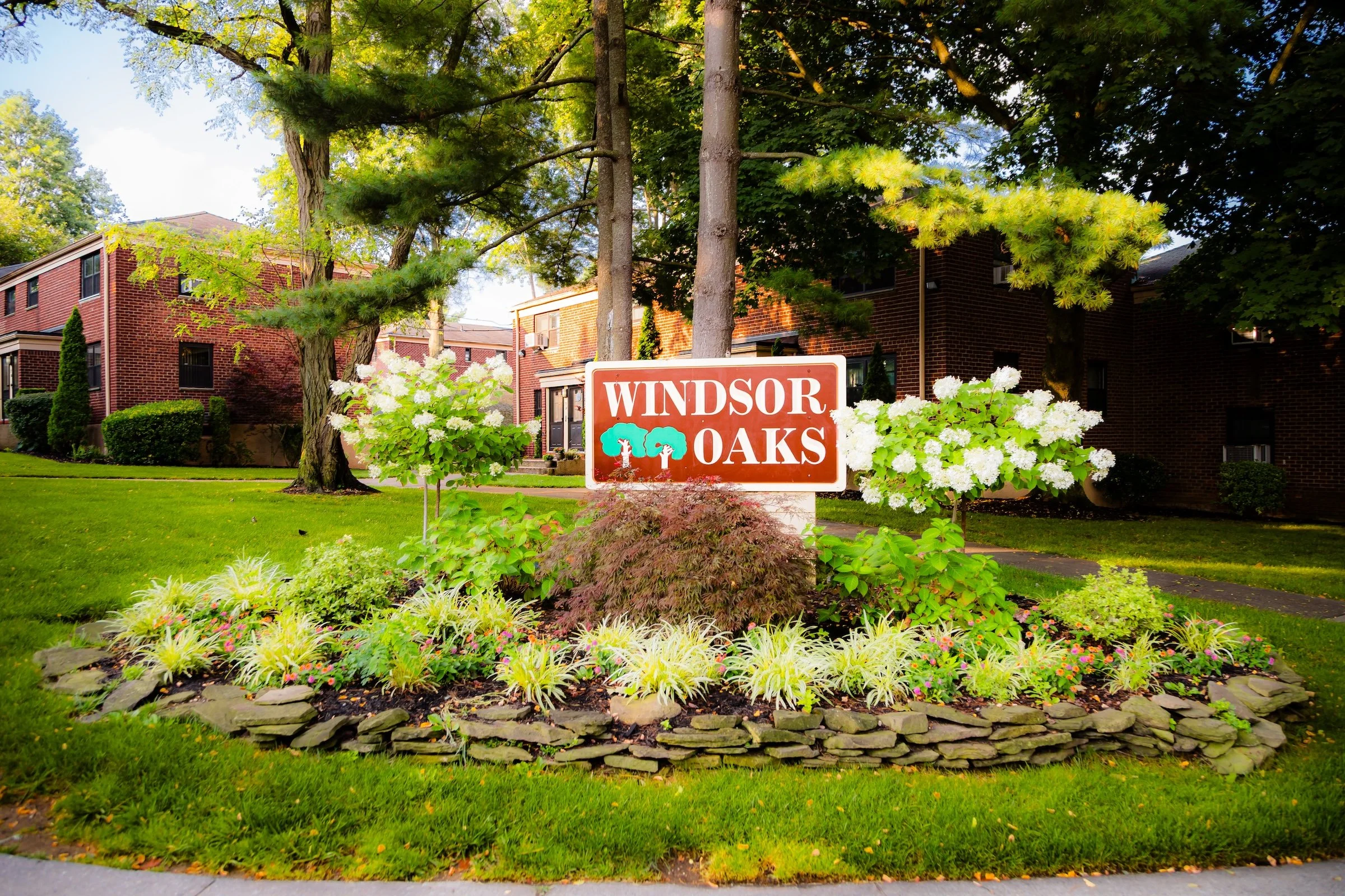
Windsor Oaks - Click To Purchase Prints
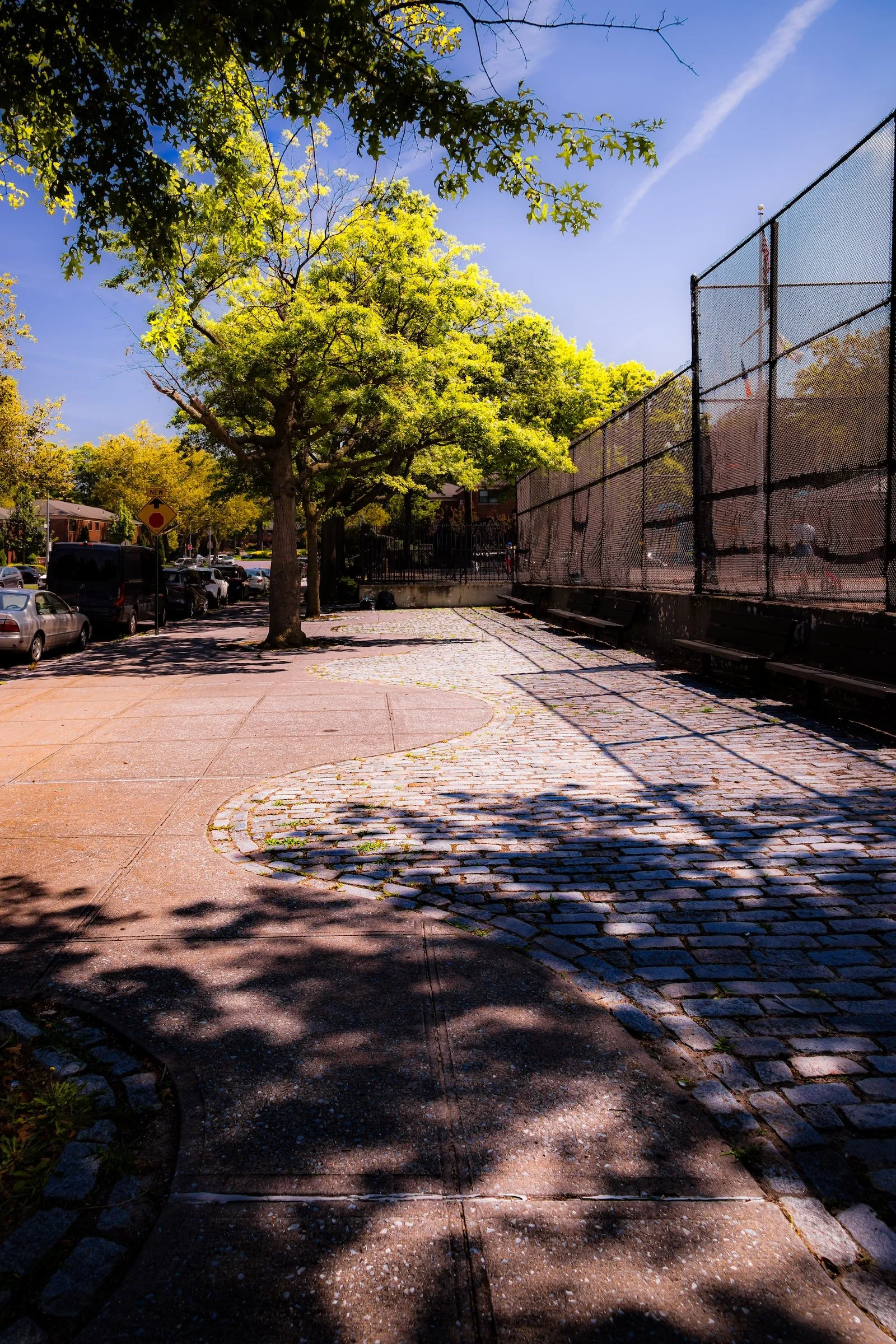
Playground Sidewalk - Click To Purchase Prints
Brick Corner - Click To Purchase Prints
Oakland Gardens Sidewalk - Click To Purchase Prints
Use this custom Google map to explore where every neighborhood in all five boroughs of New York City is located.
The Five Boroughs
One of New York City’s unique qualities is its organization in to 5 boroughs: Manhattan, Brooklyn, Queens, The Bronx, and Staten Island. These boroughs are part pragmatic administrative districts, and part vestiges of the region’s past. Each borough is an entire county in New York State - in fact, Brooklyn is, officially, Kings County, while Staten Island is, officially Richmond County. But that’s not the whole story …
Initially, New York City was located on the southern tip of Manhattan (now the Financial District) that was once the Dutch colony of New Amsterdam. Across the East River, another city was rising: Brooklyn. In time, the city planners realized that unification between the rapidly rising cities would create commercial and industrial opportunities - through streamlined administration of the region.
So powerful was the pull of unification between New York and Brooklyn that three more counties were pulled into the unification: The Bronx, Queens, and Staten Island. And on January 1, 1898, the City of New York unified two cities and three counties into one Greater City of New York - containing the five boroughs we know today.
But because each borough developed differently and distinctly until unification, their neighborhoods likewise uniquely developed. Today, there are nearly 390 neighborhoods, each with their own histories, cultures, cuisines, and personalities - and each with residents who are fiercely proud of their corner of The Big Apple.


