Geographic Setting
Centered on Main Street and bounded by Northern Boulevard to the north, Parsons Boulevard to the east, 45th Avenue to the southeast, Flushing Meadows–Corona Park to the south, and Flushing Creek to the west, Downtown Flushing – Main Street forms the bustling commercial and cultural heart of northeastern Queens. Anchored by the Main Street corridor, this district is both the economic engine of Queens and one of the most ethnically diverse urban centers in the world. Its urban core is a mosaic of high-rise offices, retail centers, traditional markets, and historic sites, where century-old churches stand beside neon-lit storefronts, and where more than 150 languages are spoken within a few blocks.
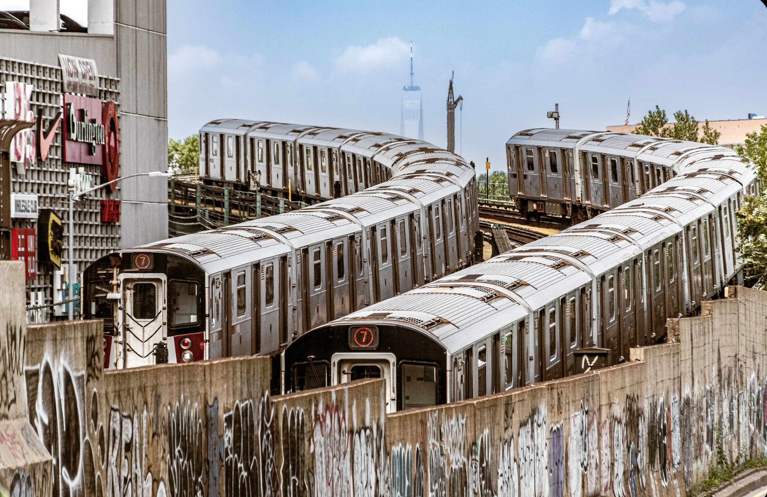
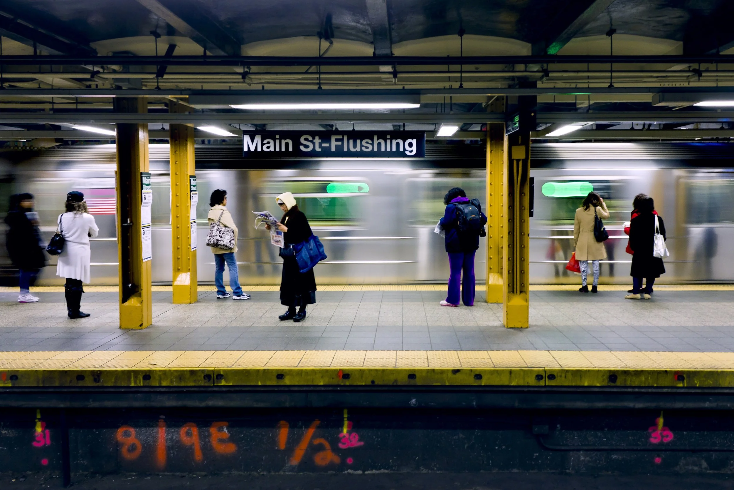
Flushing’s topography slopes gently from the higher ground near Northern Boulevard down toward the Flushing Creek, whose tidal waters flow north into the Flushing Bay. The creek’s western edge is flanked by new developments such as SkyView Center and the Flushing Commons complex, symbolizing the district’s 21st-century transformation. To the south, Flushing Meadows–Corona Park—once the site of two World’s Fairs—forms a vast green border, offering both respite and historical continuity. Within these boundaries, Main Street, Roosevelt Avenue, and Kissena Boulevard serve as the neighborhood’s vital arteries, drawing hundreds of thousands of daily commuters, shoppers, and visitors. The Flushing–Main Street Station (IRT 7 line and LIRR Port Washington Branch) ties the district to Manhattan, Long Island, and the global networks that define modern Queens.
Etymology and Origins
The name “Flushing” derives from the Dutch settlement “Vlissingen,” founded in 1645 as part of the colony of New Netherland. English settlers anglicized the name after taking control in 1664, transforming Vlissingen into Flushing. The area’s early reputation was shaped by its association with religious freedom—an ideal enshrined in the Flushing Remonstrance of 1657, a landmark document advocating liberty of conscience for Quakers and other persecuted groups under Dutch rule.
Main Street began as a rural road linking farms and homesteads that dotted the fertile Flushing Meadows, prized for their orchards and nurseries. By the 19th century, Flushing had become renowned as the “Garden Spot of Long Island,” home to horticultural pioneers like William Prince, whose nurseries supplied trees and flowers to estates across the young nation. The advent of the Flushing Railroad in 1854, and later the Long Island Rail Road, positioned Flushing as a commuter suburb of New York City—an identity that would intensify following the borough’s consolidation into Greater New York in 1898.
The Neighborhood
19th Century: From Village to Urban Center
During the 1800s, Flushing evolved from a pastoral village into one of Queens’ earliest urban centers. Main Street became the commercial heart of the township, lined with general stores, banks, and civic buildings. The Flushing Town Hall, built in 1862 in the Italianate style, served as a civic and cultural hub, hosting lectures, concerts, and political meetings. It remains today as the Flushing Town Hall Arts Center, part of the Smithsonian Institution’s Affiliates program.
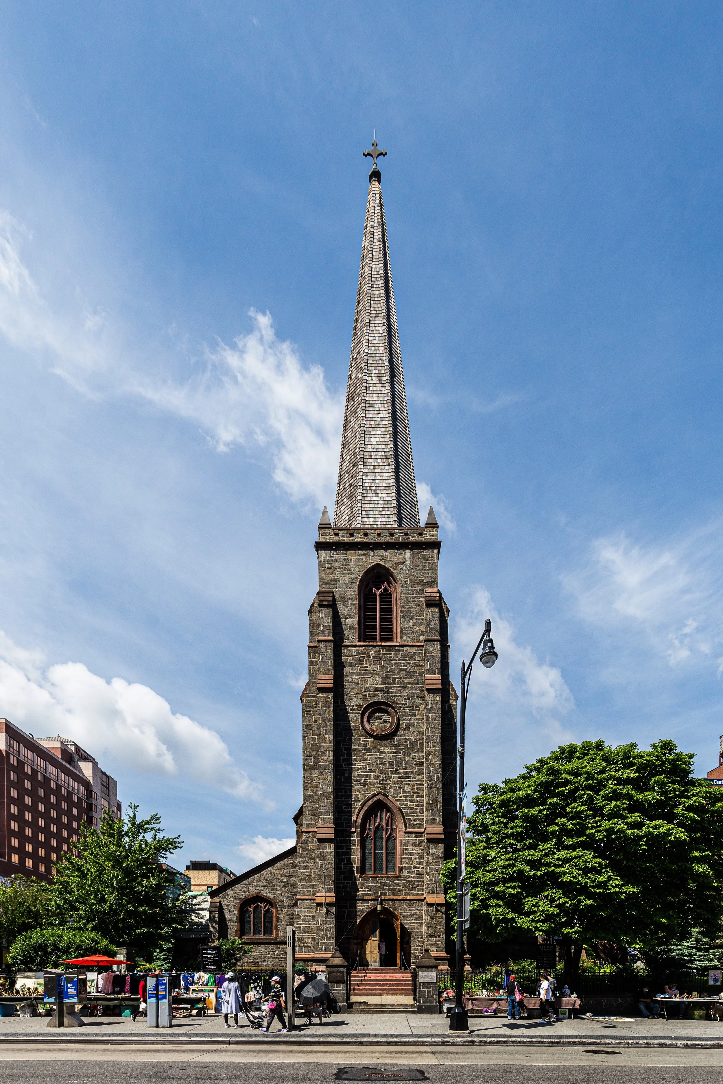
By the late 19th century, the arrival of rail and trolley lines connected Flushing to Manhattan and Brooklyn, spurring residential growth and diversification. Victorian and early Colonial Revival homes rose along Bowne Street and Sanford Avenue, while immigrant entrepreneurs began establishing shops near the station area. Churches and synagogues reflected the community’s expanding pluralism: St. George’s Episcopal Church (founded 1702), Free Synagogue of Flushing (founded 1917), and others provided continuity amid change.
Early–Mid 20th Century: Commerce, Transit, and Transition
The early 20th century marked Flushing’s emergence as the principal business district of eastern Queens. The extension of the Interborough Rapid Transit (IRT) Flushing Line in 1928 transformed Main Street and Roosevelt Avenue into one of New York’s busiest intersections. Department stores, cinemas, and restaurants flourished, while civic institutions like the Flushing Library (1930) and Flushing Hospital reinforced the area’s urban stature.
The neighborhood’s architectural landscape from this era still lingers—Art Deco façades, Beaux-Arts commercial blocks, and the early skyscrapers along Main Street that symbolized suburban modernity. The proximity to Flushing Meadows–Corona Park, developed for the 1939–1940 World’s Fair, further boosted the area’s prominence. Visitors arriving by train or ferry passed through downtown Flushing en route to the fairgrounds, making it both a literal and symbolic gateway to the future.
After World War II, Flushing experienced a new wave of suburban expansion. Single-family homes and garden apartments radiated outward from the downtown core, while Main Street remained a regional shopping destination. The completion of the Van Wyck Expressway and Long Island Expressway in the 1950s integrated Flushing more deeply into the city’s transportation network but also introduced congestion and commercial density that transformed its small-town fabric.
Downtown Flushing-Main Street Video Coming Soon
Late 20th Century: Immigration, Renewal, and the Rise of the Asian Metropolis
Beginning in the 1970s, Downtown Flushing entered its most dramatic transformation. As white and Jewish residents moved outward to Long Island and other suburbs, successive waves of immigrants—first Korean, then Chinese, Taiwanese, and later South Asian and Latin American—redefined the district. Main Street became the nucleus of a new, multilingual commercial world: supermarkets, herbal medicine shops, karaoke lounges, and dim sum palaces replaced department stores and delis.
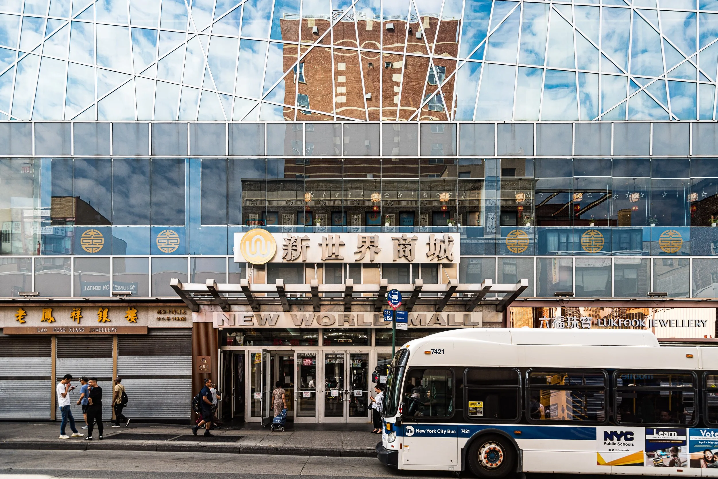
By the 1990s, Flushing had surpassed Manhattan’s Chinatown as the city’s most populous and economically dynamic Asian-American enclave. The convergence of Mandarin, Cantonese, Korean, and Fuzhounese communities created a transnational district where signs in Chinese characters and Hangul now dominate the streetscape. Landmark establishments like New World Mall, Golden Shopping Mall, and Queens Crossing embody this global energy, housing hundreds of vendors and restaurants under one roof.
Despite rapid growth, Flushing preserved key elements of its historic identity. The Bowne House (c.1661), one of the oldest structures in New York City, stands as a symbol of religious tolerance, while the Friends Meeting House (1694) continues to host Quaker services. These colonial landmarks coexist with soaring modern towers—a juxtaposition that captures Flushing’s long continuum of reinvention.
21st Century: Global City in a Borough
In the 2000s and 2010s, Downtown Flushing solidified its role as one of New York’s most important regional centers. The Main Street corridor, now among the busiest pedestrian thoroughfares in the city, draws residents and visitors from across Queens, Long Island, and even Connecticut. Flushing–Main Street Station, rebuilt and expanded, serves as both gateway and symbol of the area’s integration into the city’s global economy.
Ongoing redevelopment has reshaped the skyline with projects such as One Fulton Square, Tangram, and the SkyView Parc complex—mixed-use developments combining residential towers, retail centers, and entertainment venues. Yet alongside these symbols of modernity, everyday street life continues to pulse with local color: sidewalk vendors selling scallion pancakes and mangoes, herbalists preparing tonics, and schoolchildren streaming from P.S. 20 or John Bowne High School.
Flushing’s diversity has deepened further in the 21st century. In addition to its large East Asian populations, the area is now home to significant South Asian, Central American, and Caribbean communities. Faith institutions reflect this plurality: Buddhist temples, Korean churches, Hindu mandirs, and mosques operate within blocks of each other, underscoring Flushing’s enduring role as a crossroads of cultures.
Environmental and civic initiatives have sought to reconnect the district to its natural roots. The Flushing Creek revitalization projects, greenway expansions, and the World’s Fair Marina redevelopment aim to restore ecological balance while improving access to the waterfront. Meanwhile, the Flushing Chamber of Commerce, community groups, and cultural organizations like Flushing Town Hall continue to champion small business preservation, arts programming, and public space improvements.
Downtown Flushing-Main Street Photo Gallery
Spirit and Legacy
Downtown Flushing’s legacy is one of transformation and coexistence. From its colonial origins as a village founded on principles of tolerance to its present role as one of the most dynamic immigrant hubs in the Western Hemisphere, it embodies the evolving story of New York itself.
Here, amid the hum of traffic and conversation on Main Street, centuries of history converge—the Quaker ideals of the 1600s, the industrial optimism of the 1900s, and the global vibrancy of the 2000s. At dusk, when the neon signs of Roosevelt Avenue flicker to life and the scent of dumplings, kimchi, and tacos mingles in the air, Downtown Flushing stands as both a living chronicle of migration and a vision of the city’s future: a true capital of Queens, where the world meets and remakes itself every day.
New York City
Use this custom Google map to explore where every neighborhood in all five boroughs of New York City is located.
The Five Boroughs
One of New York City’s unique qualities is its organization in to 5 boroughs: Manhattan, Brooklyn, Queens, The Bronx, and Staten Island. These boroughs are part pragmatic administrative districts, and part vestiges of the region’s past. Each borough is an entire county in New York State - in fact, Brooklyn is, officially, Kings County, while Staten Island is, officially Richmond County. But that’s not the whole story …
Initially, New York City was located on the southern tip of Manhattan (now the Financial District) that was once the Dutch colony of New Amsterdam. Across the East River, another city was rising: Brooklyn. In time, the city planners realized that unification between the rapidly rising cities would create commercial and industrial opportunities - through streamlined administration of the region.
So powerful was the pull of unification between New York and Brooklyn that three more counties were pulled into the unification: The Bronx, Queens, and Staten Island. And on January 1, 1898, the City of New York unified two cities and three counties into one Greater City of New York - containing the five boroughs we know today.
But because each borough developed differently and distinctly until unification, their neighborhoods likewise uniquely developed. Today, there are nearly 390 neighborhoods, each with their own histories, cultures, cuisines, and personalities - and each with residents who are fiercely proud of their corner of The Big Apple.


