
SUNSET PARK
Brooklyn
Geographic Setting
Bounded by 39th Street to the north and 65th Street to the south, stretching west from 9th Avenue to the Gowanus Bay waterfront, Sunset Park occupies one of Brooklyn’s most topographically striking settings—a steep hill descending toward New York Harbor, crowned by the verdant heights of its namesake park. From the hilltop at 5th Avenue and 44th Street, the skyline of Lower Manhattan, the Statue of Liberty, and the sweep of New York Bay unfold in panoramic grandeur. It is from this elevated vantage that Sunset Park takes both its name and its soul: a place where the city’s laboring waterfront meets its most luminous view.
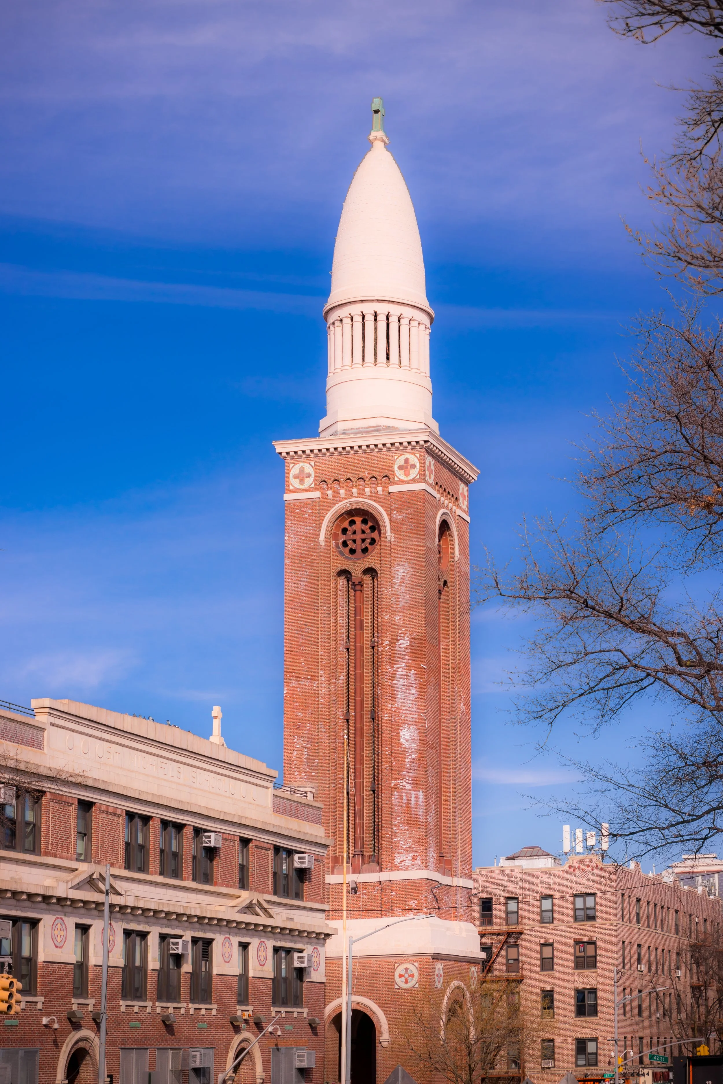
The neighborhood’s physical composition mirrors its dual identity. To the west, the Industrial Waterfront—anchored by the Bush Terminal (now Industry City) and the South Brooklyn Marine Terminal—still echoes with the sounds of freight trains and cranes, reminders of its 19th-century working-class foundation. To the east, the hillside residential grid rises in ordered tiers: 4th, 5th, 6th, 7th, and 8th Avenues lined with brick and brownstone rowhouses, tenements, and prewar apartment buildings. At its summit lies Sunset Park proper, a 24-acre public park laid out in the 1890s that remains the neighborhood’s literal and emotional centerpiece.
Etymology and Origins
The name Sunset Park derives from the elevated park established at the district’s core in 1891, which offered—and still offers—spectacular western views at sunset over New York Harbor. Before its development, the land formed part of the rural Town of South Brooklyn, characterized by rolling farmland and scattered hamlets known as “Yellow Hook” and later “Bay Ridge.” The completion of Green-Wood Cemetery in the 1840s and the subsequent expansion of Brooklyn’s street grid southward along 3rd, 4th, and 5th Avenues laid the groundwork for settlement.
By the 1860s, the waterfront along Gowanus Bay began to industrialize, driven by shipbuilding, freight handling, and warehousing. The Bush Terminal Company, founded by Irving T. Bush in 1895, transformed the shoreline into one of the most advanced integrated shipping and manufacturing complexes in the world. With rail sidings, piers, and warehouses stretching for dozens of acres, Bush Terminal made Sunset Park a critical node in global commerce and a magnet for laborers from across Europe.
The neighborhood’s name, officially adopted in the early 20th century, captured both its topographical distinction and its new urban identity: a residential community rising above the industrial plain.
The Neighborhood
19th Century: From Farmland to Working-Class Enclave
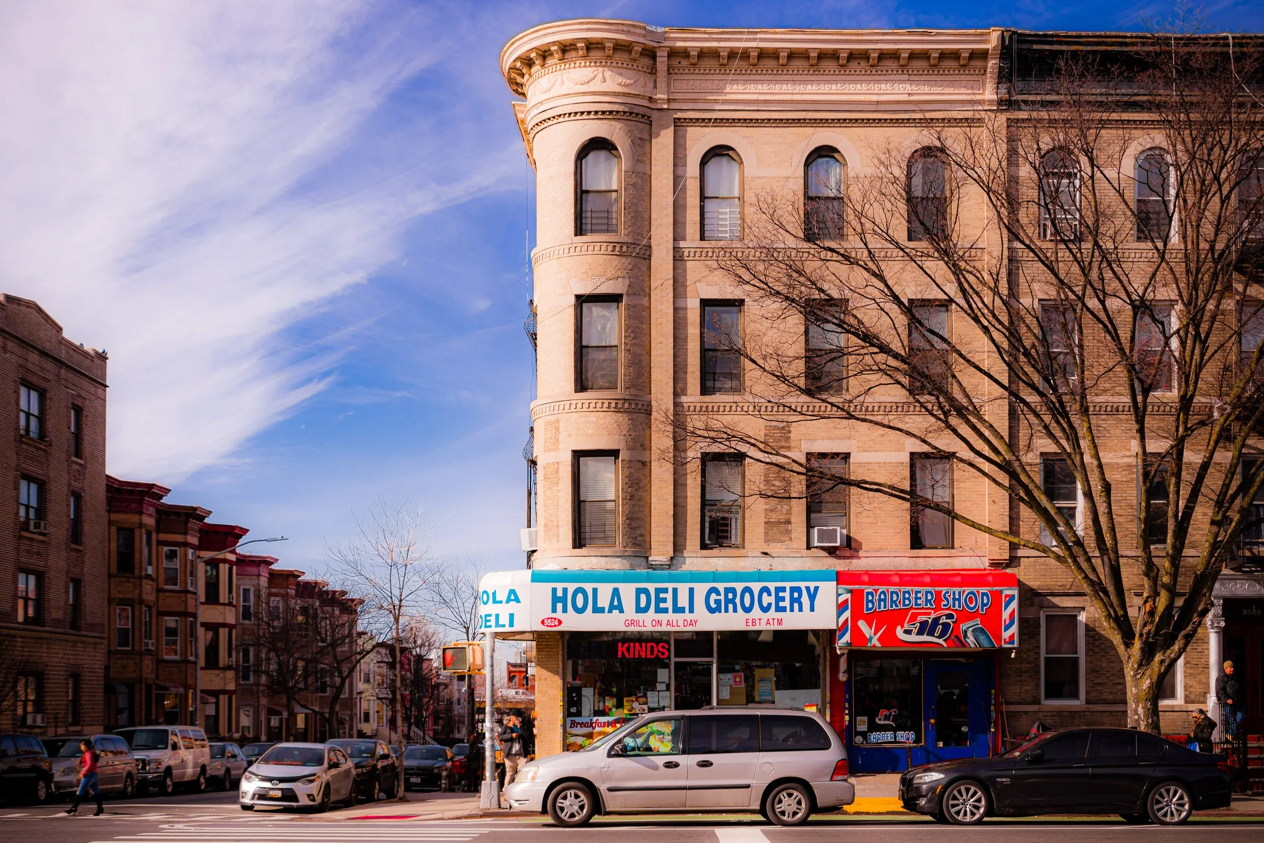
The late 19th century was a period of explosive growth. Following Brooklyn’s consolidation into Greater New York (1898) and the opening of the Fourth Avenue subway line, thousands of Irish, Norwegian, Finnish, and Polish immigrants settled in Sunset Park, drawn by employment in the nearby docks, factories, and warehouses. Builders filled the hillside with sturdy brownstone and brick rowhouses, modest in scale but rich in craftsmanship—Italianate and Neo-Grec façades adorned with cornices, lintels, and stoops.
The Sunset Park itself, designed by the Brooklyn Parks Department under Calvert Vaux’s influence, provided an essential green refuge amid the growing urban density. Featuring winding paths, terraces, and a commanding view of the harbor, it quickly became the neighborhood’s gathering ground for recreation and civic life.
By 1900, the community was distinctly working class but stable, its streets alive with Scandinavian churches, Polish bakeries, and Irish pubs. The district’s Scandinavian presence—especially Norwegian seamen and dockworkers—became so prominent that the area around Eighth Avenue earned the nickname “Little Norway.”
Early–Mid 20th Century: Industry, Immigration, and Community
The early 20th century cemented Sunset Park’s dual character: industrial might below the hill, family life above it. The Bush Terminal and nearby Army Terminal (1918) employed tens of thousands during both World Wars, serving as vital logistics hubs for the nation’s military and maritime trade. Residentially, Sunset Park thrived as a dense but cohesive immigrant neighborhood, where most residents could walk from home to work within minutes.
During the 1920s–1940s, new waves of immigrants—Italians, Finns, and Puerto Ricans—enriched the neighborhood’s cultural fabric. Cooperative housing projects, such as the Finnish Home Co-ops built along 44th to 50th Streets, introduced early models of tenant ownership and social housing reform in New York City. Finnish Hall on 43rd Street became a nexus for labor organization, political debate, and community gatherings.
The construction of the Gowanus Expressway (1941–1954), however, marked a profound rupture. Elevated along 3rd Avenue, the expressway divided the neighborhood from its waterfront, darkening the streets below and accelerating industrial decline. As maritime jobs vanished in the 1960s–1970s, unemployment rose, property values fell, and many Scandinavian and European families moved to the suburbs, replaced by Puerto Rican migrants and, later, Dominican and Mexican newcomers.
Sunset Park Photographic Video
Late 20th Century: Decline, Resilience, and New Communities
By the 1970s, Sunset Park faced severe economic hardship. The closing of the Brooklyn Army Terminal (1974) and the downsizing of Bush Terminal dealt devastating blows to local employment. Yet even in decline, the neighborhood’s tightly knit blocks and park-centered geography fostered resilience. Latino residents, primarily Puerto Rican, brought new cultural vibrancy—music, street festivals, and community activism that reanimated the district. Churches, tenant associations, and advocacy groups fought disinvestment and pushed for improved schools and housing.
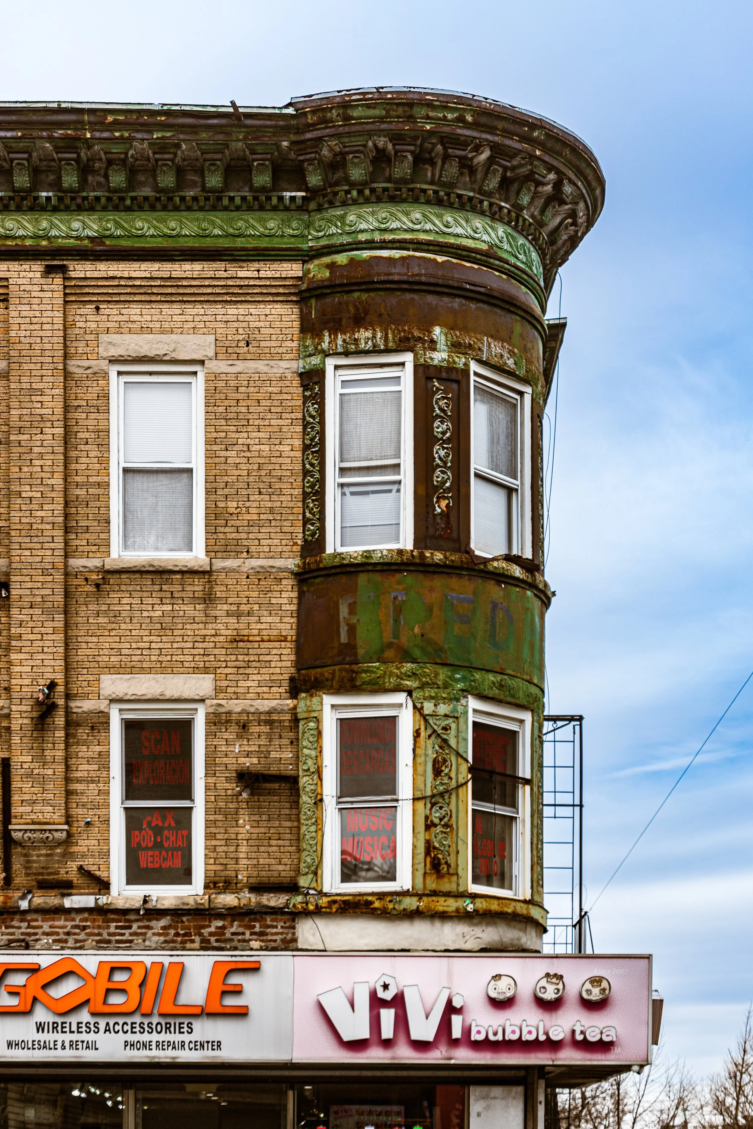
During the 1980s–1990s, another major transformation occurred as Chinese immigrants from Manhattan’s Chinatown and from Fujian Province began settling along 8th Avenue, transforming it into Brooklyn’s “Chinatown South.” Supermarkets, dim sum restaurants, herbal shops, and bilingual schools reshaped the corridor, turning Sunset Park into one of New York’s most significant centers of Chinese life. Alongside these changes, Mexican and Central American populations also grew rapidly, contributing to one of the city’s most vibrant Latin American communities.
By the end of the 20th century, Sunset Park had become a multicultural mosaic: Chinese families along 8th Avenue, Latino families near 5th and 6th Avenues, and long-established older residents scattered throughout.
21st Century: Revival and Preservation
In the 21st century, Sunset Park has experienced a dramatic revival—economically, demographically, and culturally. The redevelopment of the Bush Terminal complex into Industry City, a vast campus of creative businesses, food halls, and design studios, has reconnected the waterfront to the wider city economy. The restored Brooklyn Army Terminal, now home to tech and light-manufacturing firms, continues the neighborhood’s industrial legacy in a modern key.
Meanwhile, the residential core retains its historic integrity: rows of century-old brownstones and brick walk-ups preserved through community advocacy. In 1988, the Sunset Park Historic District was designated by the Landmarks Preservation Commission, protecting over 3,000 buildings as one of the most complete working-class architectural ensembles in New York.
Yet Sunset Park’s renewal has also brought challenges—rising rents, development pressure, and debates over gentrification, particularly around Industry City. Local organizations such as Uprose, one of Brooklyn’s oldest Latino community groups, continue to fight for environmental justice, affordable housing, and equitable development. The neighborhood remains defined by its immigrant vitality: Spanish, Cantonese, and Fujianese mix with English in the markets along 5th and 8th Avenues, while families picnic in Sunset Park under cherry trees planted a century ago.
Sunset Park Photo Gallery
Spirit and Legacy
The spirit of Sunset Park lies in its view and its people—a panorama not only of harbor and skyline but of labor, migration, and endurance. It is a neighborhood forged by industry and sustained by community, where each generation of arrivals—Scandinavian, Puerto Rican, Chinese, Mexican—has remade the streets while honoring those who came before.
New York City
Use this custom Google map to explore where every neighborhood in all five boroughs of New York City is located.
The Five Boroughs
One of New York City’s unique qualities is its organization in to 5 boroughs: Manhattan, Brooklyn, Queens, The Bronx, and Staten Island. These boroughs are part pragmatic administrative districts, and part vestiges of the region’s past. Each borough is an entire county in New York State - in fact, Brooklyn is, officially, Kings County, while Staten Island is, officially Richmond County. But that’s not the whole story …
Initially, New York City was located on the southern tip of Manhattan (now the Financial District) that was once the Dutch colony of New Amsterdam. Across the East River, another city was rising: Brooklyn. In time, the city planners realized that unification between the rapidly rising cities would create commercial and industrial opportunities - through streamlined administration of the region.
So powerful was the pull of unification between New York and Brooklyn that three more counties were pulled into the unification: The Bronx, Queens, and Staten Island. And on January 1, 1898, the City of New York unified two cities and three counties into one Greater City of New York - containing the five boroughs we know today.
But because each borough developed differently and distinctly until unification, their neighborhoods likewise uniquely developed. Today, there are nearly 390 neighborhoods, each with their own histories, cultures, cuisines, and personalities - and each with residents who are fiercely proud of their corner of The Big Apple.


