
MARINERS HARBOR
Staten Island
Geographic Setting
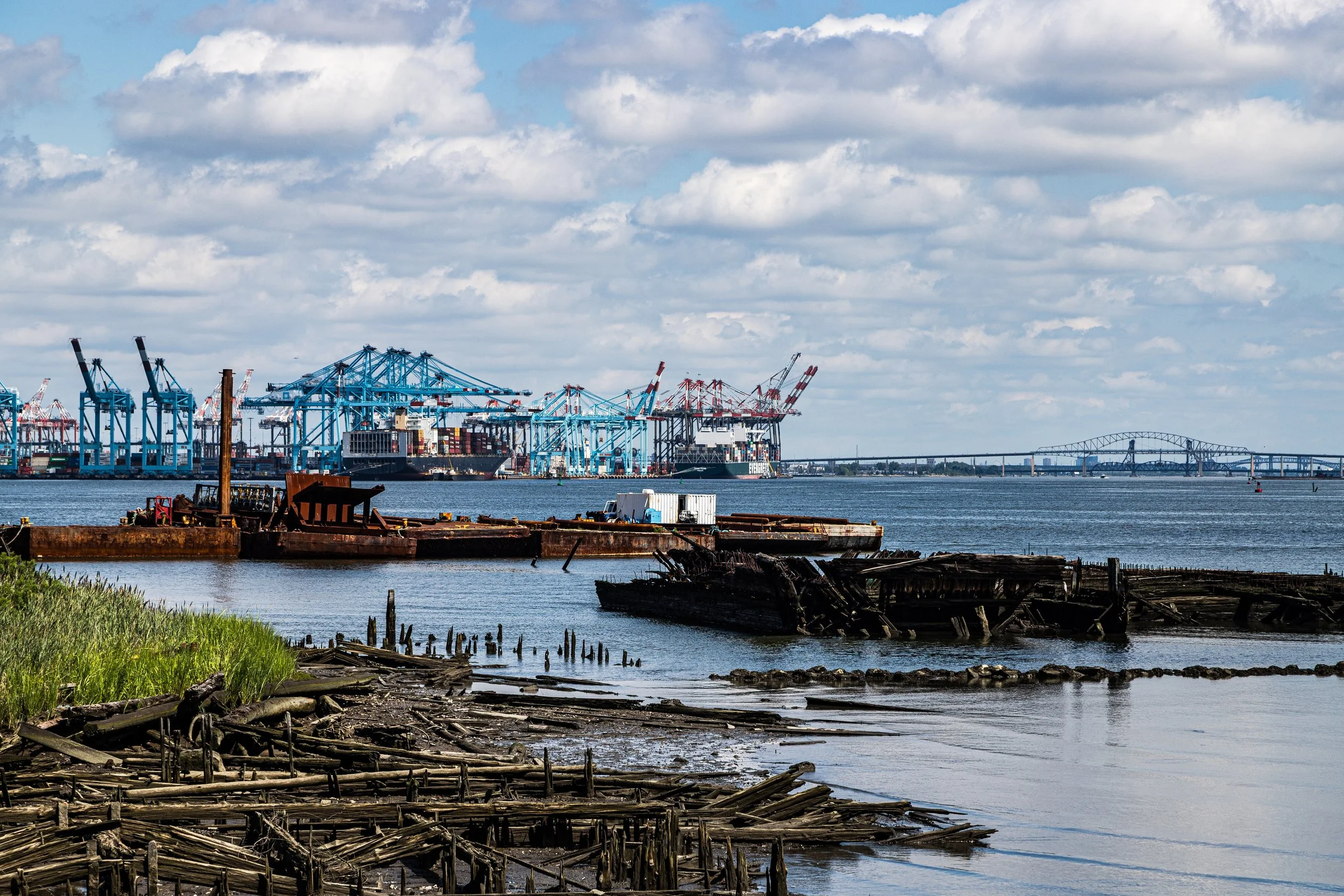
Bounded by the Dr. Martin Luther King Jr. Expressway (Route 440) to the west, the Staten Island Expressway to the south, Harbor Road to the east, and the Kill Van Kull to the north, Mariners Harbor anchors the northwestern tip of Staten Island—a district defined by its maritime heritage, industrial waterfront, and resilient working-class community. The neighborhood lies along the Kill Van Kull, the narrow tidal strait separating Staten Island from Bayonne, New Jersey, where container ships, tugboats, and ferries pass daily against a skyline of cranes and docks.
To the south, the residential heart of Mariners Harbor rises gently above the harbor’s edge, spreading along streets such as Union Avenue, Forest Avenue, and Richmond Terrace. The community’s inland sections are characterized by rows of frame houses, postwar brick homes, and public housing developments interspersed with schools, churches, and playing fields. The juxtaposition of industry, water, and residential life gives Mariners Harbor a layered geography—where shipyards and steelworks coexist with long-established neighborhoods and where generations have lived within sight of the tides that gave the community its name.
Etymology
The name Mariners Harbor originates from the district’s 19th-century maritime prominence. During the early 1800s, the sheltered waters of the Kill Van Kull provided safe anchorage for sailors and shipbuilders. Small docks, ferries, and repair yards proliferated along the shoreline, and the term “Mariners’ Harbor” came into common use to describe this safe haven for vessels. By mid-century, the name had been formalized, appearing on maps and official documents as the area transitioned from a nautical outpost to a thriving industrial village.
Its name encapsulates both place and profession—honoring the seafarers who once anchored their ships here and the deep relationship between the community and the waters that shaped its destiny. Even today, the term Mariners carries a sense of pride, invoked by schools, parks, and local teams as a living link to the neighborhood’s maritime soul.
The Neighborhood
Origins through the 19th Century
Before European settlement, the shores of Mariners Harbor were part of the ancestral lands of the Lenape, who fished and foraged along the tidal flats of the Kill Van Kull. Dutch colonists arrived in the 1600s, followed by English settlers who established farms and boat landings in what was then the Town of Northfield. The region’s location along deep navigable waters made it ideal for maritime trade.
By the early 19th century, Mariners Harbor had become one of Staten Island’s key waterfront villages. Shipyards, dry docks, and warehouses lined the shore, supported by the growing commerce between New York Harbor and the Raritan Bay. Families engaged in fishing, oystering, and boat repair, while local entrepreneurs—among them the Housman and Decker families—built wharves, sail lofts, and ferry connections to New Jersey. The community’s identity was bound to the harbor; the sound of hammering shipwrights and the sight of schooners under repair defined daily life.
The opening of Richmond Terrace as a main coastal road in the early 1800s linked the waterfront settlements of the North Shore, further integrating Mariners Harbor into Staten Island’s emerging economic framework. By mid-century, the area boasted shipyards, ropewalks, and small factories, as well as schools and churches serving a growing population of maritime workers and their families.
Early 20th Century: Industry and Immigration
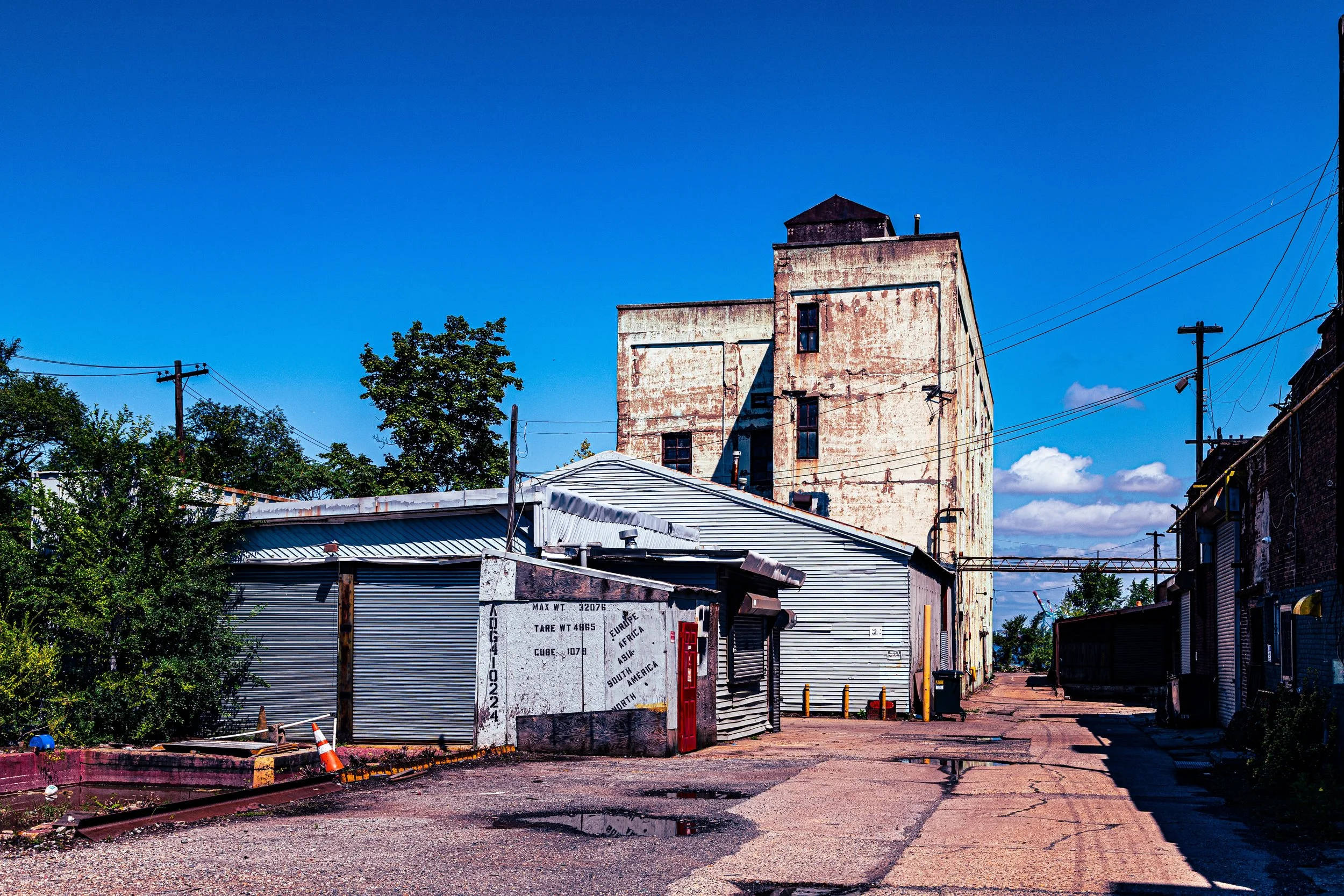
The dawn of the 20th century transformed Mariners Harbor from a maritime village into an industrial hub. The shoreline filled with factories, oil storage facilities, and warehouses serving the expanding Port of New York. Companies such as Bethlehem Steel and Standard Oil operated plants along the Kill Van Kull, while lumberyards and ship repair businesses continued to thrive. The construction of rail spurs and the Staten Island Rapid Transit’s North Shore Branch further integrated Mariners Harbor into the region’s industrial network.
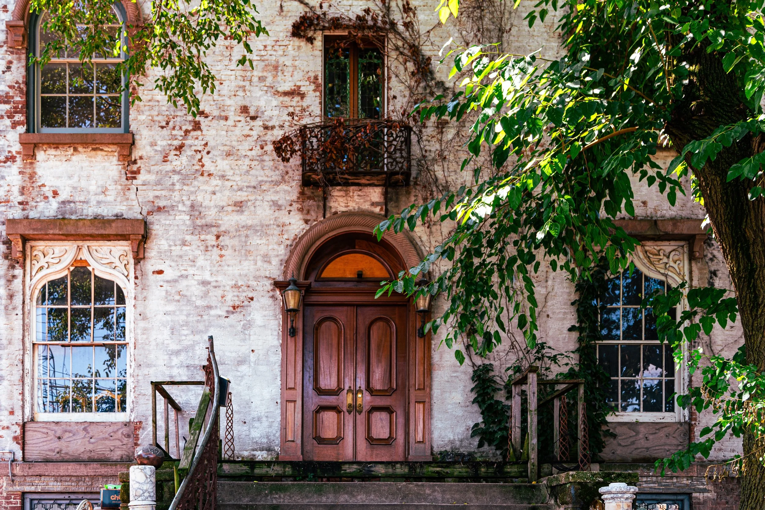
As industry grew, so did the population. Immigrants from Italy, Ireland, and Eastern Europe arrived seeking work, joining earlier families of Dutch and English descent. Modest housing developments sprang up inland from the harbor—wood-framed homes along Union and Grandview Avenues, and small apartment houses near Richmond Terrace. Churches and mutual aid societies became cornerstones of community life, fostering resilience in the face of economic fluctuation and environmental hardship.
Despite industrialization, Mariners Harbor retained its small-town intimacy. Local shops, taverns, and social clubs gave the neighborhood cohesion, while the steady hum of the waterfront instilled a rhythm that would define generations.
Mariners Harbor Video Coming Soon
Mid–Late 20th Century: Change and Renewal
The post–World War II era brought both prosperity and challenge. The expansion of the Goethals Bridge (1928) and later the Dr. Martin Luther King Jr. Expressway (1950s–60s) improved regional access but also physically divided sections of the neighborhood. As shipping modernized and containerization shifted port activity to New Jersey, many of Mariners Harbor’s shipyards and factories closed, leaving behind vacant lots and environmental scars.
At the same time, Staten Island’s population surged following the Verrazzano-Narrows Bridge (1964), and new residents arrived from Brooklyn and beyond. Public housing developments such as the Mariners Harbor Houses were constructed in the 1950s and 1960s, bringing affordable housing and a new demographic mix to the area. Though economic decline affected the industrial base, civic life persisted. Churches like Our Lady of the Assumption and community centers became stabilizing forces, while schools and playgrounds fostered local pride.
By the late 20th century, redevelopment efforts began to reclaim portions of the waterfront and revitalize the neighborhood. Environmental cleanup projects targeted polluted industrial sites, and new small businesses emerged along Forest Avenue and Richmond Terrace. The establishment of Mariners Marsh Park, a reclaimed wetland preserve, symbolized the community’s enduring connection to the land and water that had defined it for centuries.
21st Century: Diversity, Resilience, and Renewal
In the 21st century, Mariners Harbor stands as one of Staten Island’s most culturally diverse neighborhoods, home to longstanding families and newer immigrant communities from the Caribbean, Africa, and Latin America. This diversity has revitalized local commerce and community life, reflected in new restaurants, markets, and cultural institutions that blend traditions old and new.
Residentially, the neighborhood offers a mix of older frame houses, mid-century brick homes, and newer multi-family dwellings. Efforts to improve infrastructure, expand parks, and enhance flood resilience have reshaped the area’s physical landscape. The Mariners Harbor Library, opened in 2013, serves as a modern civic hub—a light-filled, eco-conscious space that anchors the community’s cultural and educational life.
Waterfront revitalization projects continue, with portions of the former industrial shoreline envisioned for mixed-use development and ecological restoration. The hum of the harbor remains, but the neighborhood’s future now orbits as much around sustainability and equity as it once did around shipbuilding and steel. Civic pride runs deep: annual cleanups, block parties, and historical initiatives underscore the residents’ commitment to preserving Mariners Harbor’s unique identity while forging a path toward renewal.
Mariners Harbor Photo Gallery
Spirit and Legacy
The spirit of Mariners Harbor lies in endurance. Born of the tides and tempered by industry, it is a community that has adapted to every wave of change—from wooden shipyards to modern highways, from immigration to reinvention. Its people have carried forward the maritime tenacity embedded in its name: resourceful, rooted, and resilient.
The legacy of Mariners Harbor is written in its landscape—the cranes that still rise along the Kill Van Kull, the clapboard houses that echo the village past, the marshlands reclaiming their natural rhythm. It is a place where Staten Island’s industrial and human histories converge, where the clang of industry has given way to the hum of daily life, and where the water remains both boundary and lifeblood.
New York City
Use this custom Google map to explore where every neighborhood in all five boroughs of New York City is located.
The Five Boroughs
One of New York City’s unique qualities is its organization in to 5 boroughs: Manhattan, Brooklyn, Queens, The Bronx, and Staten Island. These boroughs are part pragmatic administrative districts, and part vestiges of the region’s past. Each borough is an entire county in New York State - in fact, Brooklyn is, officially, Kings County, while Staten Island is, officially Richmond County. But that’s not the whole story …
Initially, New York City was located on the southern tip of Manhattan (now the Financial District) that was once the Dutch colony of New Amsterdam. Across the East River, another city was rising: Brooklyn. In time, the city planners realized that unification between the rapidly rising cities would create commercial and industrial opportunities - through streamlined administration of the region.
So powerful was the pull of unification between New York and Brooklyn that three more counties were pulled into the unification: The Bronx, Queens, and Staten Island. And on January 1, 1898, the City of New York unified two cities and three counties into one Greater City of New York - containing the five boroughs we know today.
But because each borough developed differently and distinctly until unification, their neighborhoods likewise uniquely developed. Today, there are nearly 390 neighborhoods, each with their own histories, cultures, cuisines, and personalities - and each with residents who are fiercely proud of their corner of The Big Apple.


