
THE BRONX
Part of an ongoing project to walk and photograph every neighborhood in New York City, this page explores The Bronx through maps, borough identity, history, and photography.
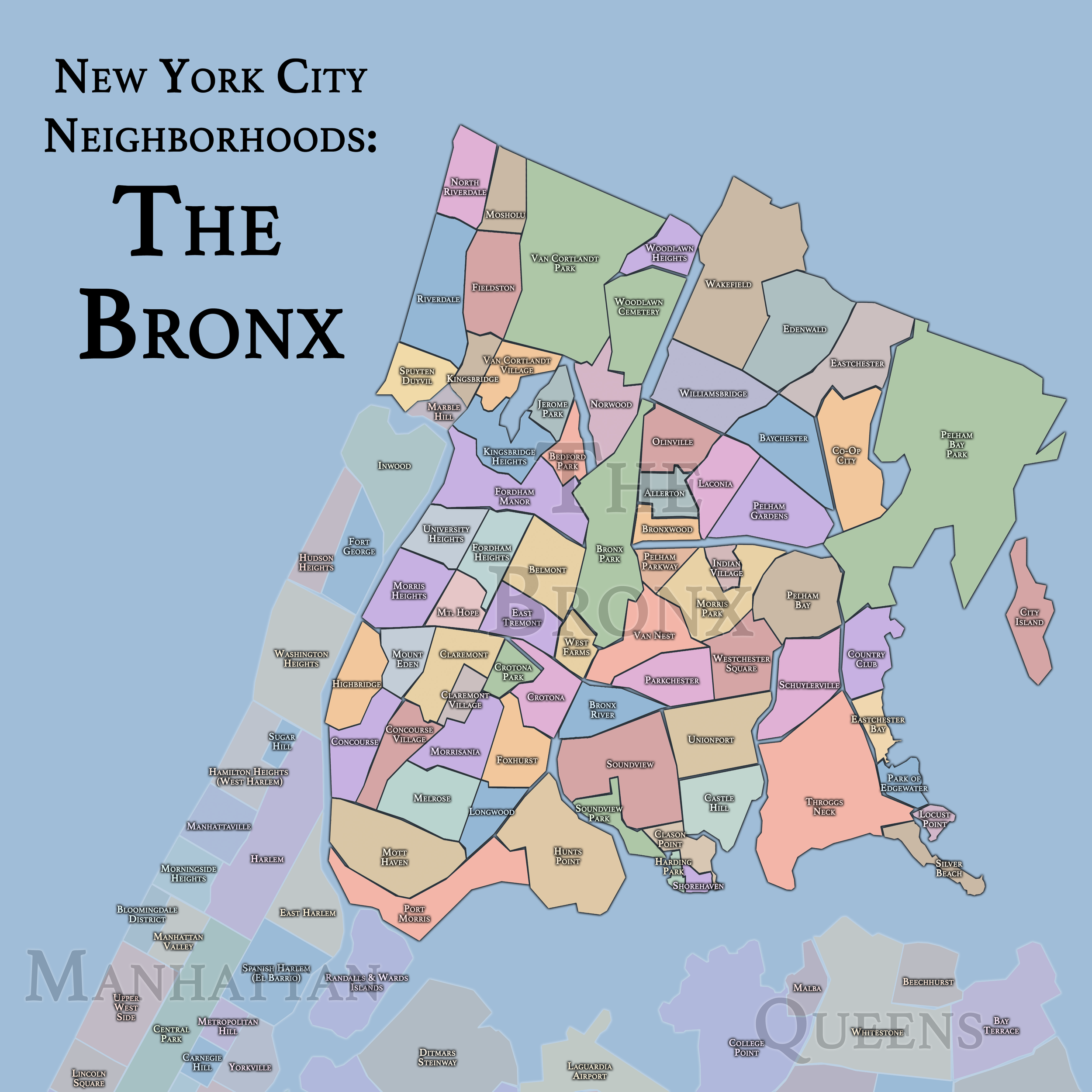
The Maps
Geographic Setting
Occupying the mainland north of Manhattan, The Bronx is New York City’s only borough attached to the continental United States, bounded by the Harlem River and East River to the south, The Long Island Sound to the east, and The Hudson River to the west. Covering about 42 square miles, its terrain is a dramatic meeting of ridges, valleys, and tidal flats, carved by the last glaciers of the Ice Age. Rolling uplands descend into waterfront industrial plains, and steep hills—especially in Riverdale, Highbridge, and University Heights—offer sweeping views of the Hudson and Harlem Rivers.
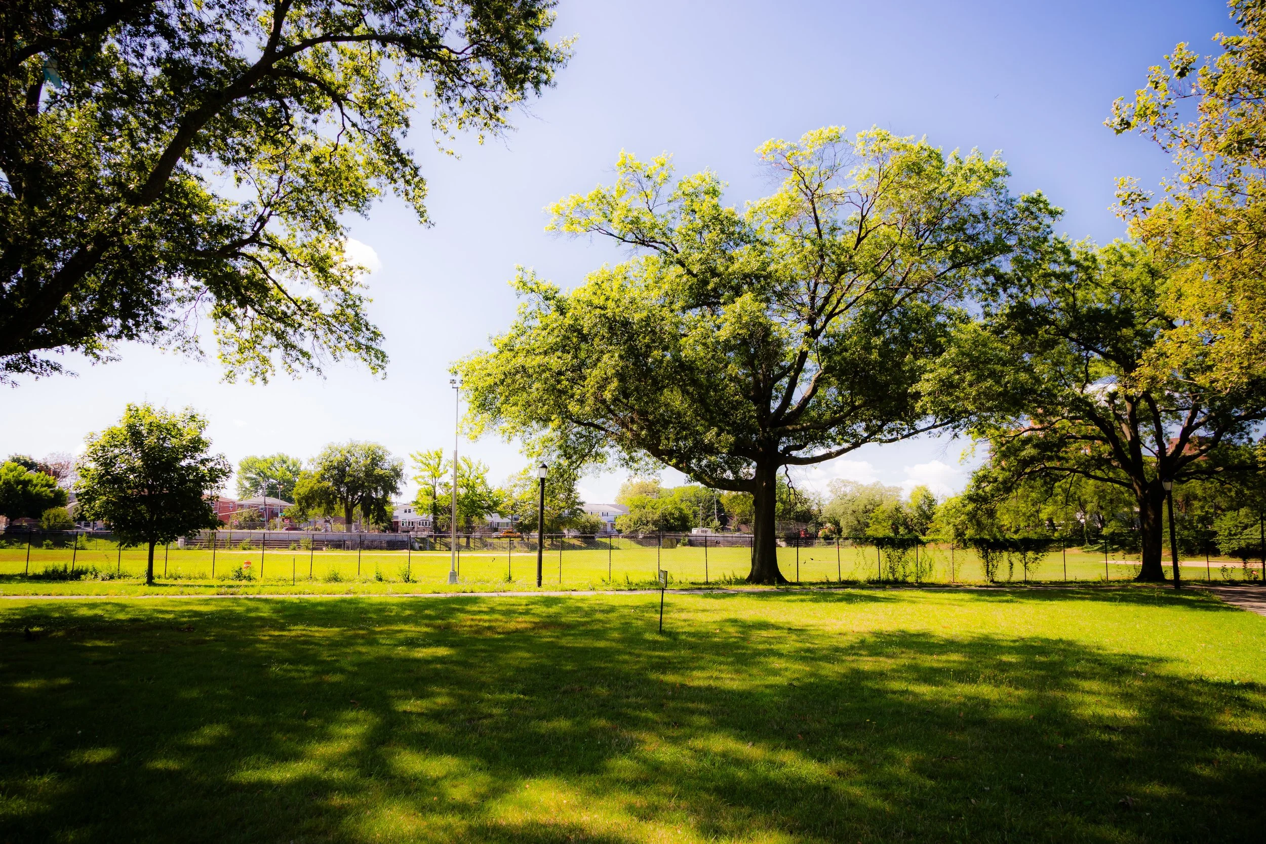
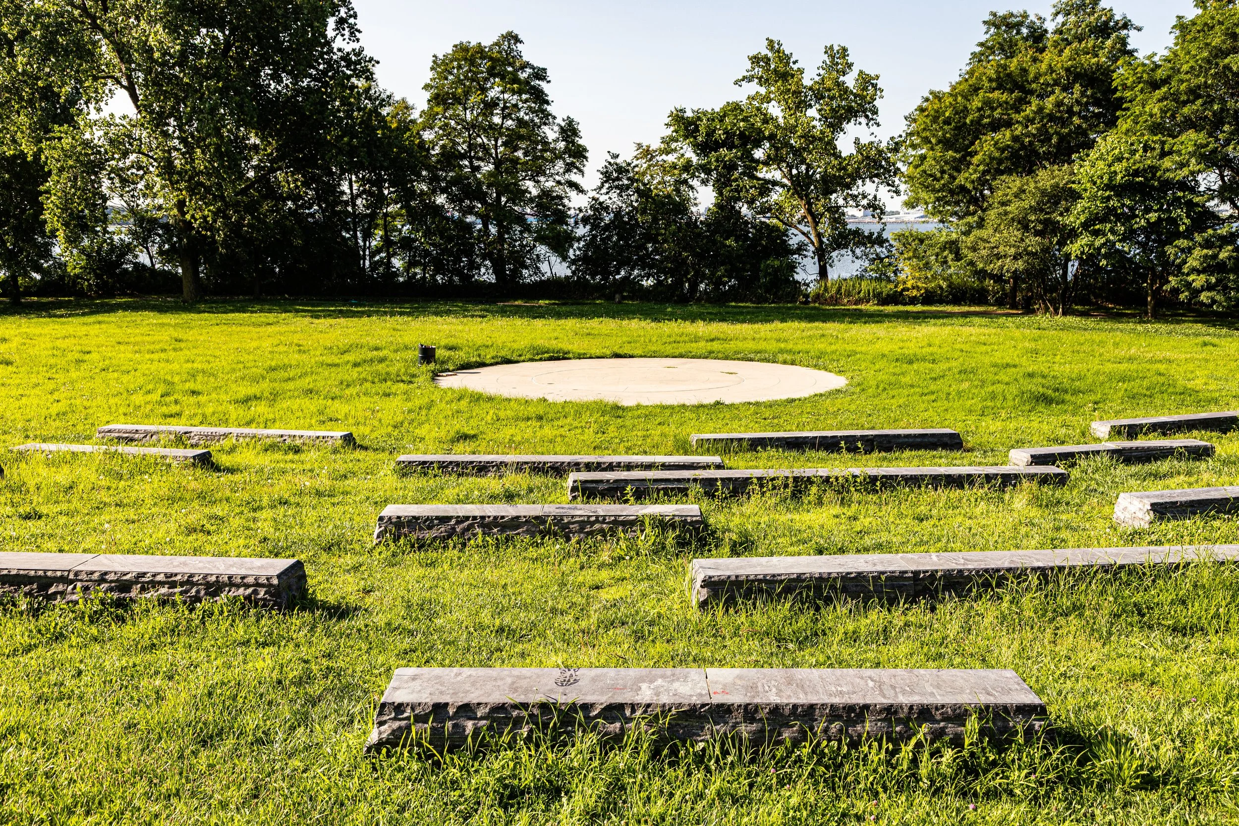
Within this varied landscape, The Bronx encompasses an extraordinary range of environments: the pastoral woodlands of Van Cortlandt Park, the restored wetlands of Pelham Bay Park, the dense urban grids of the South Bronx, and the stately parkways that wind through its hills. The borough’s parks and open spaces—covering nearly a quarter of its total land area—give it more greenery than any other borough, earning it the enduring title “The Borough of Parks.”
The Bronx Identity
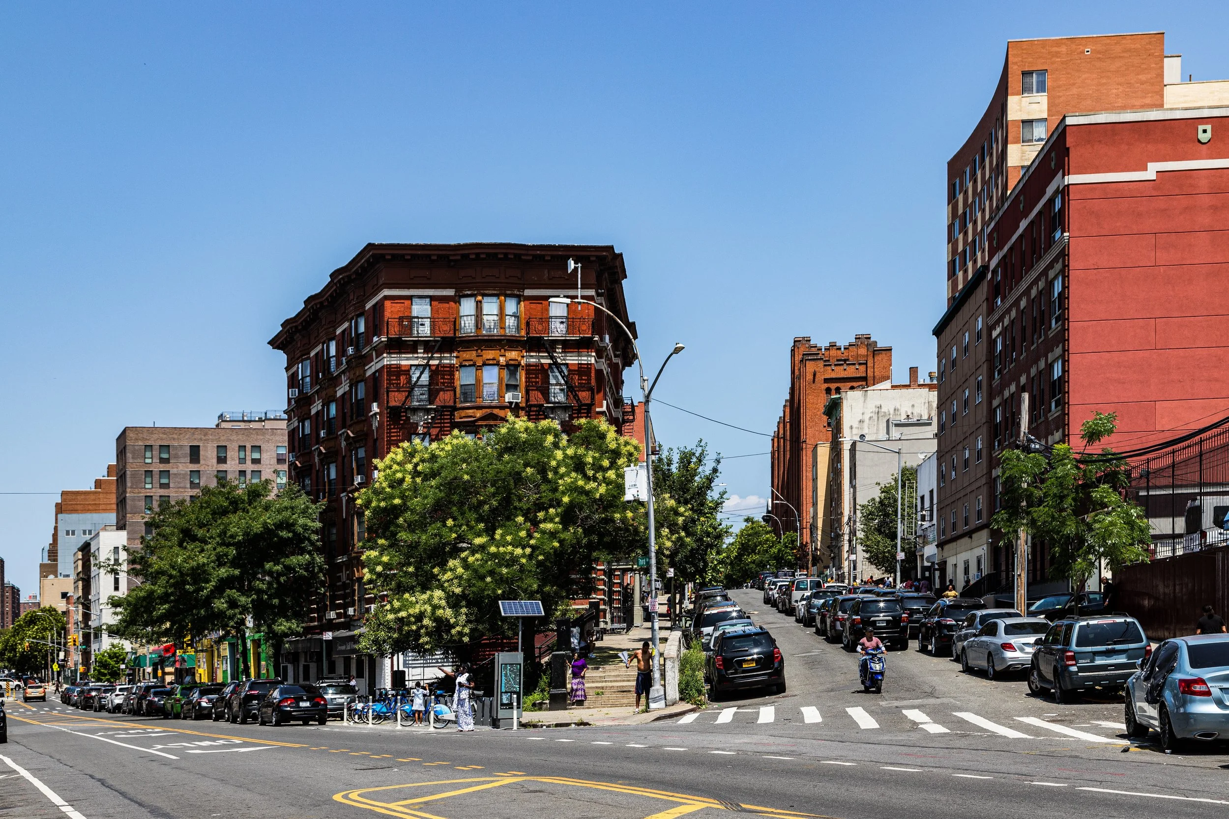
The Bronx possesses one of New York City’s most distinctive physical and emotional landscapes: a borough of hills and shorelines, broad parkways and tight commercial corridors, dense apartment districts and unexpectedly quiet residential enclaves. Its character is shaped as much by terrain as by architecture, with streets that rise and bend, neighborhoods that crest and descend, and a built environment that often feels inseparable from the land beneath it.
What distinguishes the Bronx is the force with which so many different urban conditions coexist there. Civic and residential, monumental and intimate, tough-edged and deeply communal, the borough’s neighborhoods reflect topography, migration, industry, public works, and local pride with unusual clarity. To move through the Bronx is to encounter a borough that is grounded, historically layered, and unmistakably itself.
Borough Identity
Etymology and Origins
The Bronx derives its name from Jonas Bronck, a Swedish-born immigrant who, in 1639, became the first recorded European settler in the region. Bronck established a farmstead along the river that would later bear his name—Bronck’s River—a small, winding waterway that still runs through the borough today. Over time, “Bronck’s Land” became “The Bronx,” an enduring linguistic echo of the man who crossed the Atlantic to build a home by its shores.
Long before Bronck’s arrival, the area was inhabited by the Siwanoy and Weckquaesgeek peoples of the Lenape nation, who hunted, fished, and cultivated maize along its rivers and inlets. The landscape they knew—of forests, salt marshes, and rocky hills—remains embedded in the borough’s contours, even beneath the grid of modern streets.
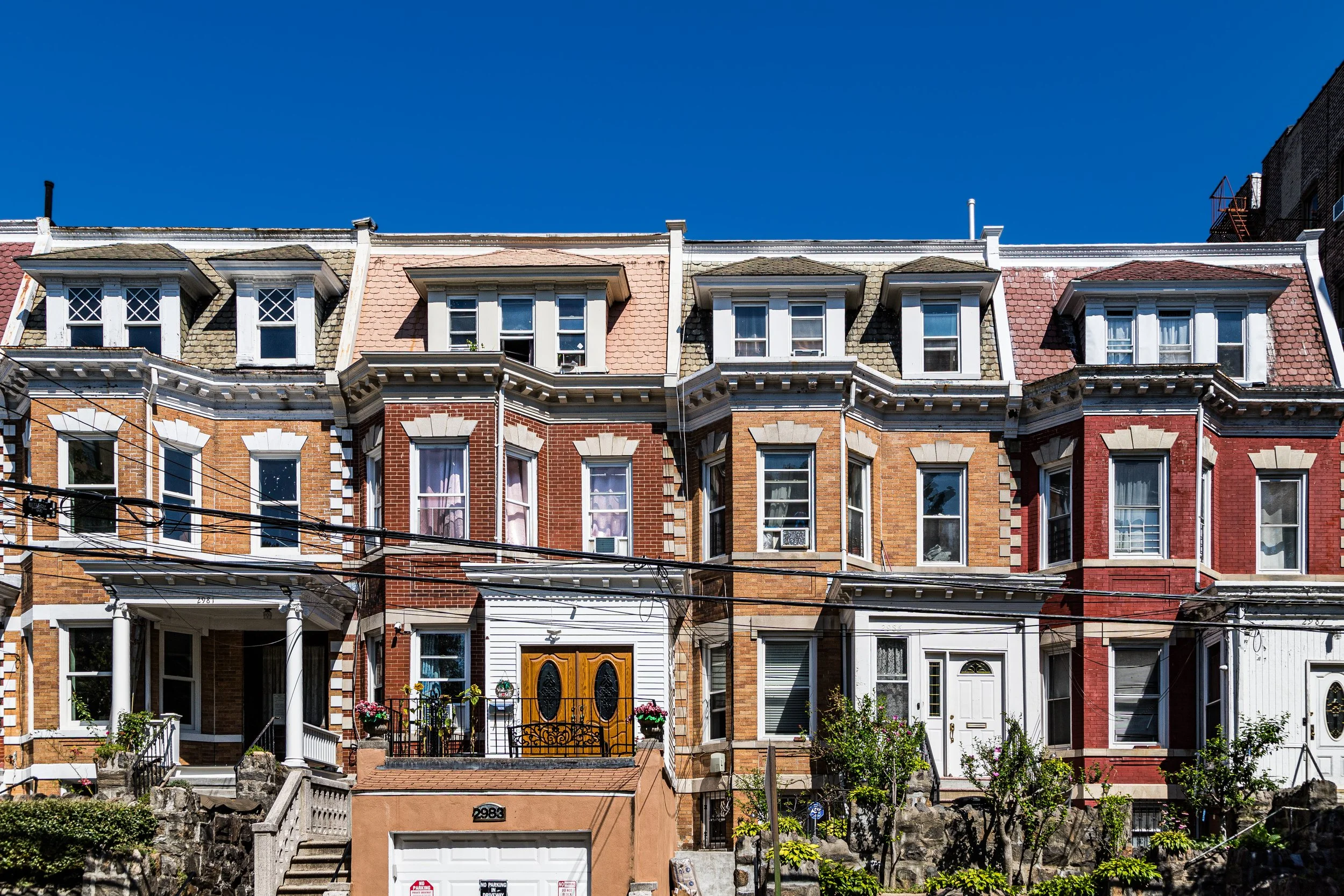
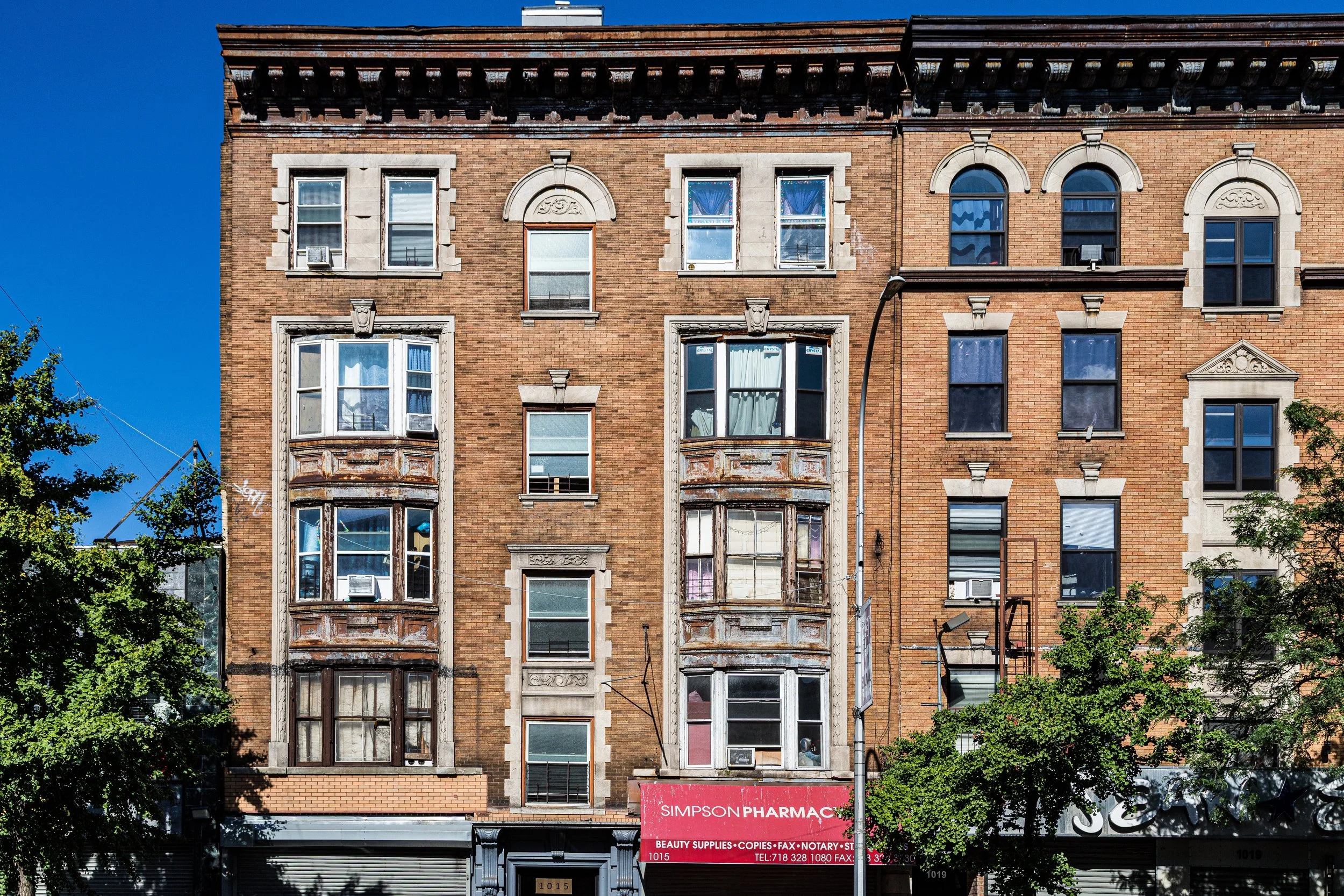
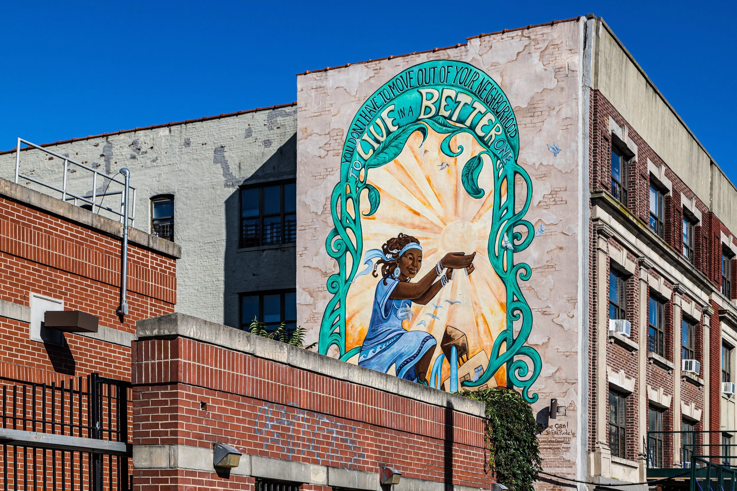
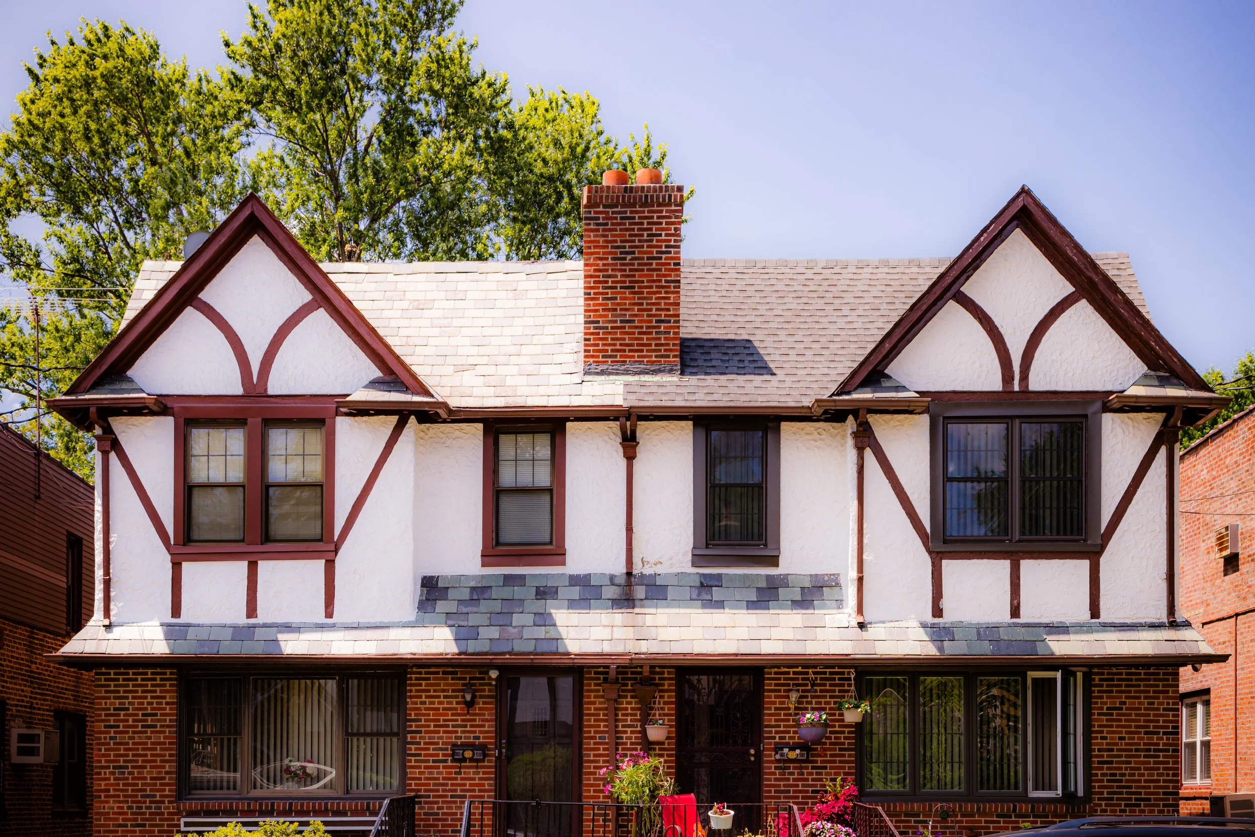
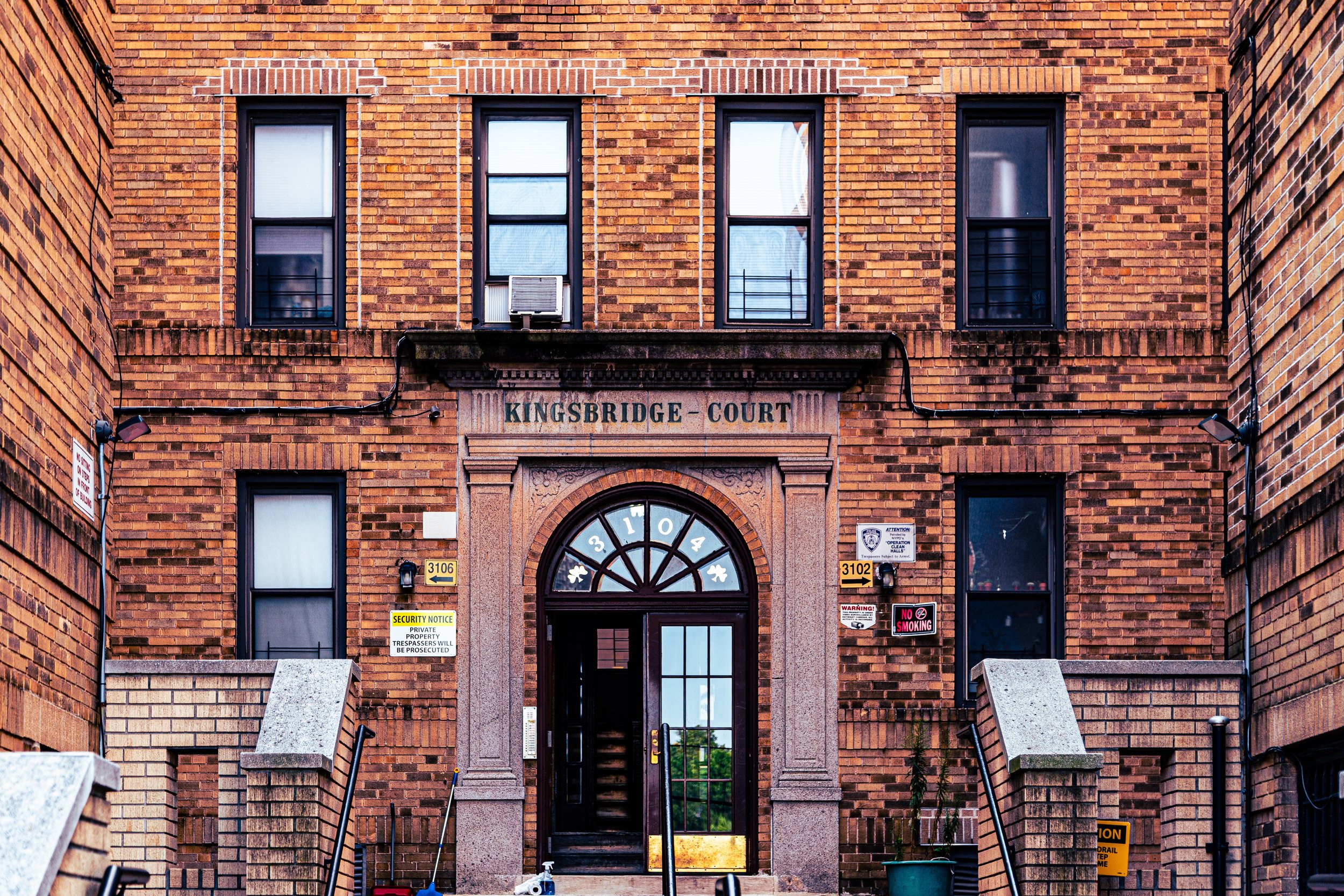
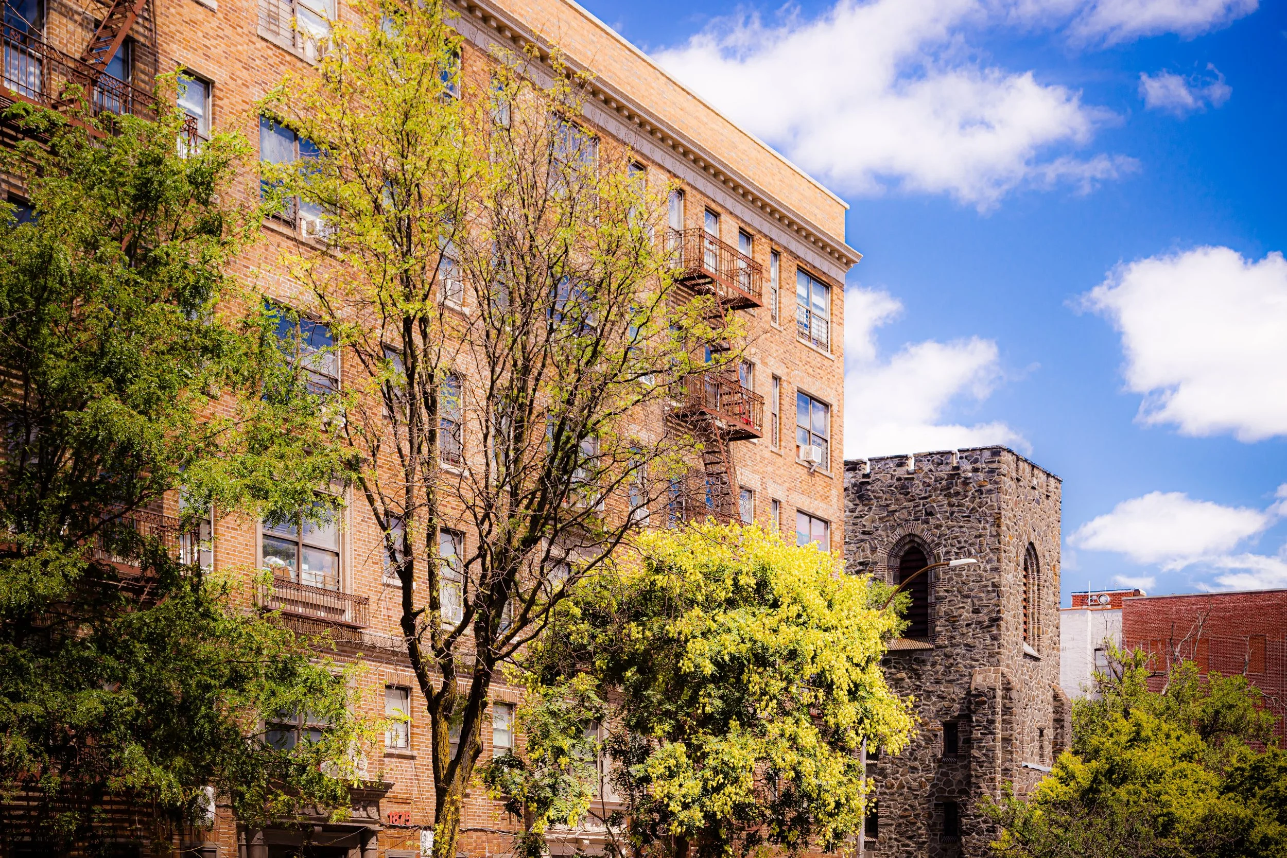
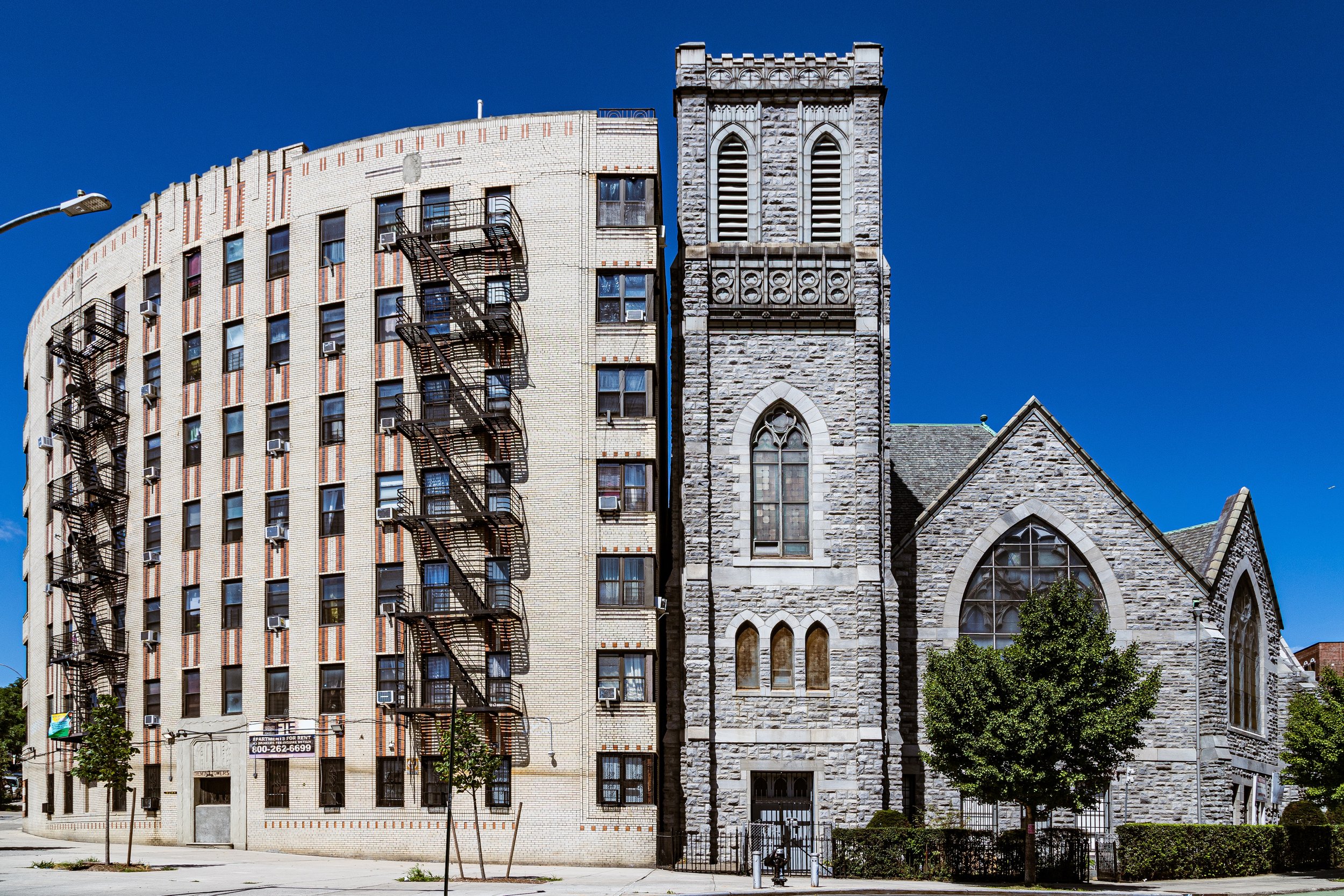
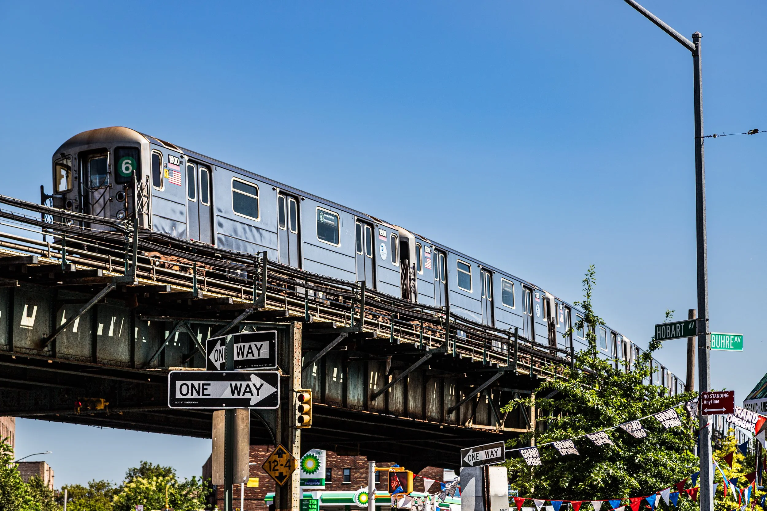
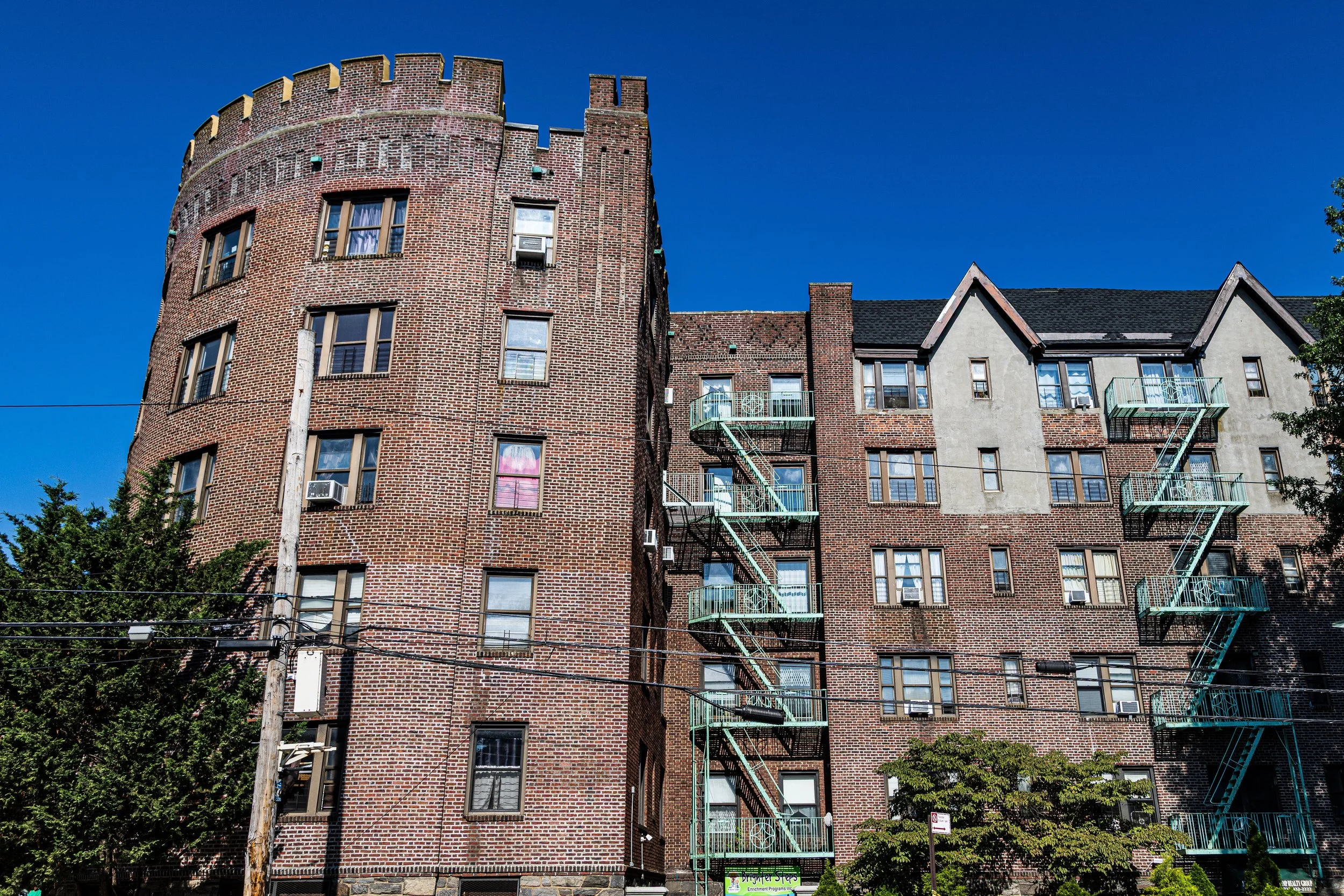
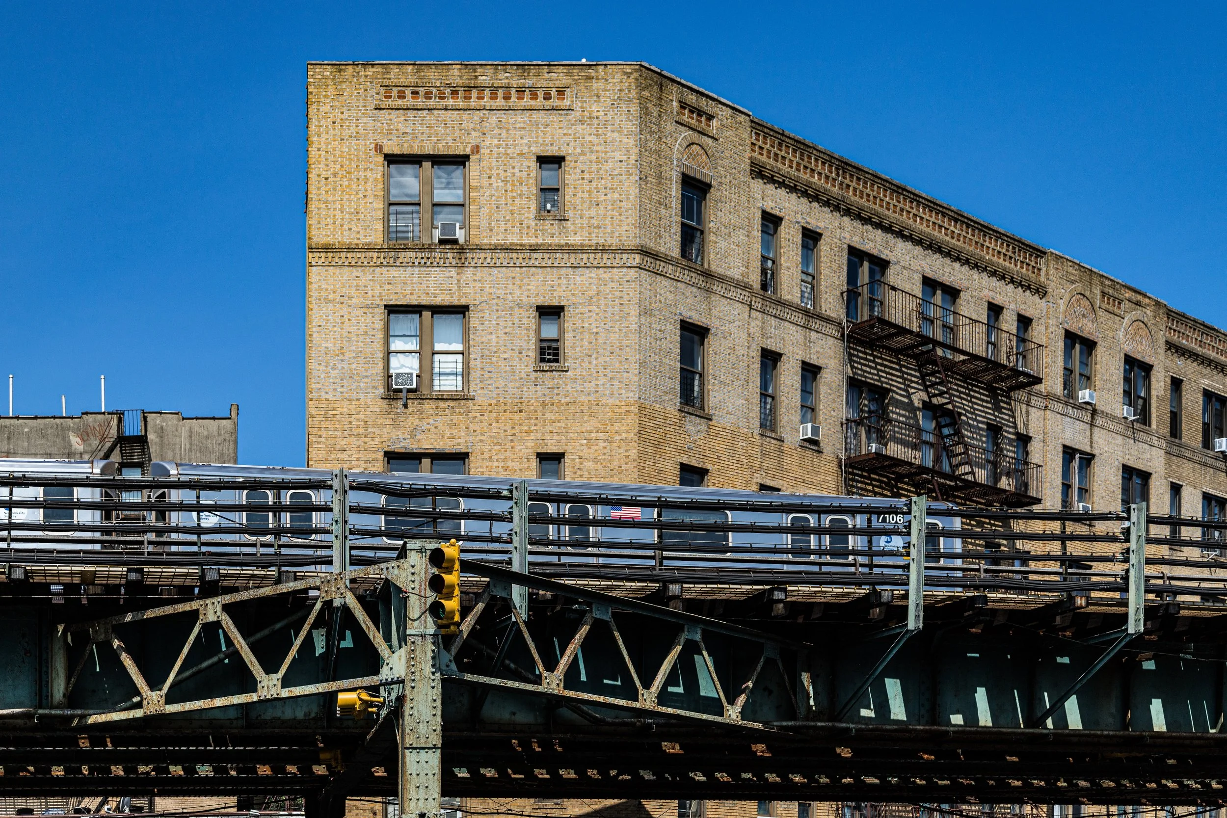
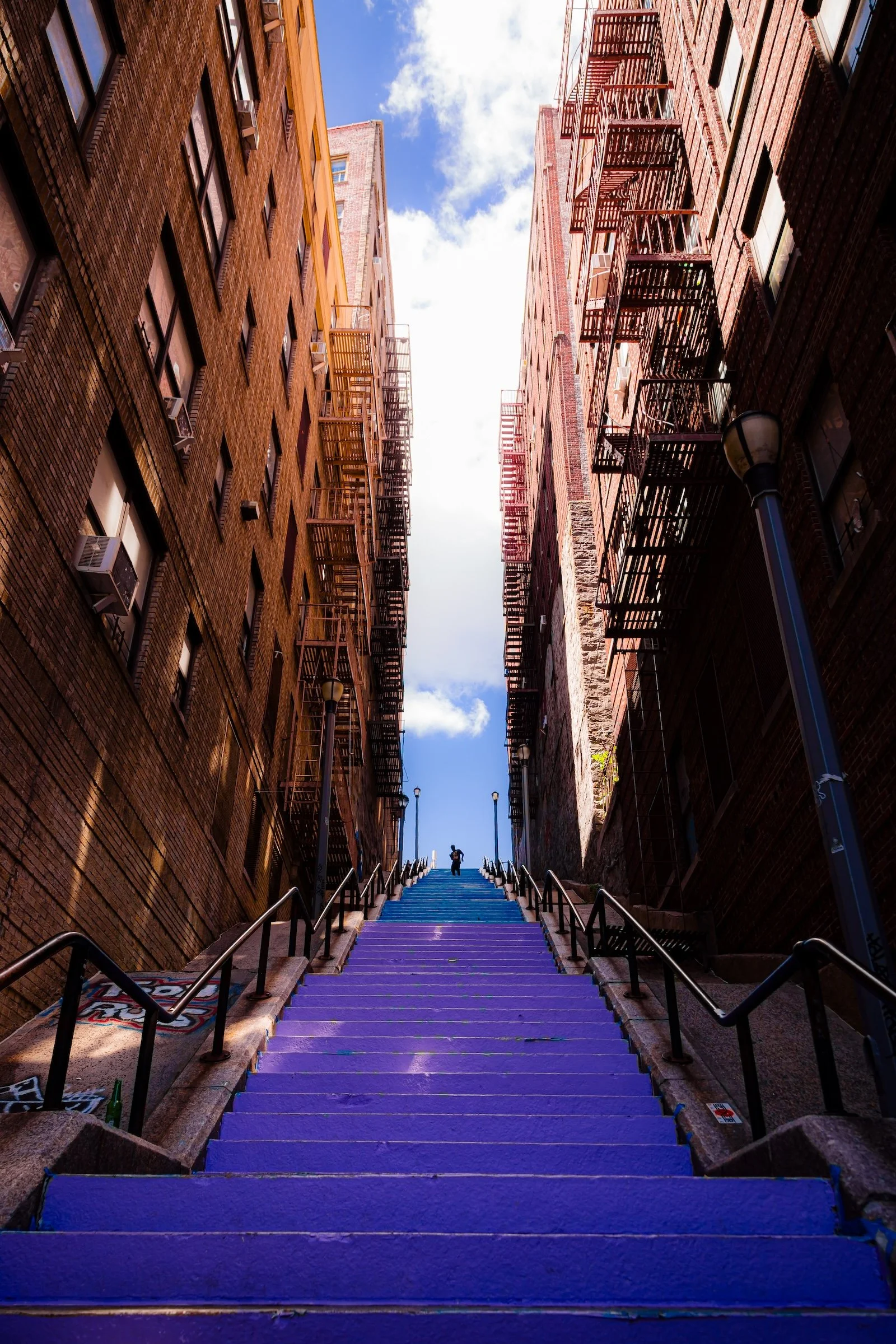
The Bronx has a visual language shaped by topography, infrastructure, and neighborhood texture. It is a borough of brick and stone, arches and stoops, hillsides and retaining walls, murals and shop signs, rail lines and stadium lights. Underpasses, overpasses, elevated tracks, and sweeping roads lend many neighborhoods a sense of drama and momentum, while garden fences, hillside steps, small porches, local bakeries, and narrow side streets soften that scale with intimacy.
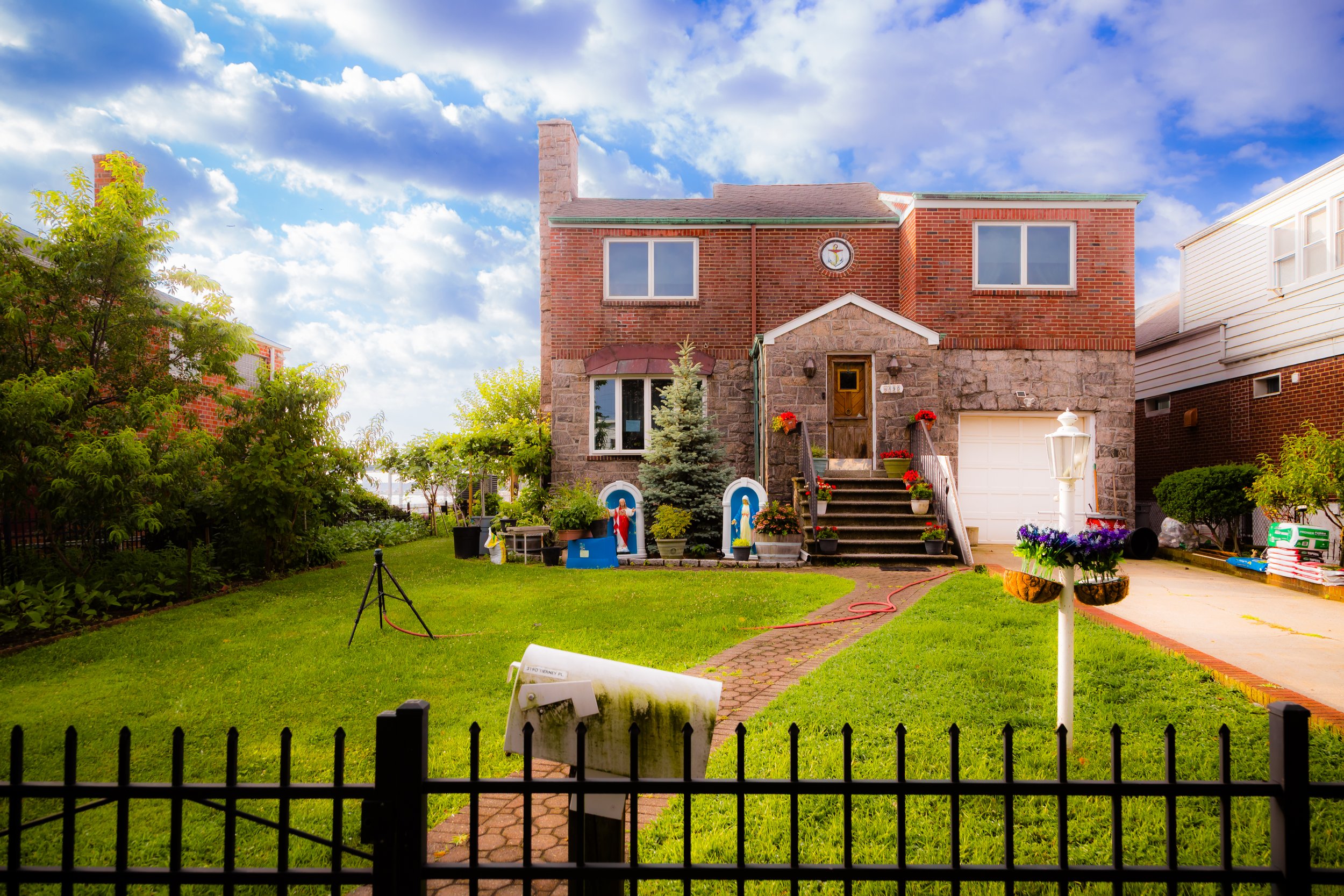
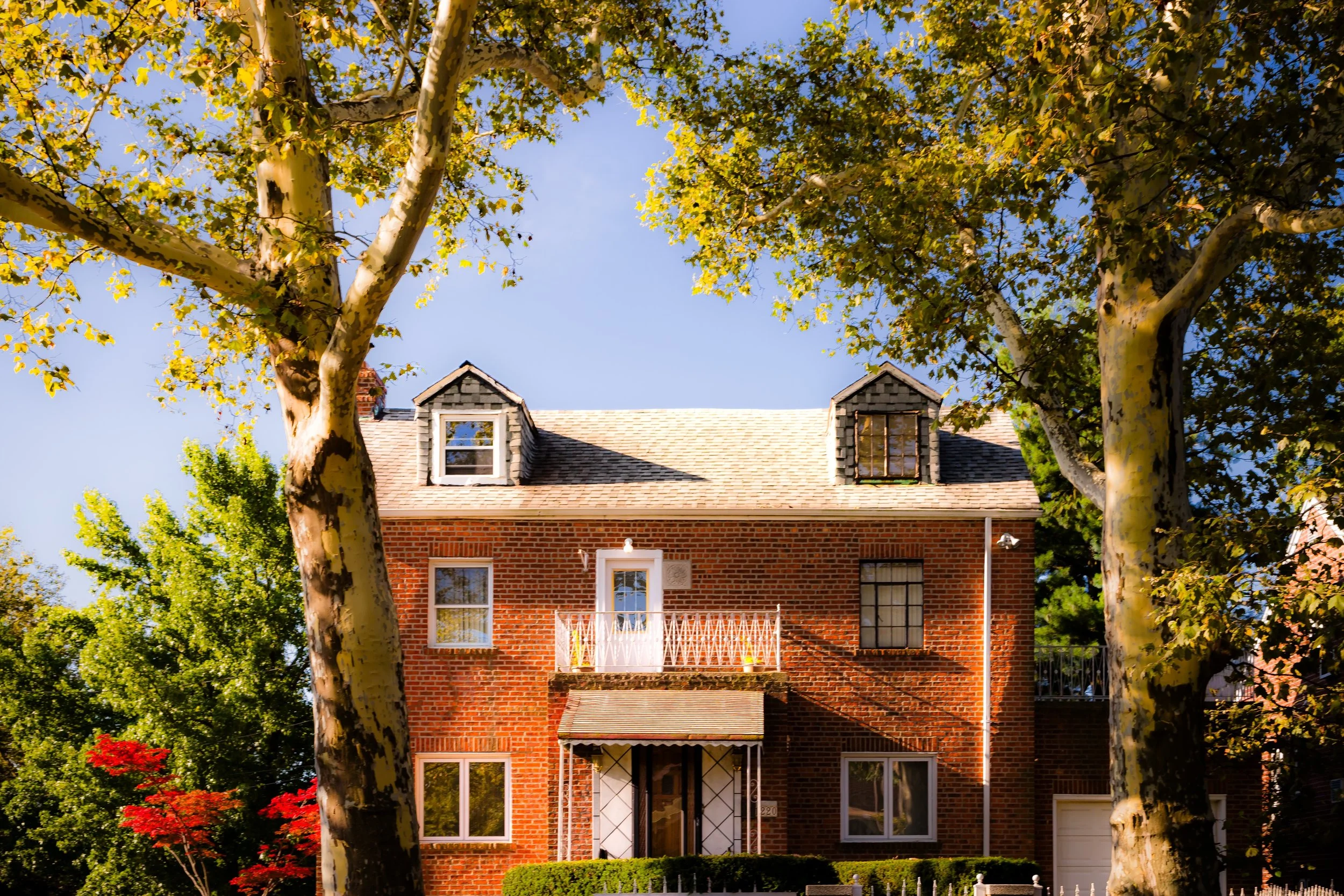
This interplay between monumentality and closeness is one of the borough’s defining visual qualities. Across the Bronx, apartment-lined corridors give way to detached homes, commercial avenues to wooded roads, and civic infrastructure to waterfront paths and quiet residential pockets. Its contrasts are immediate, its textures varied, and its visual presence bold without ever losing its local, lived character.
The Visual Identity of The Bronx
-

Dramatic Light & Shadow
-
Larger Than Life
-

Vibrant Colors
-

Painted Cityscapes
-
Repetition & Patterns
The Neighborhoods
The Bronx: where neighborhoods shift from grand boulevards and commercial storefronts to apartment-lined corridors and quiet residential hills, with winding roads through forests, walks along waterfront edges, and enduring village-like pockets. Explore the neighborhoods:
-
Bounded by Williamsbridge Road to the east, Waring Avenue to the south, Bronx Park East to the west, and Arnow Avenue to the north, Allerton lies at the northeastern heart of the Bronx—an enduring residential neighborhood defined by its ordered grid, low-rise architecture, and quiet civic rhythm.
-
Bounded by the New England Thruway (I-95) to the east, East Gun Hill Road to the southwest, Boston Road to the northwest, and East 222nd Street to the northeast, Baychester—known locally as “The Valley”—occupies a low-lying section of the northeastern Bronx, tucked between Edenwald, Wakefield, and Co-op City.
-
Bounded by East 198th Street to the southwest, the Grand Concourse to the northwest, Mosholu Parkway to the northeast, and Webster Avenue to the southeast, Bedford Park lies near the heart of the Bronx’s northern uplands—a neighborhood of shaded streets, prewar apartment houses, and quiet intellectual energy.
-
Belmont is bounded by Fordham Road to the north, Webster Avenue to the west, East 180th Street to the south, and Southern Boulevard / Bronx Park to the east.
-

Stretching from Gun Hill Road in the north to East 180th Street in the south, and from Webster Avenue on the west to the Bronx River Parkway and Bronxdale Avenue on the east, Bronx Park forms the natural heart of the borough.
-
Bounded by Pelham Parkway to the south, Bronx Park East to the west, Waring Avenue to the north, and Williamsbridge Road to the east, Bronx River forms a narrow, residential district that straddles the eastern edge of Bronx Park, defined both by its proximity to the park’s wooded slopes and by the river that gives it its name.
-
Bounded by Pelham Parkway to the south, Bronx Park East to the west, Waring Avenue to the north, and Williamsbridge Road to the east, Bronxwood forms a compact, residential enclave on the eastern shoulder of the Bronx’s central parkland.
-
Bounded by White Plains Road to the west, Lafayette Avenue to the north, and Westchester Creek to the south and east, Castle Hill occupies a peninsula-like rise in the southeastern Bronx—a neighborhood defined by both elevation and shoreline.
-
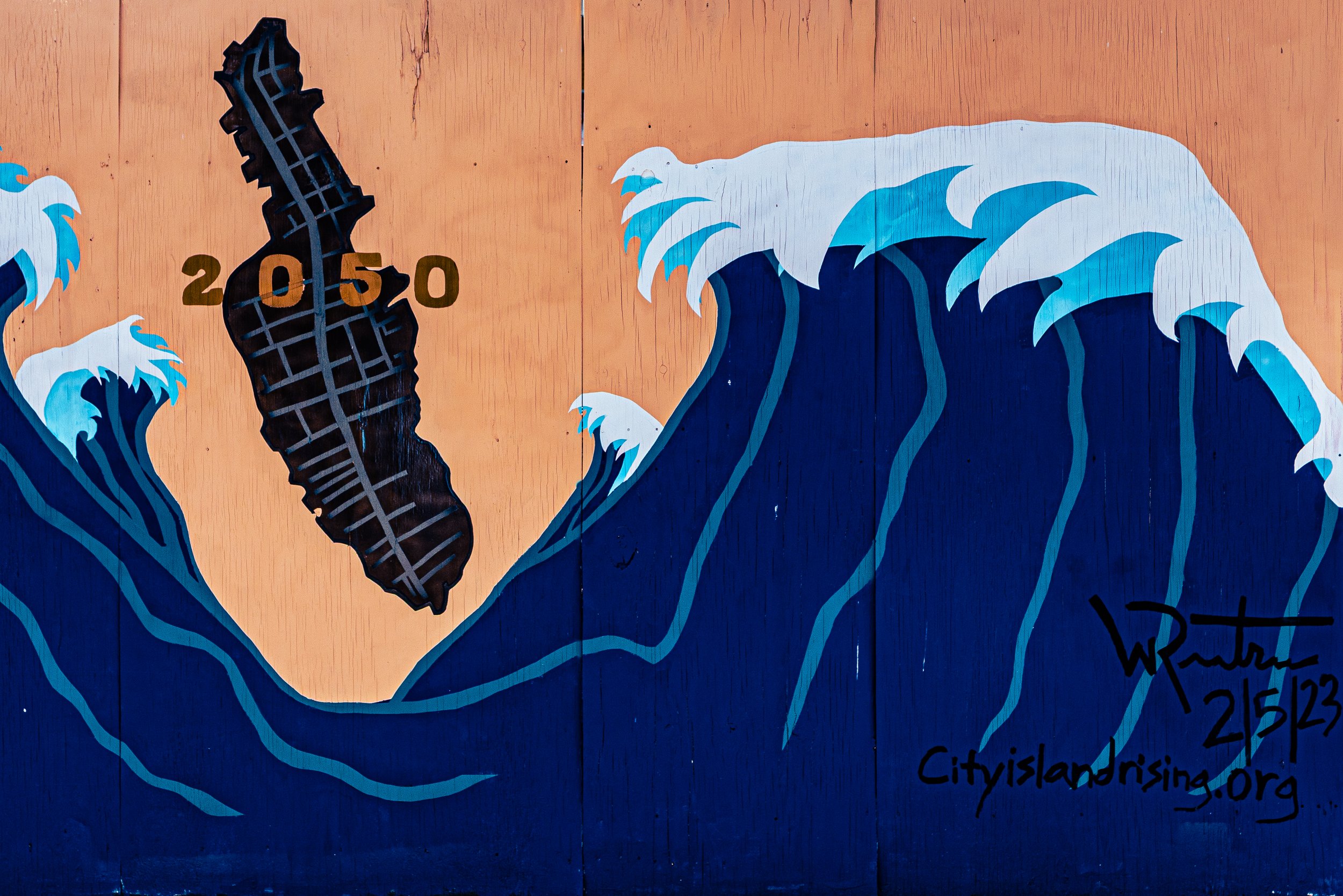
Set at the far northeastern edge of the Bronx and linked to the mainland by a single bridge across Eastchester Bay, City Island stands apart—physically, visually, and spiritually—from the rest of New York City.
-
Bounded by East 167th Street to the south, Grand Concourse to the west, the Cross Bronx Expressway to the north, then Fulton Avenue south to Claremont Parkway, east to Webster Avenue, and back down to E 167th Street, Claremont sits at the geographic center of the Bronx
-
Bounded by Grand Concourse to the west, Claremont Parkway to the north, Fulton Avenue to the east, and East 168th Street to the south, Claremont Village lies on the lower slope of the hill that rises toward Claremont Park, forming the southern half of the greater Claremont district.
-

Bounded by Lacombe Avenue to the north, Westchester Creek to the east, and Soundview Avenue and O’Brien Avenue to the west, Clason Point extends like a green-and-gray peninsula into the tidal confluence where the Bronx River meets the East River.
-
Bounded by East 167th Street to the north, Grand Concourse to the east, East 149th Street to the south, the Harlem River to the west, and Jerome Avenue curving along its northwest edge, Concourse occupies one of the most architecturally striking and symbolically important sections of the Bronx.
-
Bounded by East 149th Street to the south, Grand Concourse to the west, East 167th Street to the north, and Park Avenue and Morris Avenue to the east, Concourse Village occupies the very heart of the South Bronx
-
Situated in the far northeastern Bronx, Co-op City—short for Cooperative City—is bounded by Interstate 95 (the New England Thruway) to the west, Pelham Bay Park and Eastchester Bay to the east, the Hutchinson River Parkway and Hutchinson River to the south, and Baychester Avenue and Boston Road to the north.
-

Bounded by Layton Avenue to the south, the Bruckner Expressway to the west, Pelham Bay Park to the north, and Eastchester Bay to the east, Country Club occupies one of the Bronx’s quietest and most residential peninsulas—a green, waterfront enclave tucked between Pelham Bay and Throgs Neck.
-
Bounded by the Cross Bronx Expressway to the north, Sheridan Boulevard to the east, Freeman Street to the south, Louis Niñé Boulevard to the southwest, and Crotona Park to the west, Crotona lies in the geographic and emotional heart of the South Bronx.
-

Bounded by Crotona Park East and Prospect Avenue to the east, Fulton Avenue and Clinton Avenue to the west, Crotona Park North to the north, and Crotona Park South to the south, Crotona Park spans 127 acres in the central Bronx
-

Bounded by the Cross Bronx Expressway to the south, Webster Avenue to the west, East 180th Street to the north, and Southern Boulevard to the east, East Tremont occupies the central spine of the Bronx
-
Bounded by Co-op City Boulevard to the south, East 222nd Street to the southwest, Boston Road to the west, Westchester County to the north, and the Hutchinson River to the east, Eastchester occupies the far northeastern edge of the Bronx
-
Bounded by the Throgs Neck Expressway to the west, Layton Avenue to the north, the waters of Eastchester Bay to the east, and Weir Creek to the south, Eastchester Bay occupies a narrow, scenic strip of the southeastern Bronx where land and water blend in tidal rhythm.
-

Bounded by East 222nd Street to the south, Lacombe Avenue to the west, Bruner and Bussing Avenues to the northwest, the Westchester County line to the north, the 5-line subway tracks to the east, and Boston Road to the southeast, Edenwald marks the Bronx’s far northeastern frontier
-
Bounded by Riverdale Avenue to the southwest, the Henry Hudson Parkway to the west and north, Broadway to the east, and West 238th and West 240th Streets to the south, Fieldston occupies a lofty, secluded enclave on the western heights of the Bronx.
-
Bounded by Jerome Avenue to the west, Fordham Road to the north, Webster Avenue to the east, and East Burnside Avenue to the south, Fordham Heights occupies one of the Bronx’s most dynamic and densely populated uplands
-

Bounded by Bronx Park to the east, East Fordham Road to the south, the Harlem River to the west, and a northern border following East 225th Street and West Kingsbridge Road to the Grand Concourse, then east to East 198th Street and Southern Boulevard, Fordham Manor spans the heart of the central-west Bronx
-
Bounded by Sheridan Boulevard to the east, the Bruckner Expressway to the southeast, East 163rd Street and Prospect Avenue to the south, Crotona Park to the northwest, Louis Niñé Boulevard to the northeast, and Freeman Street to the north, Foxhurst occupies a compact section of the South Bronx defined by its convergence of rail lines, parklands, and historic boulevards.
-
Bounded by O’Brien Avenue to the north, Bolton Avenue to the east, and the Bronx River curving around its southern and western edges, Harding Park occupies a quiet, peninsular pocket of the Soundview section of the Bronx.
-
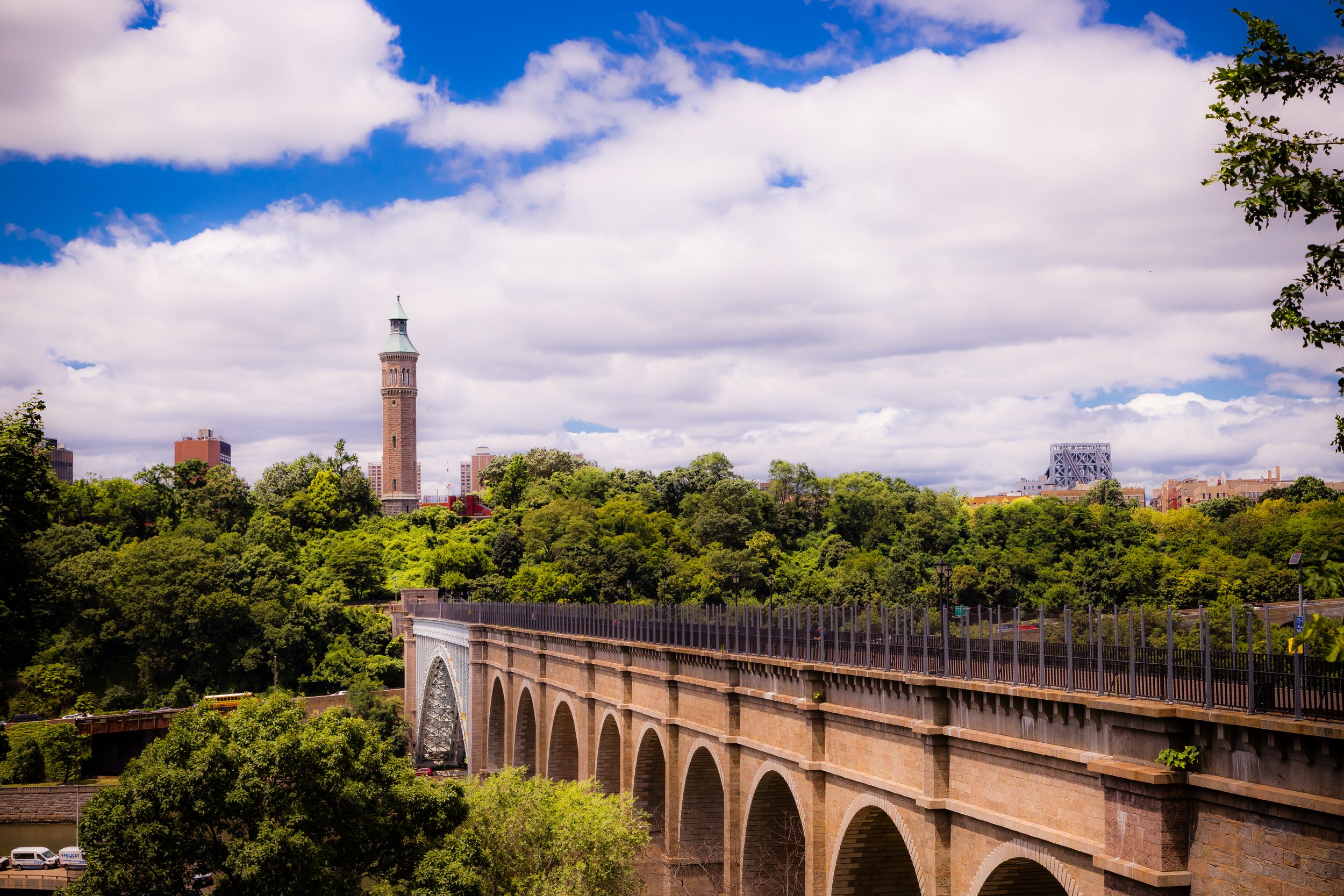
Bounded by the Washington Bridge to the north, Edward L. Grant Highway to the northeast, Jerome Avenue curving along its eastern and southern borders, and the Harlem River to the west, Highbridge occupies one of the Bronx’s most historic and topographically dramatic settings.
-
Bounded by Tiffany Street, Randall Avenue, and Leggett Avenue to the west, the Bruckner Expressway to the north, the Bronx River to the east, and the East River to the south, Hunts Point occupies a distinct peninsula in the southeastern Bronx
-
Bounded by Tiffany Street, Randall Avenue, and Leggett Avenue to the west, the Bruckner Expressway to the north, the Bronx River to the east, and the East River to the south, Hunts Point occupies a distinct peninsula in the southeastern Bronx—an industrial, maritime, and residential district whose geography has shaped both its economy and its identity for over two centuries.
-

Bounded by Williamsbridge Road to the west, Pelham Parkway to the north, Seminole Avenue to the east, and Morris Park Avenue to the south, Indian Village forms a serene, residential enclave within the larger Morris Park section of the Bronx.
-
Bounded by Broadway to the east, West 230th Street to the south, Riverdale Avenue to the west, West 238th Street to the northwest, and West 240th Street to the north, Kingsbridge occupies a vital crossroads between the uplands of Riverdale and the lower Harlem River valley.
-
Kingsbridge Heights is bounded by the Grand Concourse to the east, Kingsbridge Road to the south, Broadway to the west, and a northern line following West 231st Street east to Albany Crescent, then along Kingsbridge Terrace to the Jerome Park Reservoir and Bedford Park Boulevard.
-

Bounded by Boston Road to the northwest, East Gun Hill Road to the north, the IRT 5 train line (the Dyre Avenue branch) to the southeast, and Williamsbridge Road to the west, Laconia occupies a distinctive residential stretch in the northeastern Bronx
-
Bounded by Harding Avenue and the Throgs Neck Bridge approach to the north, the East River to the south and east, and Hammond Creek to the west, Locust Point occupies one of the Bronx’s most secluded and maritime corners
-
Bounded by East 163rd Street to the north, Prospect Avenue to the west, East 149th Street to the south, and the Bruckner Expressway to the southeast, Longwood occupies the southeastern section of the South Bronx—a neighborhood defined by its historic brownstone architecture, broad tree-lined avenues, and powerful legacy of resilience.
-

Bounded by Prospect Avenue to the east, East 149th Street to the south, Morris Avenue to the west, Park Avenue to the northwest, and East 163rd Street to the north, Melrose sits at the very heart of the South Bronx
-
Bounded by the Harlem River to the west, West 179th Street to the north, Jerome Avenue to the east, and the Cross Bronx Expressway to the south, Morris Heights occupies a dramatic stretch of the western Bronx
-

Bounded by Stillwell Avenue and Eastchester Road to the east, Sackett Avenue to the southeast, Bronxdale Avenue to the southwest, the IRT 5 train line to the northwest, and Pelham Parkway to the north—with the area surrounding Indian Village carved out as its own enclave—Morris Park forms one of the Bronx’s most distinct and enduringly tight-knit neighborhoods.
-
Bounded by Crotona Park to the north, Prospect Avenue to the northeast and east, East 163rd Street to the south, and a western border running north from East 161st Street along Park Avenue to East 168th Street, then east to Fulton Avenue, and back north to Crotona Park, Morrisania sits at the geographical and symbolic heart of the Bronx.
-
Bounded by Broadway and Van Cortlandt Park to the east, West 254th Street to the south, Riverdale Avenue to the west, and the Westchester County line to the north, Mosholu occupies a serene and wooded corner of the northwestern Bronx.
-
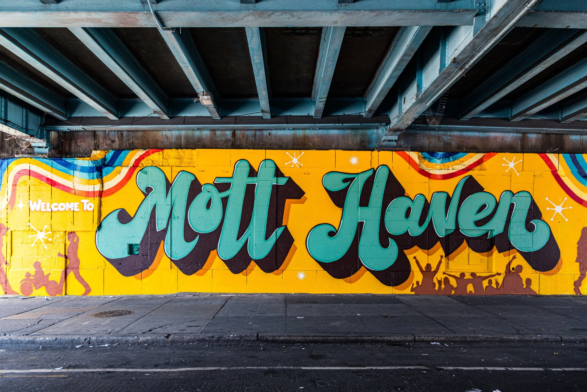
Bounded by East 135th Street to the south, the Harlem River to the west, East 149th Street to the north, and the Bruckner Expressway to the east, Mott Haven occupies the southwestern corner of the Bronx
-

Bounded by the Cross Bronx Expressway to the north, Grand Concourse to the east, East 167th Street to the south, and the Edward L. Grant Highway to the west, Mount Eden occupies a steeply sloping section of the West Bronx, rising between the Harlem River valley and the upland plateau that forms the borough’s central spine.
-
Bounded by the Cross Bronx Expressway to the south, Jerome Avenue to the west, East Burnside Avenue to the north, and Webster Avenue to the east, Mount Hope lies within the central-west Bronx, a compact but deeply storied neighborhood perched on the sloping terrain between the Harlem River valley and the elevated Grand Concourse district.
-
Bounded by Riverdale Avenue to the east, West 254th Street to the south, the Hudson River to the west, and the Westchester County line to the north, North Riverdale forms the Bronx’s northernmost neighborhood—a tranquil, leafy enclave perched atop the Hudson’s eastern bluffs.
-
Bounded by Webster Avenue to the southeast, East Mosholu Parkway to the southwest, West Gun Hill Road and Jerome Avenue to the northwest, and Van Cortlandt Park to the north, Norwood lies at the geographic center of the Bronx yet feels distinctly village-like—a pocket of calm framed by parkland, parkways, and stately prewar architecture.
-
Bounded by East Gun Hill Road to the north, Boston Road to the east, Arnow Avenue to the south, and Bronx Park East to the west, Olinville occupies a quiet, largely residential section of the northeastern Bronx nestled between Bronx Park and Williamsbridge.
-
Bounded by the Throgs Neck Expressway to the south and west, Weir Creek to the north, and Eastchester Bay to the east, Park of Edgewater—often locally shortened to Edgewater Park—occupies a tranquil peninsula at the southeastern edge of the Bronx.
-

Bounded by East Tremont Avenue to the north, Castle Hill Avenue to the east, Westchester Avenue to the south, and the Cross Bronx Expressway to the southwest, Parkchester occupies a central position in the East Bronx—a self-contained residential community distinguished by its geometric street plan, monumental courtyards, and enduring sense of order amid the surrounding urban sprawl.
-
Bounded by Middletown Road to the south, Water Place to the southwest, Eastchester Road to the west, and the Bronx and Pelham Parkway to the north, Pelham Bay occupies a key position in the northeastern Bronx, bridging the densely built mid-Bronx neighborhoods and the open parklands that lead toward the coast.
-
Bounded by Amtrak rail lines and Middletown Road to the south, Pelham Parkway and Eastchester Bay to the west, the Long Island Sound to the east, and Westchester County to the north, Pelham Bay Park spans a breathtaking 2,772 acres—making it New York City’s largest park, nearly three times the size of Central Park.
-
Bounded by East Gun Hill Road to the northeast, Stillwell Avenue to the southeast, Pelham Parkway to the south, and The Esplanade to the west, Pelham Gardens lies within the northeastern Bronx, an orderly and verdant neighborhood defined by tree-lined streets, manicured lawns, and a quiet residential rhythm that reflects its name.
-
Bounded by the 5 train tracks to the east, Bronxdale Avenue to the south, Bronx River East to the west, and Pelham Parkway South to the north, Pelham Parkway occupies a serene yet vital corridor in the central-northeastern Bronx.
-
Bounded by the Major Deegan Expressway to the north, the Bruckner Expressway to the northwest, Leggett Avenue to the northeast, Tiffany Street to the east, the East River to the southeast, the Bronx Kill to the south, and the Harlem River to the southwest, Port Morris occupies the southernmost tip of the Bronx—a low-lying industrial peninsula that juts into the confluence of three waterways.
-

Bounded by West 254th Street to the north, the Henry Hudson Parkway to the east, West 232nd Street to the south, and the Hudson River to the west, Riverdale occupies the northwestern crown of the Bronx
-
Bounded by Middletown Road to the north, the Bruckner Expressway to the east and southeast, and Westchester Creek to the west, Schuylerville occupies a compact but distinctive pocket in the East Bronx—an enclave that bridges the dense residential grid of Pelham Bay and Westchester Square with the water’s edge along Westchester Creek.
-
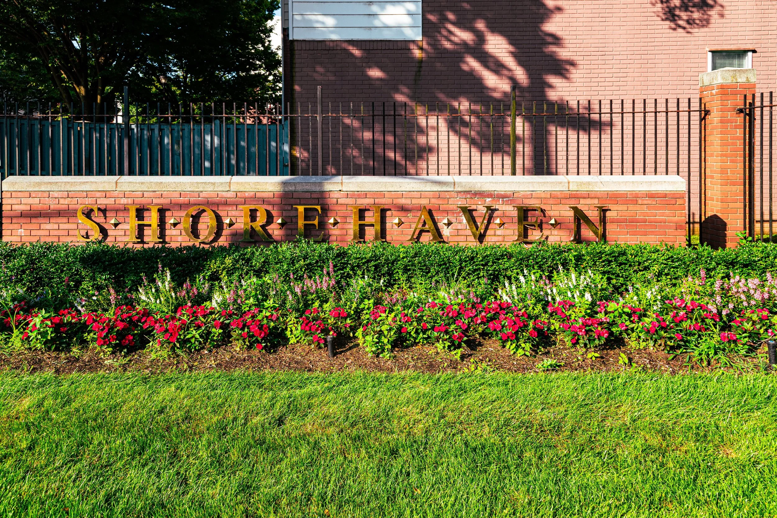
Bounded by Bolton Avenue to the west, Gildersleeve Avenue to the north, Soundview Avenue to the northeast, and the East River to the south, Shorehaven occupies a secluded waterfront stretch along the southeastern edge of the Bronx.
-

Bounded by Hollywood Avenue to the west, Shurz Avenue and Mullan Place to the north, Hammond Creek to the east, and the East River to the south and southwest, Silver Beach occupies one of the most secluded and picturesque corners of the Bronx
-
Bounded by Westchester Avenue to the north, White Plains Road to the east, Lacombe Avenue to the south, Soundview Park to the southeast, and the Bronx River to the west, Soundview occupies a broad, low-lying tract of the southeastern Bronx where the city’s urban grid meets the tidal waters of the East River estuary.
-
Bounded by Lafayette Avenue and Bronx River Avenue to the north and west, Clason Point to the southeast, and the Bronx River and East River estuaries along its eastern and southern shores, Soundview Park spans over 200 acres of salt marsh, tidal shoreline, ballfields, and meadowlands at the southernmost tip of the Bronx.
-
Bounded by West 232nd Street to the north, Riverdale Avenue to the east, Marble Hill across Irwin and Johnson Avenues to the southeast, Spuyten Duyvil Creek to the south, and the Hudson River to the west, Spuyten Duyvil occupies one of the Bronx’s most dramatic natural landscapes—a promontory of steep hills and wooded slopes overlooking the confluence of the Harlem and Hudson Rivers.
-
Bounded by the Cross Bronx Expressway and Bruckner Expressway to the north, the Throgs Neck Expressway to the east, Mullan Place and Shurz Avenue to the southeast, the East River to the south, and Westchester Creek to the west, Throggs Neck occupies a long, tapering peninsula extending into the waters of the East River at the southeastern edge of the Bronx.
-

Bounded by Westchester Avenue to the north, Westchester Creek to the east, Lafayette Avenue to the south, and White Plains Road to the west, Unionport occupies a compact and historically layered section of the southeastern Bronx—nestled between Parkchester, Soundview, and Castle Hill.
-
Bounded by West Fordham Road to the north, Jerome Avenue to the east, West 179th Street to the south, and the Harlem River to the west, University Heights occupies one of the Bronx’s most striking landscapes—a steep, elevated plateau that rises dramatically from the Harlem River’s edge to the ridge along University Avenue.
-
Bounded by Van Cortlandt Park South to the south, Broadway and the Henry Hudson Parkway to the west, Jerome Avenue and the Major Deegan Expressway to the east, and Westchester County to the north, Van Cortlandt Park encompasses more than 1,140 acres—making it the third-largest park in New York City and the green heart of the Bronx.
-
Bounded by Broadway to the west, Van Cortlandt Park to the north, the Jerome Park Reservoir to the east, Kingsbridge Terrace to the southeast, Albany Crescent to the south, and West 231st Street to the southwest, Van Cortlandt Village occupies one of the Bronx’s most elevated and scenic enclaves
-
Van Nest occupies a compact and historic enclave in the central Bronx, bounded by Bronxdale Avenue to the northeast, East Tremont Avenue to the southeast, the Cross Bronx Expressway to the south, the Bronx River to the west, and Bronx Park to the northwest.
-

Bounded by East 222nd Street to the south, the Bronx River to the west, Westchester County to the north, and an eastern border running along Bussing Avenue southwest to Bruner Avenue, then southeast to Laconia Avenue, and south again to East 222nd Street, Wakefield marks the Bronx’s northernmost neighborhood—a place where New York City yields to the towns of Mount Vernon and Yonkers.
-
Bounded by the Bronx River to the east, the Cross Bronx Expressway to the south, Southern Boulevard to the west, and Bronx Park to the north, West Farms stands at the historical and geographical heart of the Bronx—a neighborhood both ancient in its origins and enduring in its character.
-

Bounded by Westchester Creek to the east, Waterbury Avenue to the south, Castle Hill Avenue to the west, and the Amtrak and MTA rail lines to the north, Westchester Square lies at the crossroads of the eastern Bronx—a historic and enduring commercial and civic hub that has served as the heart of this region for nearly four centuries.
-
Bounded by East 222nd Street to the north, Boston Road to the east, East Gun Hill Road to the south, and the Bronx River Parkway to the west, Williamsbridge lies in the heart of the northeast Bronx—a residential and historically rich neighborhood shaped by both its proximity to the Bronx River and its enduring sense of community.
-
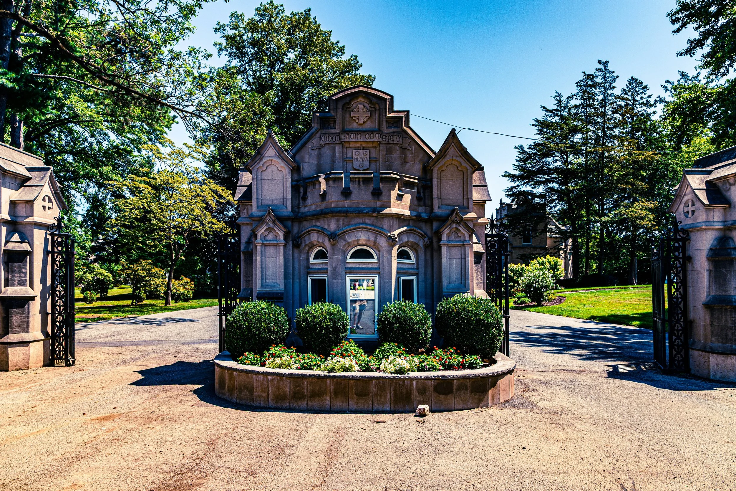
Situated in the northern Bronx and bordered by Webster Avenue to the west, East 233rd Street to the south, Jerome Avenue and Van Cortlandt Park East to the west and northwest, and The Bronx River Parkway to the east, Woodlawn Cemetery spans more than 400 acres of rolling hills, curving drives, and monumental artistry.
-

Bounded by Webster Avenue to the east, East 233rd Street to the south, Van Cortlandt Park East to the northwest, and Westchester County to the north, Woodlawn Heights—often simply called Woodlawn—occupies the Bronx’s northernmost hilltop enclave, perched between Van Cortlandt Park and the City of Yonkers.
The History
17th–18th Century: Colonial Frontier and Revolutionary Ground
Under Dutch and then English rule, the region developed as a collection of estates and small farming communities. Wealthy merchants from Manhattan built country seats along the Harlem River and the East River, while tenant farmers cultivated the interior lands. The British conquest of New Netherland in 1664 folded the area into the colony of New York, and by the 18th century, it was home to manors such as Morrisania, Van Cortlandt, and DeLancey, whose family names still mark neighborhoods and parks.
During the American Revolution, The Bronx’s position made it a theater of war. The Battle of Pell’s Point (1776), fought near today’s Pelham Bay Park, delayed British forces advancing toward White Plains and allowed Washington’s army to regroup. Skirmishes and encampments occurred throughout the borough; farmhouses and bridges were burned, and the population scattered. When peace came, many estates lay in ruins, yet the land’s fertility and proximity to Manhattan ensured its renewal.
The 19th century brought transformation and incorporation. The arrival of the Harlem Railroad (1841) and later the New York and Harlem Railroad opened the area to commuters, merchants, and industry. Wealthy New Yorkers built country estates in Riverdale, Fieldston, and Spuyten Duyvil, where the bluffs commanded panoramic views of the Hudson. Meanwhile, working-class villages such as Mott Haven, Port Morris, and Tremont grew around factories, lumberyards, and breweries that flourished along the Harlem River.
By the 1870s, industrialization had reshaped the southern Bronx, while the north retained its pastoral calm. The construction of the Third Avenue Elevated Line (1888) and later the subway extensions (1904–1920s) linked the borough to Manhattan, spurring massive residential growth. Immigrant families—Irish, German, Jewish, Italian—flocked to new neighborhoods such as Morrisania, Belmont, and Melrose, seeking light, air, and affordable rents.
In 1874, the western portion of The Bronx was annexed to New York City; the eastern half followed in 1895, and in 1914, the borough officially became the fifth and final division of Greater New York. Its name—the only borough preceded by “The”—stood as both grammatical curiosity and proud distinction.
19th Century: Estates, Industry, and Annexation
Early–Mid 20th Century: Borough of Hope and Hardship
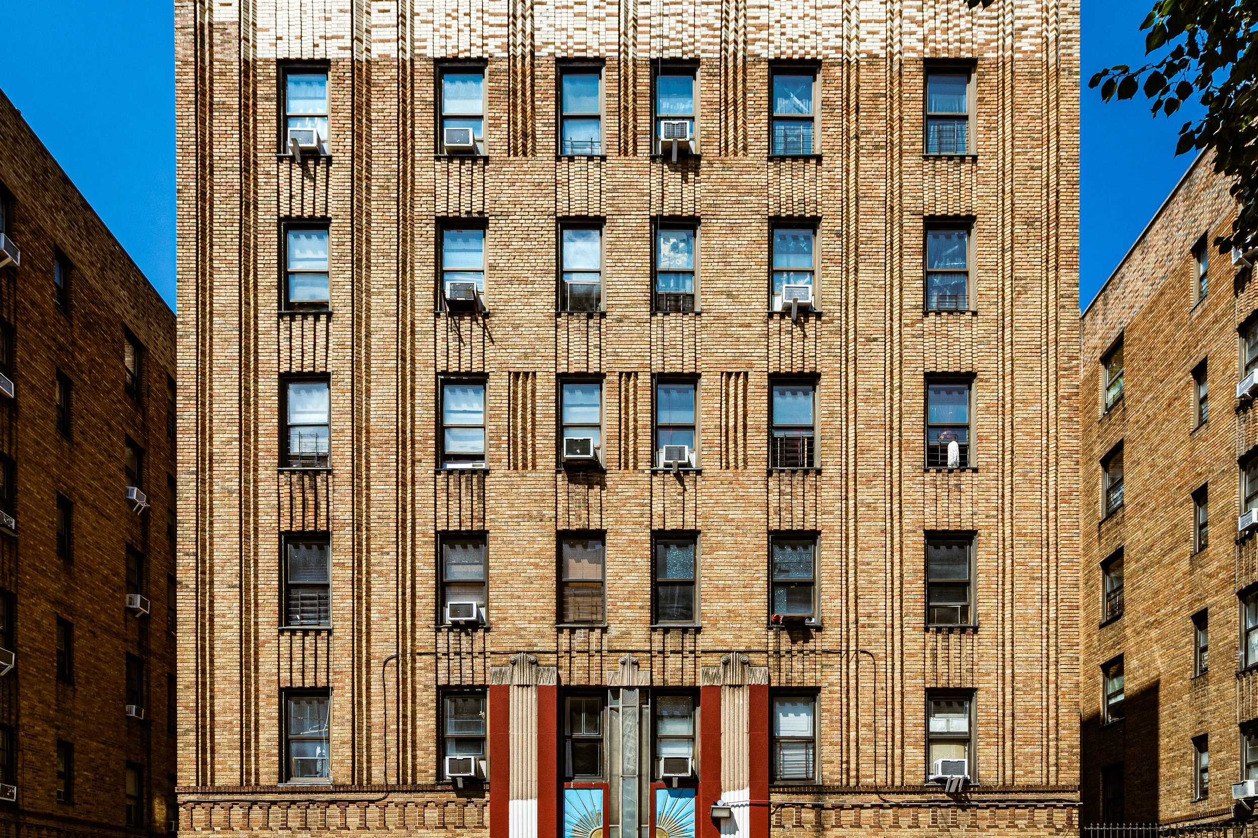
The first half of the 20th century was The Bronx’s golden age. Immigrants and their children built a dense yet livable urban fabric of five-story walk-ups, art deco apartment houses, and thriving commercial streets. The Grand Concourse, modeled after Paris’s boulevards and completed in 1909, became the borough’s showpiece—a sweeping avenue lined with theaters, shops, and modern apartments that symbolized middle-class aspiration.
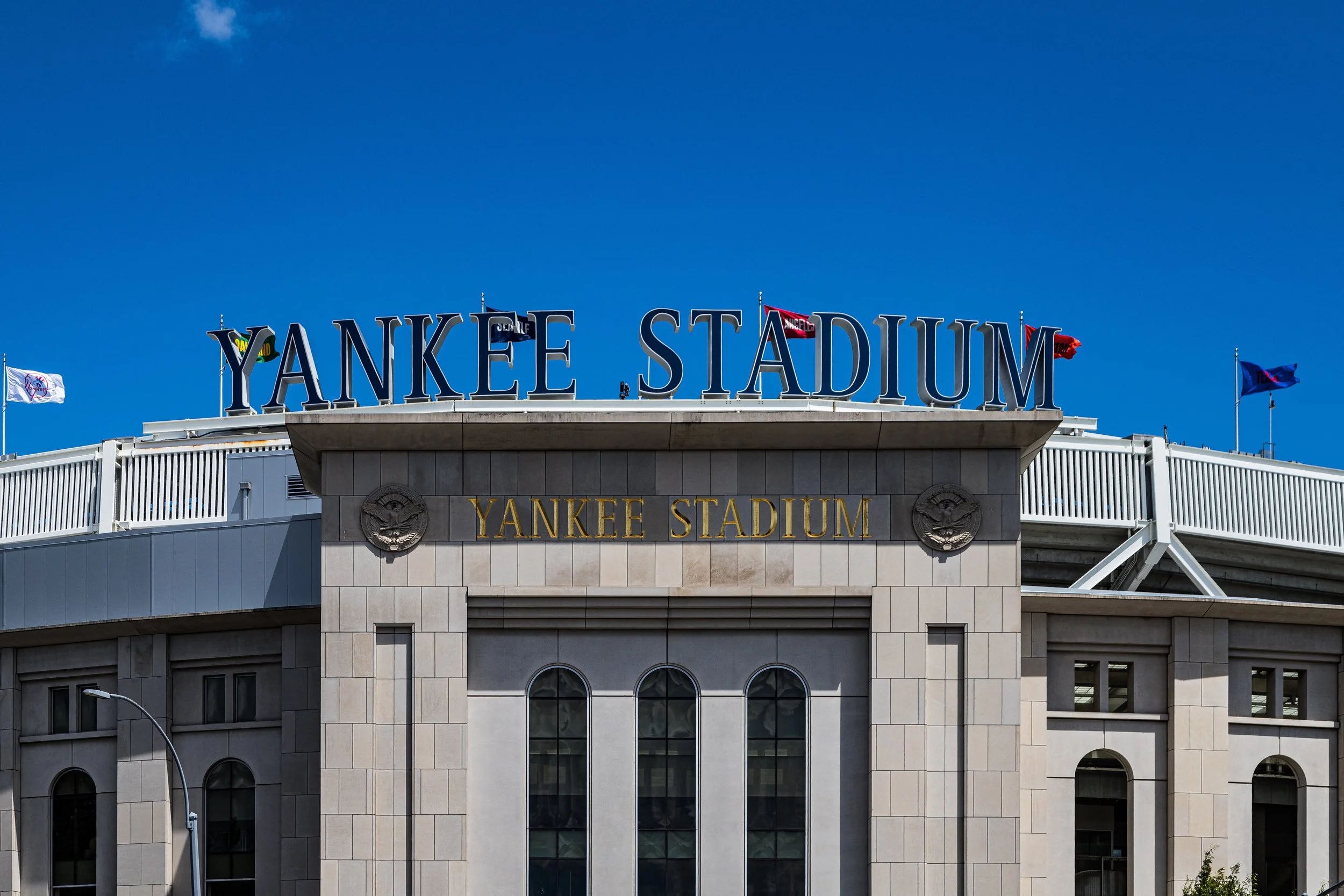
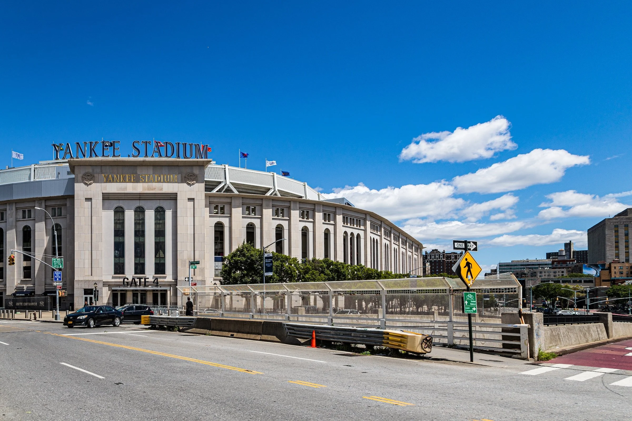
The borough also became an epicenter of culture. Yankee Stadium, “The House That Ruth Built” (1923), rose in Highbridge, becoming a national shrine to baseball. In the Belmont and Arthur Avenue district, Italian bakers and butchers built what remains New York’s most authentic “Little Italy.” The Bronx Zoo (1899) and the New York Botanical Garden (1891) turned Bronx Park into a center of conservation and science.
But prosperity proved fragile. Postwar years brought waves of change—suburban flight, disinvestment, and the construction of Robert Moses’s Cross Bronx Expressway (1948–1972), which carved a scar through once-stable neighborhoods and displaced thousands. Fires, arson, and abandonment ravaged the South Bronx in the 1970s, transforming it into a national symbol of urban decline.
Yet even amid crisis, creativity thrived. In community centers and park jams around Sedgwick Avenue, a new cultural form took shape: hip-hop. DJs like Kool Herc, MCs like Grandmaster Flash, and breakdancers turned desolation into art, giving birth to a global movement that would redefine music and urban expression. The Bronx, written off by outsiders, reinvented itself through rhythm and resistance.
Late 20th–21st Century: Renewal, Diversity, and Cultural Power
Beginning in the 1980s, grassroots activism, community development, and public investment sparked a long recovery. Residents rebuilt block by block, forming tenant associations, cooperatives, and community gardens where buildings had burned. The South Bronx—once shorthand for despair—became a laboratory for urban resilience. New housing rose on the ruins of the old, while cultural institutions like the Bronx Museum of the Arts (founded 1971) and the Pregones Theater celebrated local creativity.
Demographically, the borough evolved into one of the most diverse in the nation. Latino communities—Puerto Rican, Dominican, Mexican—joined African American, West African, and South Asian residents to form a vibrant multicultural tapestry. The Bronx’s linguistic and culinary diversity—pastelillos beside pizza, bachata beside jazz—reflects the borough’s global character.
Environmental restoration accompanied social renewal. Bronx River Park, once polluted and neglected, was revived through community activism and now features greenways, kayaking routes, and restored wetlands. Yankee Stadium, rebuilt in 2009, anchors both history and renewal. Hunts Point—once dominated by warehouses—has become a hub of urban farming and sustainability initiatives. Meanwhile, higher education institutions like Fordham University, Lehman College, and the College of Mount Saint Vincent sustain the borough’s intellectual vitality.
Spirit and Legacy
The Bronx’s legacy is endurance forged in fire. No other borough so fully embodies the cycle of rise, fall, and rebirth that defines New York itself. From pastoral estates to industrial might, from abandonment to artistry, The Bronx has turned adversity into identity. It remains the city’s conscience—tough, proud, creative, and unbreakable.
The Photography
Visual Rhythm
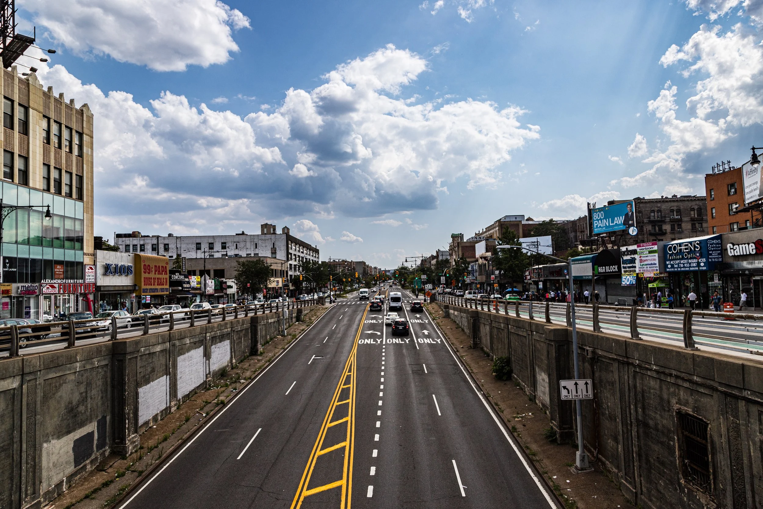
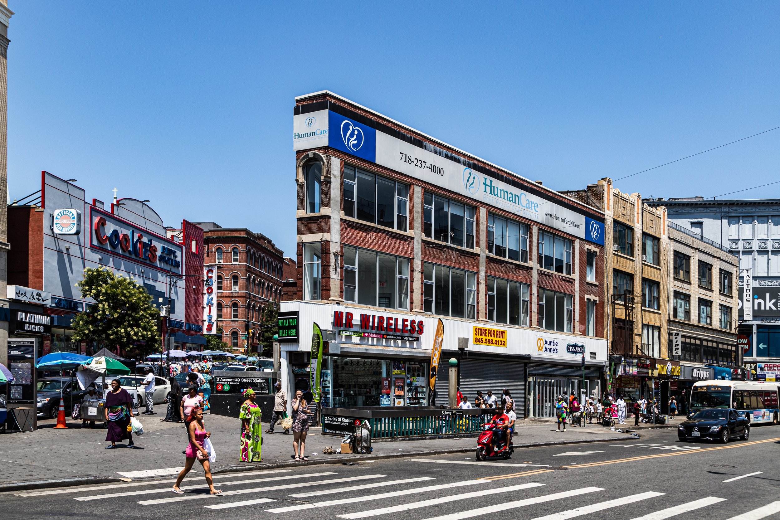
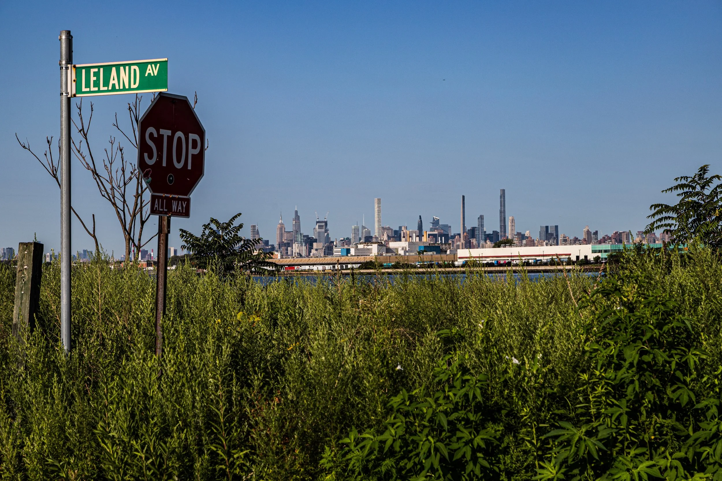
The Bronx reveals itself through contrast: tower blocks and detached homes, commercial corridors and wooded slopes, waterfront edges and tight urban canyons, civic landmarks and overlooked corners of daily life. Photographed across neighborhoods and seasons, the borough emerges not as a single visual language but as a layered and shifting one, shaped by topography, density, infrastructure, and longstanding local character.
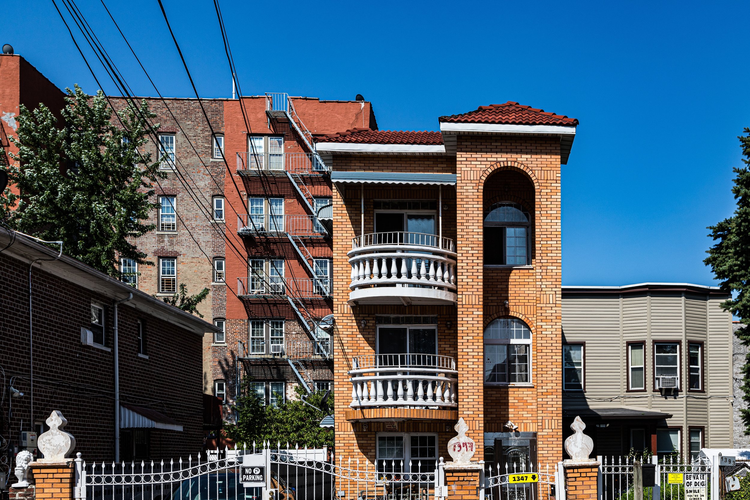
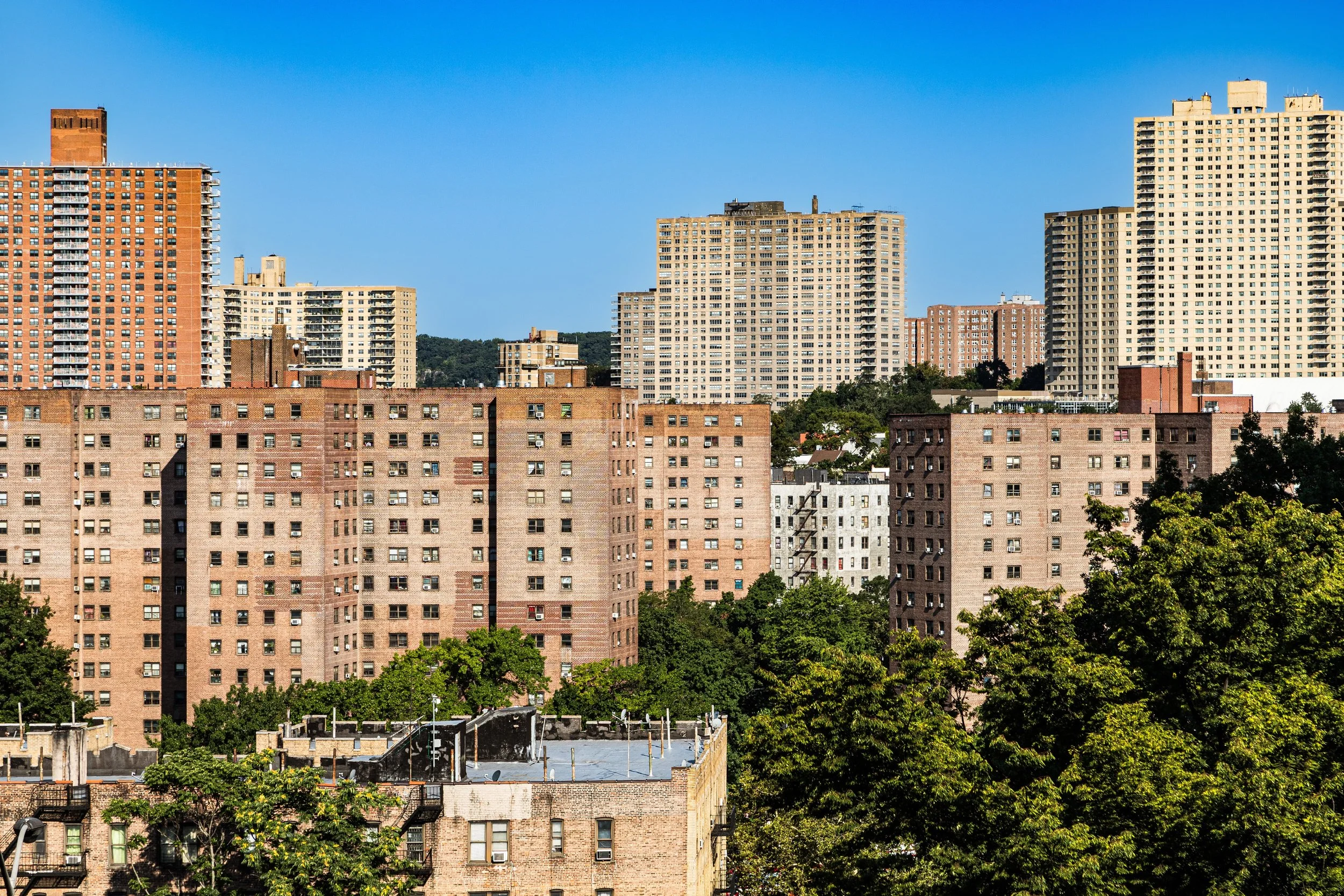
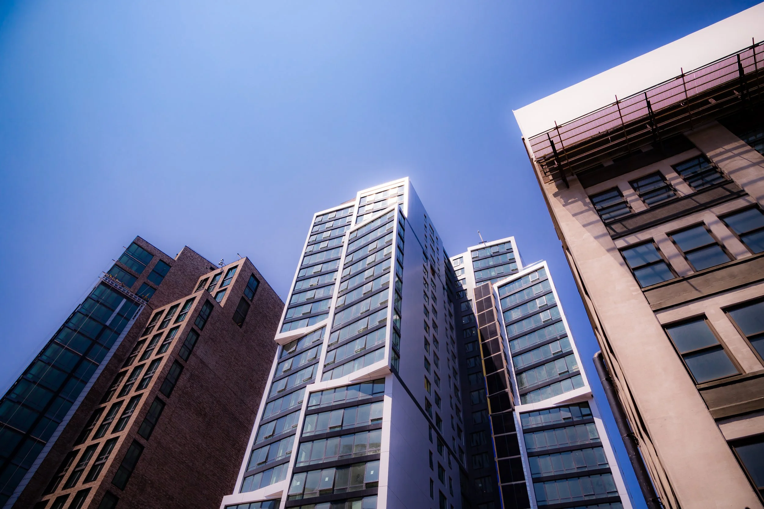
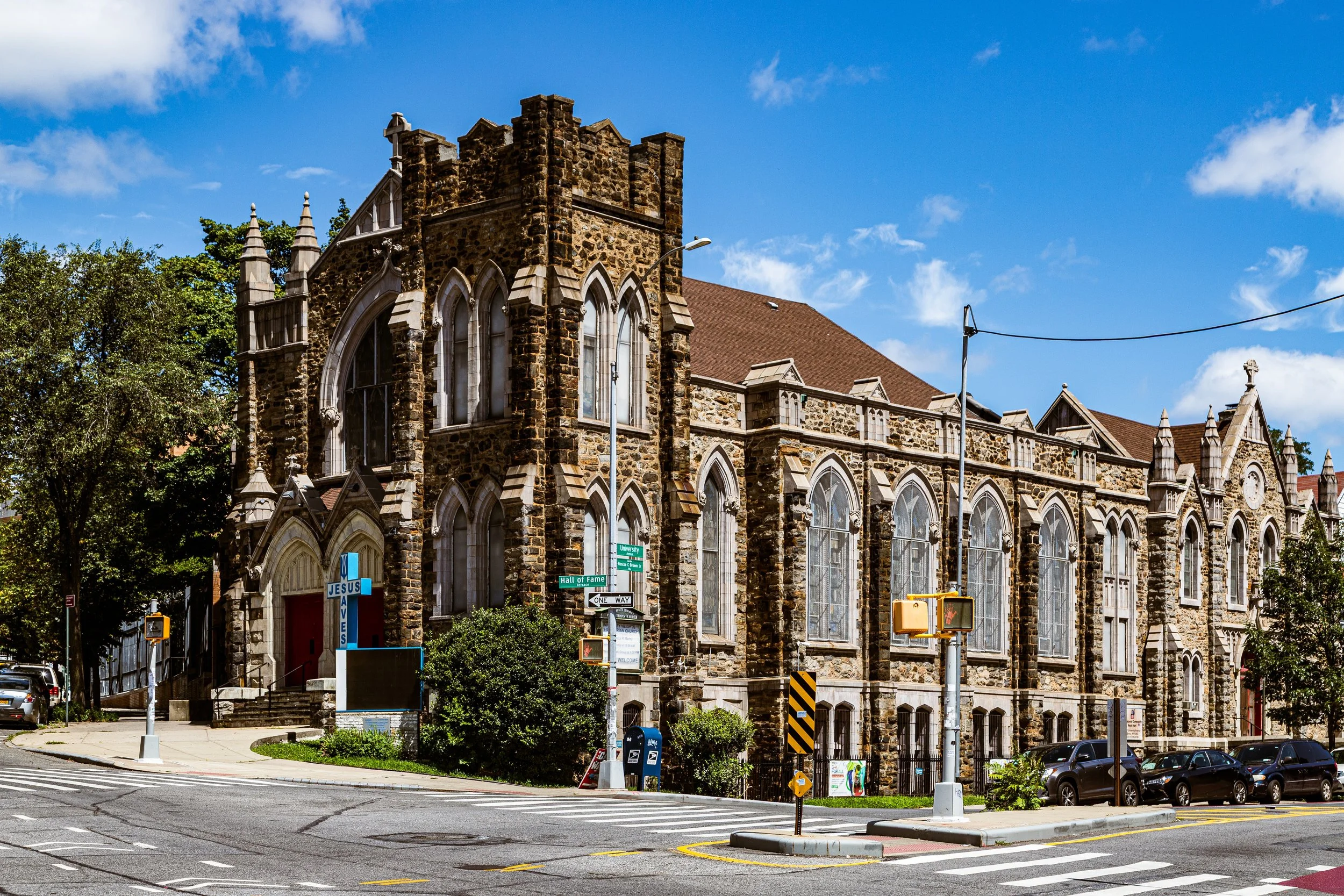
What distinguishes the Bronx photographically is the way scale keeps changing. One moment the eye is drawn upward by apartment towers, church facades, and long vertical streetscapes; the next, it settles into neighborhood textures—brickwork, stoops, murals, fences, trees, storefronts, and the intimate details that anchor everyday life. Throughout the borough, broad avenues, rail structures, bridges, parks, waterfronts, and institutional landscapes create a sense of motion and monumentality, while quieter residential pockets soften that energy with calm, repetition, and human scale.
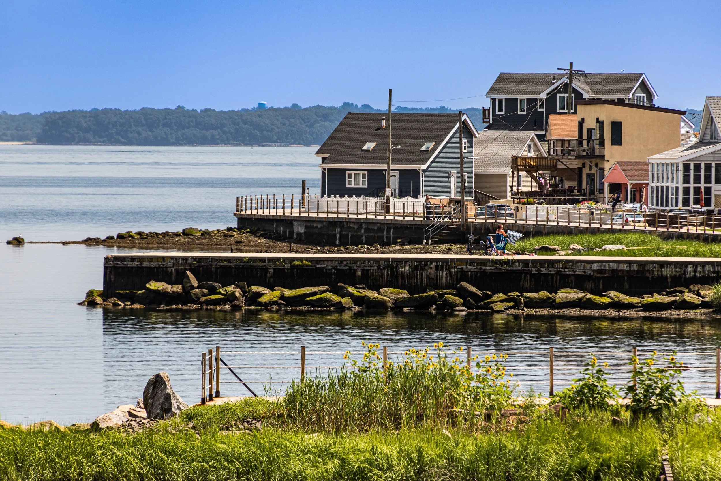
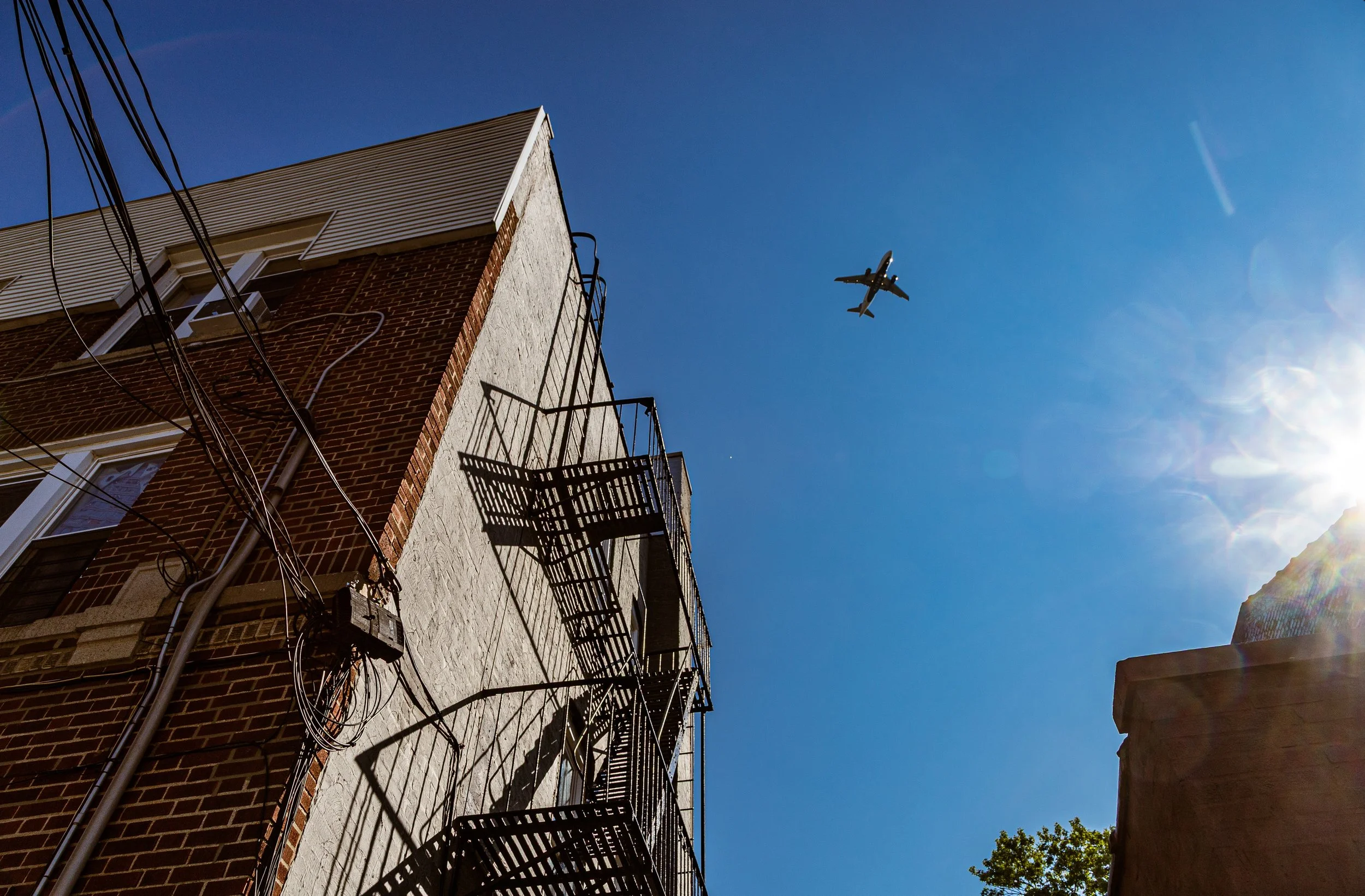
Taken together, these photographs trace a borough that is bold, grounded, and full of visual variety: a place of striking built form, persistent neighborhood identity, and recurring moments of surprise, whether in the geometry of a facade, the drama of changing light, the stillness of a shoreline, or the sudden presence of wildlife in the city. They are part record, part interpretation, and part ongoing conversation with a borough whose character is never reducible to a single image.
Through the Lens
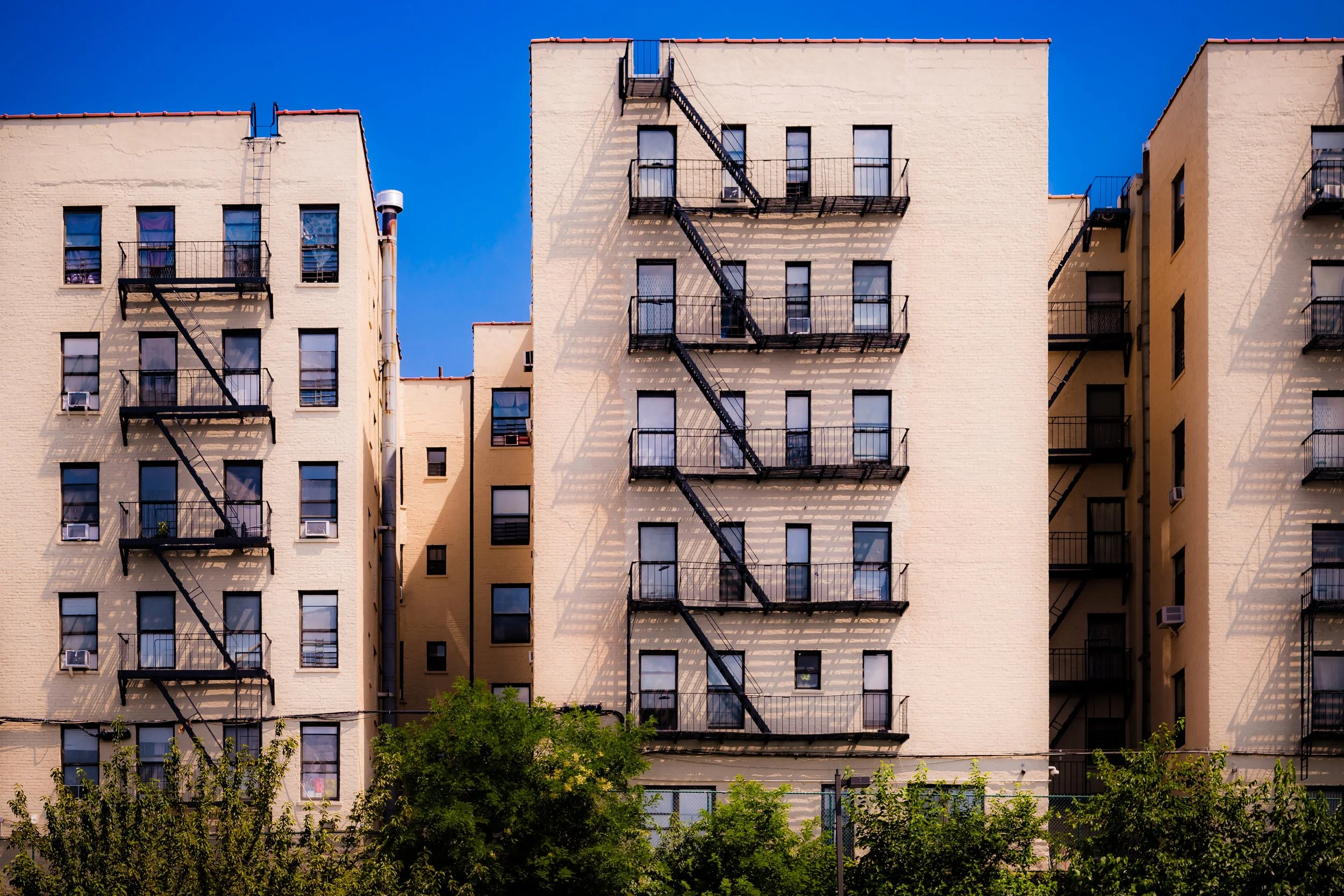
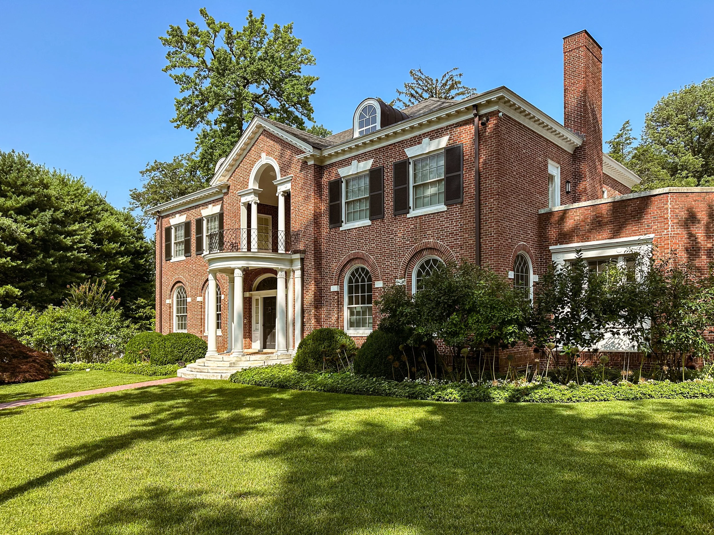
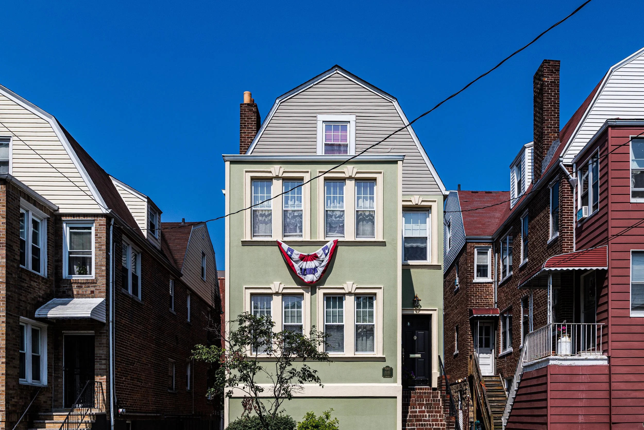
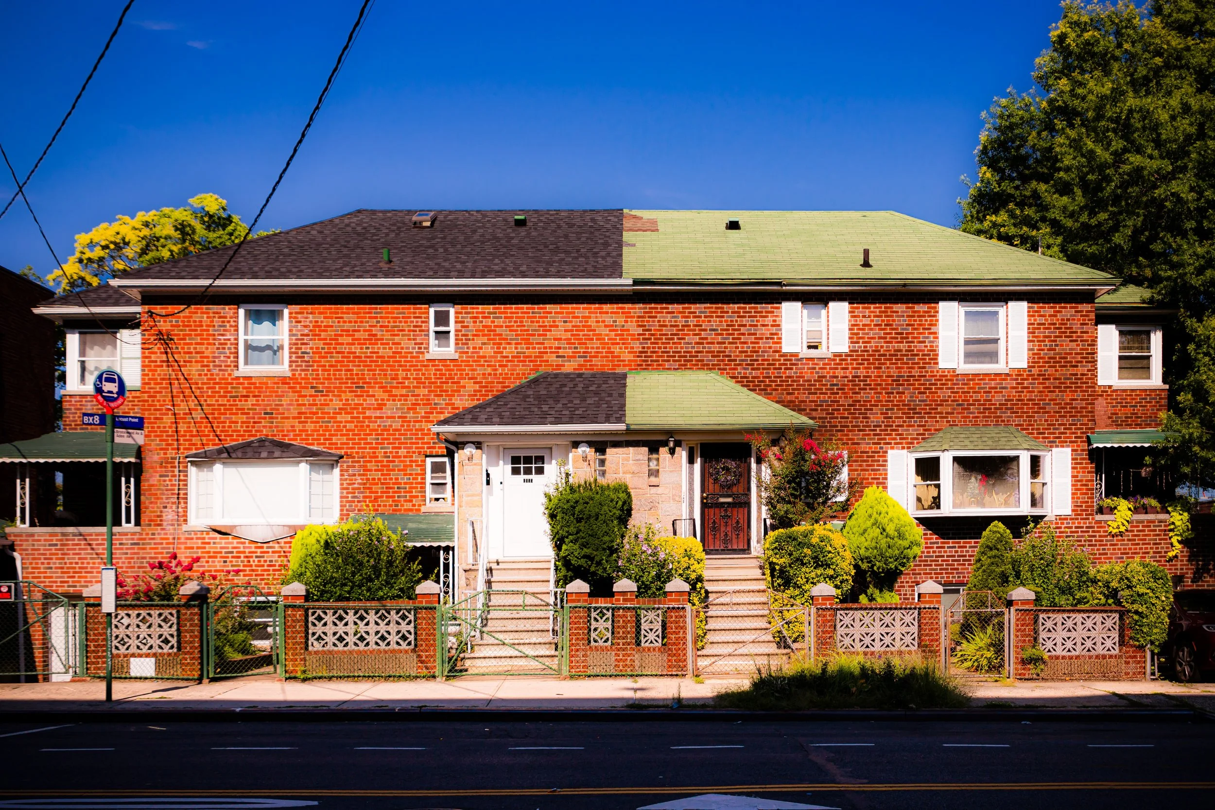
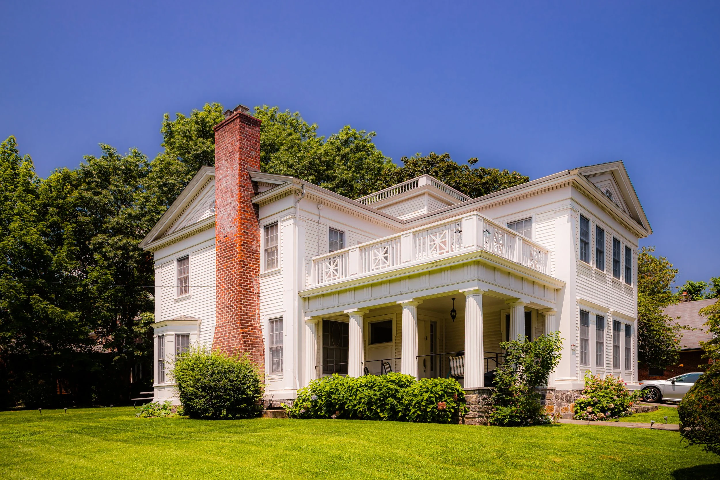
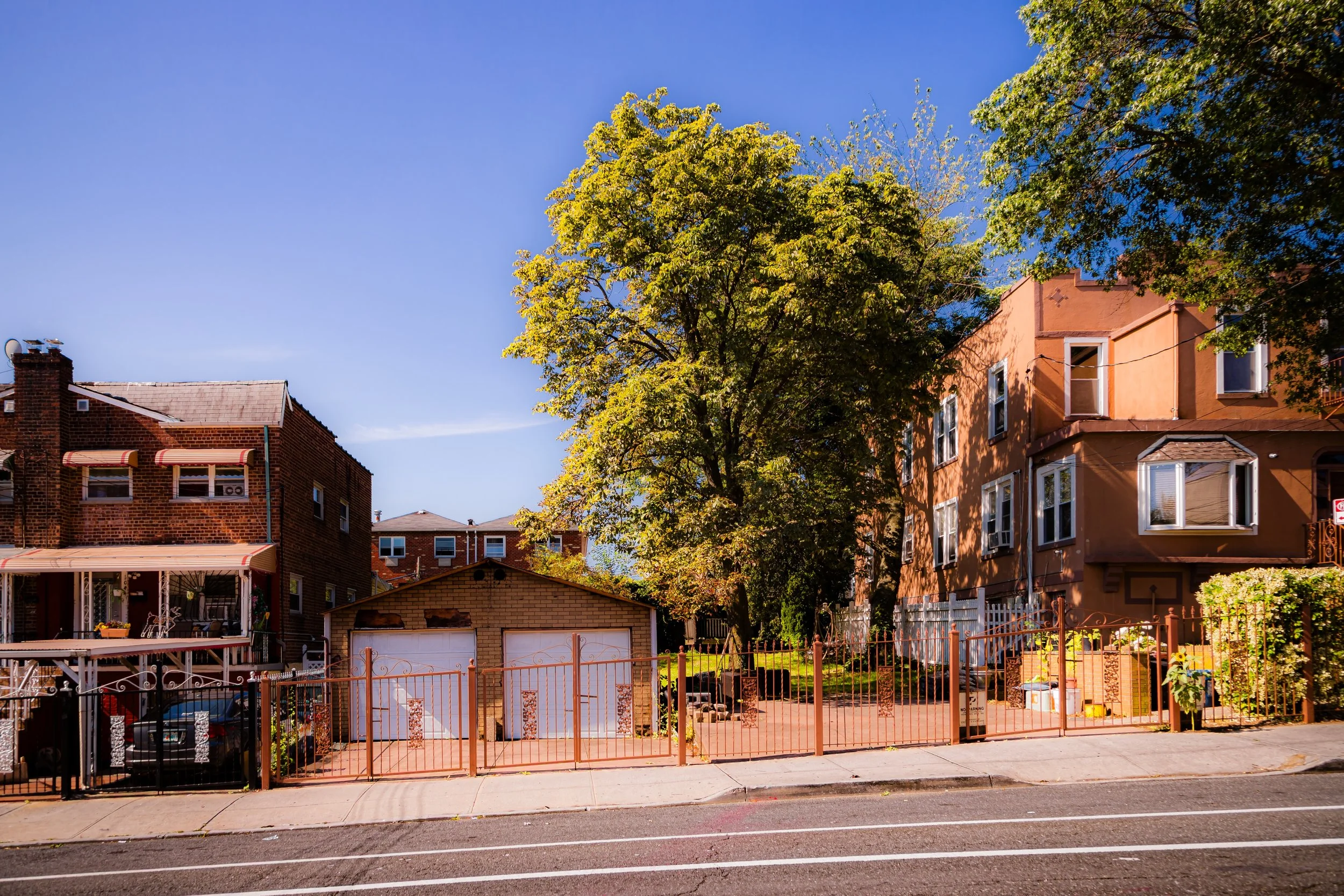
Photographing the Bronx means paying attention to structure, rhythm, and terrain. Elevation matters here. Streets climb, buildings rise abruptly from the land, and long views often open where one might least expect them. In some neighborhoods, the visual energy comes from height and repetition: apartment houses stacked against the sky, rows of windows, fire escapes, and facades that create their own beat across the block. In others, the borough becomes quieter and more spacious, marked by detached homes, leafy roads, institutional campuses, and shoreline horizons.
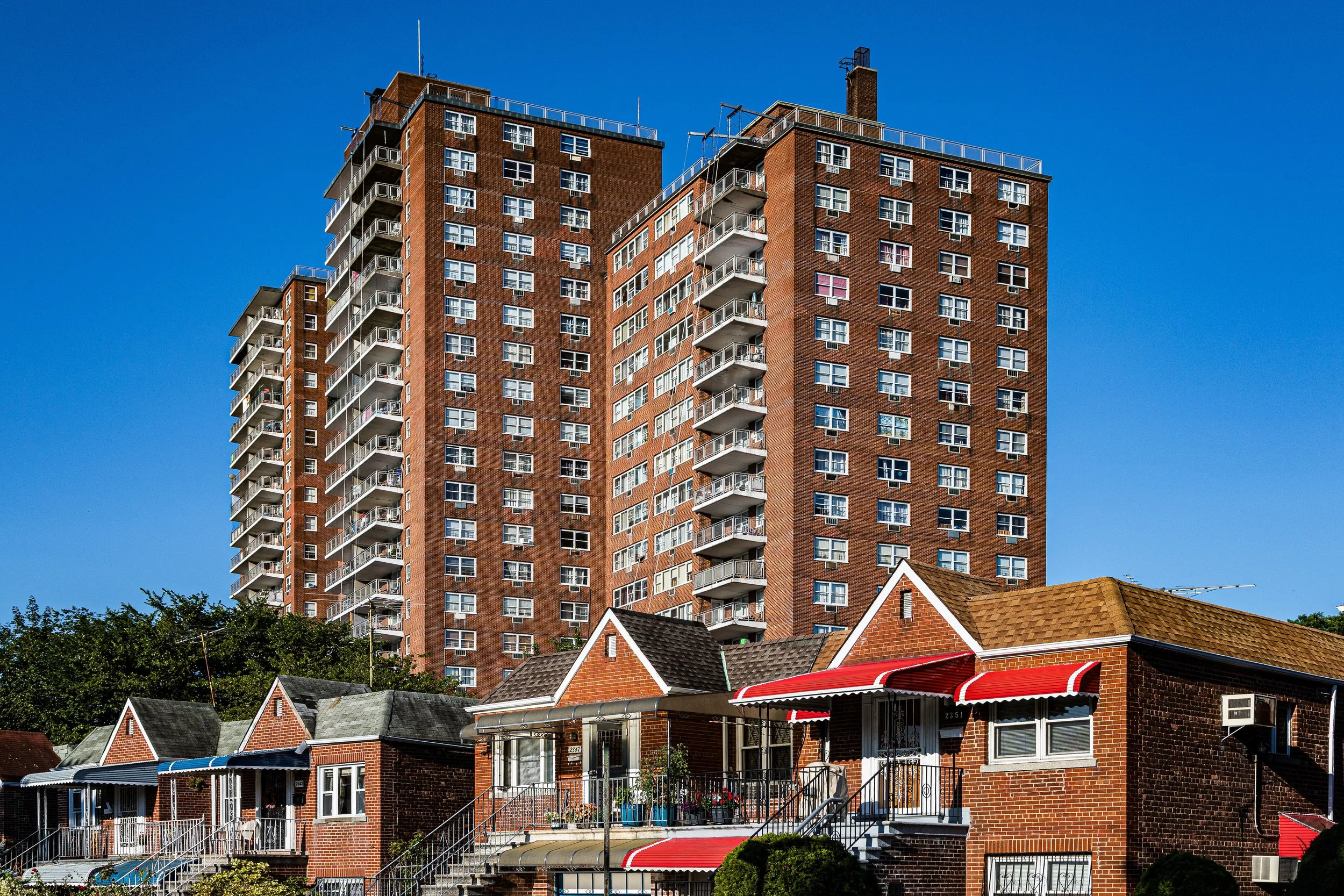
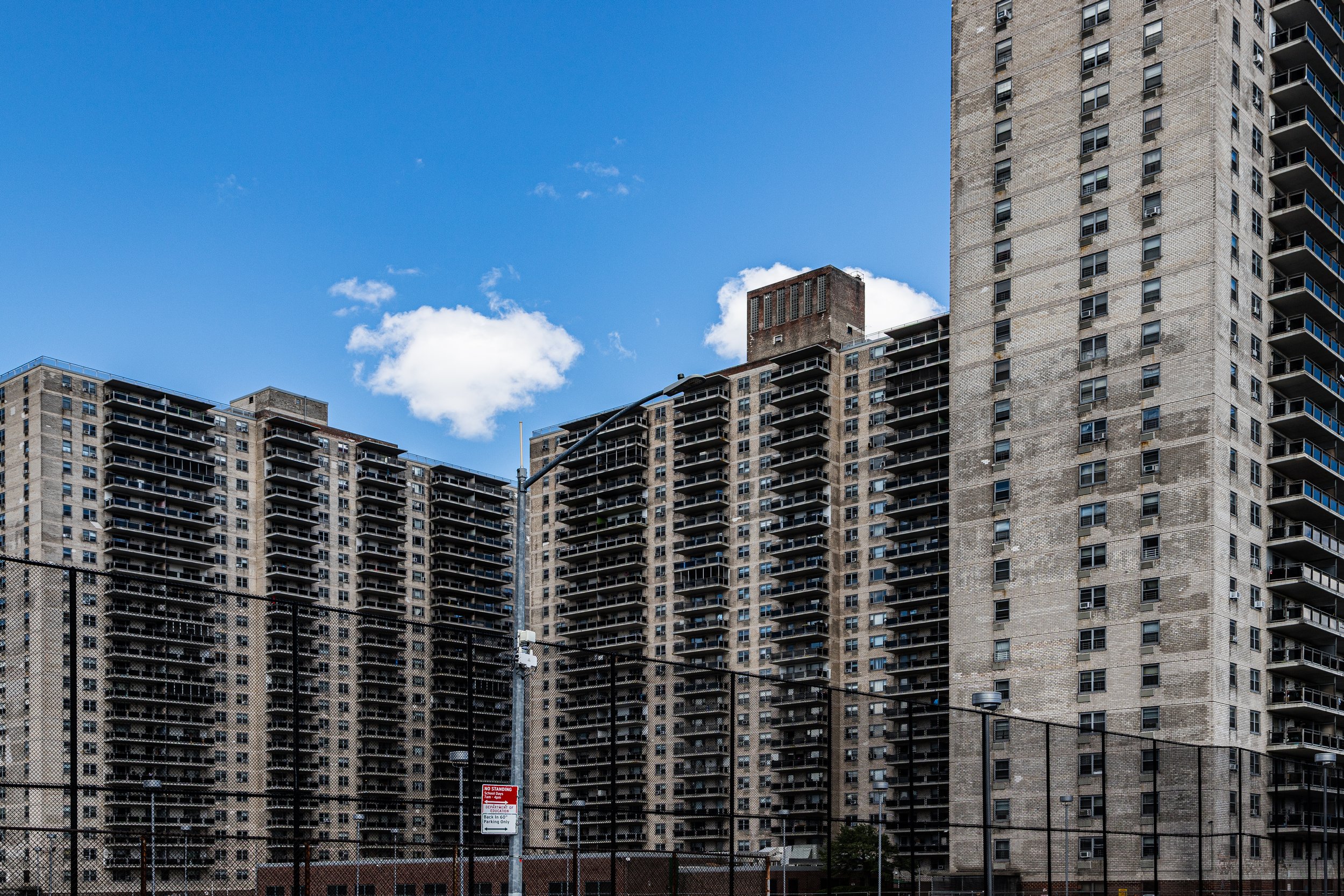
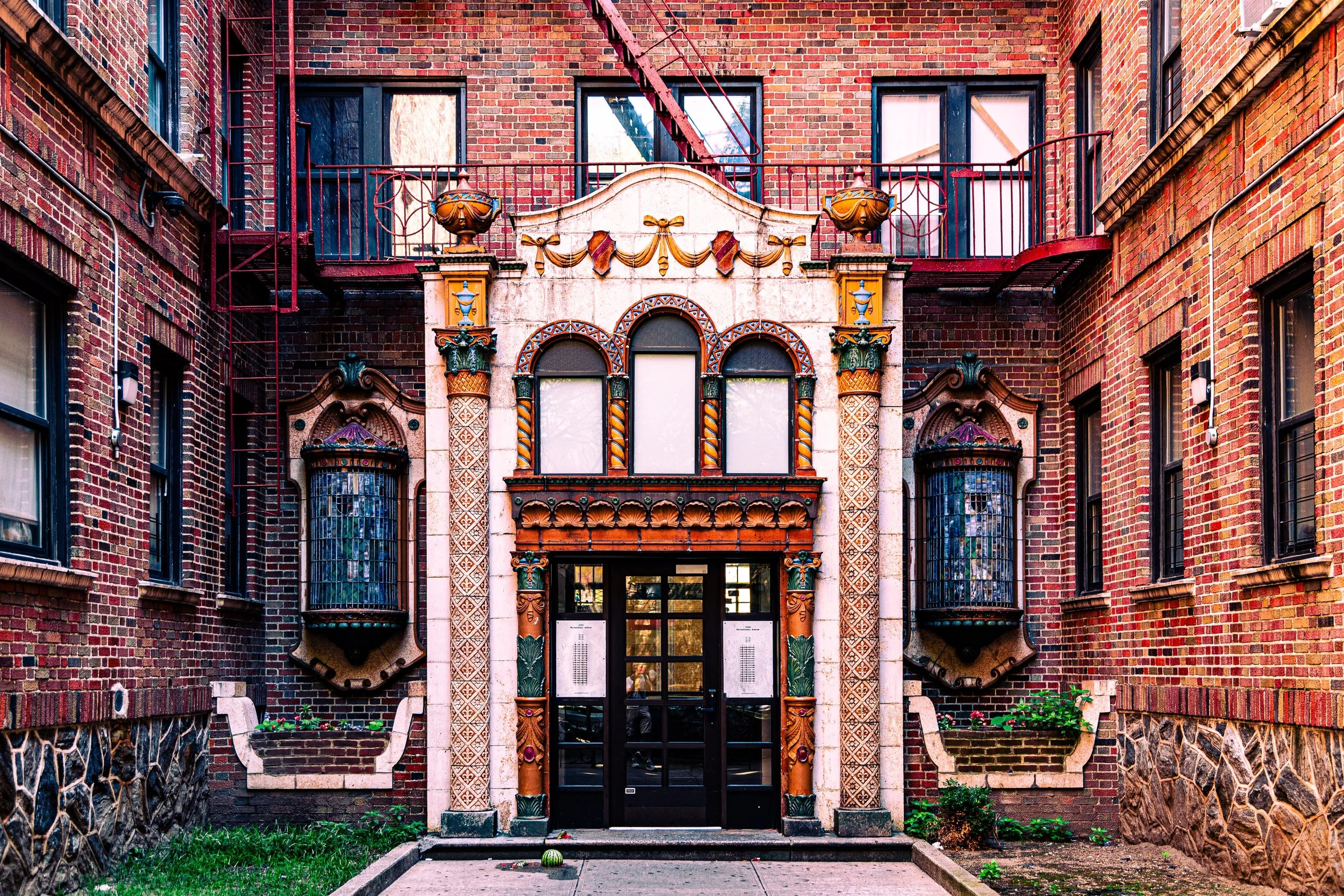
Again and again, the Bronx invites a way of seeing rooted in contrast. Monumental housing complexes stand not far from village-like streets. Bridges and elevated structures introduce drama and weight, while parks, waterfront paths, and residential hills offer release and breathing room. Murals, mosaics, signs, ornamental details, and older brick-and-stone architecture create a strong local visual vocabulary, one that feels both civic and deeply neighborhood-specific. Even the borough’s infrastructure—its overpasses, retaining walls, stairs, rail lines, and broad roadways—often becomes part of the photograph’s emotional register.
These images also suggest a Bronx of interruptions in the best sense: moments when density gives way to openness, when hard urban surfaces are softened by trees and sky, when an ordinary street corner suddenly offers pattern, color, stillness, or theatrical light. The borough rewards patience. It asks the eye to move between the large and the small, the dramatic and the familiar, the monumental and the intimate.
Fieldwork Across the Borough
These photographs are part of an ongoing effort to document the Bronx through repeated walks, neighborhood visits, and close visual attention to both landmark spaces and ordinary streetscapes. Rather than seeking only the well-known or monumental, this work approaches the borough as a lived landscape: one shaped by architecture, topography, commerce, memory, infrastructure, and everyday rhythm.
As the archive continues to grow, this section will expand to include fuller photographic logs, neighborhood-based highlights, seasonal returns, and more detailed connections between the borough’s physical character and the images made within it. Over time, it will serve not only as a gallery of selected work, but as a record of sustained observation across one of New York City’s most varied boroughs.
Lexicon Connections
Several recurring visual strategies and motifs emerge naturally across these Bronx photographs and connect closely to the broader Photographic Lexicon.
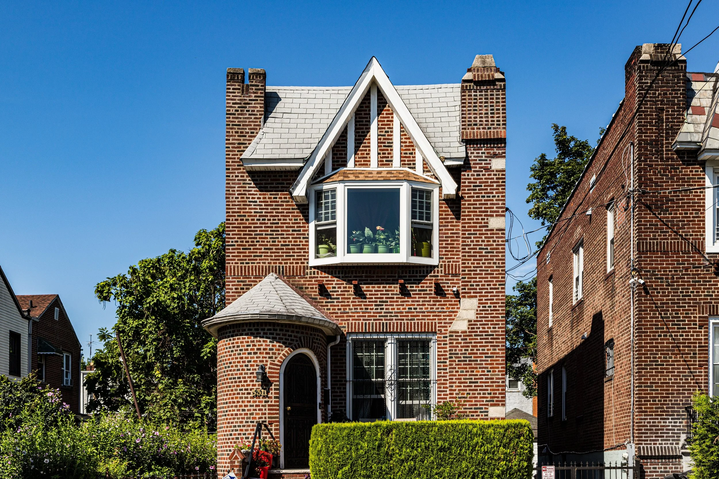
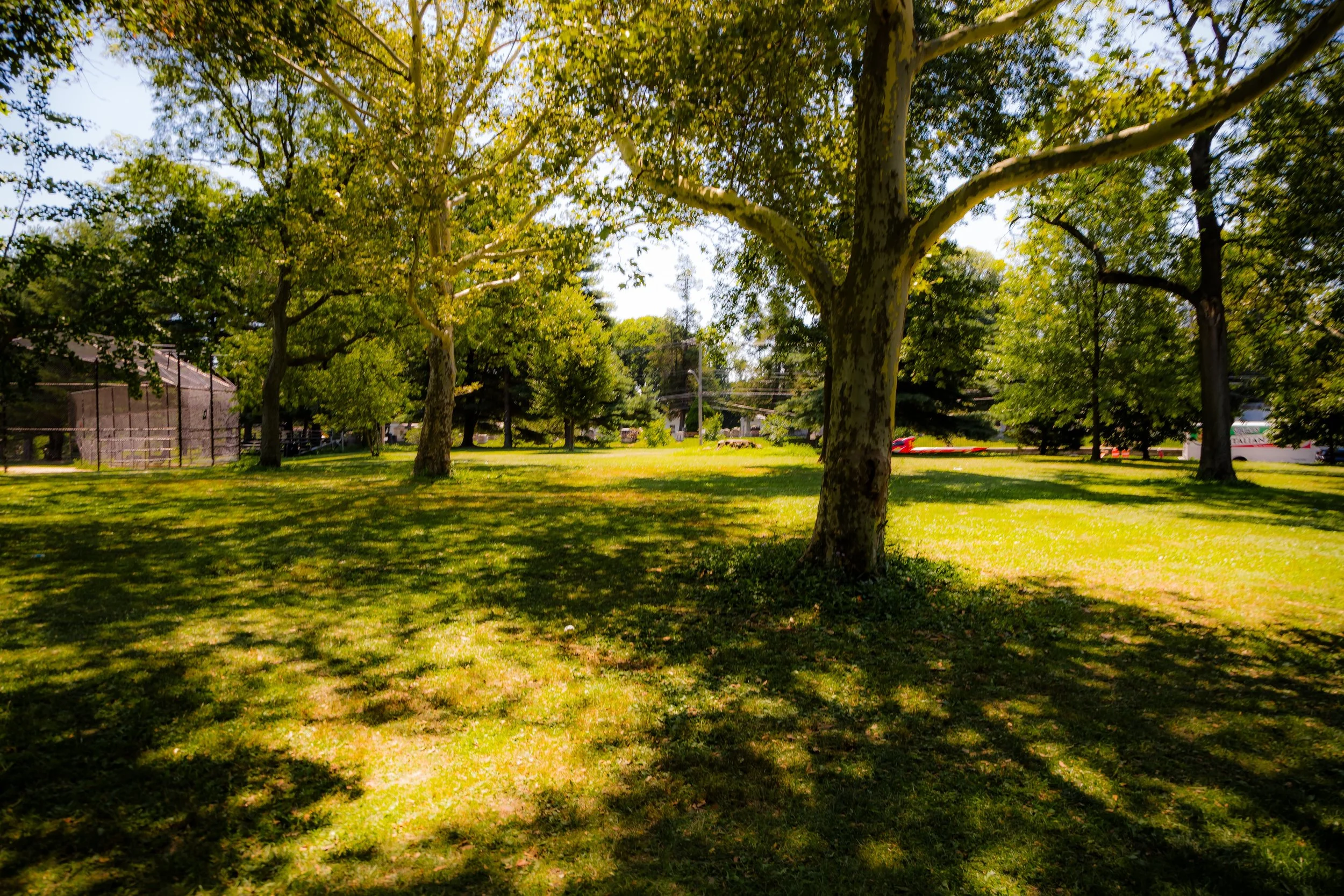
Dramatic Light & Shadow appears in the strong contrasts created by open shorelines, shifting cloud cover, elevated structures, apartment blocks, and the borough’s varied topography. In the Bronx, light often arrives with force: across facades, through trees, beneath overpasses, and against distant skyline views, giving many scenes a sense of drama without sacrificing their grounded, local character.
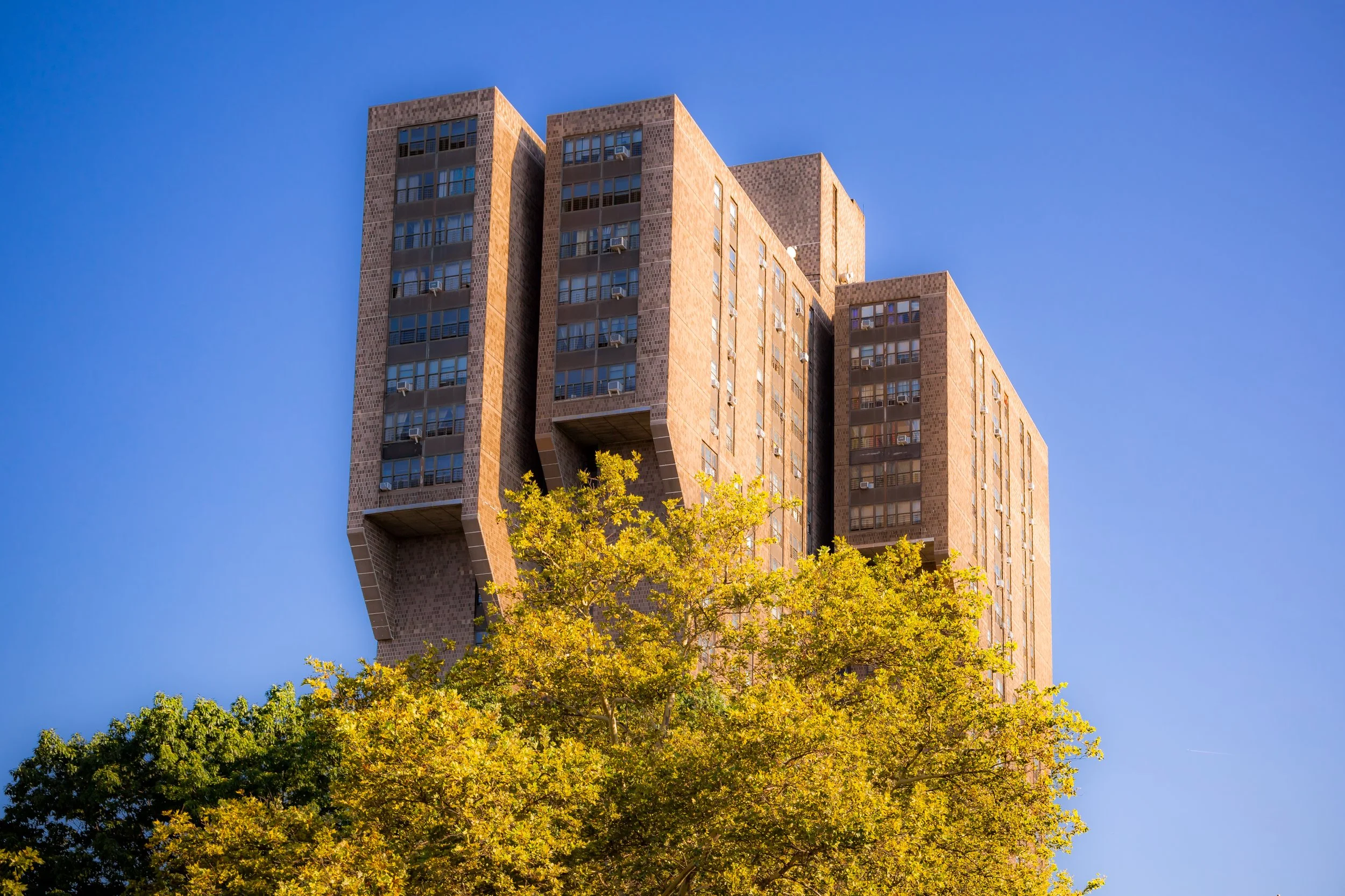
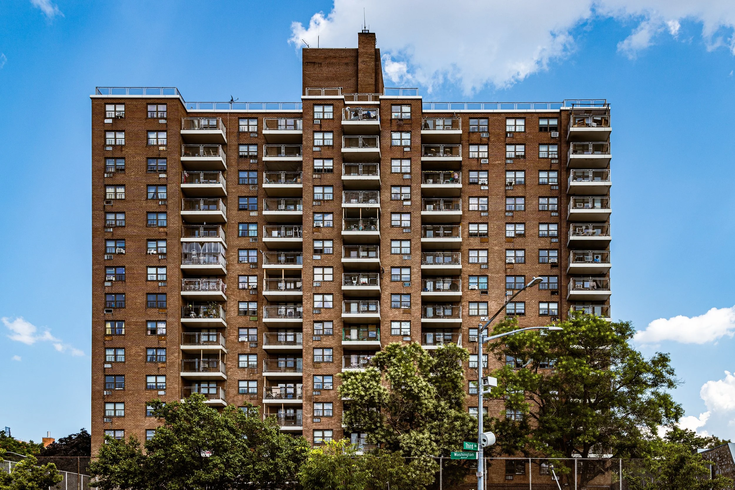
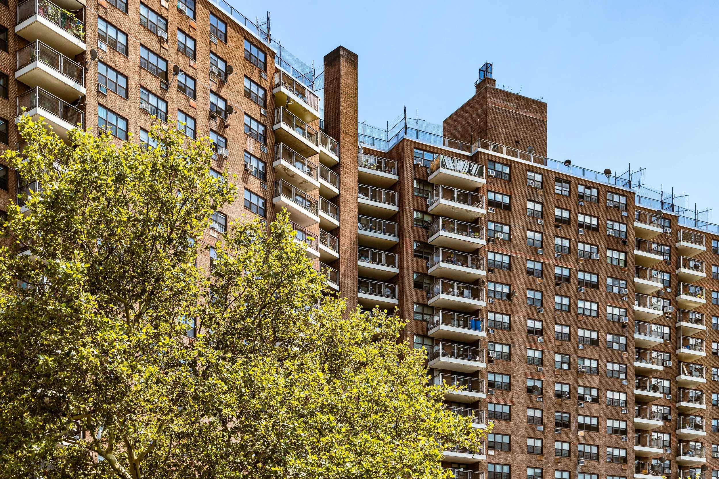
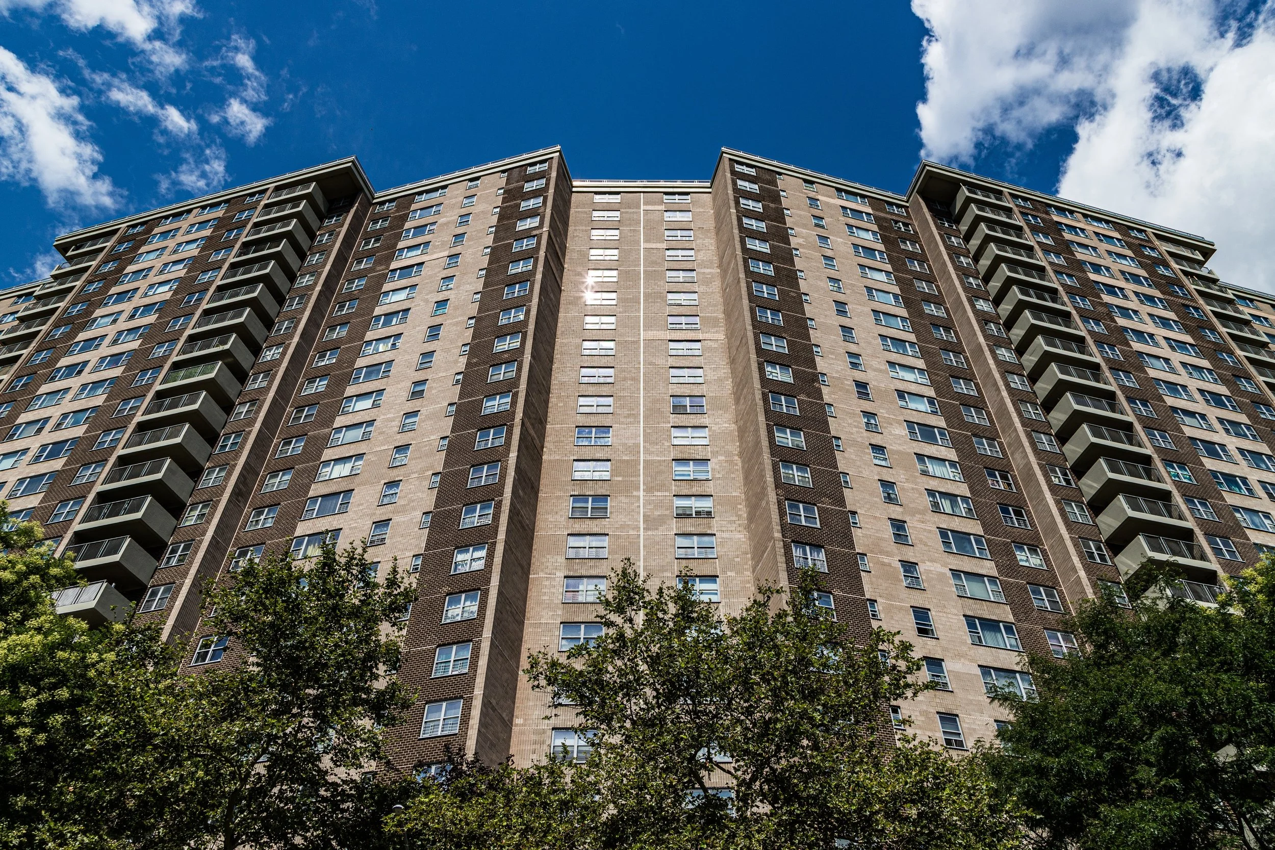
Larger Than Life is visible in the scale of apartment towers, broad civic infrastructure, stadium-adjacent spaces, oversized housing blocks, and the bold massing of the built environment. Even where the Bronx feels deeply residential, it often carries a physical presence that is unusually direct and substantial. Buildings do not merely occupy space here; they assert themselves within it.
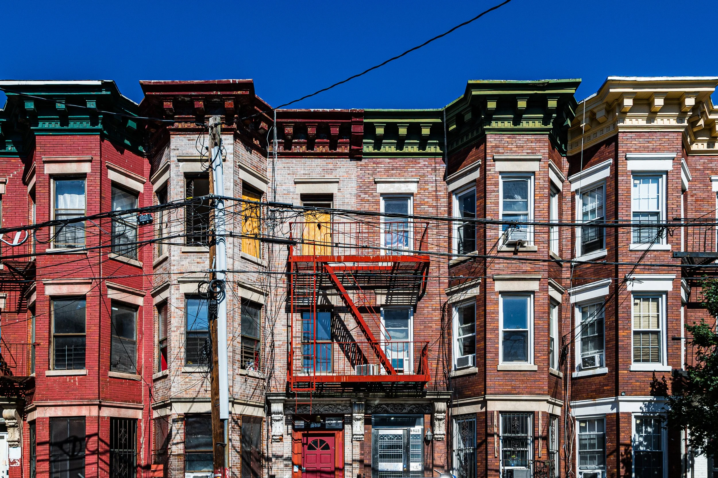
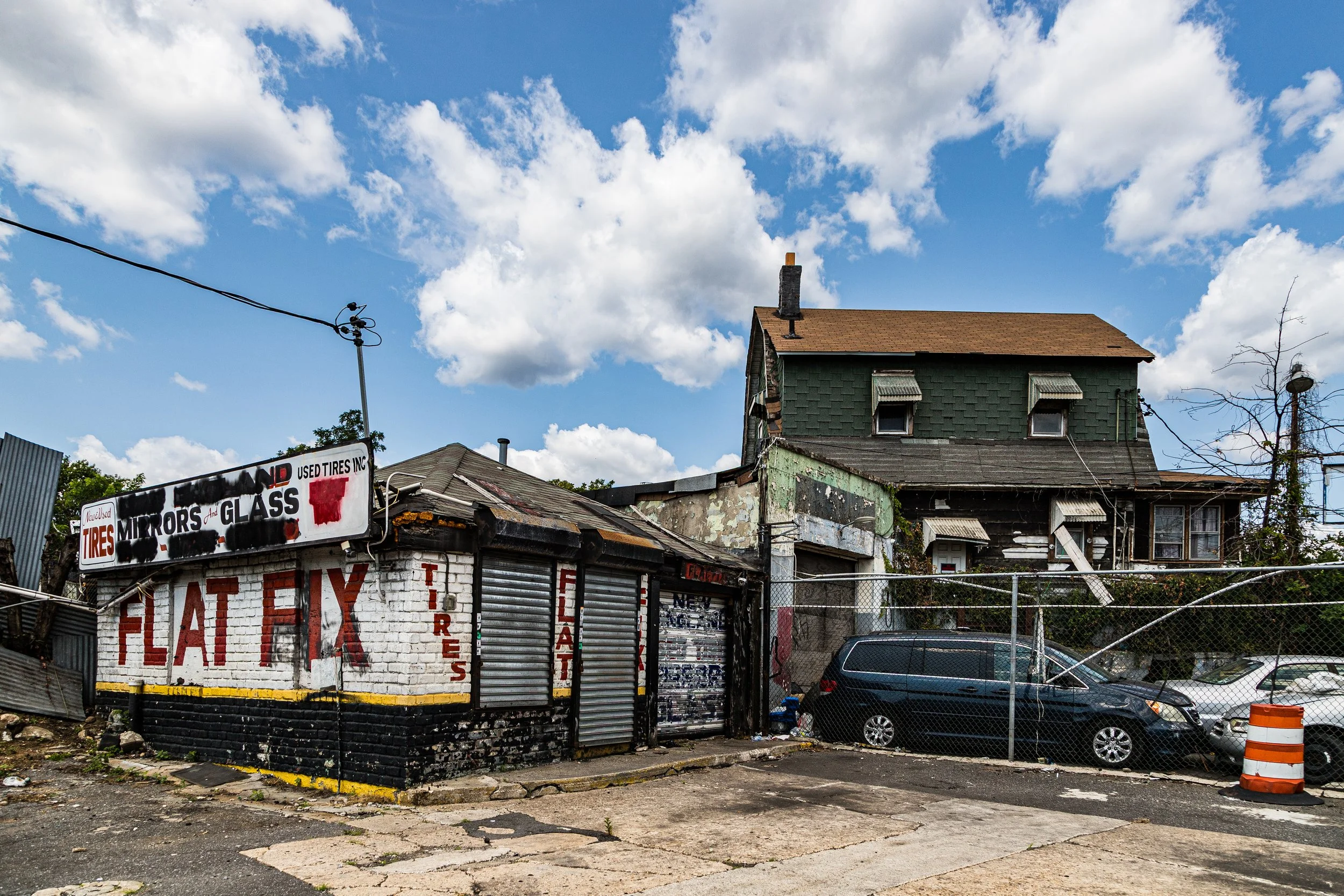
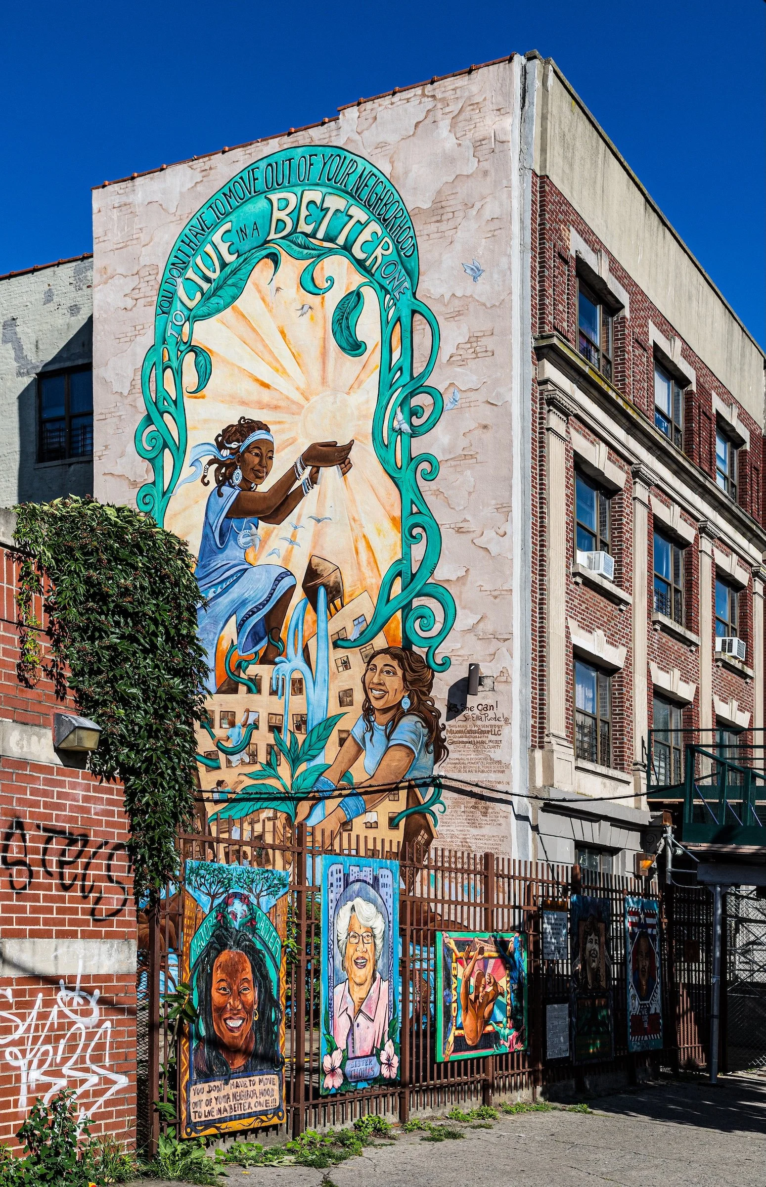
Vibrant Colors emerges in murals, painted storefronts, bright facades, signage, seasonal foliage, and those flashes of saturated color that animate the borough’s brick-and-stone streetscape. In the Bronx, color often works as both contrast and punctuation, enlivening otherwise weighty architectural settings with warmth, energy, and neighborhood specificity.
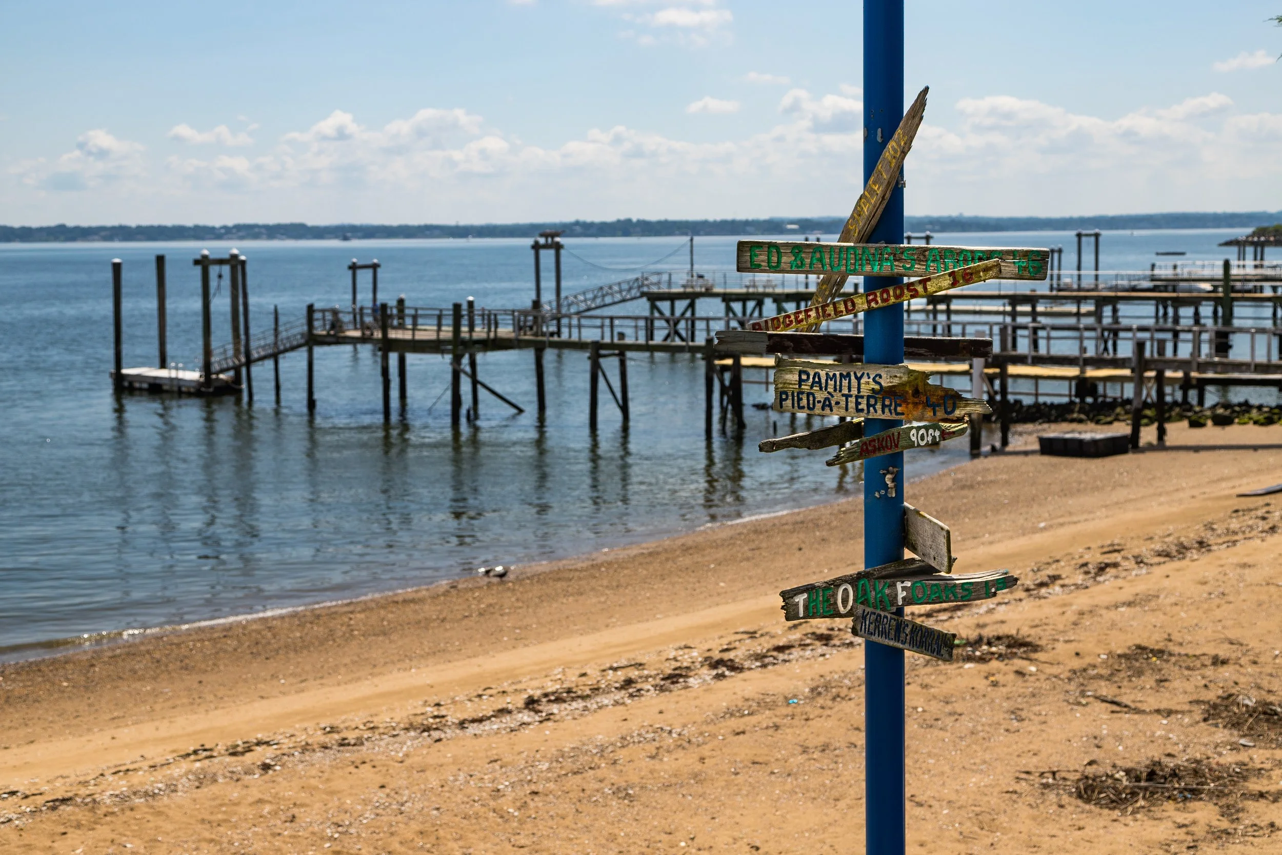
Painted Cityscapes can be seen where the borough softens into atmosphere: in tree-lined edges, open lawns, waterfront views, hazy distance, and places where architecture and landscape feel gently composed rather than sharply opposed. This quality is especially apparent where the Bronx opens outward—toward the Harlem River, Long Island Sound, parkland, or quieter residential pockets—and the city begins to take on a more painterly character.
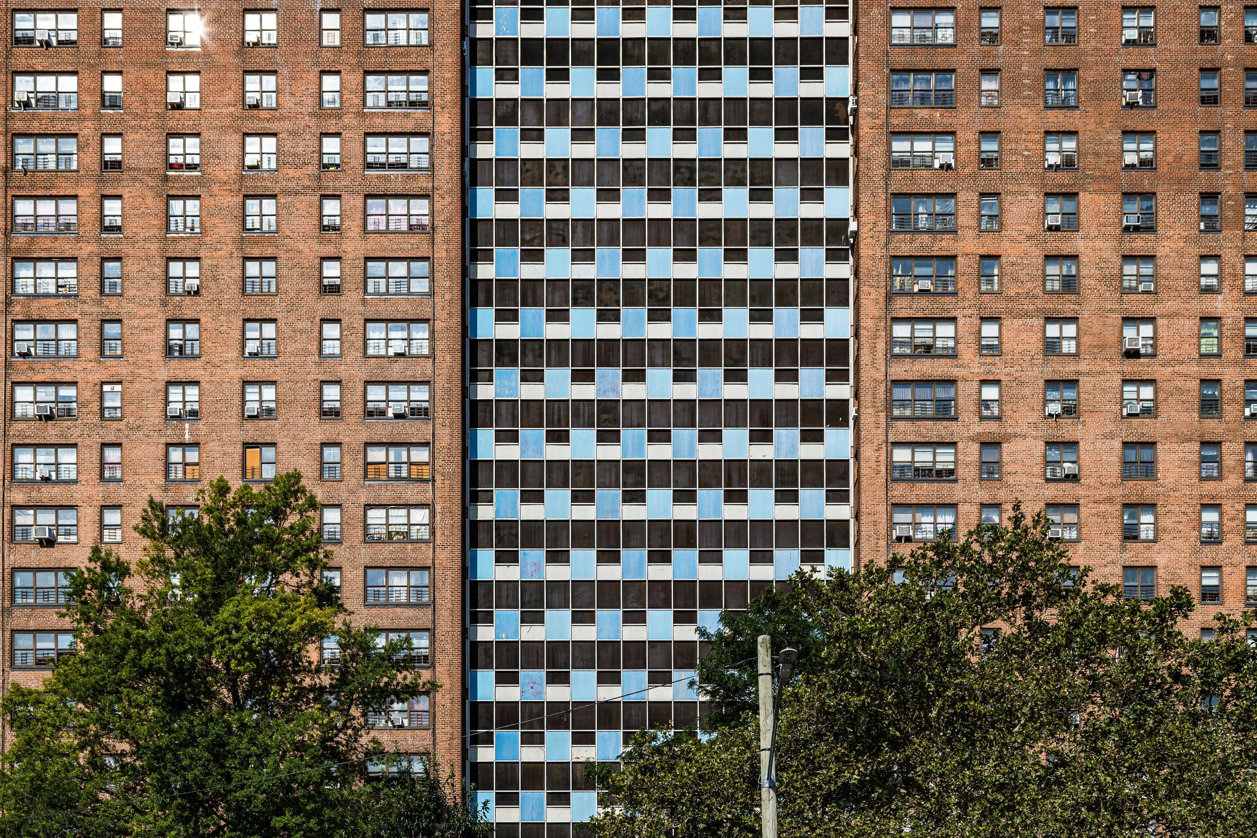
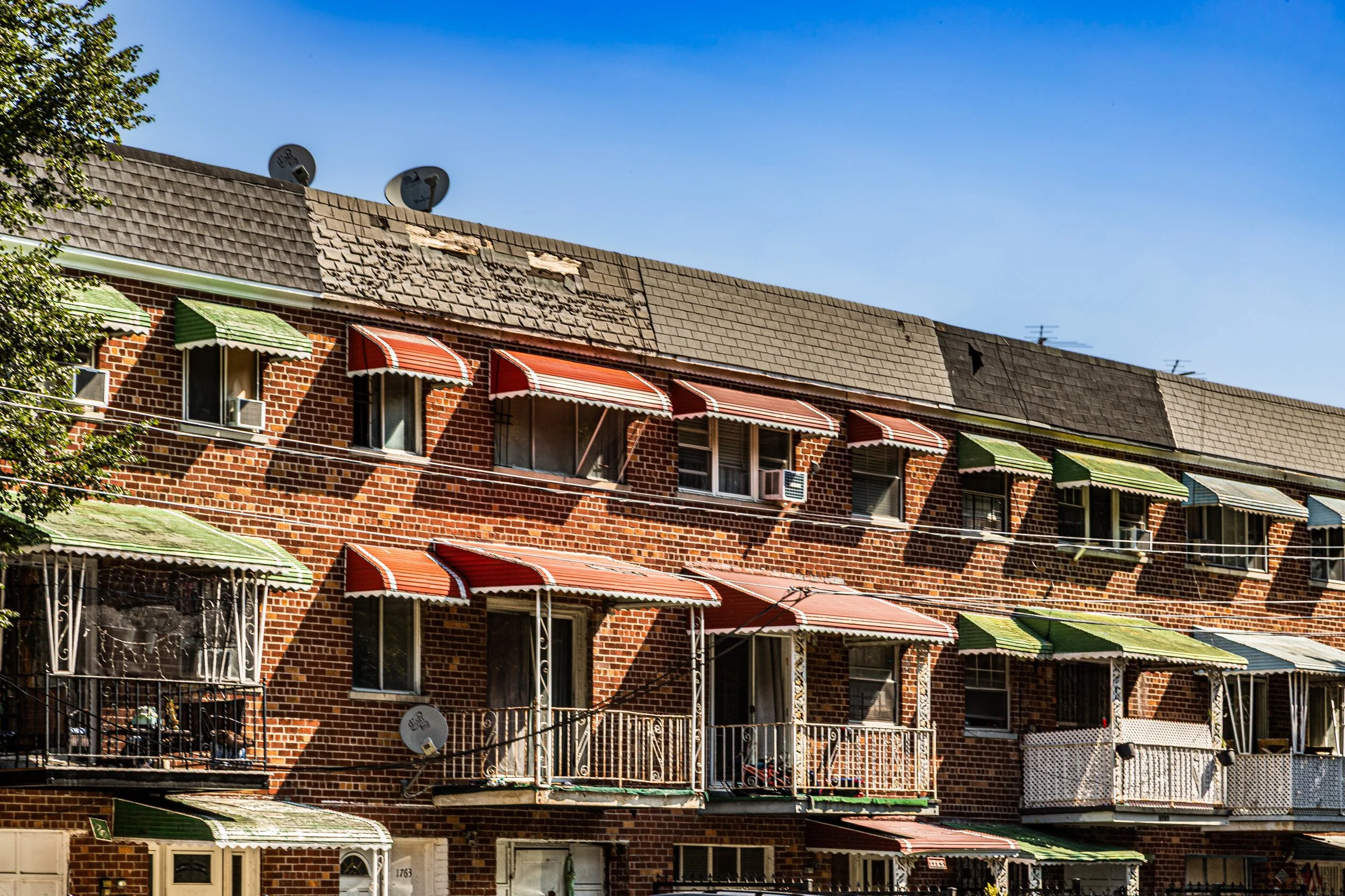
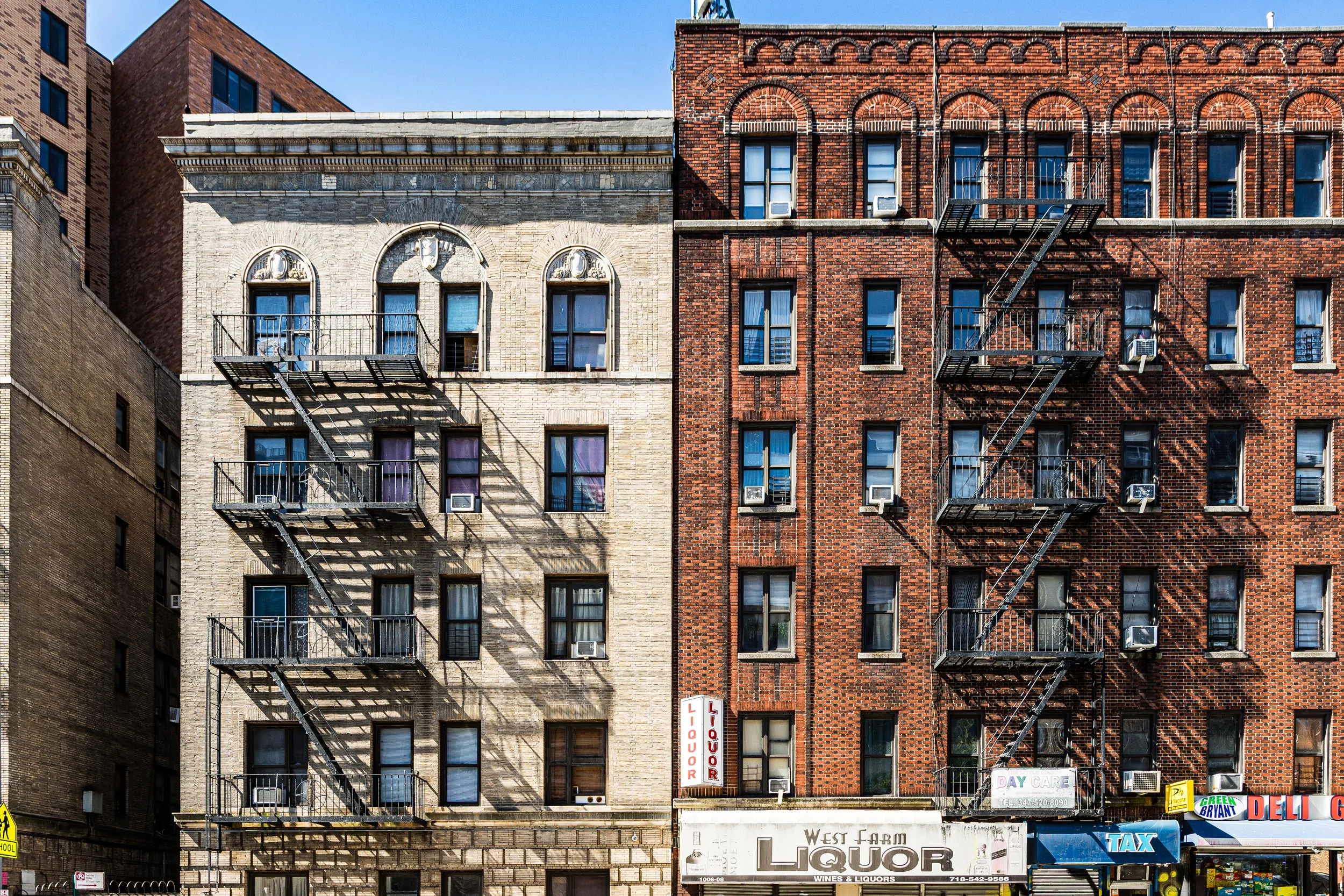
Repetition & Patterns appears in rows of windows, stacked apartment facades, fire escapes, stoops, brickwork, and the steady rhythms of residential streets. In the Bronx, repetition often feels less abstract than in Manhattan. It is not only a matter of form, but of neighborhood texture: a visual rhythm rooted in lived density, architectural continuity, and the everyday repetition of urban life.
Taken together, these visual threads help define the Bronx as both visually bold and deeply textured: a borough of strong forms, vivid contrasts, recurring rhythms, and moments of unexpected softness. As this section evolves, these motifs can be linked more directly to individual Lexicon entries, connecting the borough’s photographic character to the broader visual language of CityNeighborhoods.
The Bronx Neighborhoods In Photographs
New York City
Use this custom Google map to explore where every neighborhood in all five boroughs of New York City is located.
The Five Boroughs
One of New York City’s unique qualities is its organization in to 5 boroughs: Manhattan, Brooklyn, Queens, The Bronx, and Staten Island. These boroughs are part pragmatic administrative districts, and part vestiges of the region’s past. Each borough is an entire county in New York State - in fact, Brooklyn is, officially, Kings County, while Staten Island is, officially Richmond County. But that’s not the whole story …
Initially, New York City was located on the southern tip of Manhattan (now the Financial District) that was once the Dutch colony of New Amsterdam. Across the East River, another city was rising: Brooklyn. In time, the city planners realized that unification between the rapidly rising cities would create commercial and industrial opportunities - through streamlined administration of the region.
So powerful was the pull of unification between New York and Brooklyn that three more counties were pulled into the unification: The Bronx, Queens, and Staten Island. And on January 1, 1898, the City of New York unified two cities and three counties into one Greater City of New York - containing the five boroughs we know today.
But because each borough developed differently and distinctly until unification, their neighborhoods likewise uniquely developed. Today, there are nearly 390 neighborhoods, each with their own histories, cultures, cuisines, and personalities - and each with residents who are fiercely proud of their corner of The Big Apple.


