LITTLE NECK
Queens
Geographic Setting
Bounded by the Grand Central Parkway to the south, Marathon Parkway, Little Neck Parkway, and Douglas Road to the west, and the Nassau County line to the east, Little Neck occupies the far northeastern edge of Queens—a verdant, residential enclave that marks the city’s border with suburban Long Island. Framed by the gentle slopes that descend toward Little Neck Bay, the neighborhood combines the spaciousness of the suburbs with the cultural diversity and energy of New York City.
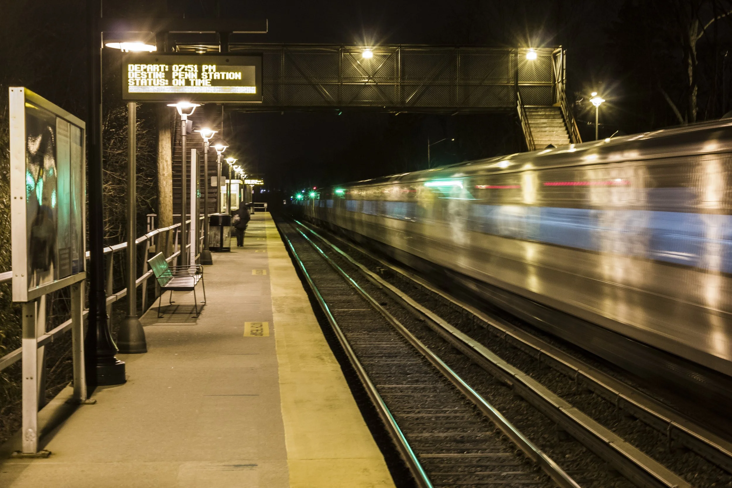
Little Neck’s landscape is characterized by tree-lined streets, single-family homes, and a strong sense of local identity rooted in its geography. Northern Boulevard (Route 25A) bisects the neighborhood east–west, serving as its main commercial artery, lined with family-owned shops, cafés, and service businesses that retain a small-town charm. To the north, the land rises toward Little Neck Bay, where tidal wetlands and wooded areas create a natural buffer between city and sea; to the south, the Grand Central Parkway provides swift access to the rest of Queens, Manhattan, and Long Island. The Long Island Rail Road’s Little Neck Station—a central fixture of the community—connects residents to Penn Station in just over half an hour, reinforcing the neighborhood’s dual identity as both urban and suburban.
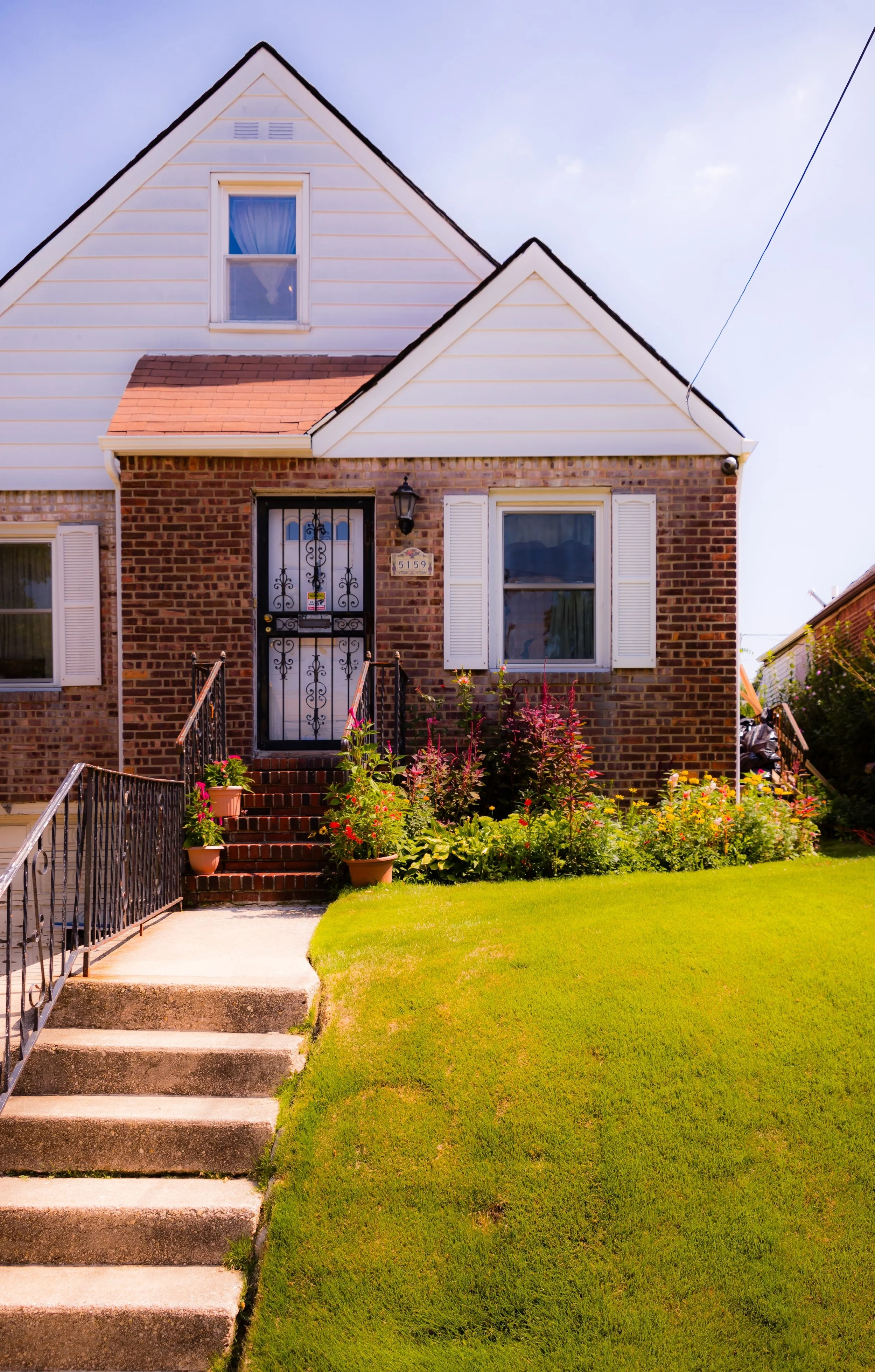
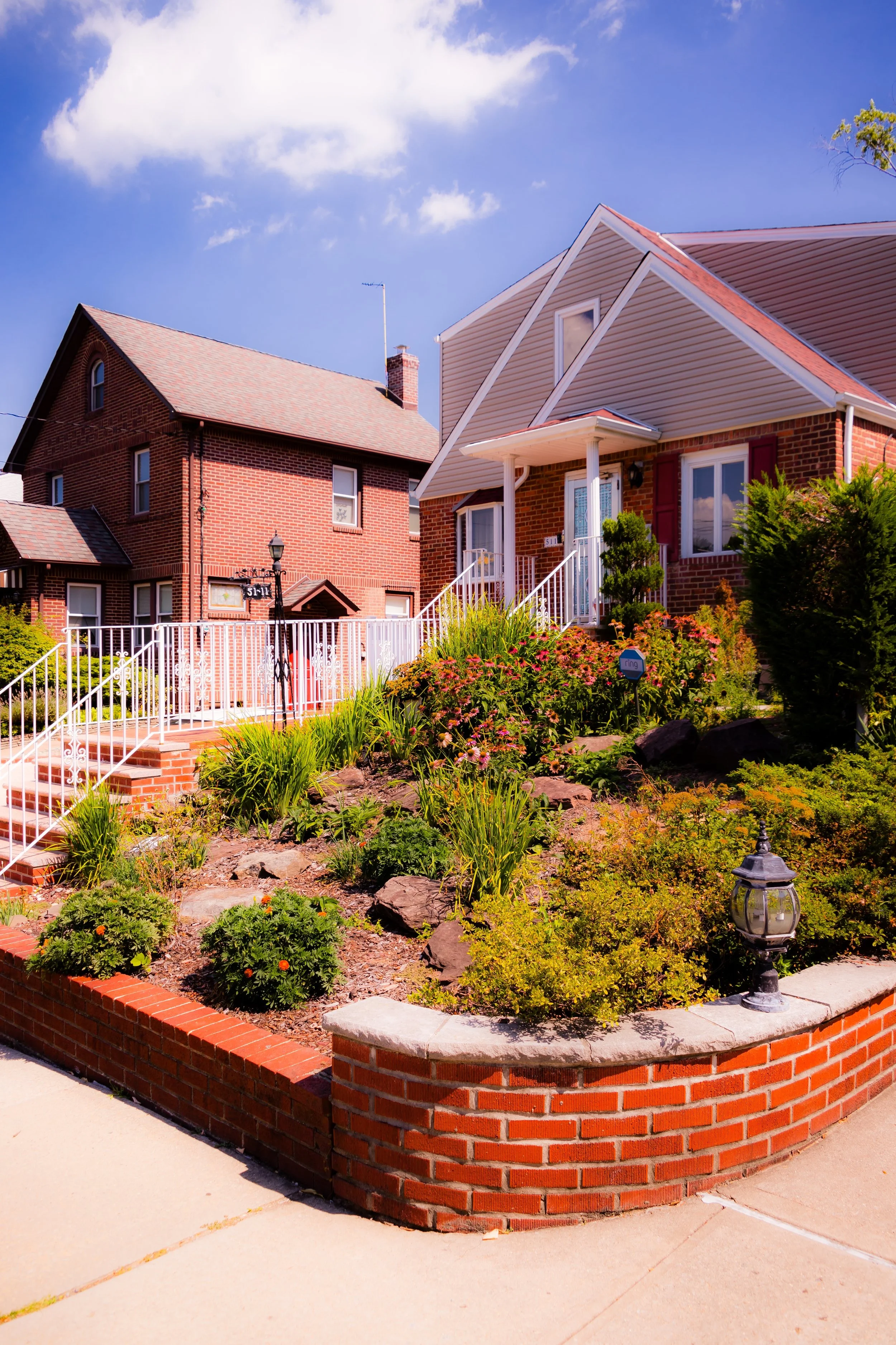
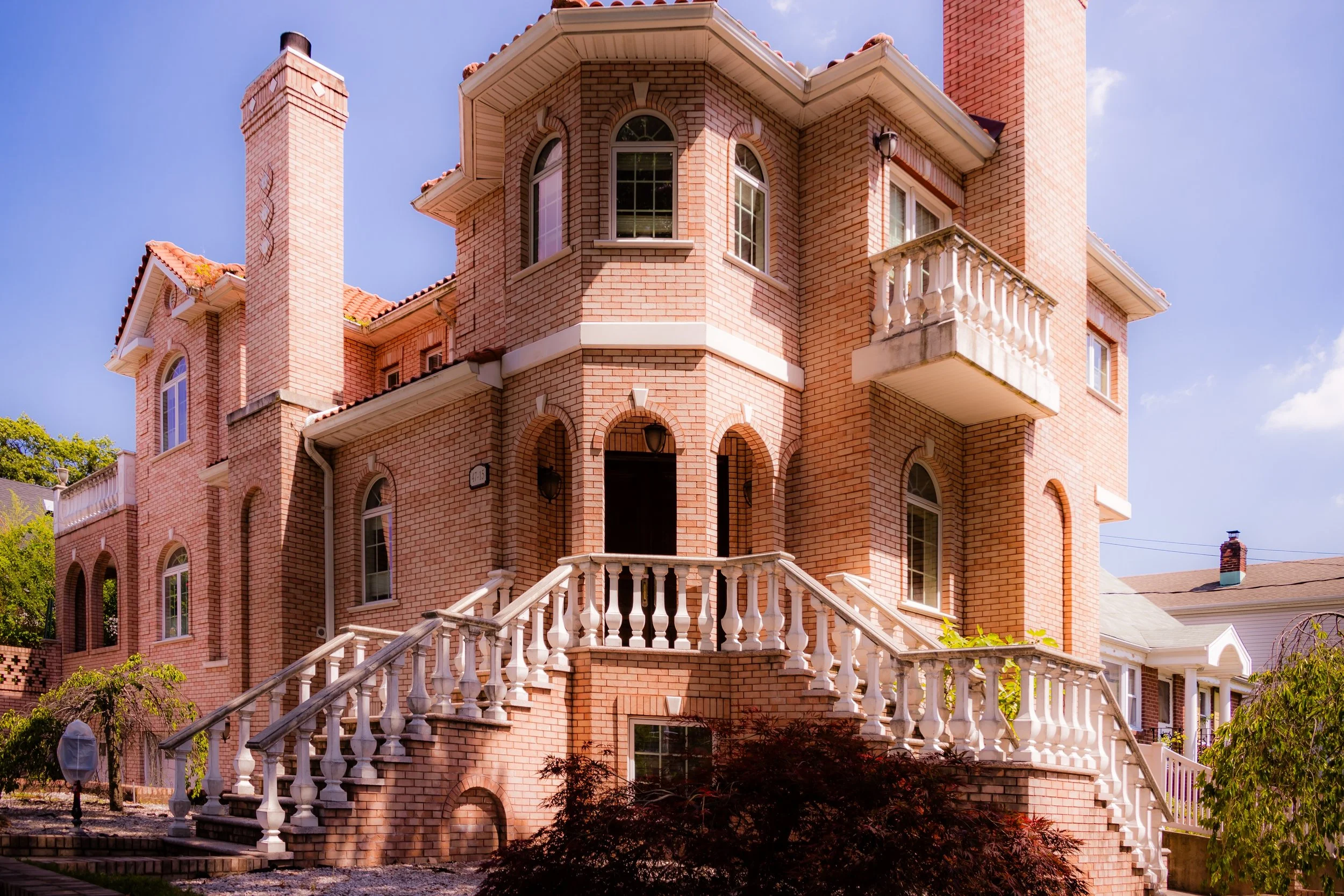
Architecturally, Little Neck presents a mosaic of Cape Cods, Tudor Revivals, and ranch-style homes, most built between the 1920s and 1960s, interspersed with modern rebuilds and condominiums that respect the area’s low-rise scale. Gardens and front lawns abound, and the neighborhood’s tidy grid, shaded by oaks and maples, reflects a long-standing ethos of care, civility, and self-containment.
Etymology and Origins
The name “Little Neck” dates back to the 17th century and refers to the small peninsula—“neck of land”—that juts into the Long Island Sound just north of the neighborhood. Early English settlers in the Town of Flushing used the term to distinguish this smaller promontory from the larger “Great Neck” immediately to the east in Nassau County. The area’s name thus reflects both geography and continuity, linking it to the waterways that defined early settlement patterns across the North Shore of Long Island.
Before urbanization, Little Neck was known for its salt meadows, farms, and shellfishing, particularly the harvesting of the Little Neck clam, a small hard clam (Mercenaria mercenaria) that became world famous in the 19th century. These clams, gathered from the clean tidal flats of Little Neck Bay, were so prized for their flavor and purity that “Little Necks” became a generic term for the most tender variety of quahog clams across the United States.
By the late 1800s, the area consisted of scattered farms, country estates, and summer homes. Wealthy New Yorkers, seeking retreat from the city, established villas along Northern Boulevard and the bay, while working-class families from Brooklyn and Manhattan found employment in nearby farms and nurseries. The Little Neck Station of the LIRR, opened in 1870, catalyzed this growth by linking the area directly to the metropolis while preserving its pastoral isolation.
The Neighborhood
Early 20th Century: From Farmland to Suburb
The early decades of the 20th century transformed Little Neck from farmland into a planned residential community. The incorporation of Queens into Greater New York City in 1898 brought municipal services—paved roads, electricity, and water lines—that made suburban development possible. Developers promoted Little Neck as an idyllic commuter haven: “The country within the city,” with clean air, good schools, and a direct rail link to Manhattan.
During the 1920s and 1930s, rows of Tudor, Colonial, and Mediterranean Revival homes rose along Little Neck Parkway, Albemarle Avenue, and 35th Avenue, while commercial growth along Northern Boulevard established the district’s civic core. Churches, synagogues, and civic associations quickly followed, among them St. Anastasia’s Roman Catholic Church (est. 1915) and the Little Neck–Douglaston Community Church, both of which remain neighborhood landmarks.
Zoning restrictions and the neighborhood’s distance from industrial centers preserved its low-density character, making Little Neck one of the few Queens communities that retained a distinctly suburban form within city limits. By the 1940s, it had become a model of postwar prosperity—tree-lined, safe, and self-contained, with homeownership as its defining value.
Mid–Late 20th Century: Postwar Growth and Community Continuity
The postwar years solidified Little Neck’s identity as a middle- to upper-middle-class residential enclave. Returning veterans and young professionals sought out its tranquil streets and strong schools, spurring construction of ranch houses, split-levels, and brick colonials throughout the 1950s and 1960s. The widening of Northern Boulevard and the completion of the Grand Central Parkway and Cross Island Parkway enhanced accessibility, linking the area seamlessly to Manhattan and Long Island while maintaining its secluded feel.
The neighborhood’s social fabric during this era was defined by civic engagement. Organizations like the Little Neck–Douglaston Lions Club, the Douglas Manor Association, and the Little Neck–Douglaston Memorial Day Parade Committee (which still organizes one of the oldest continuous Memorial Day parades in the nation) fostered a strong sense of local pride. Schools such as P.S. 94 and Louis Pasteur Middle School (M.S. 67) built reputations for excellence, attracting families eager for suburban schooling within the city’s boundaries.
While much of Queens experienced dramatic demographic shifts in the latter half of the 20th century, Little Neck’s transformation was gradual and harmonious. Its population diversified with the arrival of Greek-American, Italian-American, Jewish, and later Korean-American families, all of whom contributed to the area’s civic life while preserving its residential stability.
Little Neck Video Coming Soon
21st Century: Diversity, Preservation, and Suburban Serenity
In the 21st century, Little Neck continues to embody the ideal of suburban life within New York City. Its quiet streets, well-tended lawns, and active neighborhood associations make it one of Queens’ most stable and desirable residential areas. New residents—from across Asia, Eastern Europe, and Latin America—have brought global perspectives to a community that remains deeply local. Northern Boulevard, once dominated by delis and hardware stores, now features Korean bakeries, Japanese restaurants, and international markets, reflecting the borough’s vibrant multiculturalism.
The LIRR Station remains the community’s lifeline, while Cunningham Park, Alley Pond Park, and the Douglaston Golf Course provide expansive green spaces within minutes of any home. Civic efforts, such as the Little Neck–Douglaston Memorial Day Parade and environmental initiatives protecting Little Neck Bay’s wetlands, underscore the neighborhood’s commitment to heritage and sustainability.
Recent zoning protections have helped preserve the area’s low-rise scale, ensuring that redevelopment respects its suburban texture. Even as new families modernize older homes, the essential character—tree-lined streets, single-family dwellings, and community engagement—remains intact.
Little Neck Photo Gallery
Spirit and Legacy
Little Neck’s enduring spirit lies in its balance of urban access and suburban peace, a quality that has defined it for more than a century. From its origins as farmland by the bay to its emergence as a model commuter suburb, the neighborhood has managed to retain its identity through waves of change. It is both the threshold and the retreat—the last stop before Long Island, and the first glimpse of city life for those returning home.
New York City
Use this custom Google map to explore where every neighborhood in all five boroughs of New York City is located.
The Five Boroughs
One of New York City’s unique qualities is its organization in to 5 boroughs: Manhattan, Brooklyn, Queens, The Bronx, and Staten Island. These boroughs are part pragmatic administrative districts, and part vestiges of the region’s past. Each borough is an entire county in New York State - in fact, Brooklyn is, officially, Kings County, while Staten Island is, officially Richmond County. But that’s not the whole story …
Initially, New York City was located on the southern tip of Manhattan (now the Financial District) that was once the Dutch colony of New Amsterdam. Across the East River, another city was rising: Brooklyn. In time, the city planners realized that unification between the rapidly rising cities would create commercial and industrial opportunities - through streamlined administration of the region.
So powerful was the pull of unification between New York and Brooklyn that three more counties were pulled into the unification: The Bronx, Queens, and Staten Island. And on January 1, 1898, the City of New York unified two cities and three counties into one Greater City of New York - containing the five boroughs we know today.
But because each borough developed differently and distinctly until unification, their neighborhoods likewise uniquely developed. Today, there are nearly 390 neighborhoods, each with their own histories, cultures, cuisines, and personalities - and each with residents who are fiercely proud of their corner of The Big Apple.


