QUEENS VILLAGE
Queens
Neighborhood Profile
A sprawling and historic residential neighborhood on the eastern edge of the borough, Queens Village is a bastion of middle-class homeownership and community pride. Defined by its tidy, single-family colonial homes and its proximity to Belmont Park, the neighborhood offers a quiet, "suburban" pace of life with a diverse population and deep roots in the borough's 20th-century expansion.
Geographic Setting
Bounded by the Grand Central Parkway to the northwest, Braddock Avenue to the northeast, the Nassau County line to the east, 115th Avenue to the south, and a western border following Francis Lewis Boulevard, 212th Street, and Hollis Court Boulevard, Queens Village occupies a broad, tranquil swath of eastern Queens—a neighborhood that serves as both gateway and bridge between New York City and Long Island. Characterized by tree-lined streets, detached single-family homes, and a distinctive suburban calm, it stands as one of Queens’ most stable and civically active communities.
The area’s physical layout reflects its early-20th-century origins as a planned commuter suburb. Streets such as Springfield Boulevard, Hempstead Avenue, and Hollis Court Boulevard form its primary arteries, connecting local shopping strips, schools, and churches. Smaller residential lanes—217th Street, 221st Street, and Hundred-Tenth to One-Hundred-Twentieth Avenues—wind through quiet blocks shaded by oaks and maples. The Long Island Rail Road (LIRR) station at Springfield Boulevard provides a direct link to Manhattan, while the nearby Grand Central Parkway and Cross Island Parkway frame the neighborhood within the web of metropolitan highways.
Queens Village’s blend of urban access and suburban charm defines its enduring appeal: front lawns, porches, and corner delis coexist with small businesses, civic clubs, and a population that has continually renewed itself without losing its sense of rootedness.
Etymology and Origins
The name “Queens Village” dates to the late 19th century, when local residents sought to rebrand what was then a modest farming crossroads known as Brushville—named for the Brush family, who operated a general store and carriage works near what is now Jamaica Avenue and Springfield Boulevard. In 1856, the Long Island Rail Road established a depot here under the Brushville name, serving nearby farms and the old Hempstead Turnpike. By 1868, the community—seeking a more elegant identity to attract homebuyers and investors—adopted the name Queens Village, emphasizing both its location within Queens County and its aspiration toward refined suburban life.
Through the 19th century, the area remained largely rural, dotted with farms, nurseries, and country estates. The construction of Hollis Avenue and Springfield Boulevard as formal roads linked Queens Village to Jamaica and to Nassau’s growing towns. By the early 20th century, as the city expanded eastward and transit improved, land speculators recognized the potential for suburban development on this high, well-drained ground.
The Neighborhood
Early 20th Century: The Commuter Suburb Emerges
Queens Village’s transformation began in earnest after 1909, when the Long Island Rail Road electrified its eastern lines, making daily commuting to Manhattan both practical and appealing. Developers such as the Rickert-Finlay Realty Company, known for their work in Garden City and Forest Hills, began subdividing large estates into tidy residential lots.
By the 1920s, the area was marketed as “The Suburb Within the City”—a haven for middle-class families seeking clean air, open space, and homeownership within New York City limits. The newly paved Springfield Boulevard and Hempstead Avenue became lined with Colonial, Tudor, and Cape Cod–style homes, many featuring driveways and front lawns that reflected automobile-era suburban ideals. Small commercial nodes formed near the LIRR station and along Jamaica Avenue, catering to commuters.
The Queens Village Civic Association, founded in 1923, became one of the borough’s earliest and most active civic groups, advocating for zoning protections, school construction, and park improvements. Its efforts helped preserve the neighborhood’s low-rise, residential character even as urbanization accelerated elsewhere in Queens. Churches and synagogues—Our Lady of Lourdes (est. 1924), Hollis Presbyterian Church, and Union Temple—anchored the community’s spiritual and social life.
Mid-20th Century: Growth, Diversity, and Suburban Stability
The decades following World War II marked the neighborhood’s demographic and architectural peak. Returning veterans and city workers—many of Italian, Irish, and Jewish descent—settled in Queens Village’s tree-shaded blocks, attracted by affordable mortgages and the neighborhood’s strong schools. PS 33 Edward M. Funk School and Martin Van Buren High School (opened 1955) became academic cornerstones.
The postwar years brought modest modernization: brick ranches and split-level homes replaced older wood-frame houses, and small apartment buildings appeared along major boulevards. Yet Queens Village retained its suburban rhythm, distinguished by high rates of homeownership, civic engagement, and pride in property maintenance.
By the 1970s, as citywide demographics shifted, Queens Village began welcoming African-American, Caribbean-American, and South Asian families, many moving from Brooklyn and Harlem in pursuit of space and stability. The neighborhood’s civic institutions and churches adapted to this transition with relative harmony, preserving a culture of local involvement and respect. The Community Planning Board 13 and numerous homeowners’ associations—such as the Bellaire–Hollis Civic Association and Queens Village Civic Council—remained vigilant stewards of zoning and quality-of-life concerns.
Queens Village Video Coming Soon
Late 20th–21st Century: Continuity Through Change
By the turn of the 21st century, Queens Village had become one of New York’s most ethnically diverse yet residentially stable neighborhoods. Its population includes African-American, Caribbean, Indian, Bangladeshi, Filipino, and Latino families, alongside older Italian and Jewish residents who have remained for generations. The soundscape of its streets—church bells, soca and reggae rhythms, children playing—is an audible reflection of Queens’ multicultural identity.
Despite broader urban pressures, the neighborhood has largely retained its single-family scale and green character. New housing has been limited to infill construction and tasteful renovations that respect the original street grid and setback patterns. Commercial vitality thrives along Springfield Boulevard, Jamaica Avenue, and Braddock Avenue, where businesses range from West Indian bakeries and halal markets to traditional diners and pharmacies.
Proximity to Belmont Park, Cunningham Park, and the Cross Island Parkway continues to link residents to recreation and mobility, while the Queens Village LIRR Station provides reliable commuter access to Manhattan and Nassau County alike. Schools and churches remain central to neighborhood life, with institutions such as Our Lady of Lourdes School and Martin Van Buren High reflecting both tradition and modern multiculturalism.
Ongoing civic activism continues to define the area: block associations, senior centers, and youth programs work together to maintain public spaces and support intergenerational connection. In contrast to faster-changing sections of Queens, Queens Village retains a sense of equilibrium—a community deeply rooted in the postwar suburban ideal yet continually refreshed by the city’s global diversity.
Queens Village Photo Gallery
Through The Lens
A Legacy of Residential Diversity The spirit of Queens Village is anchored in its architectural variety, serving as a successful bridge between high-density urban planning and low-density suburban comfort. During my 2023 documentation, I focused on how these two disparate environments are unified by a mature urban forest and the brilliant clarity of the late-morning sun.
Photographer's Insight:
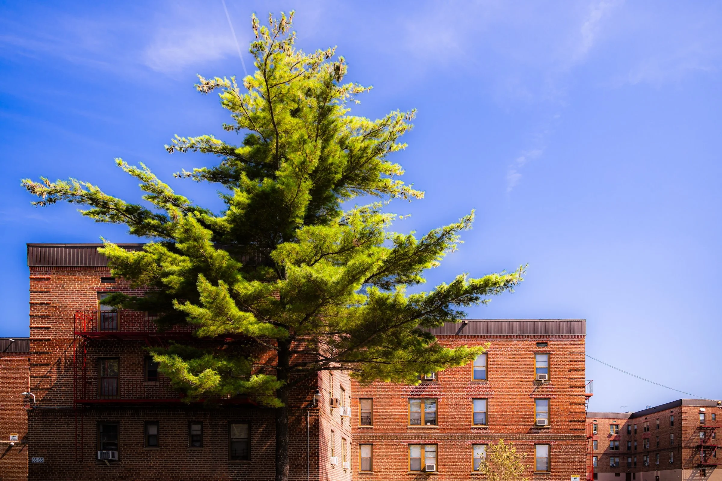
Scale and Contrast: I sought to capture the "Manhattan-adjacent" scale of the Hilltop Village and Cunningham Apartments. In “208th Street Pine,” the way the vibrant green of an evergreen tree reaches toward the upper stories of the brick towers emphasizes the neighborhood's "garden apartment" heritage—a legacy of providing air and light even in dense housing.
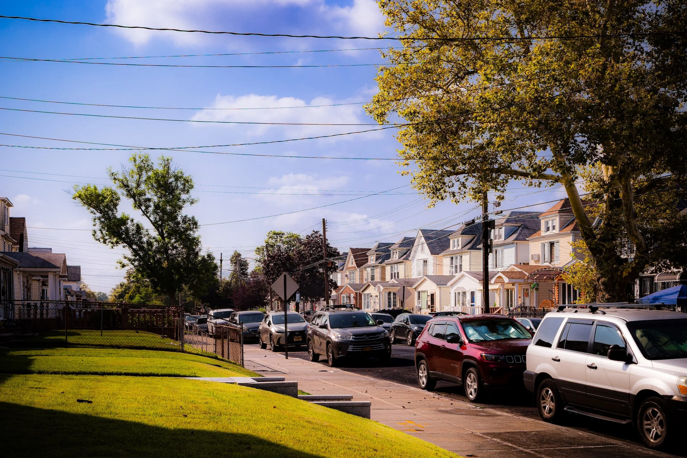
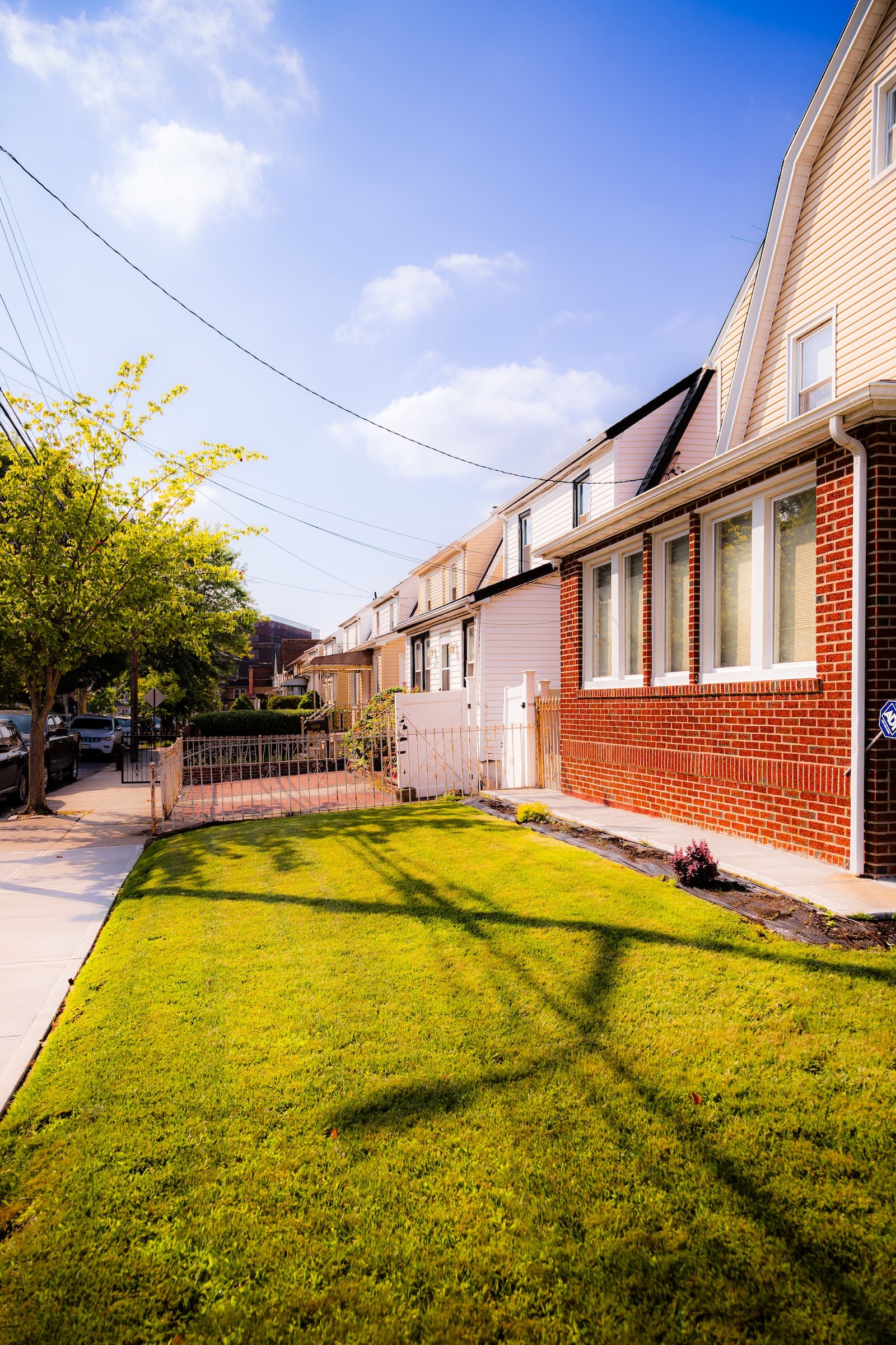
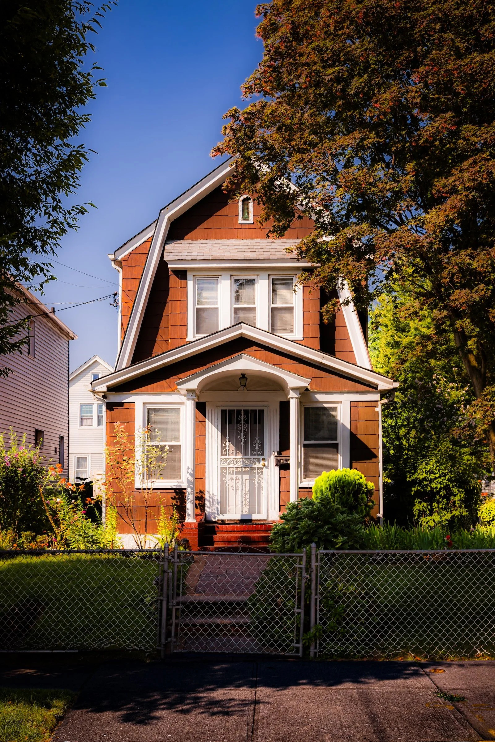
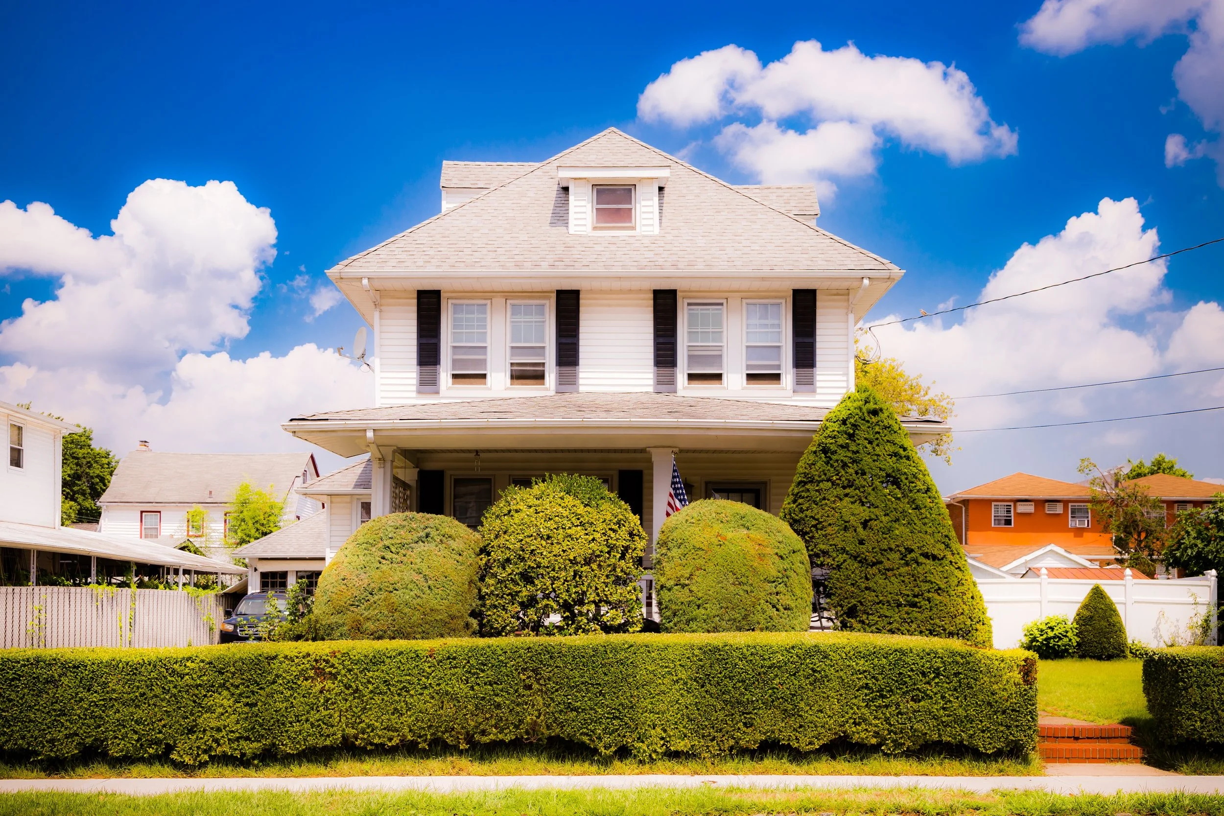
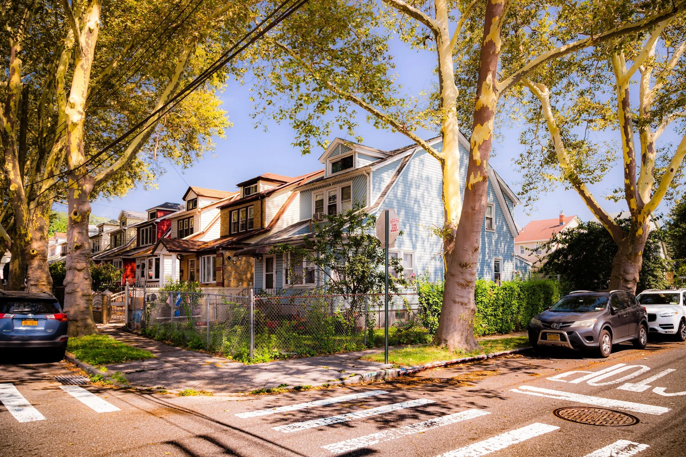
The Suburban Shimmer: On the neighborhood's residential side-streets, the 11:00 AM sun created a dramatic "shimmer" on the varied housing stock. I documented a row of detached homes in “Vandermeer Framed In Foliage,” noting how the sunlight highlights the textures of different siding, solar panels, and the sprawling, mottled trunks of ancient sycamore trees.
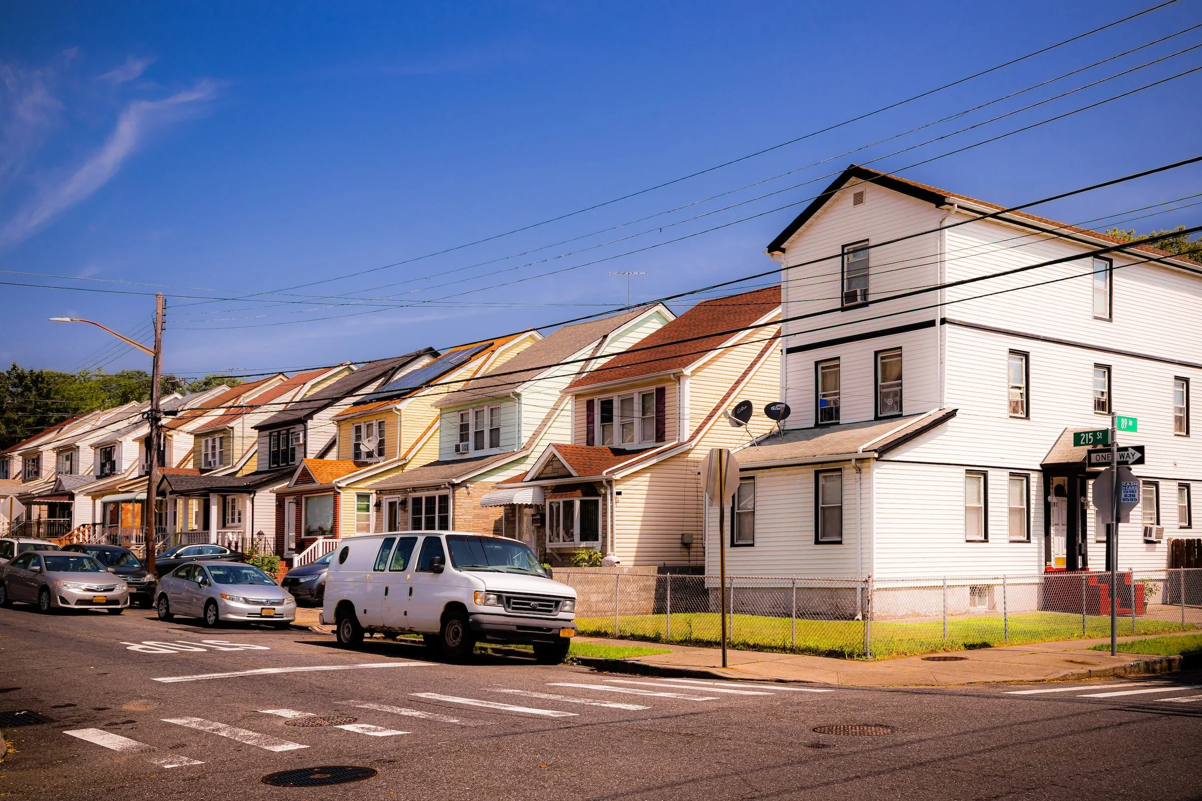
Luminous Rhythms: I focused on the geometric repetition of the streetscapes, such as the white-and-cream facades at the corner of 215th Street (see “Crossing 215th At 89th”). The high-contrast light of August casts long, graphic shadows across the pavement (see “Tree-Lined 215th Place”), perfectly framing the diverse architectural styles—from traditional Tudors to modern renovations—that define the enduring character of the community.
Spirit and Legacy
Queens Village’s legacy is one of stability amid change. For over a century, it has embodied the promise of the outer boroughs: affordable homeownership, community pride, and coexistence across lines of culture and faith. Its tidy lawns, porched colonials, and tree-lined avenues recall the optimism of an earlier era, while its present-day diversity affirms the adaptability of that ideal to new generations.
Queens Village Field Notes
-
Field Note: August 5, 2023 | 08:59 AM
Conditions: 82°F | Humidity: 49%.
Field Note: In Queens Village, the documentation reached a "glassy" state of clarity. The dropping humidity and intense August sun highlighted the architectural layers of the bustling commercial hubs, preserving the neighborhood in a state of high-vibrancy activity.
Queens Village presented a landscape of massive residential scale balanced by intimate, tree-lined quiet. I was struck by how the August sun transformed the utilitarian red-brick of Hilltop Village (see “208th Street Pine”) into something warm and inviting. There is a specific rhythm to this neighborhood—the shift from the high-density apartment complexes to the deep, sun-soaked shadows of the suburban blocks (see “Tree-Lined 215th Place”) illustrates the broad residential legacy of Eastern Queens.
Other neighborhoods visited:

Lawns At Vanderveer - Click To Purchase Print
208th Street Pine - Click To Purchase Print

Vandermeer Framed In Foliage - Click To Purchase Print
Crossing 215th At 89th - Click To Purchase Print
Tree-Lined 215th Place - Click To Purchase Print
Use this custom Google map to explore where every neighborhood in all five boroughs of New York City is located.
The Five Boroughs
One of New York City’s unique qualities is its organization in to 5 boroughs: Manhattan, Brooklyn, Queens, The Bronx, and Staten Island. These boroughs are part pragmatic administrative districts, and part vestiges of the region’s past. Each borough is an entire county in New York State - in fact, Brooklyn is, officially, Kings County, while Staten Island is, officially Richmond County. But that’s not the whole story …
Initially, New York City was located on the southern tip of Manhattan (now the Financial District) that was once the Dutch colony of New Amsterdam. Across the East River, another city was rising: Brooklyn. In time, the city planners realized that unification between the rapidly rising cities would create commercial and industrial opportunities - through streamlined administration of the region.
So powerful was the pull of unification between New York and Brooklyn that three more counties were pulled into the unification: The Bronx, Queens, and Staten Island. And on January 1, 1898, the City of New York unified two cities and three counties into one Greater City of New York - containing the five boroughs we know today.
But because each borough developed differently and distinctly until unification, their neighborhoods likewise uniquely developed. Today, there are nearly 390 neighborhoods, each with their own histories, cultures, cuisines, and personalities - and each with residents who are fiercely proud of their corner of The Big Apple.


