CO-OP CITY
The Bronx
Geographic Setting
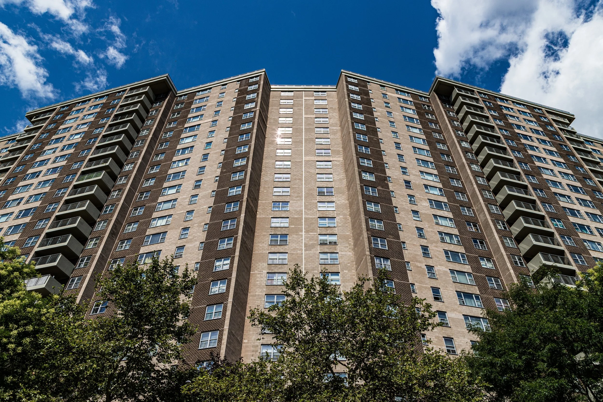
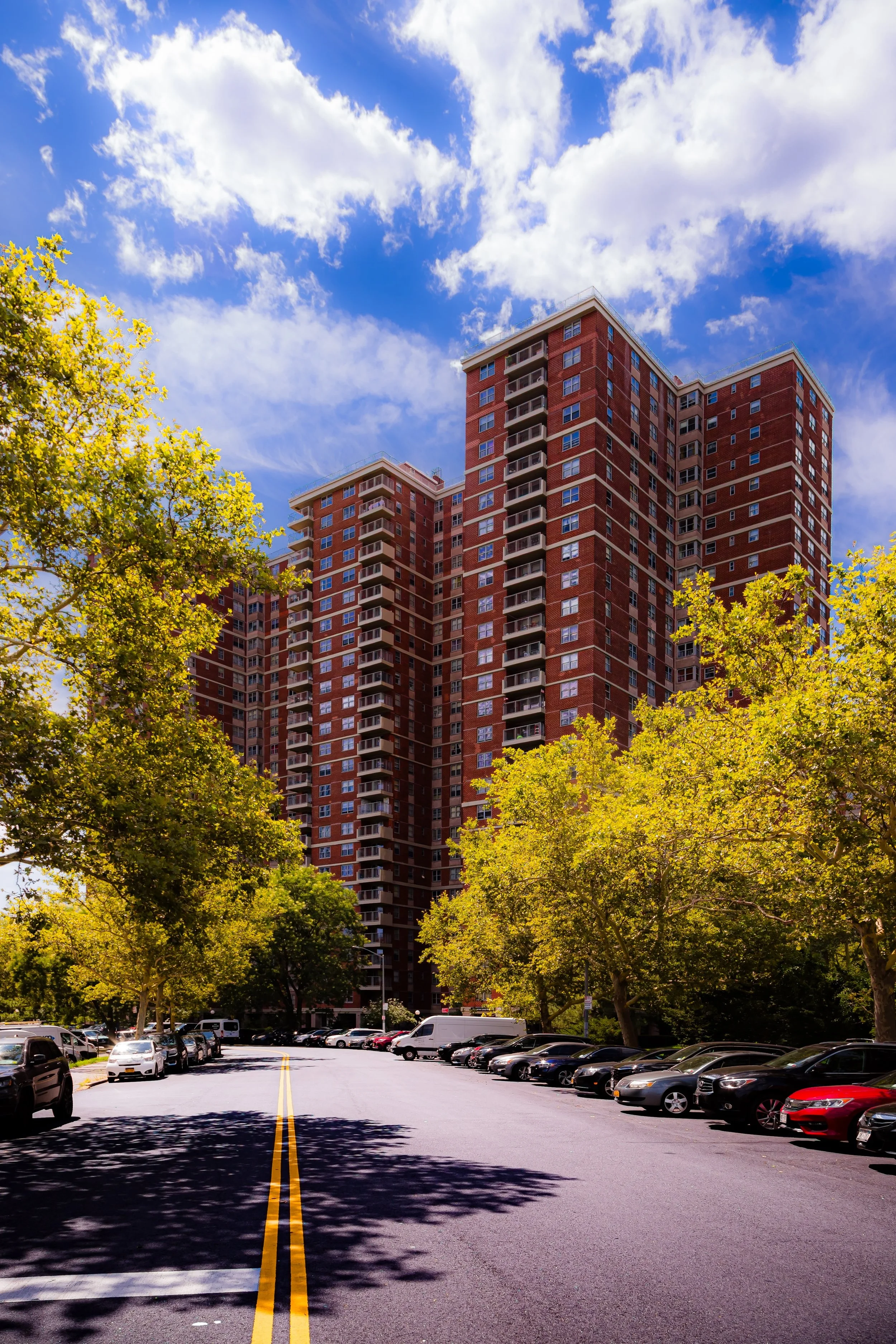
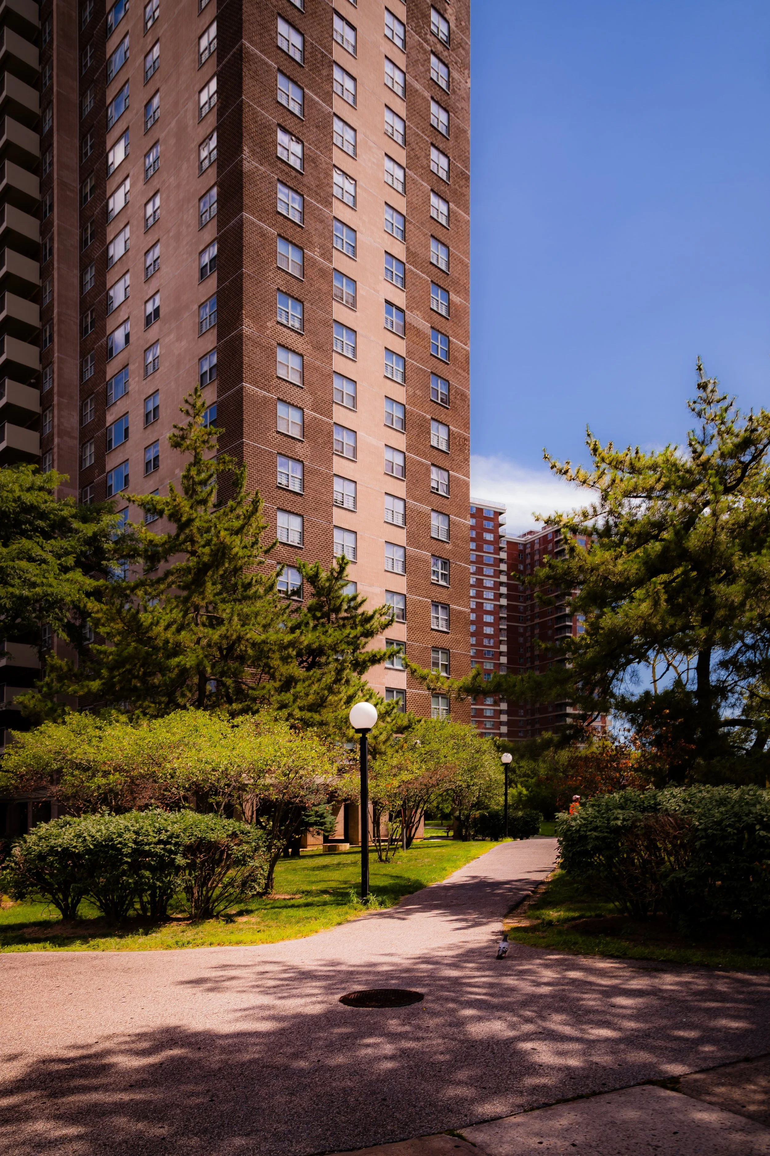
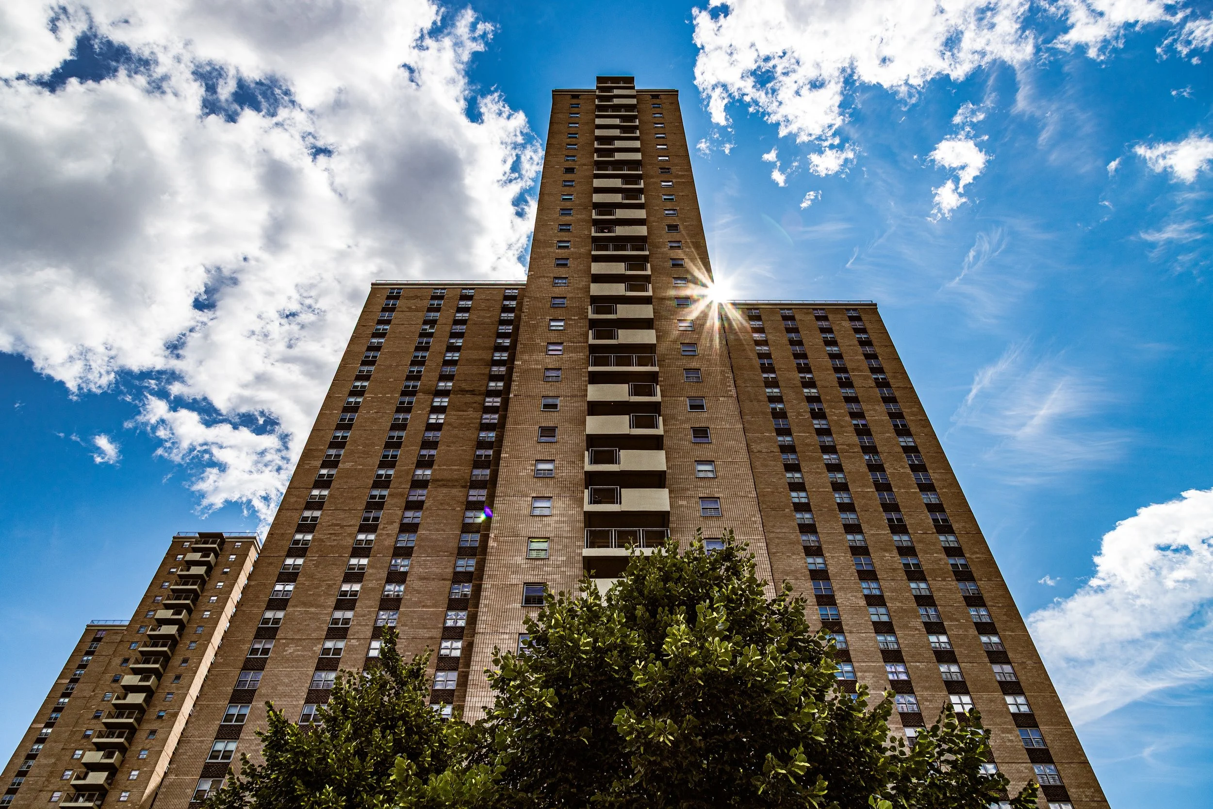
Situated in the far northeastern Bronx, Co-op City—short for Cooperative City—is bounded by Interstate 95 (the New England Thruway) to the west, Pelham Bay Park and Eastchester Bay to the east, the Hutchinson River Parkway and Hutchinson River to the south, and Baychester Avenue and Boston Road to the north. Spread across 320 acres, it stands as one of the largest planned residential developments in the world—a self-contained “city within a city,” defined by monumental housing towers, vast open lawns, schools, shopping centers, and community infrastructure built on what was once an empty tract of marshland and the site of the Freedomland U.S.A. amusement park.
The complex comprises 35 high-rise towers and seven clusters of townhouses, home to roughly 50,000 residents—a population comparable to that of a small American city. Its internal street grid—Dreiser Loop, Asch Loop, Bellamy Loop, and Carver Loop—encircles landscaped courtyards, playgrounds, and parking lots, all connected by pedestrian walkways designed to keep foot traffic separate from cars. The neighborhood’s geographic isolation is balanced by strong internal cohesion: three elementary schools, two middle schools, a high school, eight parking structures, shopping centers, and even its own power plant make Co-op City one of New York’s most self-sufficient urban communities.
Etymology
The name “Co-op City” derives from its organizational foundation as a housing cooperative—a development built under the Mitchell–Lama Housing Program of the 1960s, which provided state-backed financing for moderate-income residents to collectively own and manage their housing. “Co-op” emphasizes not only shared ownership but the social philosophy that guided its creation: a belief that large-scale, democratically run housing could deliver stability and equality for working families priced out of Manhattan.
The word “City” was no exaggeration. Conceived as a model of modern urban living, Co-op City was planned to include all the civic functions—residences, schools, shopping, parks, and utilities—of a standalone municipality within the Bronx.
The Neighborhood
Origins through the 19th Century
In the 19th century, the area that would become Concourse Village was part of the Town of Morrisania, a pastoral landscape of farms and estates owned by the Morris family. The extension of the Third Avenue Elevated Railroad in the 1880s and the development of the Grand Concourse (completed in 1909) opened the region to rapid urbanization. By the 1910s, waves of European immigrants—especially Jewish, Irish, and Italian families—settled here, drawn by new apartment buildings with modern amenities, proximity to transit, and the promise of clean air above the Harlem River valley.
The neighborhood’s location near Bronx Borough Hall and Bronx County Court House made it a civic hub as well as a residential one. Early 20th-century planners envisioned it as a dignified extension of Manhattan’s middle-class districts, anchored by the monumental boulevard to the west and the industrial corridors of Park Avenue and Third Avenue to the east.
Early 20th Century: The Bronx at Its Peak
By the 1920s and 1930s, Concourse Village (then simply part of the broader Concourse area) stood at the center of the Bronx’s golden age. Dozens of Art Deco masterpieces rose along Grand Concourse, Sheridan, and Morris Avenues, designed by architects such as Emery Roth and Horace Ginsbern. These buildings offered grand lobbies, terrazzo floors, sunken living rooms, and courtyards—an urban ideal that combined modern luxury with community scale.
The neighborhood thrived as a largely Jewish and Italian middle-class enclave. Kosher delis, bakeries, cinemas, and synagogues lined East 161st Street, while parks and promenades provided recreation. The opening of Yankee Stadium in 1923 and later the Bronx County Courthouse (1934) elevated the district’s prestige, symbolizing the Bronx’s arrival as a full-fledged metropolis.
Even during the Great Depression, the neighborhood maintained stability. Cooperative apartment ownership and strong civic institutions, such as the Bronx YMCA and Public School 31, reinforced social cohesion.
Co-Op City Video Coming Soon
Origins through the 19th Century
Long before towers rose on its horizon, the land beneath Co-op City was part of the Pelham Bay wetlands, used for farming and fishing by the Siwanoy people and later by colonial settlers. Through the 19th century, the area formed part of the Baychester and Pelham Bay tracts—rural outlands dotted with small estates and salt meadows. The coming of the New York, New Haven & Hartford Railroad and the construction of Pelham Bay Park in the late 1800s brought limited development but preserved much of the area as open space.
By the mid-20th century, the land was owned by the Freedomland Amusement Corporation, which opened Freedomland U.S.A. in 1960—a patriotic theme park often described as “America’s Disneyland.” Despite its grand ambitions, the park operated for only four years, closing in 1964 amid financial losses. The site’s extensive infrastructure—roads, utilities, and reclaimed ground—made it ideal for the large-scale housing experiment the state soon envisioned.
Early 20th Century: Vision and Construction of a Modern Cooperative
The idea for Co-op City emerged from the United Housing Foundation (UHF), a labor movement organization led by Abraham Kazan, often called the “father of cooperative housing.” The UHF had already built several successful cooperative communities, including the Amalgamated Houses and Rochdale Village in Queens. Co-op City would be their largest and most ambitious project—an entire city designed for the working and middle classes.
Construction began in 1966 and continued through 1973, producing an unprecedented urban development: 15,372 apartments across a mix of high-rises and townhouses. Architects Brown, Guenther & Simons designed the buildings in the modernist “tower in the park” tradition, emphasizing open green space and functional efficiency. The project’s cooperative structure allowed residents to purchase shares rather than traditional ownership, maintaining affordability and democratic control.
When Co-op City officially opened in 1969, it represented both a triumph of social planning and a statement of civic optimism—a community built to prove that public-spirited housing could thrive at scale.
Mid–Late 20th Century: Crisis, Protest, and Stabilization
Yet the utopia quickly encountered challenges. By the early 1970s, cost overruns, structural flaws, and management disputes led to financial crisis. The cooperative’s residents—many of them African-American, Puerto Rican, and Jewish working families—organized one of the largest tenant protests in U.S. history: the Co-op City Rent Strike of 1975–1976. For thirteen months, residents withheld payments to demand financial transparency, maintenance improvements, and democratic reform of the cooperative’s governance. Their eventual success restructured the project’s debt and solidified resident control, turning Co-op City into a powerful example of community activism.
Co-Op City Photo Gallery
Spirit and Legacy
Despite being constructed during a time when much of the Bronx faced decline and arson, Co-op City remained remarkably stable. Its geographic isolation, cooperative ownership, and strong internal governance insulated it from the disinvestment that devastated nearby neighborhoods. Through the 1980s and 1990s, the community evolved into a diverse, middle-income enclave—home to teachers, postal workers, civil servants, and retirees.
New York City
Use this custom Google map to explore where every neighborhood in all five boroughs of New York City is located.
The Five Boroughs
One of New York City’s unique qualities is its organization in to 5 boroughs: Manhattan, Brooklyn, Queens, The Bronx, and Staten Island. These boroughs are part pragmatic administrative districts, and part vestiges of the region’s past. Each borough is an entire county in New York State - in fact, Brooklyn is, officially, Kings County, while Staten Island is, officially Richmond County. But that’s not the whole story …
Initially, New York City was located on the southern tip of Manhattan (now the Financial District) that was once the Dutch colony of New Amsterdam. Across the East River, another city was rising: Brooklyn. In time, the city planners realized that unification between the rapidly rising cities would create commercial and industrial opportunities - through streamlined administration of the region.
So powerful was the pull of unification between New York and Brooklyn that three more counties were pulled into the unification: The Bronx, Queens, and Staten Island. And on January 1, 1898, the City of New York unified two cities and three counties into one Greater City of New York - containing the five boroughs we know today.
But because each borough developed differently and distinctly until unification, their neighborhoods likewise uniquely developed. Today, there are nearly 390 neighborhoods, each with their own histories, cultures, cuisines, and personalities - and each with residents who are fiercely proud of their corner of The Big Apple.


