CLIFTON
Staten Island
Geographic Setting
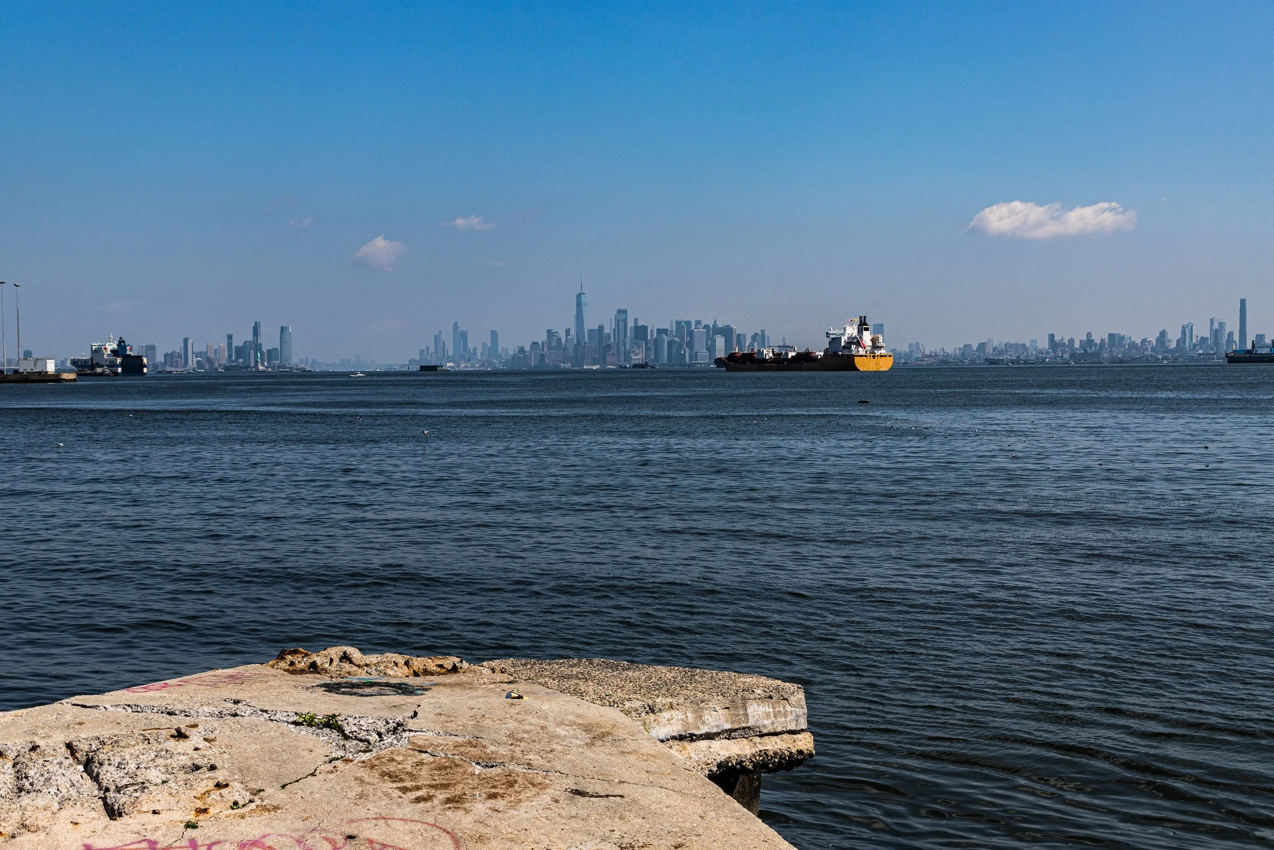
Bounded by the Staten Island Railway to the south, Osgood Avenue to the west, Vanderbilt Avenue to the north, and The Narrows to the east, Clifton occupies one of Staten Island’s most historic and topographically dynamic settings—an upland terrace overlooking the harbor approach between Staten Island and Brooklyn. Perched above the waters of The Narrows, Clifton offers sweeping views of Lower New York Bay, the Verrazzano-Narrows Bridge, and the distant skyline of Manhattan. Its narrow, curving streets descend steeply toward Bay Street, the neighborhood’s principal artery, while the uplands to the west rise toward Stapleton Heights and Park Hill.
Clifton’s landscape embodies a deep layering of New York history. The waterfront—once bustling with ferry slips, docks, and industrial yards—marks one of the oldest settled zones on the island, while the inland ridges are lined with 19th-century frame houses, tenements, and apartment blocks that testify to its long evolution from seaside resort to working-class enclave. Today, the Bay Street corridor and adjacent railway define the southern boundary of a community poised between renewal and preservation, where traces of Victorian elegance stand amid post-industrial grit and emerging redevelopment.
Etymology
The name Clifton was adopted in the mid-19th century, most likely inspired by the English word “cliff,” reflecting the neighborhood’s steep topography and its commanding view over The Narrows. In the 1840s and 1850s, developers marketed the area’s hillsides and sea vistas to affluent New Yorkers seeking summer retreats near the water. The suffix “-ton” added an air of gentility common to suburban developments of the era—echoing mainland enclaves such as Brighton and Clapton in England.
Earlier records refer to this stretch of shoreline simply as part of the Stapleton Landing district, but as new roads and estates emerged, the name Clifton came to designate the elevated portion above the bay. By the Civil War era, “Clifton” was well established, appearing in real-estate ads and railway maps. The name’s genteel associations outlasted its resort period, surviving into the 20th century as the area transformed into one of Staten Island’s most urban neighborhoods.
The Neighborhood
Origins through the 19th Century
Clifton’s roots extend deep into Staten Island’s colonial era. The area along The Narrows was first inhabited by the Lenape, who fished the tidal shallows and maintained summer settlements along the sheltered coves. In the 17th century, Dutch settlers established small farms and ferry operations here, capitalizing on the deepwater access and proximity to New York Harbor.
By the early 19th century, Clifton’s natural harbor and picturesque hills had drawn investors and leisure seekers alike. Wealthy Manhattan merchants built summer homes along the ridge, taking advantage of the sea breezes and easy access via ferry or coach from the St. George ferry landing. One of the area’s earliest landmarks was the Clifton Hotel, a grand resort built in the 1840s that catered to visitors seeking fresh air and sweeping views of the bay.
The arrival of the Staten Island Railway in 1860 transformed the district further. Clifton Station became one of its earliest stops, anchoring the community to the island’s growing transportation grid. By the 1870s, the neighborhood featured a mix of boarding houses, Victorian cottages, and modest worker dwellings serving the nearby docks, breweries, and industries springing up along Bay Street and Edgewater. The area’s dual identity—seaside elegance above, industry below—would define it for generations.
Early 20th Century: Industry, Immigration, and Urbanization
At the dawn of the 20th century, Clifton had evolved into a dense, working-class neighborhood. The waterfront bustled with maritime activity: ship repair yards, warehouses, and small factories lined Front Street and Edgewater Street, while stevedores, machinists, and dockworkers crowded the tenements along Bay Street.
Immigrants from Italy, Ireland, and Eastern Europe settled here in large numbers, drawn by affordable rents and proximity to work. Churches such as Our Lady of Mount Carmel and neighborhood social halls provided the spiritual and cultural anchors of daily life. The narrow streets rang with the sounds of street vendors, horse carts, and the constant whistle of the railway trains.
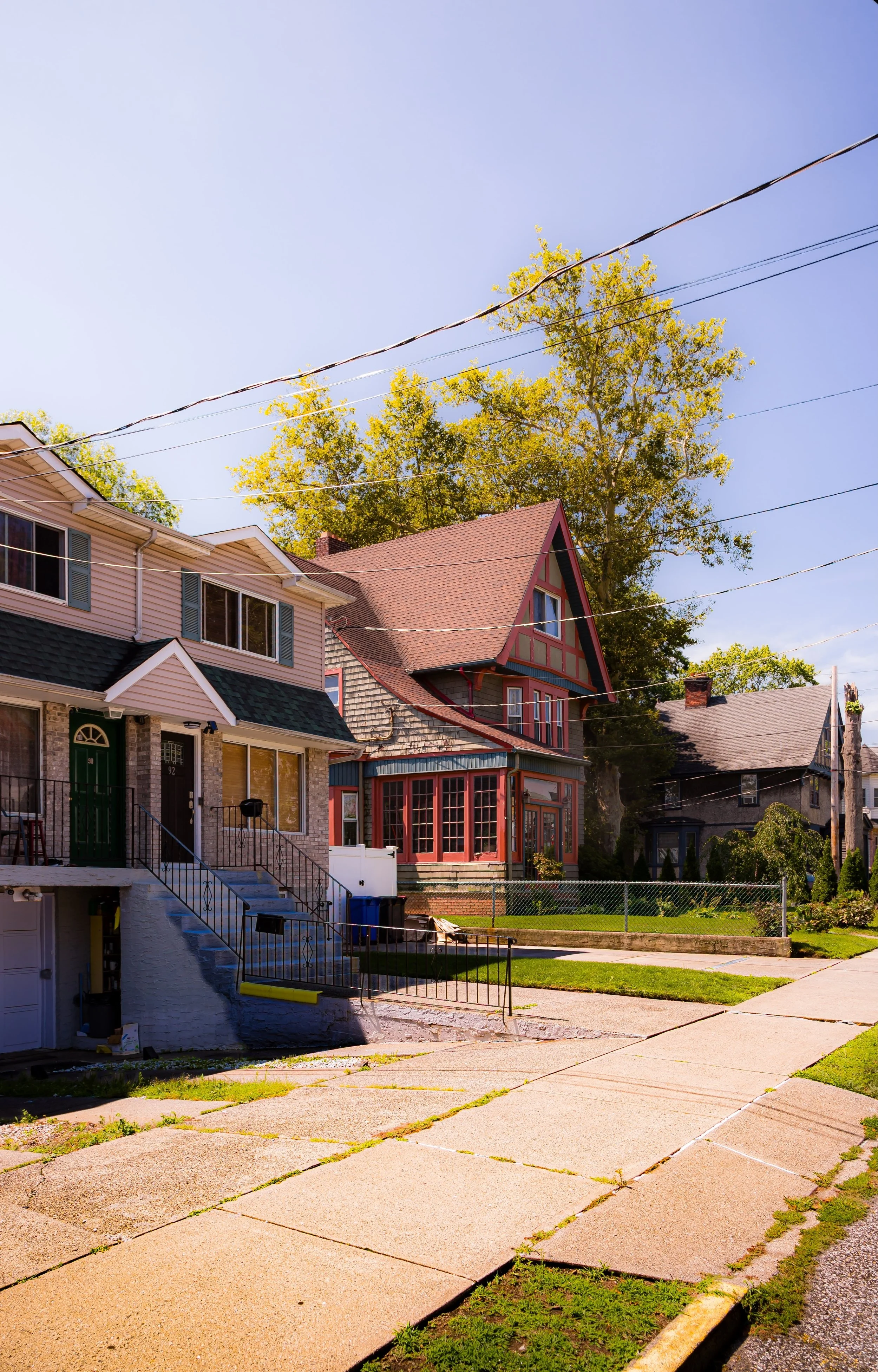
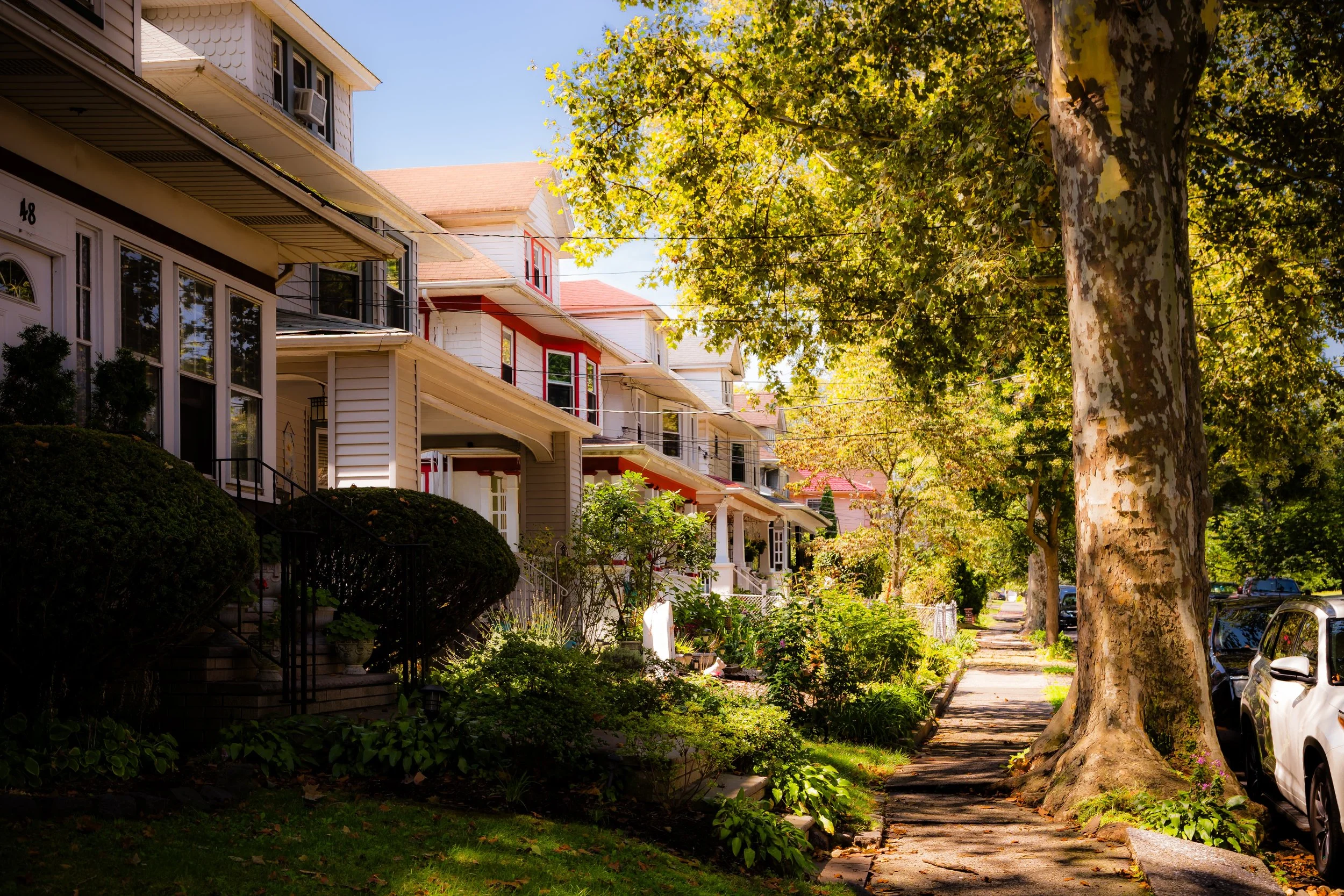
Despite its modest means, Clifton retained vestiges of its earlier grace: Victorian rowhouses with decorative porches, tree-shaded lanes, and glimpses of the harbor from the upper slopes. Its location near Stapleton and Rosebank made it part of Staten Island’s northern “urban crescent,” a series of neighborhoods that more closely resembled Brooklyn than the suburban South Shore.
During the 1920s and 1930s, public works projects improved infrastructure, paving the streets and installing sewers. Yet poverty persisted through the Great Depression, and many of the once-grand estates were subdivided into apartments or rooming houses. Clifton’s character became defined by resilience—an immigrant neighborhood sustained by labor, faith, and community.
Clifton Video Coming Soon
Mid–Late 20th Century: Decline and Persistence
The postwar decades brought both decline and adaptation. Industrial activity along the waterfront waned as shipping shifted to larger ports in New Jersey, leaving vacant docks and abandoned factories. The construction of the Verrazzano-Narrows Bridge (1964) dramatically altered the neighborhood’s skyline, but also diverted traffic and commerce away from Bay Street.
In the 1960s and 1970s, urban renewal efforts reshaped portions of Clifton. Several older housing clusters were replaced by modern apartment complexes and public housing developments, notably the Park Hill Apartments, built on the uplands west of Bay Street. Originally conceived as middle-income housing, Park Hill eventually became associated with economic hardship and social struggle as the decades wore on. Still, Clifton remained one of Staten Island’s most diverse communities—home to African American, Caribbean, and later, Liberian and West African families who brought new traditions, cuisines, and small businesses to the area.
Through periods of economic stagnation, local churches, civic groups, and youth organizations provided essential stability. The Clifton Station continued to connect the neighborhood to St. George and Tottenville, keeping it woven into the island’s commuter life. Despite physical and economic challenges, Clifton endured, held together by the strength of its residents and the geography that first drew settlers to its heights.
21st Century: Renewal on the Edge of the Bay
In the 21st century, Clifton stands poised between reinvention and preservation. The broader revitalization of the North Shore waterfront, including projects in nearby Stapleton and Tompkinsville, has brought new investment, streetscape improvements, and attention to the Bay Street corridor. Restaurants, cafés, and art studios have begun to appear in refurbished storefronts, while new housing initiatives seek to balance growth with affordability.
At the same time, Clifton’s natural and historic assets are gaining recognition. The shoreline along The Narrows offers panoramic views and opportunities for waterfront restoration, while the steep uplands continue to attract residents seeking character and proximity to the ferry. Community organizations have led efforts to strengthen safety, expand youth programs, and celebrate the neighborhood’s multicultural heritage.
Challenges remain—economic disparity, infrastructure aging, and the need for balanced development—but the momentum of renewal is unmistakable. Where once ferries and factories defined the neighborhood’s pulse, today it is marked by community gardens, renovated brownstones, and the hum of trains beneath a skyline reasserting its beauty.
Clifton Photo Gallery
Spirit and Legacy
Clifton’s spirit is one of endurance and transformation—a neighborhood that has lived many lives yet never lost its connection to the harbor and the city beyond. From resort enclave to working-class stronghold, from industrial port to multicultural community, it has absorbed each era’s imprint while retaining its sense of authenticity.
Its narrow streets and harbor winds carry echoes of every generation that has called it home—dockworkers and immigrants, musicians and shopkeepers, families who looked east toward the lights of Brooklyn and Manhattan yet built their futures here on Staten Island’s own shore.
Today, Clifton endures as a symbol of the island’s complexity: urban and coastal, historic and evolving, resilient and hopeful. Its cliffs still face The Narrows as they did two centuries ago—witness to the passage of ships, time, and the ceaseless renewal of New York City itself.
New York City
Use this custom Google map to explore where every neighborhood in all five boroughs of New York City is located.
The Five Boroughs
One of New York City’s unique qualities is its organization in to 5 boroughs: Manhattan, Brooklyn, Queens, The Bronx, and Staten Island. These boroughs are part pragmatic administrative districts, and part vestiges of the region’s past. Each borough is an entire county in New York State - in fact, Brooklyn is, officially, Kings County, while Staten Island is, officially Richmond County. But that’s not the whole story …
Initially, New York City was located on the southern tip of Manhattan (now the Financial District) that was once the Dutch colony of New Amsterdam. Across the East River, another city was rising: Brooklyn. In time, the city planners realized that unification between the rapidly rising cities would create commercial and industrial opportunities - through streamlined administration of the region.
So powerful was the pull of unification between New York and Brooklyn that three more counties were pulled into the unification: The Bronx, Queens, and Staten Island. And on January 1, 1898, the City of New York unified two cities and three counties into one Greater City of New York - containing the five boroughs we know today.
But because each borough developed differently and distinctly until unification, their neighborhoods likewise uniquely developed. Today, there are nearly 390 neighborhoods, each with their own histories, cultures, cuisines, and personalities - and each with residents who are fiercely proud of their corner of The Big Apple.


