
MARINE PARK
Brooklyn
Geographic Setting
Bounded by Kings Highway to the north, Nostrand Avenue to the northwest, Flatbush Avenue to the east, Gerritsen Avenue to the west, and Rockaway Inlet to the south, Marine Park is one of Brooklyn’s broadest, greenest, and most distinctly suburban neighborhoods—a place where urban grid gives way to open sky, salt air, and the rhythm of the tide. Centered around the vast expanse of Marine Park proper, New York City’s largest inland park, the neighborhood blends natural marshland, historic development, and 20th-century domestic architecture into a single, cohesive landscape.
The neighborhood’s character is defined by its open space and proximity to the water. To the south lies Jamaica Bay’s Rockaway Inlet, its wetlands and salt meadows stretching toward the horizon; to the north, quiet residential streets lined with brick rowhouses, semidetached homes, and postwar bungalows. Major thoroughfares—Gerritsen Avenue, Fillmore Avenue, and Avenue U—trace the edges of the park and connect the community to Flatlands, Mill Basin, and Sheepshead Bay. The namesake park at its heart is both a literal and symbolic center—a 798-acre sanctuary of meadows, creeks, and playing fields that gives Marine Park its unique balance of nature and neighborhood.
Etymology and Origins
The name Marine Park derives directly from the great park and surrounding marshlands that define the area. The term “marine” refers not to military heritage but to the district’s coastal geography—a landscape of tidal creeks, inlets, and bays. The park itself owes its existence to the preservation of the Gerritsen Creek estuary, a tidal waterway whose history predates the city by centuries.
Before urban settlement, this area was home to the Canarsee Lenape, who fished, hunted, and gathered shellfish in the surrounding wetlands. In the 17th century, Dutch settlers—among them Hugh Gerritsen, after whom Gerritsen Avenue is named—established farms along the creek and the adjoining uplands. Gerritsen constructed a tidal grist mill around 1645, one of the earliest in the New World, which stood near the modern park’s northern edge for nearly three centuries.
The Neighborhood
19th Century: Farmland and Salt Meadows
Through the 18th and 19th centuries, the area that would become Marine Park remained largely rural. It formed part of the Town of Flatlands, one of the original six towns of Kings County. The landscape was characterized by low-lying meadows, hayfields, and creeks feeding into Jamaica Bay. Salt hay harvested from these marshes was used for livestock bedding and feed, while small farms along what are now Gerritsen and Flatbush Avenues cultivated vegetables and grains for the markets of Brooklyn and Manhattan.
Development was minimal; the terrain’s marshy quality and frequent flooding discouraged large-scale construction. Yet the arrival of improved roads—particularly Flatbush Avenue (extended to the Marine Parkway by the 1890s)—and nearby trolley lines began to change perceptions of the area’s value. By the end of the 19th century, civic reformers and landscape planners saw potential in these meadows not only for agriculture but for recreation and conservation.
Early 20th Century: The Birth of Marine Park and a Neighborhood
The modern identity of Marine Park emerged in the 1910s–1930s, when city officials and private donors set aside vast tracts of salt marsh for parkland. The largest donation came from Alfred Tredway White and Frederick B. Pratt, philanthropists who in 1917 gifted 150 acres to the city for public use. The site was expanded in 1924, officially designated Marine Park—envisioned as Brooklyn’s answer to Central Park, though with a focus on natural wetlands rather than manicured gardens.
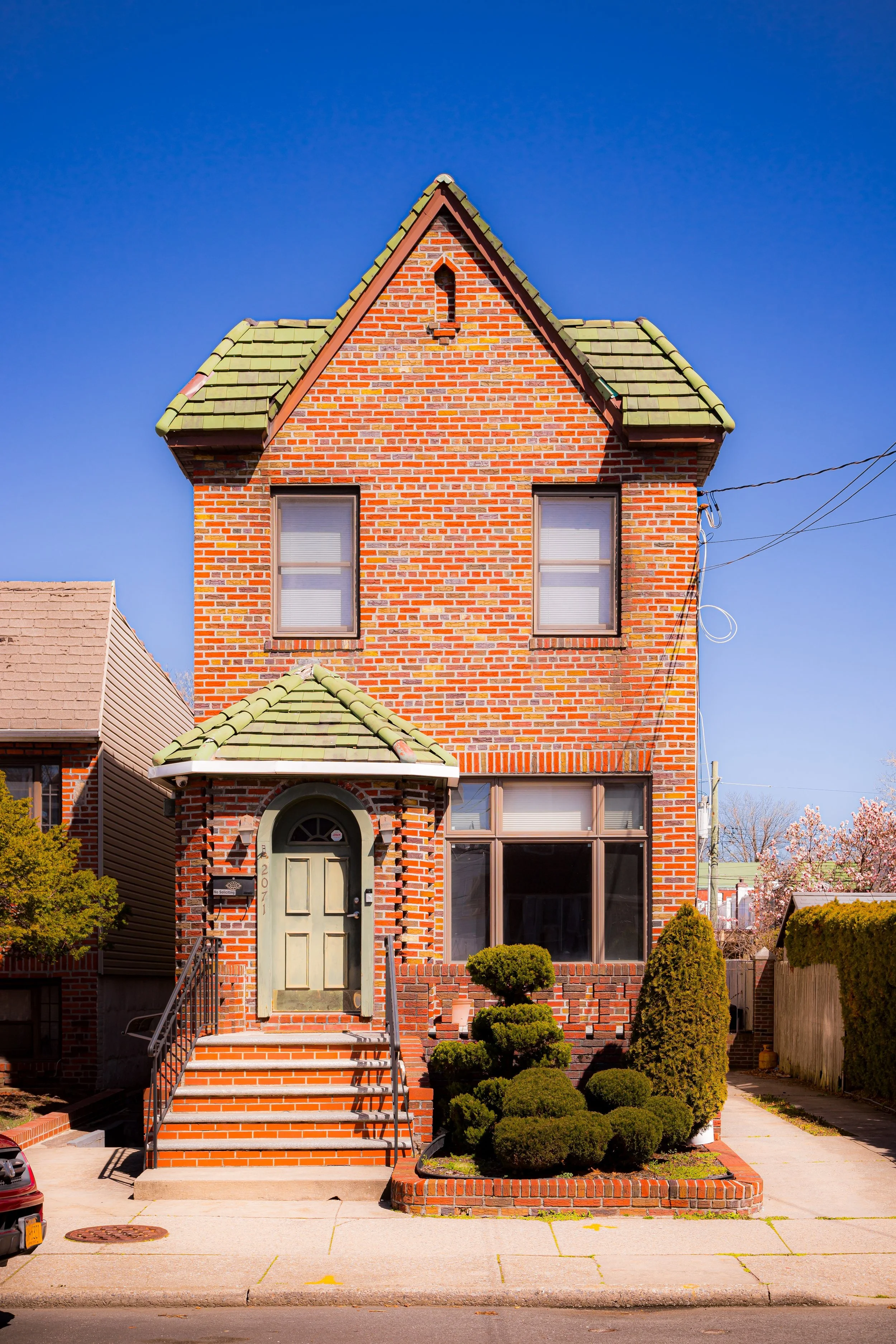
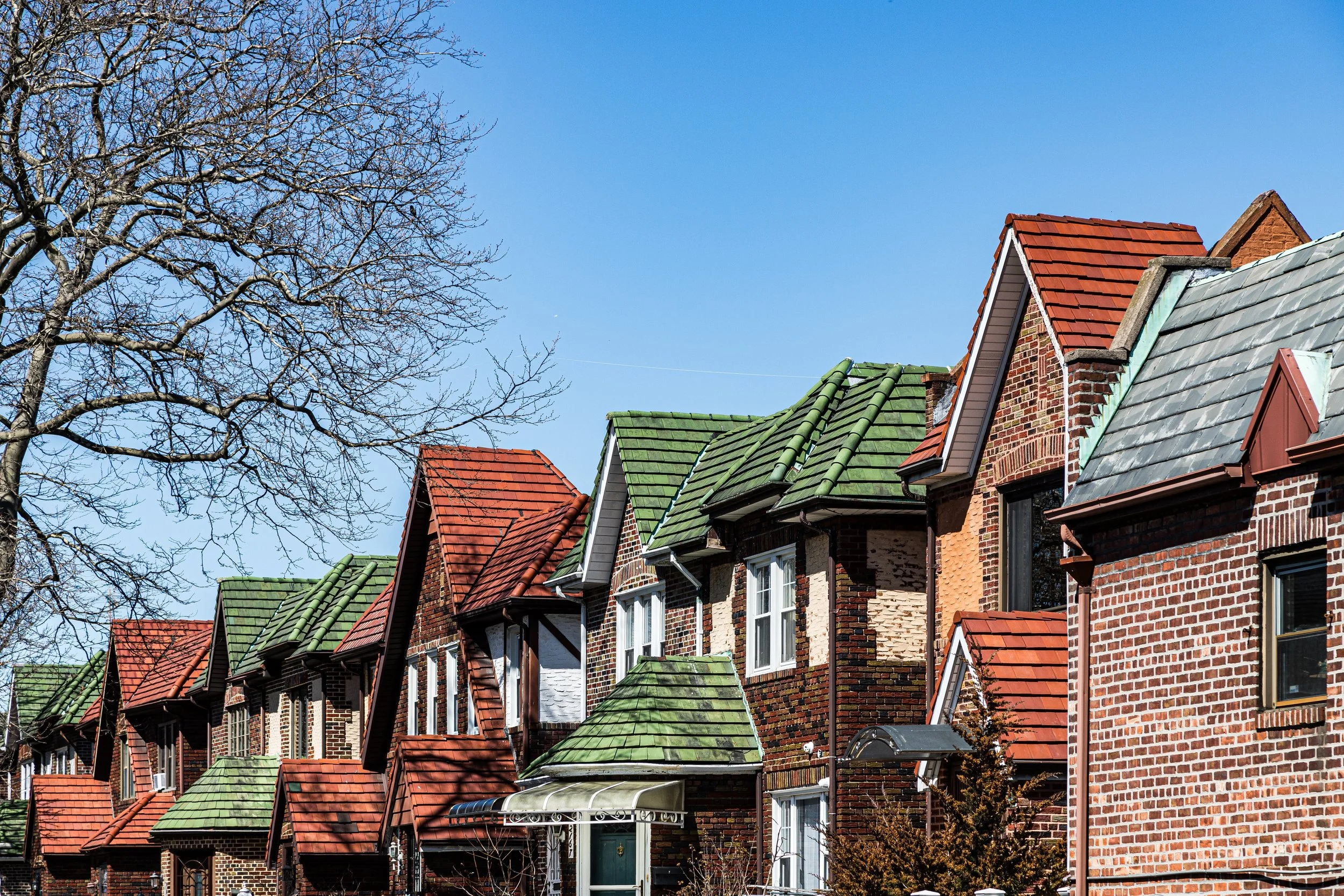
Meanwhile, the surrounding area was subdivided for residential use. Developers marketed the neighborhood as a modern suburban retreat within the city—offering fresh air, open space, and modern amenities. Streets such as Avenue S, Avenue T, and Fillmore Avenue filled with two-family brick homes, bungalows, and Tudor-style rowhouses, built for teachers, city workers, and returning veterans. The Marine Park Civic Association, founded in 1931, played a pivotal role in shaping orderly growth, advocating for schools, transit, and park improvements.
The 1930s brought large-scale park development under Robert Moses, who drained sections of the marsh and installed ballfields, playgrounds, and the oval-shaped Marine Park Golf Course (opened 1964). Moses’ crews also built the Gerritsen Inlet Seawall and improved access roads, tying the neighborhood more directly to the rest of Brooklyn.
Marine Park Video Coming Soon
Mid–Late 20th Century: Community, Growth, and Environmental Awareness
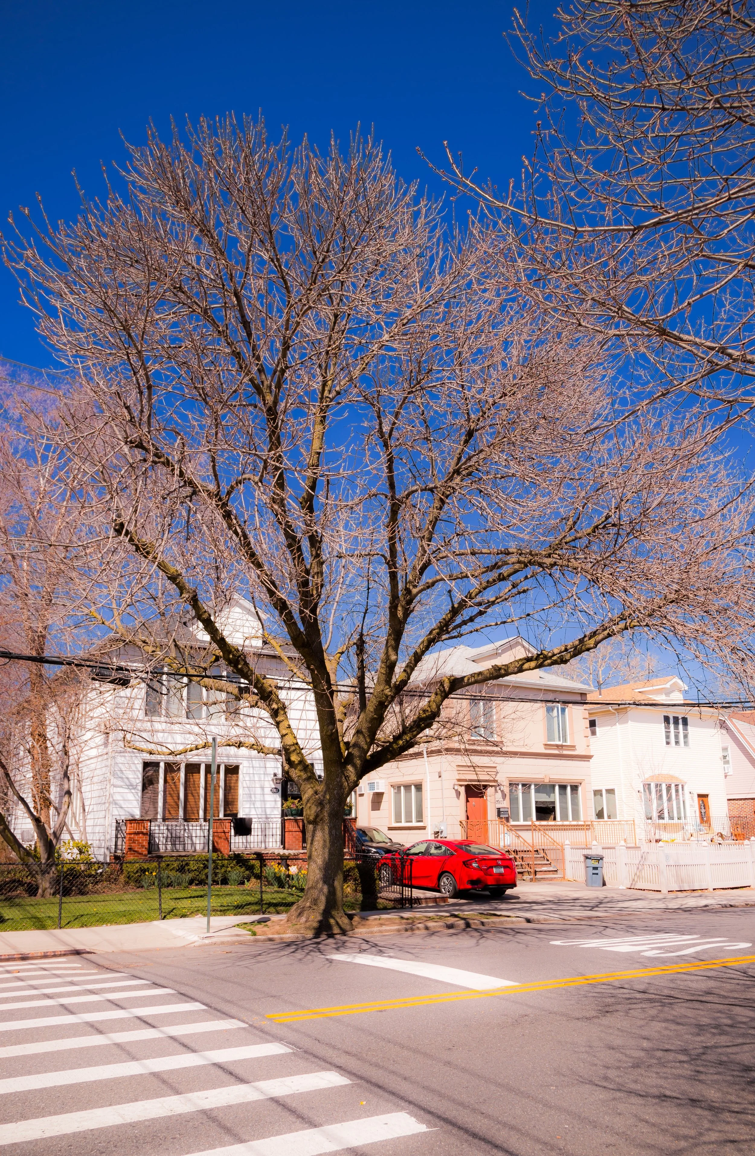
By the 1950s–1970s, Marine Park had become a model of Brooklyn’s postwar middle-class suburbia. Its residents—largely Jewish, Irish, and Italian-American families—tended small gardens, joined civic clubs, and sent their children to nearby P.S. 207 and Marine Park Junior High School (I.S. 278). The neighborhood’s stability and self-contained feel made it one of southern Brooklyn’s most desirable addresses.
Yet the area’s proximity to the water also brought awareness of ecological fragility. The remaining salt marshes, once considered expendable, came under protection through environmental activism. The Gerritsen Creek Nature Trail was created in the 1970s, allowing residents to explore tidal flats and restored wetlands. The Salt Marsh Nature Center, opened in 2000, became an educational and ecological hub, reasserting Marine Park’s original identity as a landscape of living nature.
Throughout these decades, the built environment changed little. The housing stock—solid brick two-family homes with stoops, bay windows, and shared driveways—aged gracefully. The small commercial corridors along Avenue U and Flatbush Avenue continued to serve local needs, while churches, synagogues, and social clubs reinforced community life.
21st Century: Renewal by the Water’s Edge
In the 21st century, Marine Park continues to embody the balance between city and nature that defined its birth. The neighborhood remains primarily residential and family-oriented, with tree-lined streets and a strong tradition of civic involvement. The park itself, now spanning nearly 800 acres, has become one of New York City’s most ecologically significant green spaces—home to egrets, fiddler crabs, diamondback terrapins, and miles of restored salt marsh.
Population shifts have brought greater diversity, with new arrivals from the Caribbean, Eastern Europe, and South Asia joining the neighborhood’s long-established communities. The result is a quietly cosmopolitan character expressed in its storefronts and schools. Meanwhile, environmental stewardship has taken on renewed urgency: community groups and the NYC Parks Department collaborate to restore wetlands, expand bike paths, and enhance resilience against coastal flooding.
Despite its relative tranquility, Marine Park remains deeply connected to Brooklyn’s pulse. Weekends bring joggers, golfers, and families to the park’s fields and trails; summer evenings echo with softball games, barbecues, and the calls of seabirds. The rhythm of the tide along Gerritsen Creek continues to mark the passing of the day—a sound as old as the land itself.
Marine Park Photo Gallery
Spirit and Legacy
Marine Park’s legacy is one of harmony between landscape and community. It is Brooklyn’s most literal edge—the place where the city’s orderly grid dissolves into water, meadow, and wind—and yet it remains fully urban, shaped by the same immigrant resilience and civic pride that define the borough.
New York City
Use this custom Google map to explore where every neighborhood in all five boroughs of New York City is located.
The Five Boroughs
One of New York City’s unique qualities is its organization in to 5 boroughs: Manhattan, Brooklyn, Queens, The Bronx, and Staten Island. These boroughs are part pragmatic administrative districts, and part vestiges of the region’s past. Each borough is an entire county in New York State - in fact, Brooklyn is, officially, Kings County, while Staten Island is, officially Richmond County. But that’s not the whole story …
Initially, New York City was located on the southern tip of Manhattan (now the Financial District) that was once the Dutch colony of New Amsterdam. Across the East River, another city was rising: Brooklyn. In time, the city planners realized that unification between the rapidly rising cities would create commercial and industrial opportunities - through streamlined administration of the region.
So powerful was the pull of unification between New York and Brooklyn that three more counties were pulled into the unification: The Bronx, Queens, and Staten Island. And on January 1, 1898, the City of New York unified two cities and three counties into one Greater City of New York - containing the five boroughs we know today.
But because each borough developed differently and distinctly until unification, their neighborhoods likewise uniquely developed. Today, there are nearly 390 neighborhoods, each with their own histories, cultures, cuisines, and personalities - and each with residents who are fiercely proud of their corner of The Big Apple.


