BROOKLYN
Neighborhoods
Part of an ongoing project to walk and photograph every neighborhood in New York City, this page explores Brooklyn through maps, borough identity, history, and photography.
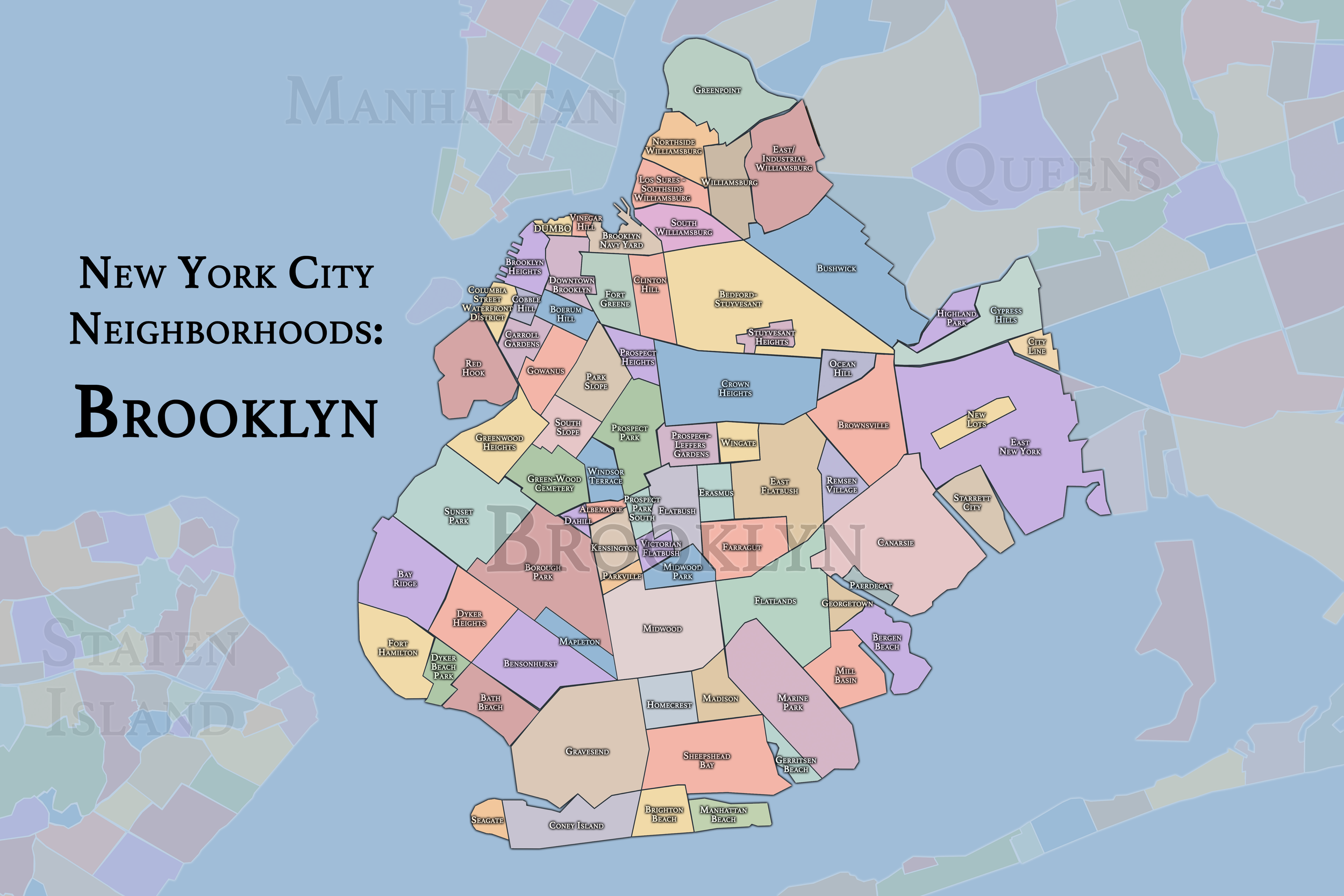
The Maps
Geographic Setting
Occupying the southwestern tip of Long Island, Brooklyn spans a landscape of remarkable diversity—flat coastal plains, glacial ridges, and tidal inlets stretching from the East River and Upper New York Bay in the west to Jamaica Bay and the Atlantic Ocean in the southeast. Covering roughly 71 square miles, it is the largest of New York City’s five boroughs, bounded by Queens to the east, Staten Island across The Narrows, and Manhattan across the East River. Its neighborhoods—over 70 in number—range from the brownstone streets of Brooklyn Heights and Park Slope to the beachside communities of Coney Island and Sheepshead Bay, the industrial waterfronts of Greenpoint and Red Hook, and the tree-lined enclaves of Flatbush, Bay Ridge, and Borough Park.
Brooklyn’s geography has always been both physical and human—a tapestry of ethnic enclaves, economic frontiers, and urban ideals. From the crest of the Terminal Moraine that forms Prospect Park’s spine, the borough slopes gently to the sea, its grid woven across what were once farmlands and salt marshes. The borough’s motto, Eendraght Maeckt Maght—“Unity Makes Strength”—captures both its Dutch colonial origins and the multiplicity of its modern identity.
Brooklyn Identity
Borough Identity
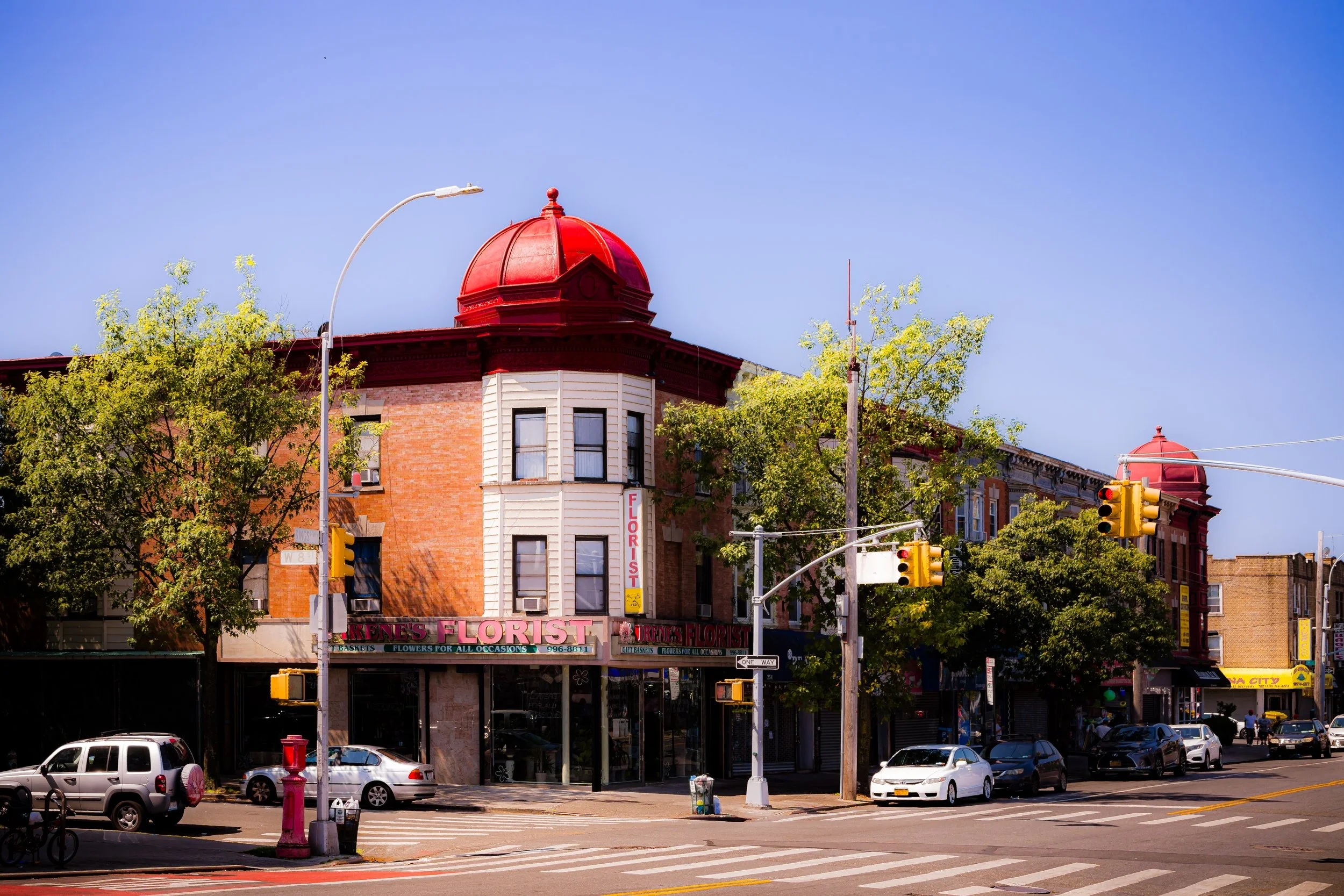
Brooklyn possesses one of New York City’s broadest and most varied urban identities: a borough of brownstone blocks and industrial waterfronts, rowhouse streets and tower clusters, civic institutions and neighborhood main streets, tightly woven residential districts and wide stretches of shoreline. More expansive than Manhattan and less topographically forceful than the Bronx, Brooklyn often feels defined by reach — geographically, architecturally, and culturally — with neighborhoods shaped as much by local identity as by any single borough-wide core.
What distinguishes Brooklyn is the confidence with which different urban conditions coexist there. Residential and industrial, historic and newly made, intimate and monumental, the borough’s neighborhoods reflect immigration, commerce, faith, public life, and local pride with unusual force and variety. To move through Brooklyn is to encounter a borough that is layered, self-possessed, and unmistakably neighborhood-driven.

Brooklyn takes its name from the Dutch town Breukelen, meaning “broken land” or “marshland,” a reference to the reclaimed wetlands of its original European settlers. When Dutch colonists established farms here in the mid-17th century, they christened their new village after the homeland they left behind, unaware that “Breukelen”—later Anglicized to Brookland and finally Brooklyn—would one day become one of the world’s great urban centers.
Before the Dutch arrival, the region was home to the Lenape, specifically the Canarsee and Nyack peoples, who fished, hunted, and cultivated the fertile plain stretching between the East River and Jamaica Bay. Their trails became the foundations of modern thoroughfares such as Kings Highway and Flatbush Avenue. The Dutch West India Company’s colonists, arriving in the 1630s, established six agricultural villages—Breukelen, Flatlands, Flatbush, Gravesend, New Utrecht, and Bushwick—that together formed the core of what would become Kings County.
Etymology and Origins
The Visual Identity of Brooklyn
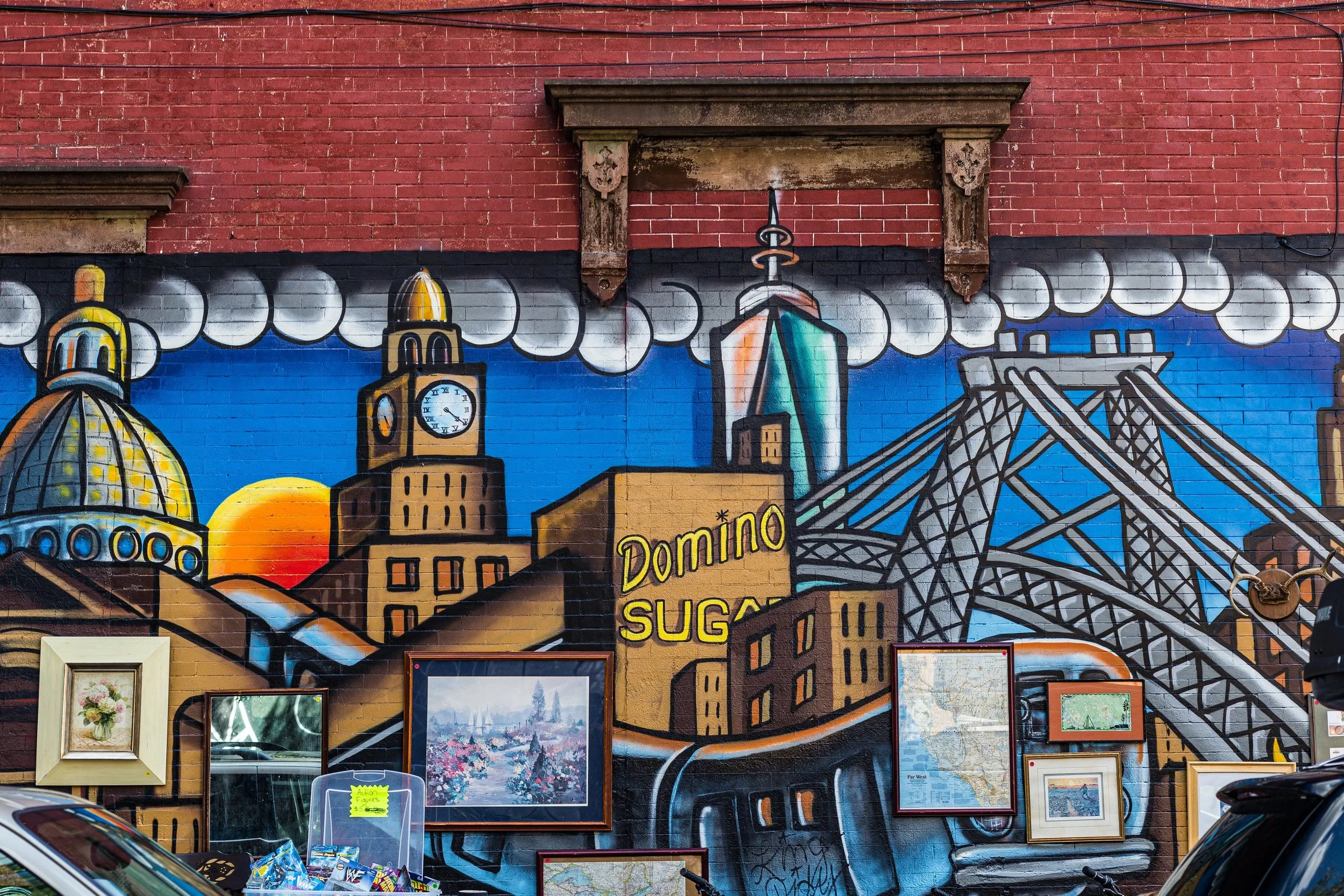
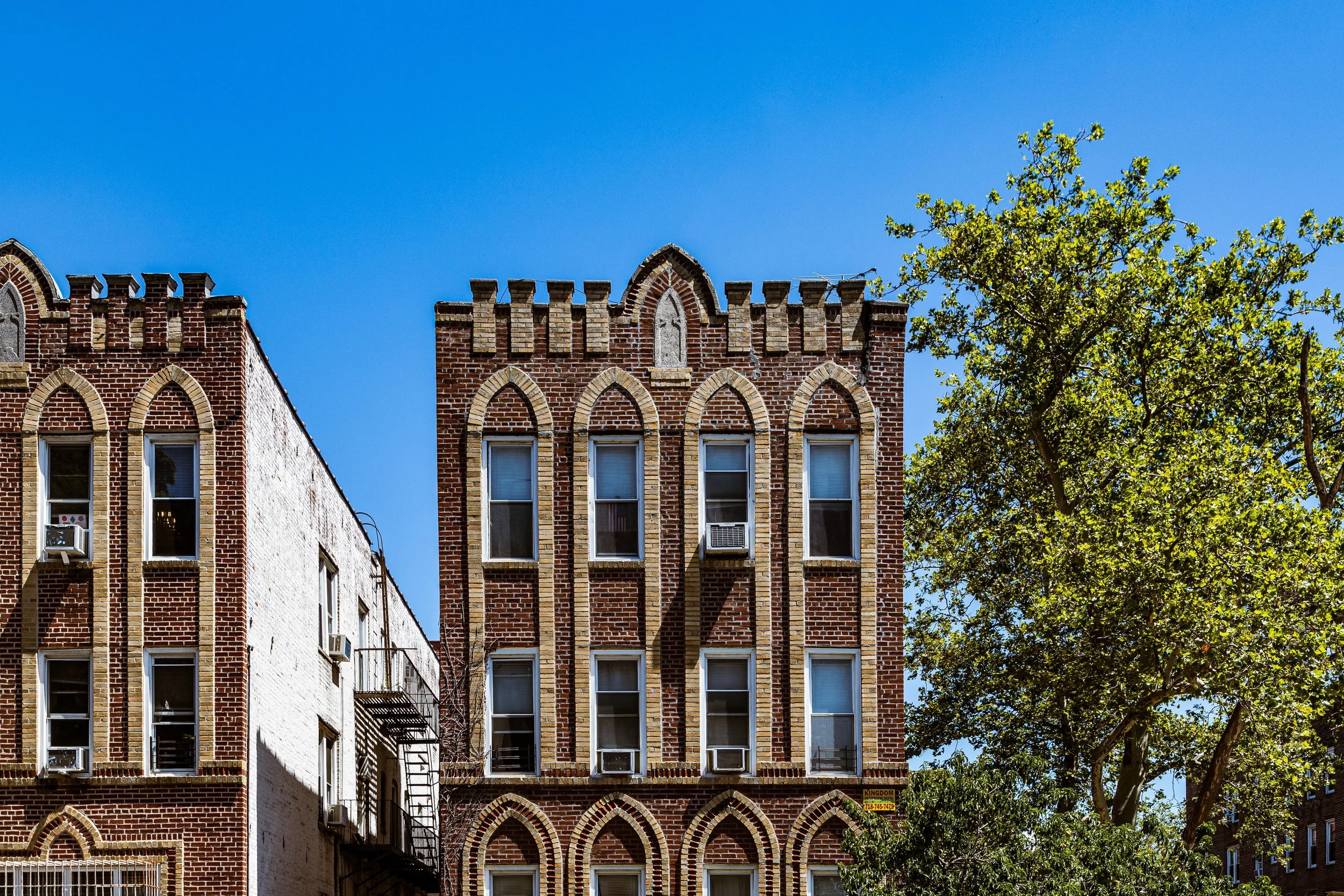
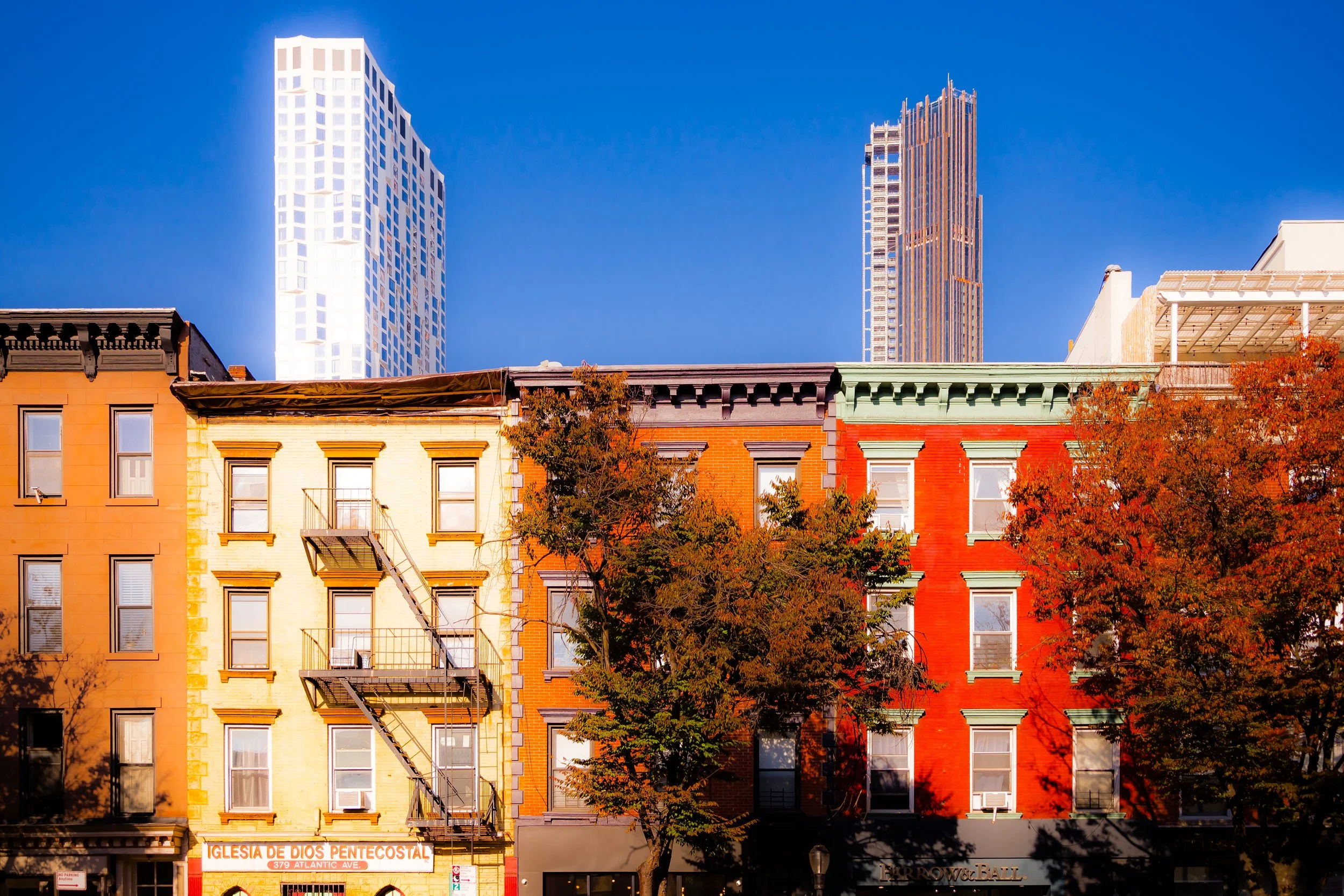
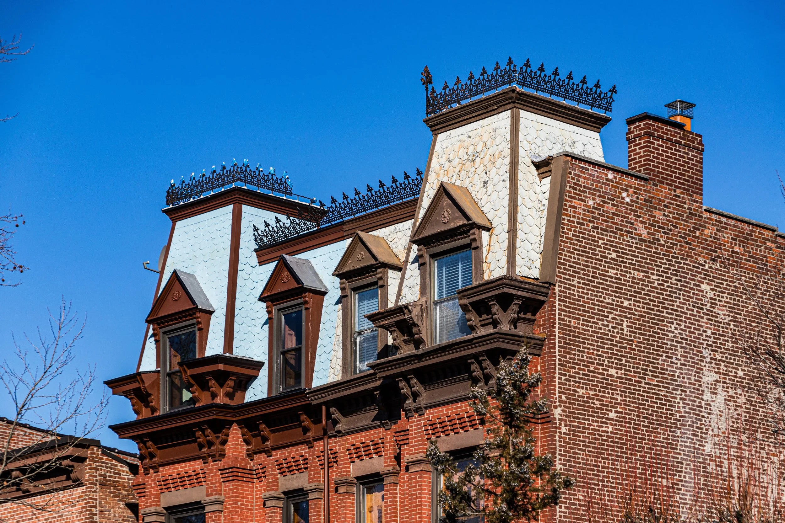
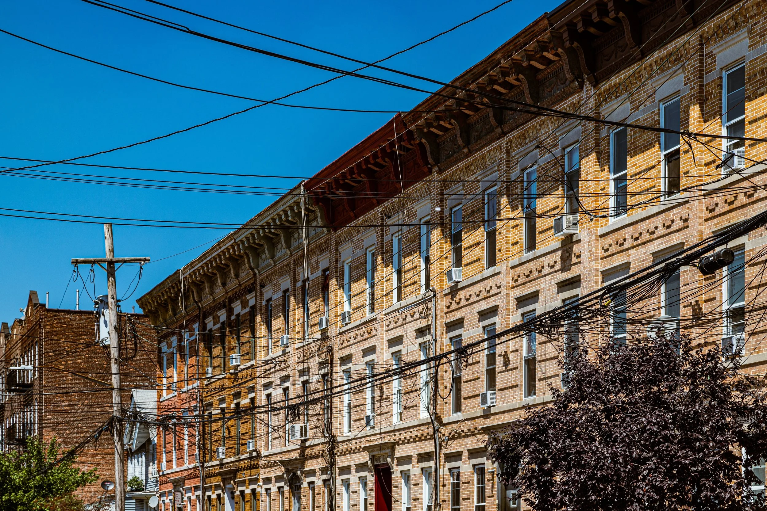
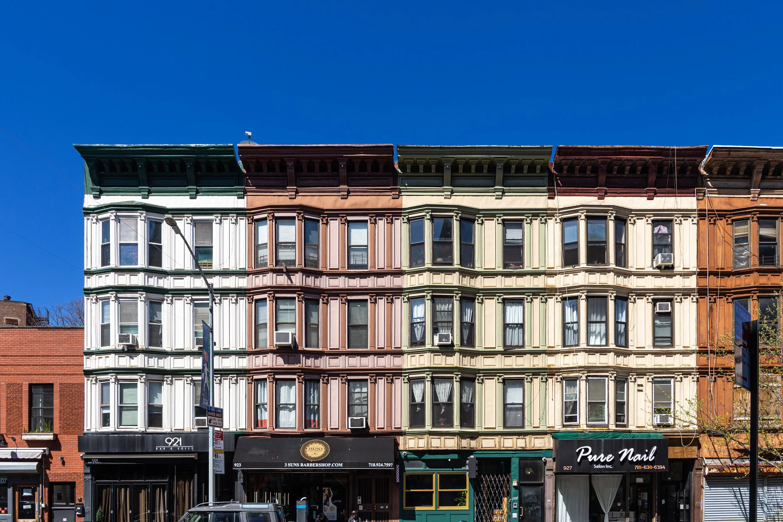
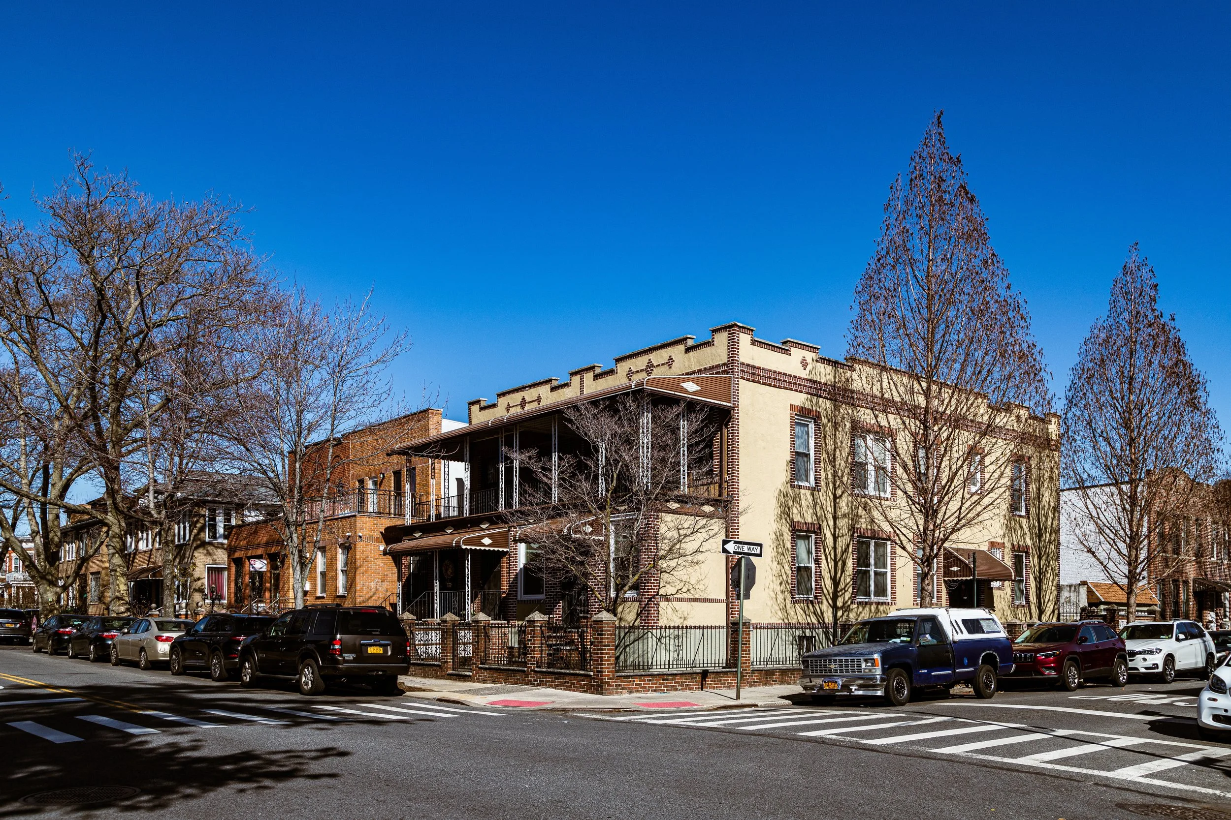
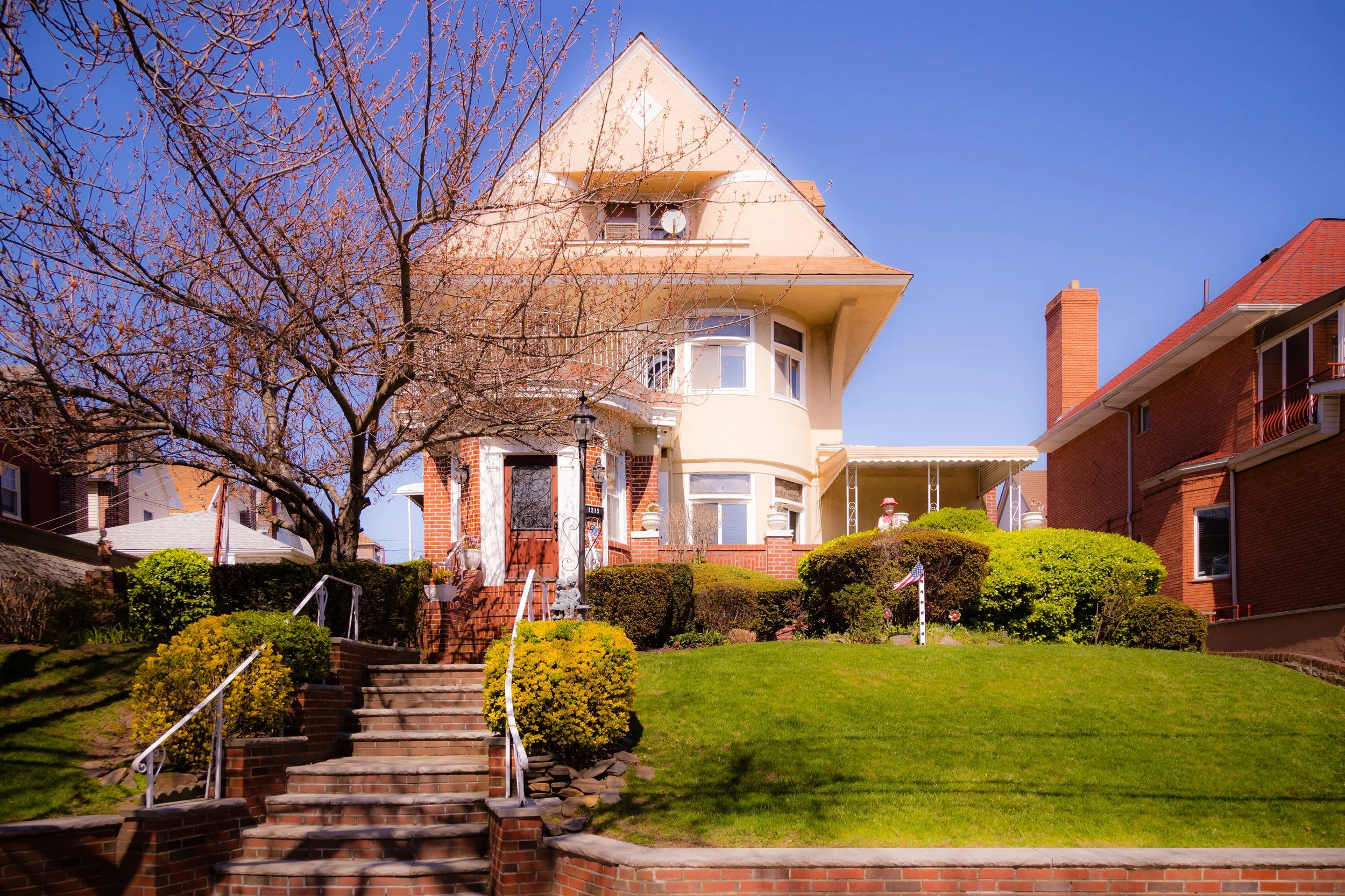
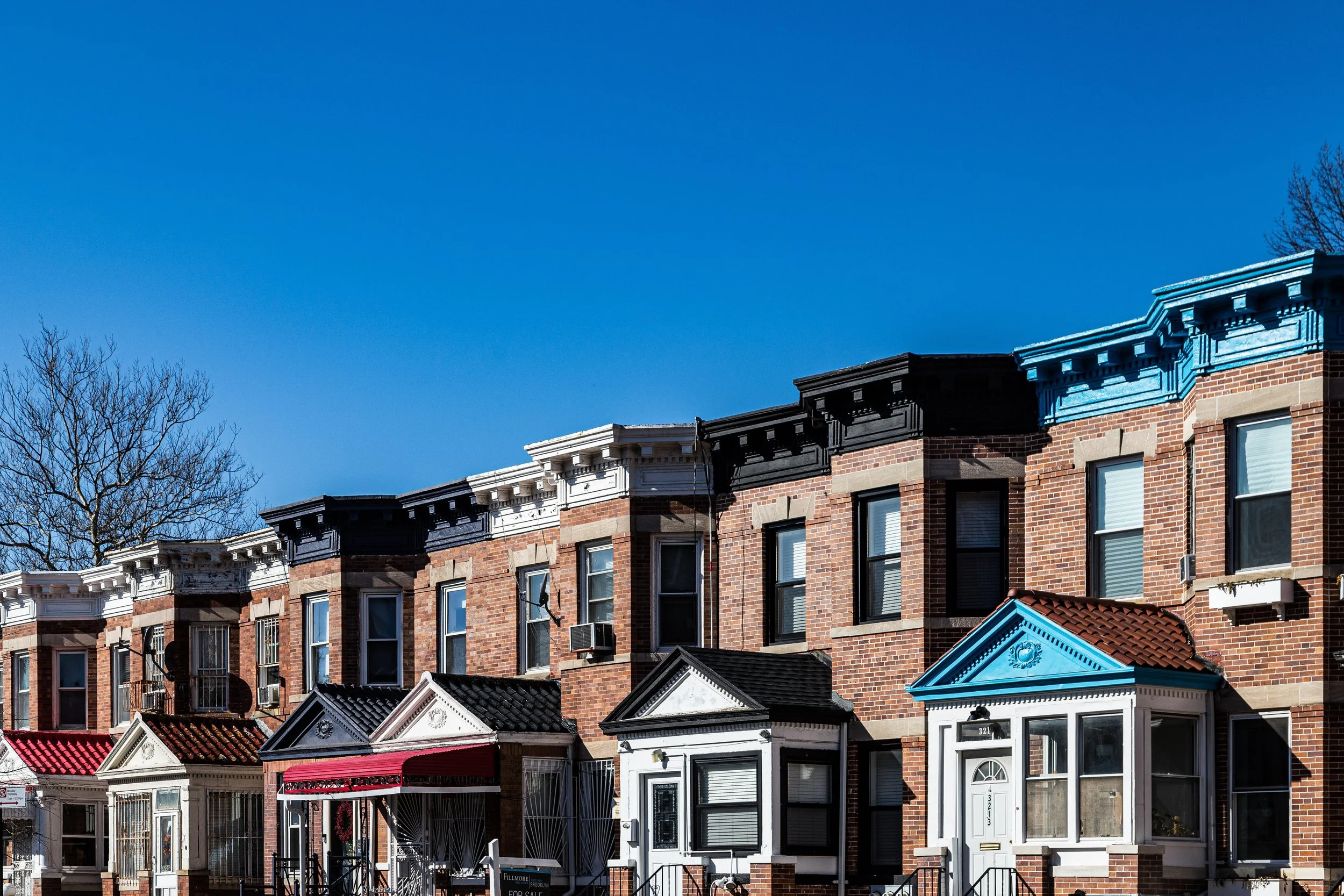
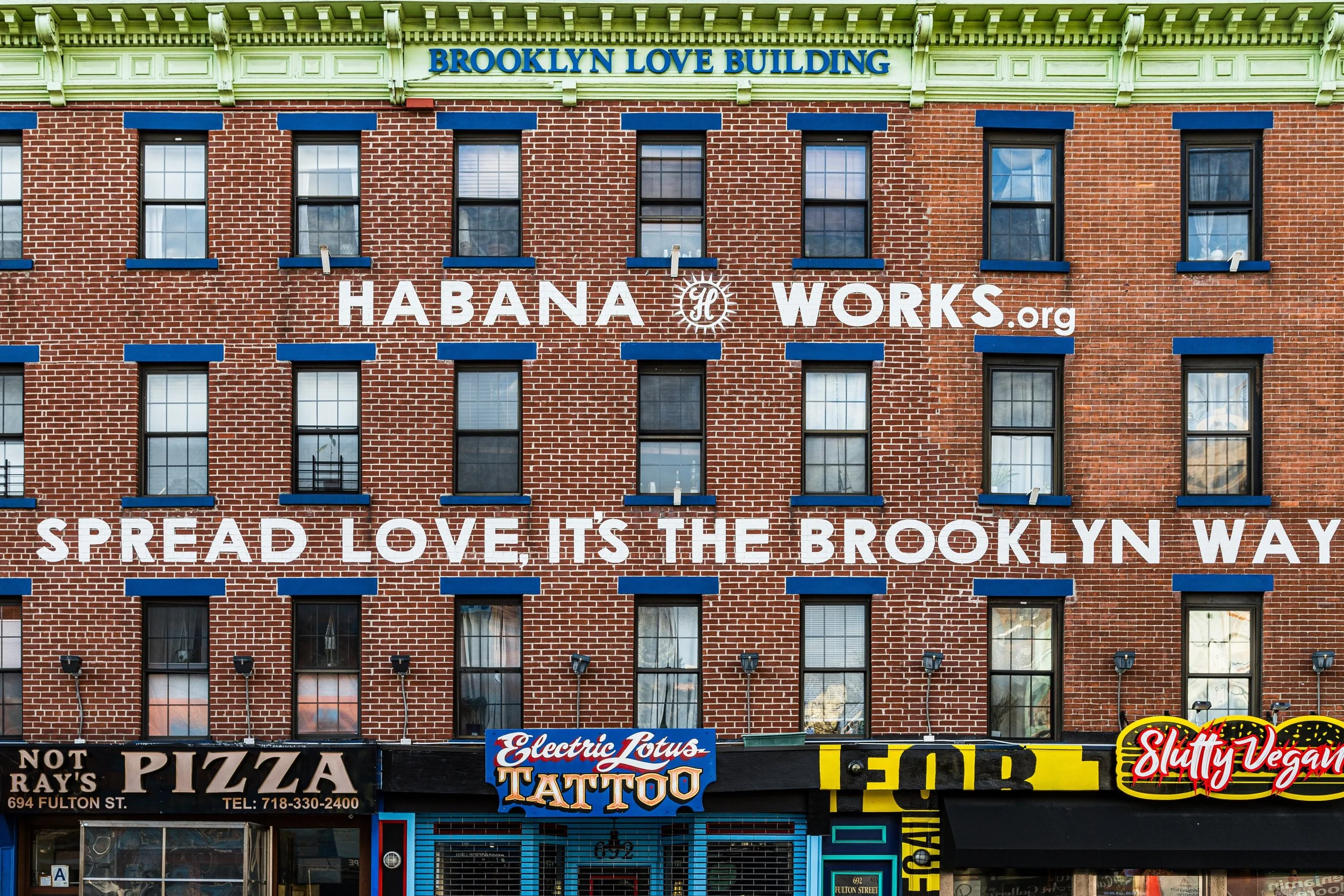
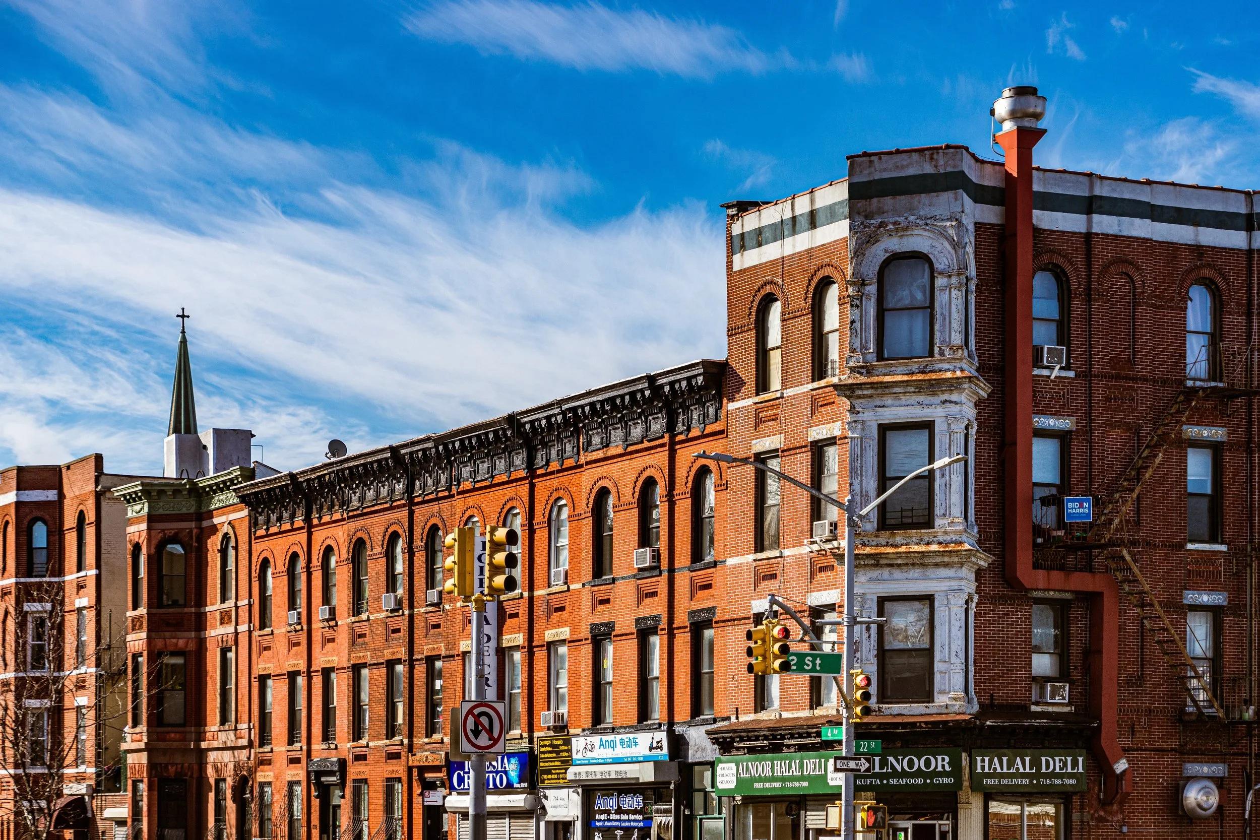
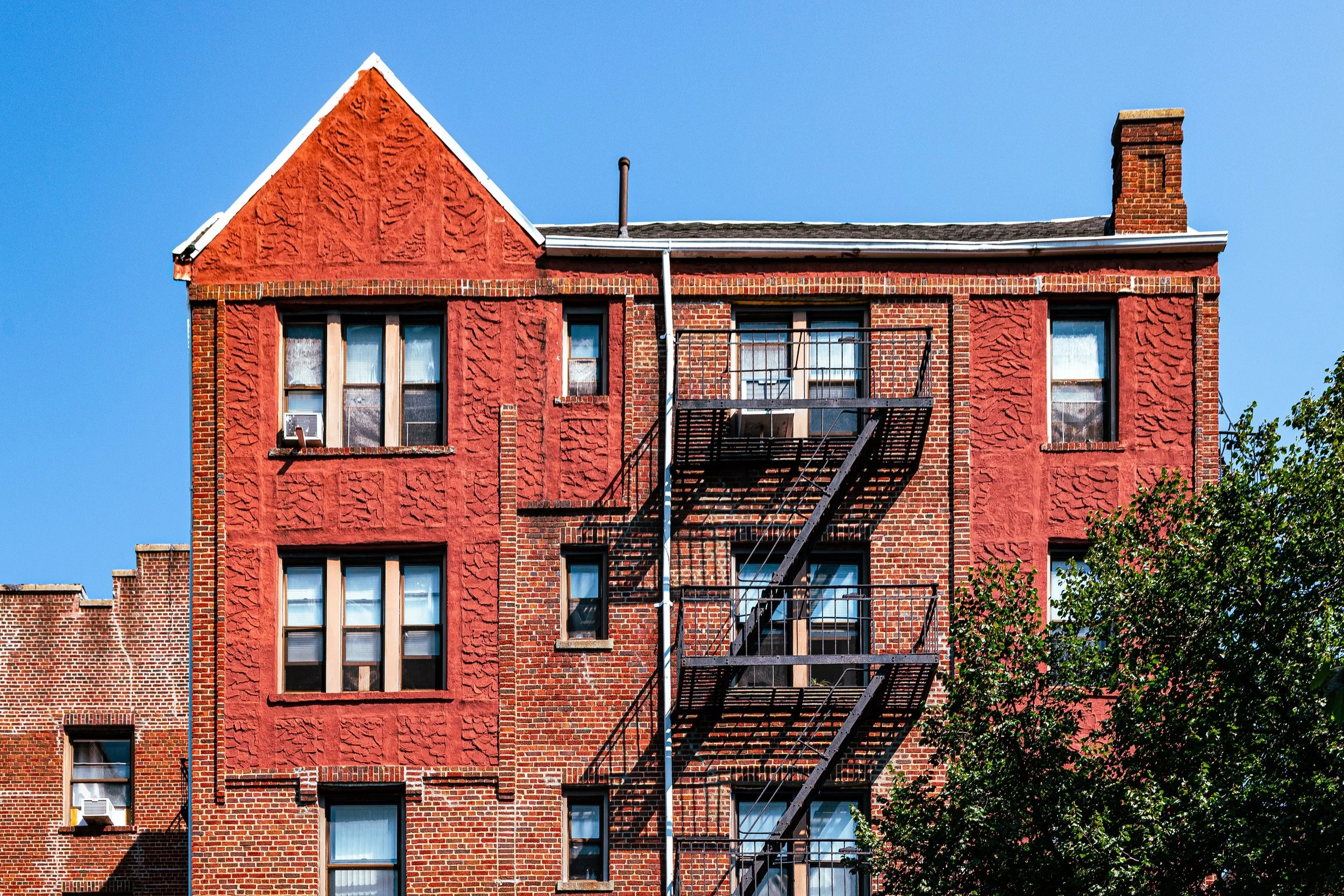
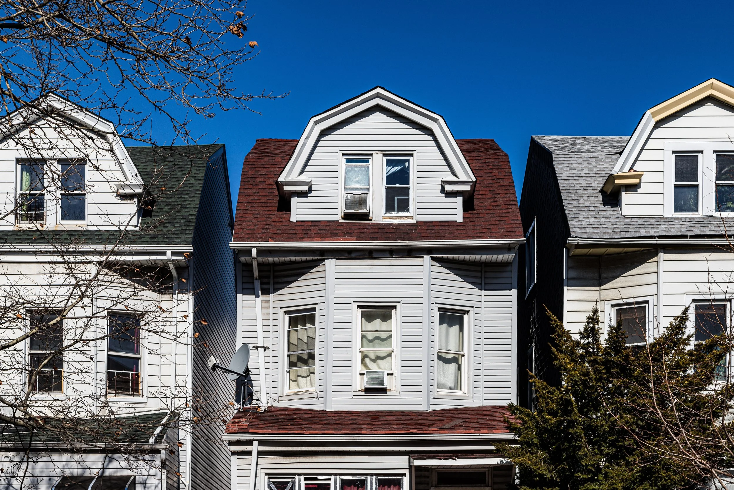
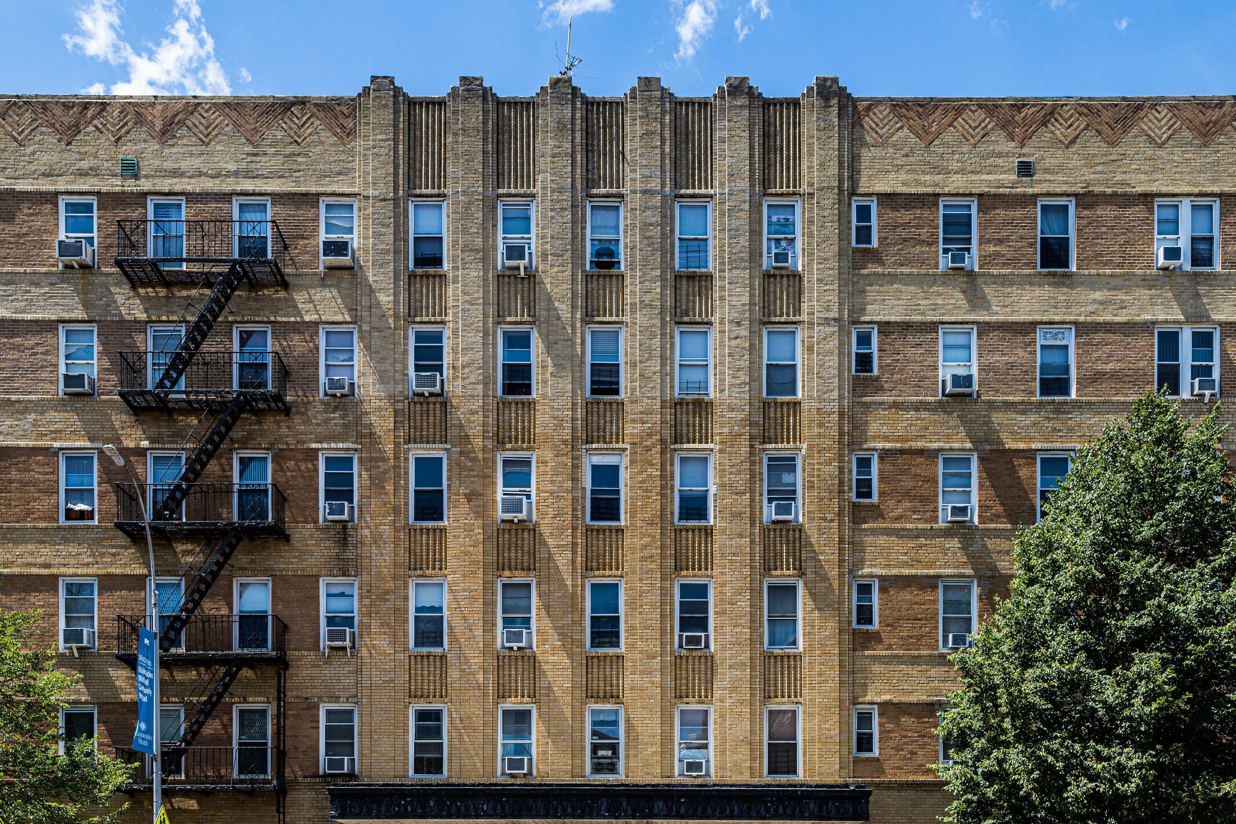
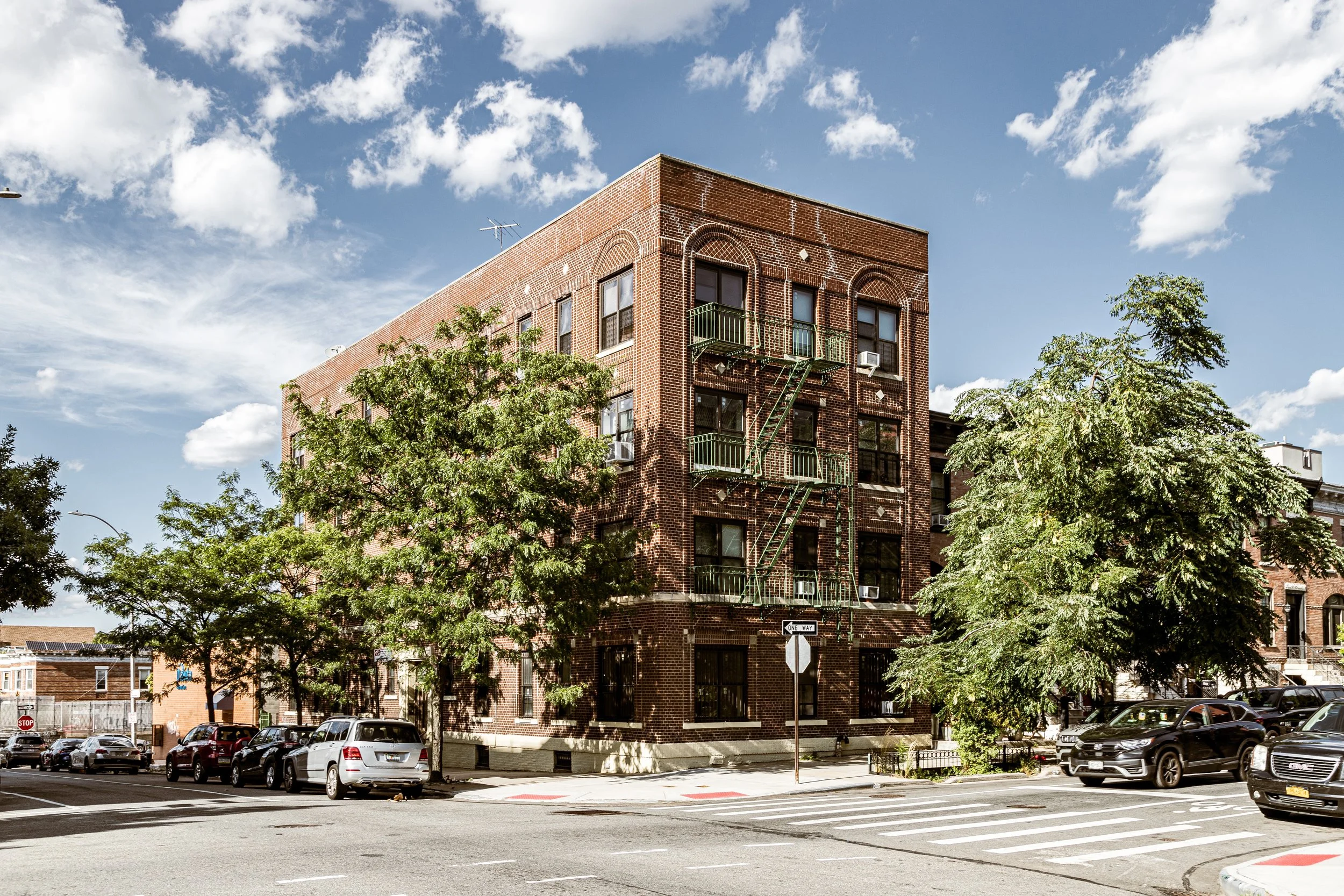
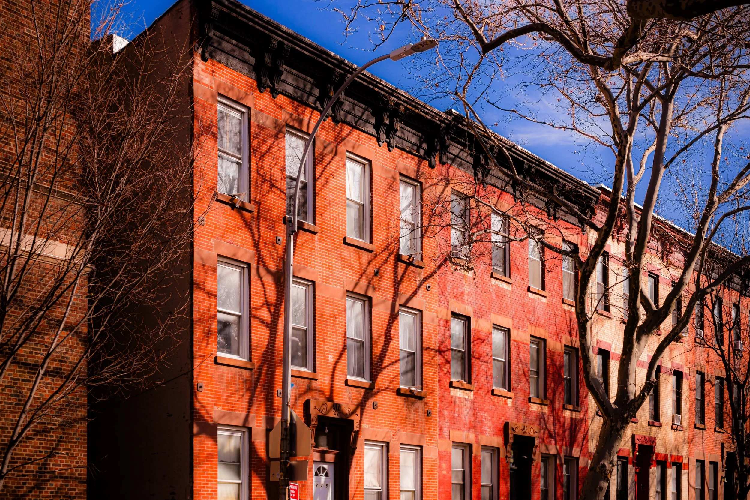
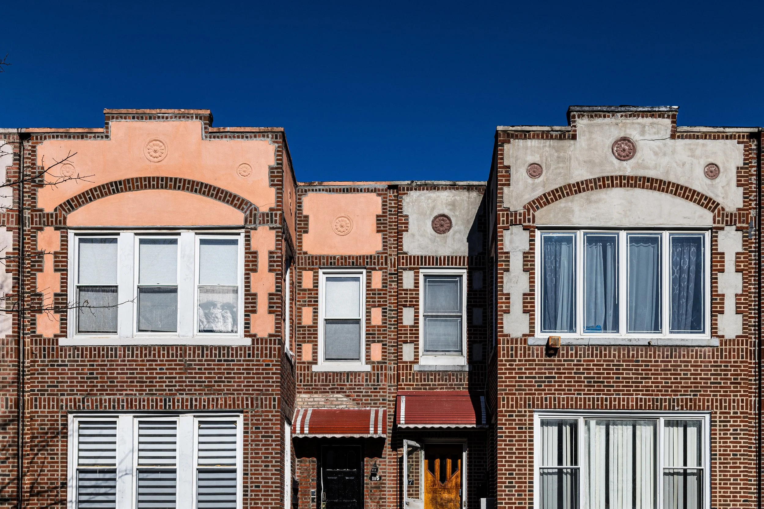
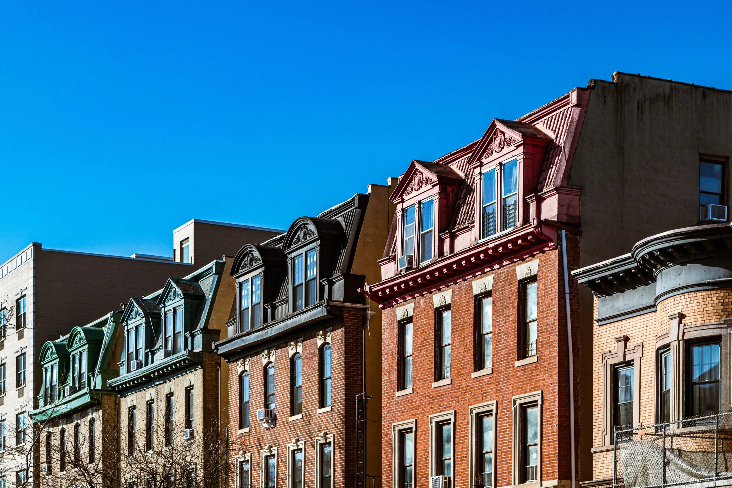
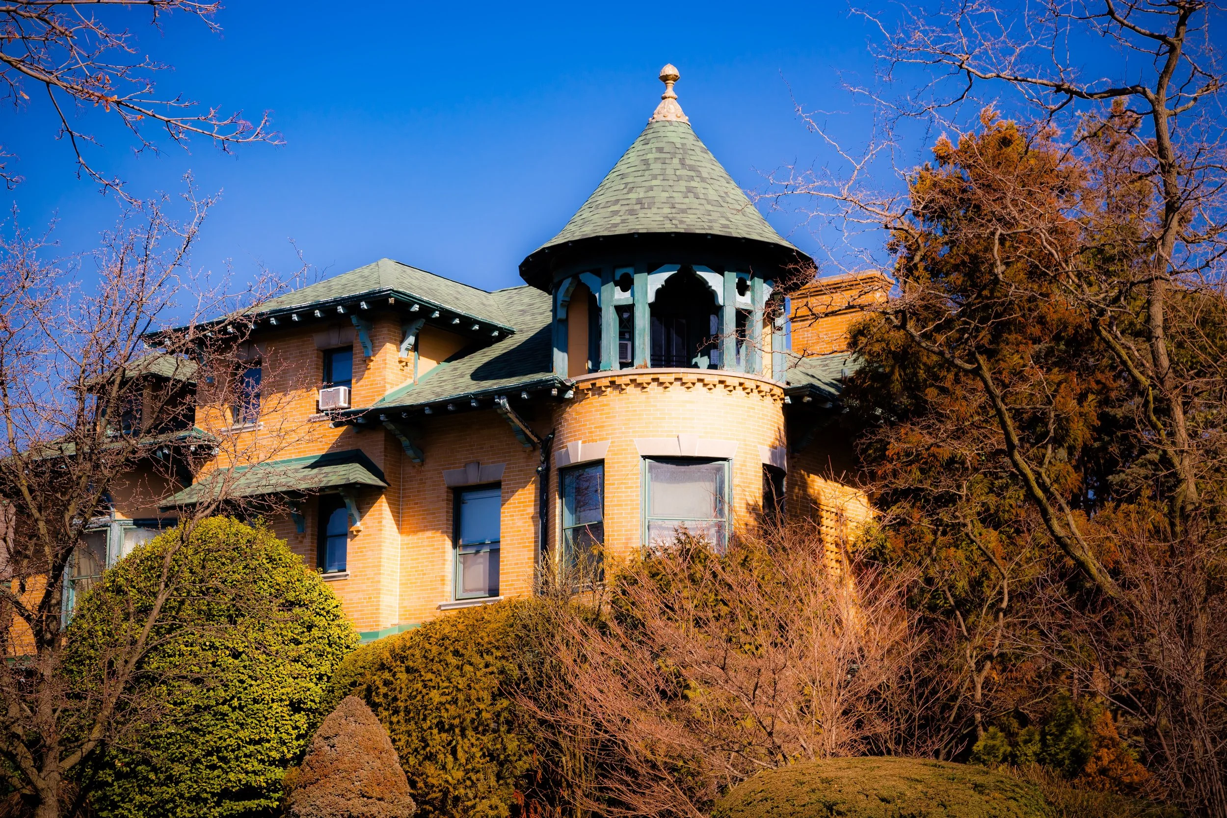
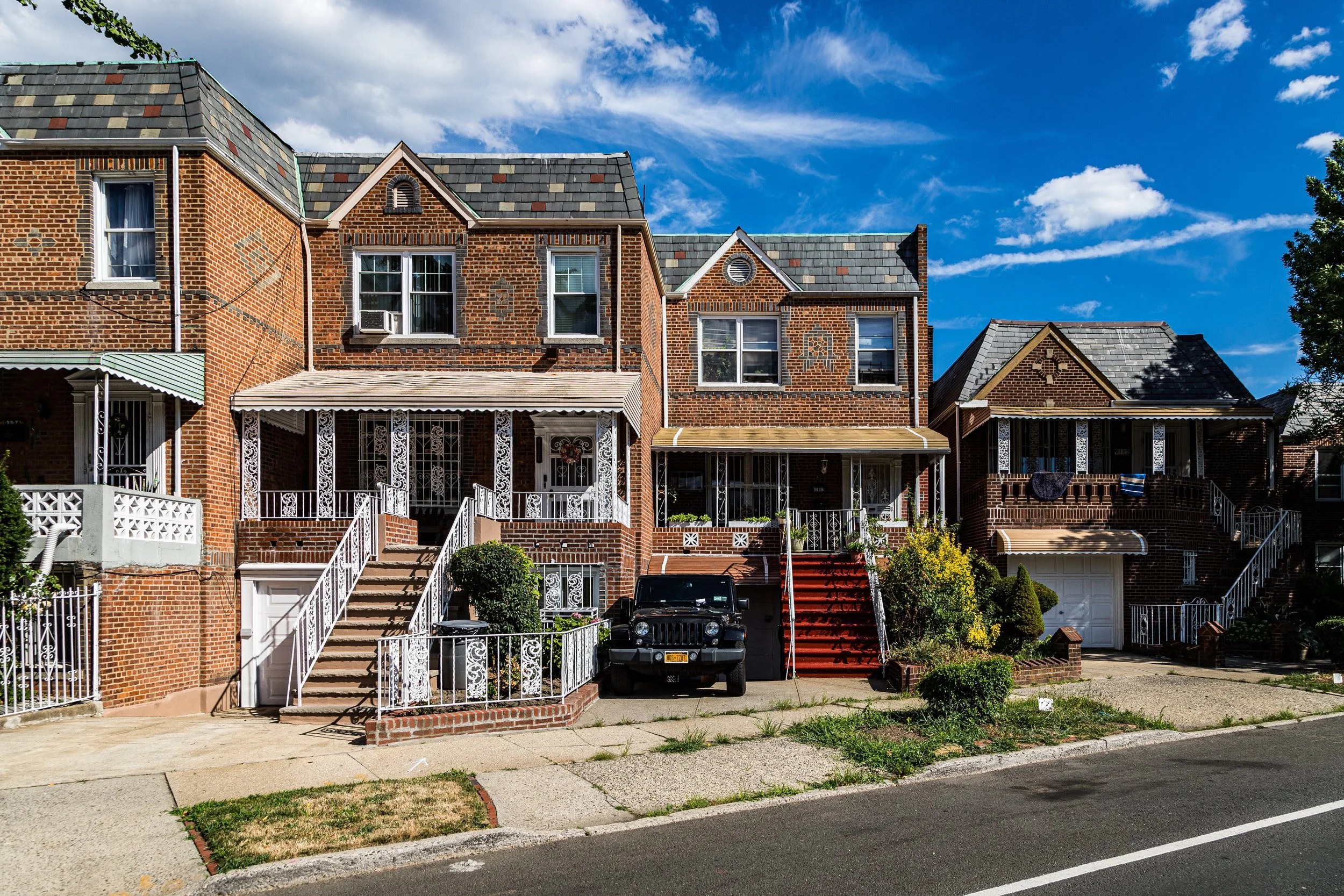
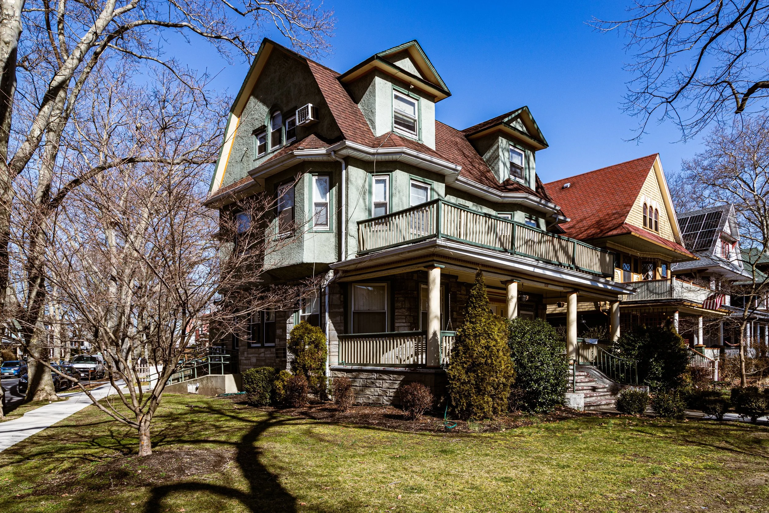
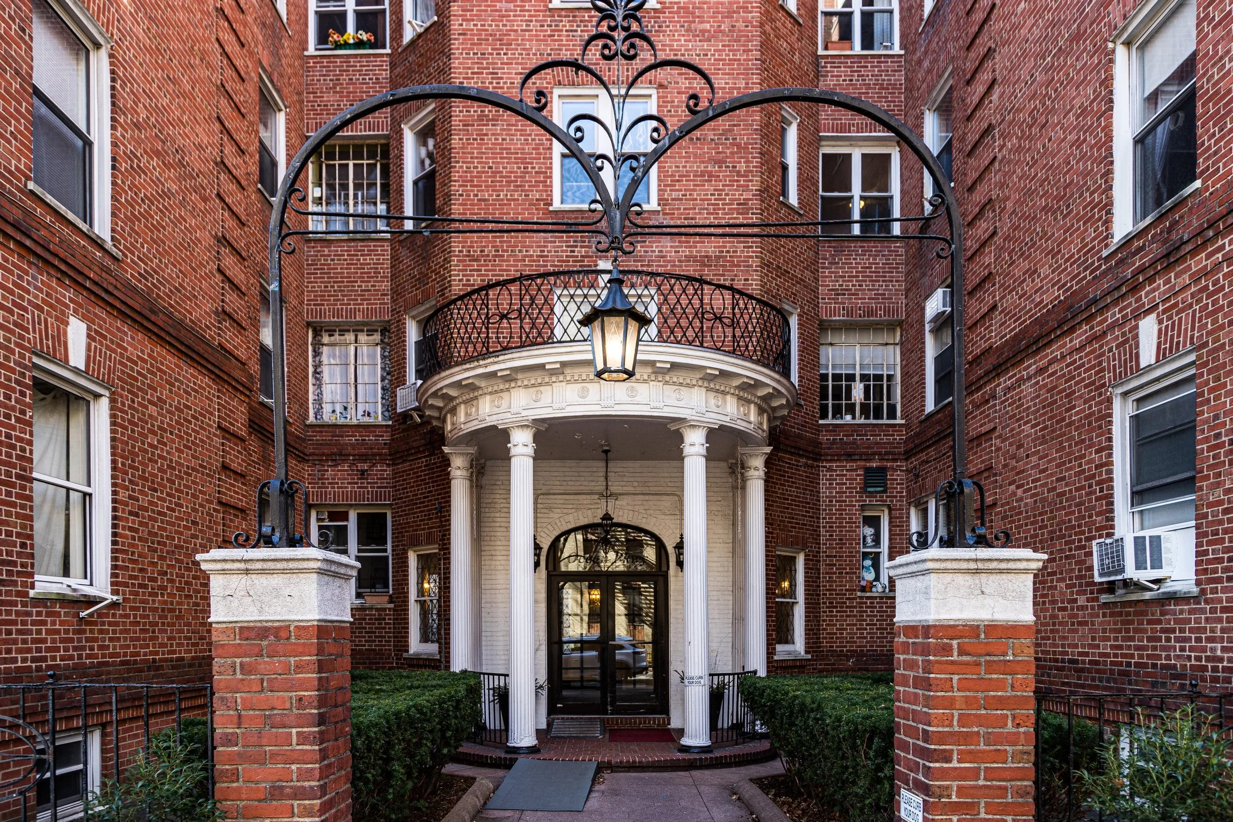
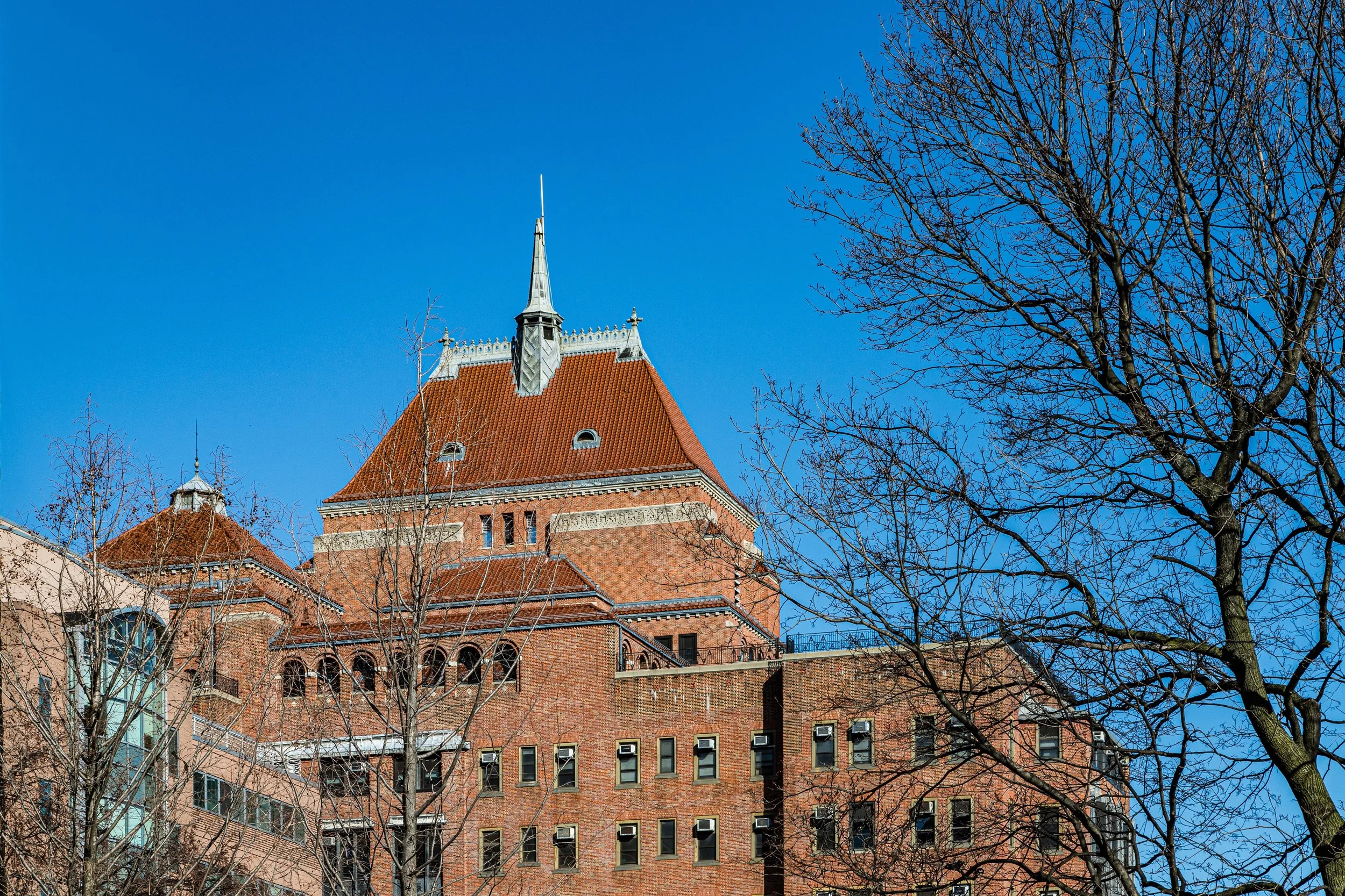
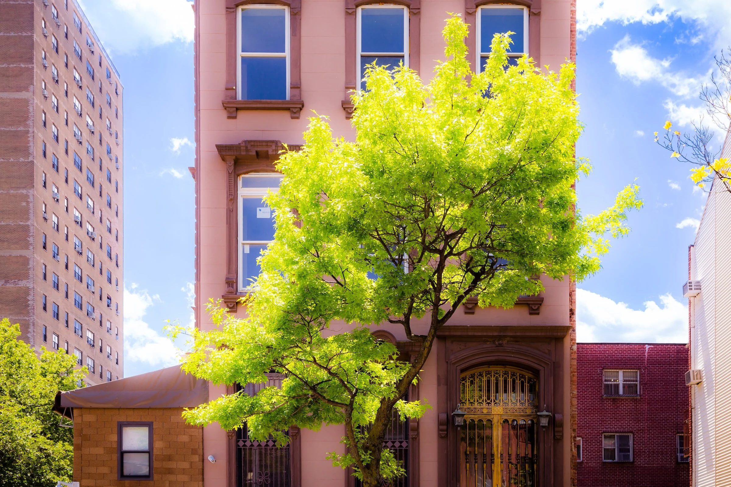
Brooklyn has a visual language shaped by repetition, texture, scale, and neighborhood contrast. It is a borough of brownstone stoops and brick facades, warehouse massing and church spires, painted storefronts and elevated tracks, broad avenues and narrow side streets. Across the borough, rowhouses, apartment houses, industrial structures, detached homes, murals, signage, and waterfront infrastructure create a built environment that feels both accumulated and deeply inhabited.
This movement between intimacy and openness is one of Brooklyn’s defining visual qualities. Long rows of stoops and domestic facades give way to factories, rail lines, bridge approaches, public housing, and newly built waterfront towers, while trees, shop signs, brickwork, garden edges, and shifting light soften the borough’s larger forms with texture and local character. Brooklyn is visually varied, materially rich, and shaped as much by neighborhood rhythm as by architectural scale.
Brooklyn Neighborhoods
Brooklyn: where brownstone blocks, industrial edges, neighborhood avenues, waterfront districts, and long-settled residential streets come together in one of New York City’s most varied boroughs. Explore the neighborhoods:
-
In central Brooklyn, the northern section of Kensington is the sub-neighborhood of Albemarle. It is flanked by Dahill to the west and Prospect Park to the east. Windsor Terrace is to the north.
-
Bounded by Gravesend Bay and 86th Street to the south and north, and extending from Bay Parkway westward to Bay 8th Street and 14th Avenue, Bath Beach occupies a serene coastal swath of southwestern Brooklyn.
-
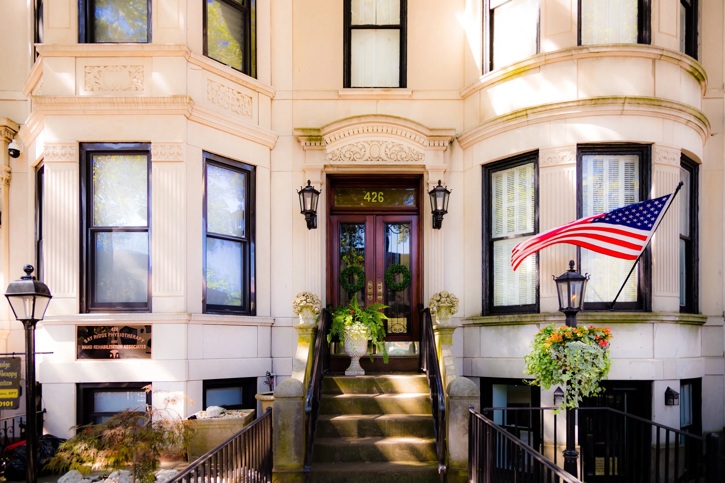
Bounded by 86th Street to the south and 65th Street to the north, with the Narrows and Upper New York Bay to the west and the Gowanus Expressway to the east, Bay Ridge occupies the southwestern edge of Brooklyn.
-
Bedford-Stuyvesant is bounded by Classon Avenue to the west, Flushing Avenue to the north, and Broadway to the east (with its southern edge conventionally extending to Atlantic Avenue).
-
Bensonhurst is bounded by 86th Street to the south and 65th Street to the north, and extending from 14th Avenue eastward to Bay Parkway (from 86th to 77th Street) and then Avenue P to McDonald Avenue.
-
Bergen Beach is bounded by Avenue N to the north, the Paerdegat Basin to the east, Mill Basin to the south, and to the west by East Mill Basin, 68th Street, and Veterans Avenue.
-
Bounded by Baltic Street to the south and Schermerhorn Street to the north, and stretching from Court Street to Fourth Avenue, Boerum Hill occupies a small but strikingly cohesive portion of northwestern Brooklyn.
-

Borough Park is bounded by Martense Ln to the northwest, Dahill Rd and McDonald Ave to the east, Avenue N to the south, and a broad western edge defined successively by 60th St to 65th St to 37th St.
-

Brighton Beach is bounded roughly by Ocean Parkway to the west, Coney Island Avenue to the east, Neptune Avenue to the north, and the Riegelmann Boardwalk and Atlantic Ocean to the south.
-
Brooklyn Heights is bounded by the East River to the west, Cadman Plaza West and Court Street to the east, Old Fulton Street to the north, and Atlantic Avenue to the south.
-
Brooklyn Navy Yard is bounded by Nassau Street and Flushing Avenue to the south, Kent Avenue to the west, Classon Avenue to the east, and the East River to the north.
-

Brownsville is bounded by Rockaway Parkway to the west, Eastern Parkway northwest to Fulton Street, Fulton Street east to Van Sinderen Avenue, Van Sinderen Avenue south to Linden Boulevard, and LIRR rail lines.
-

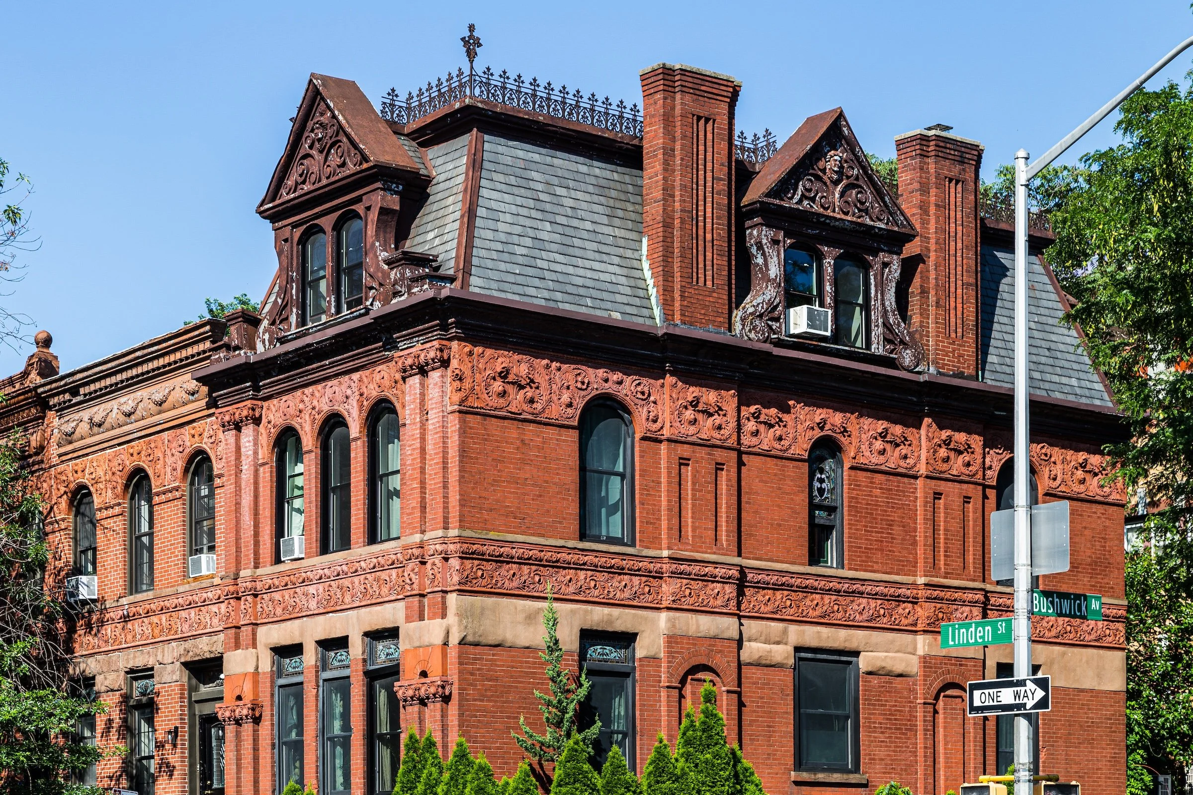
Bushwick is bounded by Broadway to the west, Flushing Avenue to the north (including the Bushwick Houses), the Queens line to the east, and the Jackie Robinson Parkway to the southeast—running northwest along Bushwick Avenue to Conway Street.
-

Canarsie is bounded by the rail line north of Avenue D to the north, Jamaica Bay to the south, Williams Avenue and East 108th Street to the east, and Paerdegat Avenue North and Ralph Avenue to the west.
-
Carroll Gardens is bounded, going clockwise, by the Brooklyn–Queens Expressway (BQE) north to Degraw Street, east to Court Street, north to Baltic Street, east to Hoyt Street, south to 5th Street, west to Smith Street, south to the Gowanus Expressway, and then northwest to the BQE.
-
Bounded by Atlantic Avenue to the north, Conduit Boulevard to the south, Euclid Avenue to the west, and the Queens borough line to the east, City Line forms a narrow but distinct pocket at Brooklyn’s easternmost edge—where the borough gives way to Ozone Park, Queens.
-
Bounded by Vanderbilt Avenue to the west, Classon Avenue to the east, Flushing Avenue to the north, and Atlantic Avenue to the south, Clinton Hill occupies a gentle rise of land just east of Fort Greene and north of Prospect Heights.
-
Cobble Hill is bounded by the (BQE) to the west, Court Street to the east, Degraw Street to the south, and Atlantic Avenue to the north.
-
The Columbia Street Waterfront District is bounded by the Gowanus Expressway to the south and Atlantic Avenue to the north, and lying west of the Brooklyn–Queens Expressway (BQE) to the New York Harbor.
-

Coney Island is bounded by West 37th Street to the west and Ocean Parkway to the east, with Coney Island Creek and the Shore Parkway forming its northern boundary and the Atlantic Ocean stretching along its southern shore.
-
Crown Heights is bounded by Atlantic Avenue to the north and Empire Boulevard to the south, and stretching from Washington Avenue on the west to Ralph Avenue on the east.
-

Cypress Hills is bounded by Atlantic Avenue to the south, Broadway Junction to the west, Jamaica Avenue and the Cypress Hills Cemetery to the north, and the Queens line to the east.
-
Tucked into a small triangular pocket bounded by Martense Lane, Fort Hamilton Parkway, and Dahill Road, the micro-neighborhood of Dahill occupies one of Brooklyn’s most quietly distinctive corners.
-
Downtown Brooklyn is bounded by Schermerhorn Street to the south and York Street to the north, with its western edge traced along Cadman Plaza and Court Street, and an irregular eastern perimeter running to the south.
-
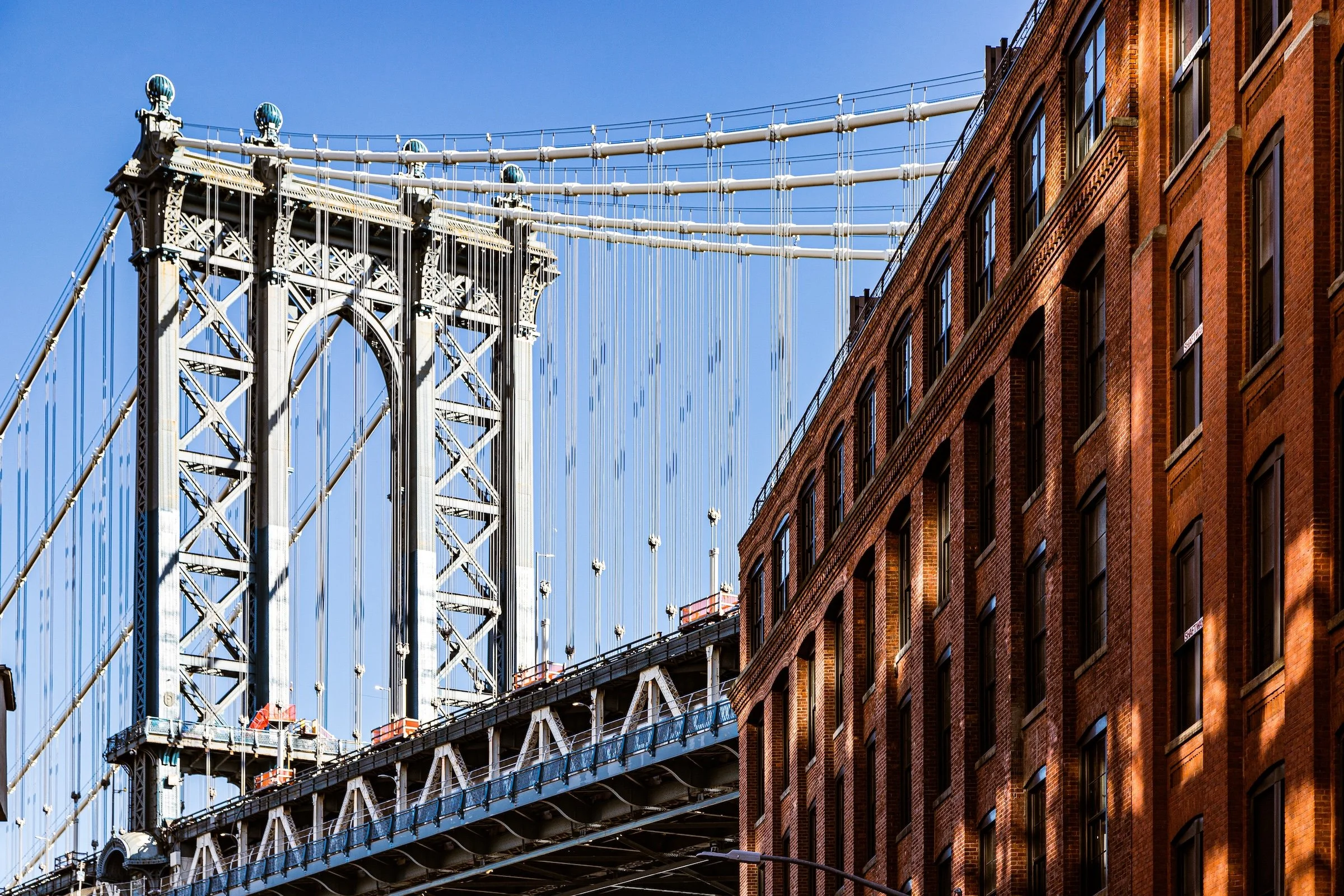
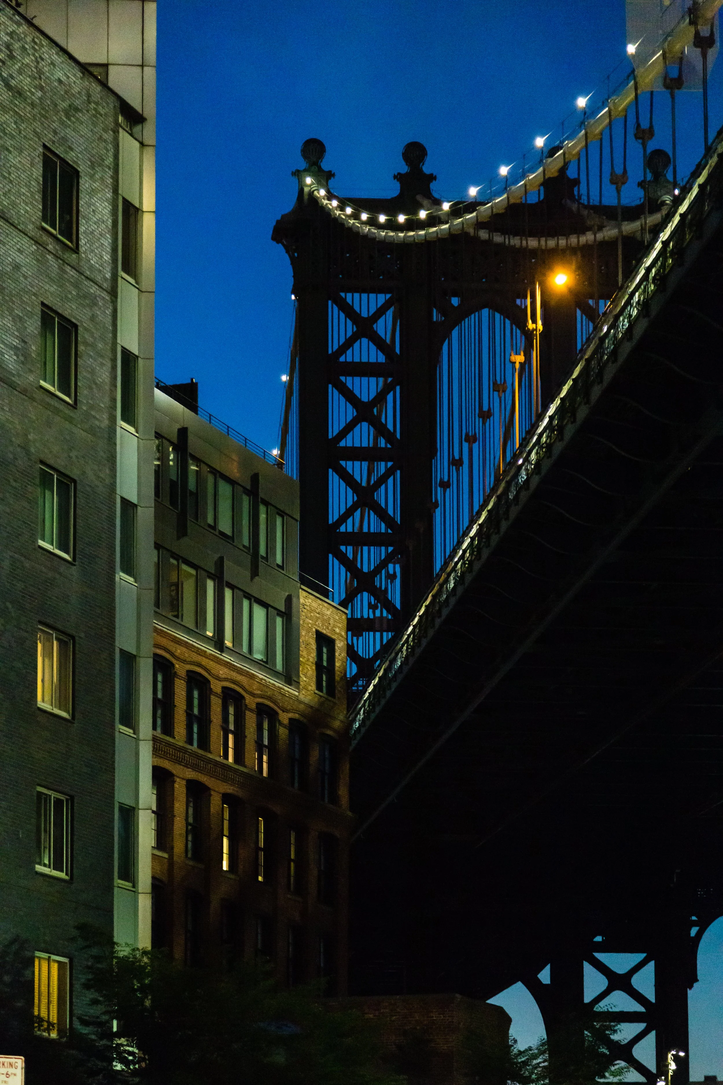
Bounded by the Brooklyn Bridge and Bridge Street to the east, and stretching north of York Street to the East River, DUMBO— Down Under the Manhattan Bridge Overpass—occupies one of the most iconic landscapes in New York City.
-

Stretching across Brooklyn’s southwestern shoreline, Dyker Beach Park is bounded roughly by 86th Street to the north, Poly Place and the Shore Parkway to the south, 7th Avenue to the east, and 14th Avenue to the west.
-
Bounded by the Gowanus Expressway to the west and 14th Avenue to the east, and stretching from 65th Street south to 86th Street, Dyker Heights occupies a commanding position atop the rolling plateau between Bay Ridge and Bensonhurst.
-

East Flatbush is bounded roughly by Clarendon Ave to the south, Empire Blvd to the north, and enclosed by Brooklyn Ave north to Clarkson Ave, east to Troy Ave, northeast along East New York Ave and Rockaway Pkwy, southeast to Kings Highway, southwest to Remsen Ave, then south to the LIRR lines near Canarsie.
-

East New York is bounded by Atlantic Avenue to the north, Conduit Avenue and the Queens border to the northeast and east, Jamaica Bay to the south, and Hendrix Creek, Williams Avenue, and Van Sinderen Avenue to the west.
-

East Williamsburg is bounded by Flushing Avenue to the south and the Brooklyn–Queens Expressway (BQE) to the north, stretching eastward to the Queens line, and defined to the west by Bushwick Avenue and Woodpoint Road.
-
Bounded by Rogers Avenue to the west and Brooklyn Avenue to the east, and stretching from Clarendon Road north to Clarkson Avenue, Erasmus lies at the historic heart of central Flatbush.
-
Bounded by Nostrand Avenue, Flatbush Avenue, and Rogers Avenue to the west, Clarendon Road to the north, Utica Avenue to the east, and the Long Island Rail Road Bay Ridge Branch to the south, Farragut forms a distinct southern extension of East Flatbush.
-
Flatbush is bounded by Rogers Ave to the east; a southern line running along Flatbush Ave from Farragut Rd to Foster Ave, east along Foster Ave to Ocean Ave; a western edge running up the Q rail line.
-
Bounded by Nostrand Avenue to the west, the Long Island Rail Road Bay Ridge Branch to the north, Ralph Avenue to the east, and Avenue T to the south, Flatlands occupies a broad expanse of southeastern Brooklyn.
-
Fort Greene is Bounded by Atlantic Ave to the south and Flushing Avenue to the north, Vanderbilt Avenue to the east, and a western line running north along Flatbush Avenue and Prince Street.
-
Bounded by 86th Street to the north, Dyker Beach Park to the east, and the Narrows—the tidal strait separating Brooklyn from Staten Island—to the south and west, Fort Hamilton occupies the southwestern corner of Brooklyn.
-
Bounded by Avenue N to the south, Ralph Avenue to the west, and the Paerdegat Basin to the east, Georgetown lies within southeastern Brooklyn’s quiet residential heartland.
-

Bounded by Gerritsen Avenue to the east, Gerritsen Creek and Ralph Avenue to the west, Gerritsen Beach occupies a small peninsula projecting into the northern reaches of Jamaica Bay.
-
Centered on the Gowanus Canal and bounded by Baltic Street to the north, the Brooklyn-Queens Expressway (BQE) to the south, Fourth Avenue to the east, and Smith Street and Hoyt Street to the west, Gowanus occupies a long, low-lying swath of central Brooklyn.
-
Gravesend is bounded roughly by Avenue P to the north, Stillwell Avenue and Coney Island Creek to the south, McDonald Avenue to the east, and West 1st Street to the west.
-

Greenpoint is bordered by Williamsburg to the south, Long Island City across the creek to the east, and the East River to the west and north, Greenpoint is both frontier and anchor: the last of old industrial Brooklyn’s waterfront towns, yet one of its most dynamic and self-contained communities.
-
Spanning 478 acres across Brooklyn’s central ridge, Green-Wood Cemetery is bounded roughly by Fifth Avenue and Fort Hamilton Parkway to the west, McDonald Avenue to the east, 20th Street to the north, and 37th Street to the south.
-
Greenwood Heights is bounded roughly by 9th Avenue and 15th Street to the north, 36th Street to the south, Eighth Avenue to the east, and Third Avenue to the west.
-

Highland Park spans roughly from Jamaica Avenue and Crescent Street in the north to Highland Boulevard and Jackie Robinson Parkway in the south, and from Force Tube Avenue on the west to Cleveland Street and the Cemetery Belt on the east.
-
Bounded roughly by Avenue P to the north, Avenue U to the south, Ocean Parkway to the west, and Ocean Avenue to the east, Homecrest sits at the heart of southern Brooklyn, between Gravesend, Sheepshead Bay, and Midwood.
-
Bounded by Church Avenue to the north, 18th Avenue to the south, Coney Island Avenue to the east, and Dahill Road to the west, Kensington forms a compact, quietly diverse enclave in central Brooklyn—nestled between Windsor Terrace, Borough Park, and Flatbush.
-
Bounded roughly by Grand Street to the north, Union Avenue to the east, Broadway and Division Avenue to the south, and the East River waterfront to the west, Los Sures—literally “the Southside”—forms the historic southern heart of Williamsburg.
-

Bounded by Kings Highway to the north, Avenue U to the south, Ocean Avenue to the west, and Nostrand and Gerritsen Avenues to the east, Madison lies in the southeastern quadrant of Brooklyn, between Midwood, Marine Park, and Sheepshead Bay.
-
Bounded by West End Avenue to the west, Sheepshead Bay to the north, and the Atlantic Ocean to the south and east, Manhattan Beach occupies the far southeastern tip of Brooklyn.
-
Bounded by 60th Street to the north, 65th Street to the south, 16th Avenue to the west, and McDonald Avenue to the east, Mapleton is a compact, quietly residential enclave tucked between Borough Park and Bensonhurst in southwestern Brooklyn.
-

Bounded by Kings Highway to the north, Nostrand Avenue to the northwest, Flatbush Avenue to the east, Gerritsen Avenue to the west, and Rockaway Inlet to the south, Marine Park is one of Brooklyn’s broadest, greenest, and most distinctly suburban neighborhoods.
-
Midwood is bounded by McDonald Avenue to the west, Nostrand Avenue to the east, Kings Highway and Avenue P forming its southeastern and southern edges, Foster Avenue sweeping northwest to Coney Island Avenue, and the Long Island Rail Road (Bay Ridge Branch) to the north.
-

Midwood Park / Fiske Terrace is bounded by the Long Island Rail Road tracks to the south, Coney Island Avenue to the west, Foster Avenue to the northwest, Flatbush Avenue to the northeast, and Nostrand Avenue to the east
-

Mill Basin lies south of Avenue T and east of Marine Park, bordered by Mill Basin Inlet to the west, Jamaica Bay to the south, and Mill Island Channel and Floyd Bennett Field to the east.
-

Bounded by Linden Boulevard to the south, Pennsylvania Avenue to the west, New Lots Avenue and Dumont Avenue to the north, and Fountain Avenue to the east, New Lots lies in the easternmost reaches of Brooklyn, forming part of the larger East New York district.
-
Stretching from the Grand Street north to McCarren Park and N 15th Street, and from the East River waterfront east to roughly Union Avenue, Northside Williamsburg occupies the industrial-to-artistic corridor that came to define Brooklyn’s cultural rebirth at the turn of the 21st century.
-
Bounded roughly by Fulton Street to the north, Ralph Avenue to the west, and Eastern Parkway wrapping along its southern and eastern edges, Ocean Hill forms a compact, historically resonant enclave within Bedford-Stuyvesant in central Brooklyn.
-
Bounded by Avenue J to the north, Seaview Avenue and Paerdegat Basin to the south, and East 80th Street to the east, Paerdegat—sometimes referred to as Paerdegat Basin or Paerdegat Section—is a quiet, low-lying residential enclave in southern Brooklyn, nestled between Canarsie, Bergen Beach, and Flatlands.
-
Bounded by Prospect Park West and Flatbush Avenue to the east, Fourth Avenue to the west, Atlantic Avenue and the Flatbush Avenue Extension to the north, and 10th Avenue to the south, Park Slope unfolds along the gentle incline rising from Gowanus toward the emerald edge of Prospect Park.
-
Bounded by McDonald Avenue to the west, Coney Island Avenue to the east, 18th Avenue to the north, and Foster Avenue to the south, Parkville is a compact, quietly distinctive enclave in the heart of south-central Brooklyn.
-
Bounded by Flatbush Avenue and Grand Army Plaza to the west and southwest, Atlantic Avenue to the north, Washington Avenue to the east, and Eastern Parkway to the south, Prospect Heights forms one of Brooklyn’s most architecturally elegant and culturally resonant neighborhoods.
-
Bounded by Ocean Avenue to the west, New York Avenue to the east, Clarkson Avenue to the south, and Empire Boulevard to the north, Prospect–Lefferts Gardens occupies a proud position on the eastern edge of Prospect Park.
-

Prospect Park, the borough’s great public landscape, spans 585 acres. The park is bordered by Prospect Park West and Eighth Avenue to the west, Parkside Avenue to the south, Ocean Avenue to the east, and Flatbush Avenue and Grand Army Plaza to the north.
-
Bounded by Caton Avenue to the north, Cortelyou Road to the south, Coney Island Avenue to the west, and the Brighton Line (Q train) to the east, Prospect Park South stands as one of Brooklyn’s most distinguished planned suburban enclaves.
-
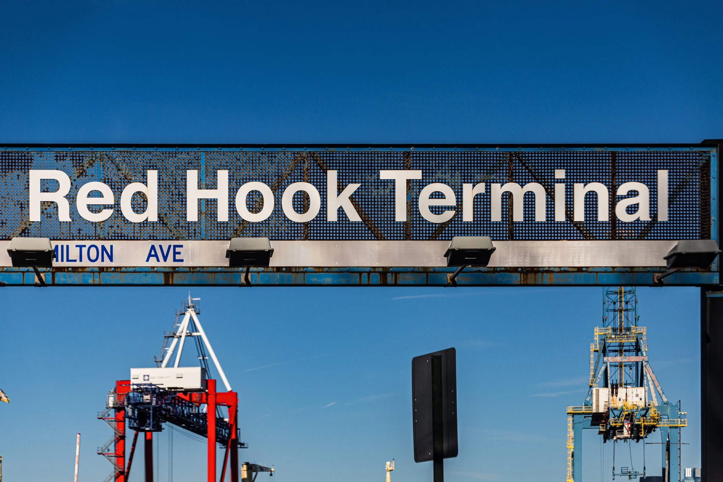
Red Hook occupies one of the most storied and atmospheric landscapes in Brooklyn. It is bounded by the Gowanus Expressway and Hamilton Avenue to the north and east, Buttermilk Channel and the Erie Basin to the south, and New York Harbor to the west.
-
Bounded by Rockaway Parkway to the northeast, the Long Island Rail Road (Bay Ridge Branch) to the southeast, Ralph Avenue to the west, and Kings Highway to the northwest, Remsen Village lies within the southeastern reaches of central Brooklyn
-
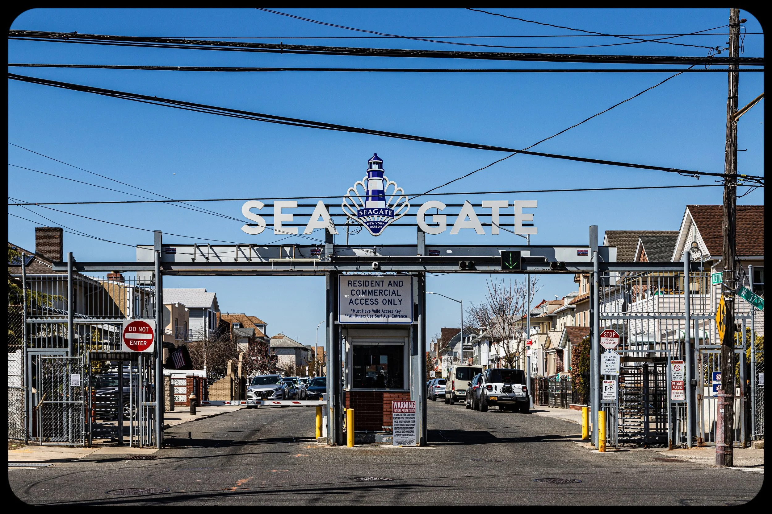
Sea Gate is a private, gated seaside community bounded on three sides by water and on the fourth by the lively expanse of Coney Island itself. It is framed by the Atlantic Ocean to the south, the Narrows to the west, Gravesend Bay to the north, and West 37th Street to the east, beyond which the amusements and boardwalk of Coney Island begin.
-
Bounded by the Sheepshead Bay inlet to the south, Avenue U to the north, Ocean Parkway to the west, and Knapp Street to the east, Sheepshead Bay occupies a glittering strip of southern Brooklyn defined by its maritime character and layered immigrant heritage.
-
Bounded by 10th Street to the northeast and Prospect Park West to the east, with Green-Wood Cemetery forming its sweeping southwestern edge, South Slope occupies the transitional slope of western Brooklyn where the hill descending from Prospect Park meets the industrial flats of Gowanus.
-

Bounded by Division Street to the north, Broadway to the northeast, Flushing Avenue to the south, and Kent Avenue along the East River to the west, South Williamsburg forms one of the most historically layered and culturally charged neighborhoods in New York City.
-
Starrett City — rebranded as Spring Creek Towers in the early 2000s — is a self-contained residential community unlike any other in the borough. It is bordered by Louisiana Avenue and Pennsylvania Avenue to the west, Flatlands Avenue to the north, Jamaica Bay and the Spring Creek marshlands to the south, and Erskine Street to the east.
-
Bedford–Stuyvesant is bounded by Tompkins Avenue to the west, Malcolm X Boulevard to the east, a southern border primarily along Fulton Street, and a northern edge traced by Macon, Halsey, and Hancock Streets, Stuyvesant Heights.
-

Bounded by 39th Street to the north and 65th Street to the south, stretching west from 9th Avenue to the Gowanus Bay waterfront, Sunset Park occupies one of Brooklyn’s most topographically striking settings.
-
Bounded by Foster Avenue to the south, Coney Island Avenue to the west, Cortelyou Road to the northwest, and Ocean Avenue to the east, Ditmas Park—the heart of the greater Victorian Flatbush district—is one of New York City’s most distinctive residential enclaves.
-
Bounded by York Street to the south, Bridge Street to the west, Hudson Avenue and Little Street to the east, and the East River to the north, Vinegar Hill is one of Brooklyn’s smallest yet most evocative neighborhoods—a cobblestoned pocket of maritime history nestled between DUMBO and the Brooklyn Navy Yard.
-

In the heart of Brooklyn’s northwestern waterfront lies Williamsburg, a vast and many-textured district whose core — Central Williamsburg — stretches inland from Union Avenue to Bushwick Avenue and Woodpoint Road.
-
Bounded by Prospect Park to the east, Green-Wood Cemetery to the west, Prospect Park West to the northwest, and Caton Avenue to the south, Windsor Terrace forms one of Brooklyn’s most serenely situated neighborhoods—a narrow, elevated stretch between two of the borough’s grandest green spaces.
-
Bounded by New York Avenue to the west, Troy Avenue to the east, Clarkson Avenue to the south, and Empire Boulevard to the north, Wingate occupies a compact rectangle in central Brooklyn, just east of Prospect-Lefferts Gardens and north of East Flatbush.
The History
17th–18th Century: Colonial Villages and Revolutionary Battlegrounds
17th–18th Century: Colonial Villages and Revolutionary Battlegrounds
The Dutch settlements prospered as farming communities, producing grain, vegetables, and dairy for export to Manhattan and beyond. The English seized control of New Netherland in 1664, but Dutch influence persisted in language, architecture, and social structure. Churches and windmills punctuated the rolling landscape, while ferries across the East River linked Brooklyn’s shore to Manhattan’s expanding port.
The American Revolution brought war to Brooklyn’s fields. In 1776, the Battle of Long Island—the largest engagement of the Revolutionary War—unfolded across the hills of Gowanus, Park Slope, and Prospect Heights. General George Washington’s retreat across the East River, under cover of fog, became a legend of courage and providence. The borough’s Revolutionary past is still memorialized at sites such as Battle Pass in Prospect Park and the Old Stone House in Park Slope.
After independence, Brooklyn remained rural but grew steadily. The Fulton Ferry (1814) and the establishment of Brooklyn Village near the ferry landing spurred urban development along the East River. The newly incorporated City of Brooklyn (1834) soon became Manhattan’s rival across the water—a quieter, cleaner, and more orderly alternative to the crowded metropolis.
19th Century: City of Churches and Industrial Powerhouse
The 19th century transformed Brooklyn from agrarian hinterland to industrial titan. Shipyards, sugar refineries, and ropeworks lined the waterfronts of Red Hook, DUMBO, and Williamsburg. Immigrants—Irish, Germans, Scandinavians, and later Italians and Eastern European Jews—arrived by the tens of thousands, fueling both labor and culture. The borough’s population exploded from 36,000 in 1834 to over one million by 1890.
This was the era of the “City of Churches,” so called for its multitude of congregations that reflected both religious devotion and ethnic diversity. Institutions like Plymouth Church of the Pilgrims, under the abolitionist preacher Henry Ward Beecher, became moral beacons, drawing figures such as Frederick Douglass and Abraham Lincoln.
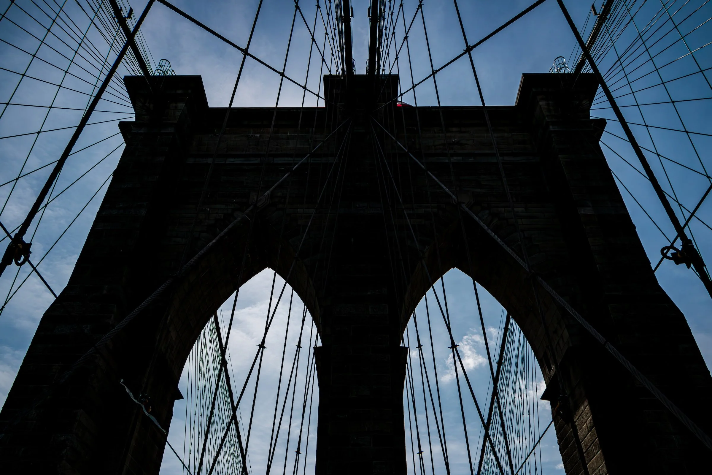
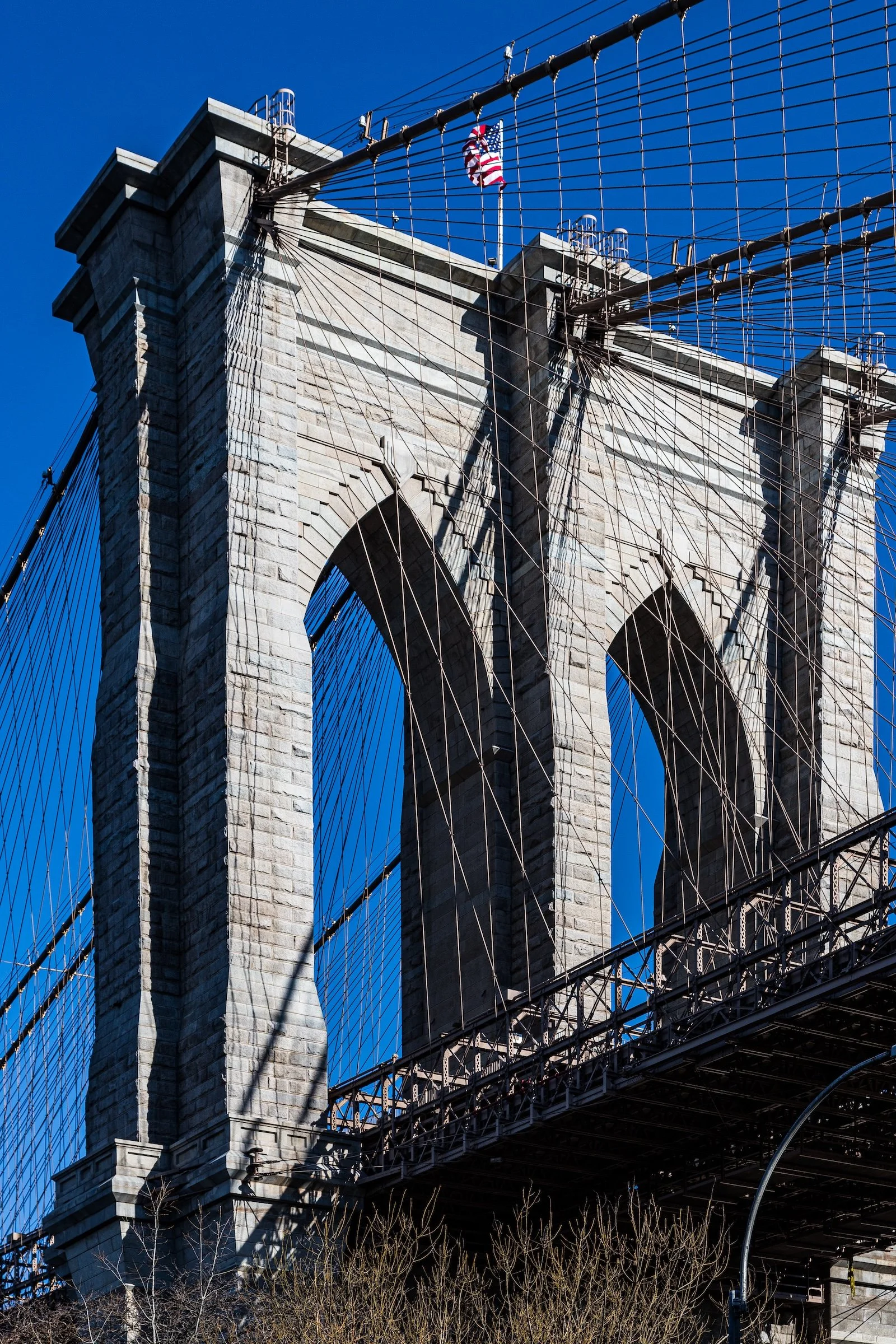
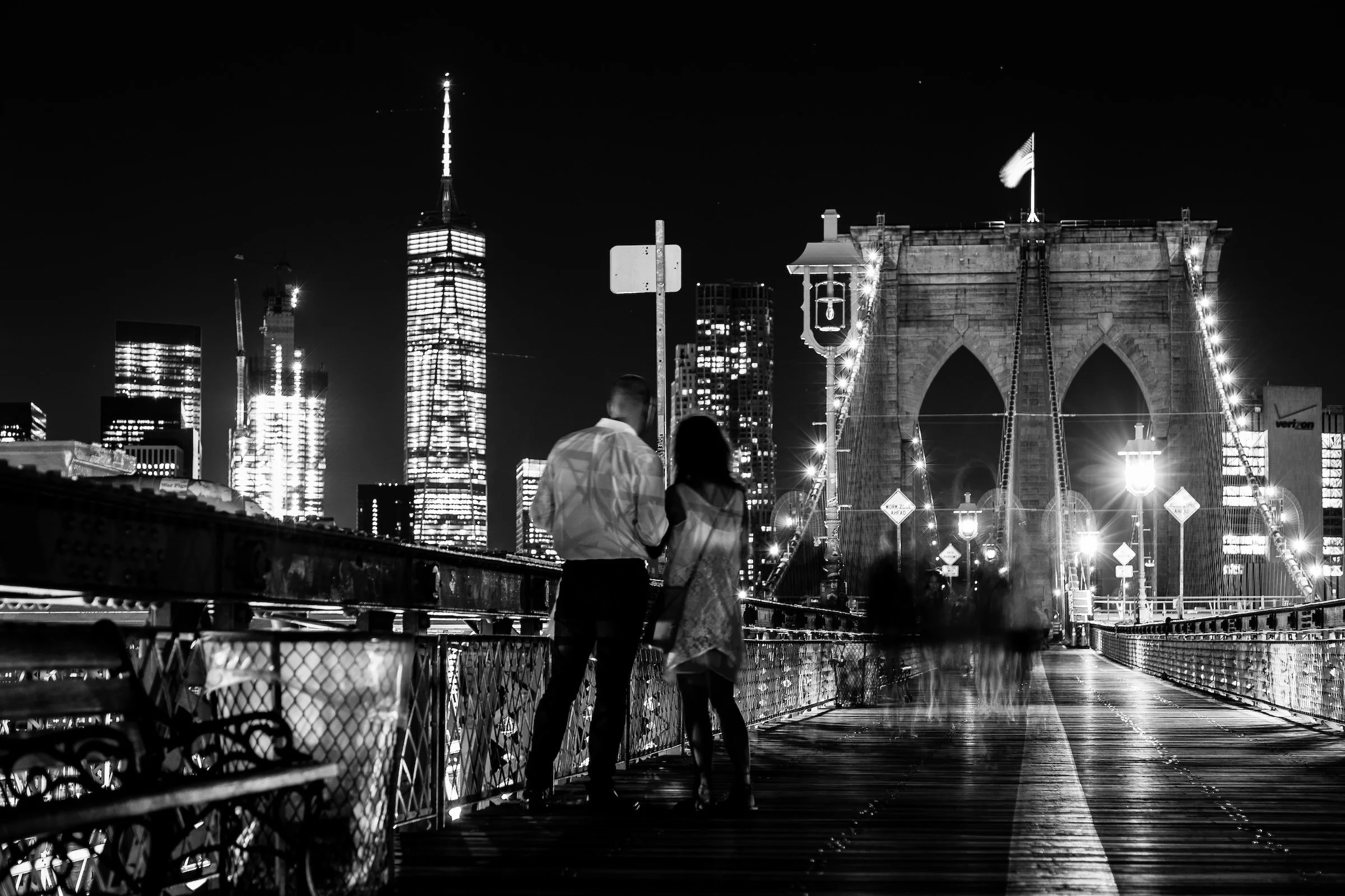
The borough’s civic identity reached its zenith with the completion of the Brooklyn Bridge in 1883—a marvel of engineering and symbolism that united Brooklyn with Manhattan. Designed by John A. Roebling and completed under his son Washington Roebling, the bridge embodied both ambition and faith in the urban future. Meanwhile, Prospect Park (1867), designed by Frederick Law Olmsted and Calvert Vaux, offered pastoral respite amid industrial bustle, anchoring surrounding neighborhoods like Park Slope and Prospect Heights in enduring beauty.
By century’s end, Brooklyn’s achievements rivaled any American city. Its public institutions—the Brooklyn Academy of Music (BAM), Brooklyn Museum, Brooklyn Botanic Garden, and Brooklyn Public Library—reflected civic pride and enlightenment ideals. When Brooklyn merged with New York City in 1898, becoming one of its five boroughs, it was reluctantly absorbed; many residents still referred to themselves as living in “the fourth-largest city in America.”
Early–Mid 20th Century: Borough of Homes and Industry
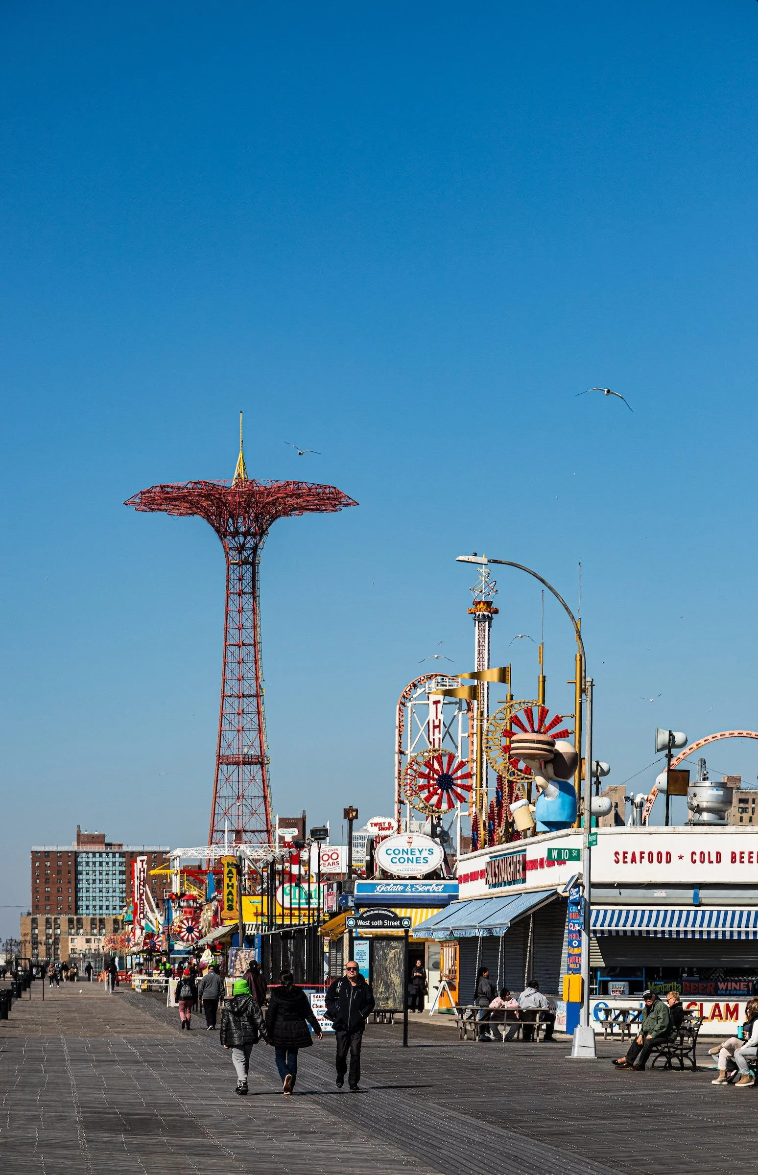
The early 20th century saw Brooklyn at its industrial and cultural height. Its docks handled global trade; factories produced everything from beer to steel cables; and Coney Island emerged as the nation’s playground, its boardwalks, roller coasters, and electric lights symbolizing the joy and modernity of urban life.
Residential growth surged. The brownstones of Brooklyn Heights, Clinton Hill, and Bed-Stuy filled with middle-class families, while newer neighborhoods such as Flatbush, Bay Ridge, and Borough Park expanded with tree-lined blocks and brick rowhouses. Immigrant communities—Italian in Bensonhurst, Jewish in Crown Heights, Polish in Greenpoint—created the ethnic patchwork that remains Brooklyn’s signature.
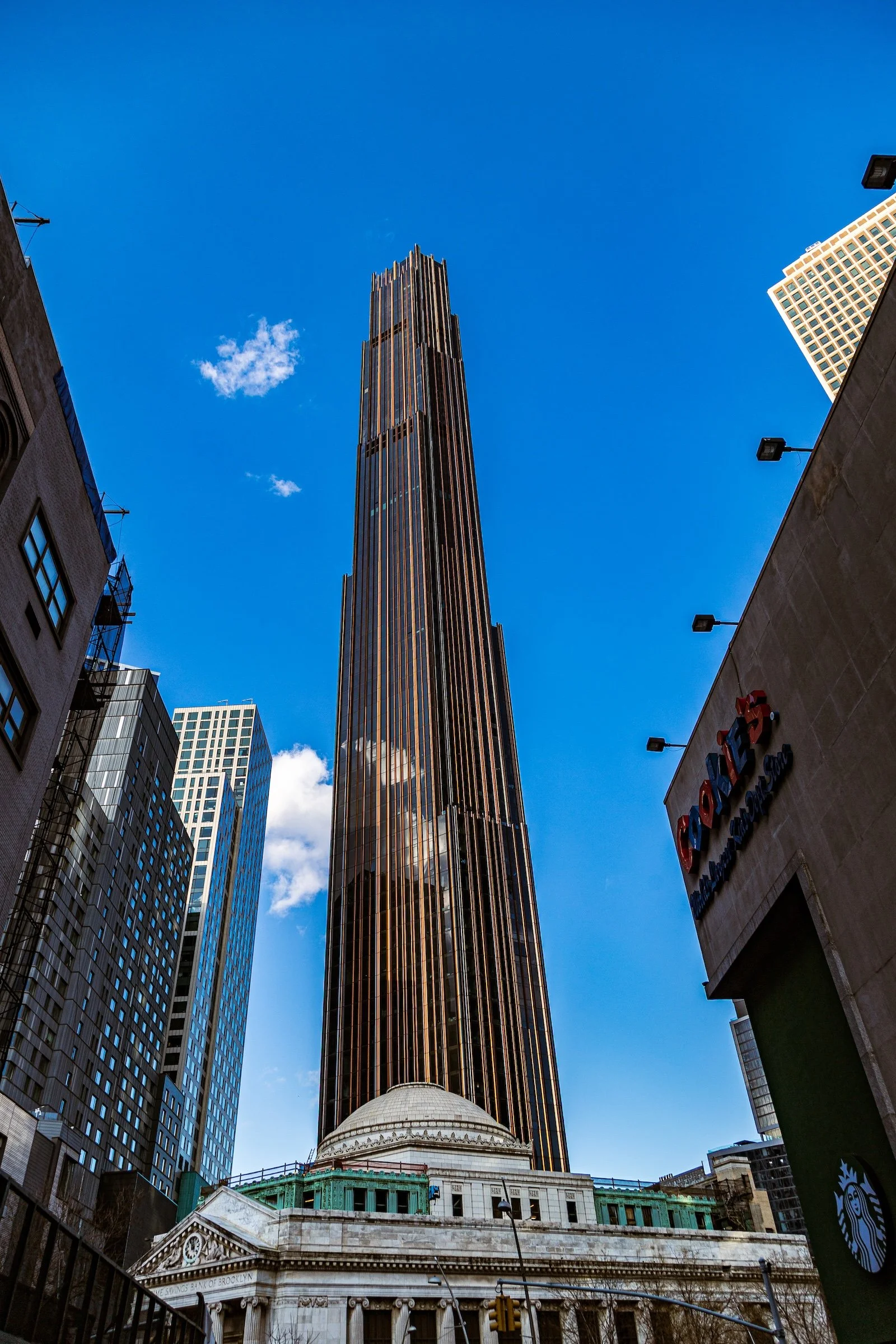
Brooklyn’s cultural icons multiplied: the Brooklyn Dodgers, playing at Ebbets Field in Flatbush, captured hearts citywide, their triumph in the 1955 World Series becoming a borough-wide myth. The Williamsburg Savings Bank Tower (1929) symbolized prewar prosperity, its gilded dome visible from miles away.
Yet the postwar years brought turbulence. The Verrazzano-Narrows Bridge (1964) connected Brooklyn to Staten Island, but urban renewal projects displaced thousands, particularly in working-class neighborhoods. The Dodgers’ move to Los Angeles in 1957 broke hearts and symbolized the borough’s sense of loss amid economic decline.

Late 20th Century: Decline and Rediscovery
The 1960s–1980s were decades of contrast—crime and decay alongside resilience and creativity. Factories closed, but grassroots activism flourished. Immigrant influxes—Caribbean, Puerto Rican, Russian, and later Chinese and Middle Eastern—revived aging neighborhoods. Artists colonized the industrial lofts of DUMBO, Williamsburg, and Bushwick, turning decay into renaissance.
Historic preservation took root. Brooklyn Heights became New York’s first designated historic district (1965), and restoration spread through Park Slope, Fort Greene, and Prospect Lefferts Gardens, reviving the borough’s architectural splendor. The cultural scene grew through institutions like BAM, whose experimental programming in the 1980s reasserted Brooklyn’s place in the avant-garde.
21st Century: The Borough Ascendant
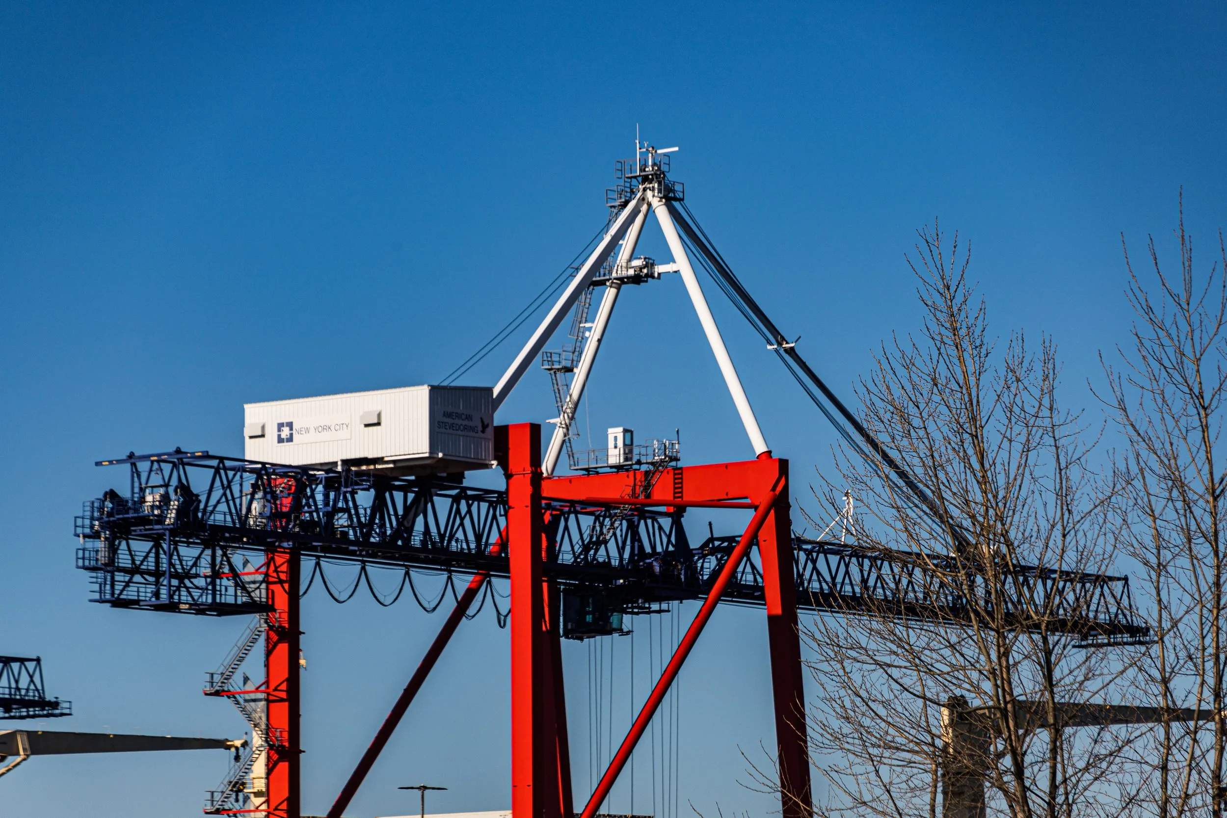
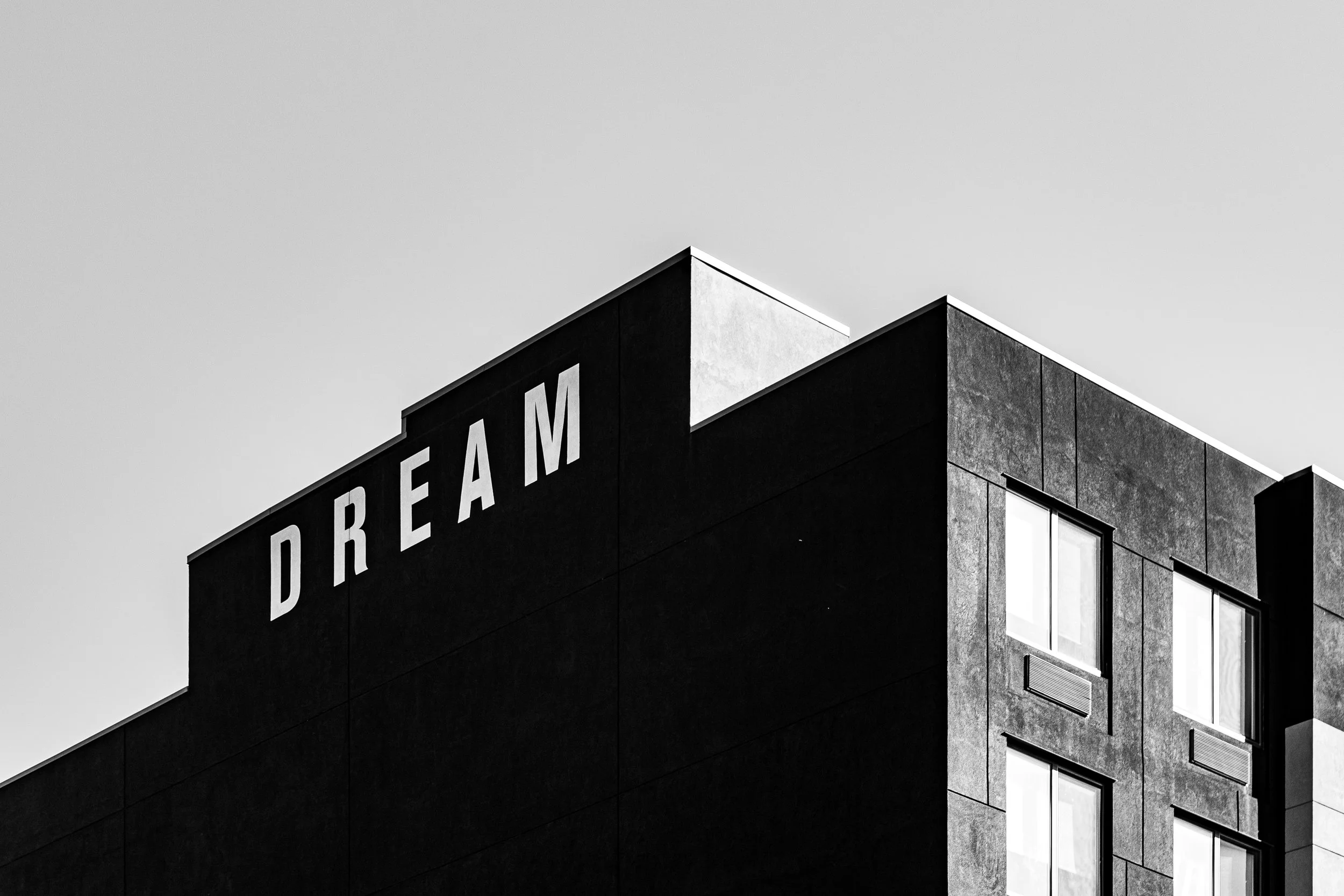
In the 21st century, Brooklyn has emerged as a global brand—a symbol of creativity, diversity, and authenticity. Neighborhoods once industrial or neglected—Williamsburg, DUMBO, Bushwick, and Red Hook—have become centers of art, design, and technology. The Brooklyn Navy Yard, once a naval shipyard, now houses film studios, urban farms, and green manufacturing. The Brooklyn Bridge Park, opened in phases beginning in 2010, transformed derelict piers into one of New York’s most beloved public spaces, reconnecting residents to the waterfront.
At the same time, the borough grapples with the duality of its success: gentrification and displacement shadow its renewal. Yet Brooklyn remains fiercely plural. From the Caribbean parades of Eastern Parkway to the Hasidic enclaves of Borough Park, from the brownstones of Bedford-Stuyvesant to the towers of Downtown Brooklyn, the borough embodies the city’s entire human range.
Cultural vitality abounds: Barclays Center anchors a new civic core in Prospect Heights; Brooklyn Academy of Music, Prospect Park, and the Brooklyn Museum remain temples of art and public life. Food, music, and innovation define its streets; small businesses thrive beside tech startups and artisan workshops. Brooklyn, once the city’s underdog, has become its conscience—an emblem of reinvention without forgetting its roots.
Spirit and Legacy
Brooklyn’s legacy is strength through unity—the same creed inscribed on its old seal. From Dutch village to industrial empire to cultural vanguard, it has absorbed the world and made it home. Its neighborhoods, each distinct yet interdependent, weave together the story of America’s urban soul: immigration, struggle, creativity, and renewal
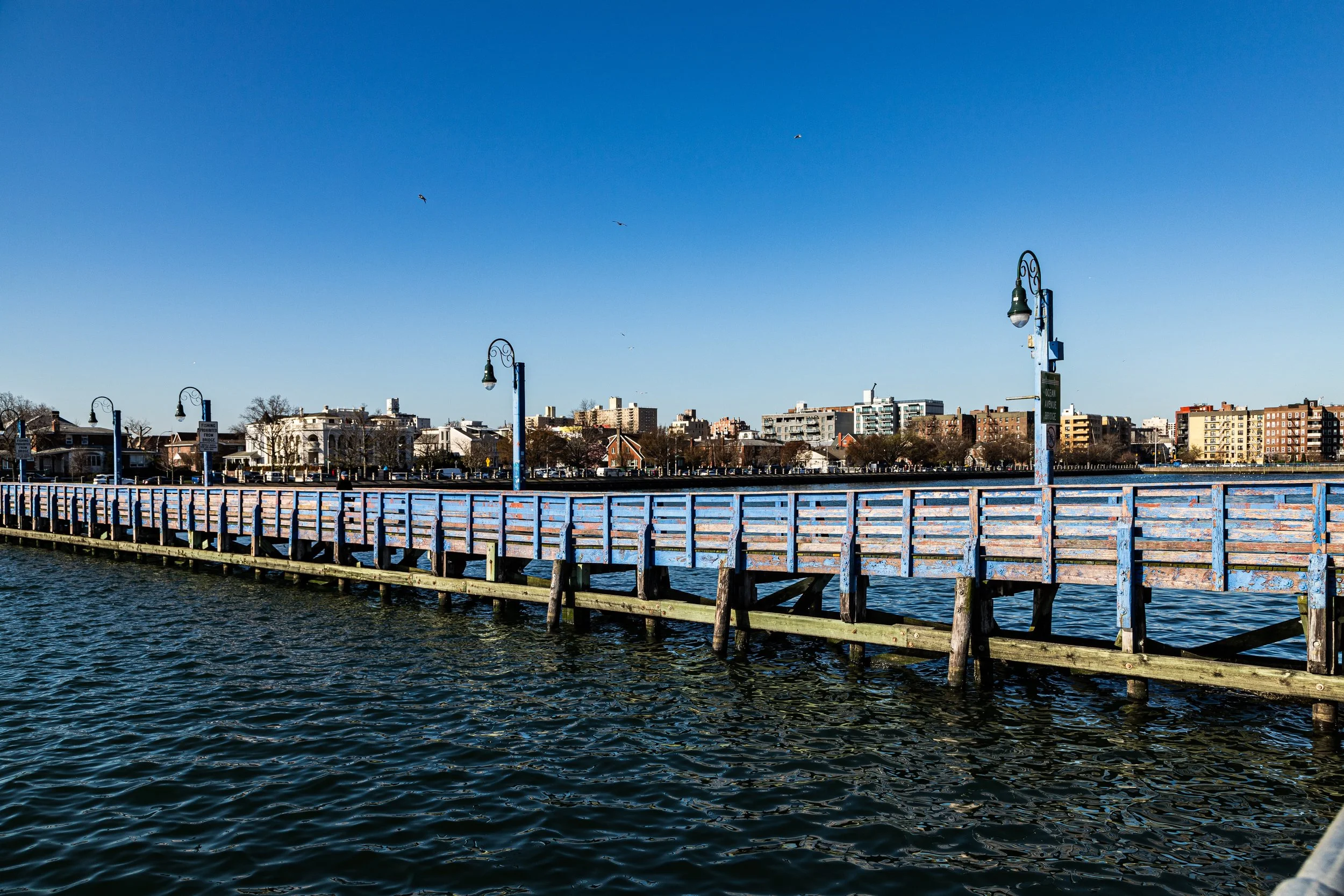
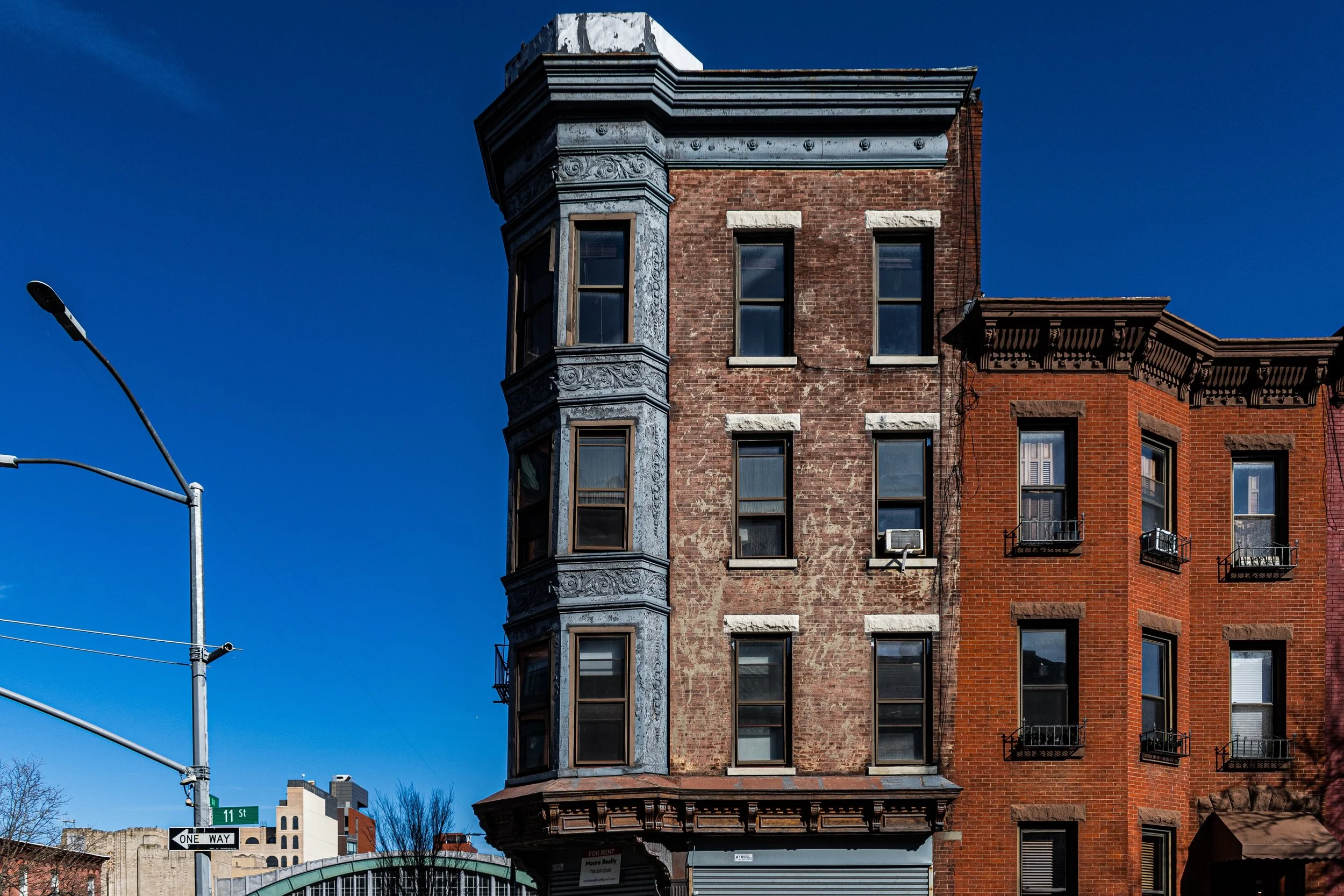
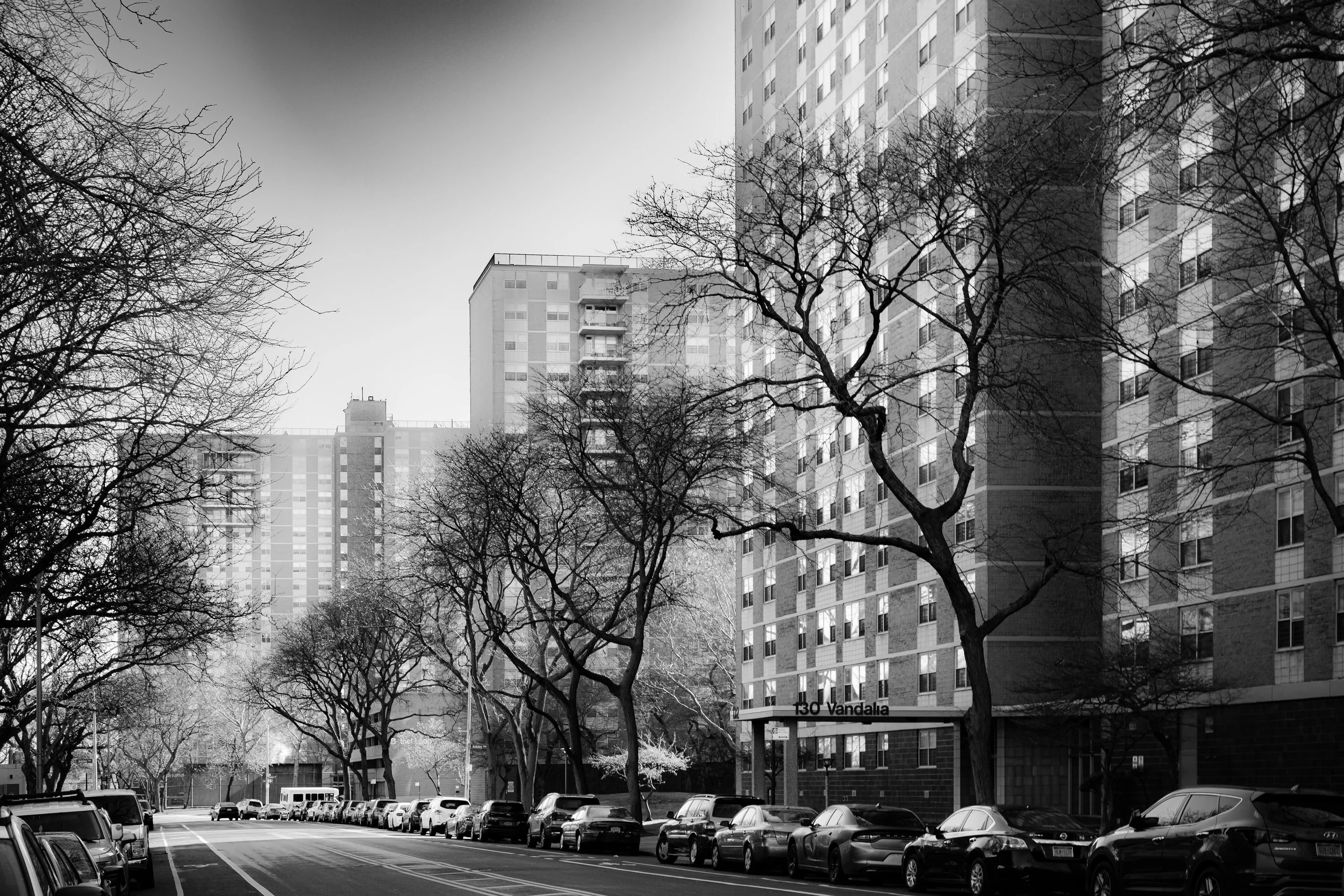
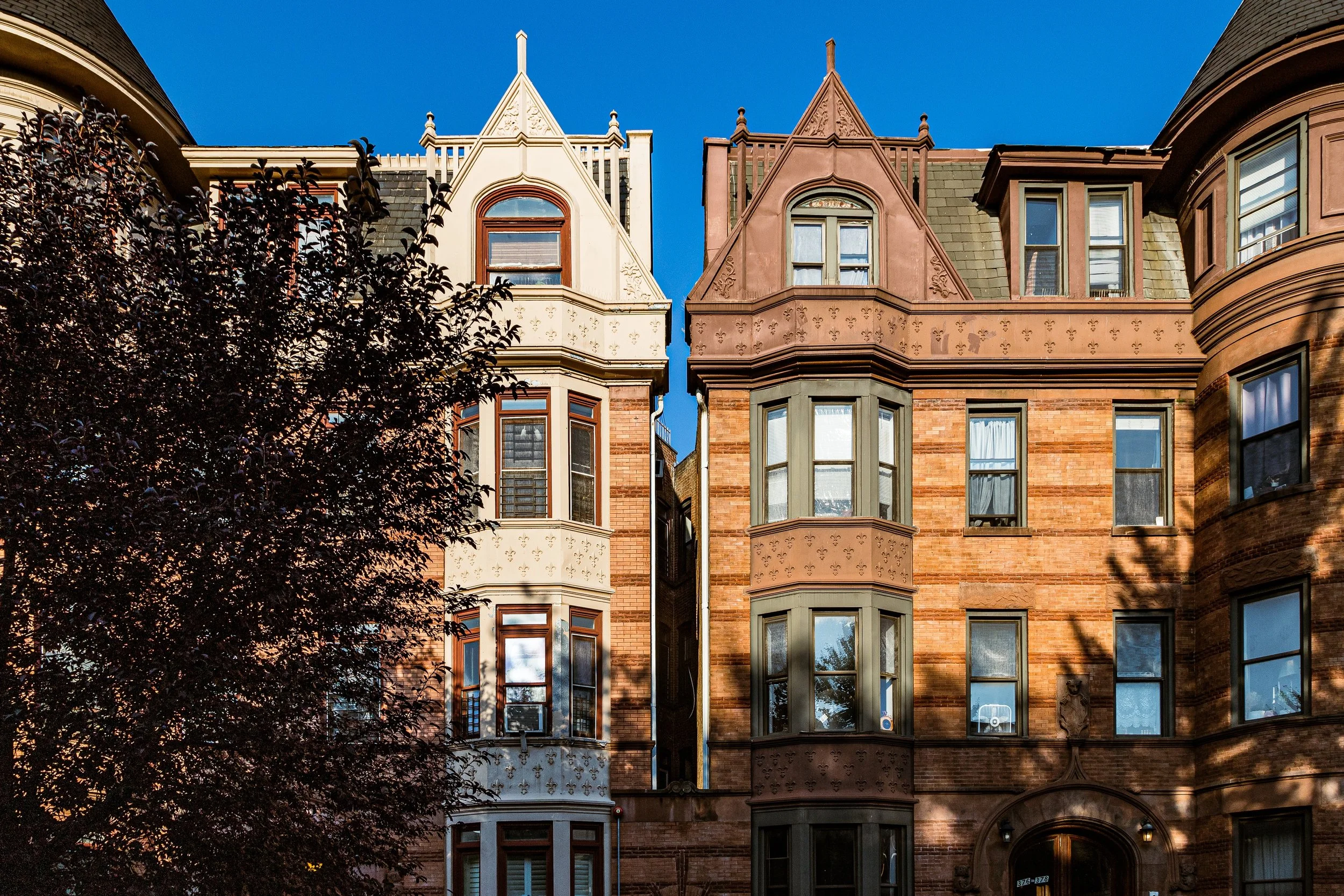
Brooklyn Photography
Visual Rhythm
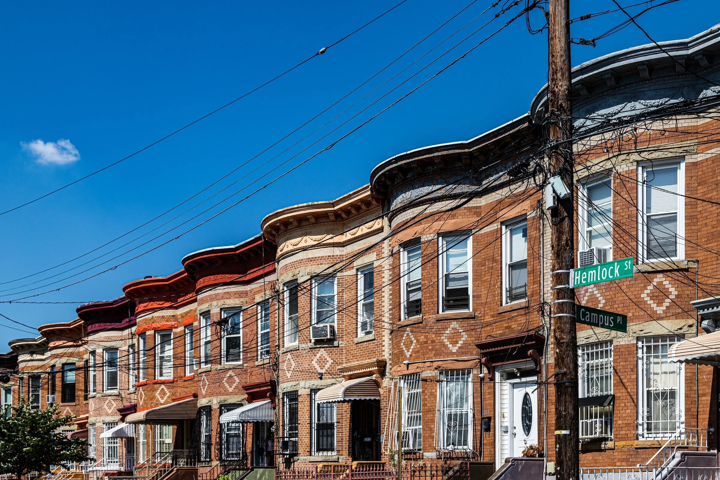
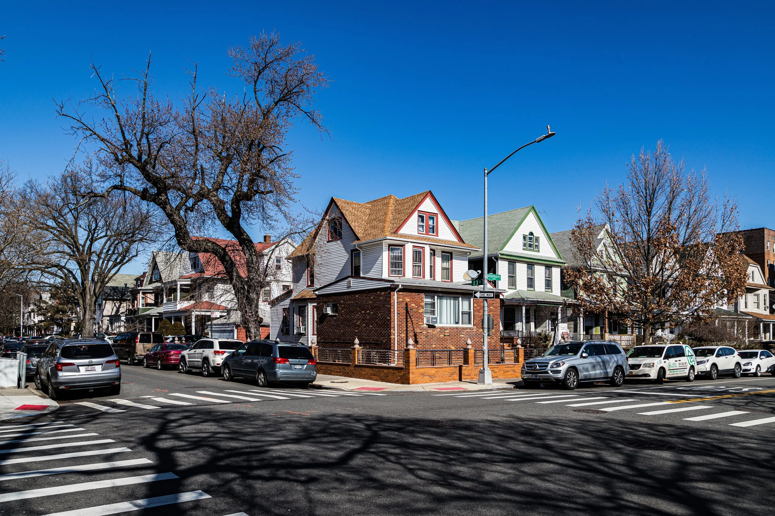
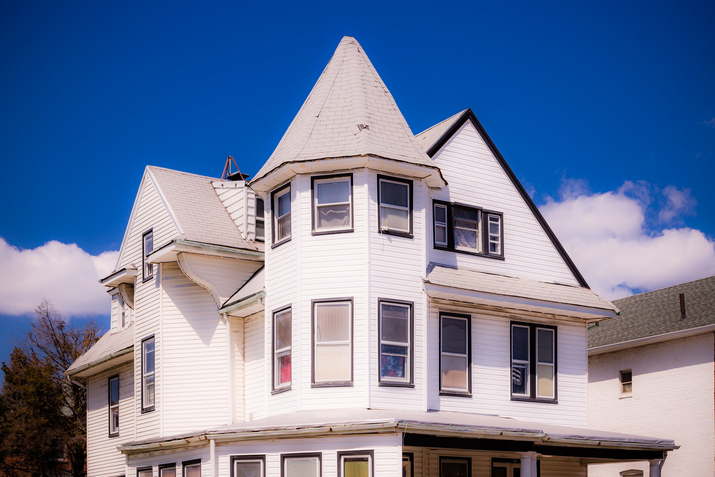
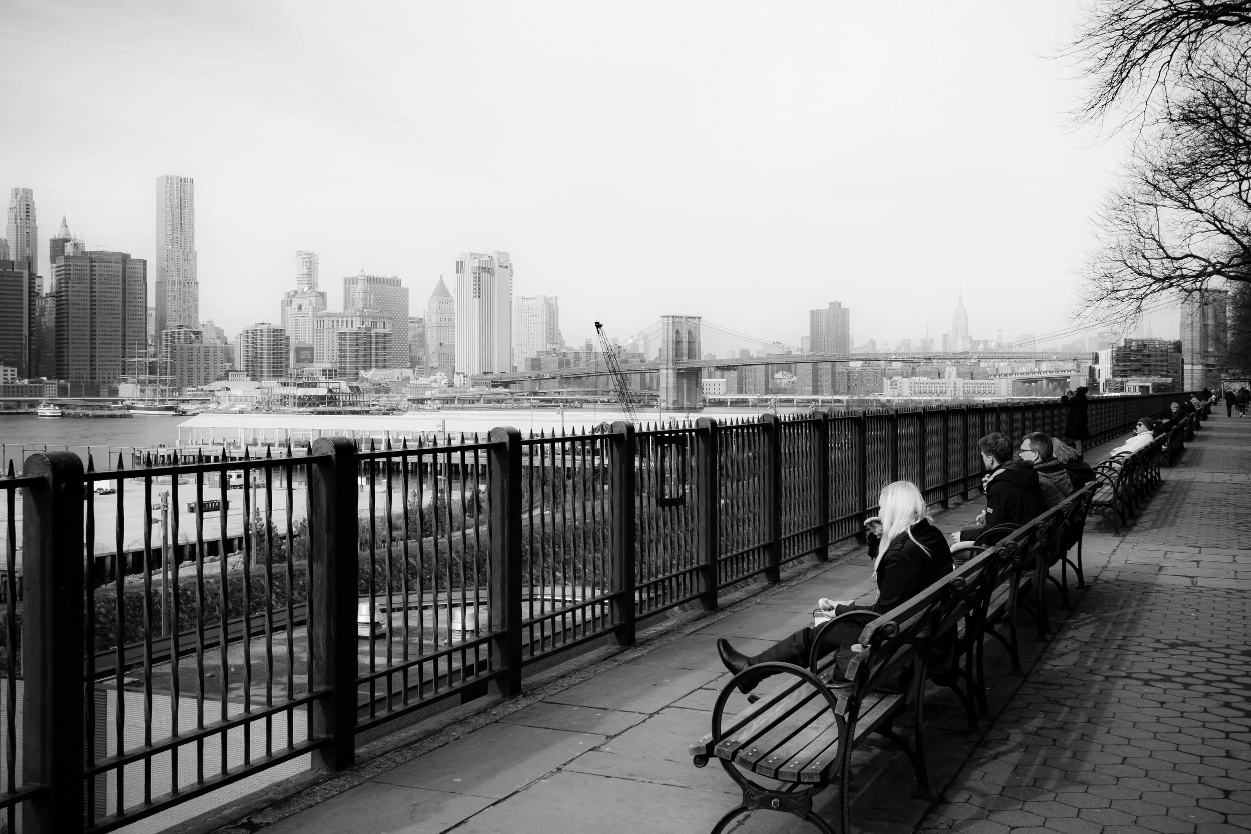
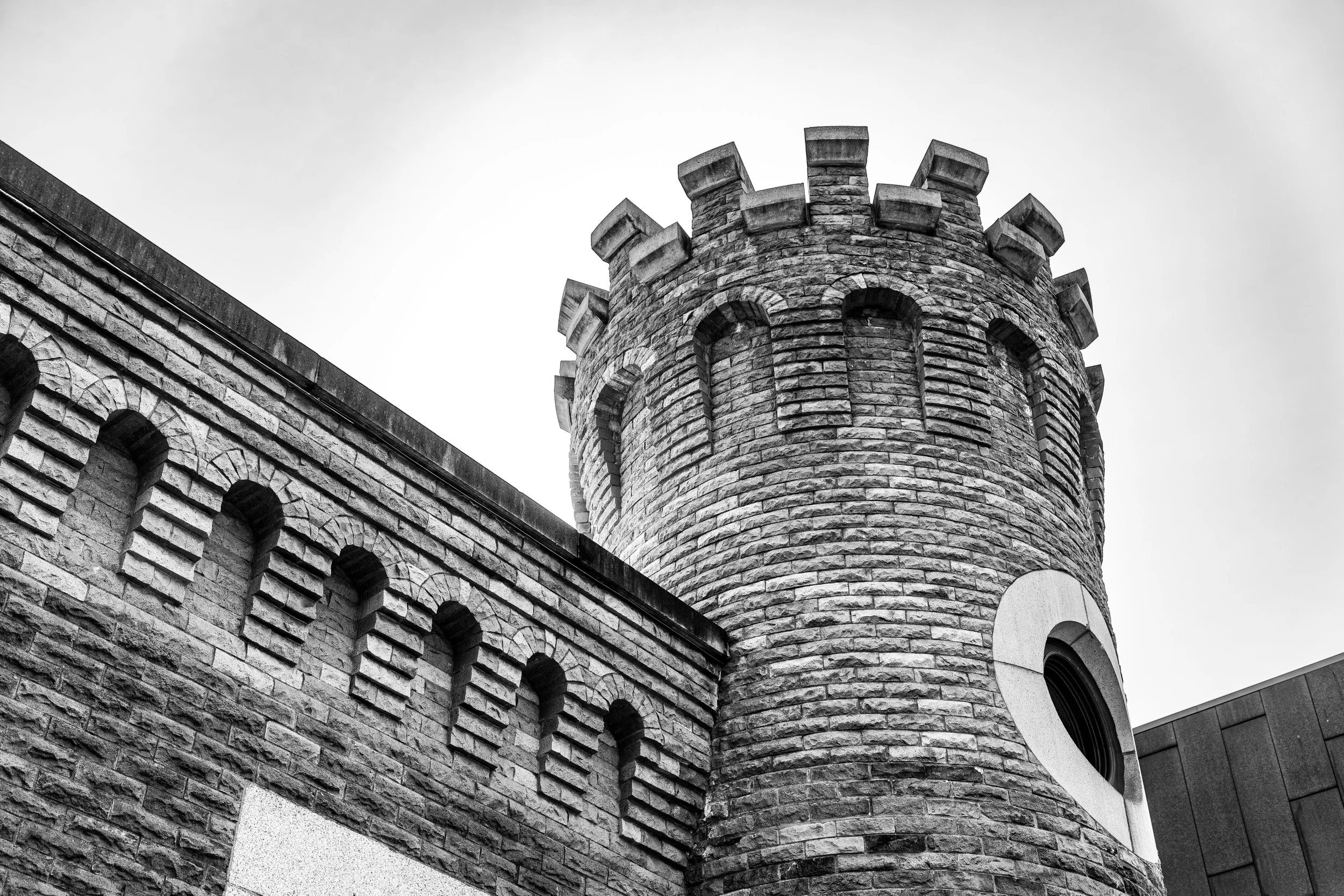
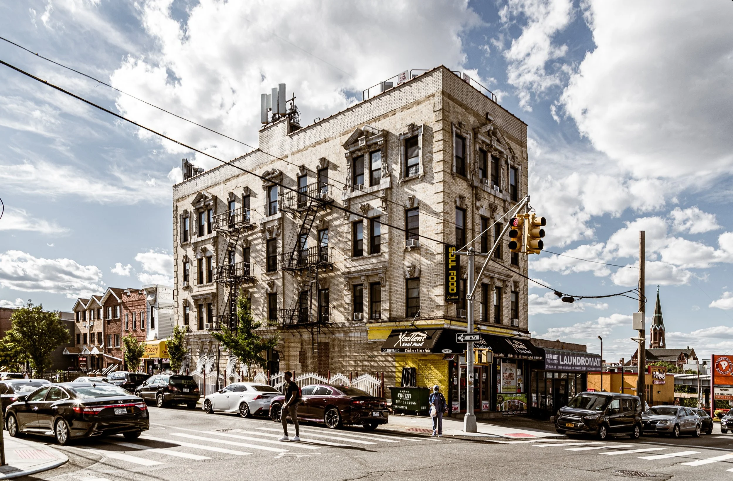
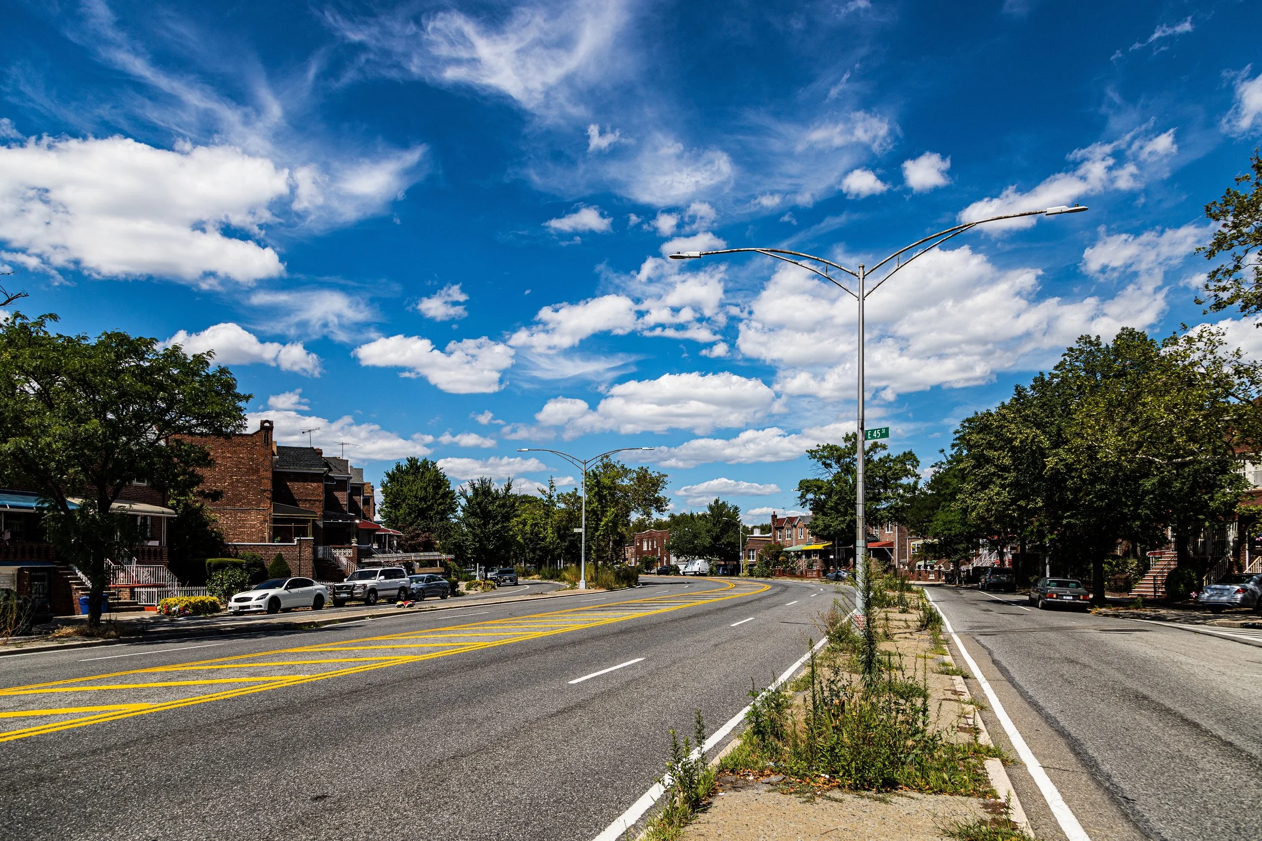
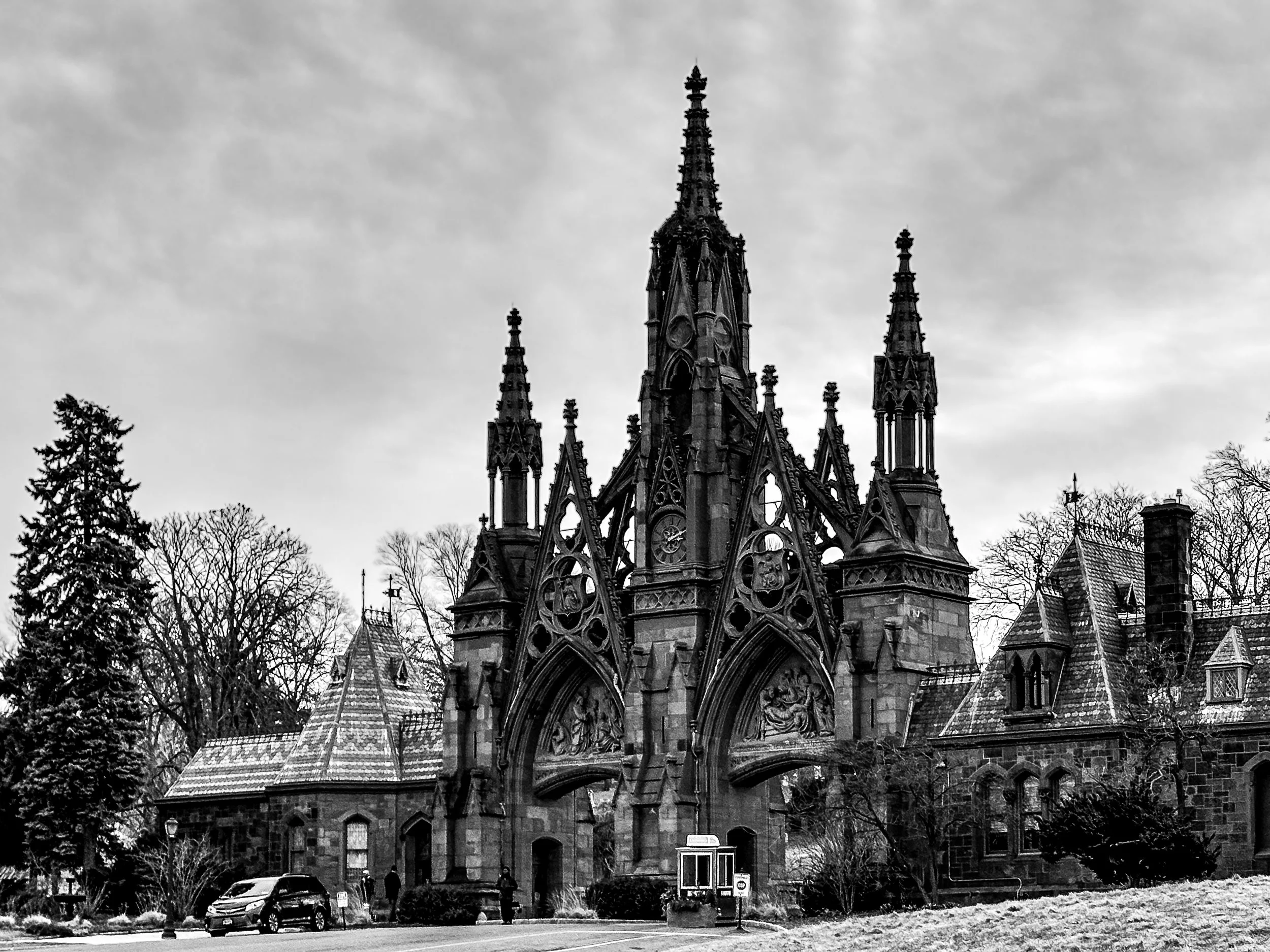
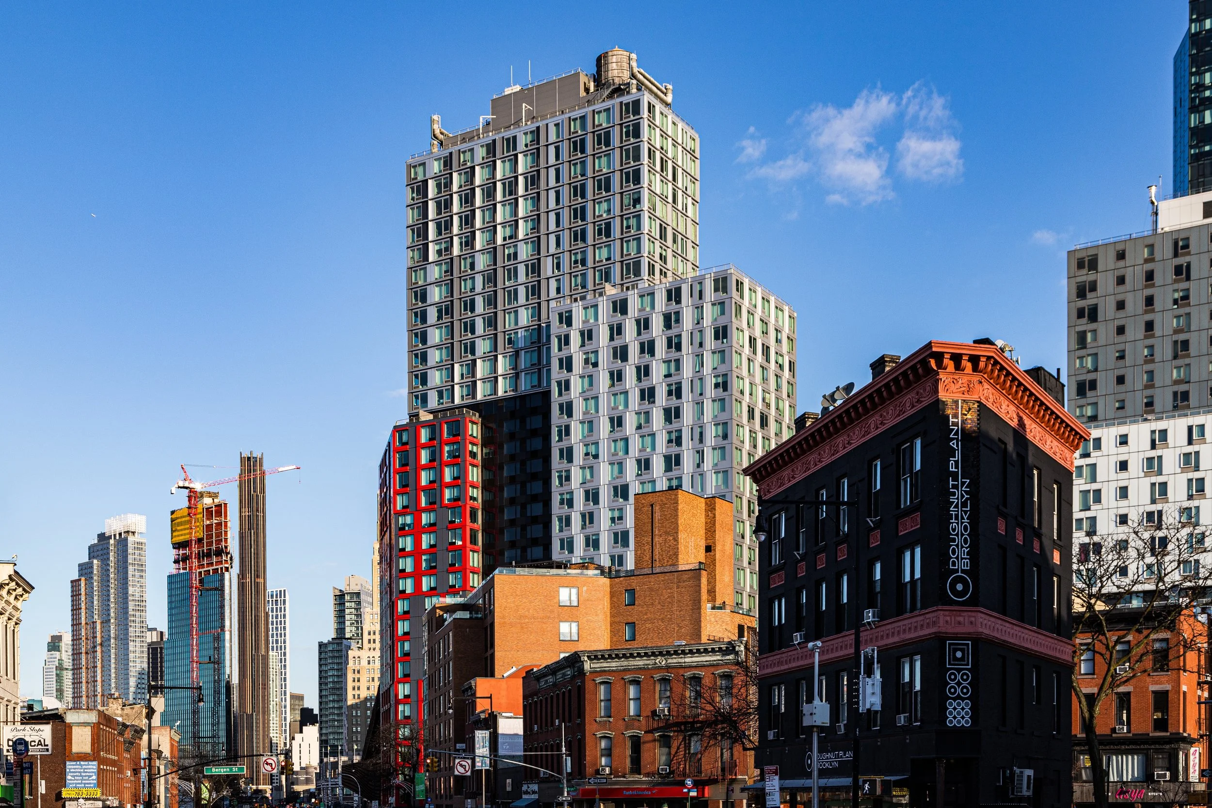
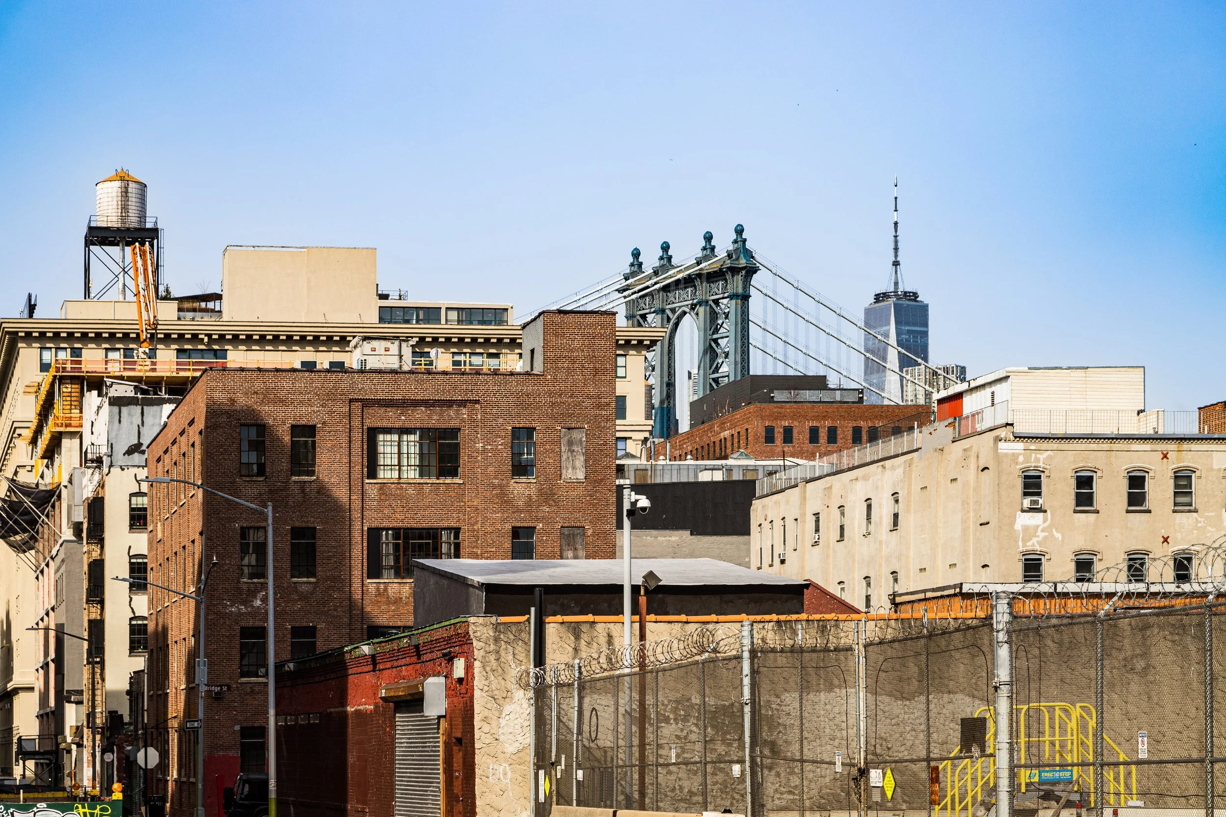
Brooklyn is a borough of visual breadth and neighborhood specificity. To photograph it is to move through a landscape where brownstone rows, industrial remnants, waterfront edges, civic architecture, public housing, detached homes, elevated tracks, murals, and newly built skylines all coexist within one broad and varied urban field. More than any single landmark or image, Brooklyn reveals itself through accumulation: the steady layering of streets, facades, materials, histories, and local identities that give each neighborhood its own visual rhythm.
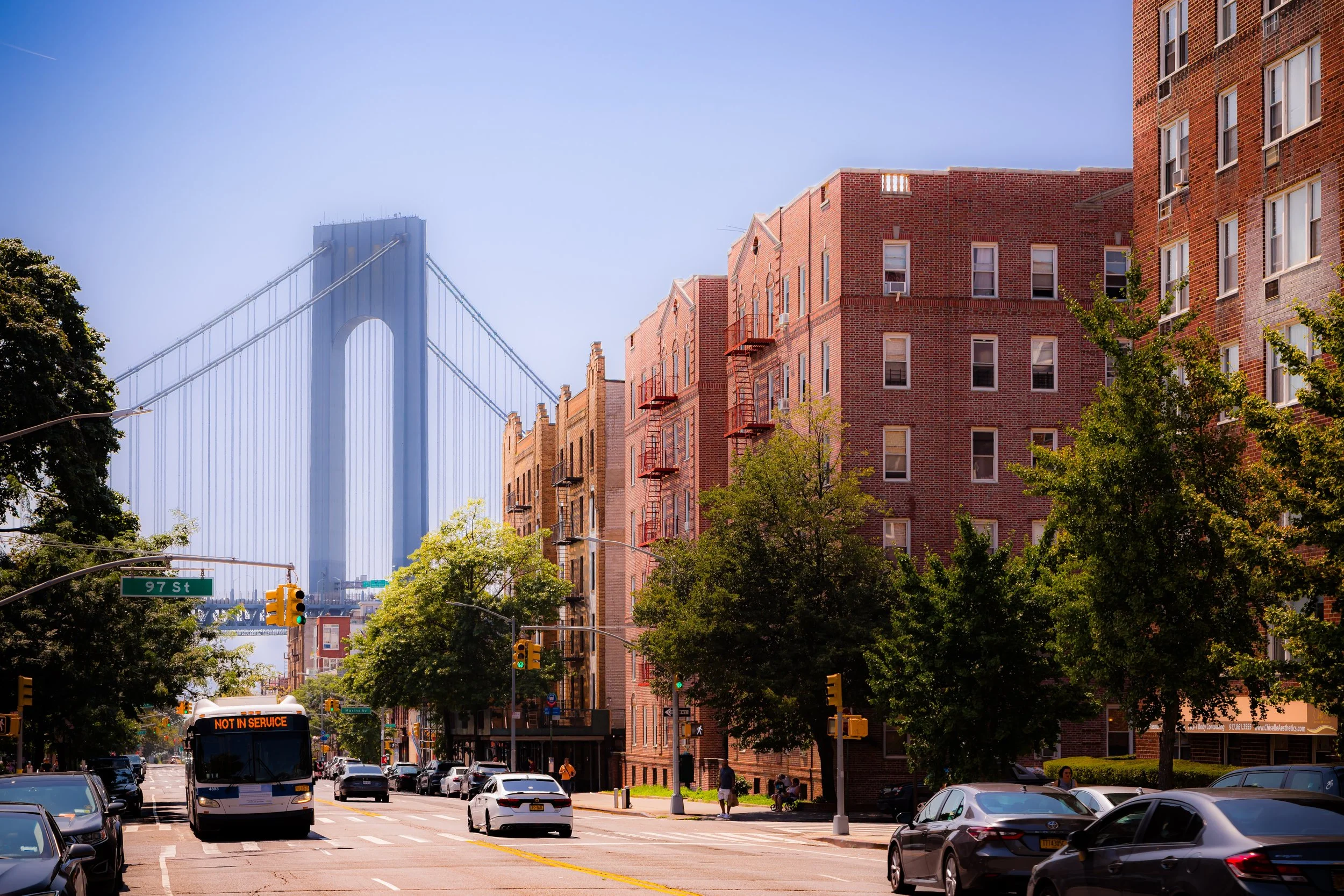
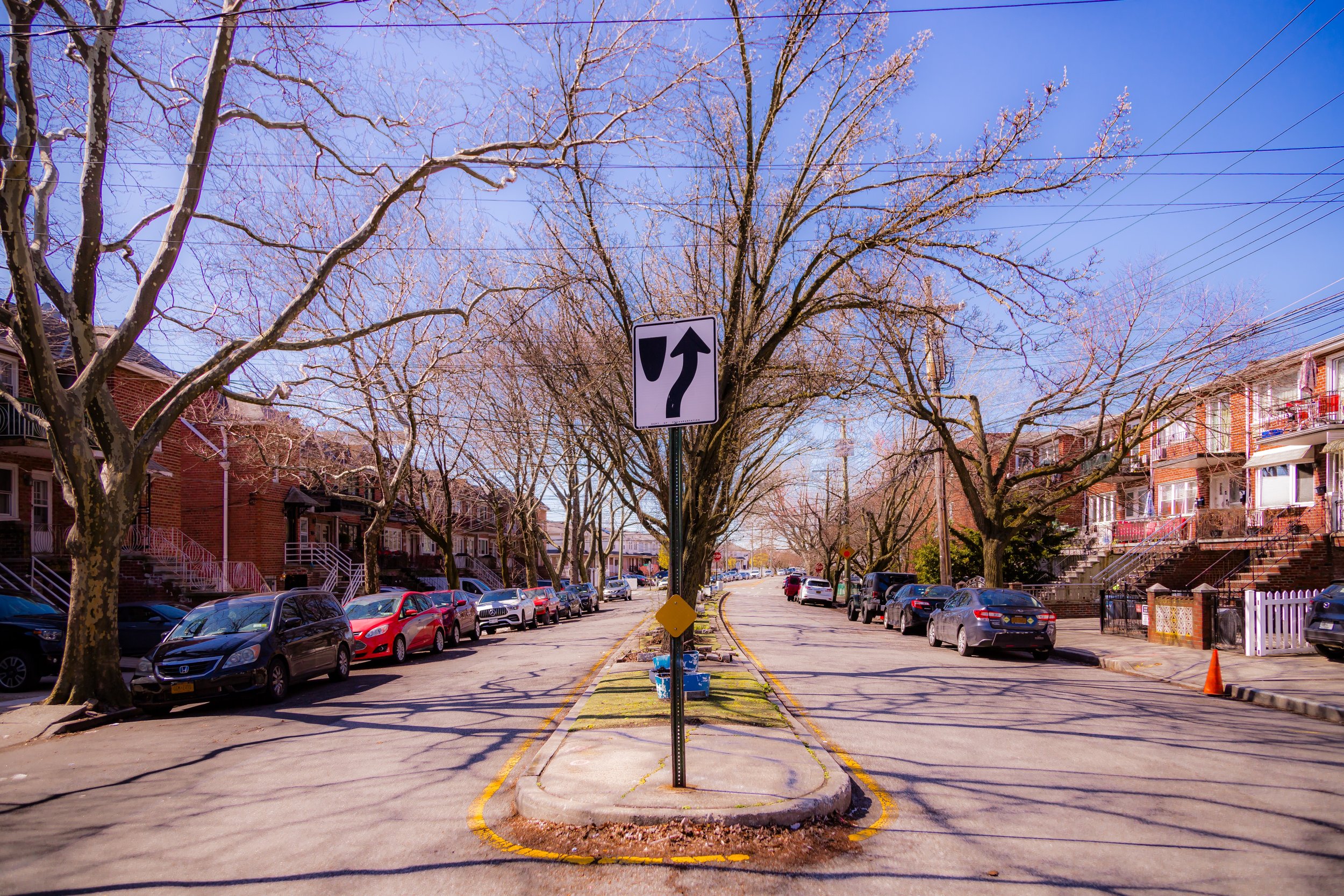
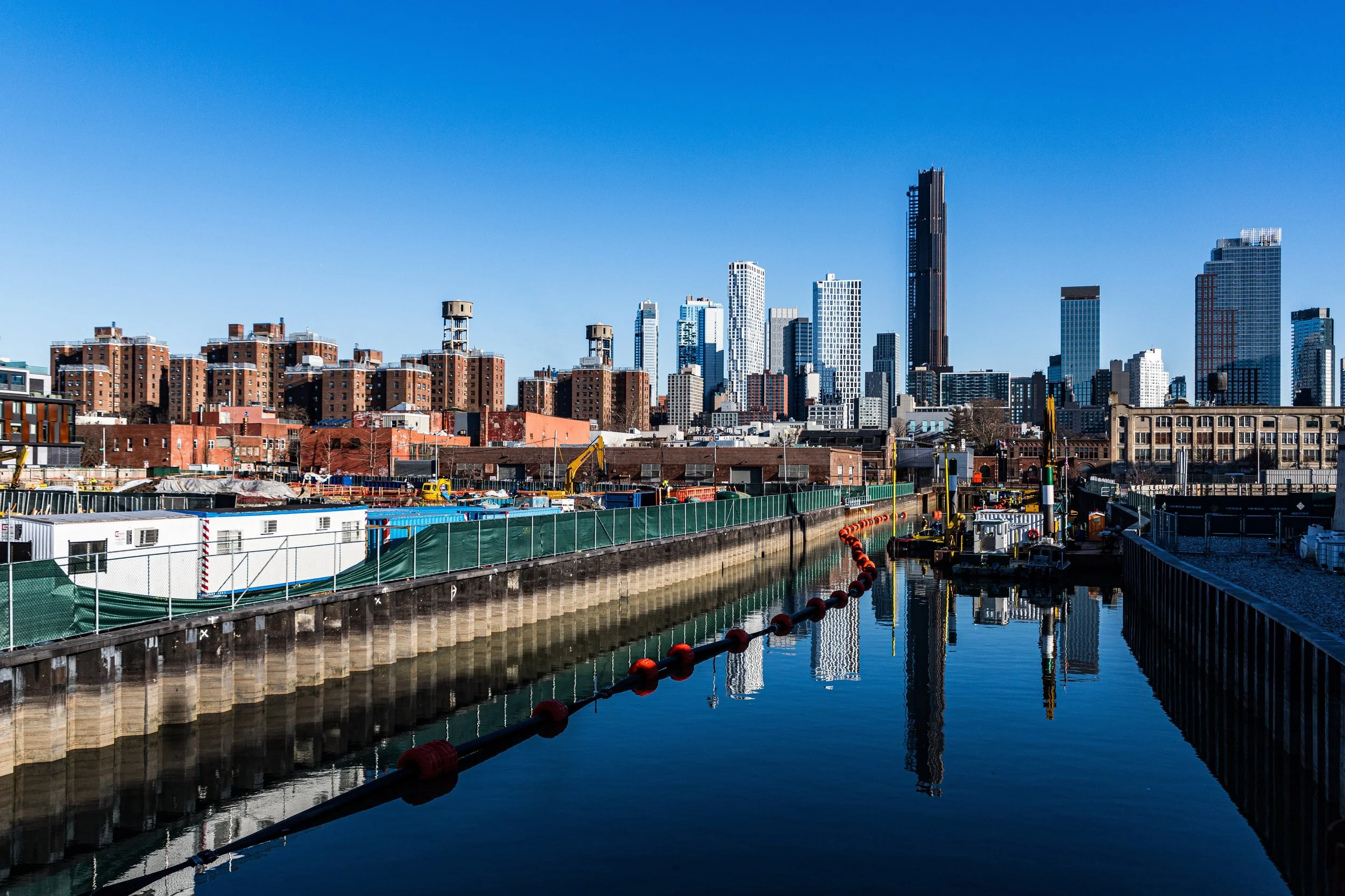
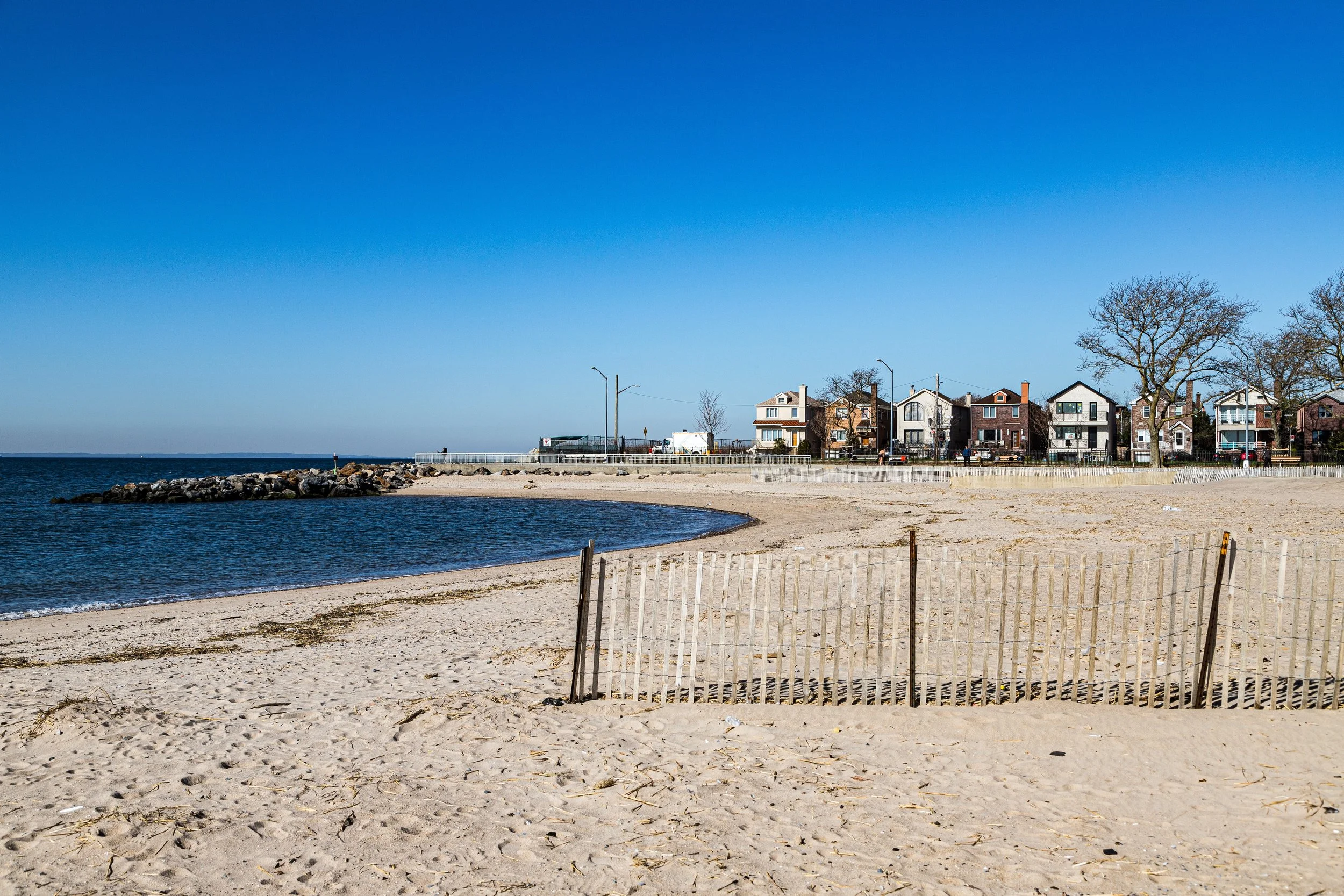
Photographically, Brooklyn is defined by contrast without rupture. Domestic streets can feel intimate, measured, and repetitive, marked by stoops, cornices, windows, trees, and brickwork; then, only a short distance away, the borough opens into rail yards, broad avenues, industrial corridors, bridge approaches, or long waterfront views. Light behaves differently across these spaces. In some places it sharpens edges and emphasizes pattern; in others it softens the streetscape into atmosphere, reflection, distance, or haze. The borough’s scale is broad, but its power often lies in the way small details and neighborhood textures hold their ground within that larger frame.
These photographs trace Brooklyn not as a single visual identity, but as a borough of many local worlds held together by material richness, strong neighborhood character, and a constant interplay between repetition and surprise. Some images lean toward skyline drama, infrastructure, and bold geometry; others toward rowhouse intimacy, storefront detail, weathered surfaces, or the quieter poetry of side streets and residential edges. Taken together, they suggest a borough that is layered, tactile, and deeply inhabited: one that rewards both the long view and close attention.
Through the Lens
Photographing Brooklyn means paying attention to rhythm. Not only the rhythm of architecture — rows of windows, stoops, cornices, facades, and fences — but also the rhythm of transition: residential to industrial, local to monumental, enclosed to open, old to newly made. Brooklyn often resists a single dominant visual mode. Instead, it presents itself through shifts in scale, use, and atmosphere, with each neighborhood carrying its own distinct visual logic.
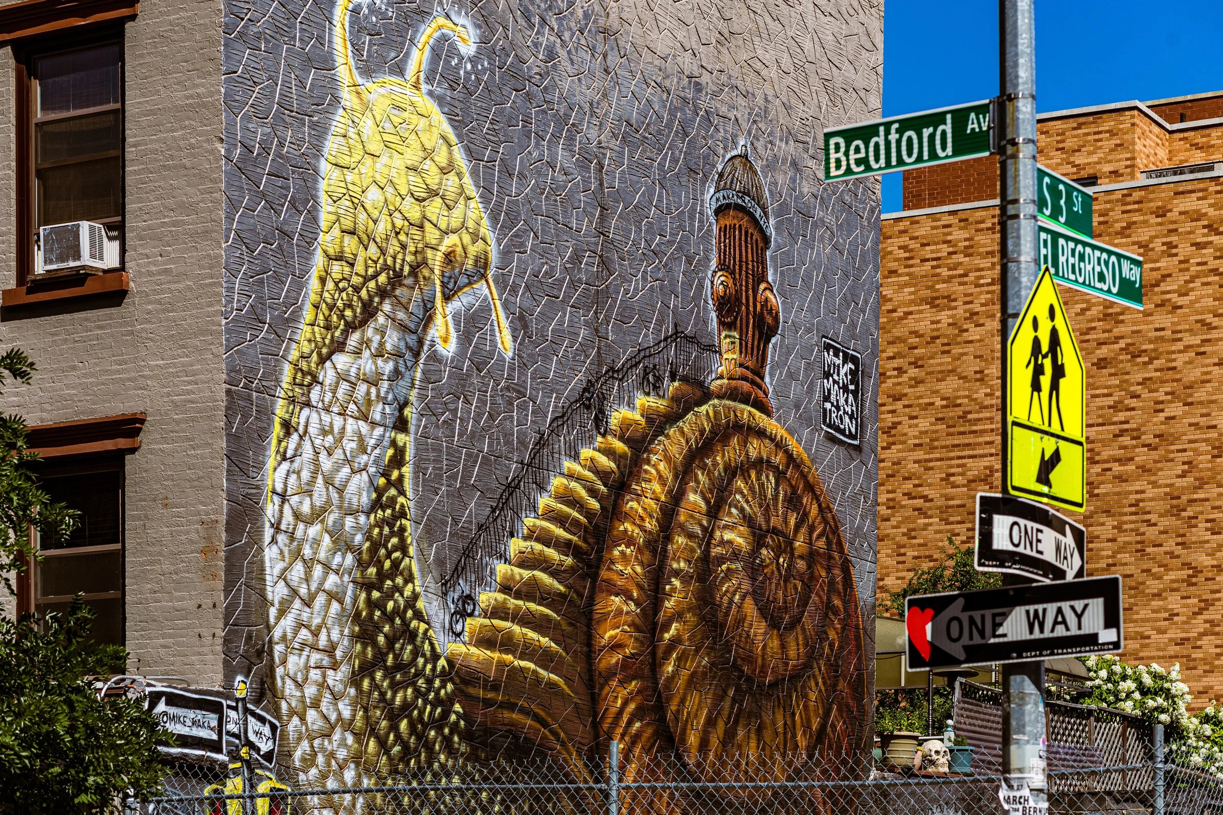
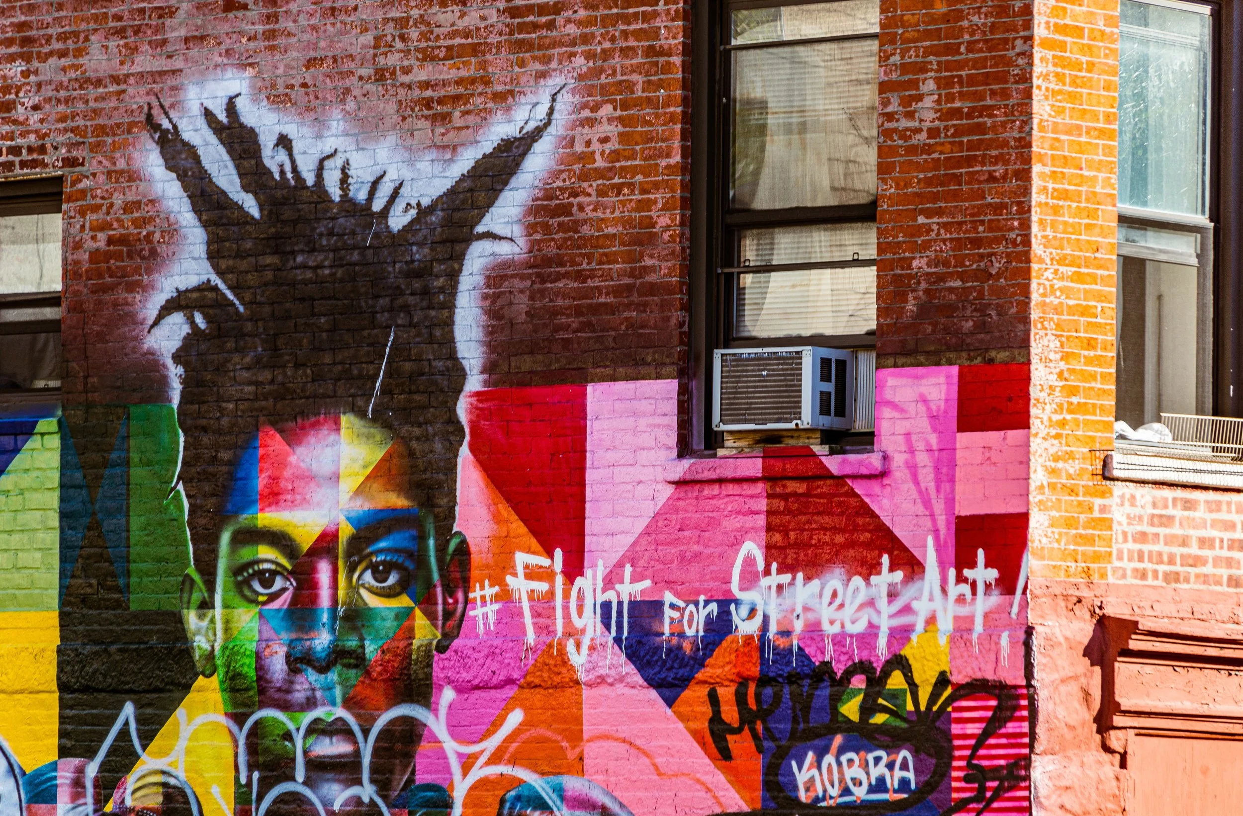
Again and again, the borough invites a way of seeing rooted in texture and coexistence. Brownstone blocks and domestic facades sit alongside elevated tracks, warehouses, public housing, church fronts, murals, waterfront esplanades, and newer glass construction. Some parts of Brooklyn feel tightly gridded and repetitive; others open into sky, water, rail lines, or broad infrastructure. This movement between intimacy and exposure gives the borough much of its photographic energy. It can feel deeply local and strangely expansive at once.
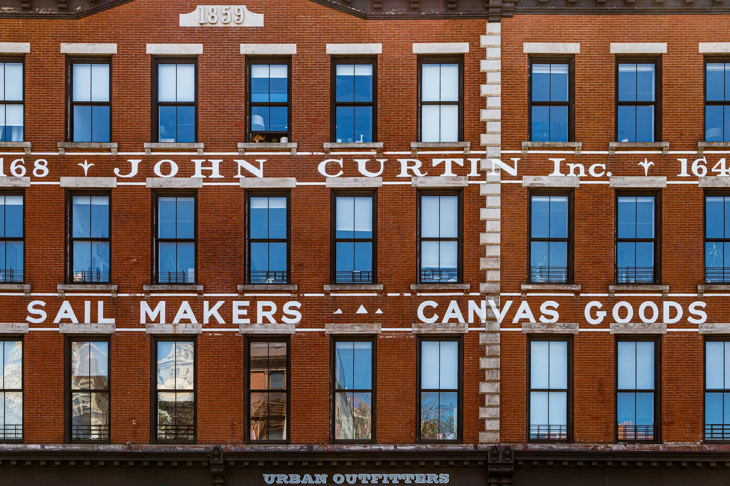
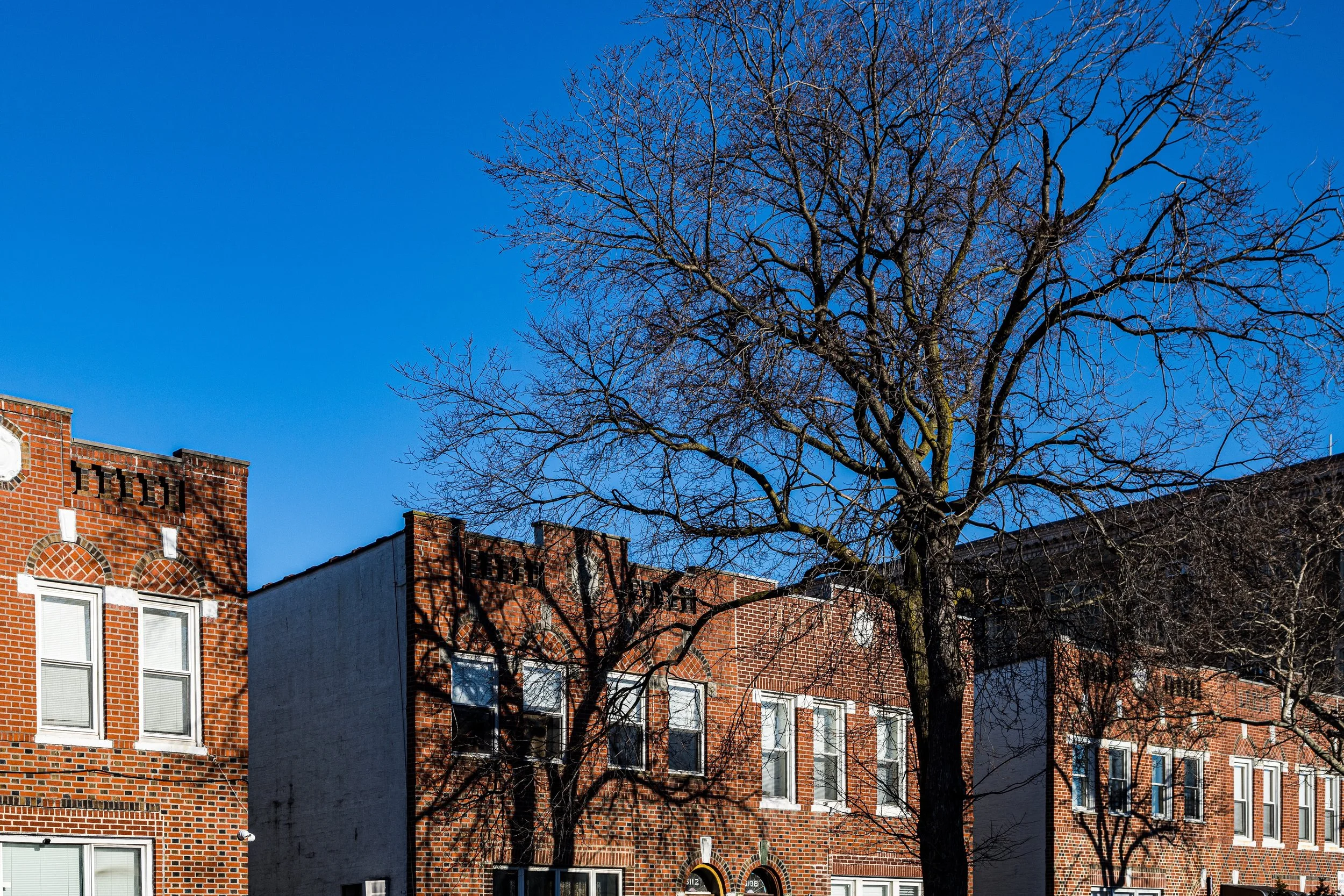
Brooklyn also has a strong material presence. Brick, stone, painted wood, steel, glass, concrete, tile, signage, weathering, and vegetation all contribute to a streetscape that rarely feels abstract. Even in its more monumental or redeveloped areas, the borough often retains evidence of working life, neighborhood use, and historical layering. That is part of what makes Brooklyn so photographically rewarding: it is visually rich without being overly polished, and expressive without needing spectacle at every turn.
To photograph Brooklyn is therefore not just to collect scenes, but to notice how the borough organizes itself through repetition, adaptation, weathering, color, infrastructure, and local character. The camera becomes a way of tracing how one neighborhood yields to another, and how the borough’s larger identity emerges through its many distinct parts.
Visual Highlights
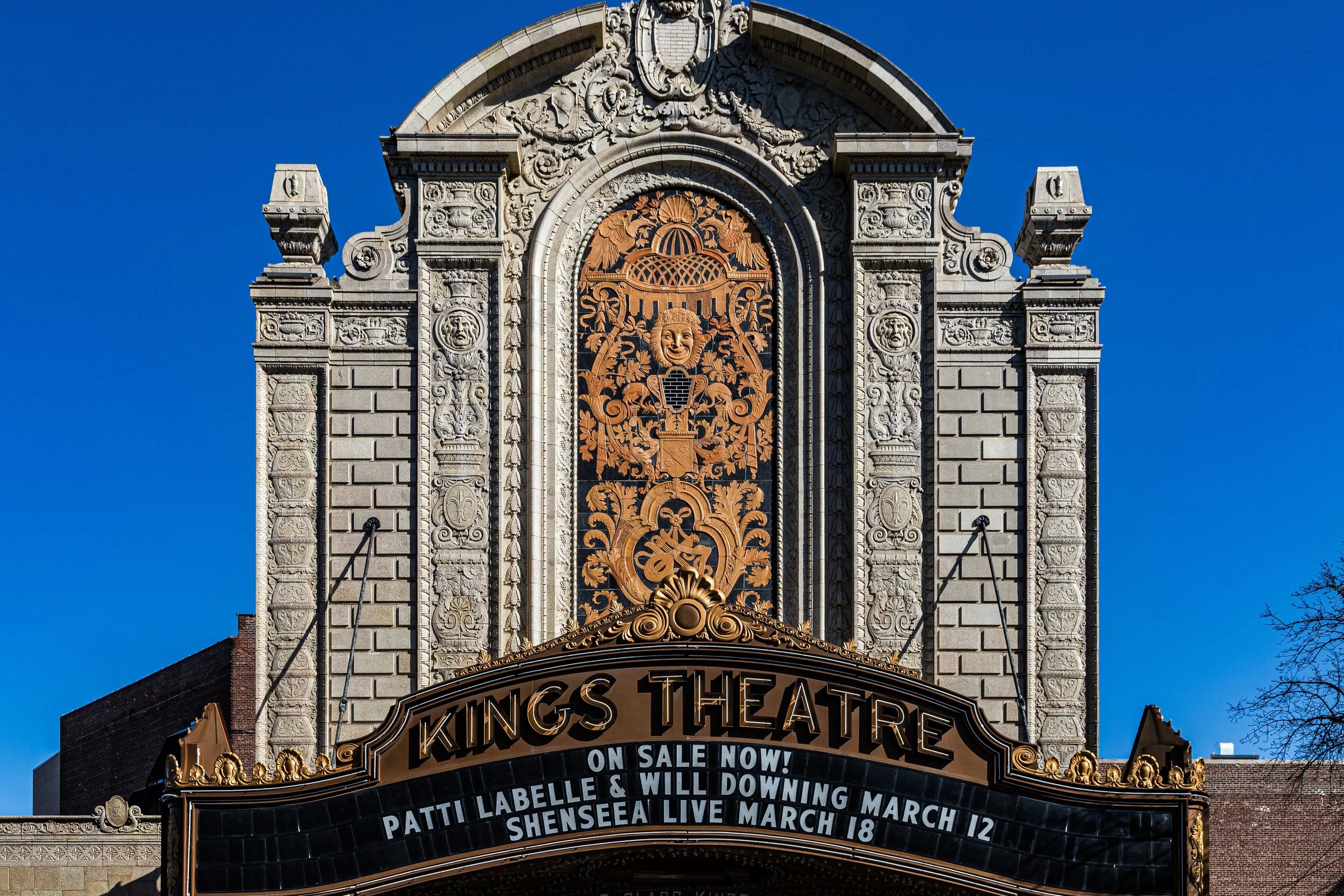
This selection reflects several of Brooklyn’s defining photographic qualities: waterfront distance and skyline perspective, brownstone and rowhouse rhythm, industrial remnants, elevated structures, neighborhood signage, murals, civic and religious architecture, gridded facades, and quiet residential textures. Some images emphasize the borough’s openness — harbor views, bridge corridors, long perspectives, and wide skies. Others focus more closely on material detail, repetition, weathered surfaces, and the visual life of ordinary blocks.
Taken together, these photographs suggest a Brooklyn of strong contrasts held in balance: domestic and industrial, historic and evolving, repetitive and improvised, intimate and expansive. They also reflect the borough’s neighborhood-based nature. Rather than presenting one unified visual formula, Brooklyn appears here as a mosaic of local identities, each shaped by its own architecture, history, scale, and streetscape.
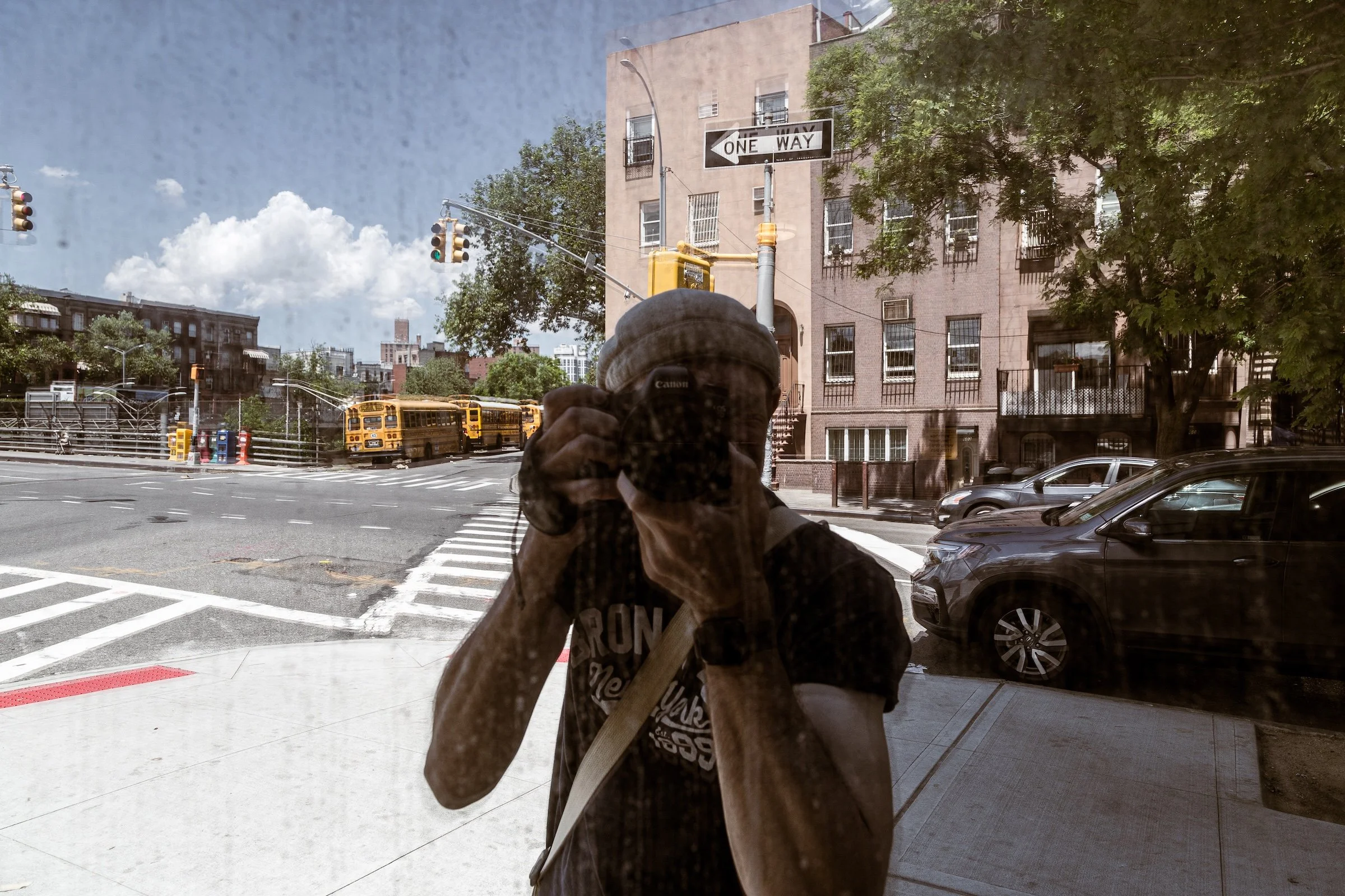
Fieldwork Across the Borough
These photographs are part of an ongoing effort to document Brooklyn through repeated walks, neighborhood visits, and close visual attention to both its landmark spaces and its ordinary streets. Rather than isolating only the iconic or the newly transformed, this work approaches Brooklyn as a lived borough: one of neighborhood distinctions, waterfront edges, architectural continuity, industrial traces, public space, commercial energy, and changing local character.
As the archive continues to grow, this section will expand to include fuller fieldwork logs, neighborhood-based highlights, seasonal returns, and more detailed visual pathways through the borough. Over time, it will serve not only as a gallery of selected work, but as an evolving record of how Brooklyn looks, feels, and changes when encountered on foot and over time.
Lexicon Connections
Several recurring visual strategies and motifs emerge naturally across these Brooklyn photographs and connect closely to the broader Photographic Lexicon.
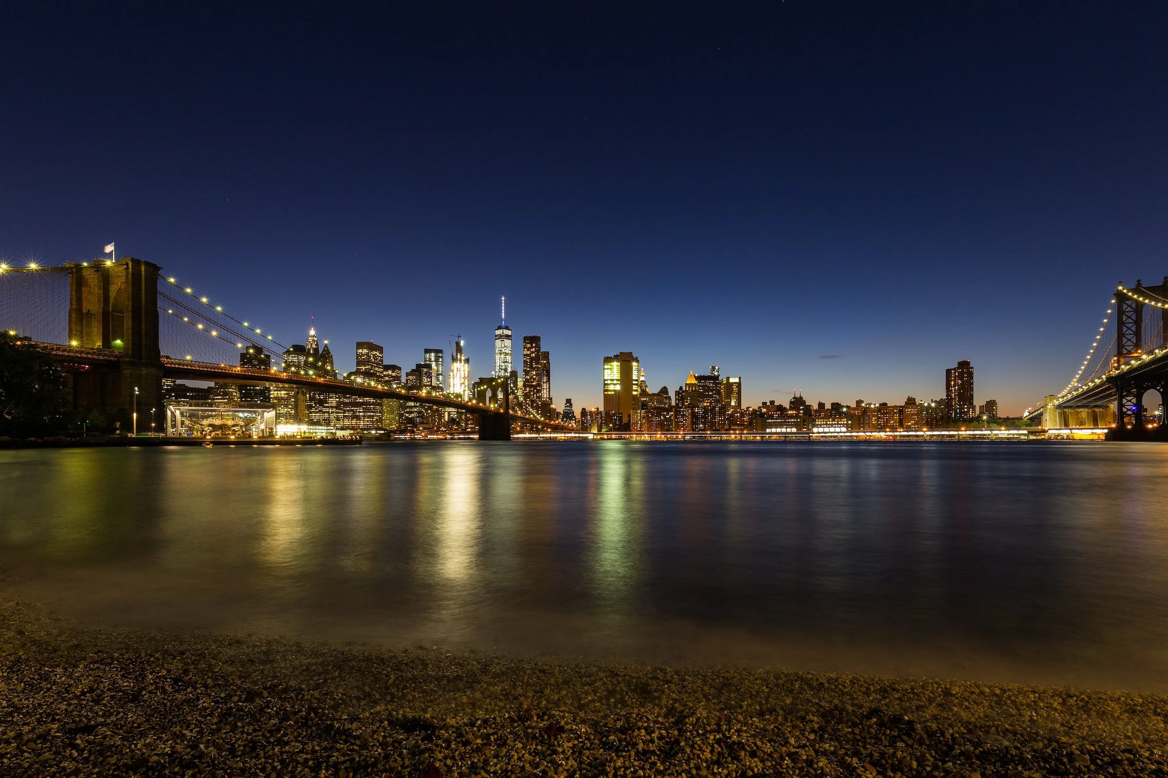
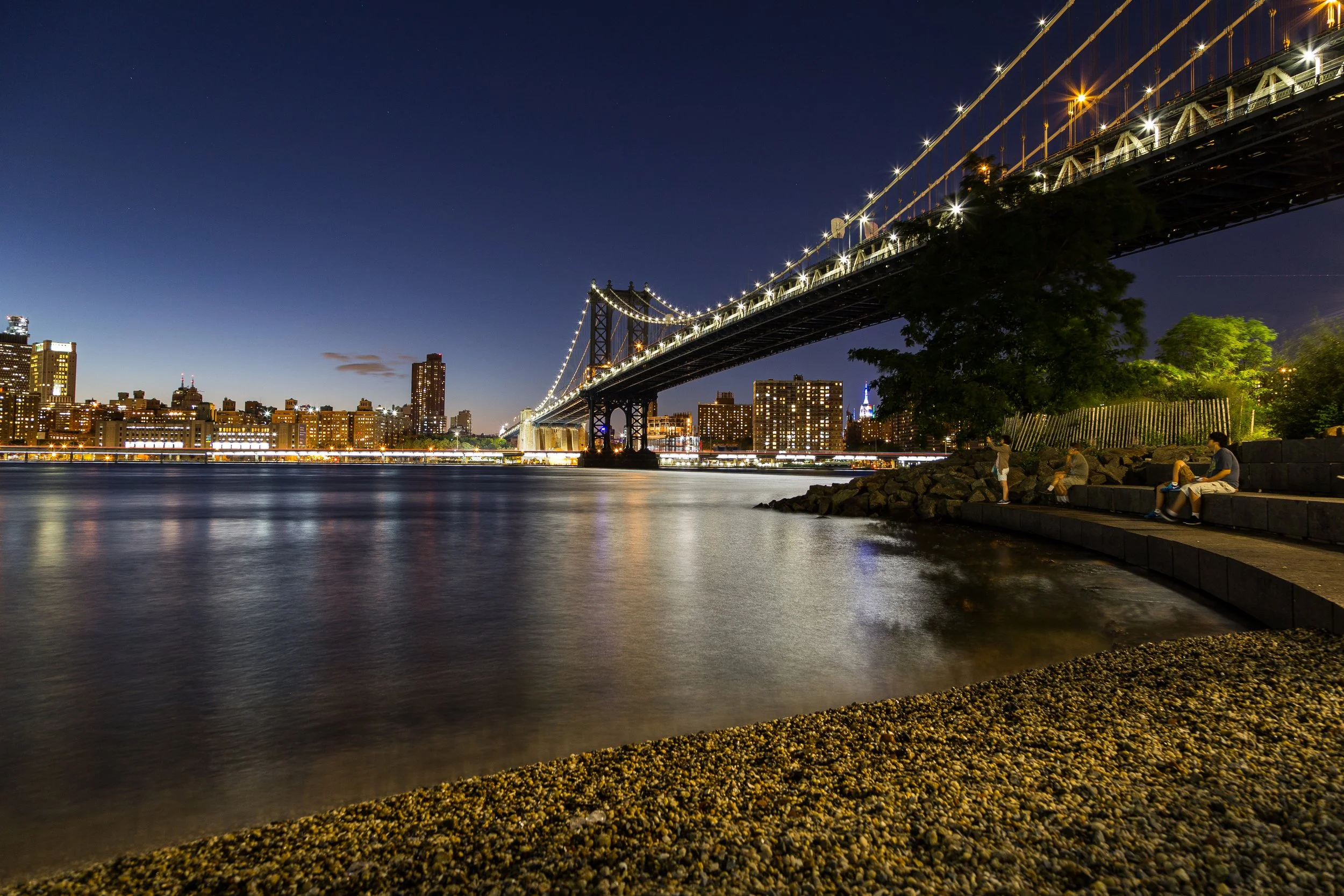
Depth & Distance appears in waterfront horizons, skyline views, bridge corridors, rail approaches, and long streets where foreground, midground, and background gather into layered urban space. Brooklyn often rewards this kind of stacked seeing, especially where neighborhood texture meets open water or distant Manhattan.
Repetitions & Patterns emerges in brownstone rows, apartment facades, windows, cornices, fire escapes, fencing, housing blocks, and the steady rhythm of residential streets. In Brooklyn, repetition often feels deeply tied to neighborhood character: not only a formal device, but part of the lived visual continuity of the borough.
A City of Reflections can be felt in waterfront light, glass surfaces, illuminated night scenes, and the subtle doubling that appears in windows, polished materials, and still water. In Brooklyn, reflection is not only urban and architectural, but also atmospheric, shaped by shoreline conditions and wide views across harbor and river.
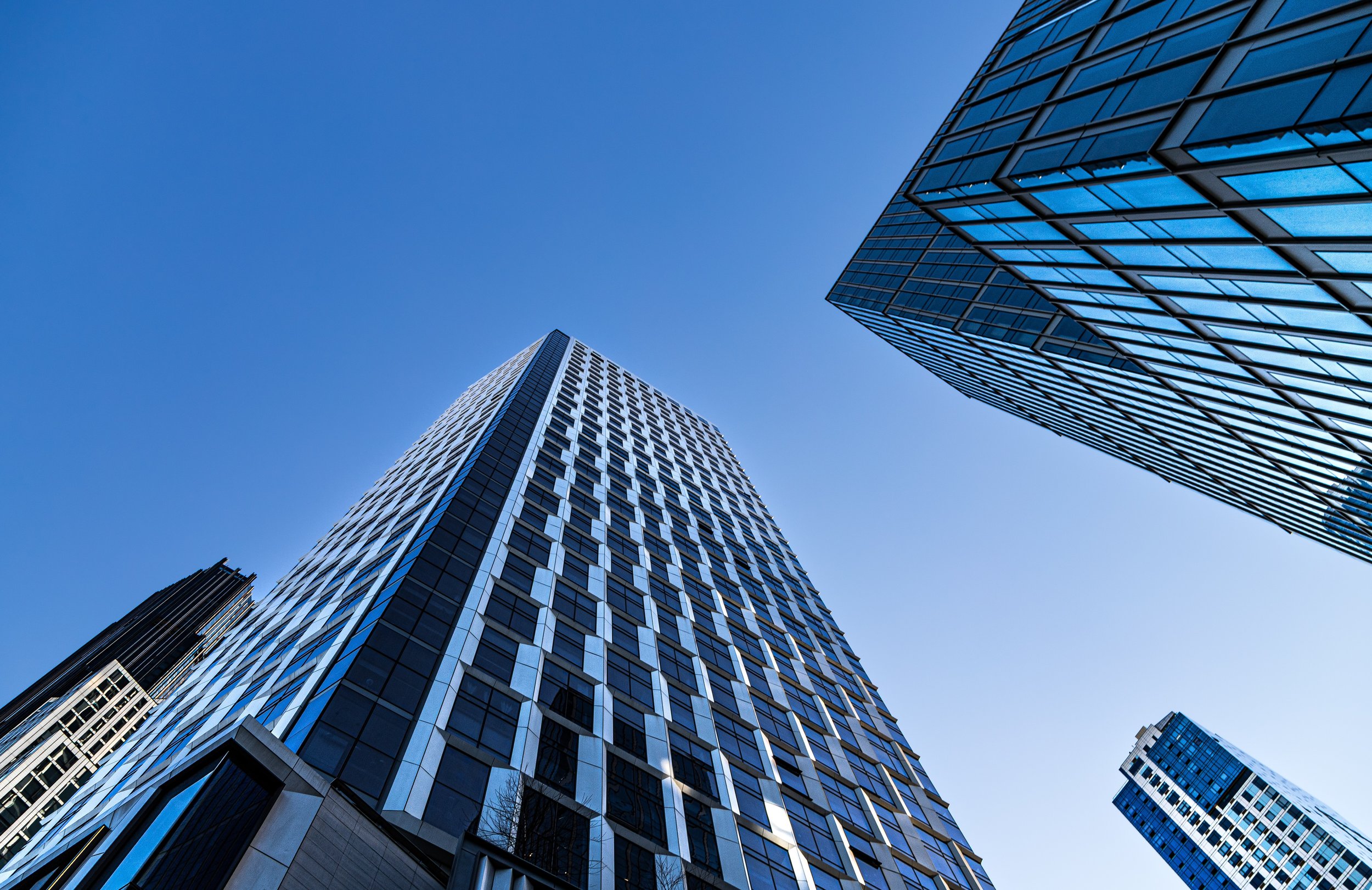
Scraping The Sky appears where towers, church spires, industrial structures, housing blocks, and bridge elements rise into open blue, shifting cloud, or nighttime light. In Brooklyn, vertical drama is often less about pure compression than in Manhattan and more about contrast: tall forms asserting themselves within a borough otherwise defined by varied and shifting scale.
Urban Canyons emerges in streets framed by housing blocks, industrial corridors, bridge approaches, and those moments when Brooklyn’s broader openness gives way to tight architectural enclosure. Light, shadow, and perspective intensify within these channels, creating a different kind of city drama than the tower-heavy canyons of Manhattan.
Taken together, these visual threads help define Brooklyn as materially rich, neighborhood-driven, and visually varied: a borough of layered distance, recurring rhythm, reflective surfaces, upward gestures, and changing spatial pressure. As this section evolves, these motifs can be linked more directly to individual Lexicon entries, connecting Brooklyn’s borough-wide photographic character to the broader visual language of CityNeighborhoods.
Brooklyn Neighborhoods In Photographs
New York City
Use this custom Google map to explore where every neighborhood in all five boroughs of New York City is located.
The Five Boroughs
One of New York City’s unique qualities is its organization in to 5 boroughs: Manhattan, Brooklyn, Queens, The Bronx, and Staten Island. These boroughs are part pragmatic administrative districts, and part vestiges of the region’s past. Each borough is an entire county in New York State - in fact, Brooklyn is, officially, Kings County, while Staten Island is, officially Richmond County. But that’s not the whole story …
Initially, New York City was located on the southern tip of Manhattan (now the Financial District) that was once the Dutch colony of New Amsterdam. Across the East River, another city was rising: Brooklyn. In time, the city planners realized that unification between the rapidly rising cities would create commercial and industrial opportunities - through streamlined administration of the region.
So powerful was the pull of unification between New York and Brooklyn that three more counties were pulled into the unification: The Bronx, Queens, and Staten Island. And on January 1, 1898, the City of New York unified two cities and three counties into one Greater City of New York - containing the five boroughs we know today.
But because each borough developed differently and distinctly until unification, their neighborhoods likewise uniquely developed. Today, there are nearly 390 neighborhoods, each with their own histories, cultures, cuisines, and personalities - and each with residents who are fiercely proud of their corner of The Big Apple.


