WOODHAVEN
Queens
Geographic Setting
Bounded by Park Lane South to the north, 98th Street to the east, Atlantic Avenue to the south, and the Brooklyn border to the west, Woodhaven lies at the geographic and cultural crossroads between the dense urban grid of Brooklyn and the greener, more residential expanses of central Queens. The neighborhood is framed by Forest Park, whose wooded slopes and winding drives shape its northern boundary, and by the commercial spine of Jamaica Avenue, which bisects Woodhaven from east to west as both its historic main street and social heart.
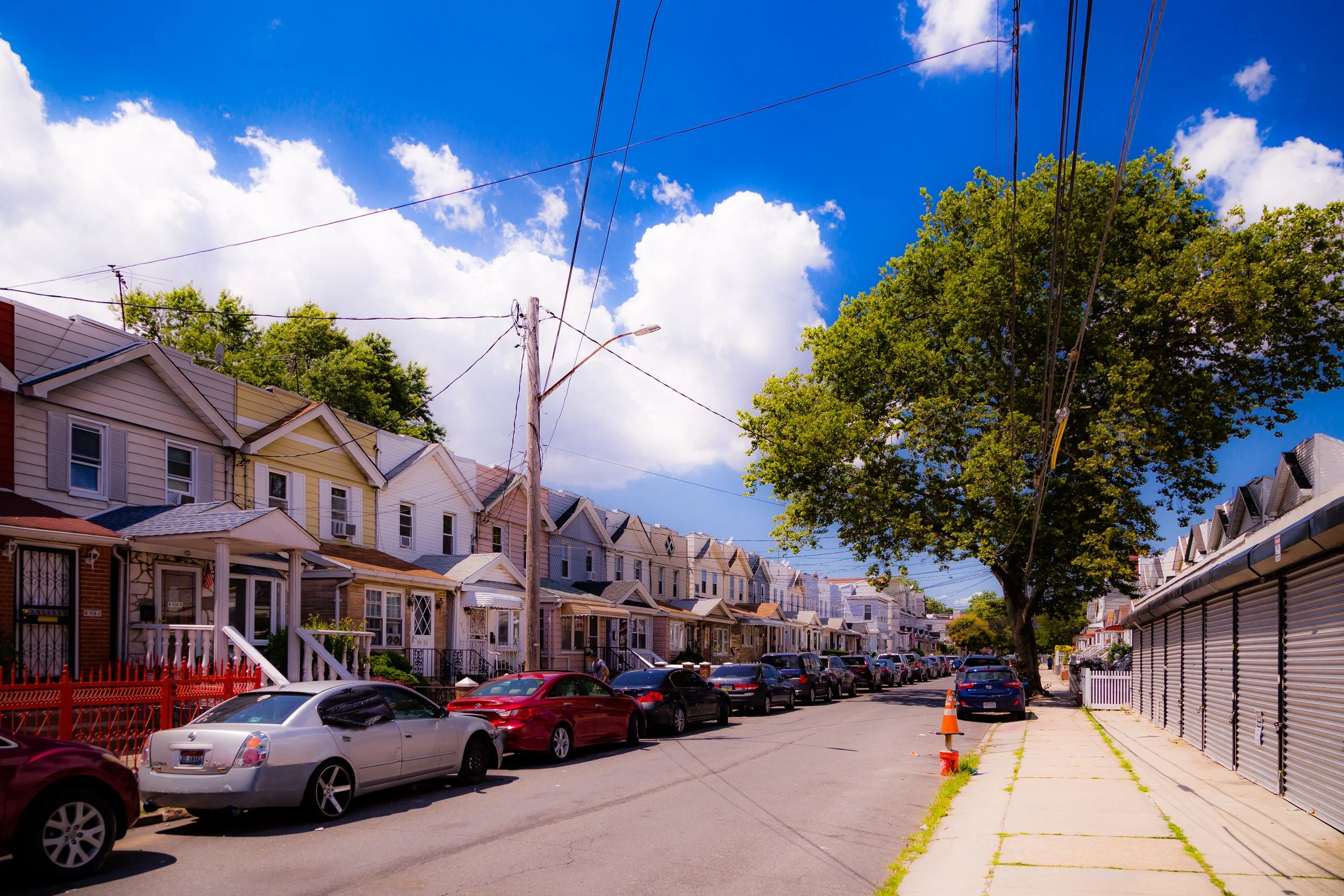
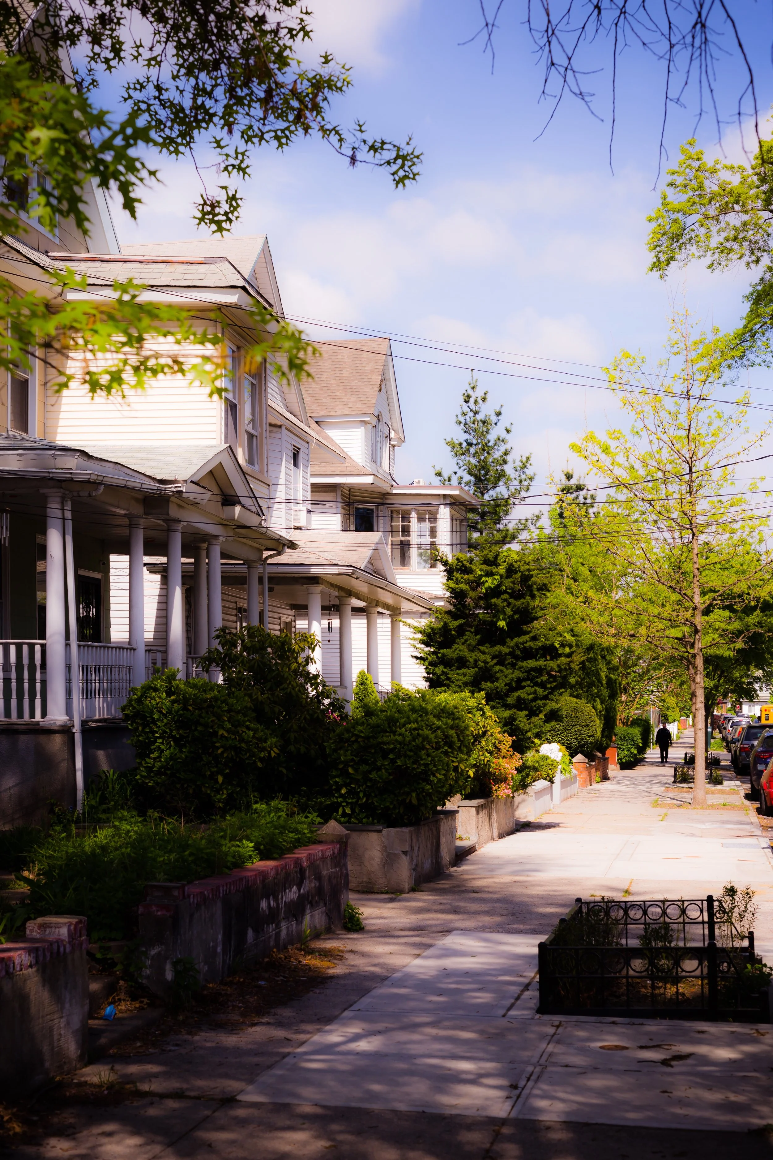
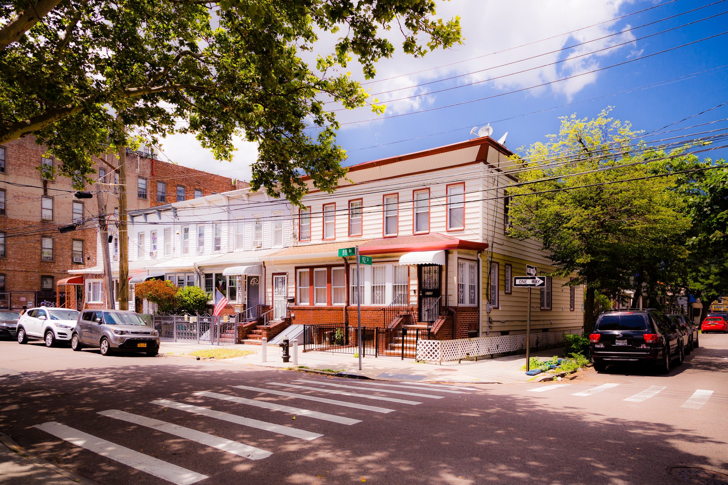
Architecturally, Woodhaven remains one of the most intact late-19th- and early-20th-century residential districts in Queens. Streets lined with Victorian frame houses, Neo-Renaissance rowhomes, and prewar apartment buildings give it an enduring, small-town character within the city. The J and Z subway lines trace Jamaica Avenue, linking the neighborhood to Lower Manhattan, while Atlantic Avenue and Woodhaven Boulevard connect it to Brooklyn, the Rockaways, and the rest of Queens. The result is a community that feels self-contained yet deeply connected—a hybrid of city accessibility and suburban stillness.
Etymology and Origins
The name “Woodhaven” reflects both geography and marketing imagination. Originally part of the Town of Jamaica, the area was densely wooded farmland in the early 19th century. In 1835, developer John R. Pitkin purchased large tracts of land to establish Woodville, a planned village intended as a suburban retreat for Manhattan professionals. When postal authorities objected to the name (duplicating a hamlet upstate), Pitkin and local residents chose Woodhaven in 1853—a title that combined the area’s wooded landscape with a sense of refuge and gentility.
Throughout the 19th century, Woodhaven was defined by lumberyards, farms, and small industries that took advantage of nearby rail and turnpike routes. The opening of the Long Island Rail Road’s Atlantic Branch (1836) and later the Jamaica Avenue streetcar line (1860s) spurred growth, transforming the area from scattered farmland into a cohesive suburban village. In 1898, Woodhaven was incorporated into the City of Greater New York, its transition from rural outskirts to urban neighborhood complete.
The Neighborhood
19th–Early 20th Century: A Working Suburb Takes Root
By the 1890s, Woodhaven had developed into a vibrant working- and middle-class suburb, its population composed largely of German, Irish, and Italian immigrants who commuted to industrial jobs in Brooklyn or Manhattan. The Forest Park reservation (established 1895) shaped the neighborhood’s northern landscape, preserving hundreds of acres of oak, maple, and hickory forest that still define the local skyline.
The period between 1890 and 1930 saw the construction of much of the housing that survives today: wood-frame homes with porches and pitched roofs, modest brick rowhouses, and three- to five-story apartment buildings near Jamaica Avenue. Developers such as Woodhaven Land and Improvement Company laid out orderly grids of streets—86th through 98th Streets—anchored by local institutions like St. Thomas the Apostle Church (founded 1909) and P.S. 60.
Jamaica Avenue emerged as the commercial lifeline, lined with bakeries, pharmacies, movie theaters, and small department stores that served generations of families. The arrival of the BMT Jamaica Line (1917) solidified Woodhaven’s integration into New York’s rapid transit system, making it one of the first true “subway suburbs” of Queens.
Mid-20th Century: Community Strength and Suburban Stability
The decades following World War II marked a period of remarkable stability for Woodhaven. Returning veterans and working families filled its well-built homes, while civic associations and religious institutions reinforced a strong sense of belonging. Local theaters like the RKO Keith’s Woodhaven and community fixtures such as Dexter Park, once home to semi-professional baseball teams and public recreation, served as neighborhood gathering points.
During this period, Woodhaven retained its largely European-American, working- and middle-class identity even as surrounding areas diversified. The neighborhood’s small scale, homeownership, and family-run businesses fostered tight social networks and continuity across generations. Forest Park, with its bandshell concerts, horse trails, and carousel (dating from 1908 and restored in 1988), remained a cherished symbol of community life.
By the 1960s and 1970s, however, larger urban shifts—economic downturns, suburban migration, and demographic change—began to reshape the neighborhood. Yet Woodhaven weathered these transitions more gracefully than many others, thanks to active local leadership, strong block associations, and the resilience of its commercial core along Jamaica Avenue.

Woodhaven Photographic Video
Late 20th–21st Century: Diversity and Renewal
By the 1980s and 1990s, Woodhaven had become one of Queens’ most diverse yet cohesive neighborhoods, as new waves of Latino, Caribbean, South Asian, and Filipino families joined long-established Italian, Irish, and German residents. The blending of cultures infused the neighborhood with new vitality—manifest in the storefronts, restaurants, and churches that line Jamaica Avenue and Woodhaven Boulevard.
While the neighborhood faced challenges typical of urban middle neighborhoods—aging infrastructure, rising property taxes, and commercial competition—it retained a strong owner-occupied housing base and deep civic pride. The Woodhaven Residents’ Block Association, founded in 1972, and the Greater Woodhaven Development Corporation became key advocates for preservation and improvement, leading campaigns for traffic safety, landmark designation, and streetscape beautification.
In recent decades, the community has balanced preservation with adaptation. Historic homes have been restored, while the elevated J train continues to link residents directly to Manhattan. Forest Park—with its golf course, running trails, and panoramic ridge views—remains the neighborhood’s anchor and escape, drawing walkers, joggers, and families from across Queens.
Woodhaven Photo Gallery
Spirit and Legacy
The spirit of Woodhaven lies in its continuity through change—a neighborhood that has absorbed over a century of urban evolution while preserving its essential sense of place. Its modest homes, civic institutions, and commercial corridors tell a story of working-class aspiration and community resilience.
New York City
Use this custom Google map to explore where every neighborhood in all five boroughs of New York City is located.
The Five Boroughs
One of New York City’s unique qualities is its organization in to 5 boroughs: Manhattan, Brooklyn, Queens, The Bronx, and Staten Island. These boroughs are part pragmatic administrative districts, and part vestiges of the region’s past. Each borough is an entire county in New York State - in fact, Brooklyn is, officially, Kings County, while Staten Island is, officially Richmond County. But that’s not the whole story …
Initially, New York City was located on the southern tip of Manhattan (now the Financial District) that was once the Dutch colony of New Amsterdam. Across the East River, another city was rising: Brooklyn. In time, the city planners realized that unification between the rapidly rising cities would create commercial and industrial opportunities - through streamlined administration of the region.
So powerful was the pull of unification between New York and Brooklyn that three more counties were pulled into the unification: The Bronx, Queens, and Staten Island. And on January 1, 1898, the City of New York unified two cities and three counties into one Greater City of New York - containing the five boroughs we know today.
But because each borough developed differently and distinctly until unification, their neighborhoods likewise uniquely developed. Today, there are nearly 390 neighborhoods, each with their own histories, cultures, cuisines, and personalities - and each with residents who are fiercely proud of their corner of The Big Apple.


