
QUEENS
Part of an ongoing project to walk and photograph every neighborhood in New York City, this page explores Queens through maps, borough identity, history, and photography.
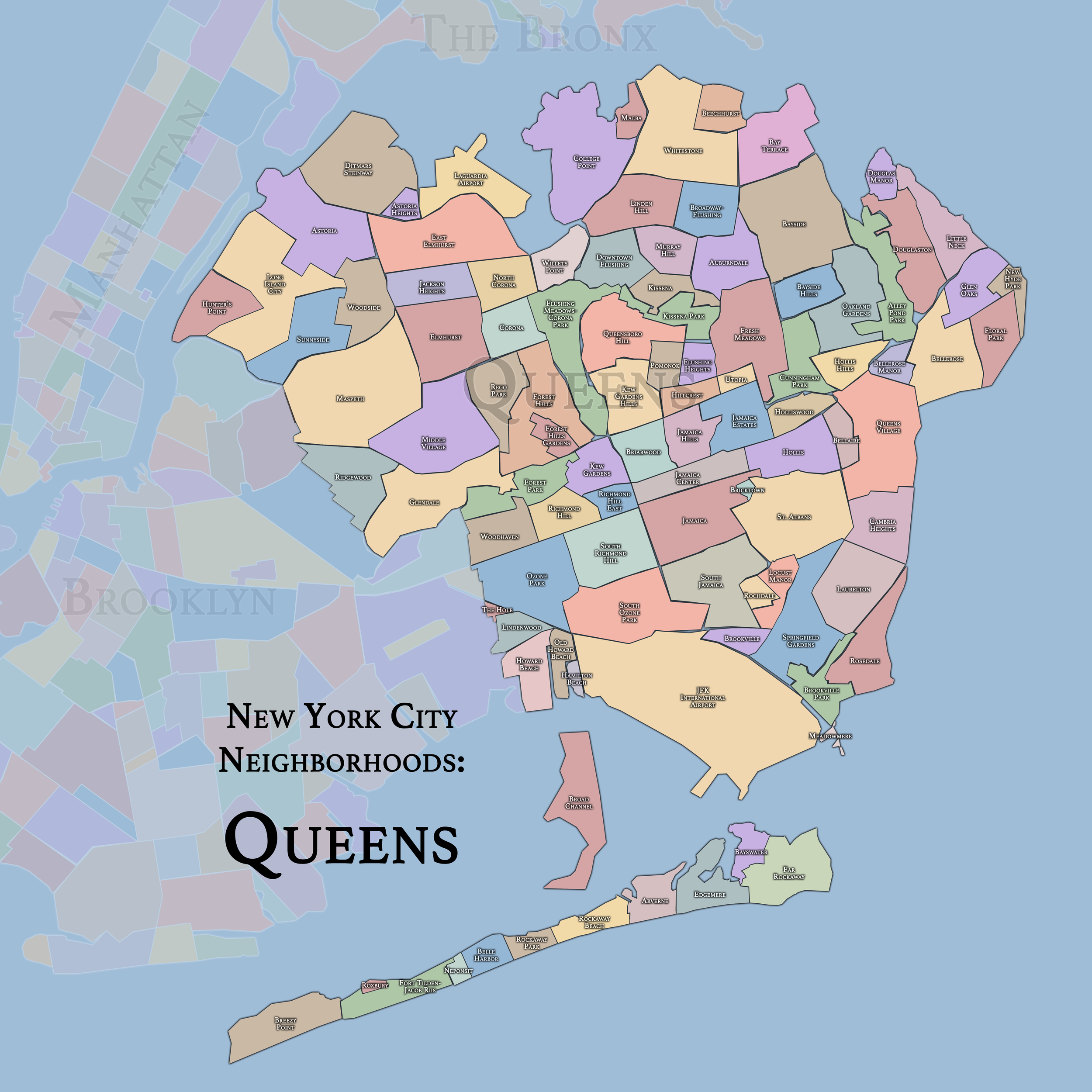
The Maps
Geographic Setting
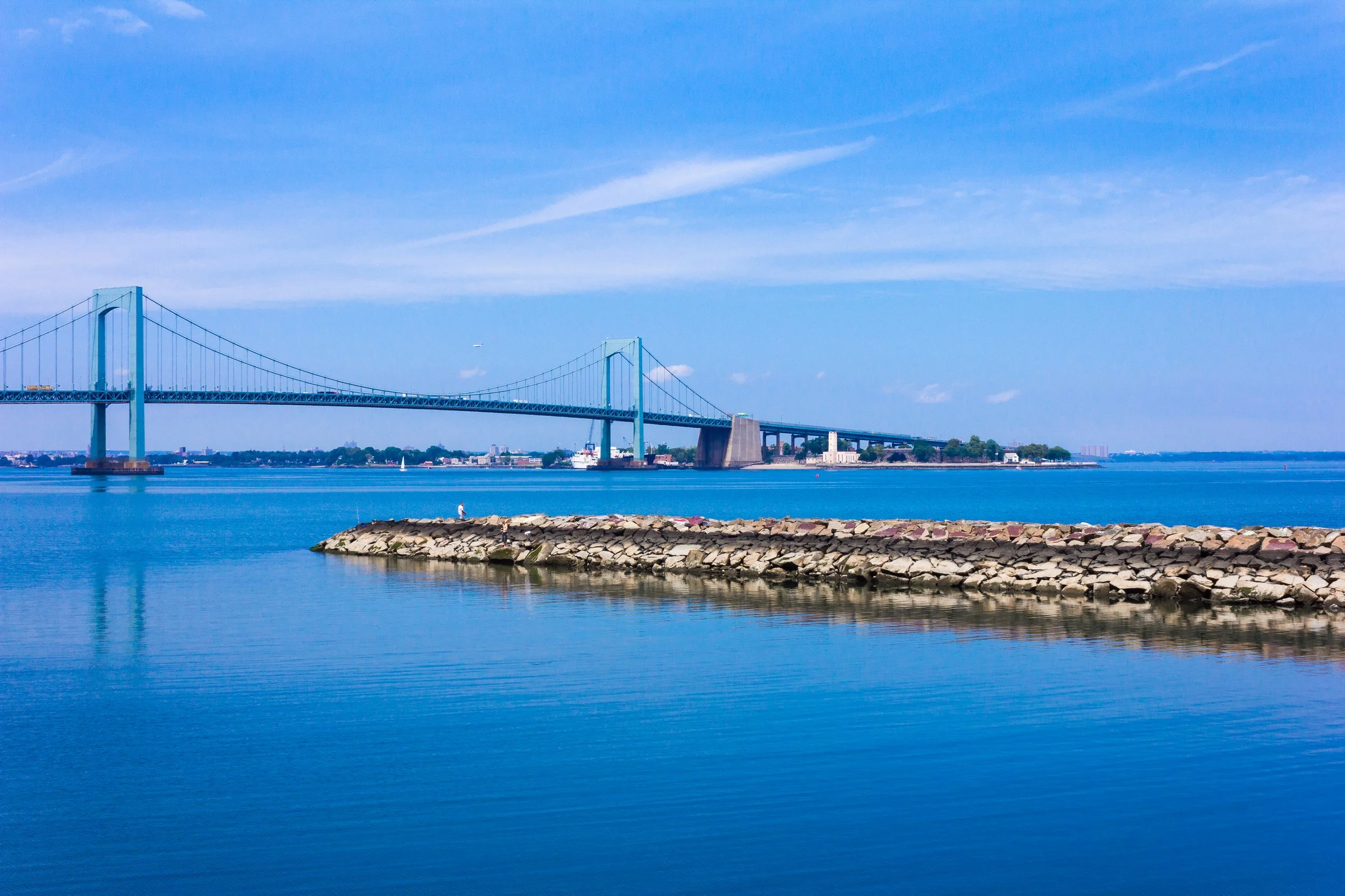
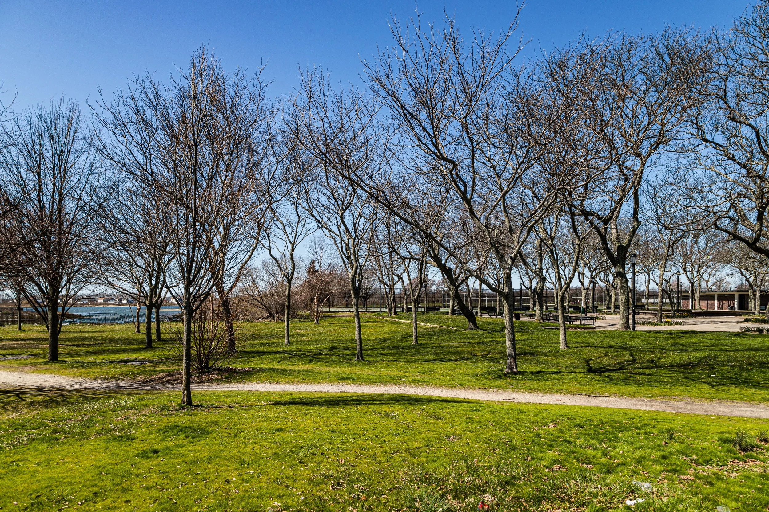
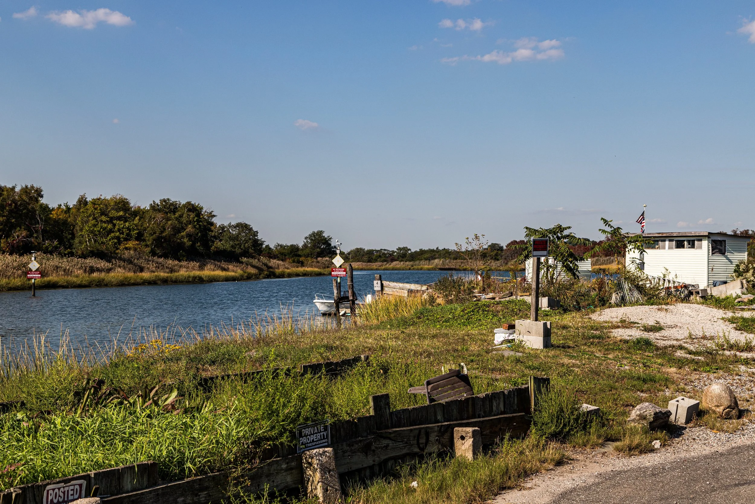
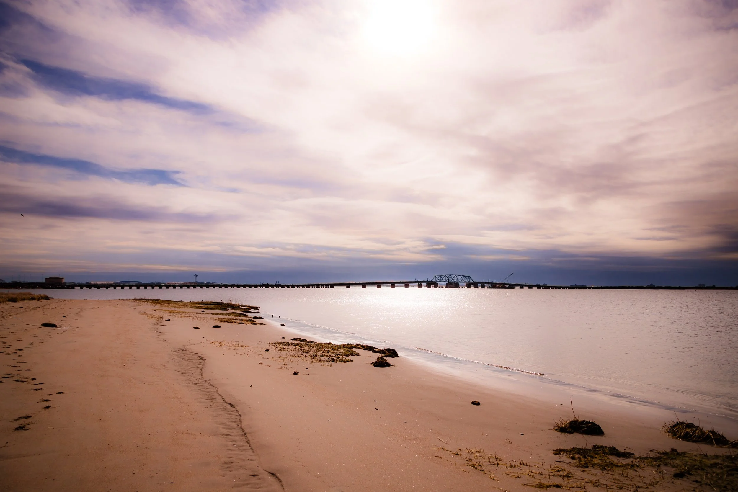
Spanning over 108 square miles from the East River to the Atlantic Ocean, Queens is the largest of New York City’s five boroughs and among the most geographically varied. It borders Brooklyn to the west, Nassau County to the east, and the Long Island Sound to the north, with its southern edge defined by the beaches, dunes, and wetlands of Jamaica Bay and the Rockaway Peninsula. Within this vast and intricate landscape lie glacial hills, tidal inlets, forests, and dense neighborhoods, all stitched together by an extraordinary patchwork of human settlement.
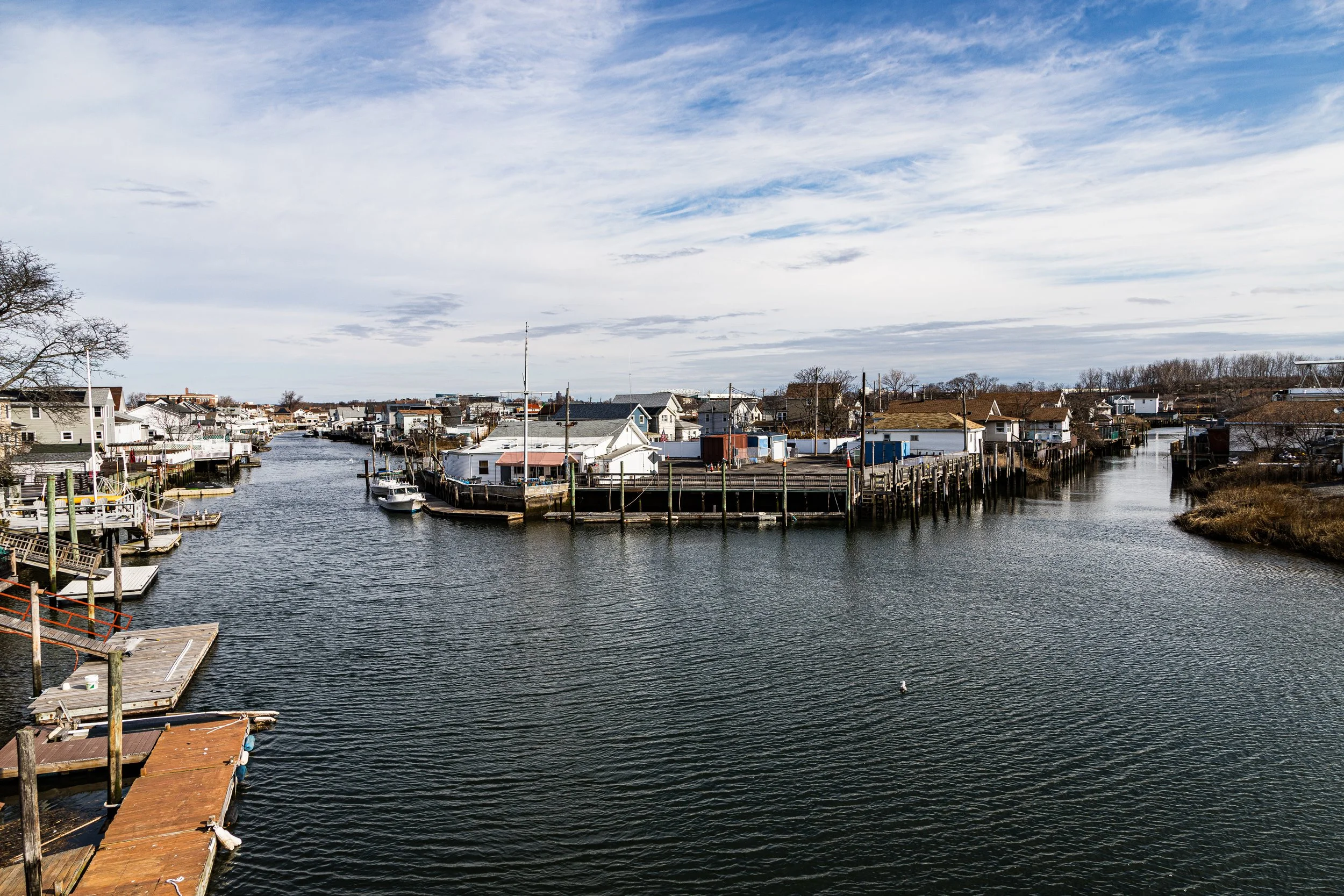
The borough is a world in miniature. Astoria and Long Island City rise with modern towers and industrial heritage beside the East River; Flushing Meadows–Corona Park unfurls as the city’s grandest open expanse; Jamaica pulses as its transit and commercial hub; and Far Rockaway, fronting the Atlantic, blends city edge with coastal horizon. Airports—LaGuardia to the north and JFK International to the south—tie Queens not just to New York but to the planet itself. In this geography, both sprawling and precise, Queens embodies movement: of people, goods, and dreams.
Queens Identity
Borough Identity
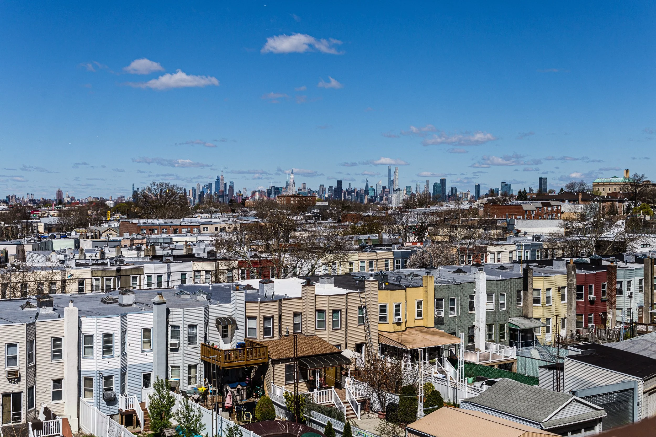
Queens possesses one of New York City’s broadest and most varied urban identities: a borough of detached houses and apartment districts, neighborhood main streets and major commercial corridors, industrial edges and parkland, institutional campuses and waterfront communities. More dispersed than Manhattan, less topographically forceful than the Bronx, and less symbolically unified than Brooklyn, Queens is defined by multiplicity, with neighborhoods shaped as much by migration, geography, and infrastructure as by any single borough-wide core.
What distinguishes Queens is the range with which different forms of city life coexist there. Residential and industrial, dense and low-rise, historic and newly made, deeply local and globally connected, the borough’s neighborhoods reflect commerce, faith, domestic life, transportation, and local continuity with unusual richness. To move through Queens is to encounter a borough that is expansive, layered, and unmistakably plural.
Queens was named in 1683 for Catherine of Braganza, queen consort of England’s King Charles II, when the English divided their new colony into counties. But the borough’s deeper story began long before colonial maps. The land belonged to the Lenape, specifically the Canarsee, Rockaway, and Matinecock peoples, who fished Jamaica Bay, farmed maize in the uplands, and navigated the island’s many creeks and estuaries.
The Dutch arrived in the 1630s, establishing farming settlements that would later form the borough’s enduring civic pattern. These included Vlissingen (Flushing), Nieuwtown (Elmhurst), Rustdorp (Jamaica), and Middelburgh (Newtown Creek region), each a distinct agricultural community tied to the markets of Manhattan by ferry and cart road. Religious tolerance—rare in its day—was part of the local DNA: the Flushing Remonstrance of 1657, in which settlers petitioned Governor Peter Stuyvesant for freedom of worship, became a foundational document of American liberty, preceding the Bill of Rights by more than a century.
Etymology and Origins
The Visual Identity of Queens
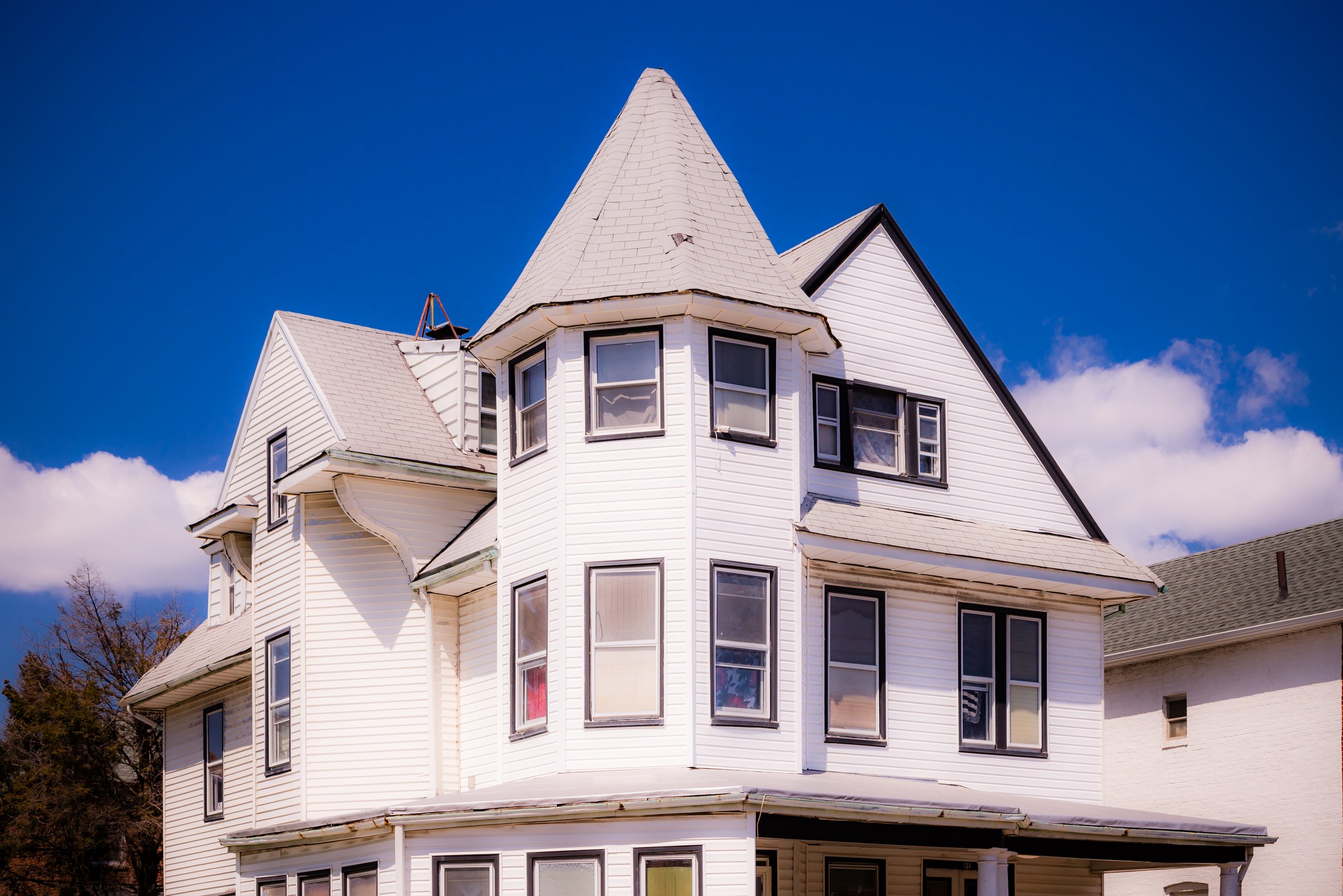
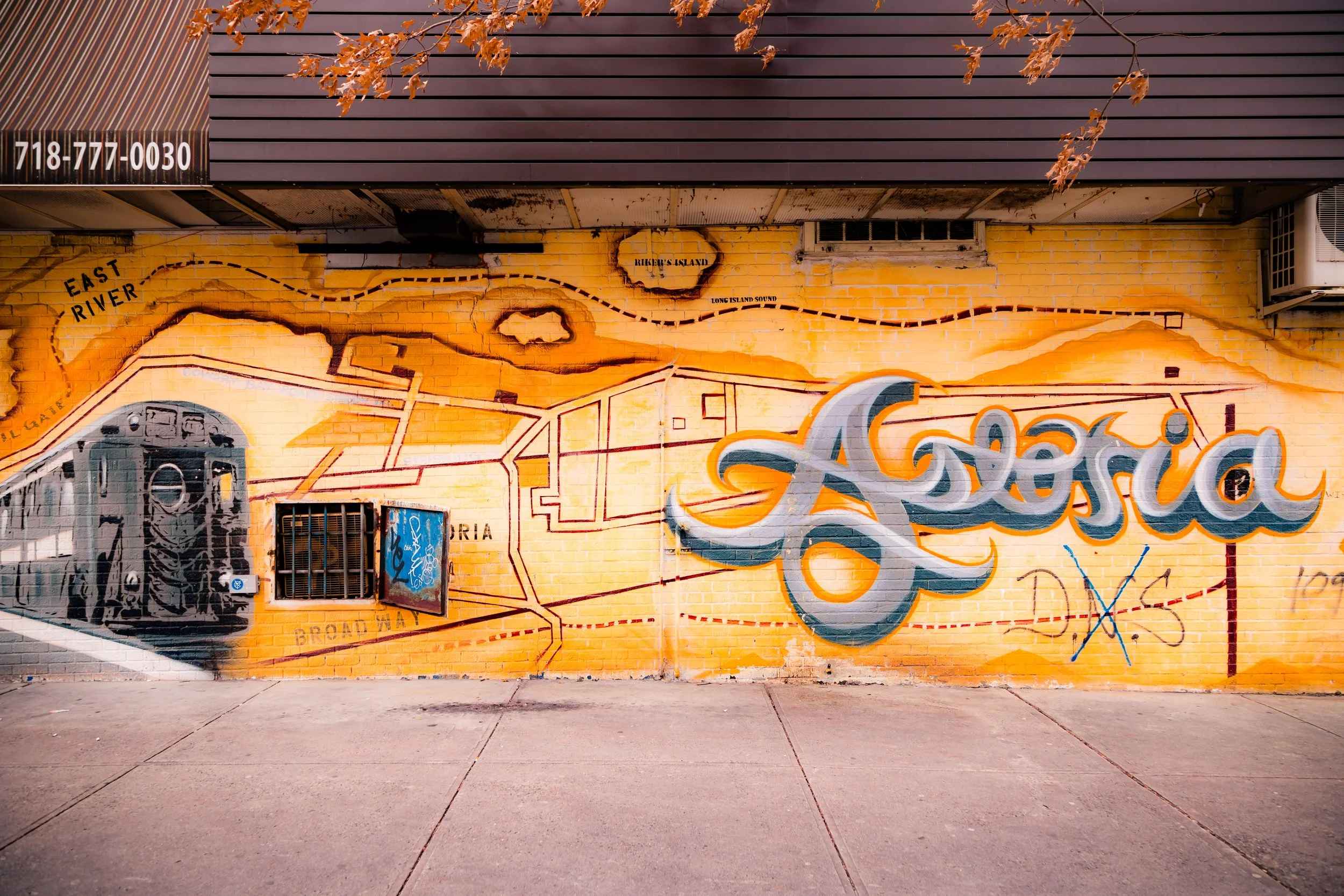
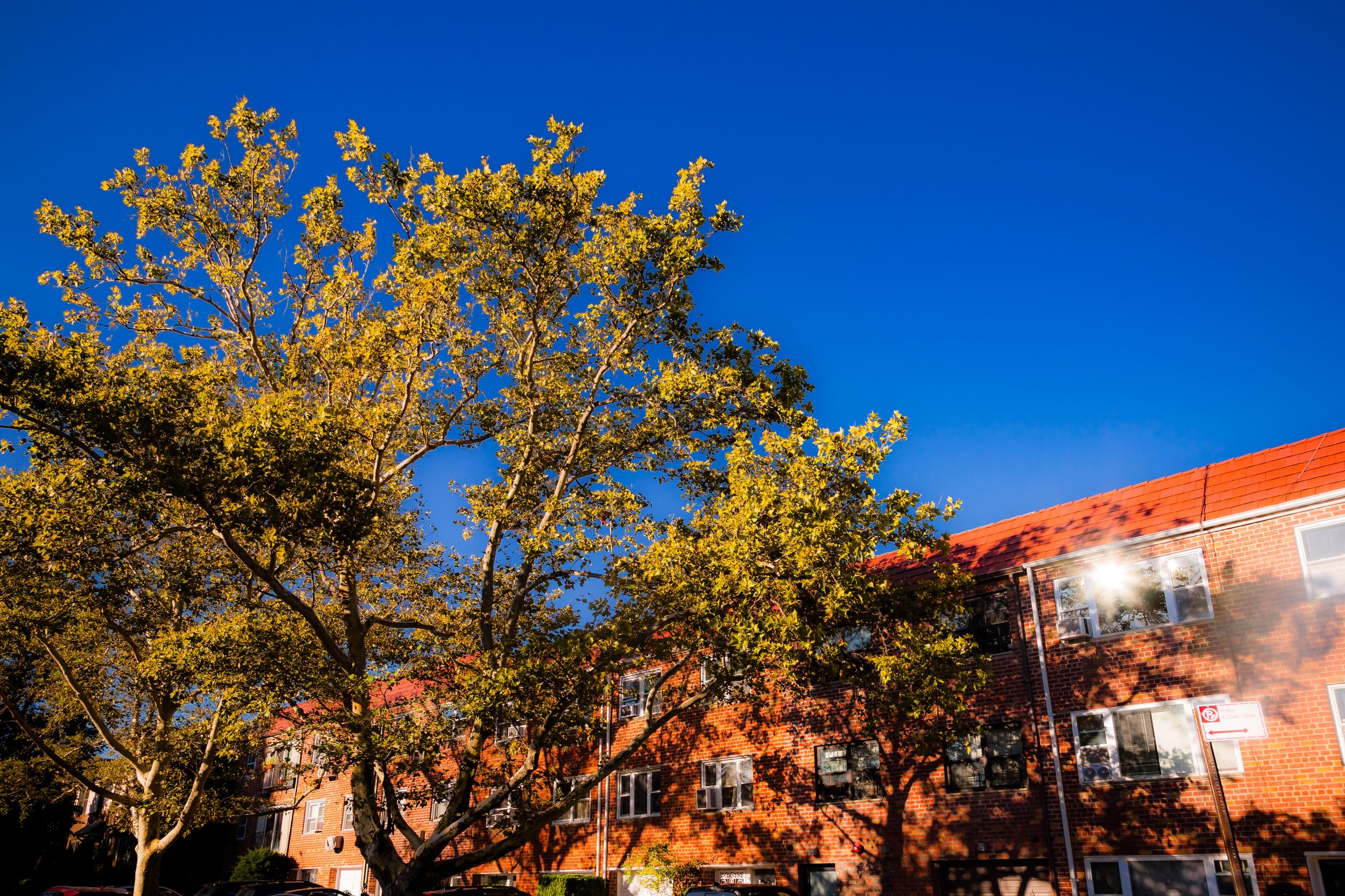
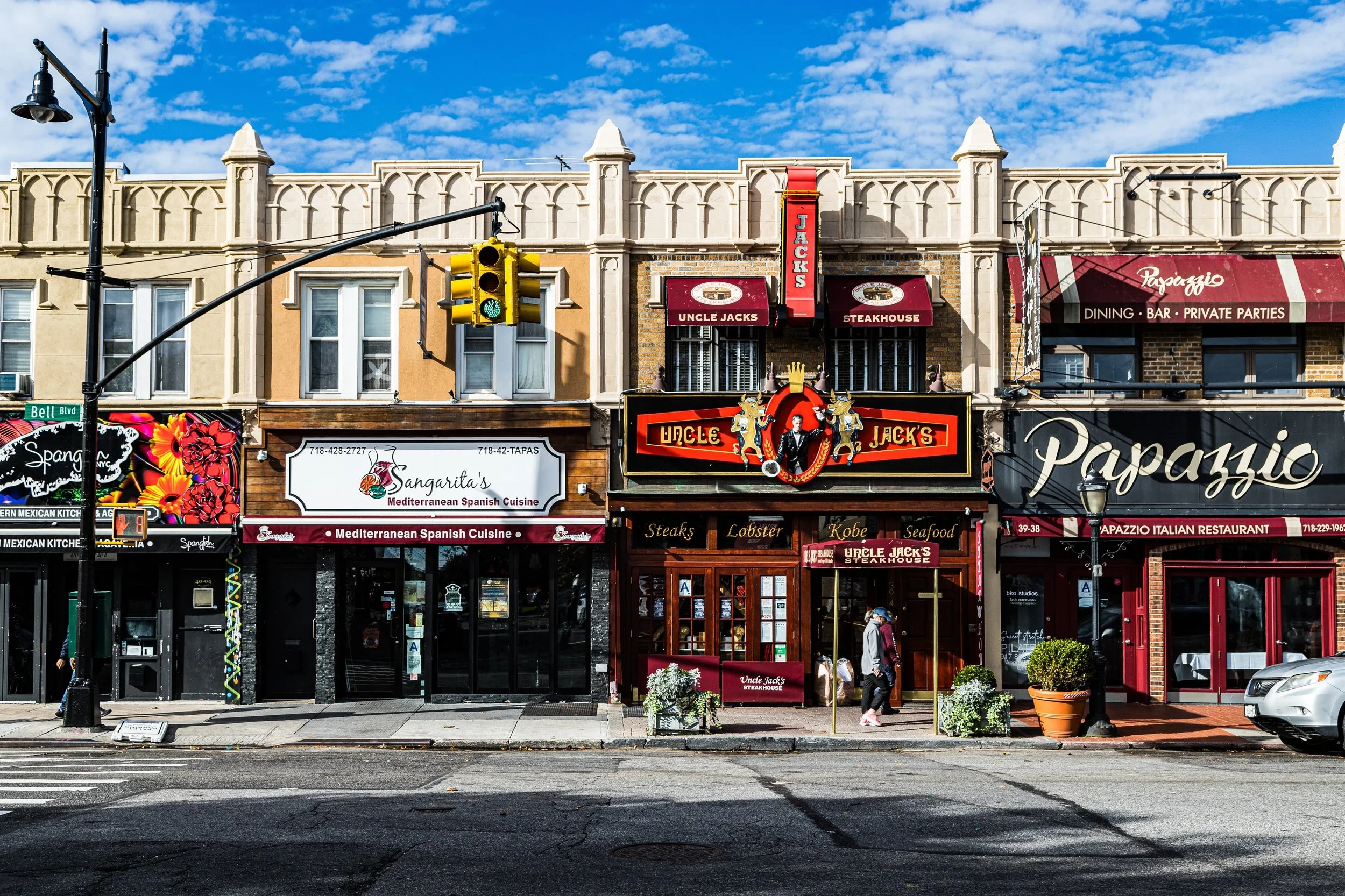
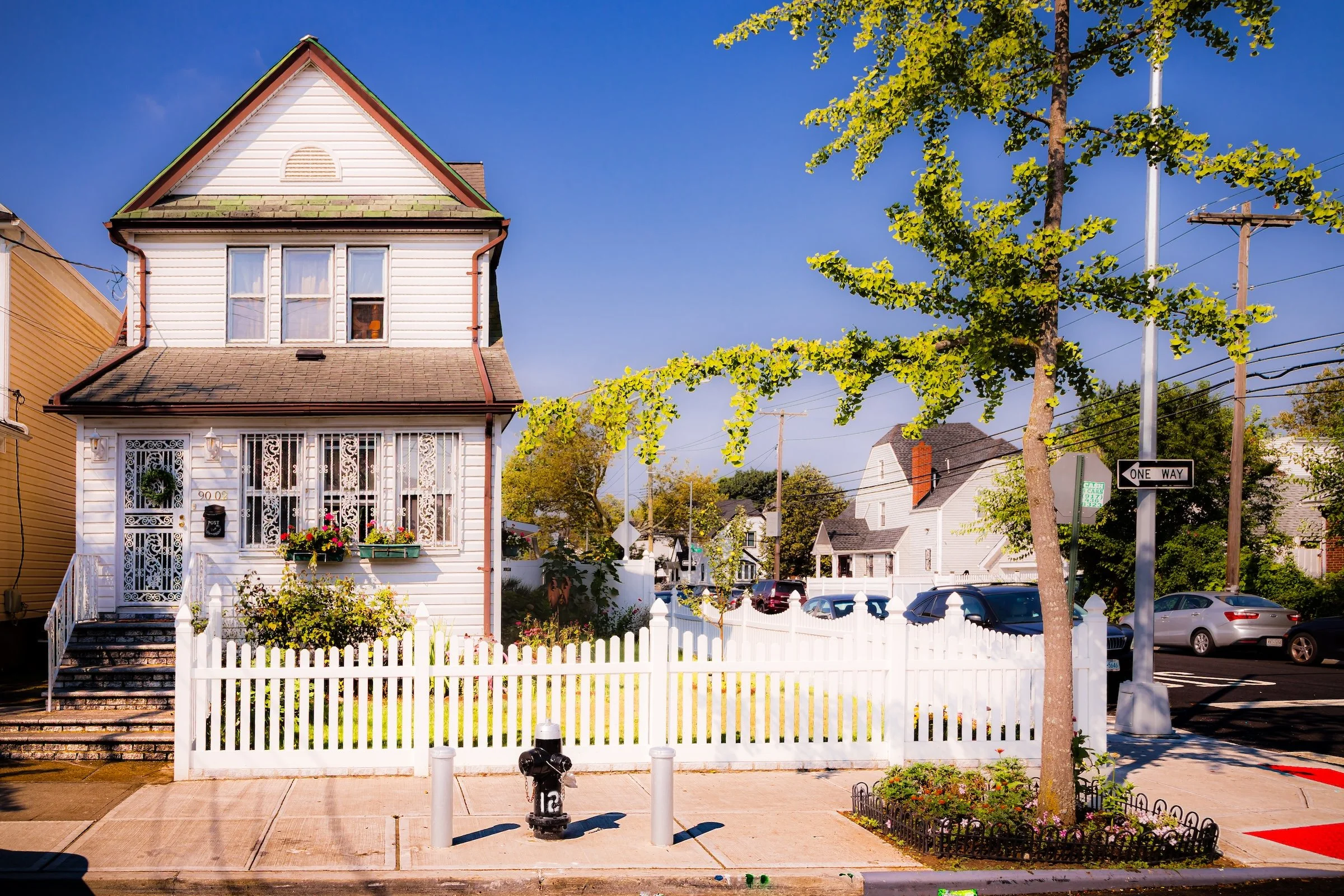
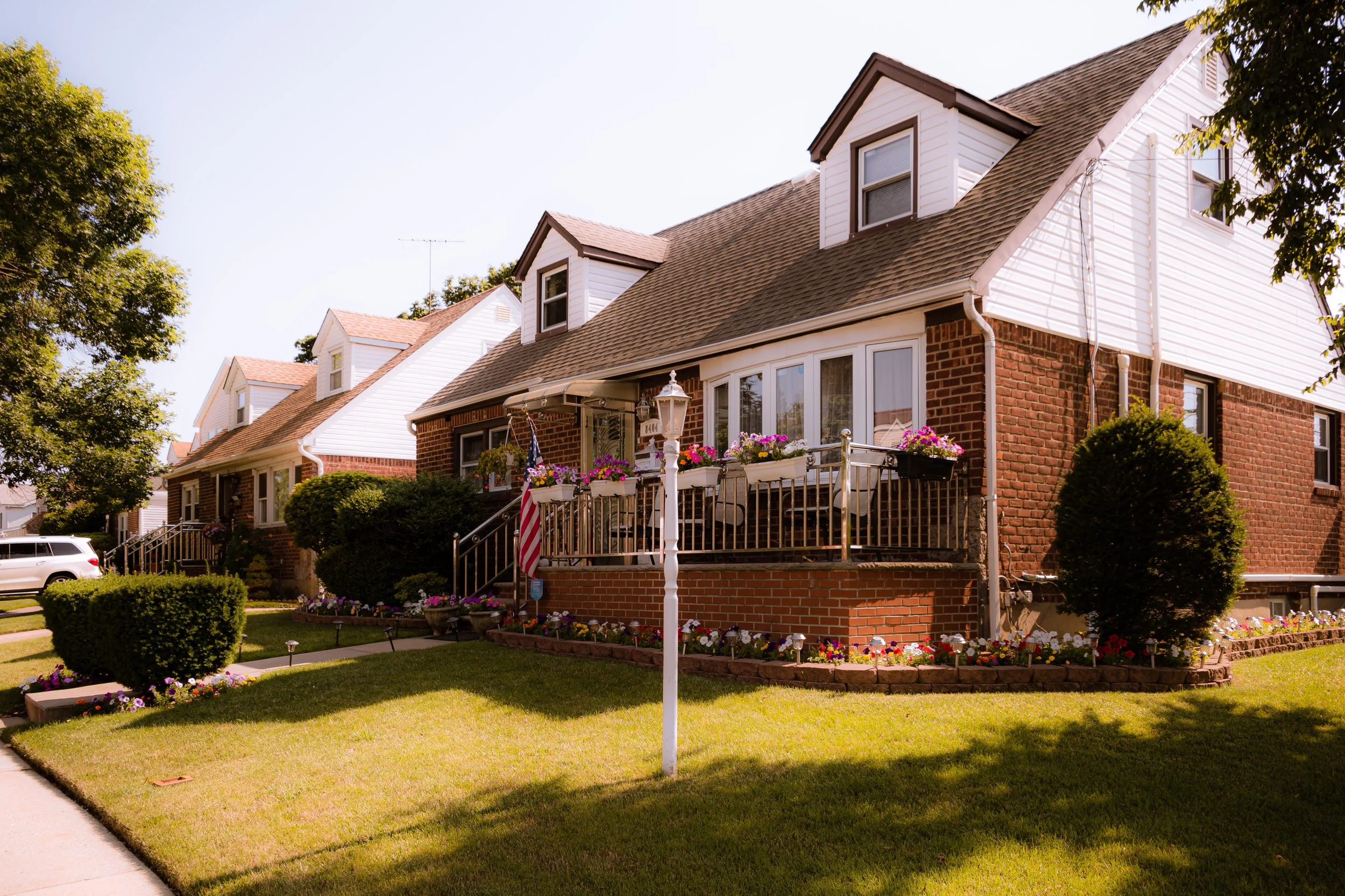
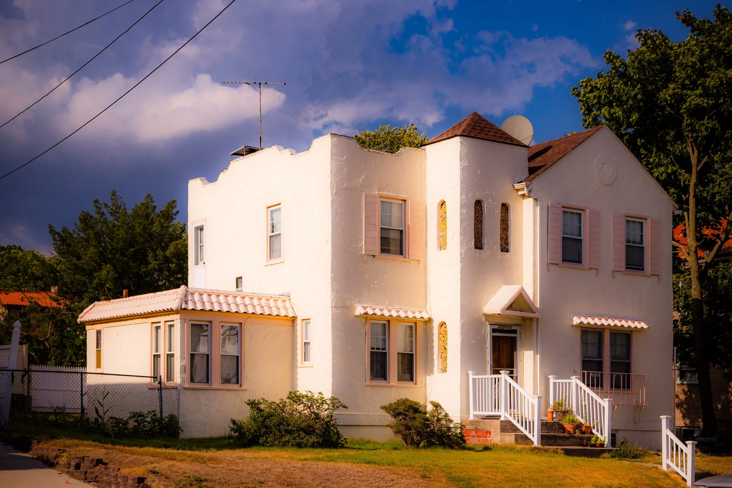
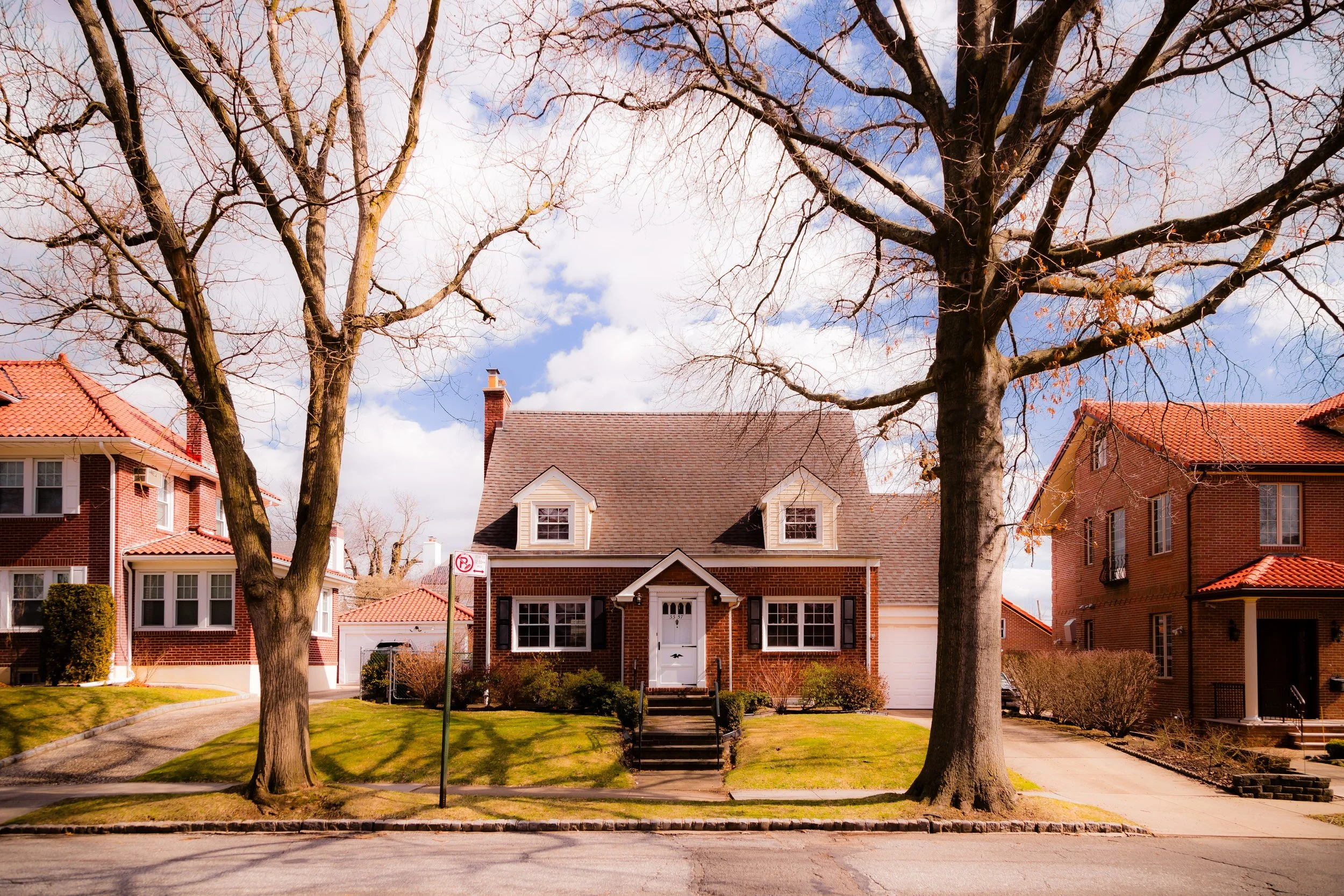
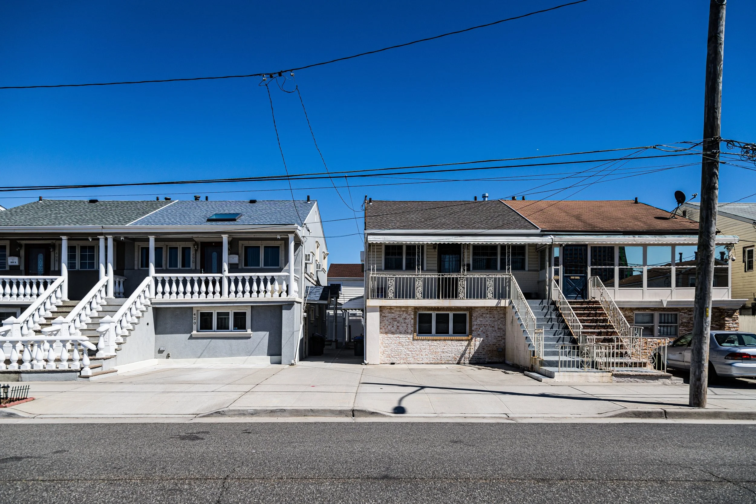
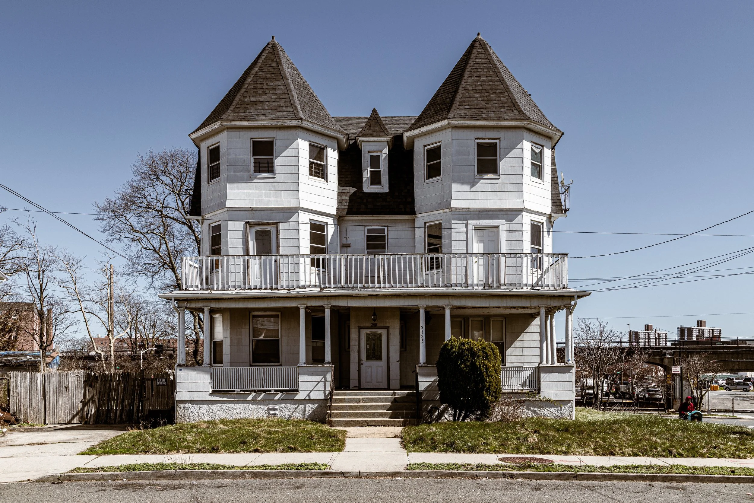
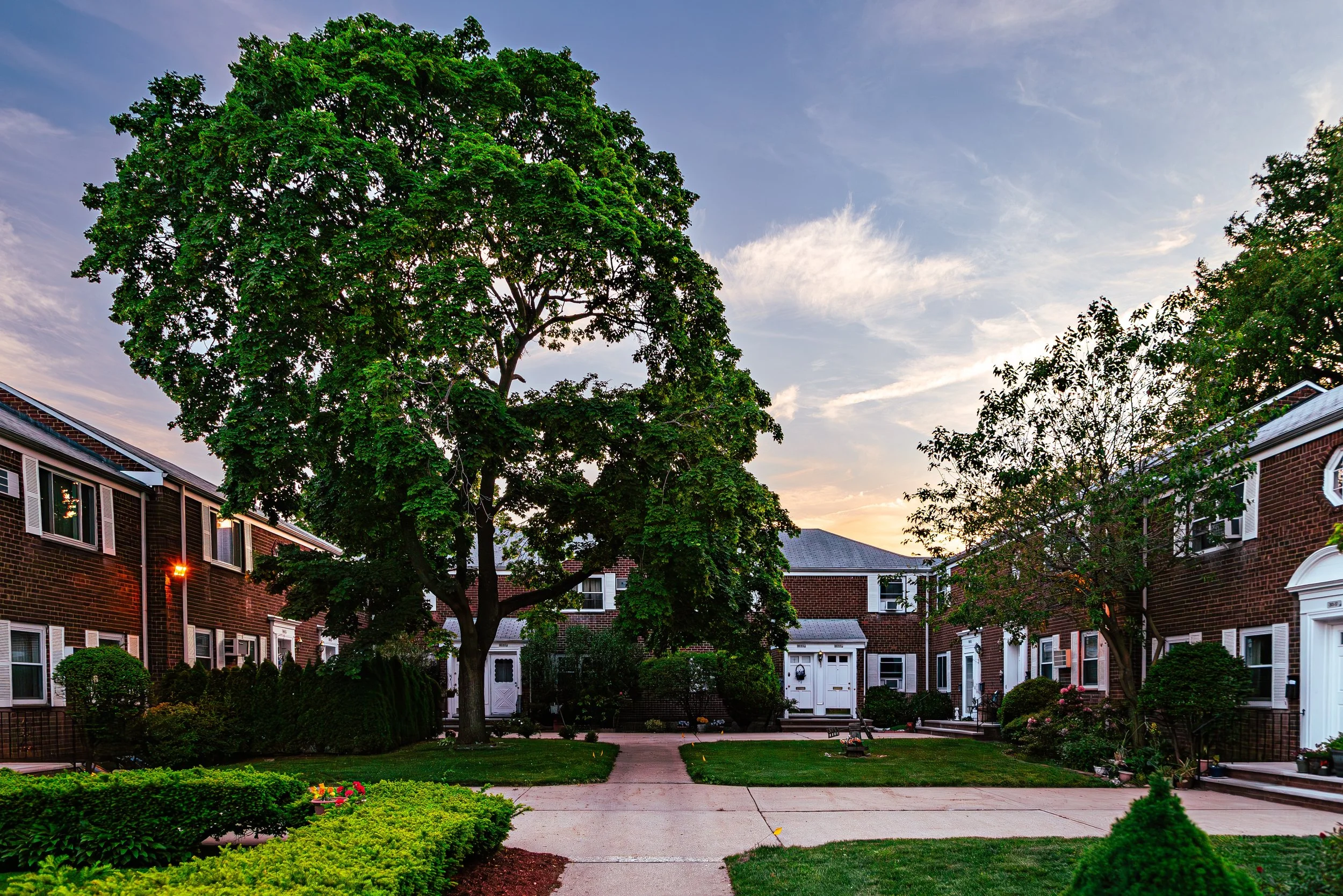
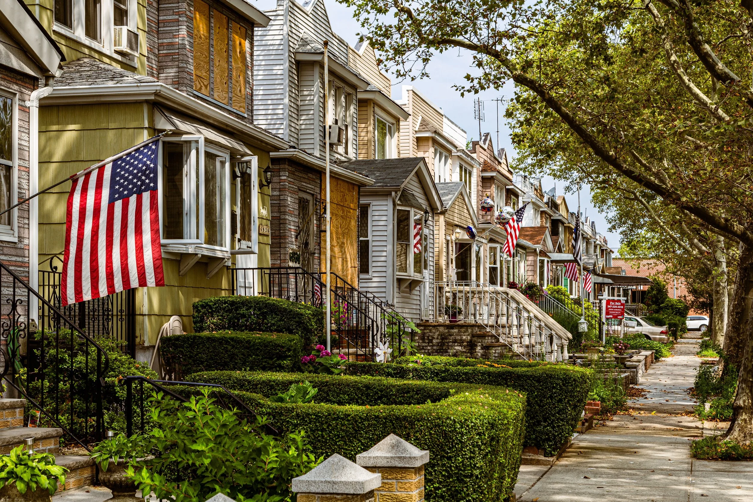
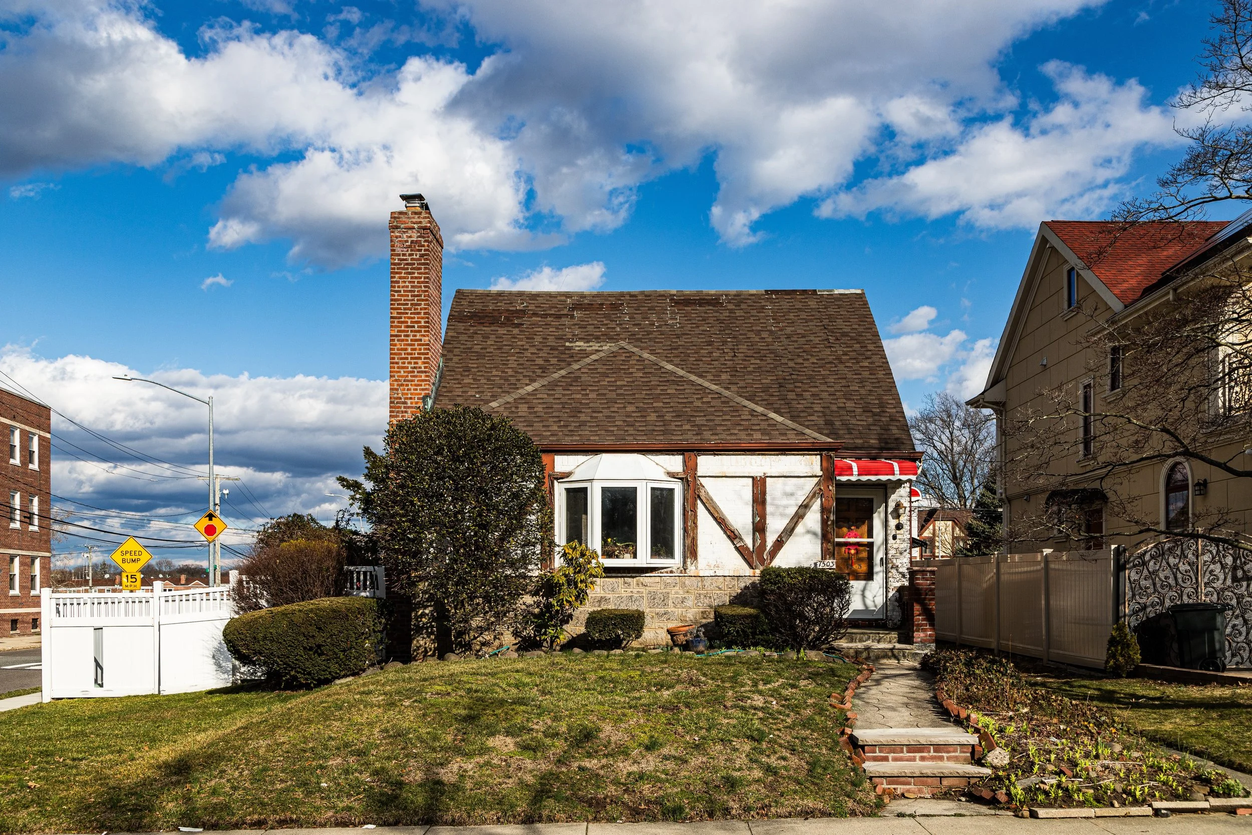
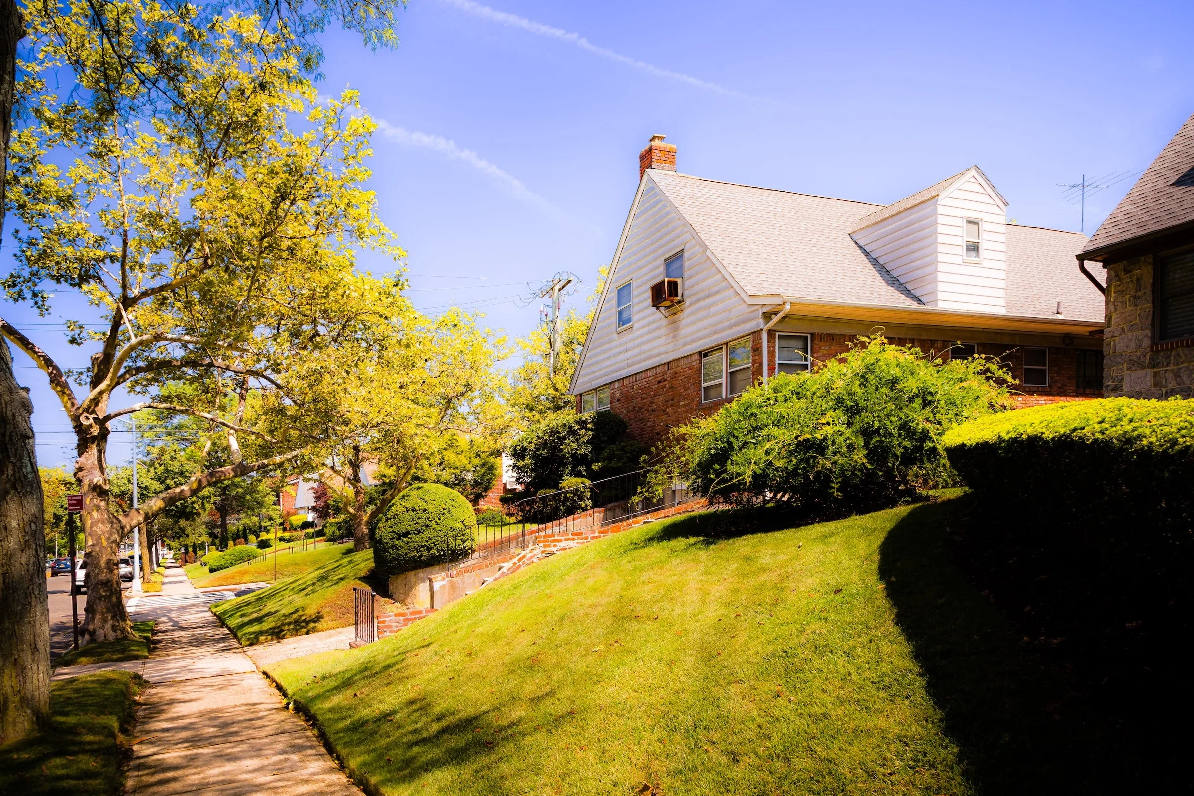
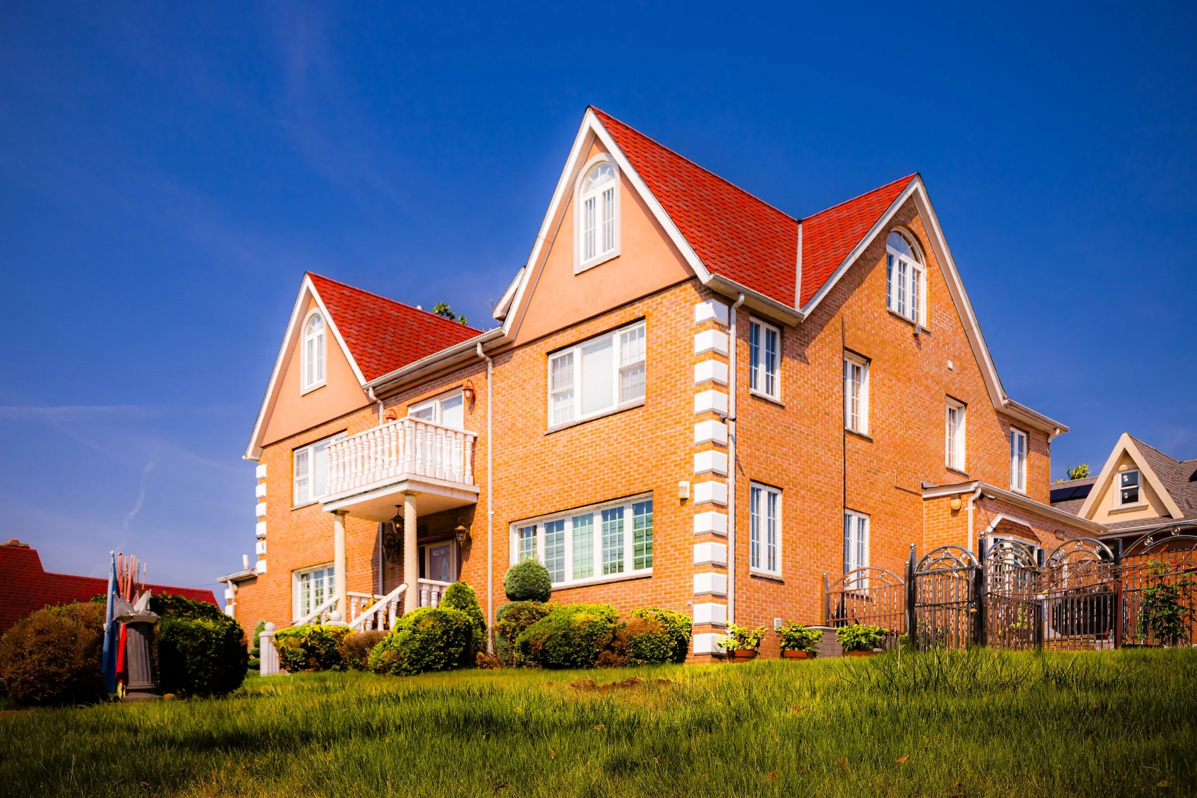
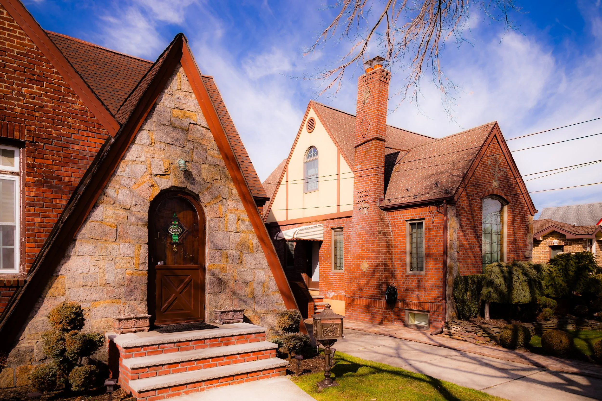
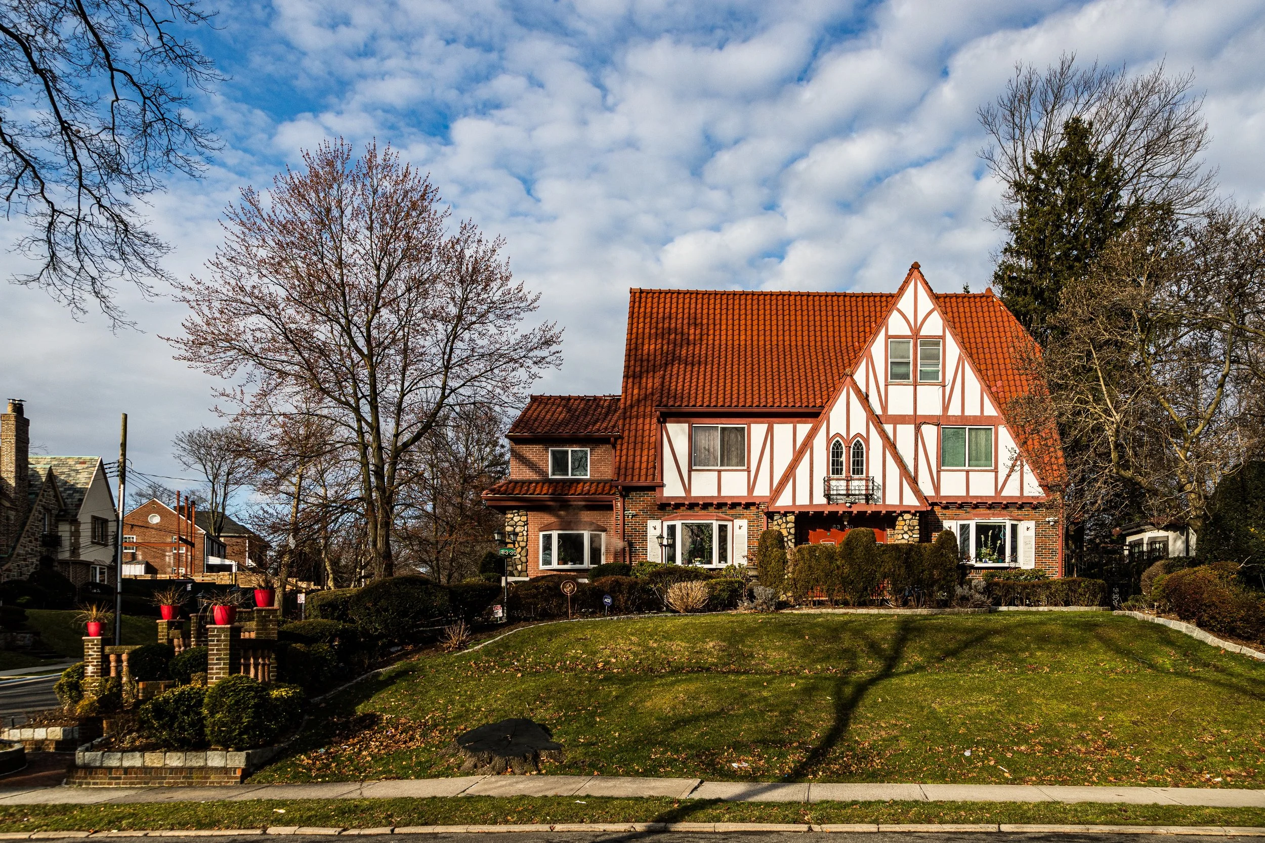
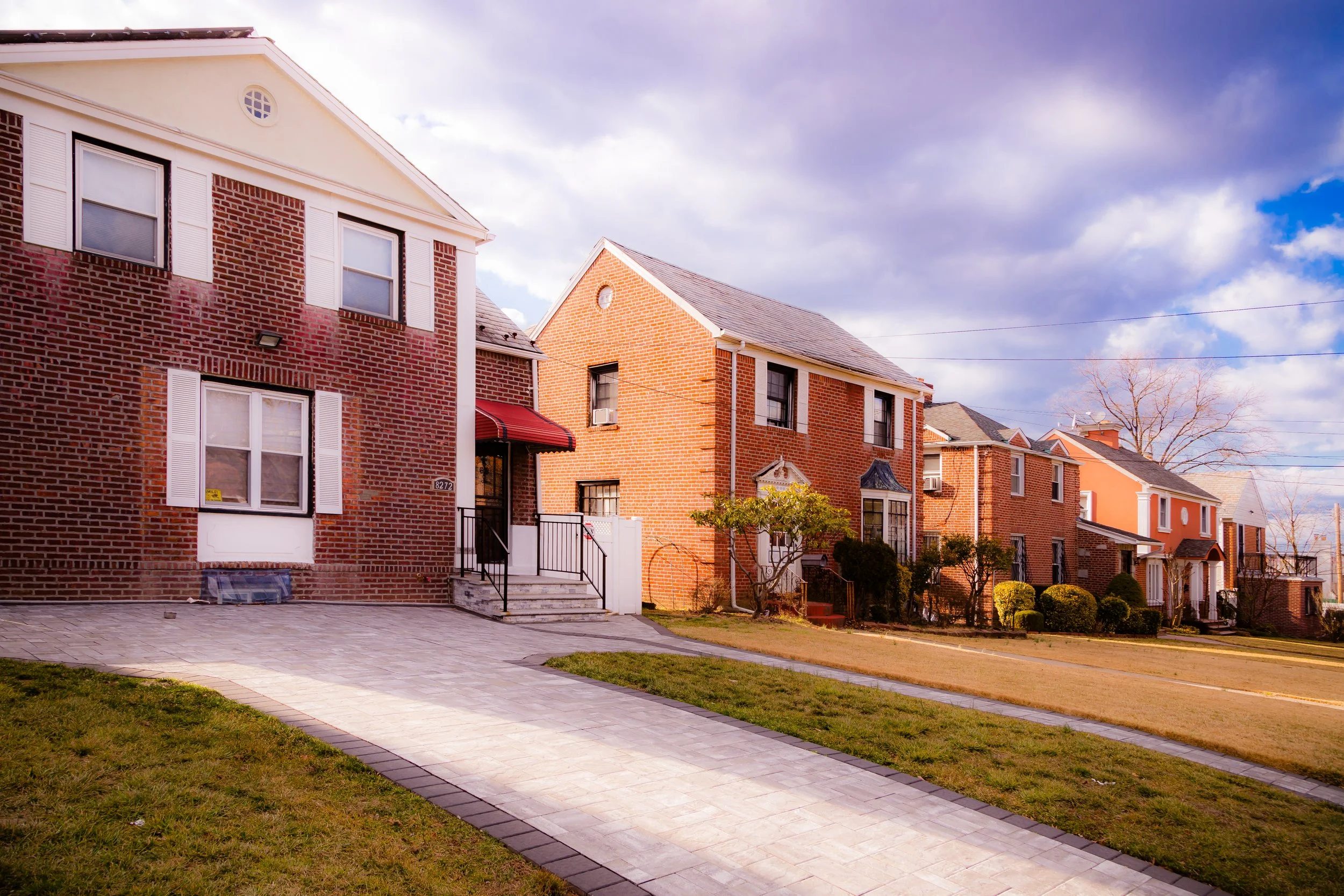
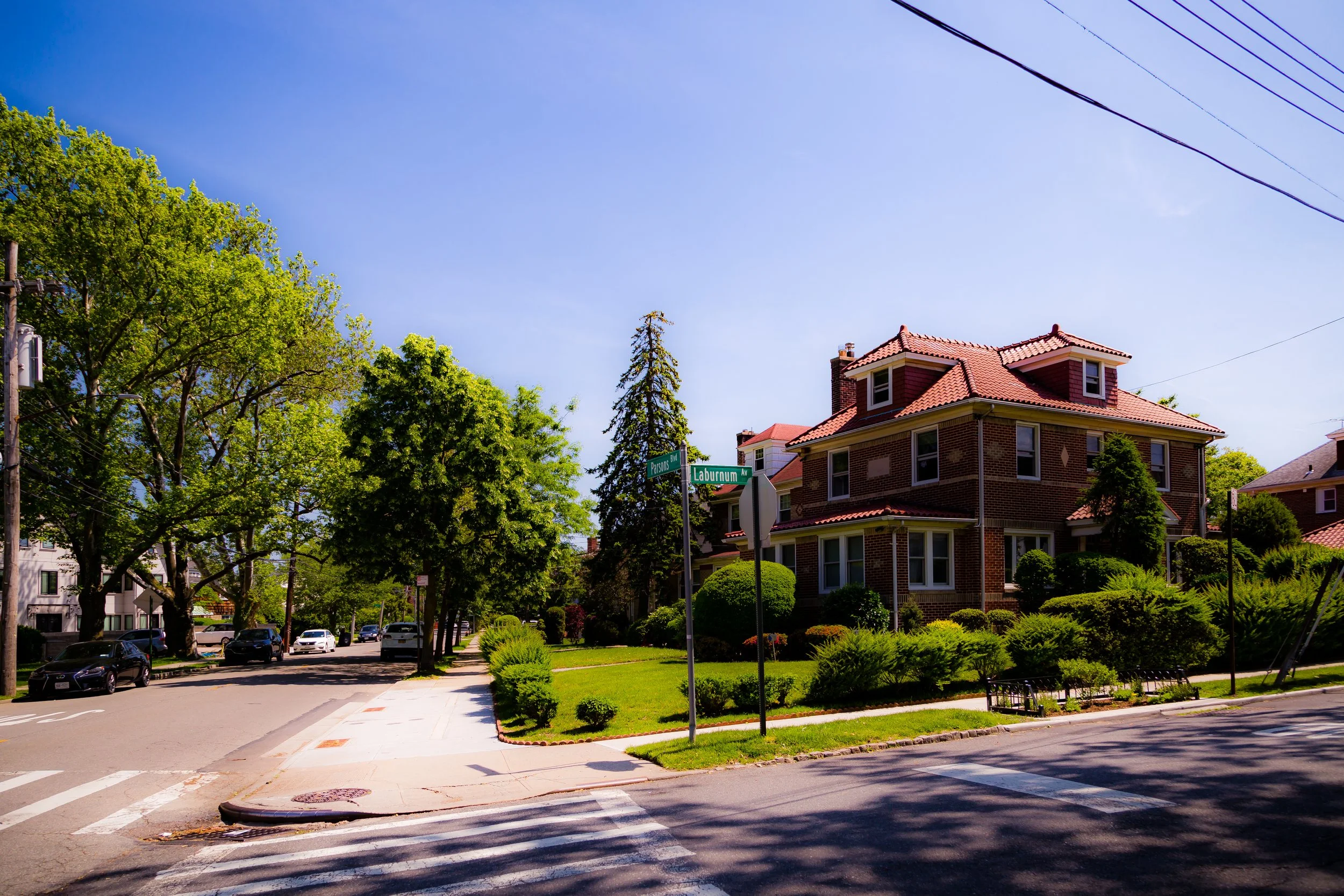
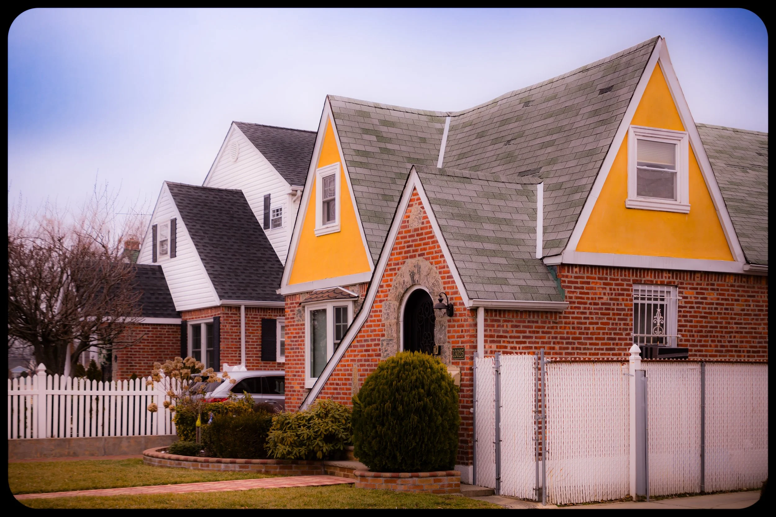
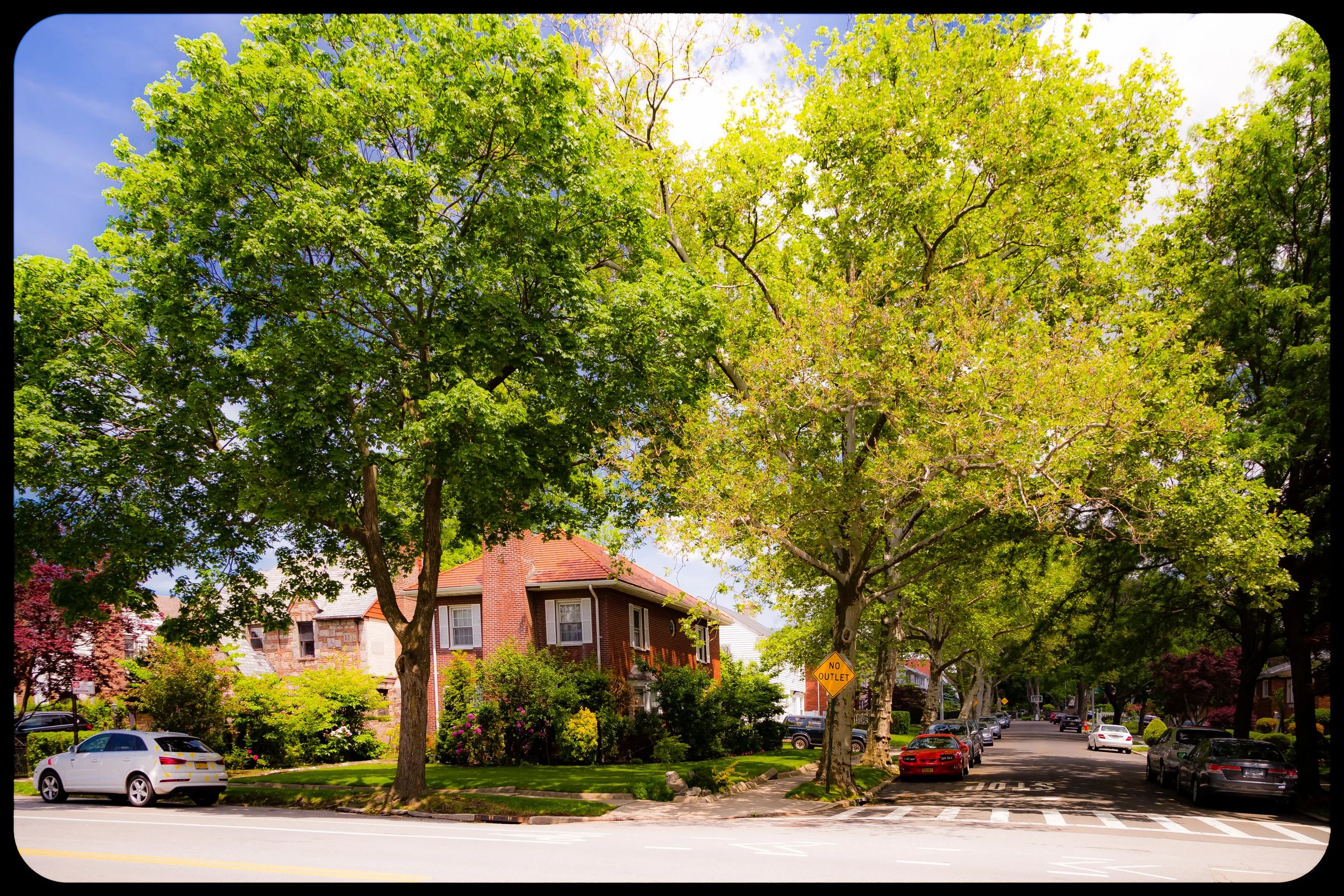
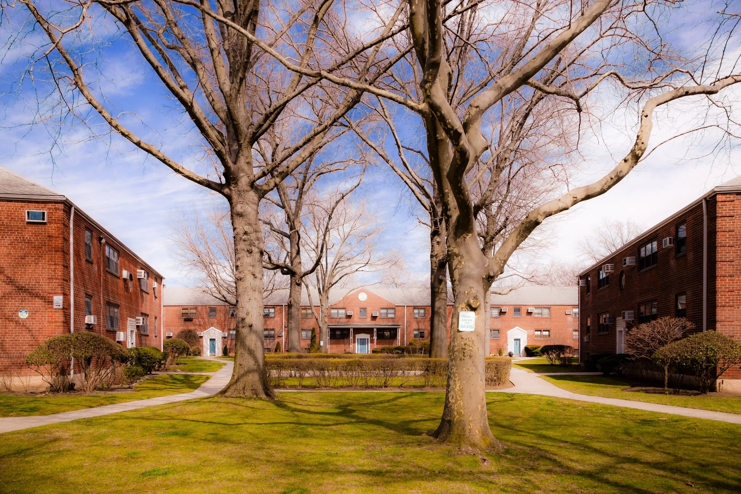
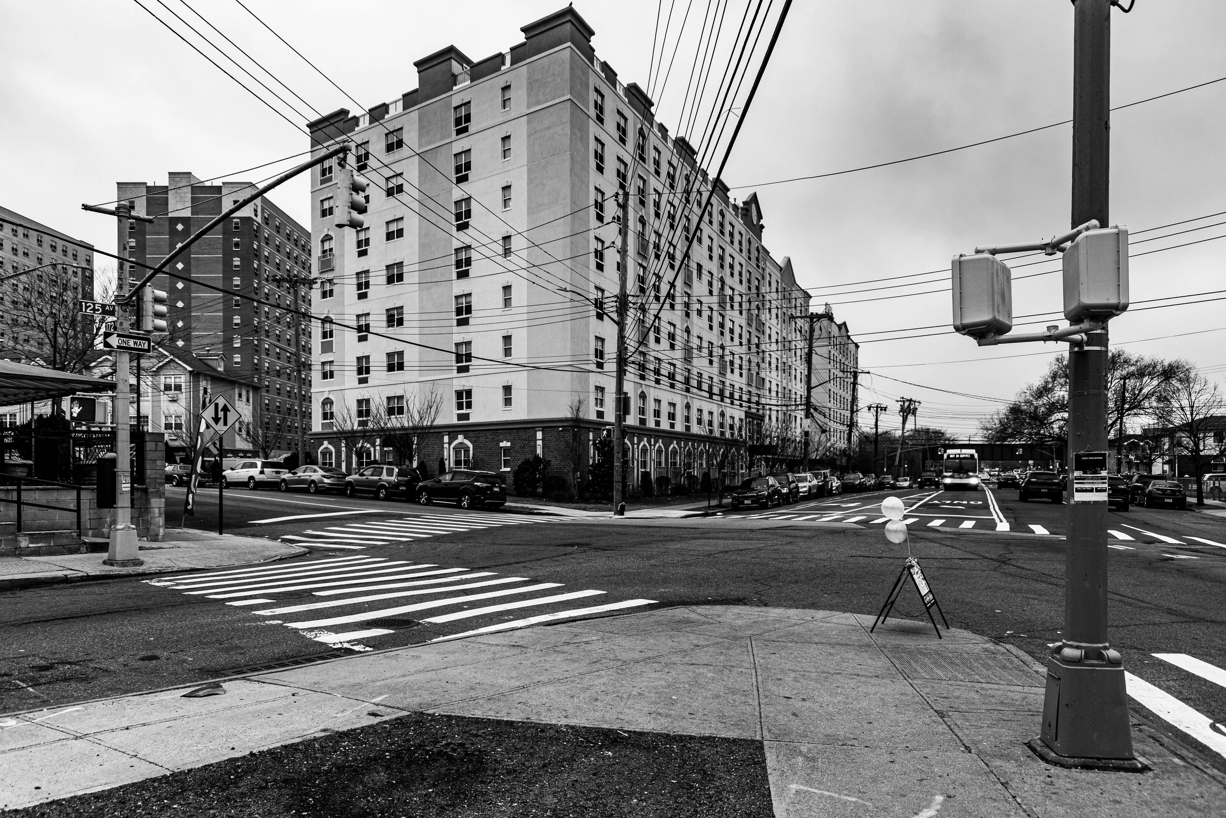
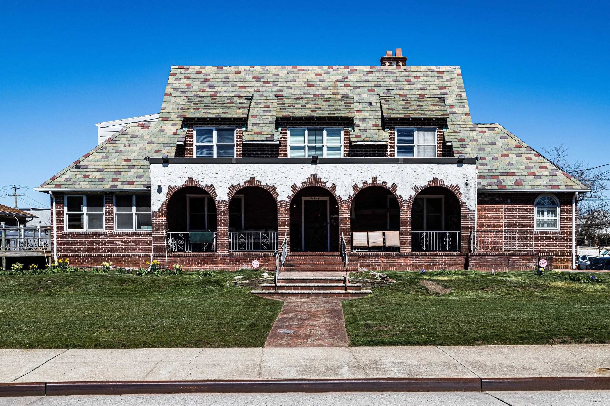
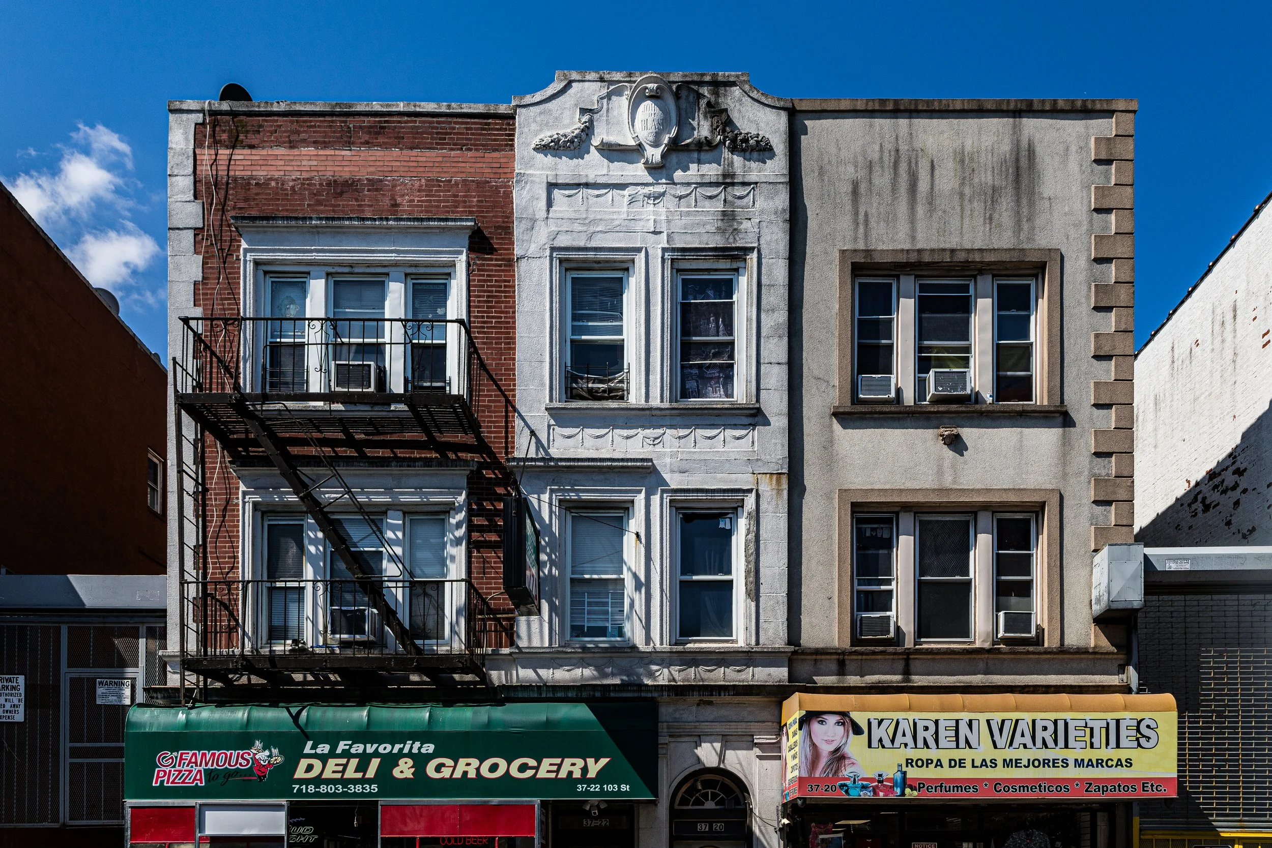
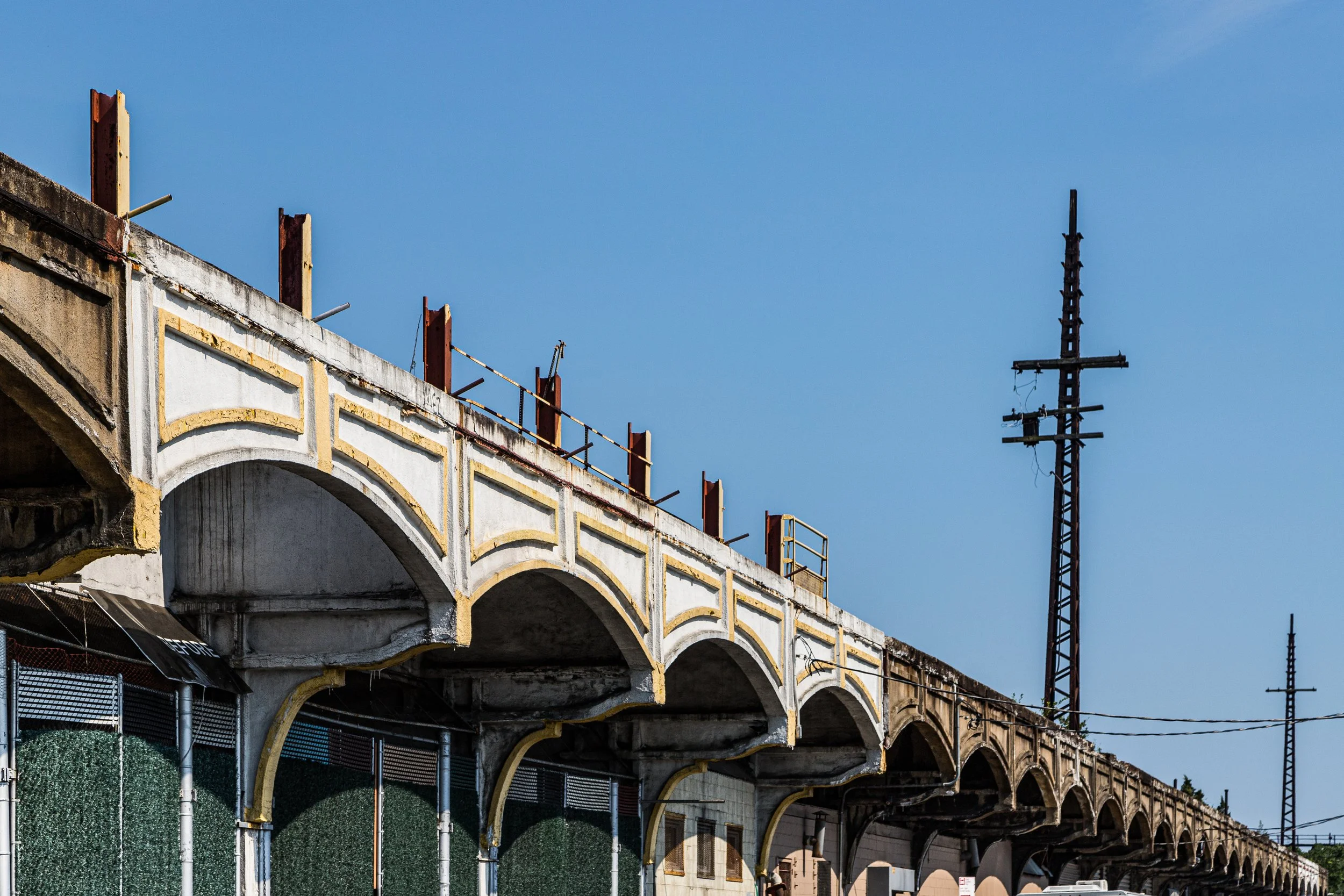
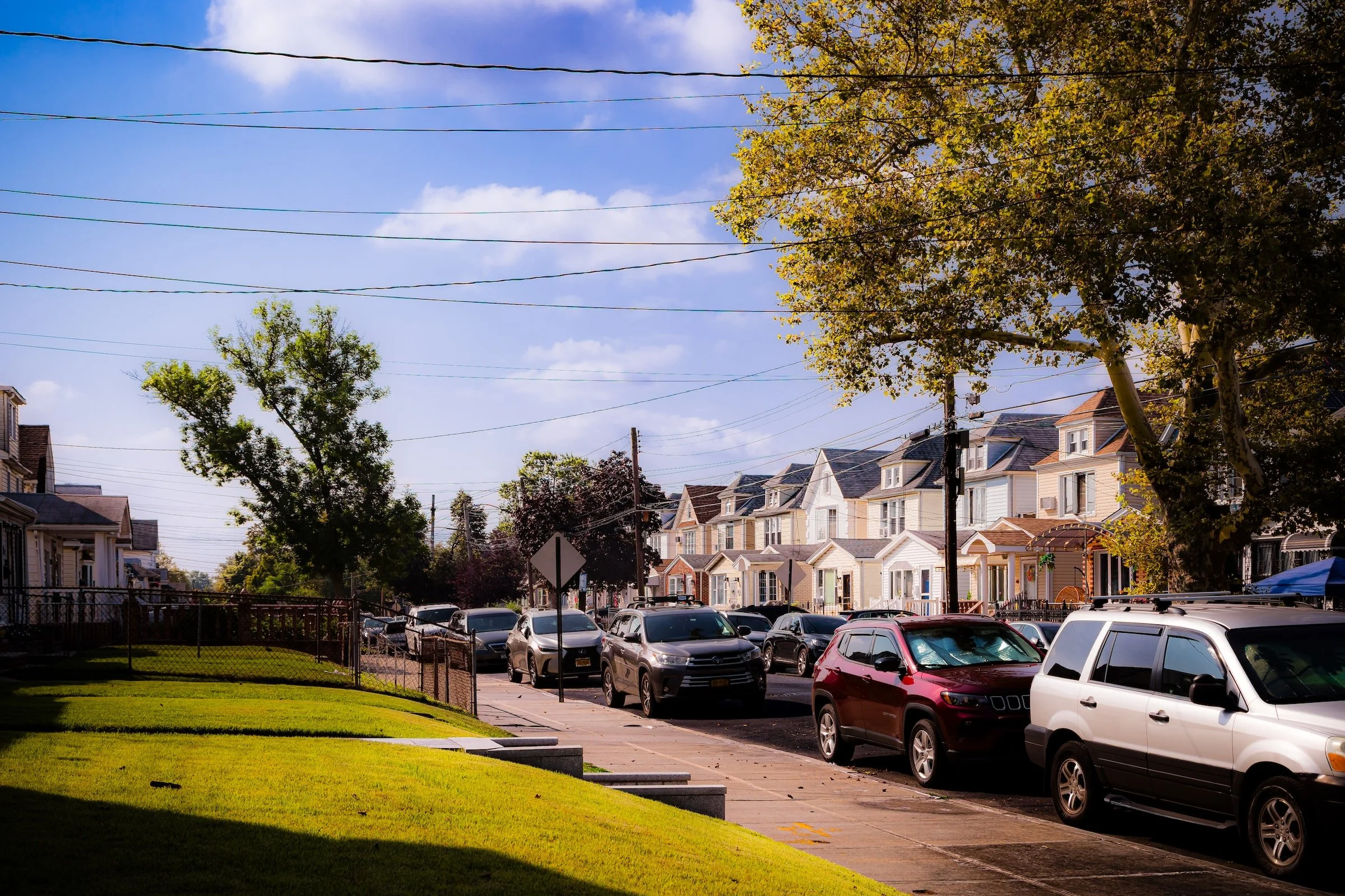
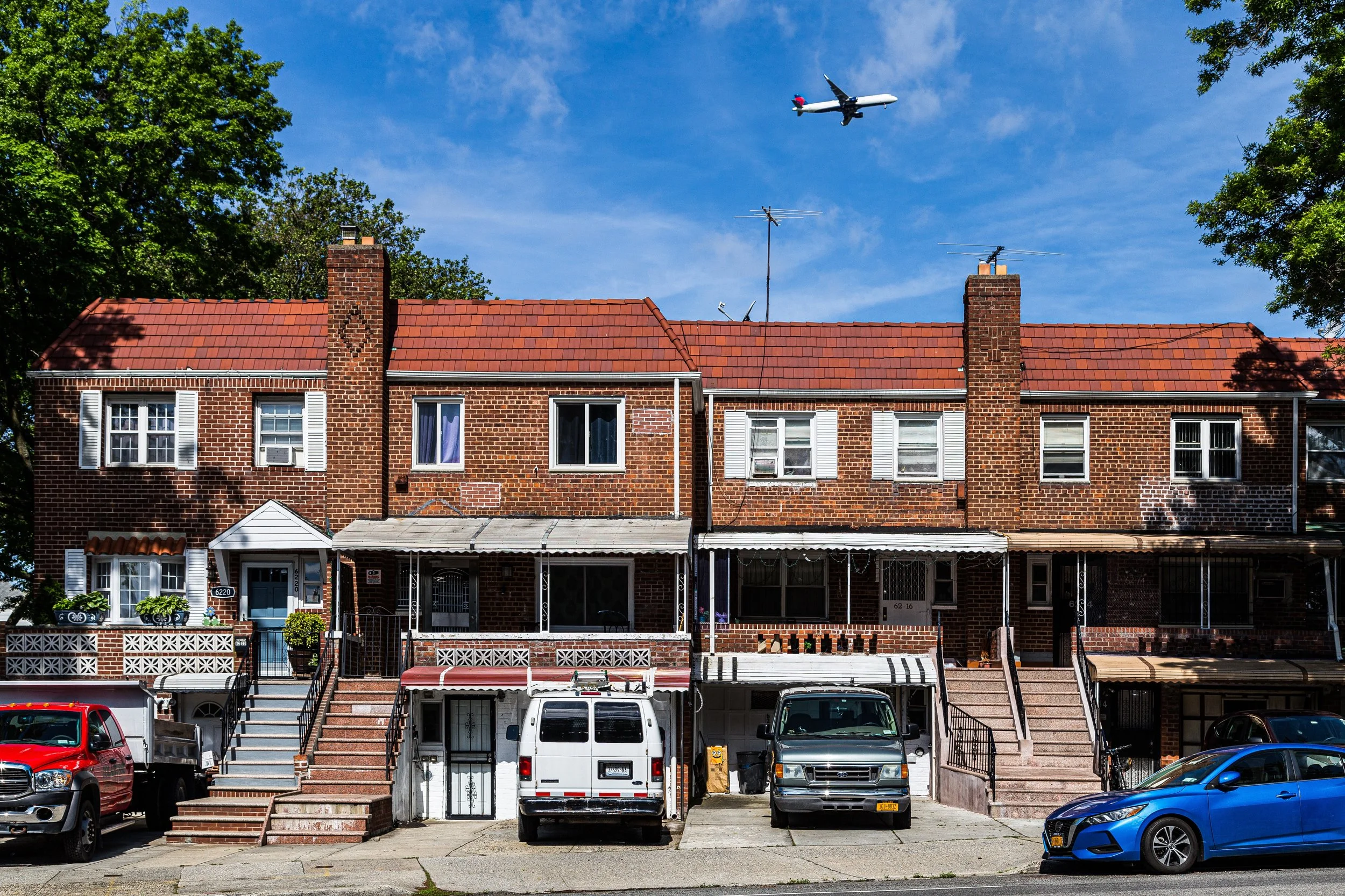
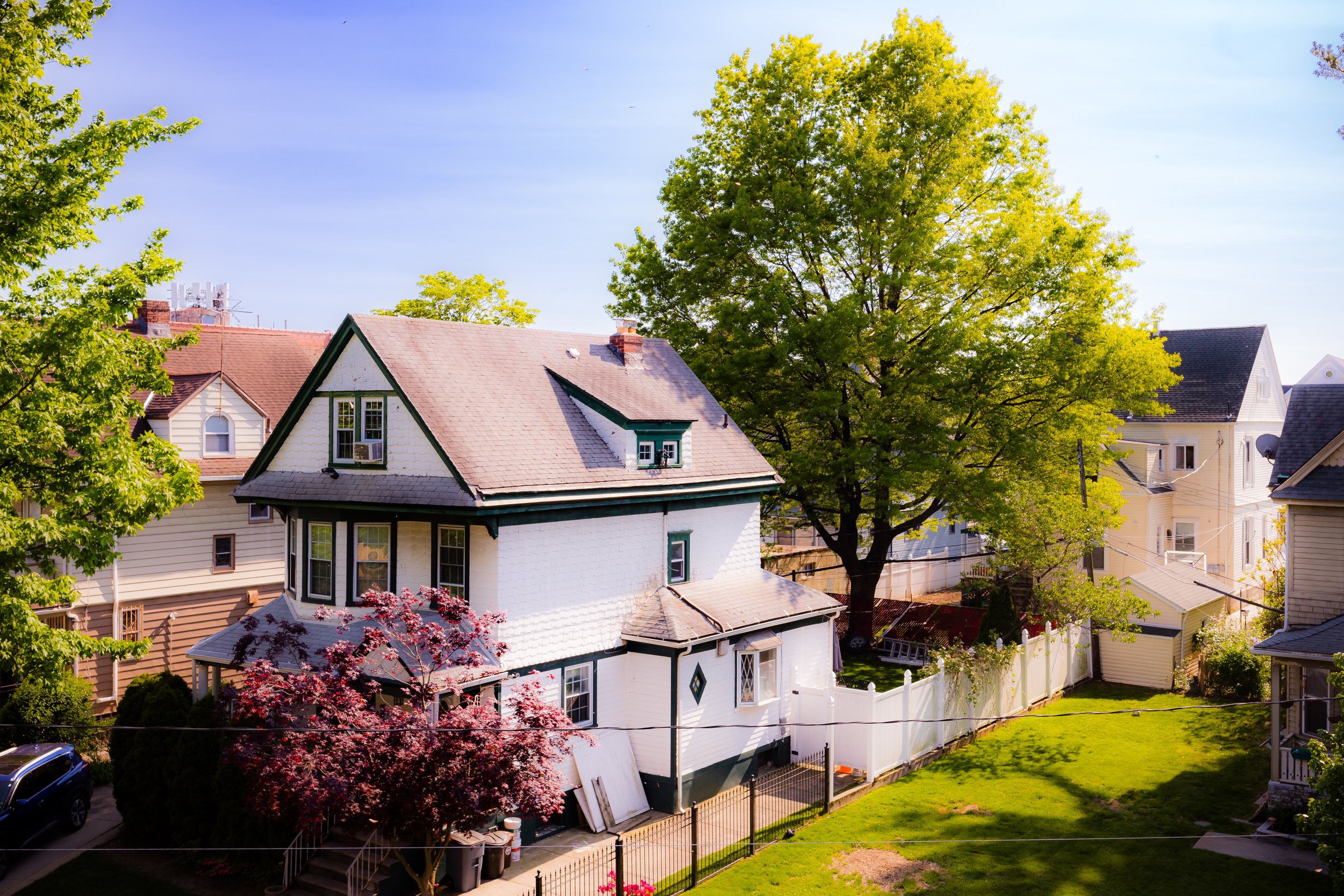
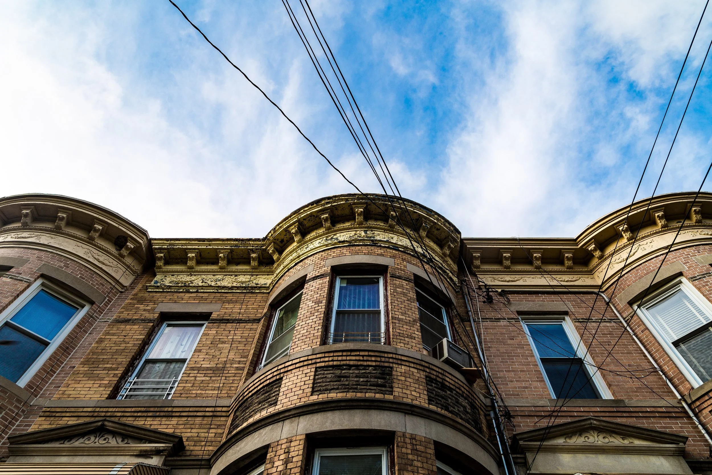
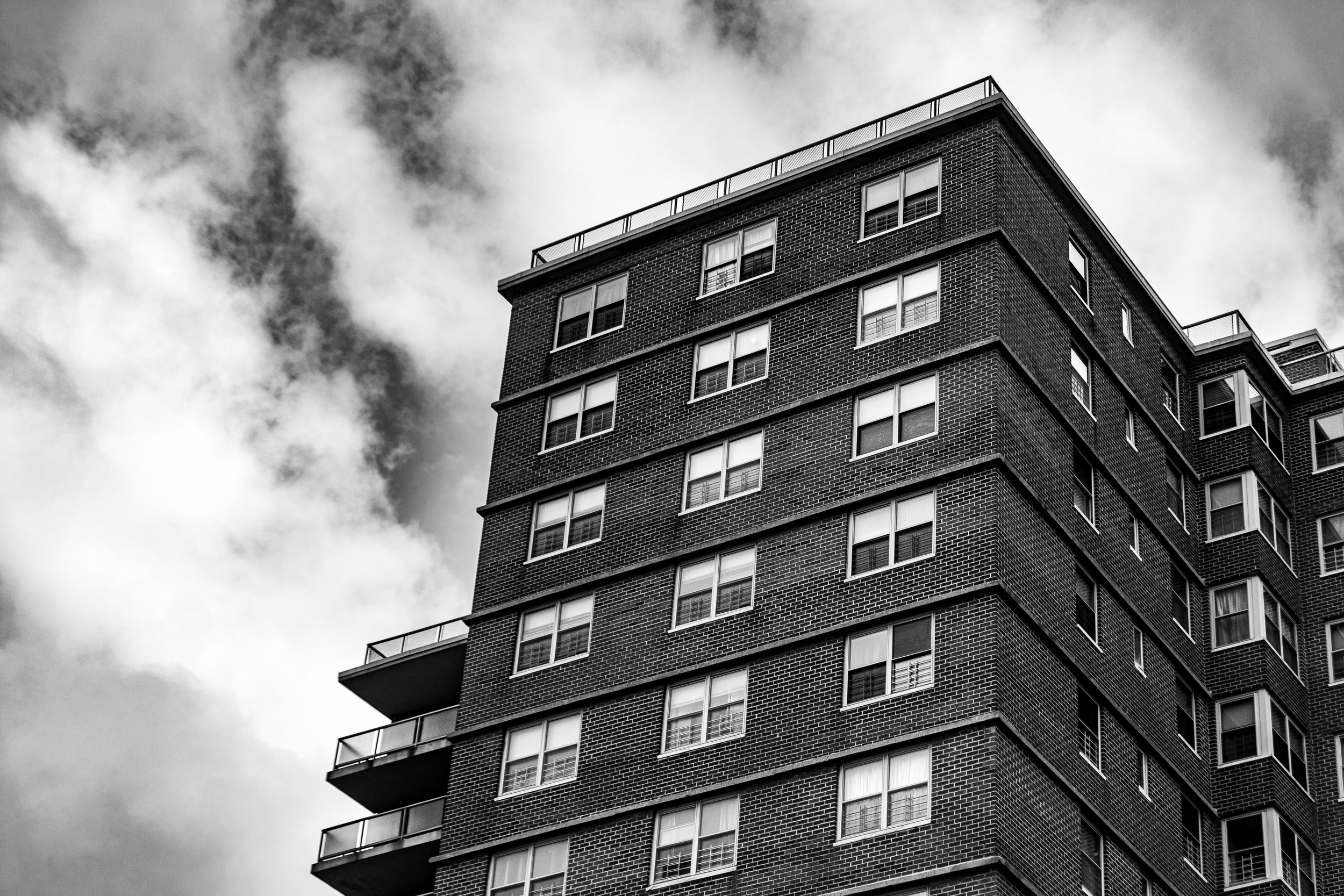
Queens has a visual language shaped by variation, transition, and neighborhood texture. It is a borough of detached homes and brick apartment houses, commercial strips and quiet side streets, elevated trains and broad boulevards, cemeteries and schoolyards, waterfront edges and industrial corridors. Across the borough, garden apartments, rowhouses, towers, religious buildings, warehouses, bungalows, murals, signage, and transit infrastructure create a built environment that feels layered rather than centralized.
This movement between density and openness is one of Queens’s defining visual qualities. Low-rise residential streets give way to apartment-lined corridors, industrial edges, parkland, shorelines, and long views, while brickwork, siding, fences, awnings, yard plantings, storefronts, and shifting light soften the borough’s larger forms with texture and local character. Queens is visually varied, spatially restless, and shaped above all by the distinct rhythms of its many neighborhoods.

-

Nature As Stage
-
Painted Cityscapes
-

Power Line Geometry
-
Repetitions & Patterns
-
Vibrant Colors
The Neighborhoods
Queens: where cultures from around the world, expressed through language, food, shops, homes, and streetscapes, give its neighborhoods their remarkable variety and personality. Explore the neighborhoods:
-

Stretching across the neighborhoods of Douglaston, Bayside, Oakland Gardens, and Hollis Hills, Alley Pond Park occupies the rolling heart of northeastern Queens, bounded generally by Union Turnpike to the south, Winchester Boulevard to the west, Douglaston Parkway to the east, and Northern Boulevard to the north.
-
Bounded by Beach 77th and Beach 79th Streets to the west and Beach 59th Street to the east, Arverne lies along the central Rockaway Peninsula—an oceanfront community defined by its proximity to both the Atlantic shoreline and Jamaica Bay.
-
Bounded by the East River to the west, the Brooklyn–Queens Expressway (BQE) to the north and east, then tracing a southeastern line along 31st Avenue to 49th Street, south to 34th Avenue, west to Steinway Street, south to 36th Avenue, west to 31st Street, north to Broadway, and west again to the river, Astoria occupies the northwestern corner of Queens
-
Bounded by Hazen Street to the northwest, 19th Avenue to the north, 81st Street to the east, and the Grand Central Parkway to the south, Astoria Heights occupies an elevated residential pocket on the northern edge of western Queens—overlooking LaGuardia Airport and the East River’s approach.
-

Bounded by 162nd Street to the west, Francis Lewis Boulevard to the east, 47th Avenue and Pidgeon Meadow Road to the south, and Crocheron Avenue to the north, Auburndale lies within the heart of northeastern Queens—a tranquil residential enclave set between Murray Hill to the west and Bayside to the east.
-
Bounded by 26th Avenue to the south, Utopia Parkway to the west, Little Bay to the north, and Little Neck Bay to the east, Bay Terrace occupies a distinctive waterfront plateau in northeastern Queens—a serene residential enclave that blends suburban calm with sweeping maritime vistas.
-
Bounded by 48th Avenue to the south, Francis Lewis Boulevard to the west, 26th Avenue to the north, and Little Neck Bay together with the Cross Island Parkway to the east, Bayside occupies a vast and storied stretch of northeastern Queens—a neighborhood defined by its gentle hills, tree-lined avenues, and commanding views of the bay.
-

Bounded to the south by the Long Island Expressway (I-495), to the west by Francis Lewis Boulevard, to the north by 48th Avenue, and to the east by Springfield Boulevard, Bayside Hills forms a distinct residential enclave within the greater Bayside area of northeastern Queens.
-
Bayswater lies along the calm waters of Mott Basin and Jamaica Bay, bordered by Far Rockaway to the east, Arverne to the west, and the Norton Basin wetlands to the north. Its boundaries roughly span Bay 32nd to Bay 28th Streets, enclosed by Nameoke Avenue, Healy Avenue, and the Bayswater Point State Park shoreline.
-

Bounded by the Cross Island Parkway to the south, 154th Street to the west, the East River to the north, and Little Bay to the east, Beechhurst forms the northernmost edge of Whitestone—an elegant, water-wrapped enclave at the far northeastern tip of Queens.
-
Bounded by Hollis Avenue to the south, Francis Lewis Boulevard to the west, Hillside Avenue to the north, and Hollis Court Boulevard and 212th Street to the east, Bellaire occupies a compact, residential stretch of eastern Queens between Hollis, Queens Village, and Cambria Heights.
-

Bounded by Beach 142nd Street to the west, Beach 125th Street to the east, Jamaica Bay to the north, and the Atlantic Ocean to the south, Belle Harbor occupies one of the most scenic and serene stretches of the Rockaway Peninsula.
-
Bellerose is bounded by Little Neck Parkway to the east, Jericho Turnpike to the south, a western perimeter tracing Gettysburg Street north to Braddock Avenue, continuing along Moline Street, 235th Court, Hillside Avenue, and Winchester Boulevard, and enclosed to the north by the Grand Central Parkway.
-
Bounded by Braddock Avenue to the south, the Grand Central Parkway to the northwest, Union Turnpike to the north, and 236th Street and 235th Court to the east, Bellerose Manor occupies a small but distinct enclave in eastern Queens—a leafy residential triangle nestled between Bellerose, Queens Village, and Glen Oaks.
-
Occupying the far western tip of the Rockaway Peninsula, Breezy Point lies between the Atlantic Ocean to the south, Jamaica Bay to the north, Fort Tilden and Riis Park to the east, and the Rockaway Inlet—which separates it from Brooklyn’s Coney Island—to the west.
-
Bounded by Hillside Avenue to the south, the Van Wyck Expressway to the east, Union Turnpike to the north, and Parsons Boulevard to the west, Briarwood lies at the geographic center of Queens—a modest yet characterful neighborhood defined by tree-lined streets, prewar apartment houses, and mid-century homes.
-
Situated in the middle of Jamaica Bay, Broad Channel is the only inhabited island within the vast tidal estuary that separates southern Queens from the Rockaway Peninsula.
-
Bounded by 154th Street to the west, 25th Avenue to the north, Utopia Parkway to the east, and Crocheron Avenue and Northern Boulevard to the south, Broadway–Flushing occupies one of the most graceful residential sections of northeastern Queens.
-
Brookville is bounded by Farmers Boulevard to the west, the Nassau Expressway to the south, the JFK Expressway to the east, and the Belt Parkway to the north.
-
Brookville Park is one of southeastern Queens’ most significant natural landscapes. The park stretches roughly from 147th Avenue south to Rockaway Boulevard, following the sinuous course of Hook Creek—a tidal inlet that meanders toward Jamaica Bay.
-
Bounded by the Cross Island Parkway to the east, 121st Avenue to the south, Springfield Boulevard to the west, and 115th Avenue and 144th Avenue to the north, Cambria Heights lies along the southeastern edge of Queens.
-

Bounded by 138th Street and 15th Avenue to the northeast, the Whitestone Expressway (I-678) to the east, Flushing Bay to the west, and the East River to the north, College Point occupies a peninsula that juts into the waters of northern Queens.
-
Bounded by the Long Island Expressway to the south, Junction Boulevard to the west, 45th Avenue to the north, and 111th Street and Flushing Meadows–Corona Park to the east, Corona lies at the vibrant heart of north-central Queens.
-

Cunningham Park occupies a broad green corridor between Fresh Meadows, Hollis Hills, and Bayside Hills, linking Union Turnpike to Grand Central Parkway and extending eastward toward Francis Lewis Boulevard and Clearview Expressway.
-
Bounded by Hazen Street to the east, the Brooklyn–Queens Expressway and the Queensboro Bridge approaches to the south, and the East River to the west and north, Ditmars–Steinway forms the northernmost section of Astoria.
-
Bounded by Douglas Road to the east, Cherry Street to the south, 235th Street and Melrose Lane to the southwest, and the waters of Little Neck Bay to the west and north, Douglas Manor occupies one of the most picturesque and historically intact waterfront enclaves in New York City.
-
Bounded by Marathon Parkway to the east, the Grand Central Parkway to the south, Alley Pond Park to the west, and 235th Street and Cherry Street to the north, Douglaston occupies one of the most distinctive and verdant corners of northeastern Queens
-
Centered on Main Street and bounded by Northern Boulevard to the north, Parsons Boulevard to the east, 45th Avenue to the southeast, Flushing Meadows–Corona Park to the south, and Flushing Creek to the west, Downtown Flushing – Main Street forms the bustling commercial and cultural heart of northeastern Queens.
-

Bounded by the Grand Central Parkway to the north and east, Northern Boulevard to the south, and the Brooklyn–Queens Expressway (BQE) to the west, East Elmhurst occupies a triangular sweep of land between Jackson Heights, Flushing Bay, and LaGuardia Airport.
-
Bounded by Beach 59th Street to the west, Beach 32nd Street to the east, Jamaica Bay to the north, and the Atlantic Ocean to the south, Edgemere occupies a windswept stretch of the Rockaway Peninsula, where the city meets the sea.
-
Bounded by Roosevelt Avenue to the north, Junction Boulevard to the east, the Long Island Expressway to the south, and the Long Island Rail Road tracks to the west, Elmhurst lies at the geographic and demographic heart of Queens.
-
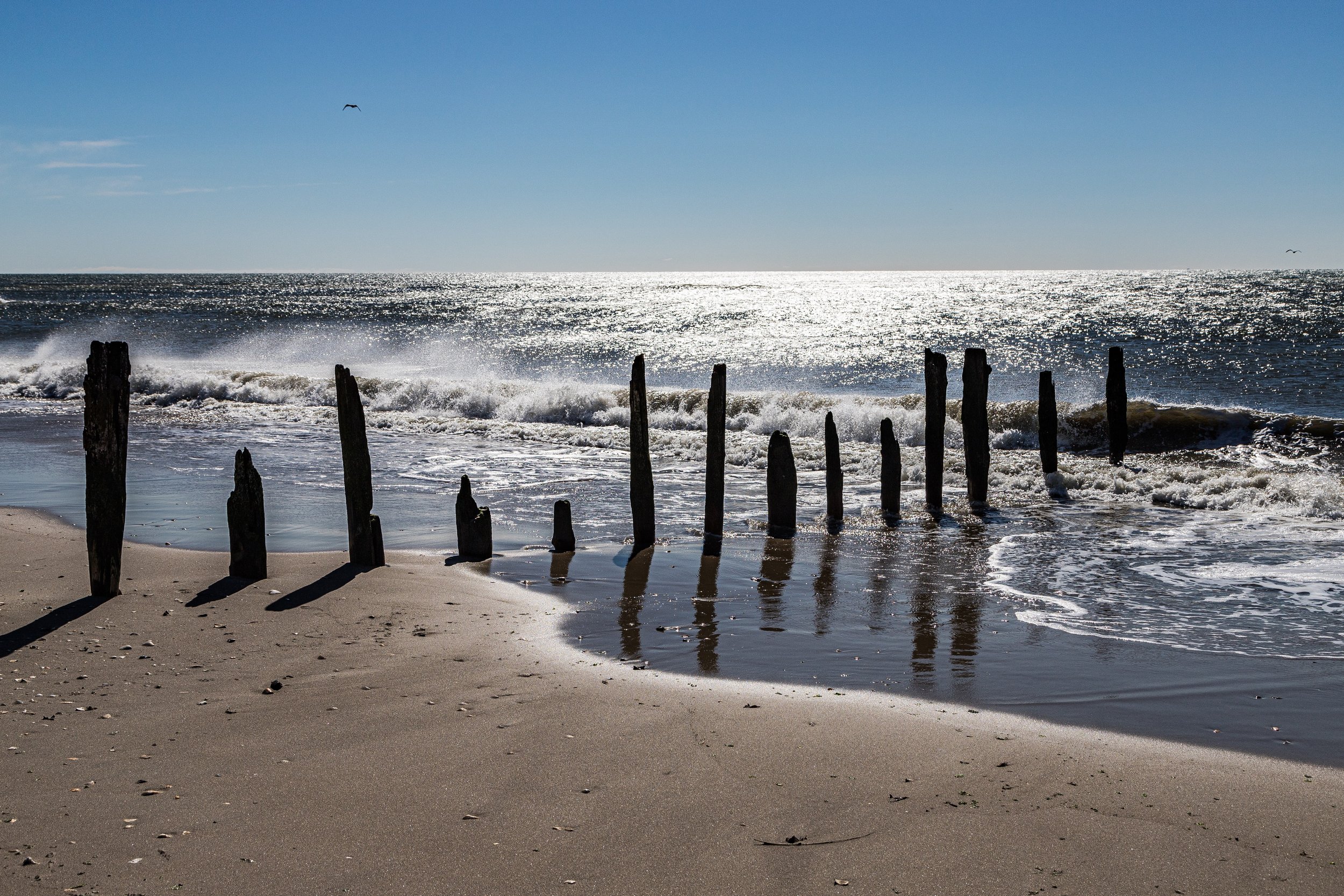
Bounded by Beach 32nd Street to the west, Nassau County to the east, Bayswater and Jamaica Bay to the northwest, and the Atlantic Ocean to the south, Far Rockaway anchors the easternmost end of the Rockaway Peninsula.
-

Bounded by Little Neck Parkway to the west, Union Turnpike to the north, 268th Street to the east, and the Nassau County line to the south and southwest, Floral Park marks the easternmost edge of Queens.
-
Bounded by 73rd Avenue to the south, 164th Street to the west, the Long Island Expressway (I-495) to the north, and Utopia Parkway to the east, Flushing Heights occupies a quiet, residential plateau in central Queens.
-

Spanning more than 900 acres in the heart of Queens, Flushing Meadows–Corona Park is the borough’s grand central green—the second-largest park in New York City and one of its most symbolically charged landscapes.
-

Bounded by the Long Island Expressway to the north, the Grand Central Parkway to the east, Union Turnpike to the south, and a western boundary that follows Woodhaven Boulevard, Selfridge Street, 67th Avenue, and 102nd Street, Forest Hills occupies the geographic center of Queens.
-

At the western edge of Forest Hills, framed by Union Turnpike, Queens Boulevard, and the Long Island Rail Road tracks, lies Forest Hills Gardens—a self-contained residential enclave of extraordinary architectural harmony and historical significance.
-

Stretching across the center of southwestern Queens, Forest Park spans roughly 538 acres of rolling hills, oak woods, and recreational fields between Kew Gardens, Woodhaven, Richmond Hill, and Glendale.
-
Occupying the broad, windswept western end of the Rockaway Peninsula, Fort Tilden and Jacob Riis Park together form one of New York City’s most striking coastal landscapes.
-
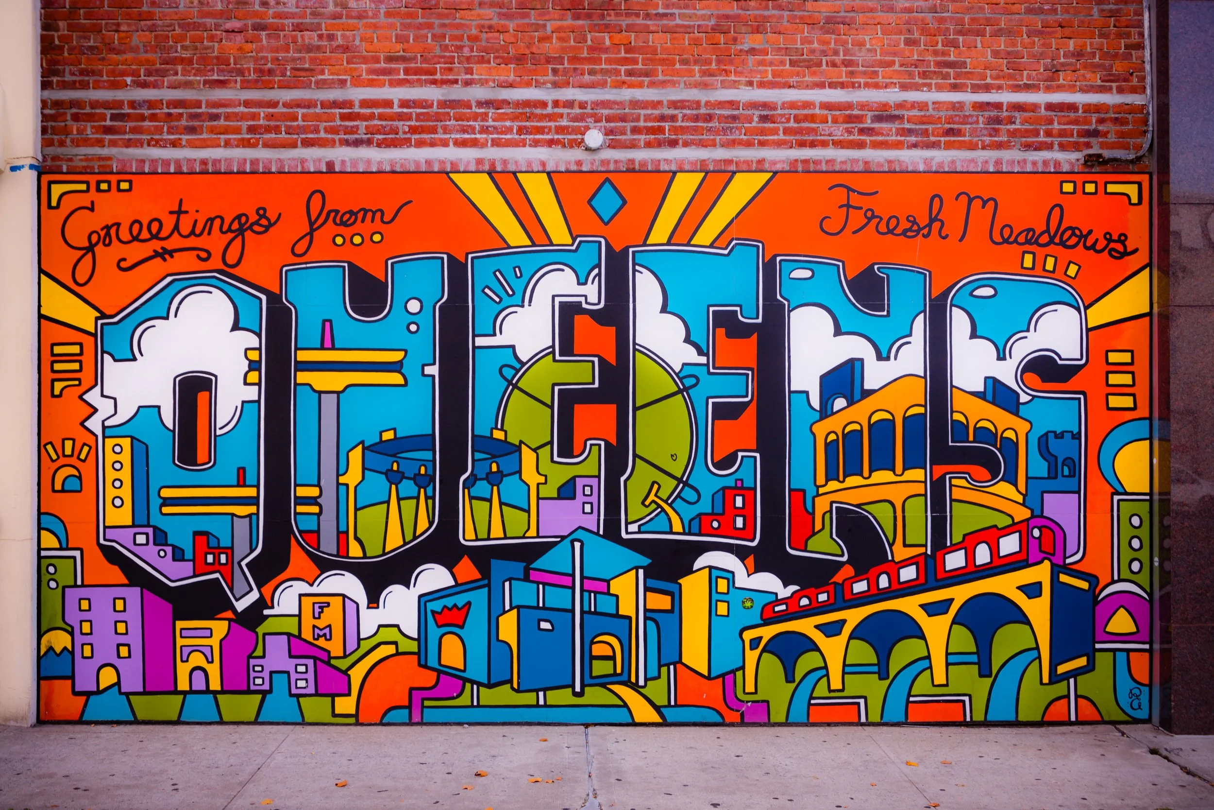
Fresh Meadows lies between Flushing, Jamaica Estates, and Bayside, occupying the elevated ground where the borough’s rolling hills begin to descend toward the coastal plain. Its boundaries are generally marked by Union Turnpike to the south, 73rd Avenue and Hollis Hills Terrace to the north, Utopia Parkway to the east, and Fresh Meadow Lane to the west.
-
Bounded by 74th Avenue and Northwell Health–Long Island Jewish Medical Center and Union Turnpike to the south, Little Neck Parkway to the west, the Grand Central Parkway to the north, and the Nassau County line to the east, Glen Oaks lies at the extreme northeastern corner of Queens
-
Bounded by Woodhaven Boulevard to the east, Forest Park and the Brooklyn borough line to the south and southwest, and the freight rail corridors and Fresh Pond Road to the west and north, Glendale sits at the southwestern edge of Queens.
-
Bounded by 160th Avenue to the north, 104th Street to the east, Jamaica Bay to the south, and Hawtree Creek to the west, Hamilton Beach is a small, low-lying waterfront neighborhood tucked within southern Queens
-
Bounded by Parsons Boulevard to the west, 73rd Avenue to the north, Utopia Parkway to the east, and Union Turnpike to the south, Hillcrest occupies a gently elevated stretch of central Queens.
-
Straddling the Queens–Brooklyn border between South Ozone Park and East New York, and roughly bounded by Linden Boulevard to the north, South Conduit Avenue to the south, Ruby Street to the east, and Vandalia Avenue to the west, The Hole occupies one of New York City’s most unusual and haunting landscapes.
-

Bounded by Hillside Avenue to the north, Francis Lewis Boulevard to the east, Hollis Avenue and 104th Avenue to the south, and 180th Street to the west, Hollis lies in southeastern Queens.
-
Bounded by the Grand Central Parkway to the east and south, the Vanderbilt Motor Parkway to the north, and Cunningham Park to the west, Hollis Hills occupies one of the most picturesque and secluded corners of eastern Queens
-
Bounded by Hillside Avenue to the south, 188th Street to the west, and the Grand Central Parkway curving around its northern and eastern edges, Holliswood occupies a verdant hilltop in central-eastern Queens—one of the borough’s most picturesque and affluent residential enclaves.
-
Bounded by the Belt Parkway to the north, Shellbank Basin and Jamaica Bay to the east, Jamaica to the south, and Spring Creek Park and the Brooklyn line to the west, Howard Beach is one of southern Queens’ signature waterfront neighborhoods.
-
Bounded by Queens Plaza South to the north, the rail lines and Sunnyside Yard to the southeast, Newtown Creek to the south, and the East River to the west, Hunter’s Point forms the westernmost edge of Long Island City.
-

Bounded by the Brooklyn-Queens Expressway (BQE) to the west, Northern Boulevard to the north, Junction Boulevard to the east, and Roosevelt Avenue to the south, Jackson Heights occupies a central plateau in northwestern Queens—a neighborhood at once historic, diverse, and architecturally distinctive.
-
Bounded by Linden Boulevard to the south, the Van Wyck Expressway to the west, Archer Avenue to the north, and an eastern line running along Merrick Boulevard, 109th Avenue, and 180th Street, Jamaica stands as one of Queens’ oldest, largest, and most historically significant neighborhoods.
-
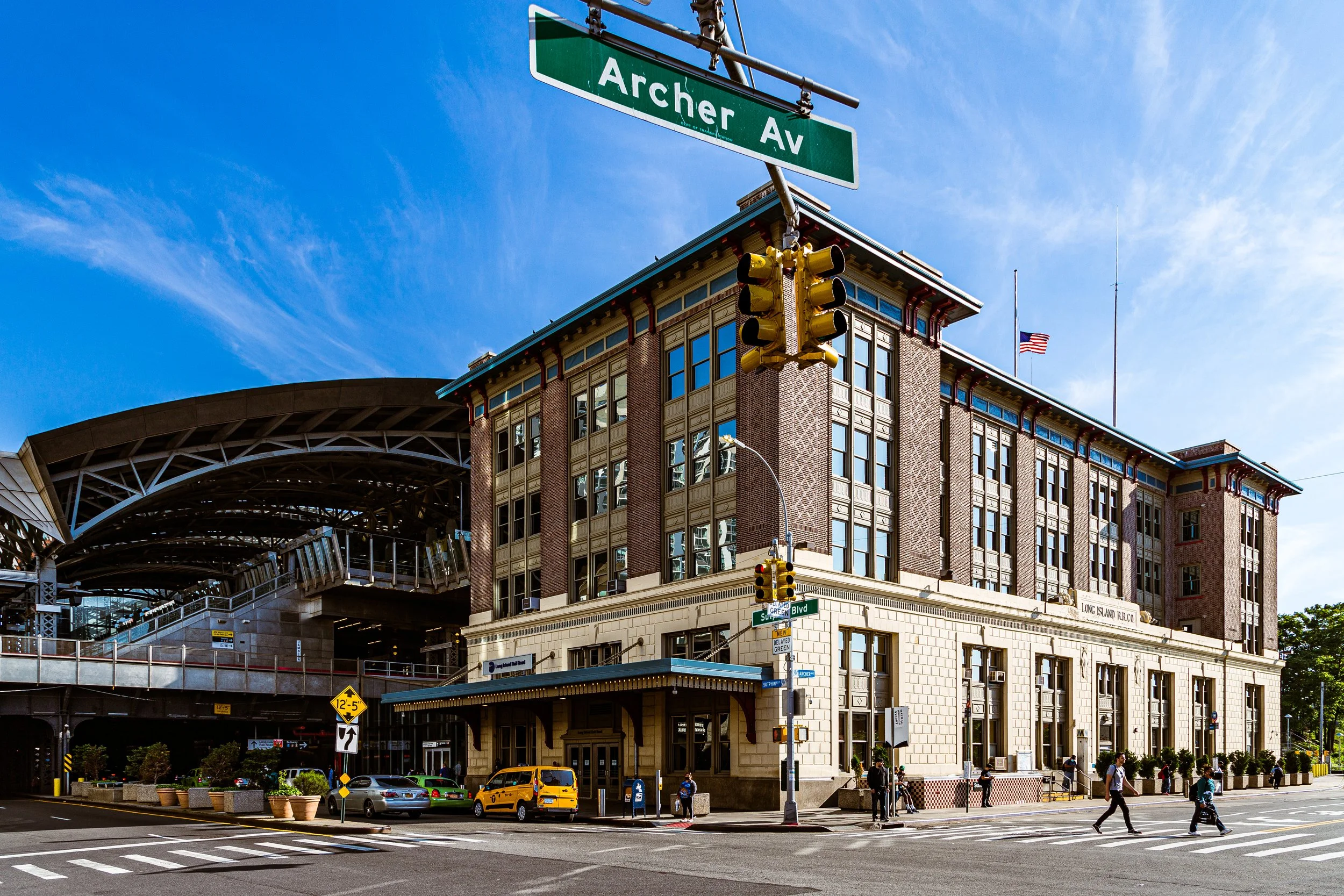
Bounded by Archer Avenue to the south, the Van Wyck Expressway to the west, Hillside Avenue to the north, and 180th Street to the east, Jamaica Center forms the historic and commercial core of Jamaica, and by extension, one of the most vital urban districts in Queens.
-
Tucked into the rolling hills of central Queens, Jamaica Estates occupies one of the borough’s most distinctive and verdant residential enclaves. It is bounded by Union Turnpike to the north, Hillside Avenue to the south, Homelawn and 170th Streets to the west, and 188th Street to the east.
-
Bounded by Hillside Avenue to the south, Parsons Boulevard to the west, Union Turnpike to the north, and 170th Street and Homelawn Street to the east, Jamaica Hills occupies a gently elevated swath of central Queens
-

John F. Kennedy International Airport (JFK) is bounded by Rockaway Boulevard and South Ozone Park to the north, Belt Parkway and Bergen Basin to the northwest, Idlewild Park Preserve and Jamaica Bay to the south, and Rosedale and Springfield Gardens to the east.
-

Bounded by the Van Wyck Expressway to the east, Hillside Avenue to the south, Babbage Street to the west, Forest Park to the northwest, and Union Turnpike to the north, Kew Gardens occupies a gently rolling landscape in central Queens
-

Bounded by Union Turnpike to the south, the Van Wyck Expressway to the west, Cedar Grove Cemetery and Melbourne Avenue to the north, and Kissena Boulevard and Parsons Boulevard to the east, Kew Gardens Hills stretches across a broad rise in central Queens
-
Bounded by Kissena Park to the south and west, 45th Avenue from Colden Street to Parsons Boulevard, 46th Avenue from Parsons Boulevard to Pidgeon Meadow Road, and Fresh Meadow Lane to the east, Kissena occupies a tranquil residential enclave in north-central Queens.
-

Stretching across more than 230 acres of central Queens, Kissena Park forms the green heart of the borough’s eastern park system. It is bounded by Main Street and Kissena Boulevard on the east, Booth Memorial Avenue to the north, 164th Street to the west, and Jewel Avenue to the south.
-

Perched on the northwestern shoreline of Queens, LaGuardia Airport (LGA) occupies a commanding position on the western edge of Flushing Bay, with Astoria to the west, East Elmhurst to the south, and College Point to the east.
-
Bounded by the Belt Parkway to the east, Mentone Avenue to the south, Carson Street to the southwest, Springfield Boulevard to the west, and 121st Street to the north, Laurelton occupies the southeastern edge of Queens.
-
Bounded by the Whitestone Expressway to the west, 25th Avenue to the north, 154th Street to the east, and Northern Boulevard to the south, Linden Hill occupies a compact rise between Flushing and Whitestone, forming one of northern Queens’ most distinct yet often-overlooked residential enclaves.
-
Bounded by Linden Boulevard to the north, Conduit Avenue to the northwest, the Belt Parkway to the southeast, and the Brooklyn border to the west, Lindenwood occupies a low-lying tract in the southwestern corner of Queens—a postwar residential community that blends orderly urban planning with a distinctly suburban calm.
-
Bounded by the Grand Central Parkway to the south, Marathon Parkway, Little Neck Parkway, and Douglas Road to the west, and the Nassau County line to the east, Little Neck occupies the far northeastern edge of Queens—a verdant, residential enclave that marks the city’s border with suburban Long Island.
-
Bounded by Baisley Boulevard to the northwest, 120th Avenue to the north, Farmers Boulevard to the east, the Belt Parkway to the south, and Guy R. Brewer Boulevard and Bedell Street to the west, Locust Manor occupies a low-lying pocket of southeastern Queens defined by its parkland, lakes, and postwar residential calm.
-
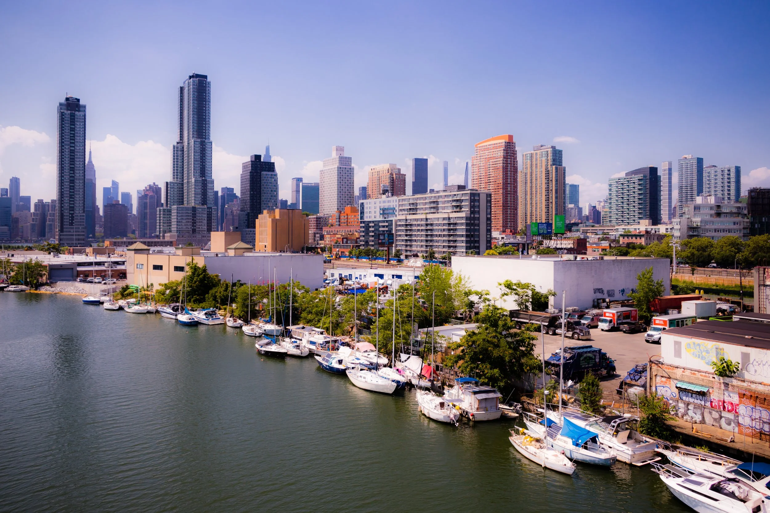
Occupying the westernmost edge of Queens along the East River, Long Island City (LIC) is both one of New York’s oldest industrial districts and its newest vertical skyline. It is bounded by Newtown Creek to the south, the East River to the west, Astoria to the north, and roughly Skillman Avenue and Van Dam Street to the east.
-
Bounded by the Whitestone Expressway to the east, 15th Avenue to the south, 138th Street to the west, and the Powell Cove inlet of the East River to the north, Malba occupies a secluded waterfront peninsula on the north shore of Queens
-
Bounded by the Brooklyn–Queens Expressway (BQE) to the north, the Long Island Rail Road freight lines to the east, Eliot Avenue to the southeast, Metropolitan Avenue to the south, and Newtown Creek and the Brooklyn border to the west, Maspeth sits at the crossroads of western Queens.
-
Meadowmere is one of the smallest and most geographically isolated neighborhoods in New York City—a quiet cluster of houses set amid the marshlands of Hook Creek near the Nassau County line. It lies between Rockaway Boulevard to the north, Hook Creek Boulevard and Nassau County (Meadowmere Park, Long Island) to the east, and the tidal inlets of Jamaica Bay to the south and west.
-
Located near the geographical center of Queens, Middle Village lies on a broad, gently undulating plain bordered by Maspeth to the west, Rego Park to the north, Glendale to the south, and Elmhurst to the east. It is bounded approximately by Woodhaven Boulevard, Eliot Avenue, Metropolitan Avenue, and Cooper Avenue, with Juniper Valley Park forming its lush green heart.
-

Bedford–Stuyvesant is bounded by Tompkins Avenue to the west, Malcolm X Boulevard to the east, a southern border primarily along Fulton Street, and a northern edge traced by Macon, Halsey, and Hancock Streets, Stuyvesant Heights.
-
Set along the western shore of the Rockaway Peninsula, Neponsit occupies one of the most scenic and exclusive coastal stretches in New York City. It is bounded by Beach 142nd Street to the east, Beach 149th Street to the west, the Atlantic Ocean to the south, and Jacob Riis Park and Beach Channel Drive to the north.
-

Bounded by 268th Street to the west, the sprawling Northwell Health/Long Island Jewish (LIJ) Medical Center campus to the north, and the Nassau County line to the east, New Hyde Park marks the easternmost edge of Queens
-
Bounded by Junction Boulevard to the west, Northern Boulevard to the north, the Grand Central Parkway to the east, and 45th Avenue to the south, North Corona lies at the cultural and geographic heart of north-central Queens.
-

Bounded by the Vanderbilt Motor Parkway to the south, Cunningham Park to the west, the Long Island Expressway east to Springfield Boulevard, and 46th Avenue to the north, Oakland Gardens occupies a gently rolling plateau in eastern Queens
-
Bounded by the Vanderbilt Motor Parkway to the south, Cunningham Park to the west, the Long Island Expressway east to Springfield Boulevard, and 46th Avenue to the north, Oakland Gardens occupies a gently rolling plateau in eastern Queens
-
Bounded by Atlantic Avenue to the north, 108th Street to the east, Aqueduct Road and the Aqueduct Racetrack to the southeast, Conduit Avenue to the southwest, and the Brooklyn border to the west, Ozone Park occupies the southwestern edge of Queens
-
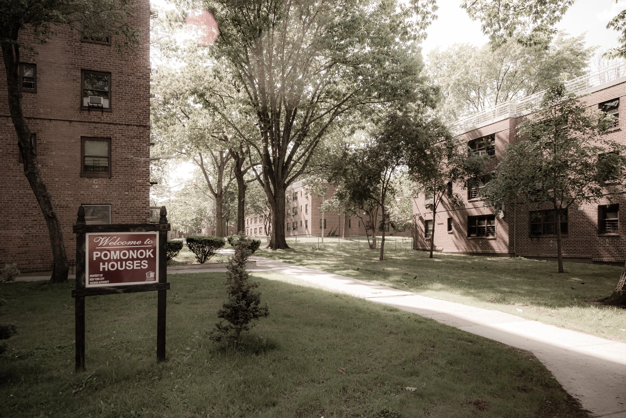
Bounded by the Long Island Expressway (LIE) to the north, 164th Street to the east, 73rd Avenue to the south, and Kissena Boulevard to the southwest and west, Pomonok lies in the heart of central Queens
-
Queens Village is bounded by the Grand Central Parkway to the northwest, Braddock Avenue to the northeast, the Nassau County line to the east, 115th Avenue to the south, and a western border following Francis Lewis Boulevard, 212th Street, and Hollis Court Boulevard.
-
Queensboro is bounded by the Van Wyck Expressway to the west, Kissena Corridor Park to the north, 164th Street to the east, and a southern boundary defined by the Long Island Expressway (LIE) and Melbourne Avenue.
-

Bounded by Metropolitan Avenue to the south, Woodhaven Boulevard to the west, the Long Island Expressway (LIE) to the north, 102nd Street to the east, 67th Avenue to the southeast, and Selfridge Street forming its far southeastern edge, Rego Park lies in the heart of central Queens
-
Bounded by Atlantic Avenue to the south, 98th Street to the west, Park Lane South to the north, Bessemer Street to the northeast, and 121st Street to the east, Richmond Hill occupies a broad, gracefully gridded expanse of central Queens
-

Bounded by Hillside Avenue to the north, the Van Wyck Expressway to the east, Atlantic Avenue to the south, 121st Street to the west, and the freight rail lines curving northwest back to Hillside Avenue, Richmond Hill East forms the quieter, more residential half of the greater Richmond Hill district
-
Bounded by Metropolitan Avenue to the north, the rail lines to the northeast, Fresh Pond Road to the east, the freight rail lines to the southeast, and Brooklyn to the west, Ridgewood stands at the westernmost edge of Queens
-
Located in southeastern Queens, Rochdale—often referred to as Rochdale Village—occupies a vast, planned expanse between Baisley Boulevard to the west, Guy R. Brewer Boulevard to the east, Bedell Street and Baisley Pond Park to the north, and North Conduit Avenue to the south.
-
Bounded by Beach 108th Street to the west, Beach 77th and 79th Streets to the east, Jamaica Bay to the north, and the Atlantic Ocean to the south, Rockaway Beach occupies the central stretch of the Rockaway Peninsula
-
Bounded by Beach 125th Street to the west, Beach 108th Street to the east, Jamaica Bay to the north, and the Atlantic Ocean to the south, Rockaway Park lies near the geographic center of the Rockaway Peninsula
-
Rosedale forms a tranquil borderland where Queens meets Nassau County and the great coastal plain of Long Island begins. The neighborhood is bounded by Springfield Boulevard to the west, Hook Creek and Francis Lewis Boulevard to the east, Merrick Boulevard to the north, and the Belt Parkway and Conduit Avenue to the south.
-
Tucked along the western reaches of the Rockaway Peninsula, Roxbury is one of New York City’s most secluded seaside enclaves. It lies between Fort Tilden to the west and Jacob Riis Park to the east, bordered by the Atlantic Ocean on the south and the Jamaica Bay inlet on the north.
-
Bounded by the Van Wyck Expressway to the west, Linden Boulevard to the north, Merrick Boulevard to the northeast, Baisley Boulevard and Guy R. Brewer Boulevard to the southeast, and the Belt Parkway to the south, South Jamaica forms the sprawling southern expanse of the greater Jamaica district
-

Bounded by Linden Boulevard to the north, the Van Wyck Expressway (curving southeast to Rockaway Boulevard and 150th Street) to the east, the Belt Parkway to the south, and Aqueduct Road to the west, South Ozone Park occupies the southwestern expanse of central Queens
-

Bounded by 108th Street to the east, Atlantic Avenue to the north, the Van Wyck Expressway to the northeast, Linden Boulevard to the south, and Conduit Avenue to the southwest, South Richmond Hill forms the vibrant southern counterpart to historic Richmond Hill.
-
Bounded by Farmers Boulevard to the west, 121st Avenue to the north, Springfield Boulevard extending south to Carson Street to the east, Brookville Park to the southeast, and Rockaway Boulevard to the southwest, Springfield Gardens occupies a broad, leafy section of southeastern Queens
-
Bounded by Francis Lewis Boulevard to the east, Springfield Boulevard to the southeast, 120th and 121st Avenues to the south, and Merrick Boulevard to the west, St. Albans occupies a proud and historically rich section of southeastern Queens.
-

Bounded by the Brooklyn-Queens Expressway (BQE) to the southeast, Newtown Creek to the south, Greenpoint Avenue and 39th Street to the west, the Long Island Rail Road tracks to the north, and 52nd and 58th Streets to the east, Sunnyside occupies a compact yet dynamic corner of western Queens just east of Long Island City.
-
Bounded by Union Turnpike to the south, Utopia Parkway to the west, 73rd Avenue to the north, and 188th Street to the east, Utopia forms a small, serene residential enclave in central Queens
-
Bounded by 25th Avenue to the south, the Whitestone Expressway (I-678) to the west, the East River to the north, and an eastern border that runs south along 154th Street to the Cross Island Parkway, then east to Utopia Parkway and south again to 25th Avenue, Whitestone occupies the far north-central tip of Queens.
-
Bounded by Meridian Road to the south, the Grand Central Parkway to the west, Flushing Bay to the north, and Flushing Creek to the east, Iron Triangle (Willets Point) occupies a wedge of low-lying land at the northwestern edge of Flushing Meadows–Corona Park, directly opposite Citi Field and adjacent to the Whitestone Expressway interchange.
-
Bounded by Park Lane South to the north, 98th Street to the east, Atlantic Avenue to the south, and the Brooklyn border to the west, Woodhaven lies at the geographic and cultural crossroads between the dense urban grid of Brooklyn and the greener, more residential expanses of central Queens.
-
Bounded by 31st Avenue to the north, the Brooklyn-Queens Expressway (BQE) to the east and south, and a western border running north from the BQE along 58th Street to Queens Boulevard, west to 52nd Street, then north on Woodside Avenue to Northern Boulevard, and finally along 49th Street to 31st Avenue, Woodside lies at the western edge of Queens
The History
Throughout the colonial era, Queens remained a quilt of rural villages connected by dirt roads and defined by creeks, mills, and modest farms. Families such as the Cornells, Hicks, and Van Wycks cultivated the fertile soil, producing vegetables and livestock for nearby New York. The region’s landscape—gentle hills, tidal meadows, and small woodlands—retained its agrarian rhythms well into the 19th century.
During the American Revolution, the borough’s position near the East River made it a zone of occupation and espionage. British troops encamped throughout the region, while local Patriots and Loyalists divided along familial and religious lines. After independence, Queens resumed its pastoral life, its villages—Jamaica, Flushing, Hempstead, and Newtown—growing slowly around taverns, churches, and crossroads.
By 1790, Queens County extended beyond today’s boundaries, including what is now Nassau County; it remained largely rural, dotted with windmills and ferry slips. Its people, a blend of English, Dutch, African, and Native descent, lived amid a landscape of open fields and salt marshes that would persist for another century.
17th–18th Century: Colonial Villages and Farmland
19th Century: Rails, Resorts, and the Birth of the Borough
The 19th century ushered in connection and transformation. The arrival of the Long Island Rail Road (1836) linked Queens’s farmlands and fishing villages to New York City, igniting suburban expansion. Villages like Flushing, Corona, and Jamaica became commuter centers, while new resort towns—Rockaway Beach, Far Rockaway, and Arverne—emerged along the southern shore, attracting summer visitors with ocean breezes and grand hotels.
Industrialization touched the western edge first. Astoria, Ravenswood, and Long Island City developed factories, breweries, and piano works, powered by access to the East River. Immigrants—German, Irish, Italian—settled nearby, forming tight-knit communities. Meanwhile, wealthier New Yorkers built estates in Bayside, Douglaston, and Jamaica Estates, their mansions overlooking the bays and meadows.
In 1898, after decades of debate, Queens joined Manhattan, Brooklyn, the Bronx, and Staten Island in the consolidation of Greater New York City. The change cut the county in half—its eastern towns forming the separate Nassau County—and the western half becoming a borough of the new metropolis. Queens thus entered the 20th century as both rural hinterland and urban frontier, poised between field and skyline.
Early–Mid 20th Century: Expansion, Aviation, and the World’s Fair
The early 20th century transformed Queens into the living map of modern urban planning. The Queensboro Bridge (1909) connected Long Island City to Manhattan, catalyzing residential growth across the borough’s west. Street grids and subway lines extended eastward, while the city’s 1911 Zoning Resolution carved Queens into residential and industrial zones still visible today.
Aviation defined its modern identity. Curtiss Field, North Beach Airport, and later LaGuardia Airport (1939) made Queens synonymous with flight; JFK International Airport (originally Idlewild, opened 1948) would later secure its global gateway status. The 1939–40 New York World’s Fair, held in Flushing Meadows–Corona Park, showcased the borough to the world with its Trylon, Perisphere, and vision of “The World of Tomorrow.” Two decades later, the 1964–65 World’s Fair, on the same site, celebrated postwar modernism with the Unisphere—a stainless steel globe that remains Queens’s emblem.
Meanwhile, neighborhoods flourished: Forest Hills Gardens, designed in 1909 as one of America’s first planned garden communities, embodied early 20th-century ideals of suburban beauty and order. Jackson Heights, developed in the 1920s by the Queensboro Corporation, offered cooperative apartments for the middle class within leafy courtyards and boulevards. Jamaica, with its bustling train station and commercial streets, became the borough’s de facto downtown.
The midcentury decades saw mass housing projects like the Queensbridge Houses (1939) rise along the East River, even as single-family homes continued to spread eastward. The borough became a place of paradox—both pastoral and industrial, both middle-class suburb and working-class city.
Late 20th Century: Immigration and Identity
From the 1960s onward, Queens experienced one of the most profound demographic transformations in urban history. Waves of immigrants from Latin America, Asia, the Caribbean, and Eastern Europe remade its neighborhoods and languages. Greek families transformed Astoria; Koreans and Chinese revitalized Flushing; Dominicans, Colombians, and Ecuadorians filled Jackson Heights and Corona with storefronts and sound; while Indo-Caribbeans and Bangladeshis brought color and faith to Richmond Hill and Jamaica Hills.
Queens became the most ethnically diverse county in the United States—home to over 150 nationalities and nearly 200 languages. Each community left its imprint in temples, churches, mosques, restaurants, and festivals. Its diversity was not imposed but organic, evolving block by block and market by market. The borough’s political and cultural voice expanded accordingly: figures like Shirley Chisholm, America’s first Black congresswoman, and Geraldine Ferraro, the first female vice-presidential nominee of a major party, both called Queens home.
21st Century: The World’s Borough
Today, Queens embodies the 21st century’s urban ideal—multicultural, interconnected, and continually in motion. Its airports handle more than 80 million passengers annually, making it both New York’s gateway and its threshold to the world. Flushing Meadows–Corona Park, reclaimed from ash dumps and fairgrounds, serves as the borough’s green heart, where languages mix as freely as the birds on Meadow Lake. The Museum of the Moving Image in Astoria, the Queens Museum, and institutions like Citi Field and the USTA Billie Jean King National Tennis Center situate Queens at the crossroads of art, sport, and global culture.
Residentially, its neighborhoods remain fiercely local. Forest Hills preserves early-20th-century elegance; Elmhurst, Jackson Heights, and Corona hum with market life and street food from every continent; Bayside and Douglaston retain leafy suburban quiet; while Long Island City has risen as the borough’s new skyline—its glass towers reflecting both the East River and the future. The challenge of balancing development with affordability and identity remains central, as Queens navigates its dual destiny as home and hub.
Spirit and Legacy
Queens’s legacy is plurality as strength. It is a borough without a single center, defined instead by networks—of rail, of language, of faith, of family. Where Brooklyn distilled New York’s heart, Queens reveals its voice: polyglot, adaptable, global. Its story is not one of conquest or dominance, but of coexistence—the quiet miracle of millions building a shared life across difference.
The Photography
Visual Rhythm
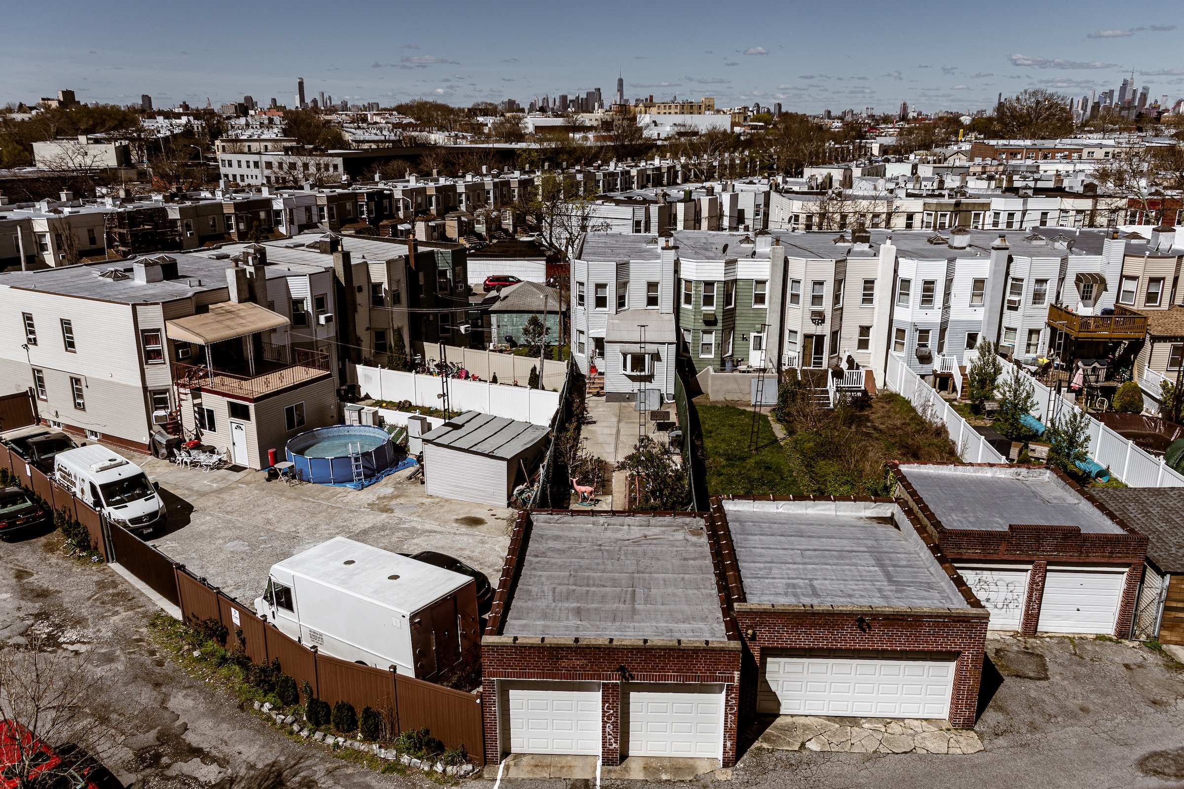
Queens is a borough of variation, adjacency, and constant transition. To photograph it is to move through a landscape where detached homes, apartment blocks, commercial strips, industrial corridors, elevated tracks, quiet residential streets, cemetery expanses, waterfront edges, and long transit routes all coexist within one broad urban field. More than any single skyline or landmark, Queens reveals itself through accumulation: the gradual layering of neighborhood textures, infrastructures, viewpoints, and local identities that give the borough its distinctive visual richness.
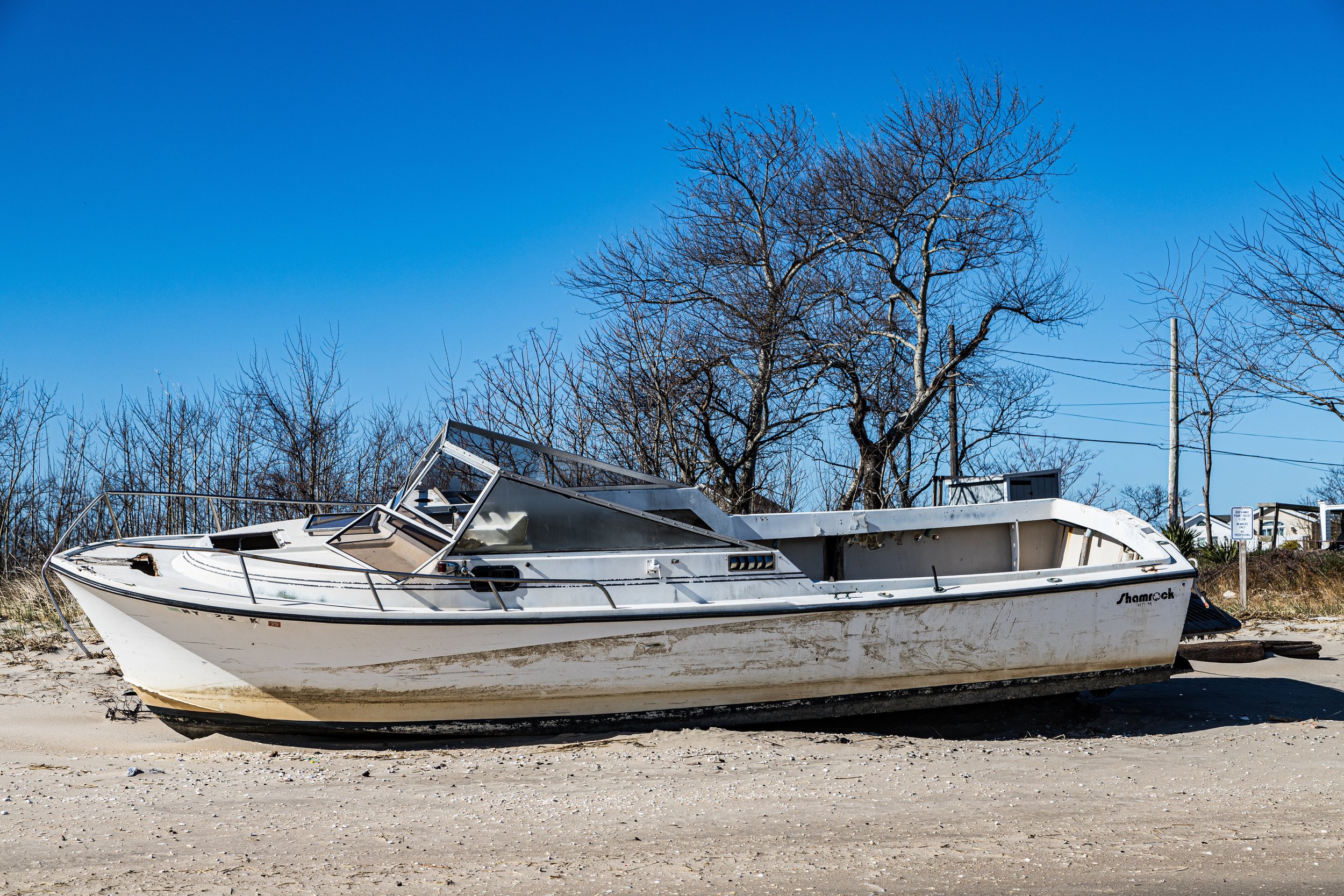
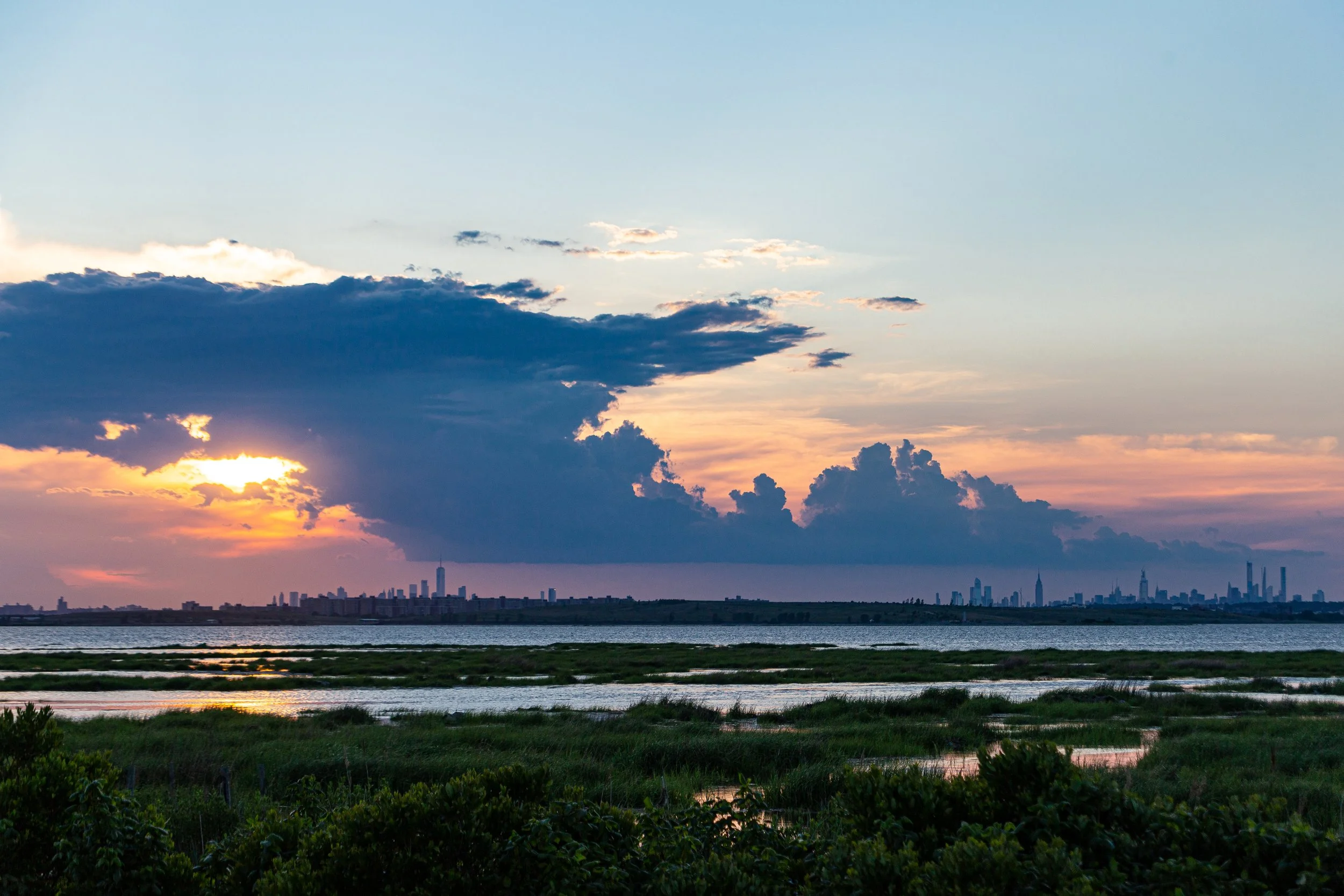
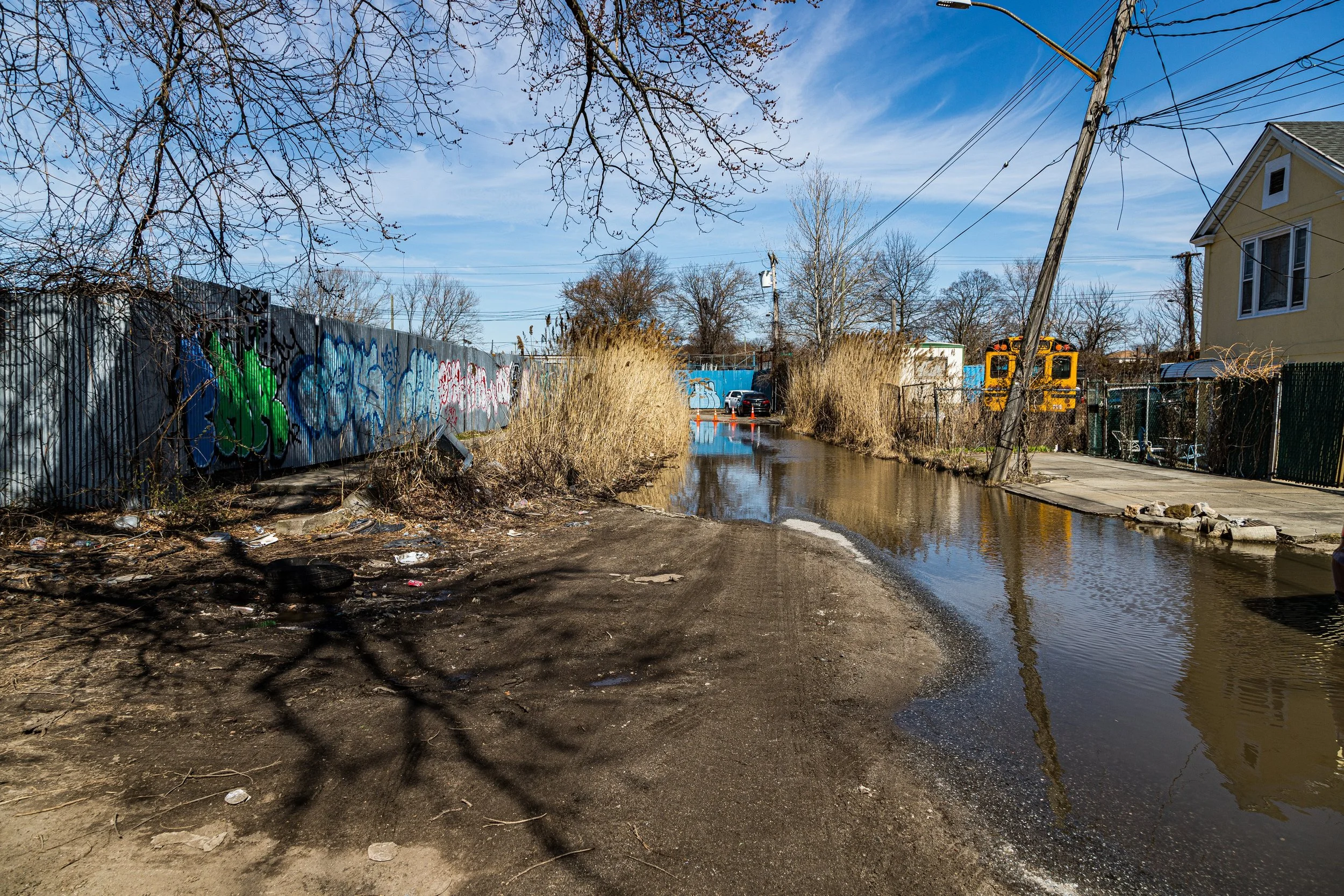
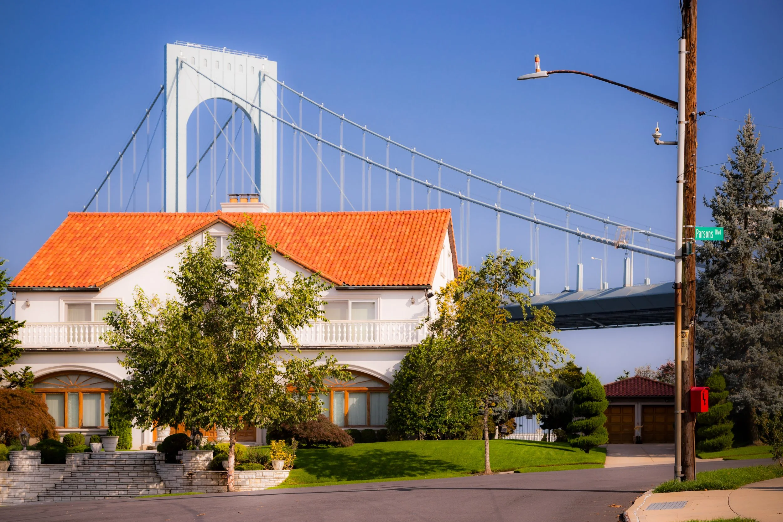
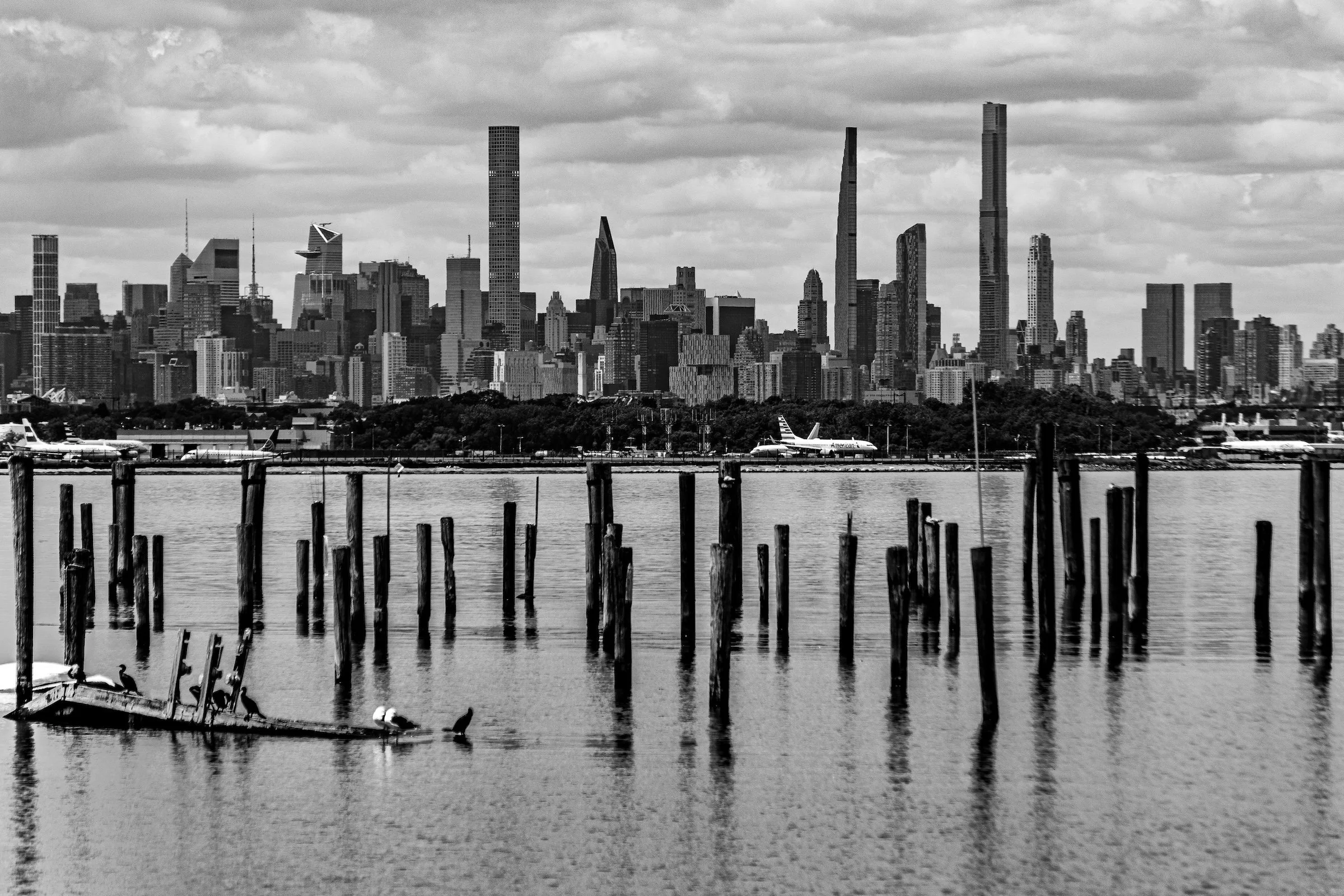
Photographically, Queens is defined by shifts in scale and atmosphere. One neighborhood may feel low-rise, leafy, and domestic, shaped by porches, fences, sidewalks, and tree canopy; another may open into rail lines, apartment corridors, broad avenues, or long industrial edges. In some places, the borough feels tightly patterned and grounded in material detail. In others, it opens suddenly into sky, water, marsh, cemetery landscape, or distant views toward Manhattan, Brooklyn, Long Island, or the harbor. This movement between enclosure and openness gives Queens much of its visual energy.
These photographs trace Queens not as a single visual identity, but as a borough of many local worlds held together by movement, layering, and neighborhood character. Some images lean toward transit lines, roadways, and directional force; others toward domestic texture, tree-lined calm, weathered surfaces, or the softer atmosphere of waterfronts and open landscapes. Taken together, they suggest a borough that is plural, spacious, and deeply inhabited: one whose character emerges not from one dominant image, but from the cumulative force of its many distinct parts.
Through the Lens
Photographing Queens means paying attention to transitions. The borough rarely insists on one visual mode for long. Streets of detached homes give way to apartment-lined avenues; commercial strips open into cemetery landscapes or park edges; elevated tracks run alongside local storefronts, industrial yards, and residential side streets. Again and again, Queens asks the eye to notice how different urban conditions meet, overlap, and coexist.
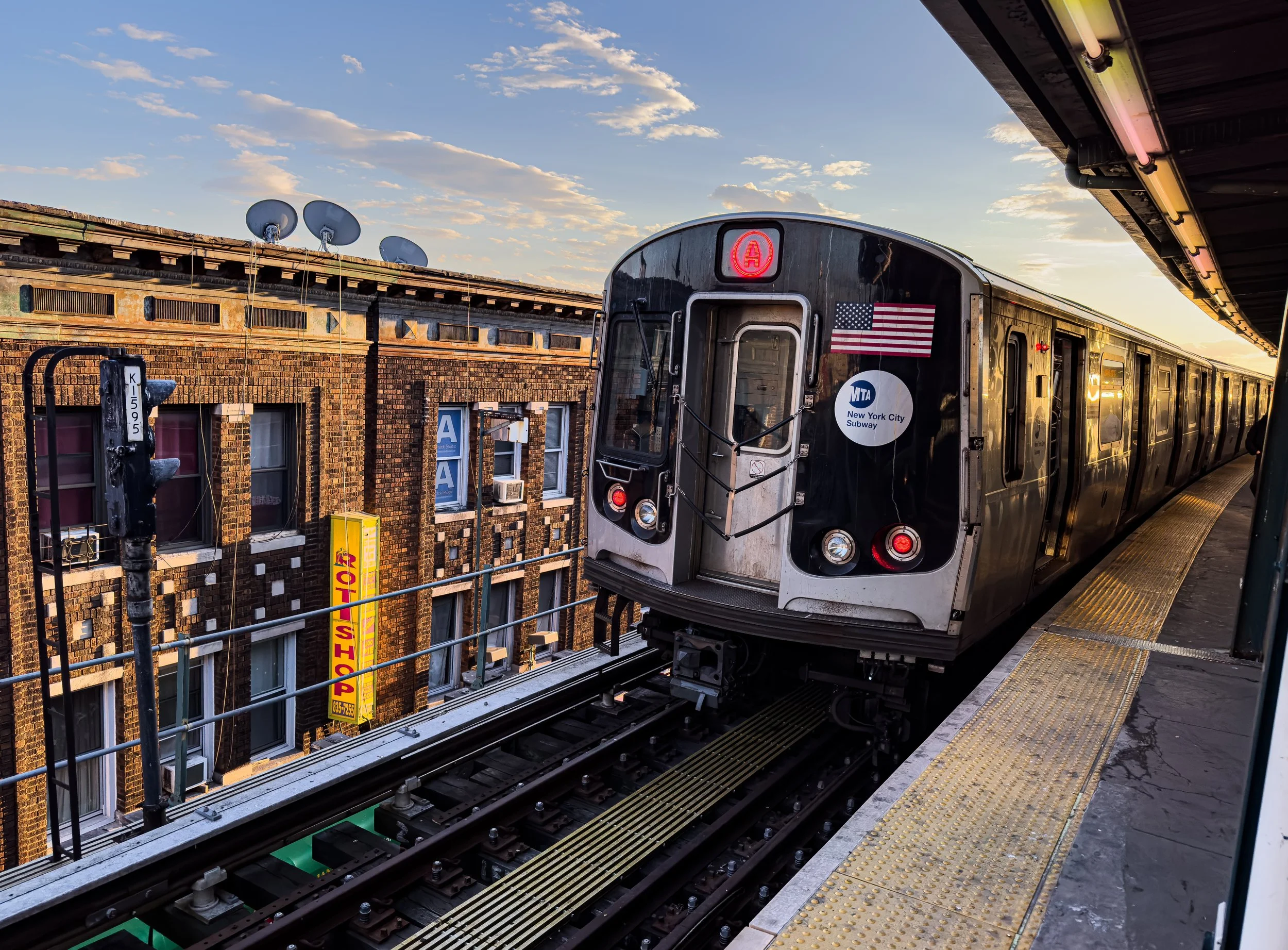
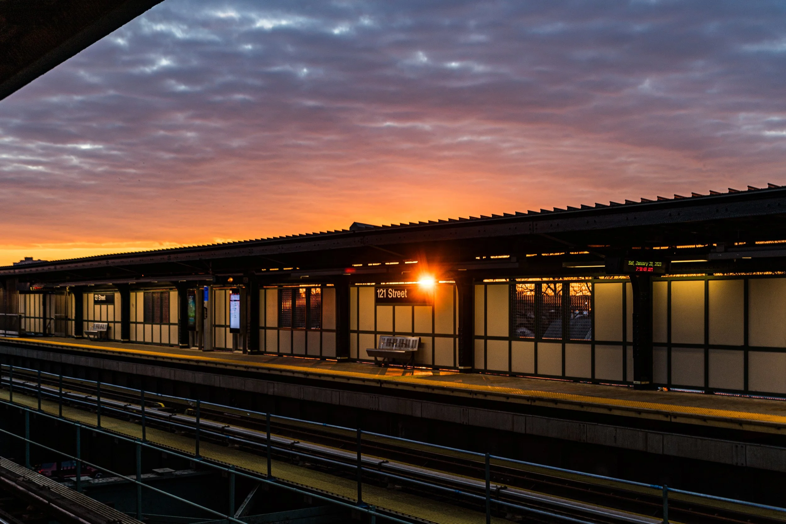
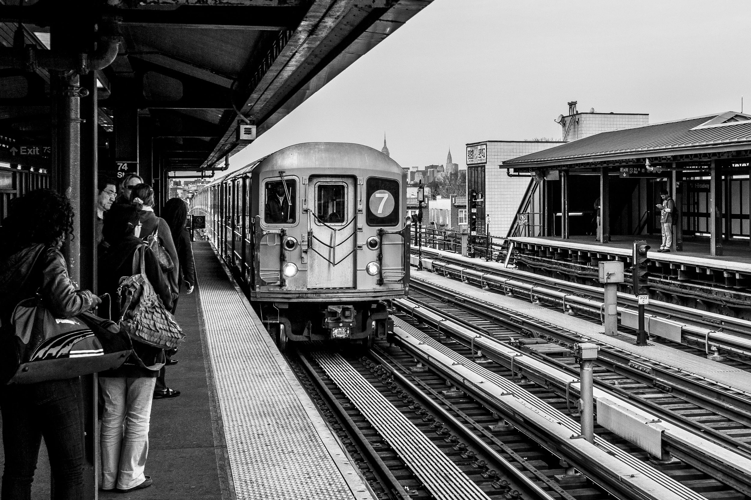
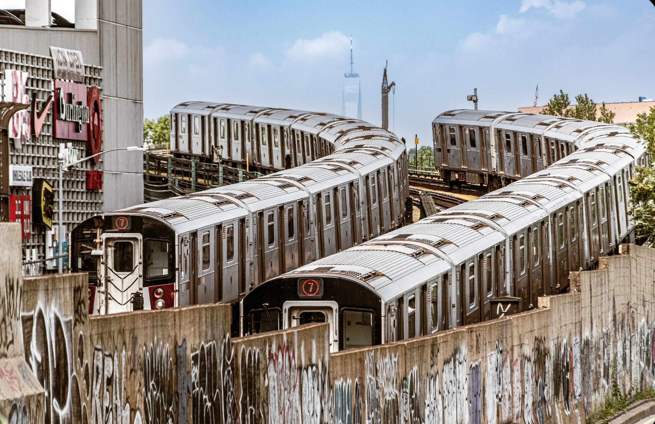
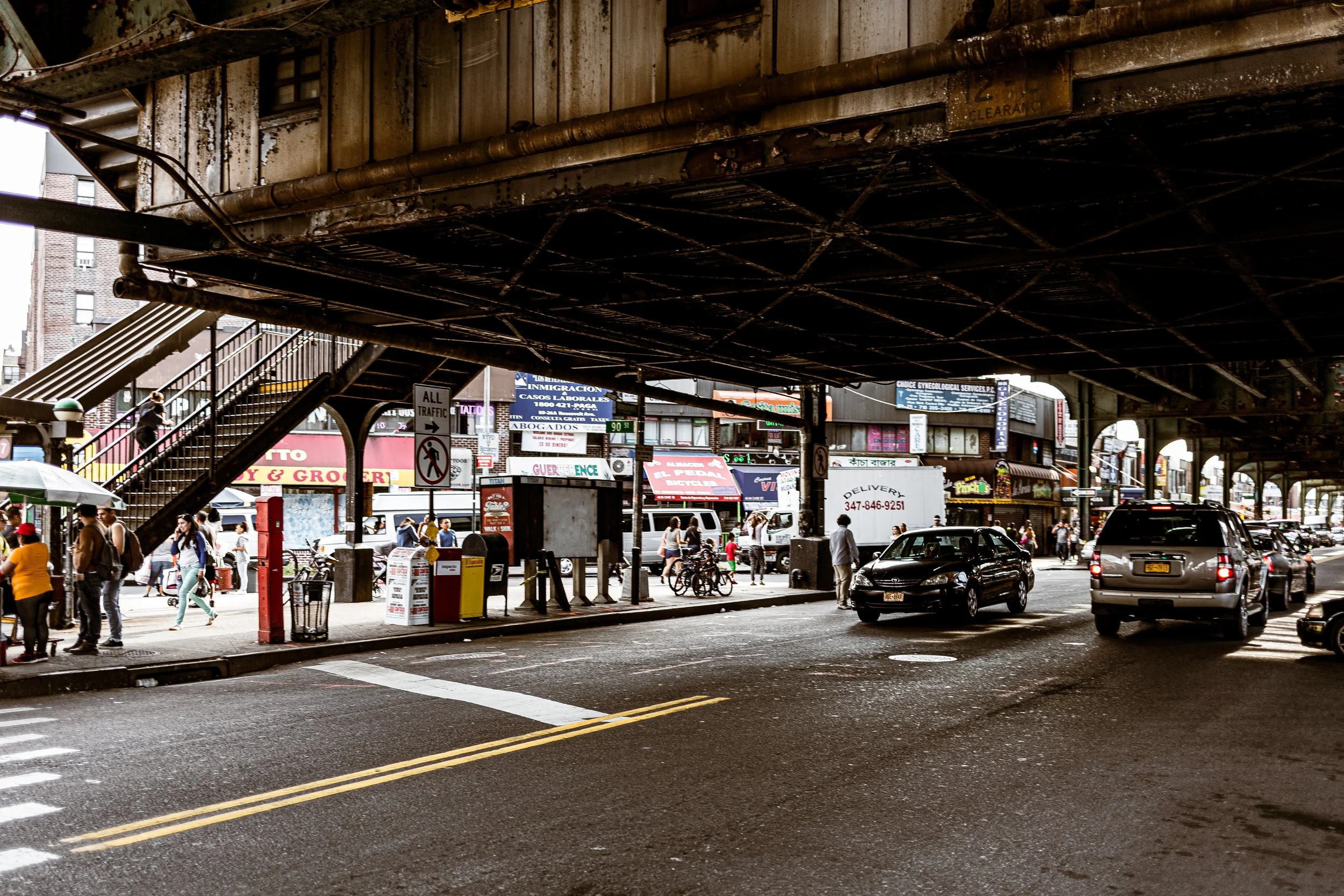
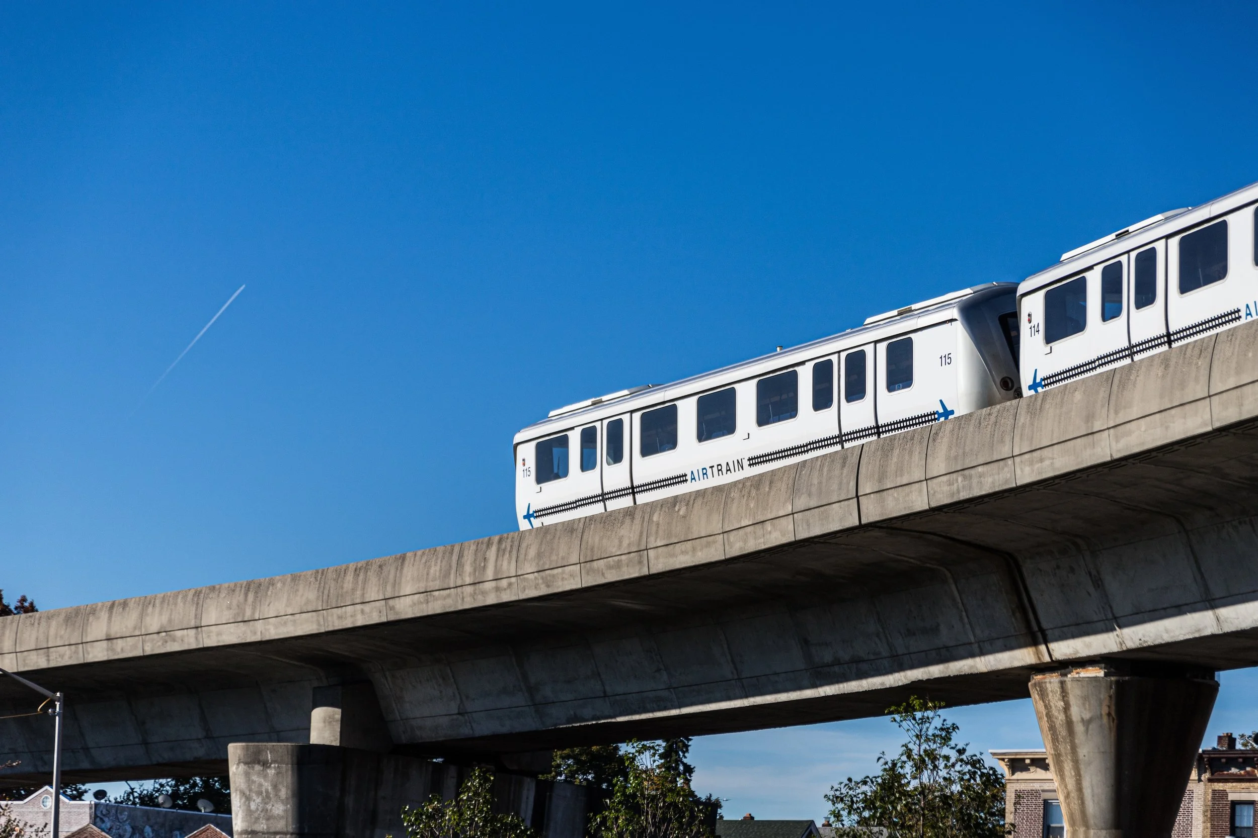
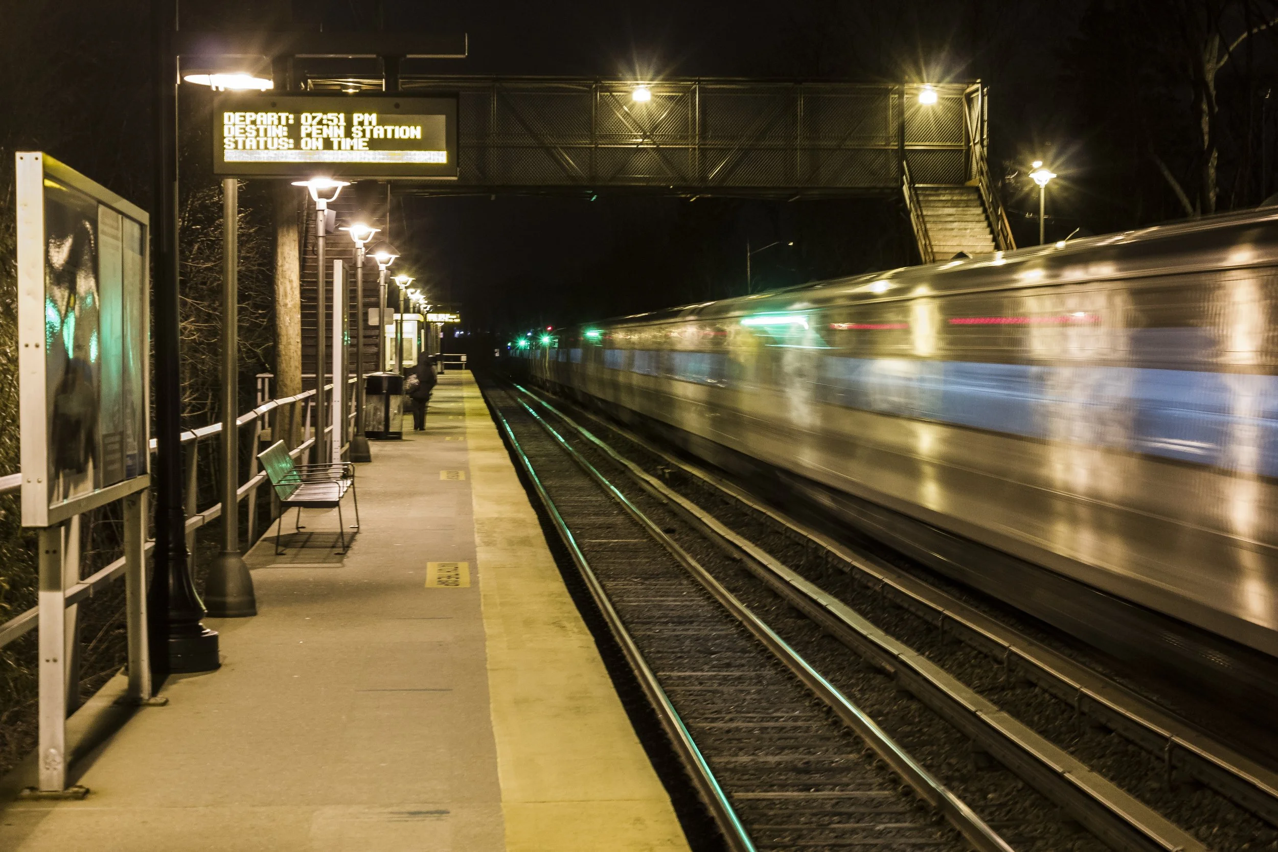
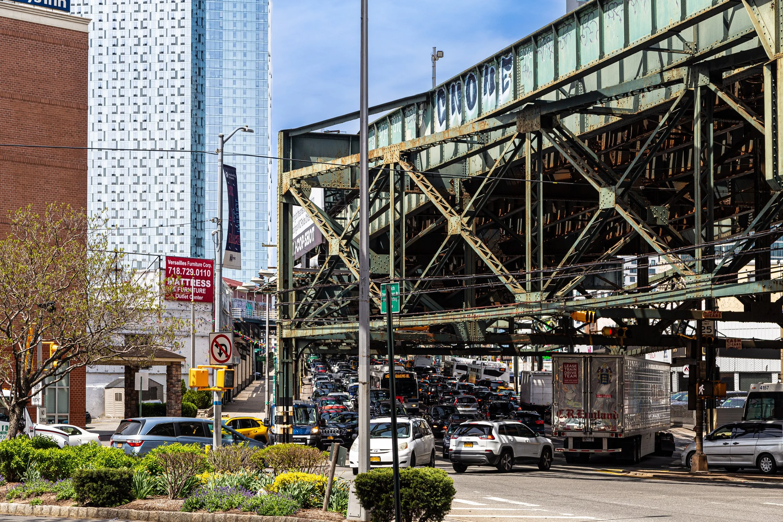
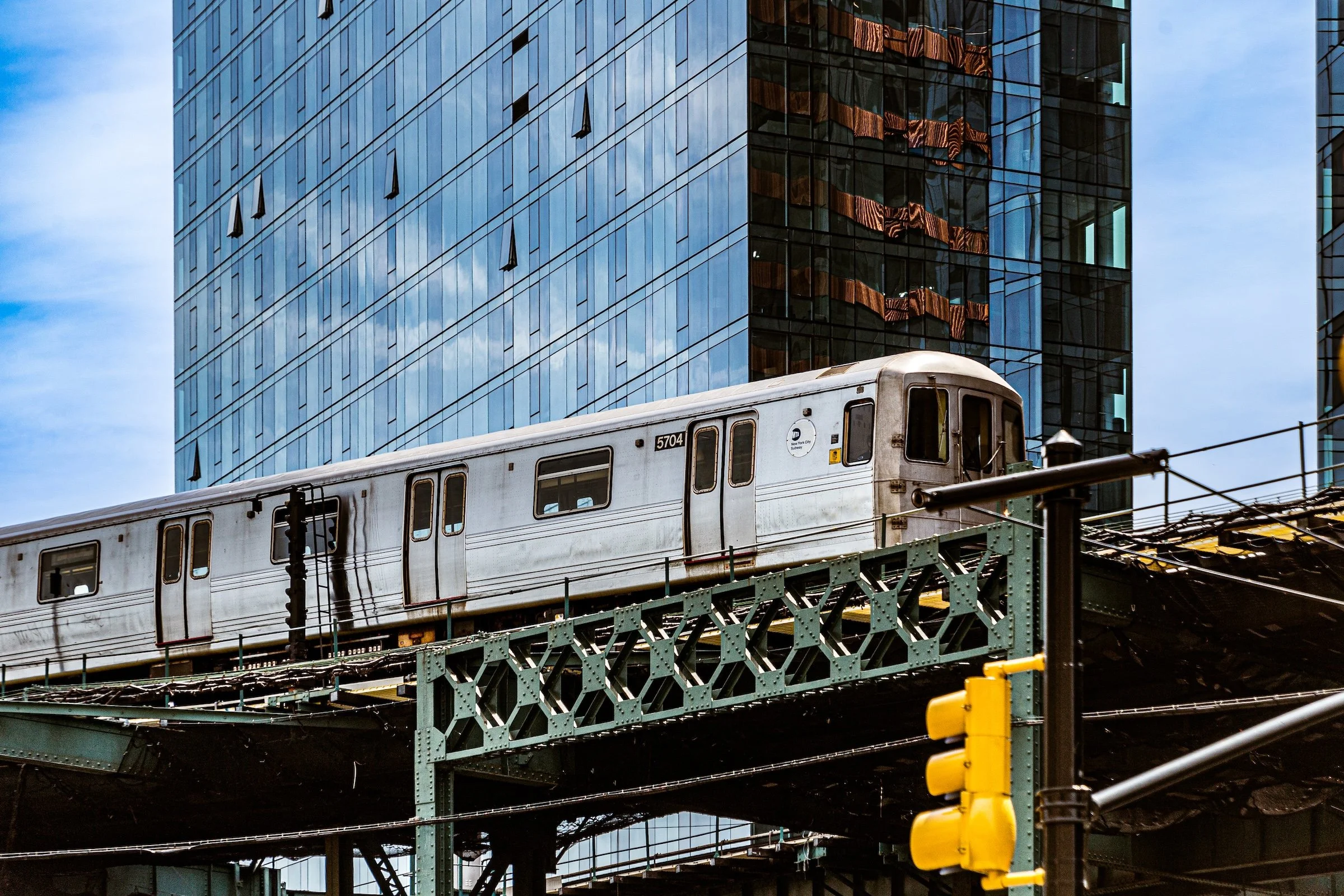
Transit plays a powerful role in that visual language. Subway platforms, train tracks, overpasses, wide roads, directional signs, and the long perspective of movement all shape the borough’s photographic character. Queens often feels less like a singular image than a sequence of linked passages: corridors, thresholds, crossings, routes, and local destinations held together by momentum and adjacency. Even stillness in Queens often feels connected to movement nearby.
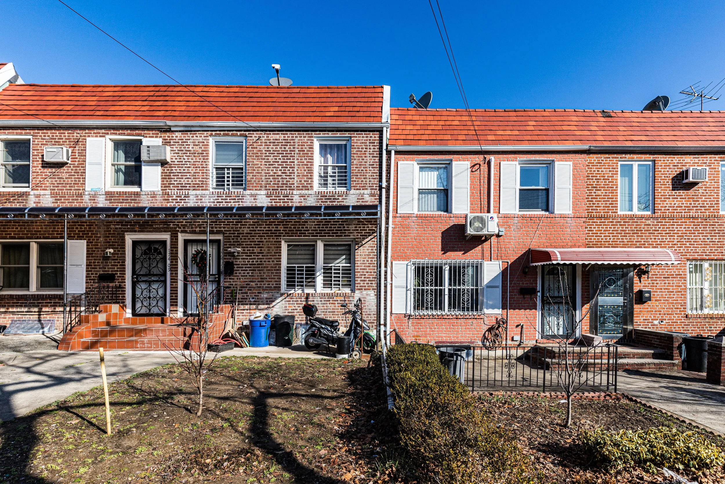
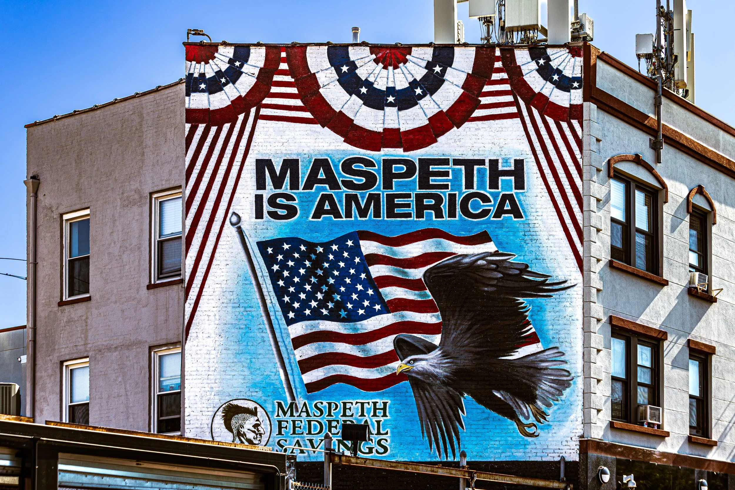
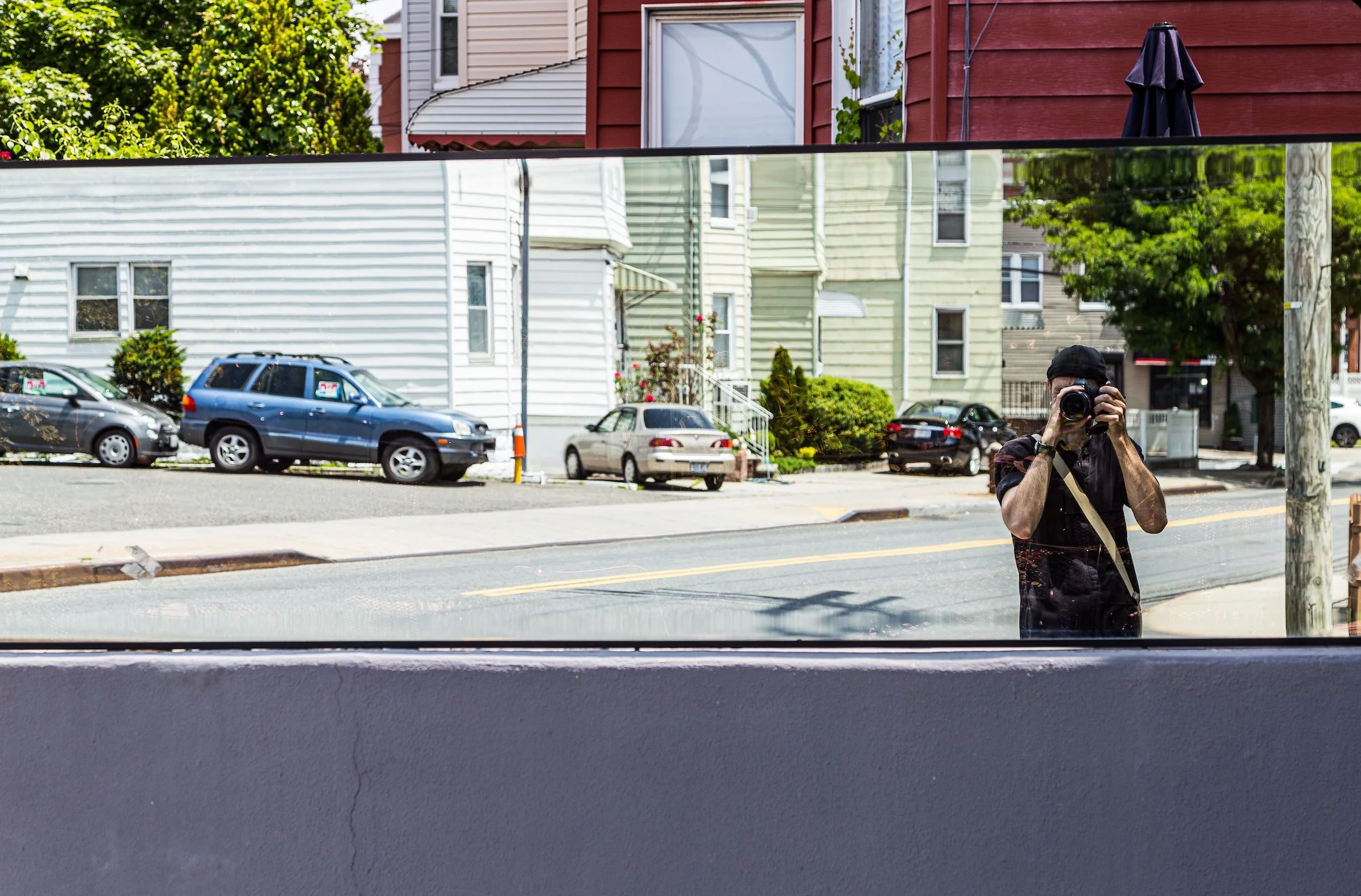
At the same time, Queens is one of the city’s most textured boroughs. Brick facades, stucco walls, awnings, utility poles, fences, murals, religious architecture, yard plantings, storefront signs, and small neighborhood details all contribute to its visual identity. Tree canopy and open sky play an especially important role, softening the built environment and creating moments of quiet release amid the borough’s denser and more infrastructural spaces. This combination of local intimacy and spatial breadth is one of Queens’s defining photographic qualities.
To photograph Queens, then, is not simply to document landmarks or dramatic views. It is to notice the borough’s layered ordinariness: how neighborhoods change block by block, how transit and domestic life coexist, how open space interrupts density, and how the borough’s identity emerges through rhythm, variation, and lived continuity.

Visual Highlights
This selection reflects several of Queens’s defining photographic qualities: transit corridors and subway platforms, broad streets and neighborhood signage, tree-lined residential blocks, detached homes and apartment buildings, waterfront horizons, cemetery landscapes, underpasses, civic architecture, industrial remnants, and long views shaped by movement and distance.
Some images emphasize Queens as a borough of routes and connections — train tracks, roads, directional signage, overpasses, and corridors of motion. Others focus more closely on neighborhood texture: facades, homes, fences, leafy streets, small details, and local materials that give individual districts their own visual atmosphere. Together, these photographs suggest a borough of unusual breadth: one that moves fluidly between domestic calm, infrastructural force, and open, atmospheric distance.
Fieldwork Across the Borough
These photographs are part of an ongoing effort to document Queens through repeated walks, neighborhood visits, and close visual attention to both its major corridors and its quieter local streets. Rather than isolating only the iconic or highly recognizable, this work approaches Queens as a lived borough: one of neighborhood distinctions, transit routes, domestic streetscapes, shorelines, institutional landscapes, and continually shifting spatial character.
As the archive continues to grow, this section will expand to include fuller fieldwork logs, neighborhood-based highlights, seasonal returns, and more detailed visual pathways through the borough. Over time, it will serve not only as a gallery of selected work, but as an evolving record of how Queens looks, feels, and changes when encountered on foot and over time.
Lexicon Connections
Several recurring visual strategies and motifs emerge naturally across these Queens photographs and connect closely to the broader Photographic Lexicon.
Tracks, Roads, and Routes appears in subway platforms, elevated lines, broad avenues, overpasses, directional signage, and the long perspective of corridors shaped by movement. In Queens, infrastructure is not merely functional backdrop; it is one of the borough’s defining visual conditions.
Neighborhood Textures emerges in brickwork, siding, stucco, storefronts, fences, utility poles, awnings, porches, religious ornament, and the small accumulated details that give each part of the borough its own local atmosphere. In Queens, texture often carries identity more powerfully than monumentality.
Branches and Canopies is visible in leafy residential streets, cemetery landscapes, park edges, shaded roadways, and upward views through trees. Queens often softens its built environment with greenery, giving the borough a visual rhythm shaped as much by canopy and shadow as by architecture.
Sky, Water, and Distance appears in marshes, shorelines, inlets, reservoirs, open cemeteries, and long views toward other boroughs or the wider metropolitan horizon. Queens repeatedly opens outward, offering atmospheric release and spatial breadth within the larger city.
Layers of the Borough emerges where houses meet apartment blocks, industrial edges meet wetlands, transit corridors meet local streets, and commercial avenues give way to quieter residential pockets. Queens often reveals itself through overlap rather than singularity, with many distinct urban conditions existing side by side.
Taken together, these visual threads help define Queens as layered, spacious, and neighborhood-driven: a borough of routes, textures, canopy, openness, and shifting local worlds. As this section evolves, these motifs can be linked more directly to individual Lexicon entries, connecting Queens’s borough-wide photographic character to the broader visual language of CityNeighborhoods.
Every Queens Neighborhood:
New York City
Use this custom Google map to explore where every neighborhood in all five boroughs of New York City is located.
The Five Boroughs
One of New York City’s unique qualities is its organization in to 5 boroughs: Manhattan, Brooklyn, Queens, The Bronx, and Staten Island. These boroughs are part pragmatic administrative districts, and part vestiges of the region’s past. Each borough is an entire county in New York State - in fact, Brooklyn is, officially, Kings County, while Staten Island is, officially Richmond County. But that’s not the whole story …
Initially, New York City was located on the southern tip of Manhattan (now the Financial District) that was once the Dutch colony of New Amsterdam. Across the East River, another city was rising: Brooklyn. In time, the city planners realized that unification between the rapidly rising cities would create commercial and industrial opportunities - through streamlined administration of the region.
So powerful was the pull of unification between New York and Brooklyn that three more counties were pulled into the unification: The Bronx, Queens, and Staten Island. And on January 1, 1898, the City of New York unified two cities and three counties into one Greater City of New York - containing the five boroughs we know today.
But because each borough developed differently and distinctly until unification, their neighborhoods likewise uniquely developed. Today, there are nearly 390 neighborhoods, each with their own histories, cultures, cuisines, and personalities - and each with residents who are fiercely proud of their corner of The Big Apple.


