
BROWNSVILLE
Brooklyn
Geographic Setting
Bounded by Rockaway Parkway to the west, Eastern Parkway northwest to Fulton Street, Fulton Street east to Van Sinderen Avenue, Van Sinderen Avenue south to Linden Boulevard, and then following the rail lines southwest back to Rockaway Parkway, Brownsville occupies a wide, low-lying tract of eastern Brooklyn. It is a neighborhood defined by its history of hardship and resilience, by waves of migration and activism, and by a powerful sense of local identity that endures through generations of change.
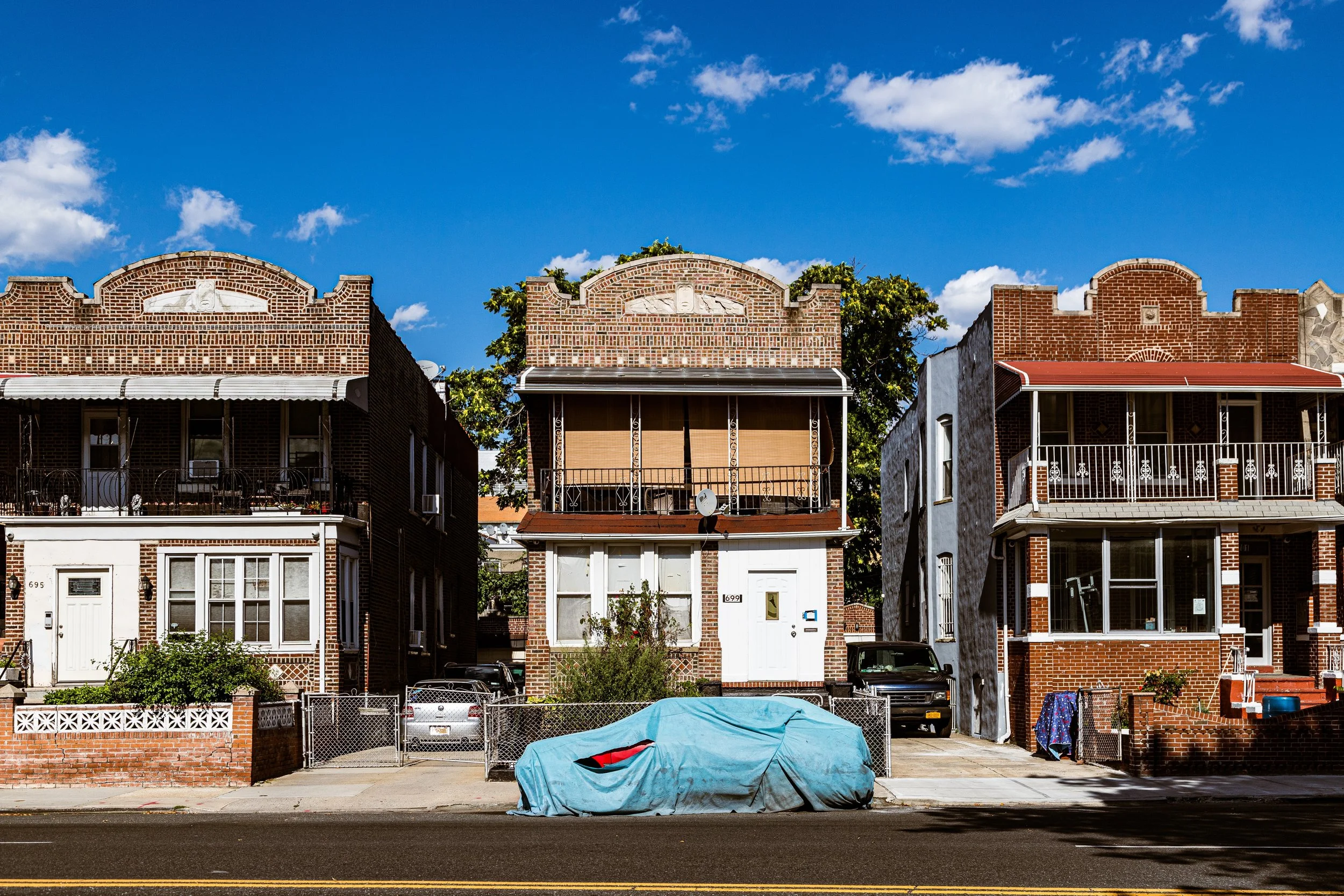
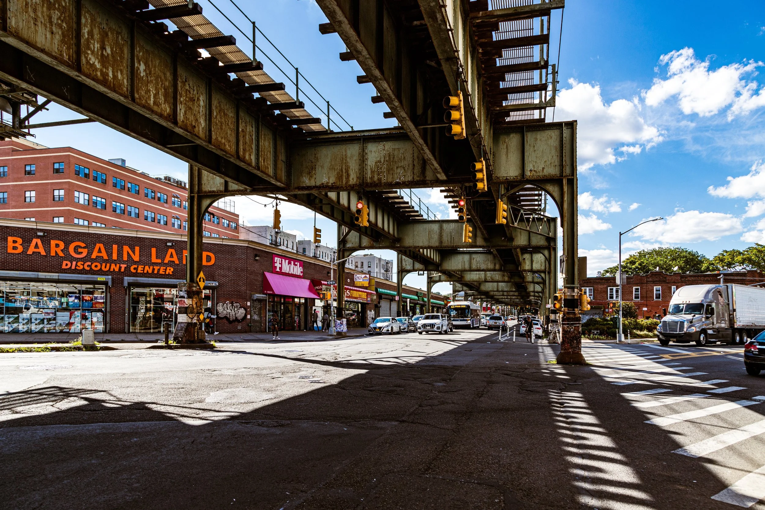
Situated between Crown Heights, East New York, and Canarsie, Brownsville is crisscrossed by major arteries—Pitkin, Sutter, and Livonia Avenues—and framed by the elevated 3 and L trains, whose rumble marks the neighborhood’s pulse. The landscape is a mix of early 20th-century tenements, postwar public housing, and modest brick rowhouses, with institutions such as Brownsville Recreation Center (Linden Boulevard) and Zion Triangle Park serving as vital public anchors. Despite long struggles with disinvestment, Brownsville possesses one of Brooklyn’s richest civic traditions, rooted in the strength of its people and their fight for dignity, housing, and opportunity.
Etymology and Origins
Brownsville takes its name from Charles S. Brown, a developer who purchased farmland here in 1865 from the Dutch-descended Vanderveer and Lott families. Originally part of the old Town of Flatbush, the area was largely rural, composed of meadows, mills, and scattered homesteads. Brown envisioned a suburban settlement and began selling small lots under the name “Brownsville” in 1867, marketing the district as an affordable refuge for working-class families priced out of central Brooklyn.
However, its remote location and limited transit connections delayed development. For several decades, Brownsville remained a patchwork of unpaved roads and wooden cottages, surrounded by farmland and brickyards. It was only with the extension of streetcar and elevated train lines in the 1890s that the area transformed—swiftly and decisively—into one of the most densely populated immigrant districts in the city.
The Neighborhood
19th Century: From Farmland to Tenement Frontier
The 1890s brought the first major wave of settlement to Brownsville. Thousands of Eastern European Jewish immigrants, displaced by rising rents in Manhattan’s Lower East Side, moved eastward across the East River in search of affordable housing and stability. Developers responded by erecting rows of four- and five-story tenements, often on narrow, irregular lots. The housing was cramped but solid, offering indoor plumbing and light courts—modest improvements over the Lower East Side’s squalor.
By 1900, Brownsville had become a bustling, self-contained urban village—its streets alive with pushcarts, tailors, and open-air markets. Pitkin Avenue emerged as its commercial spine, lined with bakeries, garment shops, and theaters. Known as the “Jerusalem of America,” Brownsville was home to dozens of synagogues, labor halls, and social clubs. Its residents, largely Jewish and working-class, were intensely communal, politically active, and devoted to education and self-improvement. Labor unions flourished, and the neighborhood became a crucible of socialist and progressive thought.
Early–Mid 20th Century: The Jewish Capital of Brooklyn
Between 1910 and 1940, Brownsville reached its demographic and cultural peak. Housing nearly 250,000 residents within two square miles, it was among the most densely populated neighborhoods in America. Yet despite poverty, Brownsville nurtured a remarkable civic vitality. Public School 125 and the Hebrew Educational Society produced generations of teachers, writers, and community leaders. Social activists like Meyer London and Baruch Charney Vladeck found their footing here, organizing tenants and garment workers into some of the most effective labor movements of the early 20th century.
The area’s architecture reflected both density and dignity—rows of brick walk-ups, corner delis, and the graceful façades of small theaters like the Loew’s Pitkin (built 1929), whose Art Deco marquee still glimmers today. The Brownsville Boys Club, founded in 1876, and Betsy Head Park, with its monumental Art Deco pool (1936), provided recreation and civic cohesion in a sea of tenements.
However, the Depression and wartime years revealed the limits of overcrowding. As Jewish families gained prosperity, many moved to new neighborhoods such as Flatbush, Borough Park, and Long Island suburbs. Their departure set the stage for one of the most dramatic demographic transitions in the city’s history.
Neighborhood Video Coming Soon
Mid–Late 20th Century: Migration, Decline, and Resistance
By the 1950s, Brownsville’s population had shifted from predominantly Jewish to predominantly African American and Caribbean, as Black families displaced by urban renewal projects in Harlem and Bedford-Stuyvesant sought affordable housing. Simultaneously, the city erected vast public housing complexes—Van Dyke Houses (1955), Langston Hughes Houses (1962), Howard Houses (1958), and others—making Brownsville home to one of the largest concentrations of public housing in the United States.
What followed was a convergence of structural inequities: redlining, industrial decline, and inadequate city investment led to high unemployment and deteriorating services. During the 1960s–1970s, Brownsville became a focal point of urban struggle. The 1968 Ocean Hill–Brownsville teachers’ strike exposed racial and political tensions over school control, while residents mobilized for safer streets, better housing, and youth programs. Leaders such as Ossie Davis, Clara Barton High School activists, and local clergy organized block associations and community boards that kept the neighborhood’s spirit intact even amid crisis.
In the 1980s–1990s, Brownsville gained a national reputation for violence and poverty, yet these years also witnessed the birth of enduring grassroots institutions—the Brownsville Multi-Service Center, Made in Brownsville, and the Pitkin Avenue Business Improvement District—that laid groundwork for renewal.
21st Century: Resilience and Reimagining
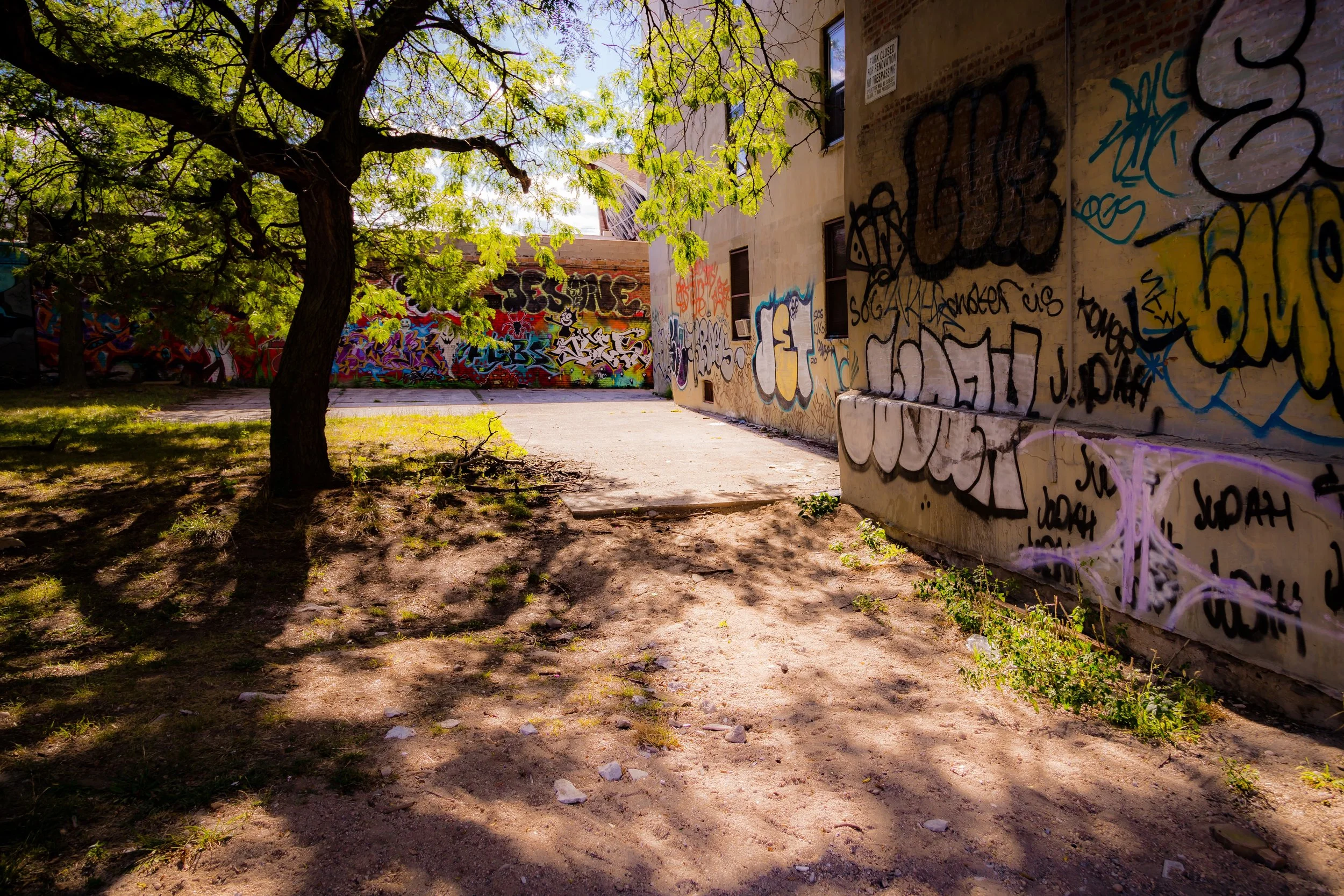
In the 21st century, Brownsville continues to evolve as a community determined to define its own future. While challenges of poverty and housing inequity persist, local initiatives have rekindled optimism and creativity. New developments, such as Marcus Garvey Village (rehabilitated 2018) and Brownsville Partnership, integrate affordable housing with public art, green space, and job programs. The Pitkin Avenue BID promotes small business growth, while murals and youth arts projects reclaim public space as expressions of pride rather than neglect.
Cultural identity remains central. Annual events like Brownsville Heritage Day and community storytelling initiatives preserve the memory of the neighborhood’s Jewish, Caribbean, and African American roots. The legacy of labor activism has found new expression in food co-ops, mentorship programs, and urban agriculture initiatives like Isabahlia Farm and the Brownsville Collaborative Middle School Garden.
Meanwhile, the Livonia Avenue corridor, long shadowed by the elevated train, is being reimagined as a greenway of housing and cultural centers linking Brownsville with East New York. Though gentrification pressure has begun to encroach from neighboring districts, Brownsville remains defined by self-determination rather than displacement.
Brownsville Photo Gallery
Spirit and Legacy
Brownsville’s legacy is one of endurance, activism, and reinvention. It has been a crucible of immigrant ambition, a battleground of social justice, and a proving ground for urban resilience. From the pushcarts of Pitkin Avenue to the picket lines of the 1930s and the youth movements of today, Brownsville’s story is the story of New York’s working-class struggle—its tragedies and triumphs intertwined.
New York City
Use this custom Google map to explore where every neighborhood in all five boroughs of New York City is located.
The Five Boroughs
One of New York City’s unique qualities is its organization in to 5 boroughs: Manhattan, Brooklyn, Queens, The Bronx, and Staten Island. These boroughs are part pragmatic administrative districts, and part vestiges of the region’s past. Each borough is an entire county in New York State - in fact, Brooklyn is, officially, Kings County, while Staten Island is, officially Richmond County. But that’s not the whole story …
Initially, New York City was located on the southern tip of Manhattan (now the Financial District) that was once the Dutch colony of New Amsterdam. Across the East River, another city was rising: Brooklyn. In time, the city planners realized that unification between the rapidly rising cities would create commercial and industrial opportunities - through streamlined administration of the region.
So powerful was the pull of unification between New York and Brooklyn that three more counties were pulled into the unification: The Bronx, Queens, and Staten Island. And on January 1, 1898, the City of New York unified two cities and three counties into one Greater City of New York - containing the five boroughs we know today.
But because each borough developed differently and distinctly until unification, their neighborhoods likewise uniquely developed. Today, there are nearly 390 neighborhoods, each with their own histories, cultures, cuisines, and personalities - and each with residents who are fiercely proud of their corner of The Big Apple.


