JAMAICA
Queens
Geographic Setting
Bounded by Linden Boulevard to the south, the Van Wyck Expressway to the west, Archer Avenue to the north, and an eastern line running along Merrick Boulevard, 109th Avenue, and 180th Street, Jamaica stands as one of Queens’ oldest, largest, and most historically significant neighborhoods. Serving as both the civic and commercial heart of southeastern Queens, it occupies a broad basin at the meeting point of major transit lines, highways, and institutions—an urban crossroads where history, commerce, and community converge.
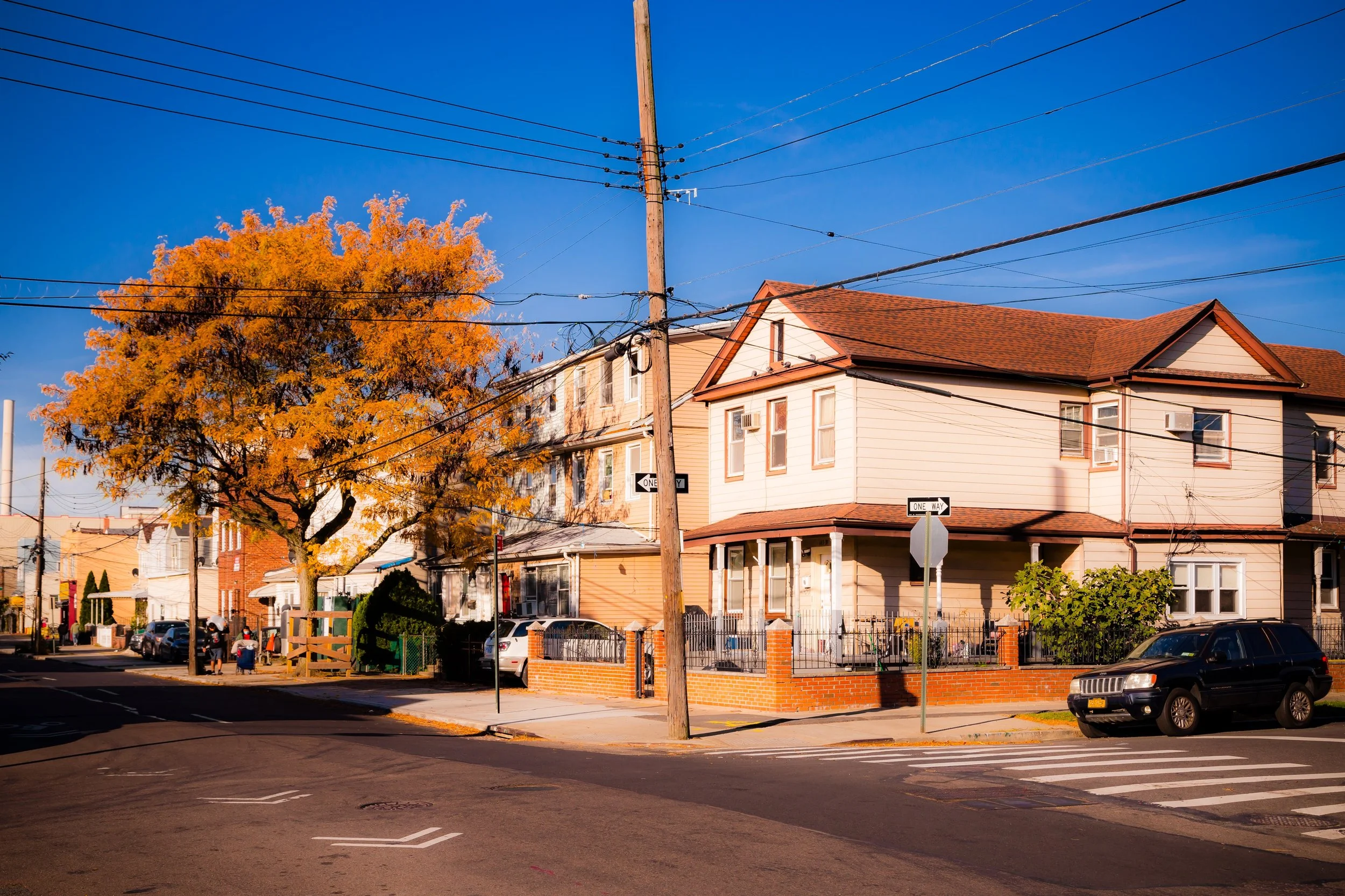
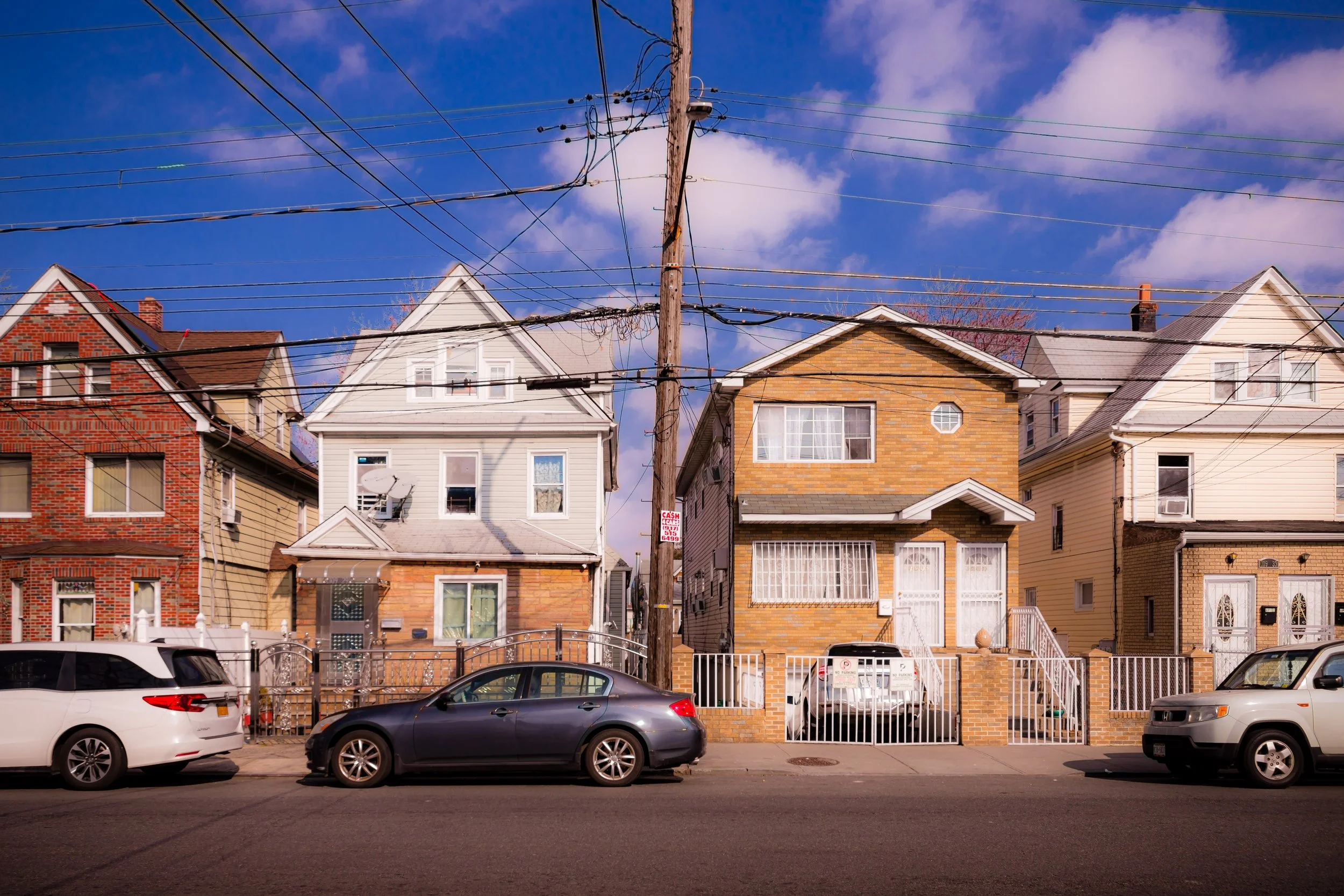
The neighborhood’s geography defines its dual identity. To the north and west, the elevated tracks of the LIRR Jamaica Station and the E, J, and Z subway lines form the nucleus of a bustling downtown core centered on Sutphin Boulevard, Jamaica Avenue, and Parsons Boulevard. Here, government offices, courthouses, and shopping corridors blend with historic churches and new glass towers. South and east of this civic core, Jamaica transforms into quieter residential districts—tree-lined blocks of single-family homes, modest rowhouses, and small apartment buildings that spread toward Hollis, South Jamaica, and St. Albans.
The neighborhood’s topography slopes gently upward from west to east, tracing the ancient path of Beaver Pond Creek and the vanished streams that once flowed toward Jamaica Bay. Today, its landscape is marked by a mix of dense urban infrastructure and green corridors such as Captain Tilly Park, Rufus King Park, and the grounds of York College, each providing rare pockets of open space within an otherwise intensely developed district.
Etymology and Origins
The name “Jamaica” derives from the word “Yameco” or “Jameco”, used by the Lenape people (the original inhabitants of Long Island) to describe the local beaver population and the waterways that sustained them. When English settlers established a village here in 1656, they adopted and anglicized the name—long before the Caribbean island of Jamaica became widely known in the English-speaking world.
The area’s early history traces to the Town of Jamaica, one of the first English settlements on Long Island, established within the Dutch colony of New Netherland. The town became a key agricultural and administrative center, its fertile soil supporting farms and mills along what are now Jamaica Avenue and Beaver Road. During the American Revolution, Jamaica was a Loyalist stronghold occupied by British troops; in the 19th century, it became a stagecoach and rail hub linking eastern Long Island with Brooklyn and Manhattan.
When Queens County was incorporated into Greater New York City in 1898, Jamaica emerged as the borough’s de facto downtown—its historic town square at Jamaica Avenue and 160th Street evolving into the civic and commercial heart of Queens.
The Neighborhood
19th–Early 20th Century: Transportation and Civic Growth
The late 19th and early 20th centuries were transformative for Jamaica. The arrival of the Long Island Rail Road (LIRR) in 1836 and the establishment of Jamaica Station as a major junction cemented its role as Long Island’s transportation crossroads. The area’s main street—Jamaica Avenue—was widened and paved, lined with department stores, theaters, and municipal buildings that gave the town an urban identity long before other parts of Queens suburbanized.
During this period, Jamaica also became the civic center of Queens County. The Queens County Courthouse (1872), King Manor (home of Founding Father Rufus King), and later the Queens Borough Public Library’s Central Branch (1930) all reinforced its prominence as a seat of government, education, and culture. The neighborhood’s population swelled as electric trolley lines and the extension of the IND Subway (E train) in the 1930s connected Jamaica directly to Manhattan.
Residential expansion followed rapidly. Streets south of Jamaica Avenue filled with Colonial Revival and Tudor-style homes built for middle-class families, while apartment buildings rose near transit corridors. Churches, schools, and civic clubs flourished, reflecting Jamaica’s growing diversity and vitality.
Mid-20th Century: Commercial Peak and Urban Challenges
By the 1950s, Jamaica had matured into a thriving downtown—the retail heart of Queens. Shoppers flocked to department stores like Gertz, Mays, and E.J. Korvette along Jamaica Avenue, while the surrounding blocks housed movie theaters, restaurants, and professional offices. The population was a tapestry of Irish-, Italian-, Jewish-, and African-American families, many drawn by affordable homes and transit access.
However, postwar suburbanization and economic shifts began to erode Jamaica’s commercial dominance. The construction of the Van Wyck Expressway (1940s–1950s) physically separated the neighborhood from its western districts, while the growth of suburban shopping malls siphoned retail activity away. By the 1970s, Jamaica faced the challenges of urban decline common across New York: disinvestment, rising vacancy rates, and social tension.
Despite these pressures, Jamaica remained a vital center for African-American and Caribbean-American life in Queens. During the Civil Rights era, local churches and organizations such as the NAACP Jamaica Branch and York College (CUNY) became hubs of activism and education. York College’s relocation to Jamaica in the 1970s revitalized the area’s academic presence, while community coalitions worked to stabilize housing and preserve historic landmarks.
Jamaica Photographic Video
Late 20th Century: Renewal and Resilience
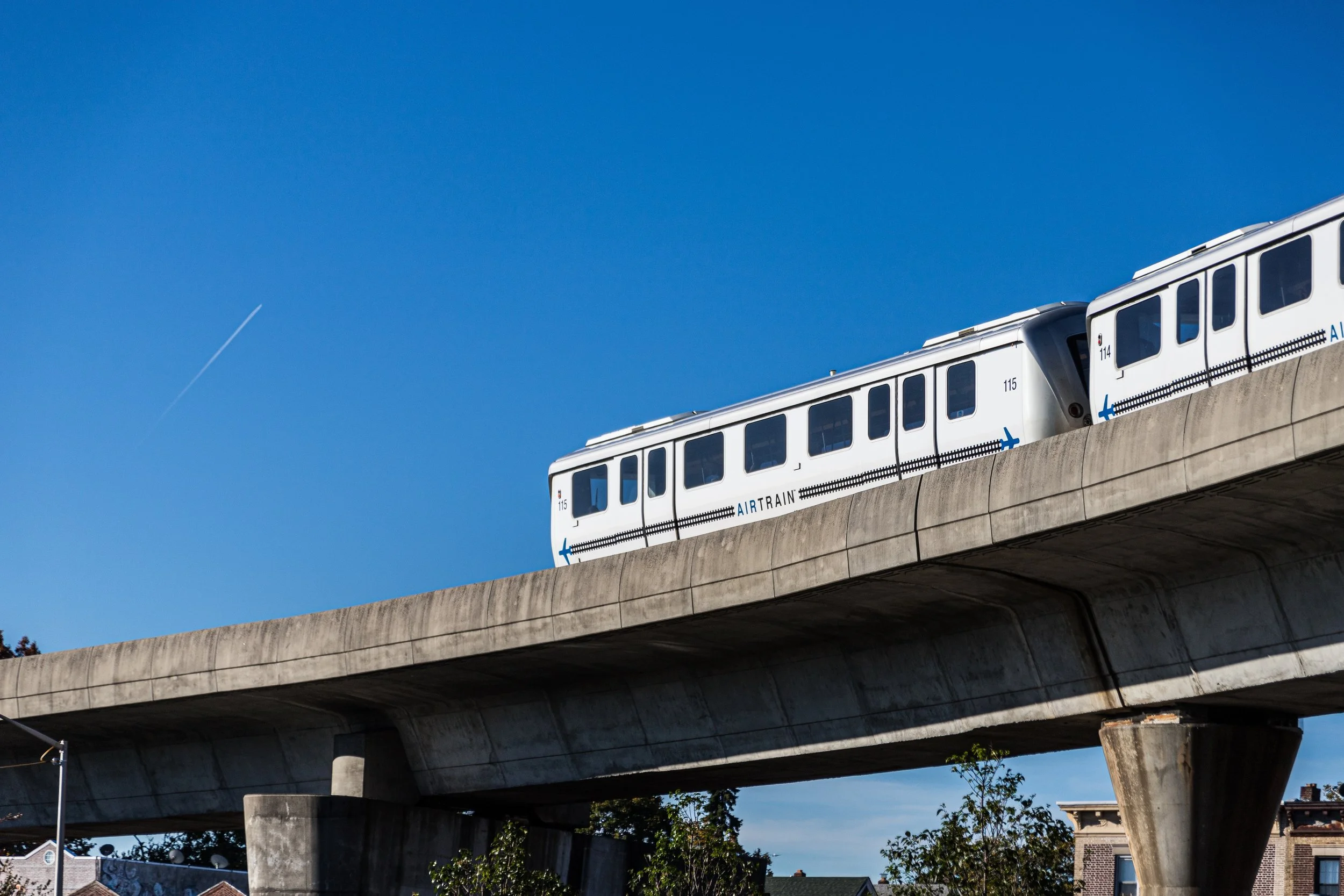
In the closing decades of the 20th century, Jamaica began a slow but steady recovery driven by community advocacy and public investment. The Jamaica Center Business Improvement District (BID), established in the 1970s, spearheaded the renovation of storefronts and public spaces along Jamaica Avenue. The Archer Avenue Extension Project (completed in 1988) modernized subway service, introducing the E, J, and Z lines into a new subterranean concourse at Sutphin Boulevard–Archer Avenue–JFK Airport Station.
This renewed connectivity, coupled with the opening of the AirTrain JFK in 2003, transformed Jamaica into a major regional transportation hub, linking Manhattan, Brooklyn, Long Island, and JFK International Airport in under 20 minutes. New civic investments followed: the Jamaica Performing Arts Center, Jamaica Market, and mixed-use developments brought fresh energy to the area.
Simultaneously, residential neighborhoods such as Addisleigh Park, South Jamaica, and Hollis continued to serve as centers of African-American homeownership and civic leadership, producing prominent figures in politics, sports, and culture—including Run-D.M.C., Russell Simmons, and Congressman Gregory Meeks.
21st Century: Urban Revival and Cultural Mosaic
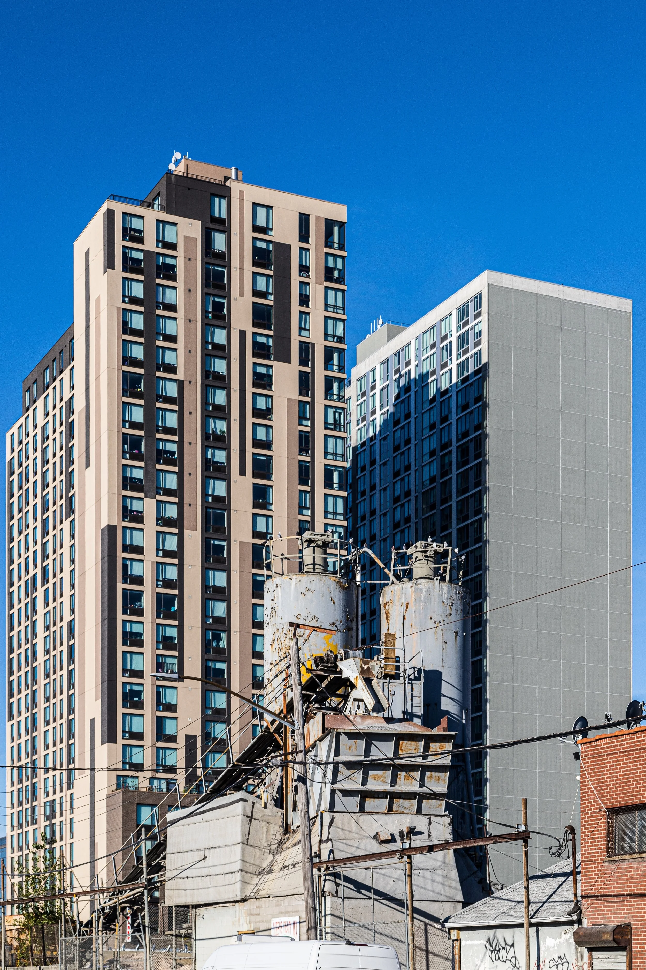
Today, Jamaica stands at the forefront of Queens’ ongoing urban transformation. New high-rise residential and mixed-use developments—particularly along Sutphin Boulevard, Archer Avenue, and Parsons Boulevard—are reshaping the skyline. The Downtown Jamaica Redevelopment Initiative, launched in the early 2000s, has attracted millions in public and private investment, funding new housing, retail, hotels, and cultural spaces.
Yet even amid this modernization, Jamaica’s historic and cultural character endures. Rufus King Park remains the green heart of the community, while landmarks such as the King Manor Museum and First Presbyterian Church of Jamaica preserve links to its colonial past. The Central Library of Queens Public Library continues to serve as one of the most visited in the United States, reflecting the neighborhood’s intellectual and civic vitality.
Jamaica’s population today mirrors the borough’s diversity: African-American, Caribbean, Bangladeshi, Guyanese, Latino, and South Asian communities coexist, enriching the neighborhood’s cuisine, language, and faith traditions. Jamaica Avenue’s street life—vendors selling food, clothing, and jewelry alongside chain stores and global eateries—captures the pulse of a neighborhood that remains dynamic, adaptive, and authentically urban.
Jamaica Photo Gallery
Spirit and Legacy
Jamaica’s legacy is that of a city within a city—a place where New York’s history and future meet. From colonial crossroads to commercial capital, from decline to revitalization, its story embodies the resilience and renewal that define Queens itself. It remains a place of firsts and continuities: the borough’s civic birthplace, a hub of Black entrepreneurship, and a modern transit gateway linking millions of travelers to the wider world.
New York City
Use this custom Google map to explore where every neighborhood in all five boroughs of New York City is located.
The Five Boroughs
One of New York City’s unique qualities is its organization in to 5 boroughs: Manhattan, Brooklyn, Queens, The Bronx, and Staten Island. These boroughs are part pragmatic administrative districts, and part vestiges of the region’s past. Each borough is an entire county in New York State - in fact, Brooklyn is, officially, Kings County, while Staten Island is, officially Richmond County. But that’s not the whole story …
Initially, New York City was located on the southern tip of Manhattan (now the Financial District) that was once the Dutch colony of New Amsterdam. Across the East River, another city was rising: Brooklyn. In time, the city planners realized that unification between the rapidly rising cities would create commercial and industrial opportunities - through streamlined administration of the region.
So powerful was the pull of unification between New York and Brooklyn that three more counties were pulled into the unification: The Bronx, Queens, and Staten Island. And on January 1, 1898, the City of New York unified two cities and three counties into one Greater City of New York - containing the five boroughs we know today.
But because each borough developed differently and distinctly until unification, their neighborhoods likewise uniquely developed. Today, there are nearly 390 neighborhoods, each with their own histories, cultures, cuisines, and personalities - and each with residents who are fiercely proud of their corner of The Big Apple.


