
SUGAR HILL
Manhattan
Geographic Setting
Bounded by West 145th Street to the south and West 155th Street to the north, and stretching from Amsterdam Avenue eastward to Edgecombe Avenue, Sugar Hill crowns the high western plateau of Harlem—a commanding terrace overlooking the Harlem River Valley and the Bronx beyond. Its elevation offers sweeping views and breezes that have shaped its allure for more than a century. Set within northern Hamilton Heights, the district is defined by leafy blocks, elegant rowhouses, and apartment buildings perched above the winding course of St. Nicholas Place and Edgecombe Avenue, where terraces descend toward St. Nicholas Park and City College’s neo-Gothic towers rise to the south.
Architecturally cohesive yet richly varied, Sugar Hill’s streetscape features Renaissance Revival, Romanesque, and Beaux-Arts townhouses interspersed with grand prewar apartment buildings. Convent Avenue, St. Nicholas Avenue, and Edgecombe Avenue carry its quiet traffic, while pocket parks, church spires, and the rhythmic brownstone stoops lend the neighborhood its enduring dignity. Its name—evocative and melodic—has long symbolized aspiration and achievement, earned as much through its physical beauty as through the cultural heights reached by those who called it home.
Etymology and Origins
The name “Sugar Hill” arose during the 1920s Harlem Renaissance, coined by Black residents to describe the neighborhood’s “sweet life” —a place of affluence, grace, and success, where Harlem’s professional and creative elite came to live “up on the hill.” The phrase was both literal and metaphorical: the area’s higher ground made it cooler and breezier than the lowlands below, while its social elevation represented a triumph over the racial and economic barriers that constrained Black life elsewhere in the city.
Before this cultural flowering, the hill had been known simply as part of Hamilton Heights, itself named for Alexander Hamilton, whose country estate, The Grange, once stood nearby. In the 19th century, the area’s commanding topography attracted wealthy New Yorkers seeking suburban serenity within the expanding city grid.
The Neighborhood
19th Century: From Country Heights to Elegant Enclave
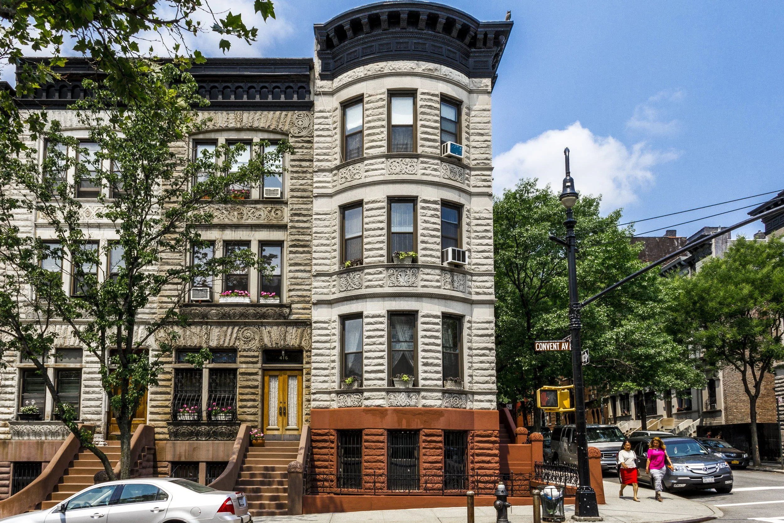
During the late 1800s, as the northern reaches of Manhattan were subdivided for urban development, Sugar Hill’s high terrain was prized for its air and views. The Manhattan Streetcar extension (1886) and later the elevated rail lines along Eighth Avenue (1893) opened the area to residential builders. Rows of brownstone and limestone townhouses rose along Convent Avenue, West 147th through 152nd Streets, and St. Nicholas Place, designed by architects such as William Grinnell, John Hauser, and Clarence True. Their façades—elaborate with turrets, bay windows, and cornices—reflected the stylistic exuberance of the Gilded Age.
At the crest of St. Nicholas Place, the Morris-Jumel Mansion (1765)—Manhattan’s oldest surviving house and a former Revolutionary War headquarters—stood as a historical anchor, connecting the new neighborhood to the city’s colonial past. By the 1890s, Sugar Hill was home to a comfortable white middle and upper-middle class, drawn by the tranquility of the hill and its proximity to the burgeoning City College campus. Street names like Edgecombe and St. Nicholas Terrace suggested both refinement and distance from the urban tumult below.
Early 20th Century: Harlem’s Ascent and the Great Migration
The demographic transformation that would define Sugar Hill began in the 1910s–1920s, as Harlem emerged as the epicenter of Black life in America. Restrictive housing elsewhere in the city, coupled with the Great Migration from the South, drove upwardly mobile Black professionals northward. As wealthier white residents departed, African American doctors, educators, and artists purchased or rented the handsome townhouses and apartments that defined the hilltop.
By the 1920s, Sugar Hill had become synonymous with achievement. Its residents included W. E. B. Du Bois, civil-rights leader and editor of The Crisis; Thurgood Marshall, future Supreme Court Justice; and musical legends such as Duke Ellington, Cab Calloway, and Count Basie. The hill’s reputation inspired songs like “Take the ‘A’ Train”—whose opening line, “You must take the A train, to go up to Sugar Hill way up in Harlem,” immortalized it as both destination and dream.
While Harlem’s nightlife thrived along Lenox and Seventh Avenues, Sugar Hill was its residential soul—a place of family, respectability, and pride. Sunday mornings brought elegant churchgoers to St. James Presbyterian, Mother A.M.E. Zion, and St. Philip’s Episcopal churches, while afternoons filled the parks with music and conversation. The neighborhood’s very name became shorthand for success within Black America.
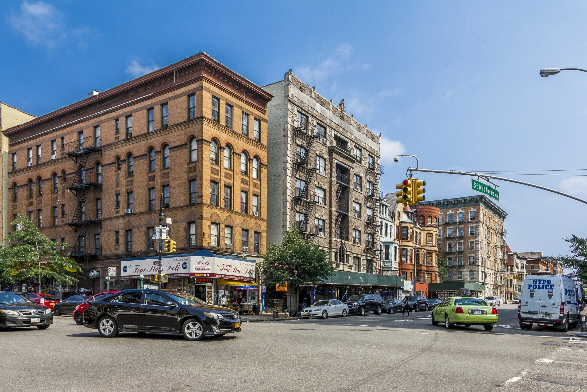
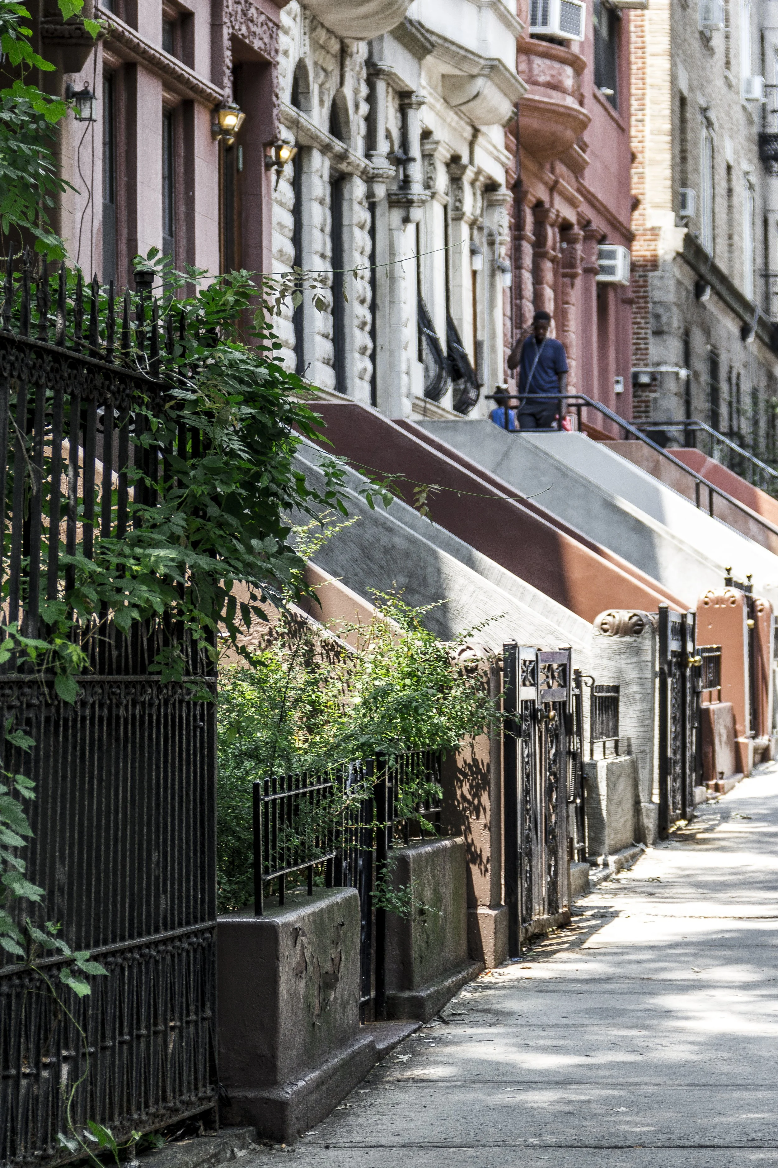
Sugar Hill Photographic Tour
Mid–Late 20th Century: Preservation and Perseverance
The postwar decades brought challenge as well as change. Urban disinvestment, redlining, and the decline of city services in the 1960s–1970s strained even Sugar Hill’s solid foundations. Yet compared to many parts of Harlem, the neighborhood’s strong housing stock and deep-rooted community helped preserve its fabric. Families who had lived there for generations—teachers, postal workers, ministers, and musicians—maintained their homes through difficult times.
Community activism flourished: the Sugar Hill Neighborhood Association formed to protect architectural integrity and advocate for city investment. Preservationists, recognizing the area’s historical significance, secured designation of the Sugar Hill Historic District in 2000, encompassing more than 400 structures between 145th and 155th Streets and Amsterdam to Edgecombe Avenues. This recognition formalized what residents had long known—that Sugar Hill was not merely a neighborhood, but a cultural landmark of national importance.
During the same period, new generations of artists and civic leaders emerged, inspired by the hill’s legacy of excellence. The Dance Theatre of Harlem, founded by Arthur Mitchell nearby in 1969, embodied the area’s ongoing contribution to Black artistic achievement.
21st Century: Heritage, Housing, and Cultural Continuity
Today, Sugar Hill retains the architectural grandeur and cultural pride that first gave it its name. Restored brownstones, tree-lined avenues, and panoramic river views make it one of northern Manhattan’s most sought-after addresses. While gentrification pressures have increased property values, the community continues to champion affordable housing and local culture. The Sugar Hill Children’s Museum of Art & Storytelling (opened 2015 at 155th Street and St. Nicholas Avenue) integrates art, education, and neighborhood history in a striking contemporary building by David Adjaye, symbolizing a bridge between past and future.
The C–B and A trains still glide beneath the hill, linking it directly to the downtown avenues once celebrated in jazz. Street murals, block parties, and heritage tours sustain the rhythm of community life, while historic churches and schools anchor continuity. Visitors come to admire the architecture; residents stay for the sense of belonging—a continuity of aspiration that transcends decades.
Sugar Hill Photo Gallery
Spirit and Legacy
Sugar Hill’s essence lies in its name: sweetness earned, not given. It represents the summit of Harlem’s story—geographically elevated, culturally ascendant, and morally grounded. From its brownstone stoops came the poets, jurists, and bandleaders who redefined American art and conscience. Its enduring grace lies not only in its limestone cornices or leafy avenues, but in the conviction that beauty and excellence belong to everyone who seeks them.
New York City
Use this custom Google map to explore where every neighborhood in all five boroughs of New York City is located.
The Five Boroughs
One of New York City’s unique qualities is its organization in to 5 boroughs: Manhattan, Brooklyn, Queens, The Bronx, and Staten Island. These boroughs are part pragmatic administrative districts, and part vestiges of the region’s past. Each borough is an entire county in New York State - in fact, Brooklyn is, officially, Kings County, while Staten Island is, officially Richmond County. But that’s not the whole story …
Initially, New York City was located on the southern tip of Manhattan (now the Financial District) that was once the Dutch colony of New Amsterdam. Across the East River, another city was rising: Brooklyn. In time, the city planners realized that unification between the rapidly rising cities would create commercial and industrial opportunities - through streamlined administration of the region.
So powerful was the pull of unification between New York and Brooklyn that three more counties were pulled into the unification: The Bronx, Queens, and Staten Island. And on January 1, 1898, the City of New York unified two cities and three counties into one Greater City of New York - containing the five boroughs we know today.
But because each borough developed differently and distinctly until unification, their neighborhoods likewise uniquely developed. Today, there are nearly 390 neighborhoods, each with their own histories, cultures, cuisines, and personalities - and each with residents who are fiercely proud of their corner of The Big Apple.


