Geographic Setting
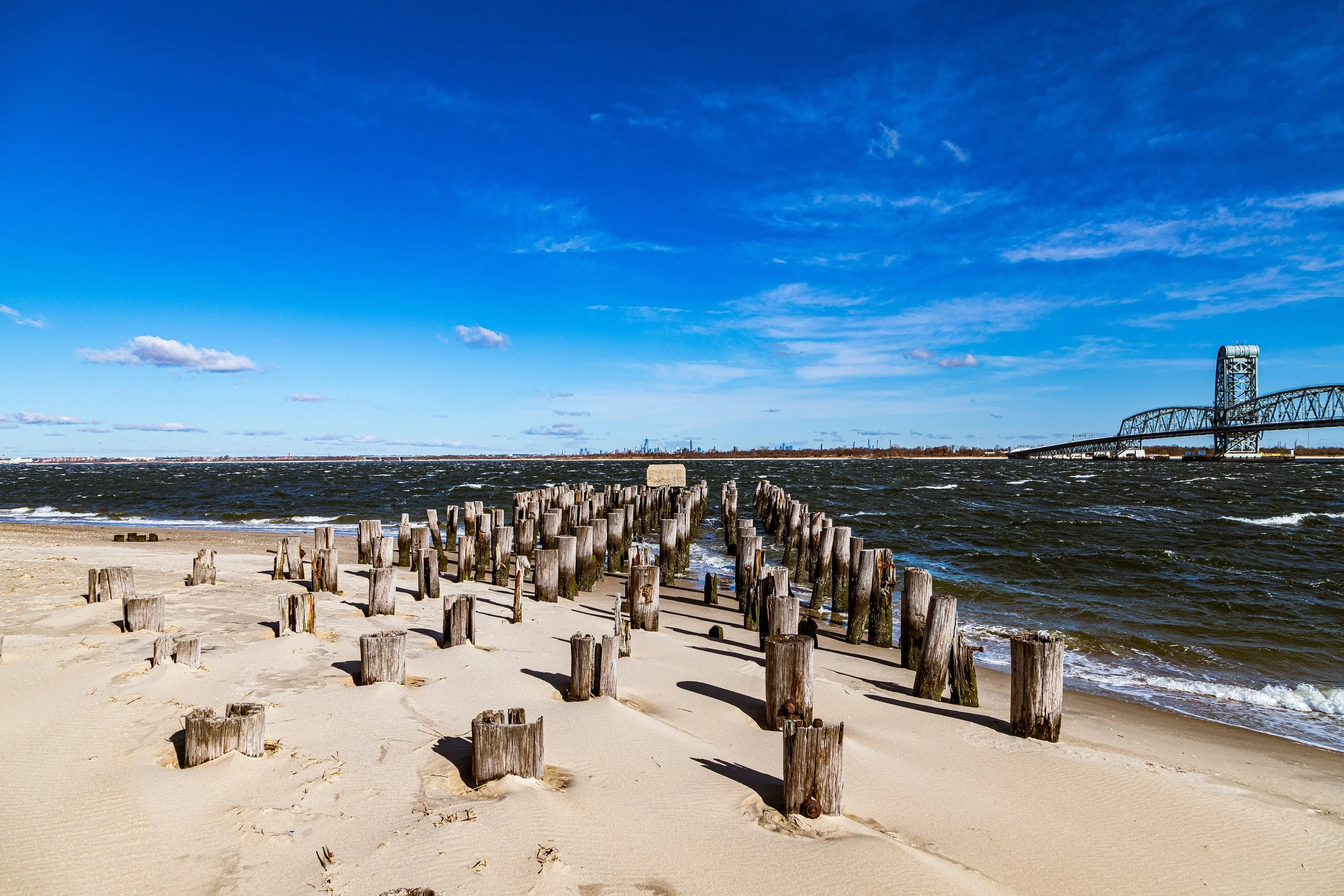
Occupying the broad, windswept western end of the Rockaway Peninsula, Fort Tilden and Jacob Riis Park together form one of New York City’s most striking coastal landscapes—a vast expanse where dunes, sea grass, and surf meet remnants of fortifications and early 20th-century architecture. The combined area stretches from Breezy Point Tip eastward to roughly Beach 149th Street, bordered by the Atlantic Ocean to the south and Jamaica Bay to the north. The Marine Parkway–Gil Hodges Memorial Bridge connects the site to Brooklyn’s Floyd Bennett Field, forming part of the Gateway National Recreation Area, a national park system that unites land and sea across borough boundaries.
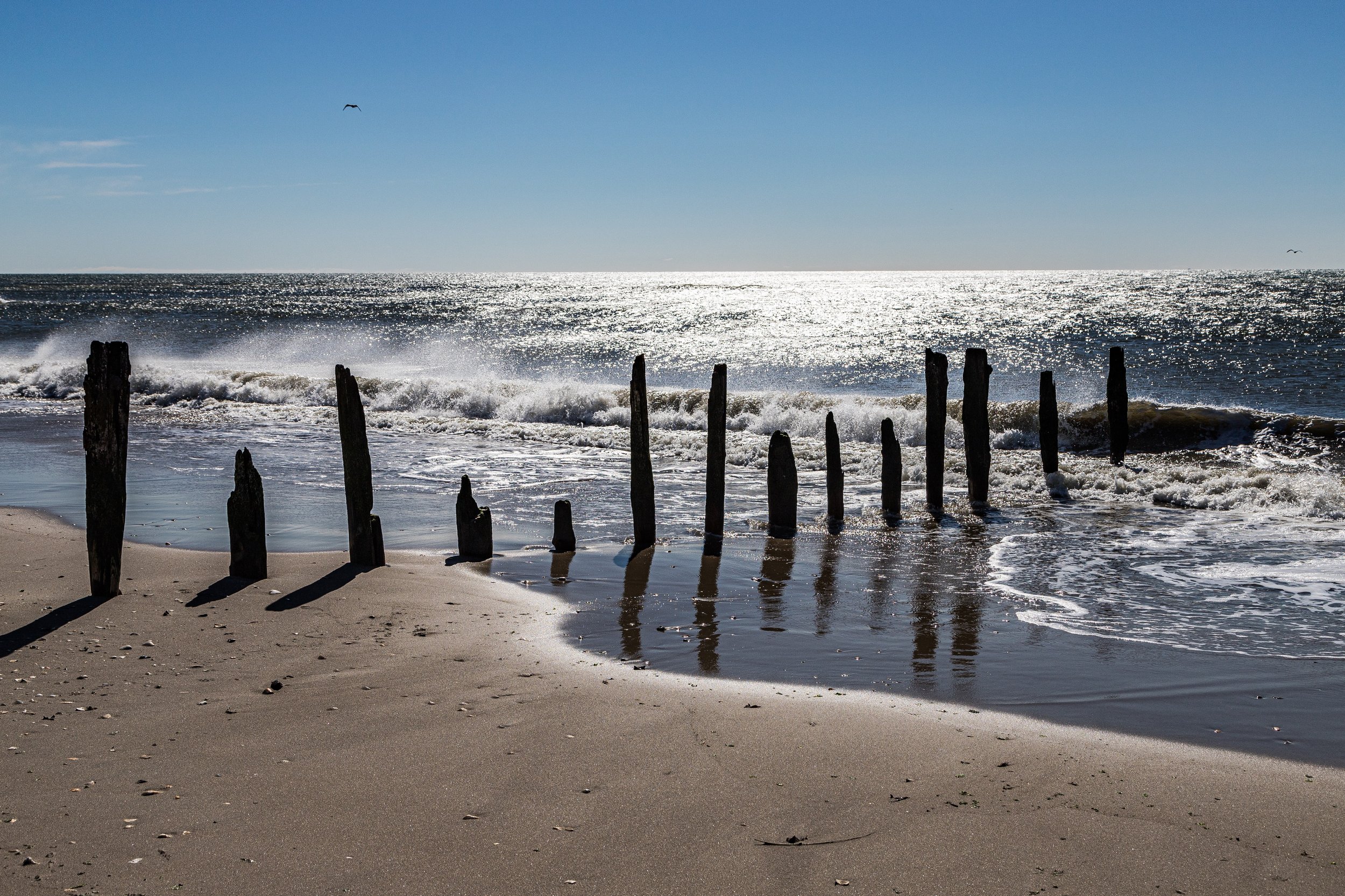
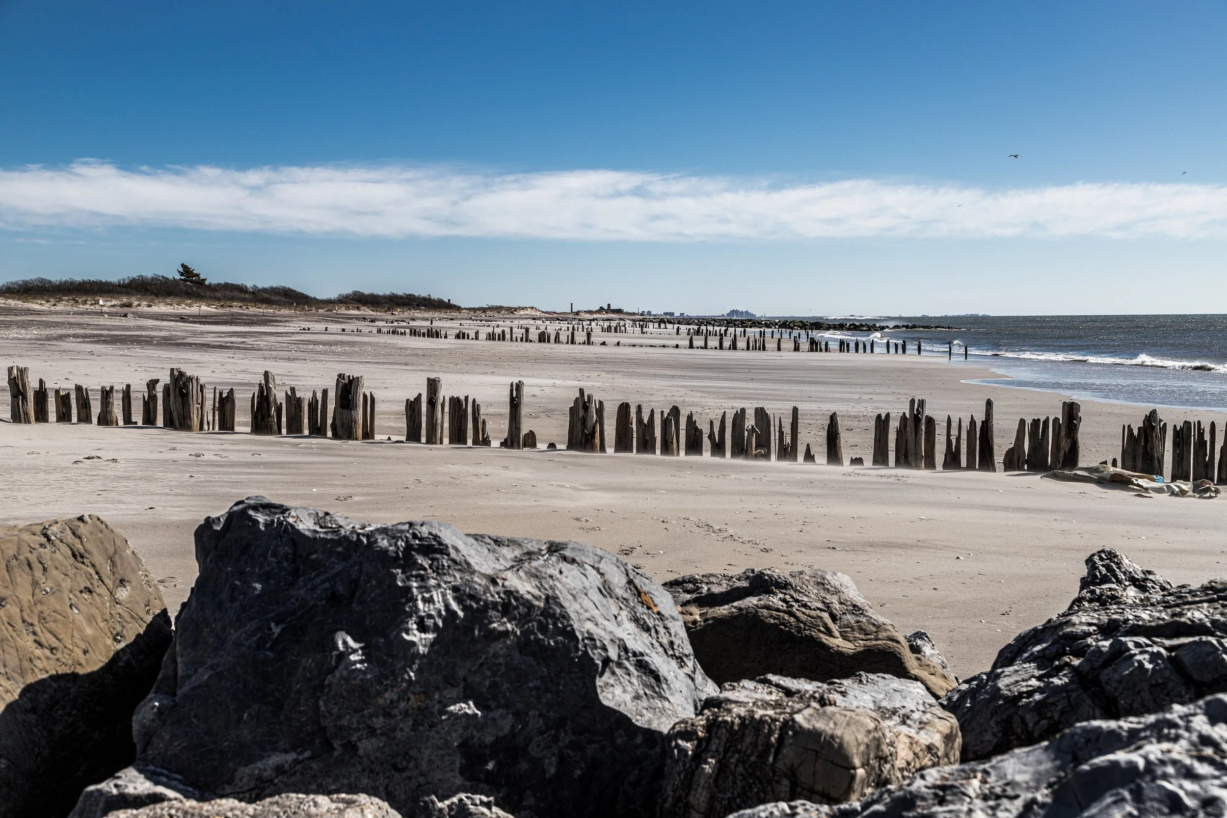
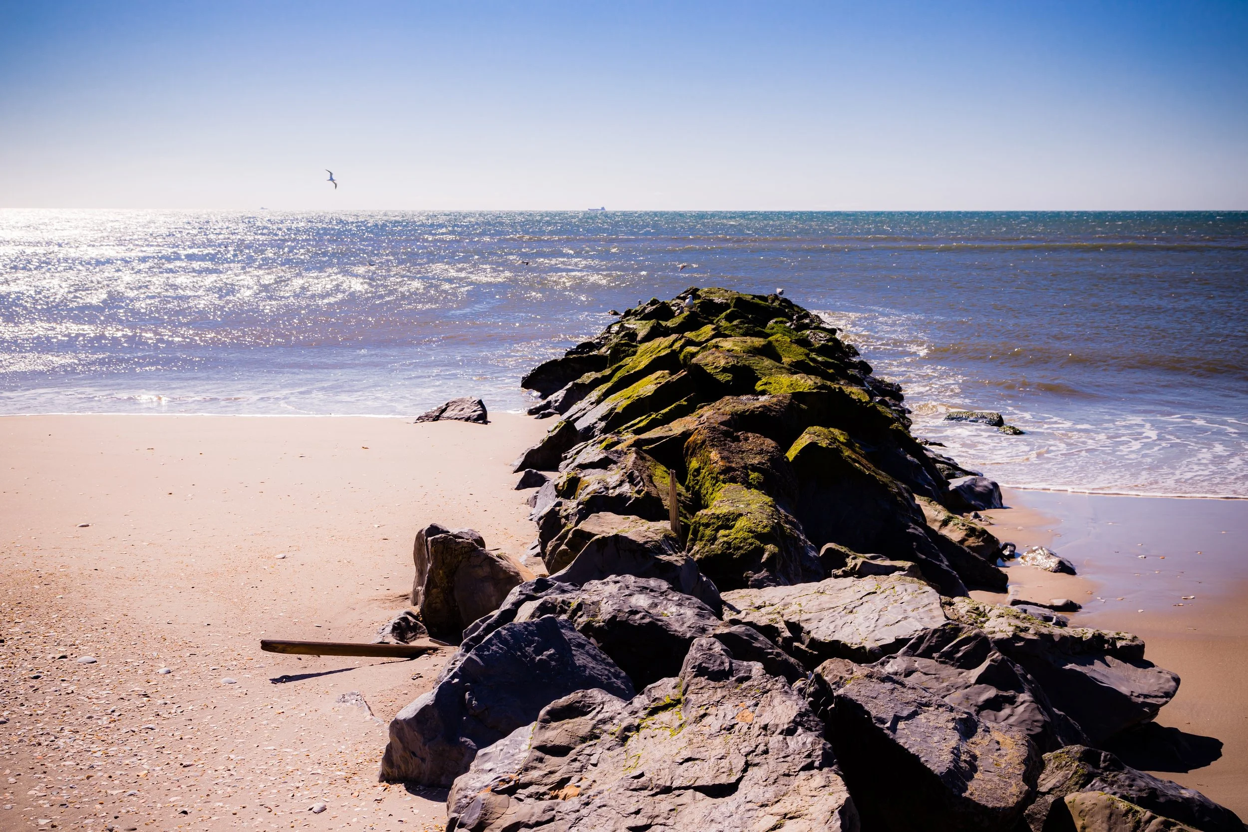
Here, the geography tells the story: barrier dunes shaped by Atlantic winds, tidal wetlands along the bay, and a shoreline that alternates between wild serenity and structured recreation. Riis Park’s bathing beaches and Art Deco bathhouse open onto wide sandy expanses, while Fort Tilden’s overgrown bunkers and artillery batteries rest quietly beneath maritime forest, their concrete softened by decades of salt and sun.
Etymology and Origins
The two names enshrine different legacies. Fort Tilden, established in 1917, honored Samuel J. Tilden, the former New York governor and reform-minded presidential candidate of 1876. It was built as a coastal defense installation to protect New York Harbor during World War I. Jacob Riis Park, created in 1932, commemorates the pioneering photojournalist and social reformer Jacob A. Riis, whose writings and photographs exposed urban poverty and championed public access to recreation and sunlight—values realized in this very stretch of seashore.
The Neighborhood
19th Century–Early 20th Century: From Wild Shore to Public Vision
Before development, this peninsula was a raw landscape of dunes and tidal marshes known as Rockaway Point. Sparse settlements dotted the area, accessible mainly by boat. The U.S. government first surveyed the site in the late 19th century for its strategic potential as a harbor defense position guarding the entrance to New York Bay. With the approach of World War I, construction began on Fort Tilden (1917) as part of the Harbor Defenses of New York.
Massive concrete batteries, observation towers, and underground magazines were installed among the dunes, camouflaged by vegetation. During both world wars, Fort Tilden housed coastal artillery and later Nike missile installations that formed part of the Cold War defense network. The fort’s position—facing open ocean with sweeping visibility—made it both militarily and symbolically vital.
Meanwhile, just to the east, city planners under Robert Moses envisioned a grand public beachfront. In the early 1930s, land was acquired for what became Jacob Riis Park, designed as the “People’s Beach” to provide working-class New Yorkers with access to the Atlantic. Opened in 1932, the park’s monumental Art Deco bathhouse, designed by Aymar Embury II, and its long, geometrically precise boardwalk reflected the modernist ideals of health, sunlight, and egalitarian leisure.
Mid-20th Century: Defense and Recreation Side by Side
Throughout the 1940s and 1950s, Fort Tilden remained an active military base, upgraded for anti-aircraft defense with radar towers and Nike missile silos. The juxtaposition of soldiers drilling beside vacationers on the neighboring beach created a uniquely American scene—national security sharing the horizon with sunbathers and children.
Jacob Riis Park thrived in these decades as one of the city’s most popular beaches. Expansive parking fields, concession arcades, and playgrounds accommodated thousands each weekend. The park embodied the democratic promise of Moses’s park system: ocean air within reach of subway riders via the IND Rockaway Line and city buses. Nearby, the smaller Breezy Point Cooperative emerged as a private residential enclave, while Fort Tilden’s barracks and radar domes watched silently over the shoreline.
Fort Tilden-Jacob Riis Video Coming Soon
Late 20th Century: Abandonment and Rebirth
Fort Tilden was decommissioned in 1974, its military purpose rendered obsolete by changing technology. Its vast acreage—still dotted with concrete bunkers and radar towers—was transferred to the National Park Service and incorporated into the newly created Gateway National Recreation Area (1972). Nature quickly reclaimed the site: dunes stabilized, maritime forests of bayberry and cedar flourished, and migratory birds returned to nest along the beaches. The fort’s ruins became haunting monuments to both war and wilderness.
Jacob Riis Park likewise entered a new phase under federal stewardship. Though attendance waned in the city’s turbulent 1970s and 1980s, community groups and preservationists fought for its restoration. The bathhouse, listed on the National Register of Historic Places, underwent partial rehabilitation, while portions of the boardwalk and lifeguard stations were rebuilt following storms and neglect.
21st Century: Preservation, Ecology, and Renewal
Today, Fort Tilden and Jacob Riis Park form complementary halves of a single coastal narrative. Fort Tilden’s trails lead visitors through meadows and dunes to secluded beaches favored by artists, birdwatchers, and solitude-seekers. The Rockaway Artists Alliance, housed in former military buildings, curates exhibitions that merge art with landscape. The Breezy Point Tip, nearby, serves as a wildlife refuge for piping plovers and horseshoe crabs, emblematic of the region’s environmental renewal.
Jacob Riis Park, by contrast, has regained its civic energy. Restoration of its Art Deco bathhouse (ongoing since 2017) and revitalization of the Riis Park Bazaar have transformed the boardwalk into a vibrant weekend destination, drawing diverse crowds from across the city. Lifeguard towers gleam again in summer sunlight, and the horizon once patrolled by soldiers now hosts kite surfers and families picnicking beneath the same vast sky.
Fort Tilden-Jacob Riis Photo Gallery
Spirit and Legacy
Together, Fort Tilden and Jacob Riis Park embody New York’s dialogue between defense and leisure, history and renewal. They tell of a coastline that has served both cannon and child, both the solitude of nature and the fellowship of recreation. Walking from the shaded ruins of Battery Harris to the sunlit expanse of Riis Beach, one feels the continuum of purpose that defines this shore: protection, restoration, and joy.
At dusk, as the tide withdraws and the light fades behind the bridge, the wind carries echoes of two centuries—of bugle calls and laughter, of waves striking concrete and sand alike. The sea, indifferent yet eternal, binds them into one story: the story of how New York, ever restless, always returns to its edge to rediscover itself.
New York City
Use this custom Google map to explore where every neighborhood in all five boroughs of New York City is located.
The Five Boroughs
One of New York City’s unique qualities is its organization in to 5 boroughs: Manhattan, Brooklyn, Queens, The Bronx, and Staten Island. These boroughs are part pragmatic administrative districts, and part vestiges of the region’s past. Each borough is an entire county in New York State - in fact, Brooklyn is, officially, Kings County, while Staten Island is, officially Richmond County. But that’s not the whole story …
Initially, New York City was located on the southern tip of Manhattan (now the Financial District) that was once the Dutch colony of New Amsterdam. Across the East River, another city was rising: Brooklyn. In time, the city planners realized that unification between the rapidly rising cities would create commercial and industrial opportunities - through streamlined administration of the region.
So powerful was the pull of unification between New York and Brooklyn that three more counties were pulled into the unification: The Bronx, Queens, and Staten Island. And on January 1, 1898, the City of New York unified two cities and three counties into one Greater City of New York - containing the five boroughs we know today.
But because each borough developed differently and distinctly until unification, their neighborhoods likewise uniquely developed. Today, there are nearly 390 neighborhoods, each with their own histories, cultures, cuisines, and personalities - and each with residents who are fiercely proud of their corner of The Big Apple.


