
EAST FLATBUSH
Brooklyn
Geographic Setting
Bounded roughly by Clarendon Avenue to the south and Empire Boulevard to the north, and enclosed by a broad perimeter following Brooklyn Avenue north to Clarkson Avenue, east to Troy Avenue, then northeast along East New York Avenue and Rockaway Parkway, southeast to Kings Highway, southwest to Remsen Avenue, then south to the LIRR rail lines near Canarsie and back west along Utica Avenue to Clarendon Avenue, and finally west again to Brooklyn Avenue, East Flatbush spans one of the largest and most vital residential districts in Brooklyn. It forms the geographic and cultural bridge between Crown Heights, Flatbush, and Canarsie—a vast neighborhood of tree-lined streets, early-20th-century housing, and remarkable demographic continuity through generations of change.
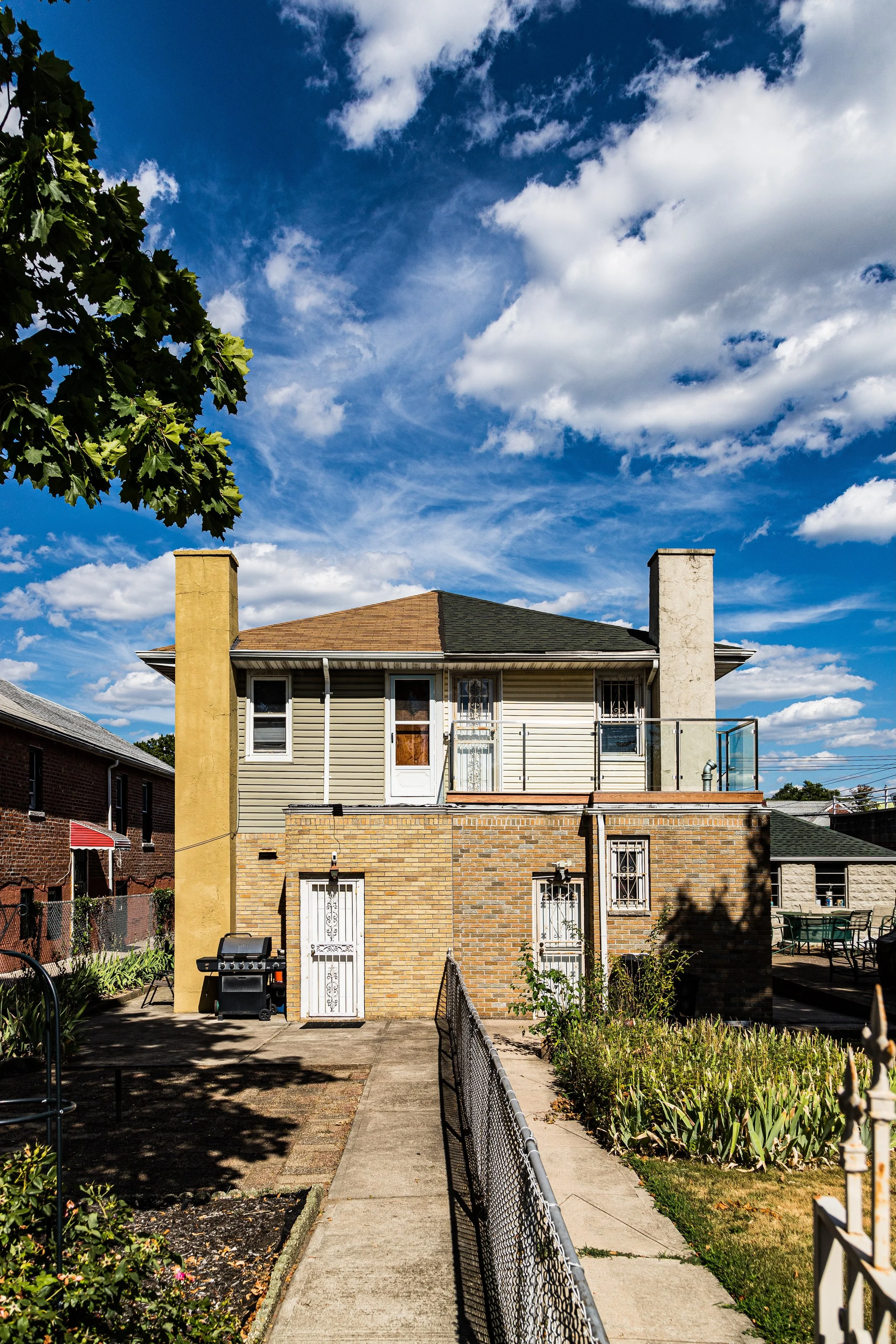
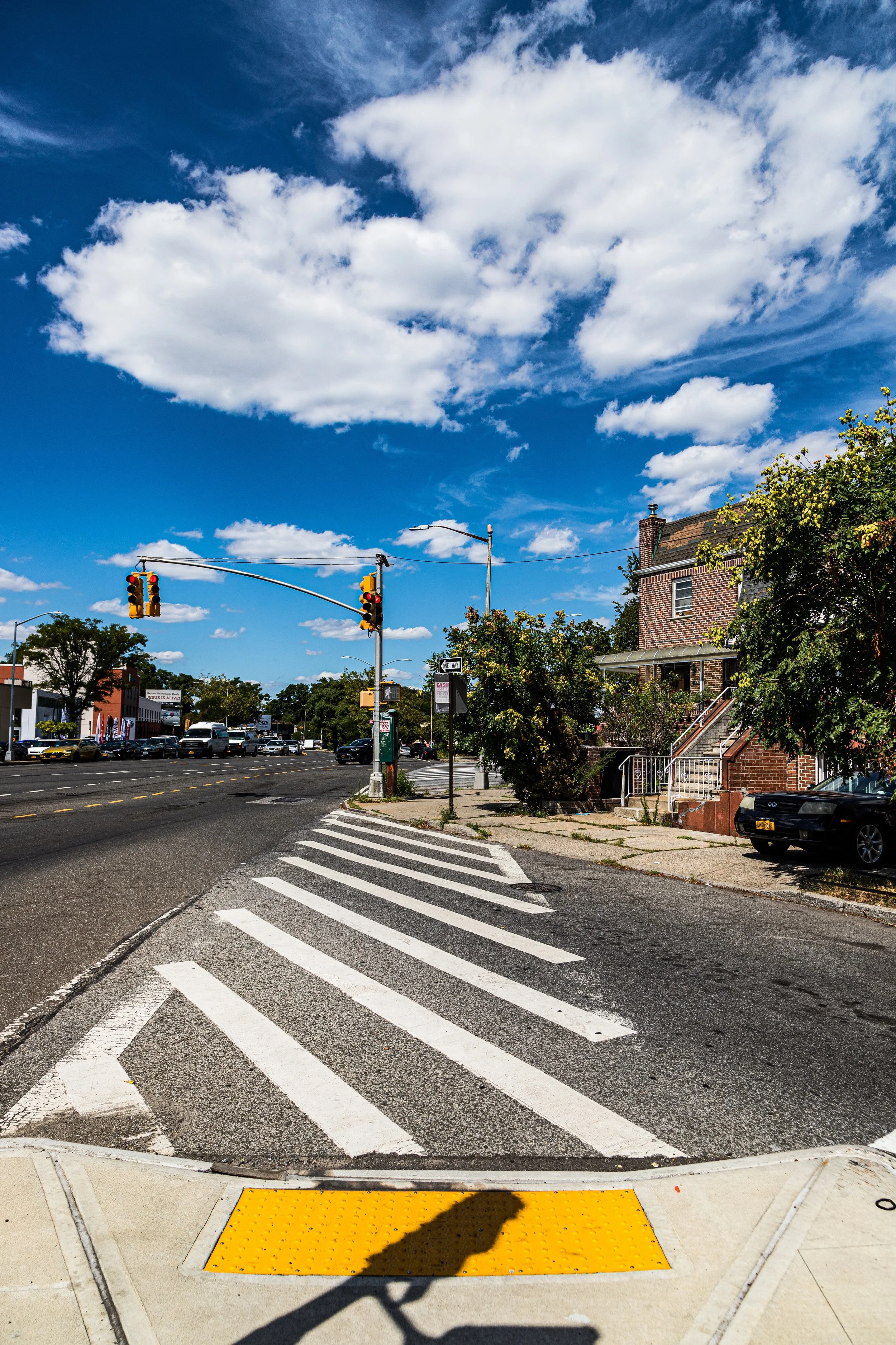
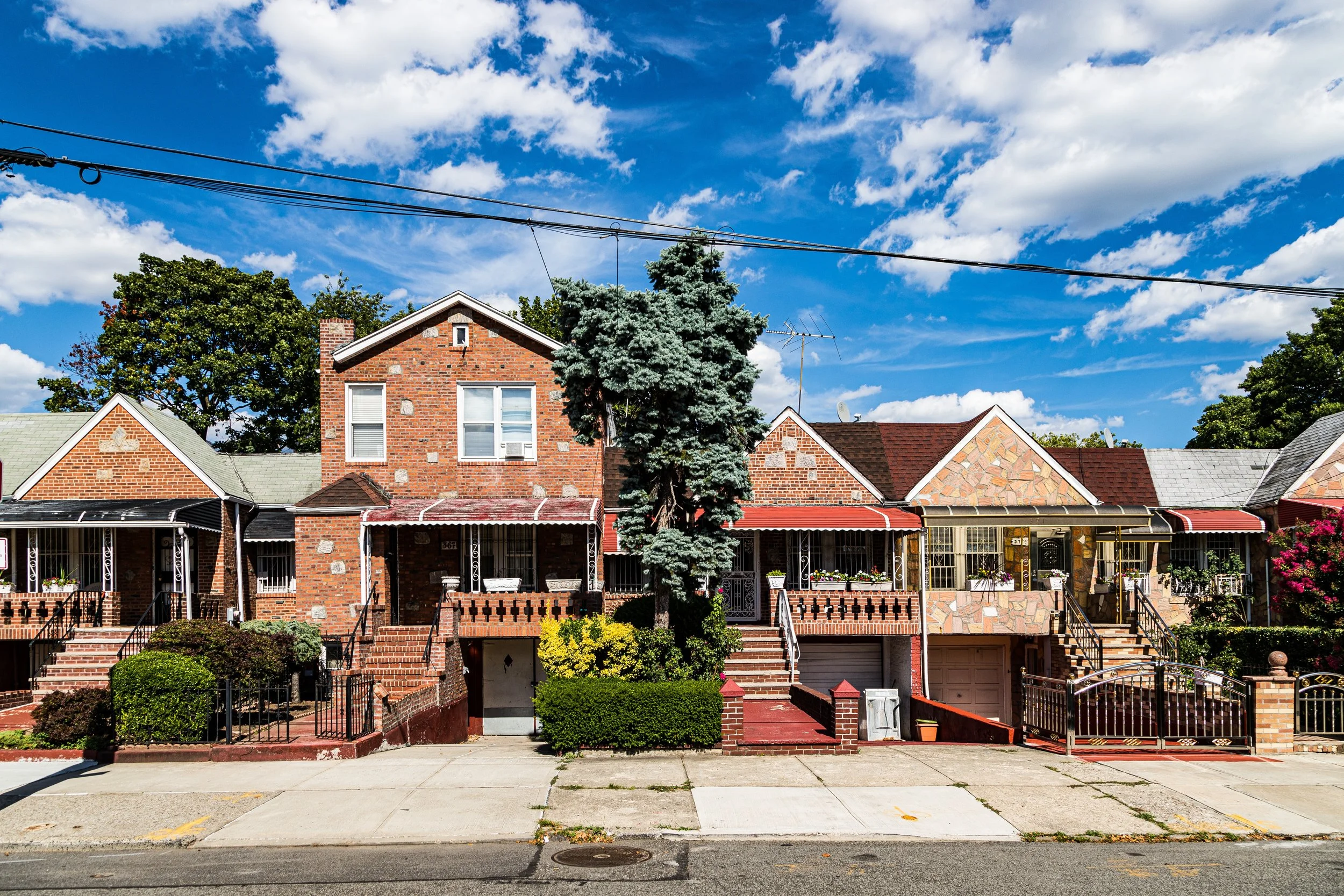
Topographically, East Flatbush occupies a gentle slope descending southward from the Crown Heights ridge, where the glacial plain of central Brooklyn flattens into a checkerboard of avenues and small parks. Its heart lies along Church Avenue and Utica Avenue, bustling commercial corridors lined with bakeries, barbershops, West Indian groceries, and storefront churches. While lacking the stately brownstones of Crown Heights or the manicured lawns of Ditmas Park, East Flatbush offers its own cohesive urban rhythm: solid brick rowhouses, freestanding two-family homes, and small apartment buildings—many built between 1910 and 1940—arranged with near-mathematical precision along broad, tree-shaded streets.
Today, East Flatbush stands as one of New York City’s most vibrant centers of Caribbean-American life, home to tens of thousands of immigrants and descendants from Jamaica, Trinidad, Haiti, Barbados, and Guyana, whose cultural imprint animates every block.
Etymology and Origins
The name Flatbush comes from the Dutch Vlacke Bos—“flat woods”—the term used by settlers of Nieuw Amersfoort in the 1600s to describe the fertile, lightly forested plain between the marshy coast and the upland ridges. What is now East Flatbush lay at the eastern edge of that colonial township, part of a patchwork of Dutch and English farms connected by wagon roads such as Kings Highway and Flatbush Avenue, both of which still trace the lines of 17th-century cart paths.
For over two centuries, the area remained rural. The Lefferts, Vanderveer, and Remsen families owned large estates and grew vegetables, grains, and hay for Brooklyn’s markets. Not until the late 19th century—when streetcar lines extended south from Crown Heights and Bedford, and when Brooklyn’s annexation into Greater New York (1898) spurred development—did East Flatbush begin its transformation into a residential district.
The Neighborhood
Late 19th to Early 20th Century: From Farmland to Streetcar Suburb
Between the 1890s and 1930s, East Flatbush was reshaped from farmland into one of Brooklyn’s great streetcar suburbs. Developers subdivided estates into narrow lots for two-family houses, apartment buildings, and small businesses, marketing them to middle- and working-class families seeking affordable homes beyond the denser districts closer to downtown Brooklyn.
The extension of electric trolley lines along Church Avenue, Utica Avenue, and Kings Highway connected residents to jobs in downtown Brooklyn and Manhattan. Streets such as East 51st, Schenectady, and Remsen Avenues filled with neat rows of brick houses—many in the Colonial Revival and Neo-Renaissance styles popular in the era of stoops and cornices. Churches and schools quickly followed: Holy Cross Roman Catholic Church (1897) on Church Avenue became one of the neighborhood’s enduring landmarks, soon joined by Holy Innocents, St. Vincent Ferrer, and numerous Protestant congregations.
Immigrant families—Italian, Jewish, and Irish—formed the backbone of the early East Flatbush community. They opened corner groceries, built synagogues, and organized block associations, laying the foundation for a neighborhood that prized stability, education, and self-reliance. By the 1930s, East Flatbush was fully urbanized: a grid of solid, well-tended homes whose front porches and small gardens mirrored the aspirations of a growing middle class.
Mid 20th Century: Growth, Transition, and Resilience
The 1940s–1960s brought new housing and new populations. The construction of public housing developments—including the Glenwood Houses (1950) and Rutland Towers (1954)—added density and affordability for returning veterans and working families. The Flatbush Avenue subway lines extended access to Manhattan, and East Flatbush’s population swelled.
During this period, the neighborhood’s Jewish community flourished, supporting a network of synagogues, bakeries, delis, and Yiddish cultural organizations. Meanwhile, African American families, many relocating from Harlem and Bed-Stuy during the postwar housing shortage, began settling in East Flatbush’s central and eastern sections. By the late 1960s, Caribbean immigrants—especially from Jamaica, Trinidad, and Barbados—had begun arriving in large numbers, drawn by affordable housing, good schools, and familiar church traditions.
As demographic change accelerated, tensions occasionally flared, but East Flatbush weathered transition better than many New York neighborhoods. Homeownership remained high, civic associations remained active, and the neighborhood retained its essential orderliness.
East Flatbush Video Coming Soon
Late 20th Century: The Caribbean Capital of Brooklyn
By the 1980s–1990s, East Flatbush had emerged as the beating heart of Brooklyn’s Caribbean diaspora. The avenues echoed with patois, Creole, and calypso rhythms; bakeries sold beef patties and hard dough bread; barbershops and churches doubled as community hubs. The Utica Avenue corridor, with its small groceries, record shops, and jerk chicken stands, became one of the city’s great cultural thoroughfares—an urban Main Street for Brooklyn’s West Indian community.
Institutions such as the Holy Cross Church, the Clarendon Road Church, and the St. Jerome R.C. Church fostered tight-knit congregations, while civic groups like the Caribbean American Chamber of Commerce (founded in nearby Crown Heights) reflected the area’s growing economic influence. King’s County Hospital, the SUNY Downstate Medical Center, and Kingsbrook Jewish Medical Center provided not only healthcare but also professional employment for thousands of residents, solidifying East Flatbush’s identity as both a residential and professional enclave.
Despite citywide challenges in the late 20th century—rising crime, economic hardship, and strained public services—East Flatbush remained remarkably cohesive. Residents organized block cleanups, cultural festivals, and political drives, producing a generation of civic leaders and entrepreneurs.
21st Century: Renewal, Diversity, and Continuity
In the new millennium, East Flatbush stands as one of Brooklyn’s most populous and culturally self-sustaining neighborhoods. Caribbean flags flutter from porches and storefronts; Labor Day’s West Indian American Day Parade—though centered on Eastern Parkway—feels like a local holiday here, with families gathering for barbecues and block parties across the district.
New immigrants from Haiti, Guyana, Grenada, and Nigeria have joined the established Jamaican and Trinidadian communities, reinforcing the area’s status as one of the most ethnically diverse neighborhoods in New York City. While some longtime residents worry about rising rents and creeping gentrification from Prospect-Lefferts Gardens and Crown Heights, East Flatbush remains largely anchored by owner-occupied homes, family-run businesses, and church-centered community life.
Recent improvements to Utica Avenue’s transit corridor, new housing initiatives along Kings Highway, and small business grants along Church and Clarkson Avenues have strengthened local infrastructure. The district’s hospitals and schools continue to anchor employment, while the neighborhood’s calm, residential character persists—tree-lined, resilient, and unmistakably Brooklyn.
East Flatbush Photo Gallery
Spirit and Legacy
East Flatbush’s legacy is one of persistence through change. It has been, in turn, Dutch farmland, Jewish suburb, and Caribbean stronghold—each era leaving its imprint in the rhythm of its streets and the cadence of its voices. Unlike the flashier transformations of Brooklyn’s waterfront or brownstone belts, East Flatbush’s strength lies in continuity: block by block, porch by porch, a community sustained by work, worship, and pride of place.
New York City
Use this custom Google map to explore where every neighborhood in all five boroughs of New York City is located.
The Five Boroughs
One of New York City’s unique qualities is its organization in to 5 boroughs: Manhattan, Brooklyn, Queens, The Bronx, and Staten Island. These boroughs are part pragmatic administrative districts, and part vestiges of the region’s past. Each borough is an entire county in New York State - in fact, Brooklyn is, officially, Kings County, while Staten Island is, officially Richmond County. But that’s not the whole story …
Initially, New York City was located on the southern tip of Manhattan (now the Financial District) that was once the Dutch colony of New Amsterdam. Across the East River, another city was rising: Brooklyn. In time, the city planners realized that unification between the rapidly rising cities would create commercial and industrial opportunities - through streamlined administration of the region.
So powerful was the pull of unification between New York and Brooklyn that three more counties were pulled into the unification: The Bronx, Queens, and Staten Island. And on January 1, 1898, the City of New York unified two cities and three counties into one Greater City of New York - containing the five boroughs we know today.
But because each borough developed differently and distinctly until unification, their neighborhoods likewise uniquely developed. Today, there are nearly 390 neighborhoods, each with their own histories, cultures, cuisines, and personalities - and each with residents who are fiercely proud of their corner of The Big Apple.


