
ARROCHAR
Staten Island
Geographic Setting
Bounded by the Staten Island Expressway to the northeast, Tompkins Avenue to the east, McClean Avenue to the south, Linwood Avenue to the west, Hylan Boulevard to the northwest, and Fingerboard Road to the north, Arrochar lies at the southeastern foot of Staten Island, nestled between Fort Wadsworth and South Beach. It is one of the island’s most strategically situated neighborhoods—a gateway between the island’s inland communities and its waterfront, where the land descends from the heights of Grasmere toward the gleaming expanse of the Lower New York Bay.
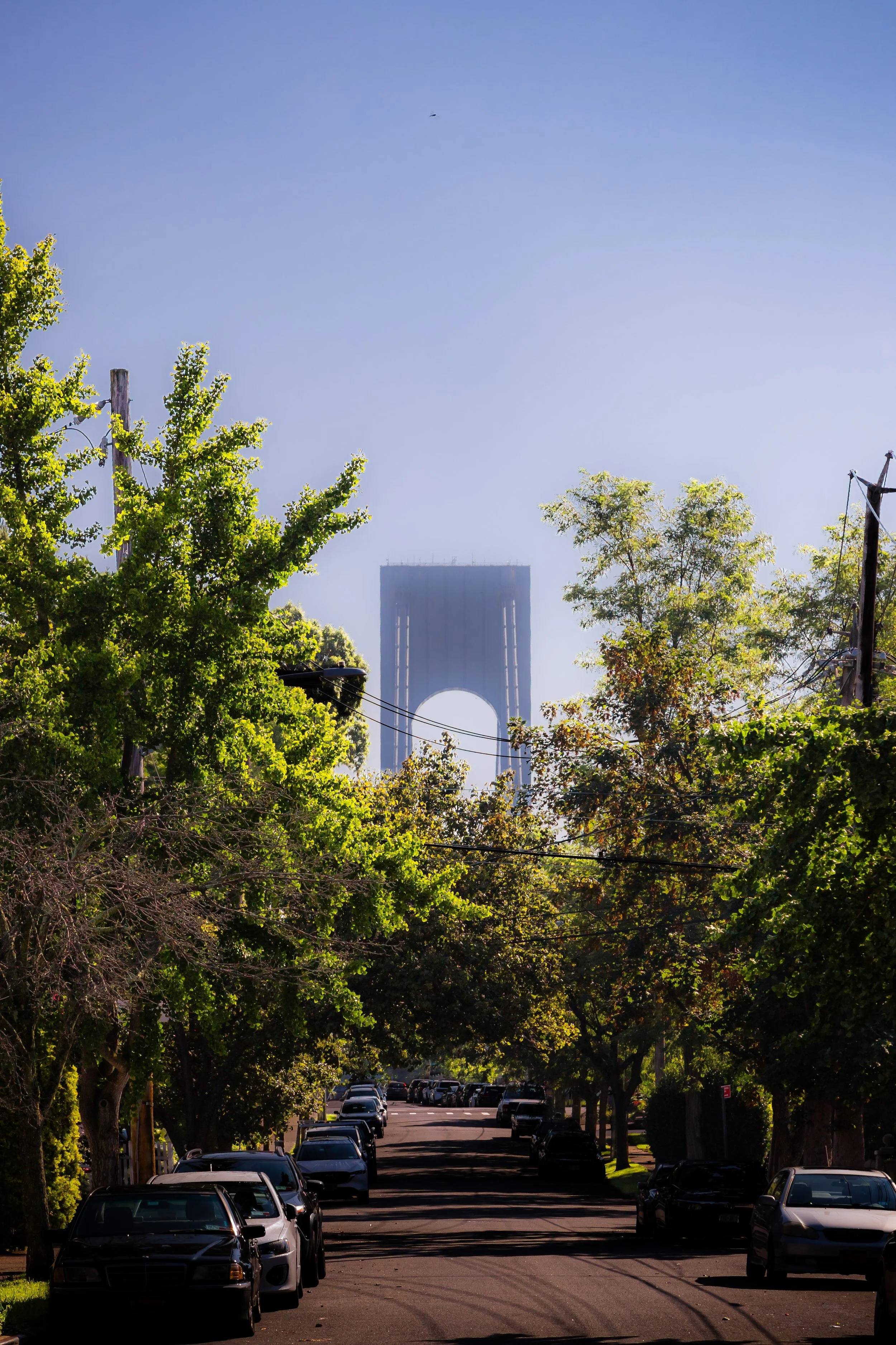
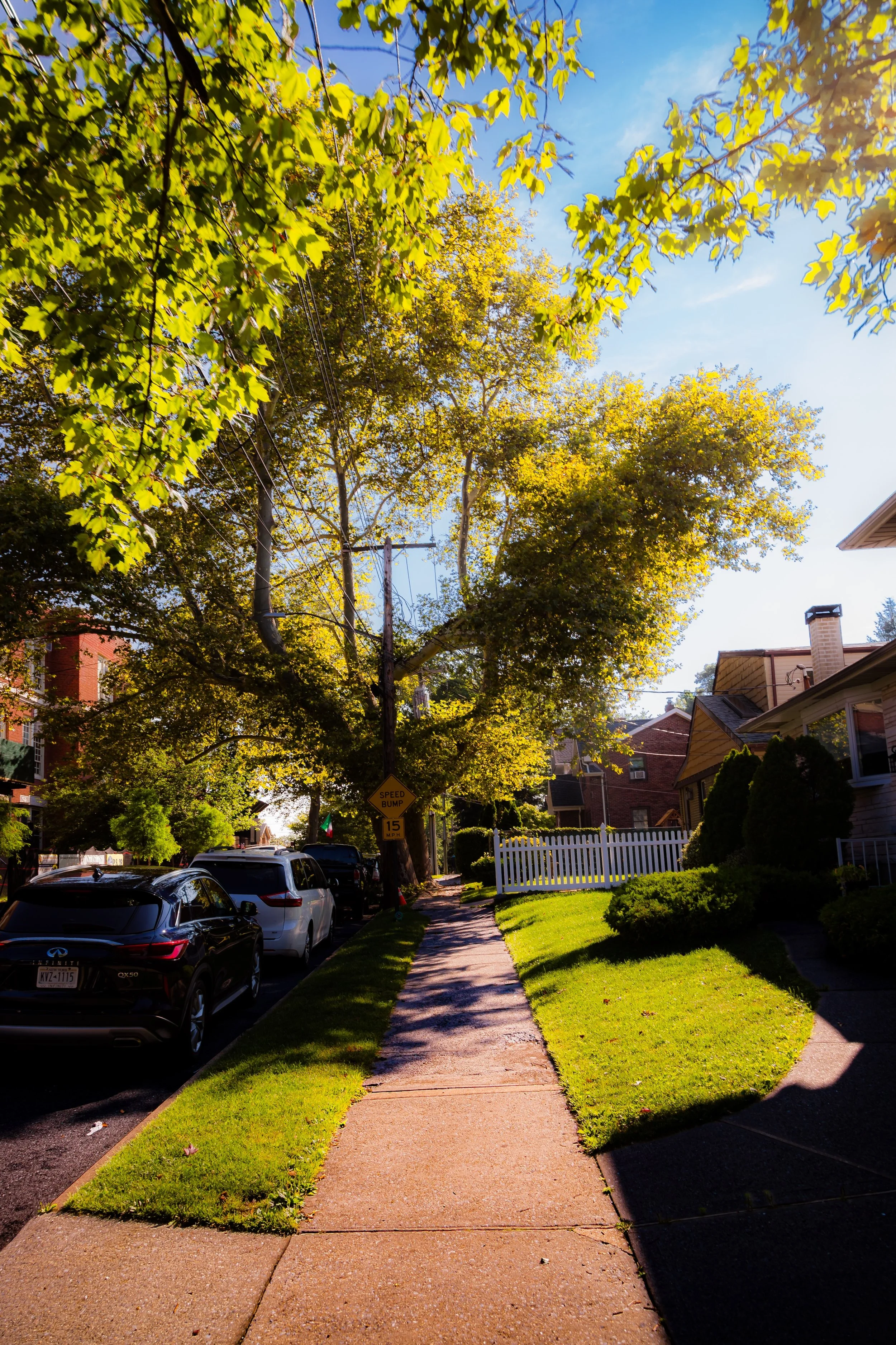
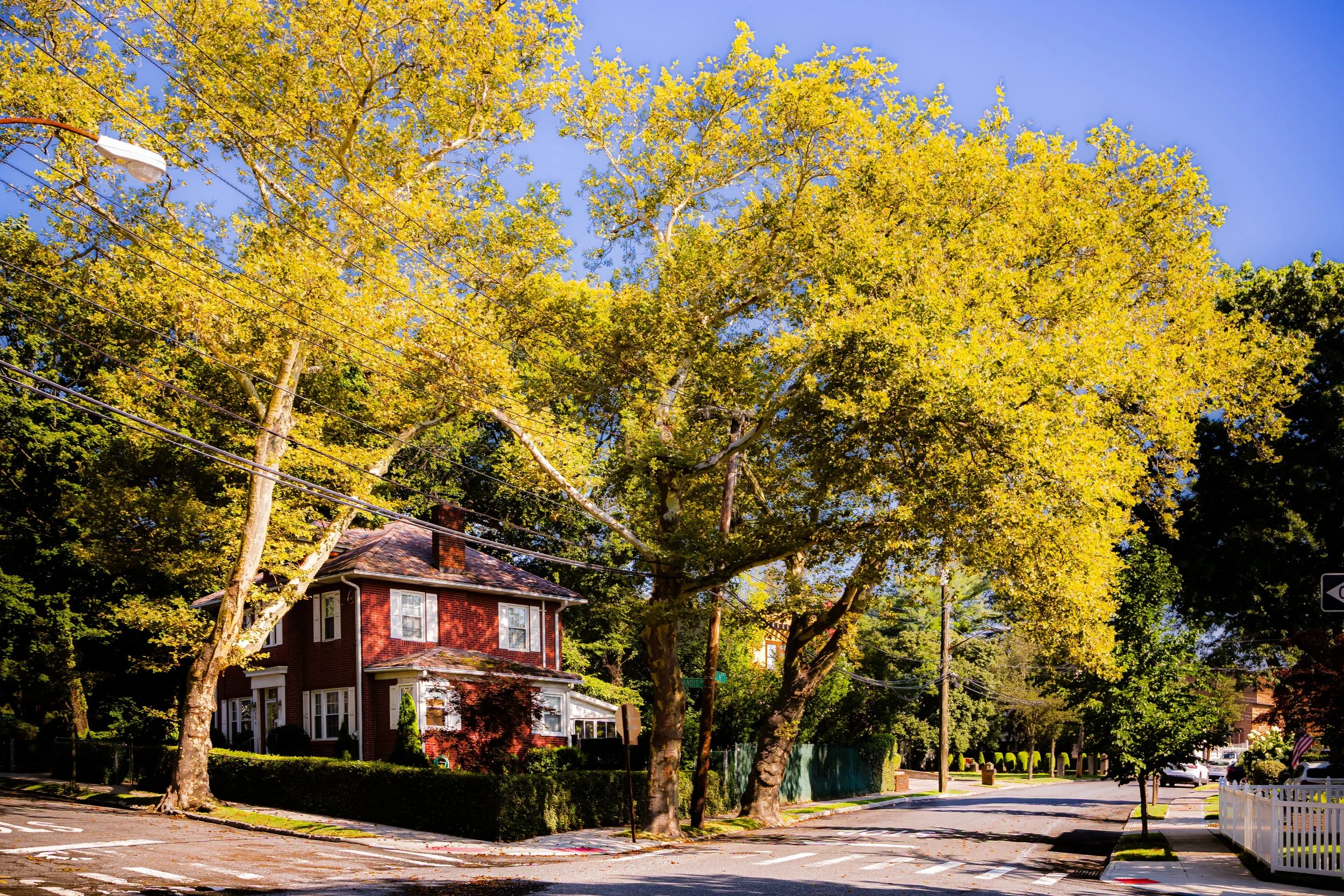
Arrochar’s streets form a mosaic of early 20th-century homes, postwar bungalows, and modest apartment buildings shaded by mature trees. The neighborhood’s topography slopes gently southward, allowing glimpses of the Verrazzano-Narrows Bridge, whose towers rise just to the west. Hylan Boulevard and Fingerboard Road—historic corridors dating to the island’s earliest colonial days—trace its edges, connecting Arrochar to neighboring Old Town, South Beach, and Fort Wadsworth. The expressway divides it from Grasmere to the north, yet Arrochar maintains a close-knit, small-town atmosphere amid the movement of cars, buses, and ferries that define its urban setting.
Etymology
The name Arrochar is one of Staten Island’s most distinctive and storied. It derives from Arrochar-on-Loch Long, a village in western Scotland near the head of Loch Long in Argyll and Bute. The name was bestowed in the mid-19th century by William Wallace MacFarland, a Scottish immigrant and prominent Staten Island landowner who named his estate “Arrochar” after his ancestral homeland. His property occupied much of the present-day neighborhood, extending to the waterfront where the Staten Island Hotel later stood.
The name, evoking the Highlands and a sense of rugged beauty, took hold when MacFarland’s land was subdivided for development in the late 1800s. “Arrochar” thus carried both nostalgia and aspiration—an Old World name placed upon New World ground. The Scottish connection endures not just in name but in spirit: Arrochar remains a place of transition, between land and sea, between the island’s quiet interior and its sweeping ocean horizon.
The Neighborhood
Origins through the 19th Century
Before the arrival of settlers, the land now called Arrochar was home to the Lenape, who used its shorelines and tidal flats for fishing and shellfishing. By the 17th century, Dutch and English colonists claimed the area as part of the South Shore commons, using it for grazing and small-scale farming. The proximity to the Narrows—the narrow tidal strait between Staten Island and Brooklyn—made the area strategically important; by the Revolutionary War, Fort Wadsworth had already been established just west of the present neighborhood, guarding the harbor entrance.
During the early 19th century, the future Arrochar remained sparsely settled farmland, characterized by meadows and scattered homesteads along the primitive Hylan Boulevard and Fingerboard Road. The turning point came in the mid-1800s, when William W. MacFarland, a wealthy Scottish merchant, purchased the tract and established his estate “Arrochar.” His mansion, landscaped with gardens and shaded drives, became a landmark of Staten Island gentility. Following his death in 1882, the land was subdivided into residential lots as Staten Island’s shoreline communities began to urbanize. The Staten Island Railway, running nearby through Old Town, made commuting to St. George and Manhattan possible, attracting middle-class families who built cottages and boarding houses near the sea.
Early 20th Century: From Estate to Suburb
By the early 1900s, Arrochar had evolved from countryside estate to burgeoning residential enclave. The area’s proximity to South Beach Amusement Park—then one of New York’s great seaside resorts—spurred rapid growth. Cottages, inns, and guesthouses filled the grid of newly laid streets such as Fairfield Street, Winfield Street, and Windham Avenue, serving tourists and summer visitors. The Arrochar Hotel and smaller boarding establishments offered views of the Lower Bay, and the air carried the scent of saltwater and amusement park popcorn from the neighboring shore.
Arrochar’s permanent population also grew. Churches like Our Lady of Good Counsel (founded 1902) anchored local life, while small businesses lined Fingerboard Road. The construction of Fort Wadsworth’s expanded garrison brought both employment and military presence to the area, and Arrochar became a community of both soldiers and civilians.
During this period, the neighborhood began to exhibit its enduring duality: seaside and residential, transient and rooted. Families who stayed year-round built tight bonds, organizing civic associations and volunteer fire companies to serve the growing district.
Arrochar Video Coming Soon
Mid–Late 20th Century: Transformation under the Bridge
The mid-20th century brought profound change. The construction of the Verrazzano-Narrows Bridge (1959–1964) transformed Arrochar’s landscape—physically, economically, and symbolically. The bridge’s Staten Island anchorage rose directly above the western edge of the neighborhood, requiring the demolition of dozens of homes and altering traffic patterns permanently. Fingerboard Road became a major access route to the Verrazzano Bridge toll plaza, while nearby streets were reconfigured or truncated.
The Staten Island Expressway, completed concurrently, formed Arrochar’s northern boundary, bringing noise and accessibility in equal measure. The once-quiet, seaside neighborhood became a transit corridor, yet its residents adapted with characteristic endurance. New housing developments filled the cleared land, blending Cape Cod–style homes and brick multi-family buildings with older Victorian cottages that survived the upheaval.
Through the 1960s and 1970s, Arrochar reflected Staten Island’s broader suburbanization. Many Brooklyn and Manhattan families relocated here, drawn by affordability and proximity to the bridge. Schools such as P.S. 39 and parish institutions reinforced community life, while the area’s older Italian-American families and newcomers from across the city shaped a diverse, close-knit identity. The South Beach Boardwalk, though in decline after the amusement park’s closure, remained a nearby recreational outlet, linking Arrochar’s residents to the shore that had defined its origins.
21st Century: Renewal and Connection
In the 21st century, Arrochar continues to evolve as both commuter hub and coastal neighborhood. The Verrazzano Bridge looms as its defining landmark—its cables visible from nearly every street—while the Staten Island Expressway ensures quick access to the rest of the city. Recent years have seen renewed investment in infrastructure and flood resilience projects, reflecting the neighborhood’s vulnerability to storm surges from the Lower New York Bay. After Hurricane Sandy (2012), Arrochar, like much of the South Shore, confronted the realities of coastal living. Home elevations, drainage improvements, and green infrastructure initiatives have reshaped its urban fabric while preserving its residential core.
Demographically, Arrochar has grown increasingly diverse, with families of Italian, Polish, Latino, and Asian descent living side by side. The commercial corridors along Hylan Boulevard and Tompkins Avenue remain vibrant, offering a mix of long-standing family businesses, bakeries, and restaurants that reflect the neighborhood’s evolving population. The Arrochar Friendship Park and community gardens provide green respite amid dense development, and the continued proximity to Fort Wadsworth and South Beach offers residents both history and recreation within walking distance. Despite the ceaseless hum of bridge traffic, Arrochar remains remarkably intimate—a neighborhood of front porches, Sunday Mass, and neighbors who still greet one another by name.
Arrochar Photo Gallery
Spirit and Legacy
Arrochar’s spirit is one of endurance and adaptation. From Scottish estate to seaside suburb to bridgefront community, it has continually reshaped itself without losing its sense of place. Its name, carried across the Atlantic by a Scottish immigrant, has come to symbolize the neighborhood’s continuity across centuries of change.
Here, the old and new coexist: the echo of waves along the seawall, the shadow of the Verrazzano Bridge, and the quiet streets that still trace the lines of MacFarland’s 19th-century estate. Arrochar endures as a microcosm of Staten Island itself—diverse, transitional, and deeply tied to both geography and memory.
For those who call it home, Arrochar is defined not by the roar of the expressway but by the nearness of the bay, the strength of its community, and the persistence of its identity at the edge of the sea. It is a place that has weathered transformation with grace—a neighborhood that stands, resilient and proud, beneath the great span that connects Staten Island to the world beyond.
New York City
Use this custom Google map to explore where every neighborhood in all five boroughs of New York City is located.
The Five Boroughs
One of New York City’s unique qualities is its organization in to 5 boroughs: Manhattan, Brooklyn, Queens, The Bronx, and Staten Island. These boroughs are part pragmatic administrative districts, and part vestiges of the region’s past. Each borough is an entire county in New York State - in fact, Brooklyn is, officially, Kings County, while Staten Island is, officially Richmond County. But that’s not the whole story …
Initially, New York City was located on the southern tip of Manhattan (now the Financial District) that was once the Dutch colony of New Amsterdam. Across the East River, another city was rising: Brooklyn. In time, the city planners realized that unification between the rapidly rising cities would create commercial and industrial opportunities - through streamlined administration of the region.
So powerful was the pull of unification between New York and Brooklyn that three more counties were pulled into the unification: The Bronx, Queens, and Staten Island. And on January 1, 1898, the City of New York unified two cities and three counties into one Greater City of New York - containing the five boroughs we know today.
But because each borough developed differently and distinctly until unification, their neighborhoods likewise uniquely developed. Today, there are nearly 390 neighborhoods, each with their own histories, cultures, cuisines, and personalities - and each with residents who are fiercely proud of their corner of The Big Apple.


