HUNTER’S POINT
Queens
Geographic Setting
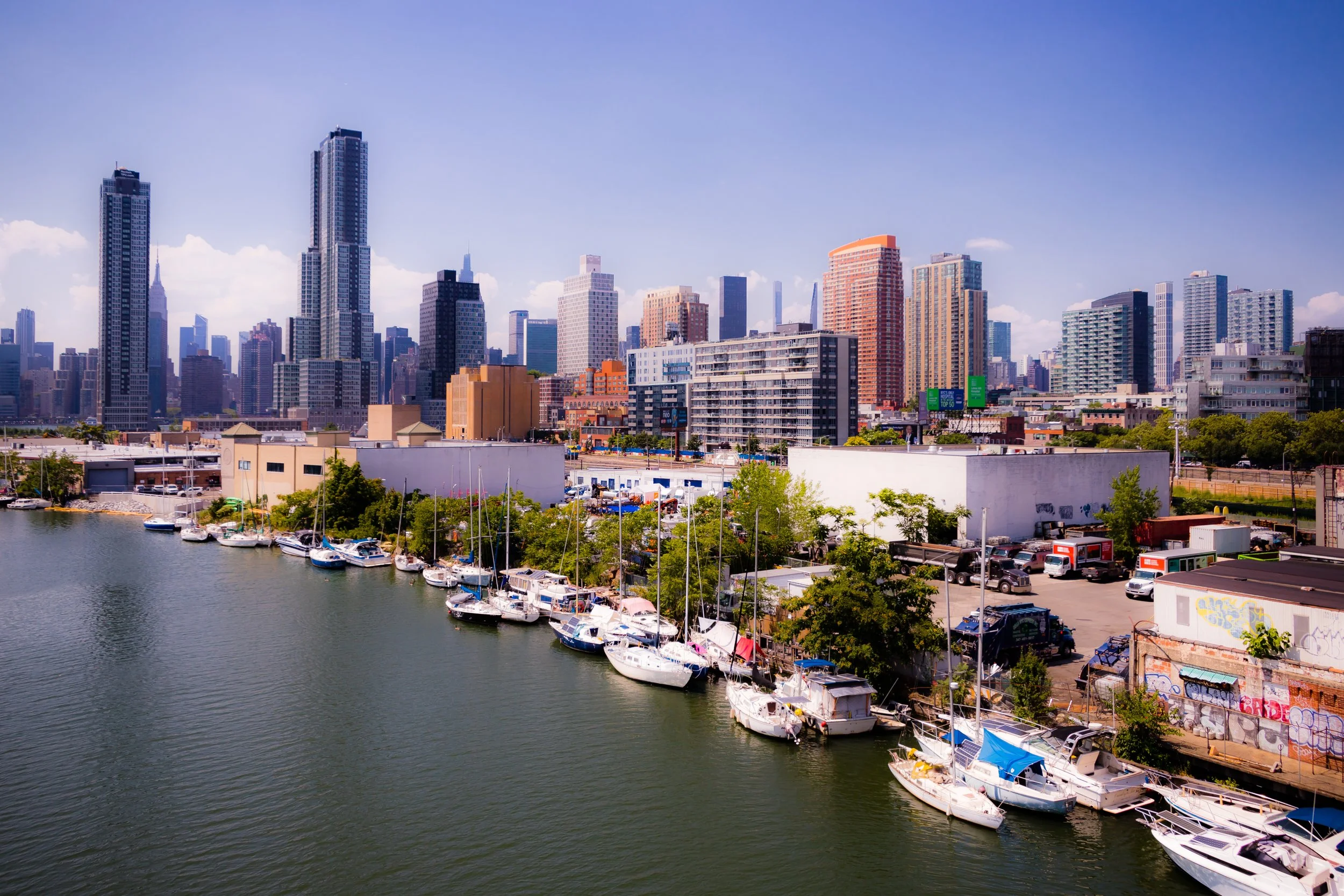
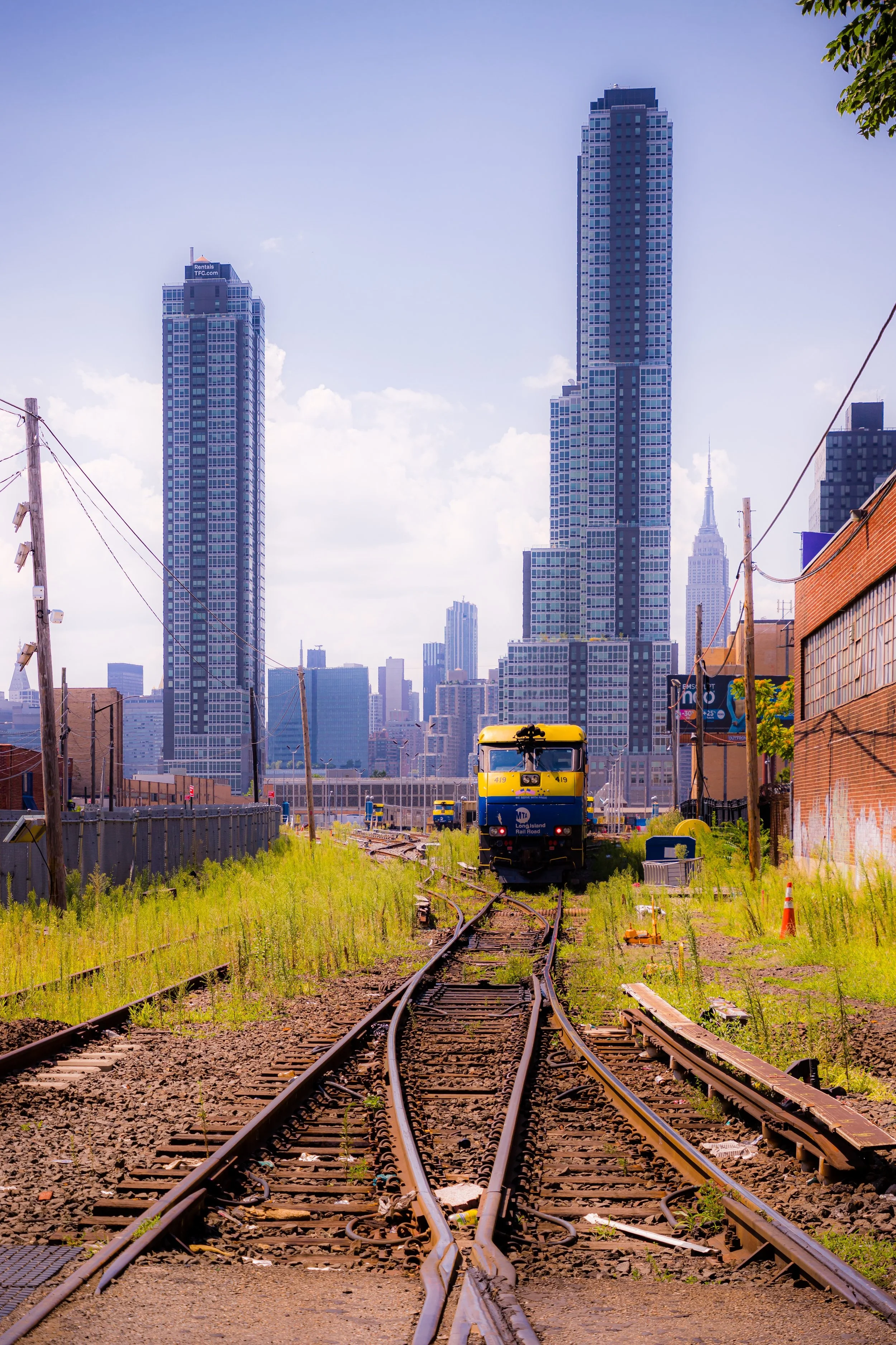
Bounded by Queens Plaza South to the north, the rail lines and Sunnyside Yard to the southeast, Newtown Creek to the south, and the East River to the west, Hunter’s Point forms the westernmost edge of Long Island City—a waterfront district that has undergone one of the most dramatic transformations in modern New York. Once dominated by shipyards, factories, and warehouses, Hunter’s Point today stands as a striking mosaic of glass towers, reimagined industrial buildings, and reclaimed waterfront parks, all set against sweeping views of the Manhattan skyline across the East River.
The neighborhood’s physical geography defines its dual identity: to the west, the East River shoreline, now transformed into Gantry Plaza State Park and Hunter’s Point South Park, offers promenades, lawns, and restored gantry cranes as reminders of the area’s industrial past; to the east, beyond Jackson Avenue and 11th Street, the elevated tracks and vast expanse of Sunnyside Yard mark the boundary between old Long Island City and the modern high-rise district that has emerged since the early 2000s. The grid of Vernon Boulevard, Jackson Avenue, and Borden Avenue remains the historic heart of Hunter’s Point—home to corner cafés, small galleries, and a community that balances old Queens grit with new cosmopolitan energy.
Etymology and Origins
The name “Hunter’s Point” dates back to the mid-18th century and refers to George Hunter, a Scottish immigrant and landowner whose family held extensive property along the East River in what was then part of the Town of Newtown. The term “Point” denoted the peninsula-shaped projection of land that jutted into the East River at the mouth of Newtown Creek. During the colonial era, the area was largely rural—salt meadows, tidewater inlets, and farmland worked by Dutch and English settlers.
By the early 19th century, Hunter’s Point began to shift from agriculture to industry. The completion of the Newtown Creek Canal system and the arrival of the Long Island Rail Road in the 1850s turned the area into a transportation and manufacturing hub. In 1852, the Long Island City Rail Terminal was established here, offering ferry connections to Manhattan. The neighborhood’s proximity to the water made it ideal for shipbuilding, oil refining, and metal works, and by the 1870s, Hunter’s Point had become the industrial core of western Queens—a city within a city.
The Neighborhood
19th Century: Industry, Incorporation, and Immigrant Labor
Hunter’s Point’s transformation from farmland to industrial powerhouse mirrored New York’s broader expansion. Factories, warehouses, and docks sprang up along the waterfront, while residential blocks filled with immigrant workers from Ireland, Germany, and later Italy. The neighborhood became part of the newly incorporated City of Long Island City in 1870, serving as its civic and economic center until Queens joined Greater New York City in 1898.
During this period, the neighborhood’s landscape hardened into a dense industrial grid. Borden Avenue and 11th Street buzzed with wagon traffic carrying goods to and from the river, while the Pepsi-Cola bottling plant, rail freight yards, and oil depots dominated the shoreline. Vernon Boulevard, lined with saloons, bakeries, and general stores, became the main commercial artery. Housing ranged from brick tenements for workers to modest rowhouses for foremen and shopkeepers.
The completion of the Pulaski Bridge (connecting to Brooklyn) and later the Queensboro Bridge (1909) further integrated Hunter’s Point into the city’s economic network, solidifying its role as an industrial gateway to Long Island.
Early–Mid 20th Century: Decline and Industrial Stagnation
By the early 20th century, Hunter’s Point was firmly industrial, with little green space and limited residential life. Its waterfront was lined with oil tanks, lumberyards, and factories producing everything from paint to paper. The East River ferries waned after the opening of the Queensboro Bridge and subway service to Manhattan in 1915, and while factories remained busy through the mid-century, the neighborhood’s fortunes declined after World War II as manufacturing left New York City.
By the 1960s and 1970s, much of Hunter’s Point had become a landscape of decaying warehouses and underused rail yards. The population dwindled, and the area’s identity narrowed to its industrial core. Yet even in this period of decline, a few seeds of transformation were planted: artists seeking cheap studio space began to occupy old industrial buildings, joining the small but enduring working-class community that had never left. This creative presence, combined with proximity to Manhattan, would eventually set the stage for the neighborhood’s rebirth.
Hunter’s Point Video Coming Soon
Late 20th Century: Industrial Ruins to Artistic Revival
The late 20th century marked the beginning of Hunter’s Point’s post-industrial renaissance. In the 1980s, as New York’s manufacturing economy collapsed, the city and state began exploring ways to redevelop the Queens waterfront. Artists, photographers, and small manufacturers moved into former factories on Vernon Boulevard and Borden Avenue, establishing studios and galleries that gave the area a new cultural identity.
The opening of PS1 Contemporary Art Center (now MoMA PS1) in 1976, housed in a former public school building on Jackson Avenue, made Hunter’s Point a beacon of experimental art and drew attention to Long Island City’s potential as a creative district. Around the same time, the Gantry Plaza State Park project was conceived as part of the city’s effort to reclaim industrial waterfronts for public use. When the park opened in 1998, its restored gantry cranes became icons of Queens’ industrial past and symbols of its new urban identity.
21st Century: Transformation and Skyline Ascendancy
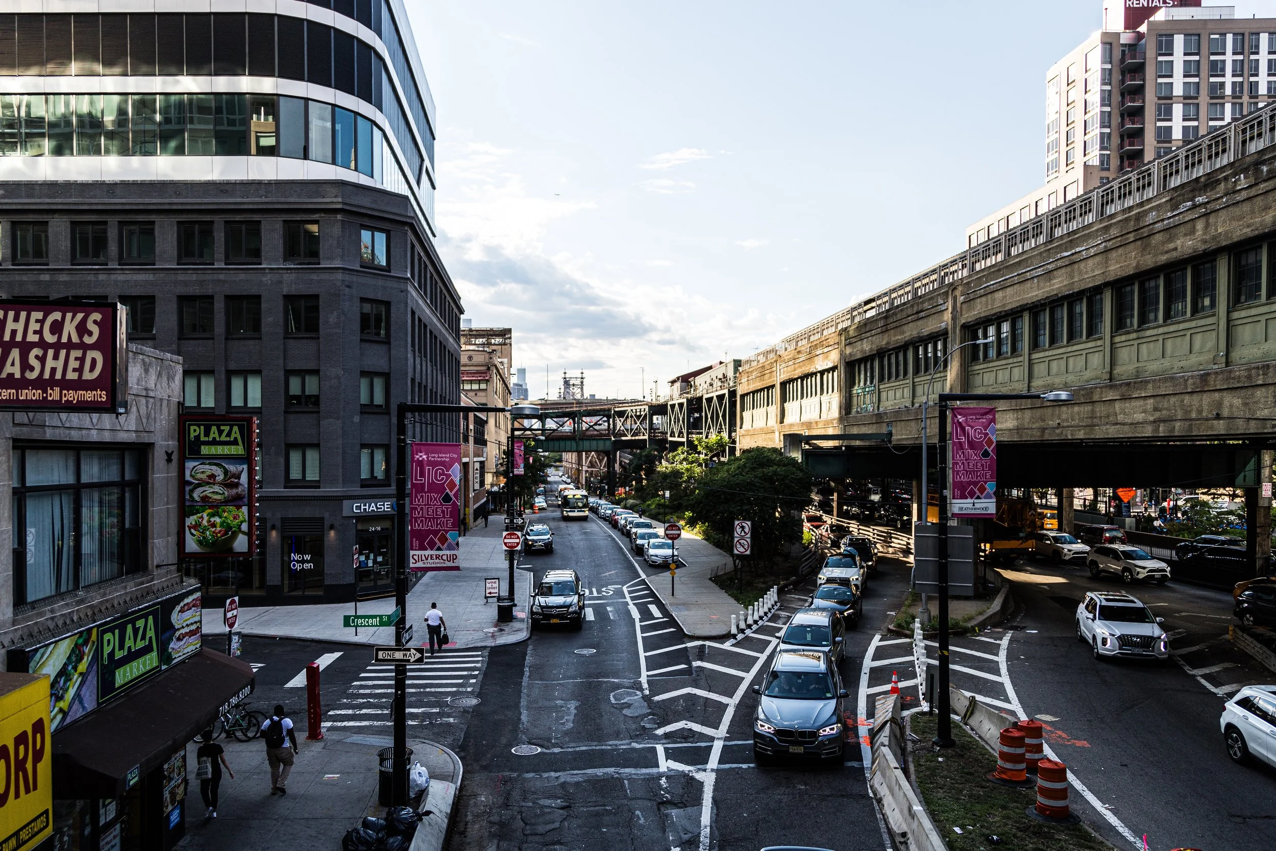
The 21st century has brought a complete reinvention of Hunter’s Point. Rezoned in 2001, the neighborhood became the epicenter of a massive urban redevelopment initiative—transforming disused lots and warehouses into high-rise residential towers, schools, and waterfront parks. Luxury condominiums and rental towers now line the East River, from Center Boulevard to Borden Avenue, offering panoramic skyline views that rival those of Manhattan.
The creation of Hunter’s Point South, a master-planned development begun in 2011, introduced thousands of new mixed-income apartments, a waterfront park, a public school, and retail spaces designed with sustainability and resiliency in mind. The Hunter’s Point South Park, completed in phases between 2013 and 2018, set a new standard for urban landscape design—blending storm-resilient infrastructure with recreational lawns, piers, and wetlands.
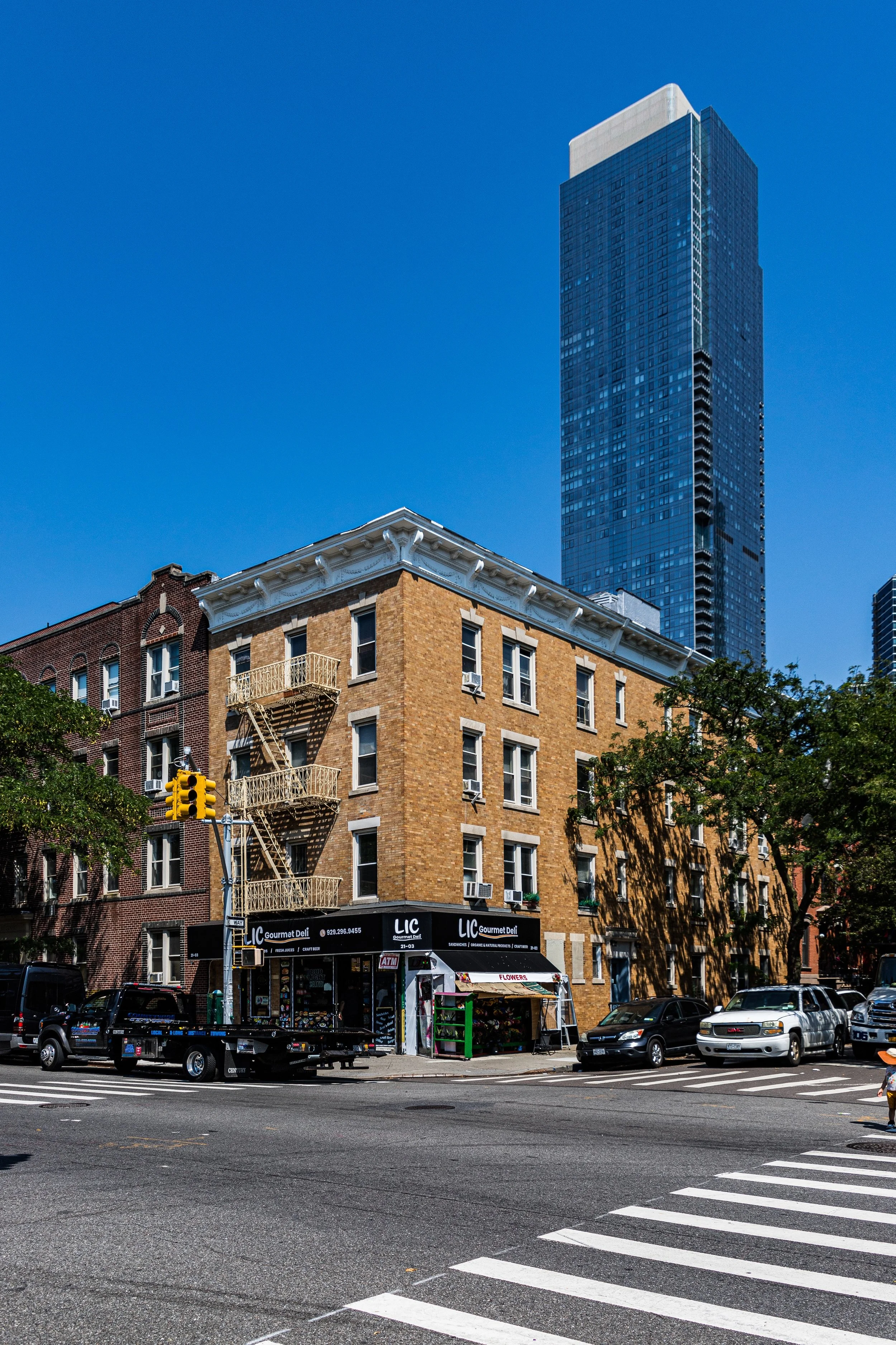
Yet amid the high-rises, traces of the old neighborhood remain. Vernon Boulevard retains its row of century-old brick buildings, now housing bakeries, coffee shops, and restaurants that serve both newcomers and longtime residents. The industrial relics along Newtown Creek stand as reminders of the neighborhood’s blue-collar roots. The 7 train and East River Ferry have made Hunter’s Point one of the most connected—and desirable—addresses in New York City, while the presence of MoMA PS1 and local artist studios continues to tie the district to its creative lineage.
Hunter’s Point Photo Gallery
Spirit and Legacy
Hunter’s Point’s story is one of transformation without complete erasure—a microcosm of New York’s perpetual reinvention. From farmland to factory district, from artist enclave to modern skyline, it embodies both continuity and change. Its preserved gantries, reimagined parks, and thriving waterfront community stand as proof that a neighborhood can honor its industrial heritage while embracing its future.
New York City
Use this custom Google map to explore where every neighborhood in all five boroughs of New York City is located.
The Five Boroughs
One of New York City’s unique qualities is its organization in to 5 boroughs: Manhattan, Brooklyn, Queens, The Bronx, and Staten Island. These boroughs are part pragmatic administrative districts, and part vestiges of the region’s past. Each borough is an entire county in New York State - in fact, Brooklyn is, officially, Kings County, while Staten Island is, officially Richmond County. But that’s not the whole story …
Initially, New York City was located on the southern tip of Manhattan (now the Financial District) that was once the Dutch colony of New Amsterdam. Across the East River, another city was rising: Brooklyn. In time, the city planners realized that unification between the rapidly rising cities would create commercial and industrial opportunities - through streamlined administration of the region.
So powerful was the pull of unification between New York and Brooklyn that three more counties were pulled into the unification: The Bronx, Queens, and Staten Island. And on January 1, 1898, the City of New York unified two cities and three counties into one Greater City of New York - containing the five boroughs we know today.
But because each borough developed differently and distinctly until unification, their neighborhoods likewise uniquely developed. Today, there are nearly 390 neighborhoods, each with their own histories, cultures, cuisines, and personalities - and each with residents who are fiercely proud of their corner of The Big Apple.


