GRASMERE
Staten Island
Geographic Setting
Bounded by the Staten Island Expressway to the north, Fingerboard Road to the east, Hylan Boulevard to the southeast, Old Town Road to the south, Glendale Avenue to the southwest, and Gateway Drive and Mosel Avenue to the west, Grasmere occupies a serene, residential pocket on Staten Island’s northeastern slope—nestled between Concord, Old Town, and Arrochar, and lying in the shadow of the Verrazzano-Narrows Bridge. The neighborhood stretches from the wooded ridges near the expressway down toward the coastal plain, where lakes, creeks, and parklands lend the area its signature pastoral character.
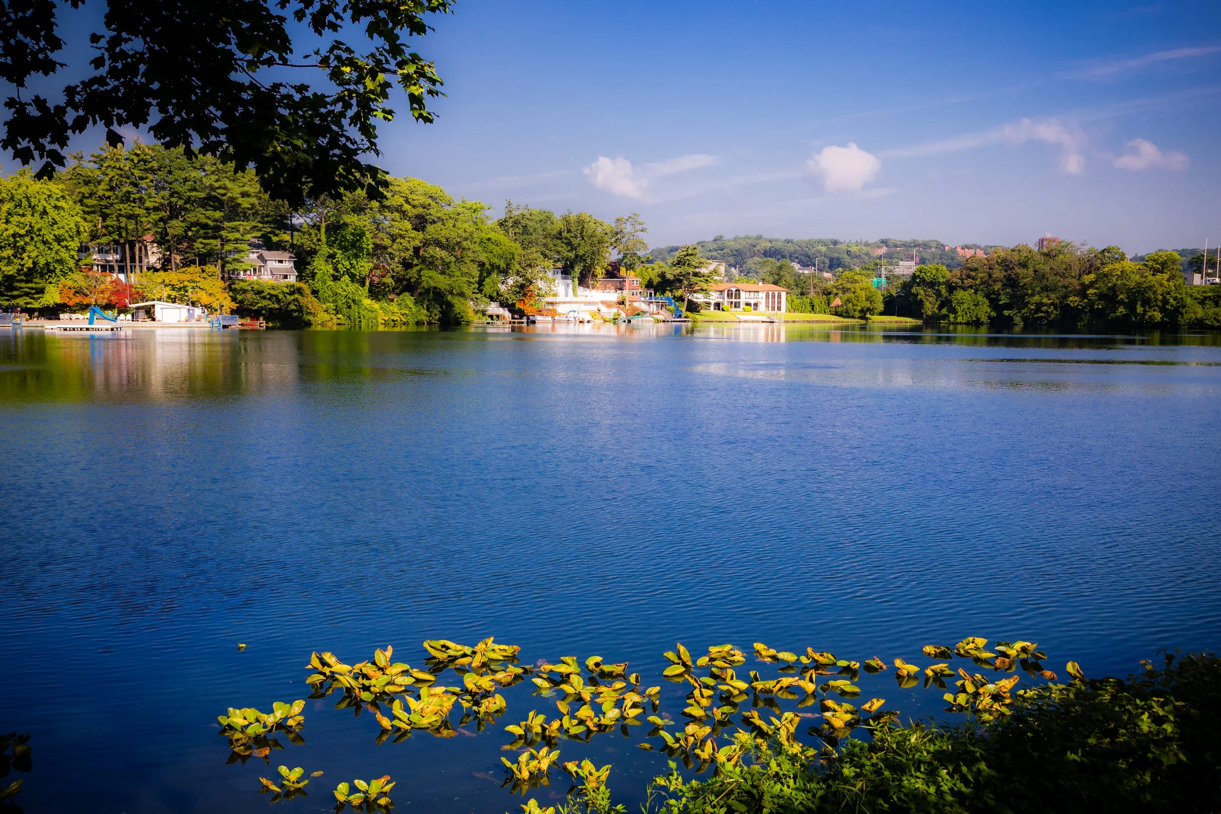
At its heart lies Grasmere Lake, a spring-fed body of water encircled by homes, trees, and walking paths—a rare and tranquil centerpiece within New York City’s urban fabric. The surrounding terrain, once part of Staten Island’s glacial moraine, undulates gently, creating natural terraces that define the neighborhood’s winding roads. Despite its proximity to major thoroughfares, Grasmere retains an aura of calm and intimacy; its leafy streets, historic homes, and proximity to both Clove Lakes Park and South Beach make it one of Staten Island’s most picturesque and well-balanced communities.
Etymology
The name Grasmere derives from the famed Grasmere village in England’s Lake District, a pastoral region celebrated by the Romantic poet William Wordsworth. The Staten Island neighborhood was named in the mid-19th century by early developers seeking to evoke the beauty and tranquility of that English landscape. The presence of its own central lake made the comparison particularly apt.
The name, meaning “grass lake” or “lake in the meadow,” captured both the geography and the idyllic aspiration of the area’s founders. From its earliest appearance on 19th-century maps, Grasmere has stood for cultivated beauty—a suburban retreat whose very name promised green hills, still water, and the gentler rhythms of life at the city’s edge.
The Neighborhood
Origins through the 19th Century
In the colonial period and well into the 1800s, the land now known as Grasmere was part of the rural Town of Southfield, a district of farms and woodlands stretching inland from the Narrows. The region’s freshwater springs and rich soils supported small-scale agriculture and orchards, while Richmond Road served as the primary route connecting these inland farms to the ferry landings at Tompkinsville and Stapleton.
By the early 19th century, the scenic beauty of the area—its wooded slopes, meadows, and natural ponds—began attracting wealthy New Yorkers seeking rural estates within easy reach of Manhattan. Among the earliest settlers of note was Sir Roderick Cameron, a Scottish-born shipping magnate, who in the 1850s built an elegant estate surrounding Grasmere Lake. His property, complete with gardens and carriage paths, became the nucleus of the neighborhood and gave the area its name.
The arrival of the Staten Island Railway (1860) spurred further development. The Grasmere station, built near Clove Road, made the area accessible to commuters and weekend visitors. By the late 19th century, Grasmere had emerged as one of Staten Island’s earliest suburban enclaves—an exclusive retreat of large Victorian homes, landscaped grounds, and unpaved lanes shaded by towering oaks.
Early 20th Century: A Garden Suburb Emerges
The early 1900s saw Grasmere evolve from rural retreat to fully realized residential neighborhood. The estates of the 19th century were gradually subdivided into smaller parcels, and new homes—often designed in Colonial Revival and Craftsman styles—rose along Hylan Boulevard, Clove Road, and the newly laid Circle Road and Lakeview Terrace. Yet the developers who reshaped Grasmere were careful to preserve its natural beauty. The lake and surrounding woods remained central features, and new construction was designed to harmonize with the landscape rather than dominate it.
The neighborhood’s affluence was reflected in its civic infrastructure. Churches and schools appeared, while local associations maintained the lake and park areas. Grasmere’s reputation for tranquility made it a haven for Staten Island professionals—judges, physicians, and educators—who prized its mix of refinement and accessibility. The nearby Arrochar and Old Town stations provided direct railway service to the ferry, linking Grasmere seamlessly to the city.
By the 1930s, the community’s balance of nature and suburbia was well established. The old estates had given way to a village-like district of elegant but comfortable homes, where neighbors gathered for lake festivals and community picnics, and where the sound of frogs and crickets carried through the summer nights.
Grasmere Video Coming Soon
Mid–Late 20th Century: Transformation and Resilience
The post–World War II decades brought change to Grasmere, as Staten Island entered a period of rapid suburbanization. The construction of the Staten Island Expressway (1960s) redefined the neighborhood’s northern edge, cutting through portions of its wooded buffer but improving accessibility to the rest of New York City. The Verrazzano-Narrows Bridge (1964), visible from nearby ridges, ushered in new waves of residents from Brooklyn and Manhattan seeking suburban homes within the five boroughs.
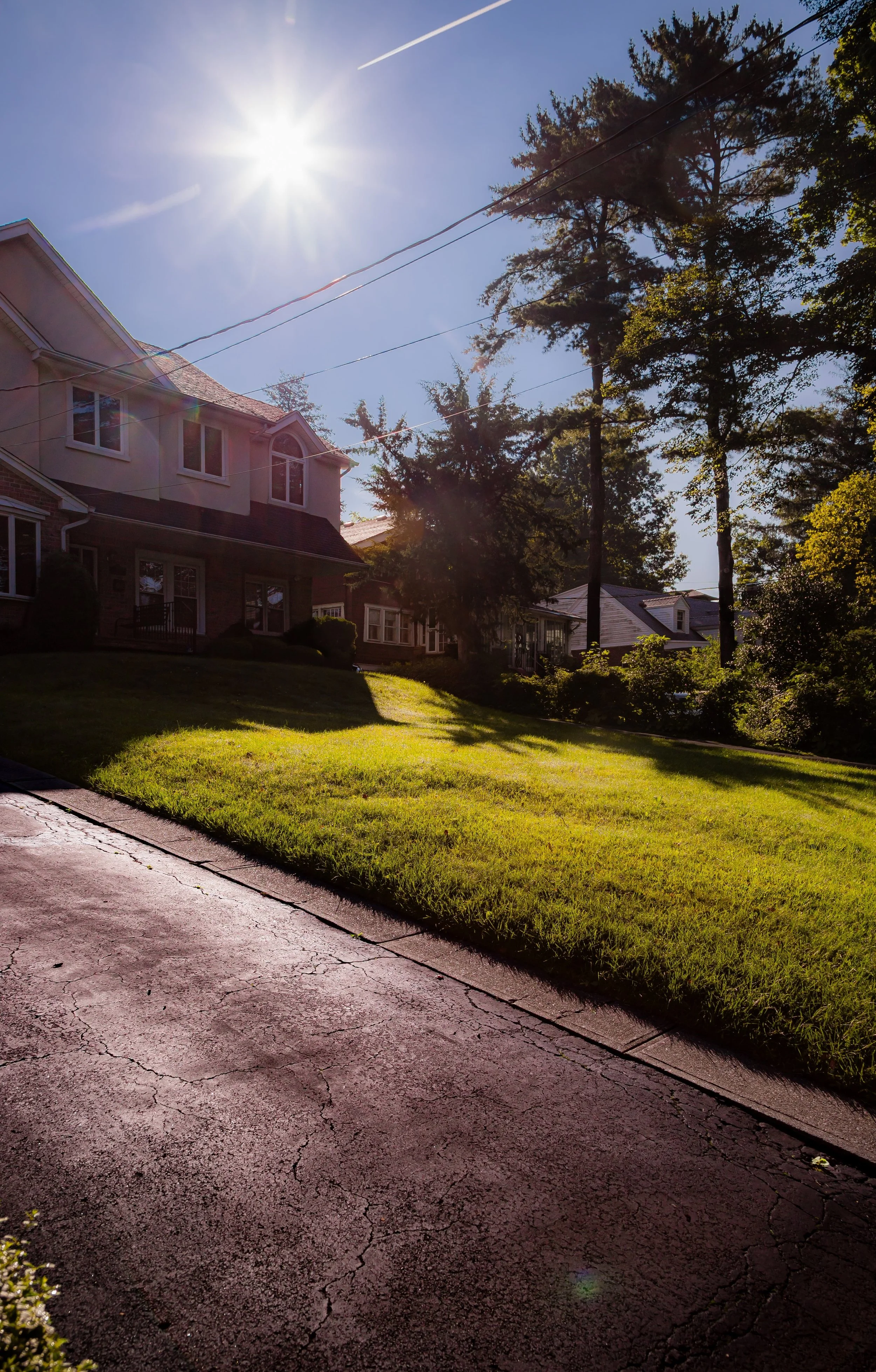
Through the 1950s and 1960s, new housing filled many of Grasmere’s remaining open parcels, yet the area’s distinctive character persisted. Developers adhered to the established scale—single-family houses with landscaped yards and curving streets. The lake remained the centerpiece, surrounded by both long-established residences and newer postwar homes that preserved its reflective tranquility.
During this era, Grasmere also became known for its cultural diversity. Italian-American families predominated, but Jewish, Irish, and later Asian-American residents added to the neighborhood’s fabric. Civic organizations, garden clubs, and homeowners’ associations worked to preserve the area’s quality of life amid the borough’s explosive growth. The enduring presence of Grasmere Lake Park and nearby Clove Lakes Park ensured that the neighborhood’s founding vision of green space and natural serenity remained intact.
21st Century: Serenity in the City
In the 21st century, Grasmere stands as a model of sustainable suburban living within the city. Its quiet, tree-lined blocks and proximity to both natural and urban amenities make it one of Staten Island’s most desirable residential enclaves. The Grasmere station on the Staten Island Railway continues to serve as a vital commuter link, while Hylan Boulevard provides direct access to the island’s commercial corridors.
The community’s environmental legacy endures in Grasmere Lake, now a protected feature under the city’s Department of Parks and Recreation, and in the nearby Reeds Basket Willow Swamp Park and Clove Lakes Park, which form part of Staten Island’s celebrated Greenbelt system. Civic groups remain active in lake maintenance, neighborhood beautification, and environmental education, ensuring that Grasmere’s natural assets are not only preserved but celebrated.
While many homes have been modernized, the neighborhood’s architectural scale and wooded charm remain inviolate. The population has grown increasingly diverse, reflecting Staten Island’s broader transformation, yet the local ethos—pride, civility, and a reverence for the landscape—continues to unite residents across generations. The hum of traffic from the expressway fades quickly as one descends into Grasmere’s heart, where reflections on the lake mirror the constancy of its spirit.
Grasmere Photo Gallery
Spirit and Legacy
The spirit of Grasmere lies in its seamless union of nature and neighborhood. From its 19th-century origins as a lakeside estate to its modern life as a tranquil suburban haven, it has remained faithful to its name—a meadow by the water, a place of reflection and repose. The same hills that once drew Sir Roderick Cameron and his contemporaries continue to shelter generations seeking balance between urban access and natural peace.
Grasmere’s legacy is one of quiet resilience: a community that has weathered the tides of change without surrendering its soul. Its lake still glimmers at the center of local life; its roads still curve with the contours of the land; its name still conjures images of poetry and pastoral grace.
New York City
Use this custom Google map to explore where every neighborhood in all five boroughs of New York City is located.
The Five Boroughs
One of New York City’s unique qualities is its organization in to 5 boroughs: Manhattan, Brooklyn, Queens, The Bronx, and Staten Island. These boroughs are part pragmatic administrative districts, and part vestiges of the region’s past. Each borough is an entire county in New York State - in fact, Brooklyn is, officially, Kings County, while Staten Island is, officially Richmond County. But that’s not the whole story …
Initially, New York City was located on the southern tip of Manhattan (now the Financial District) that was once the Dutch colony of New Amsterdam. Across the East River, another city was rising: Brooklyn. In time, the city planners realized that unification between the rapidly rising cities would create commercial and industrial opportunities - through streamlined administration of the region.
So powerful was the pull of unification between New York and Brooklyn that three more counties were pulled into the unification: The Bronx, Queens, and Staten Island. And on January 1, 1898, the City of New York unified two cities and three counties into one Greater City of New York - containing the five boroughs we know today.
But because each borough developed differently and distinctly until unification, their neighborhoods likewise uniquely developed. Today, there are nearly 390 neighborhoods, each with their own histories, cultures, cuisines, and personalities - and each with residents who are fiercely proud of their corner of The Big Apple.


