TOTTENVILLE
Staten Island
Geographic Setting
Bounded by Page Avenue to the east, the Raritan Bay to the south, and the Arthur Kill to the west, Tottenville occupies the southwestern tip of Staten Island—the southernmost point in both New York City and the entire state of New York. Surrounded on two sides by water, it stands at the confluence of the Arthur Kill and Raritan Bay, directly across from Perth Amboy, New Jersey, where the Outerbridge Crossing spans the narrow channel between the two states.
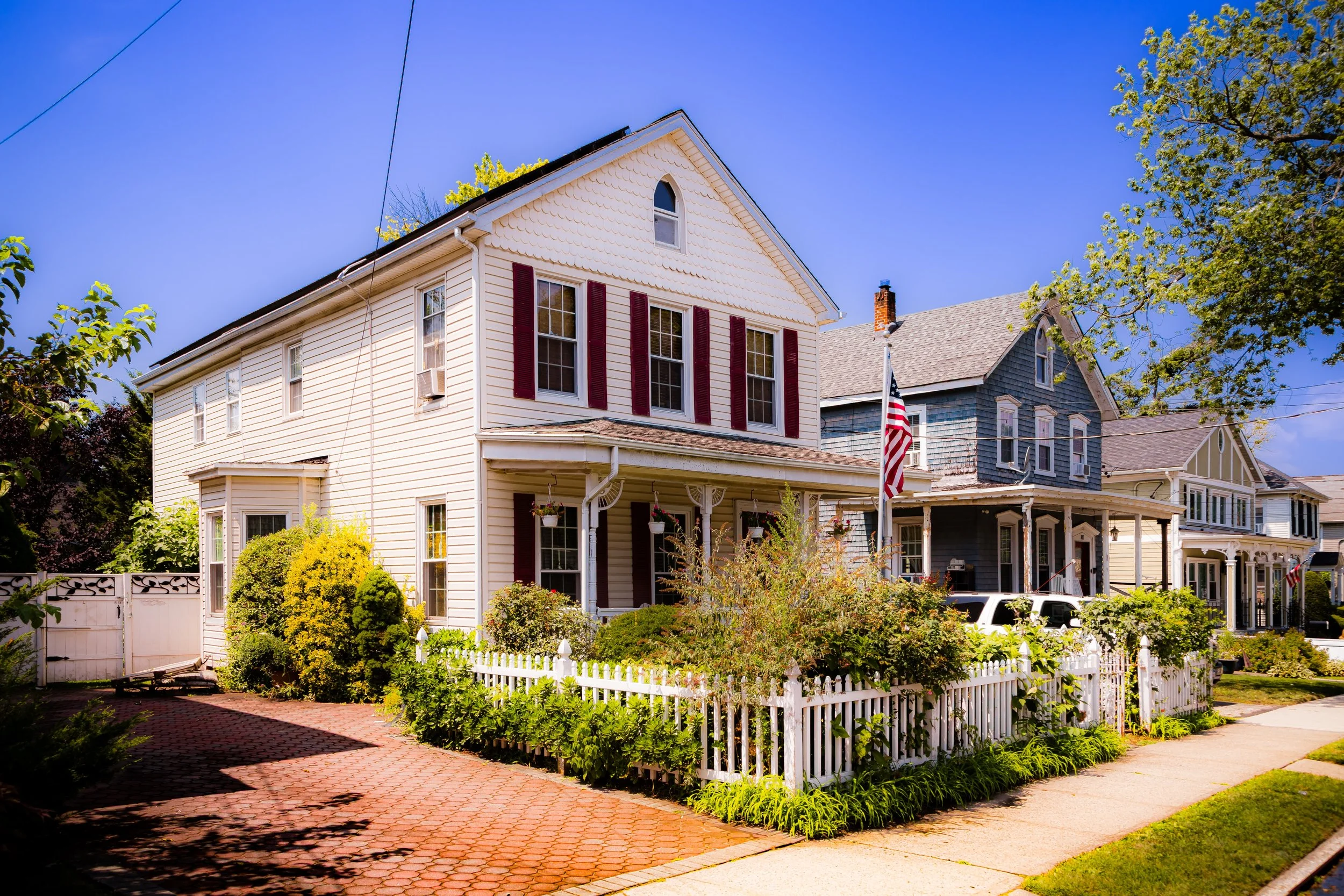
Tottenville’s geography has always defined its character: a peninsula of gentle slopes, tidal flats, and maritime horizons. Its shoreline alternates between rocky bluffs and sandy coves, framed by the protective forests of Conference House Park at the southern end. Inland, quiet residential streets, historic churches, and centuries-old homes blend into newer suburban developments. The sea remains a constant presence—visible, audible, and deeply embedded in the rhythm of local life.
Etymology
The name Tottenville honors the Totten family, early settlers of English descent who established themselves on Staten Island in the 17th century and became prominent landowners, shipbuilders, and civic leaders. Before adopting its present name in 1869, the area was known as Bentley Manor and later Unionville, reflecting its agrarian and industrial roots.
The “ville” suffix reflected 19th-century conventions for naming prosperous suburban communities. Combined with the Totten name—synonymous with local leadership and enterprise—it signaled the neighborhood’s growing identity as a distinct village within Staten Island. Even today, the name carries both heritage and intimacy, evoking a sense of continuity that runs from colonial farmland to modern shorefront suburb.
The Neighborhood
Origins through the 19th Century
Tottenville’s history reaches back to Staten Island’s earliest European settlement. In the 1670s, descendants of the Billopp family established Bentley Manor, a sprawling estate covering much of Staten Island’s southern shore. The manor’s great house, known later as the Conference House, gained a unique place in American history when, on September 11, 1776, British Admiral Richard Howe met with Continental Congress representatives—including Benjamin Franklin, John Adams, and Edward Rutledge—in a final, unsuccessful attempt to negotiate peace during the Revolutionary War.
fter the Revolution, the land gradually passed from aristocratic estates into farms, small shipyards, and hamlets along the water. By the early 19th century, Tottenville had become a hub of shipbuilding and maritime trade. Its proximity to the Arthur Kill—then a vital shipping route—made it ideal for docks, lumberyards, and ferry slips. Craftsmen and oystermen thrived along the shore, harvesting the rich oyster beds of Raritan Bay, which became world-renowned for their abundance and flavor.
The Totten family, whose patriarch John Totten settled in the area around 1788, helped shape its development through civic leadership and entrepreneurship. The opening of the Staten Island Railway in 1860 transformed the village into a commuter community, linking it to St. George and the Manhattan ferry. By the late 19th century, Tottenville was a flourishing seaport village of shipwrights, sailors, and merchants, its waterfront lined with piers, dry docks, and chandlers. Elegant Victorian homes and churches rose along Amboy Road and Arthur Kill Road, while schools and civic halls anchored the growing town center.
Early 20th Century: Maritime Prosperity and Small-Town Life
In the early 20th century, Tottenville reached the height of its maritime and civic prominence. The neighborhood’s shipyards—such as the Tottenville Shipyard and Jacob M. Rutan’s Yard—constructed and repaired vessels for both commercial and naval use, sustaining generations of skilled laborers. The Perth Amboy Ferry, which operated until 1963, provided a vital link to New Jersey and the mainland economy.
Tottenville’s proximity to the bay and its reliable rail and ferry connections made it both a working waterfront and a desirable residential enclave. Amboy Road, the community’s main thoroughfare, became a commercial spine lined with shops, bakeries, barbers, and general stores. Churches such as St. Paul’s United Methodist (1883) and Our Lady Help of Christians (1890) reflected the area’s diverse religious life. Neighborhood schools and fraternal societies fostered a strong sense of local identity—Tottenville was often described as a self-sufficient “village within the city.”
During this period, Tottenville also became known as the “Town the Oyster Built.” Oyster harvesting and processing dominated local industry, with fleets of small boats working the Raritan Bay and Arthur Kill. Families passed down oyster leases and techniques through generations, and the industry supported both affluence and community cohesion.
Despite its prosperity, Tottenville retained a distinctly rural atmosphere well into the 1930s, its streets shaded by elms and maples, its edges fringed with farmland and woodlots. Summers drew visitors from elsewhere on Staten Island and even Brooklyn, who came for the sea breezes and the open skies at the island’s southern edge.

Tottenville Video Coming Soon
Mid–Late 20th Century: Suburban Expansion and Environmental Awareness
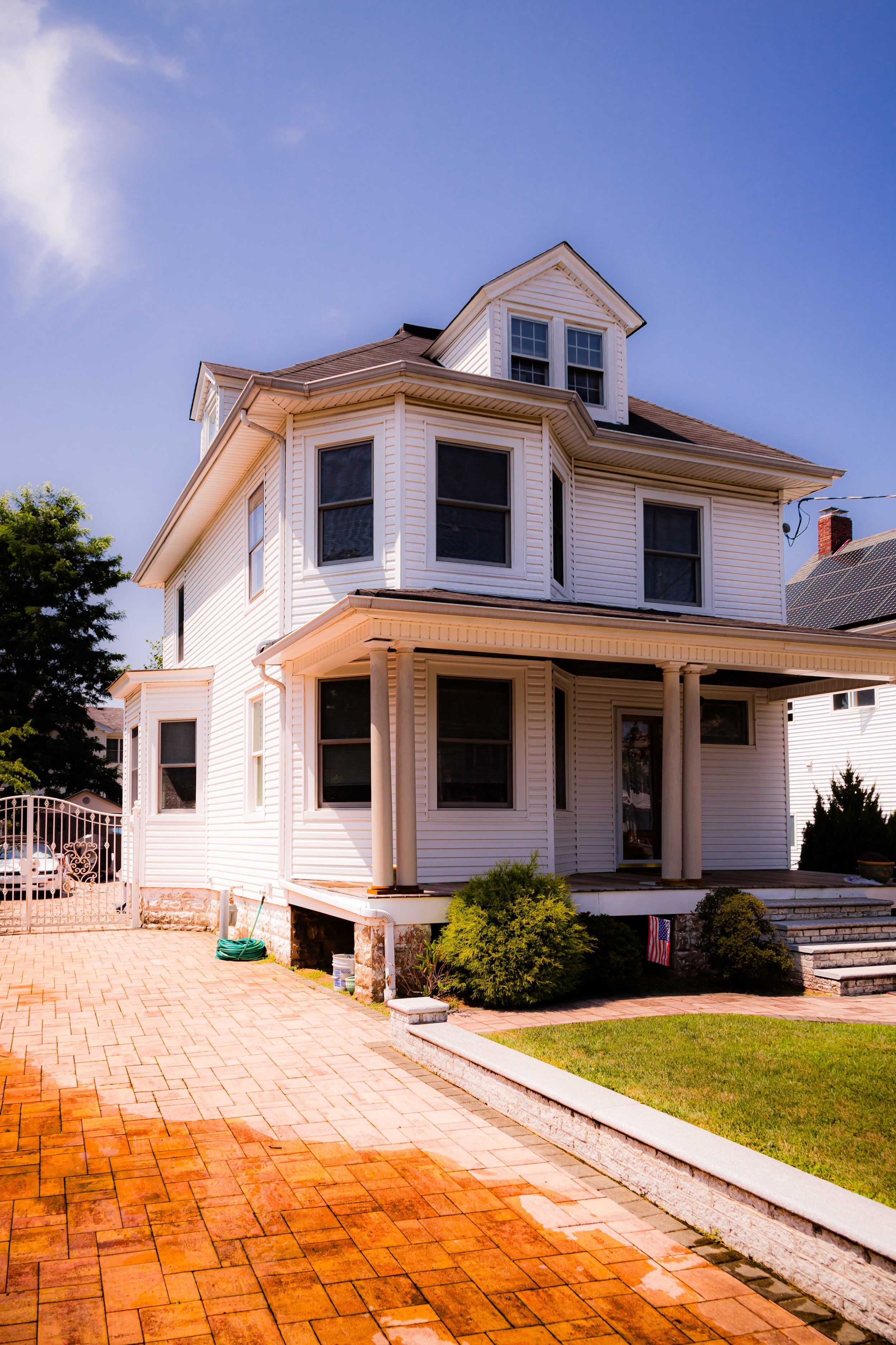
The mid-20th century brought dramatic change. The Verrazzano-Narrows Bridge (1964) and Staten Island’s ensuing population boom reached even Tottenville’s farthest corners. Farmland and wooded tracts gave way to subdivisions of split-level and Colonial-style homes, while new schools and shopping centers arose to serve the influx of families. Yet Tottenville managed to retain much of its small-town character, its main streets still lined with mom-and-pop stores and its waterfront still echoing with maritime rhythms.
The decline of the oyster industry—brought about by pollution and overharvesting in the early 20th century—forced economic diversification. Many residents turned to trades, education, or civil service, while others commuted to Manhattan via the Staten Island Railway and ferry.
At the same time, growing environmental awareness led to efforts to preserve the area’s historic and natural heritage. The Conference House and its surrounding parklands were restored and designated a National Historic Landmark in 1966, while the creation of Conference House Park preserved over 260 acres of woodland, shoreline, and meadow at Staten Island’s southern tip. The park became both a historical site and a natural refuge, protecting the same landscape that witnessed colonial diplomacy nearly 250 years earlier.
The completion of the Outerbridge Crossing (1928) and the continued operation of the Staten Island Railway cemented Tottenville’s role as both a commuter neighborhood and a regional gateway. Through the 1970s and 1980s, community activism helped preserve key landmarks and fostered a strong sense of local stewardship.
21st Century: A Waterfront Village Reimagined
In the 21st century, Tottenville remains a distinctive blend of history, suburban life, and coastal ecology. Its tree-lined streets, historic architecture, and access to open space make it one of Staten Island’s most attractive residential communities. The Staten Island Railway terminus at Tottenville Station continues to anchor the neighborhood’s transportation network, while the commercial corridors along Amboy Road and Arthur Kill Road sustain a mix of long-standing family businesses and new enterprises.
The waterfront, long defined by industry, has gradually shifted toward recreation and conservation. The Tottenville Shoreline Protection Project, part of New York’s coastal resilience initiative, aims to restore wetlands, construct living shorelines, and protect the community from future storm surges. Hurricane Sandy (2012) profoundly affected Tottenville’s low-lying areas, but the neighborhood’s recovery highlighted its deep-rooted resilience and civic cohesion.
Culturally, Tottenville has retained its village feel. Local schools, the Tottenville Branch Library, and community organizations maintain a strong sense of continuity, while the restored Conference House Park serves as both historic landmark and gathering place for festivals, reenactments, and environmental programs. The neighborhood’s mix of historic homes, 20th-century houses, and modern infill developments reflects a living evolution—a community aware of its past yet attuned to its future.
Tottenville Photo Gallery
Spirit and Legacy
The spirit of Tottenville resides in its dual identity as both edge and origin: the southern frontier of New York City and the birthplace of some of its earliest stories. It is a place where the rhythms of the sea still shape daily life, where colonial history meets suburban continuity, and where community pride flows as steadily as the tides.
Its legacy is maritime and moral—built on shipwrights and oystermen, on ferry captains and civic reformers, on families who found in this peninsula not isolation but belonging. Tottenville stands as a living chronicle of Staten Island itself: from Native settlement and colonial negotiation to industrial might and modern preservation.

New York City
Use this custom Google map to explore where every neighborhood in all five boroughs of New York City is located.
The Five Boroughs
One of New York City’s unique qualities is its organization in to 5 boroughs: Manhattan, Brooklyn, Queens, The Bronx, and Staten Island. These boroughs are part pragmatic administrative districts, and part vestiges of the region’s past. Each borough is an entire county in New York State - in fact, Brooklyn is, officially, Kings County, while Staten Island is, officially Richmond County. But that’s not the whole story …
Initially, New York City was located on the southern tip of Manhattan (now the Financial District) that was once the Dutch colony of New Amsterdam. Across the East River, another city was rising: Brooklyn. In time, the city planners realized that unification between the rapidly rising cities would create commercial and industrial opportunities - through streamlined administration of the region.
So powerful was the pull of unification between New York and Brooklyn that three more counties were pulled into the unification: The Bronx, Queens, and Staten Island. And on January 1, 1898, the City of New York unified two cities and three counties into one Greater City of New York - containing the five boroughs we know today.
But because each borough developed differently and distinctly until unification, their neighborhoods likewise uniquely developed. Today, there are nearly 390 neighborhoods, each with their own histories, cultures, cuisines, and personalities - and each with residents who are fiercely proud of their corner of The Big Apple.


