
UNIONPORT
The Bronx
Geographic Setting
Bounded by Westchester Avenue to the north, Westchester Creek to the east, Lafayette Avenue to the south, and White Plains Road to the west, Unionport occupies a compact and historically layered section of the southeastern Bronx—nestled between Parkchester, Soundview, and Castle Hill. Its geography is defined by the bend of Westchester Creek, a tidal inlet that once gave rise to docks and shipyards, and by the dense web of residential blocks that extend inland from its banks. The area sits at a natural crossroads, where the Cross Bronx Expressway and Bruckner Expressway converge nearby, linking Unionport to both the Bronx interior and the East River shore.
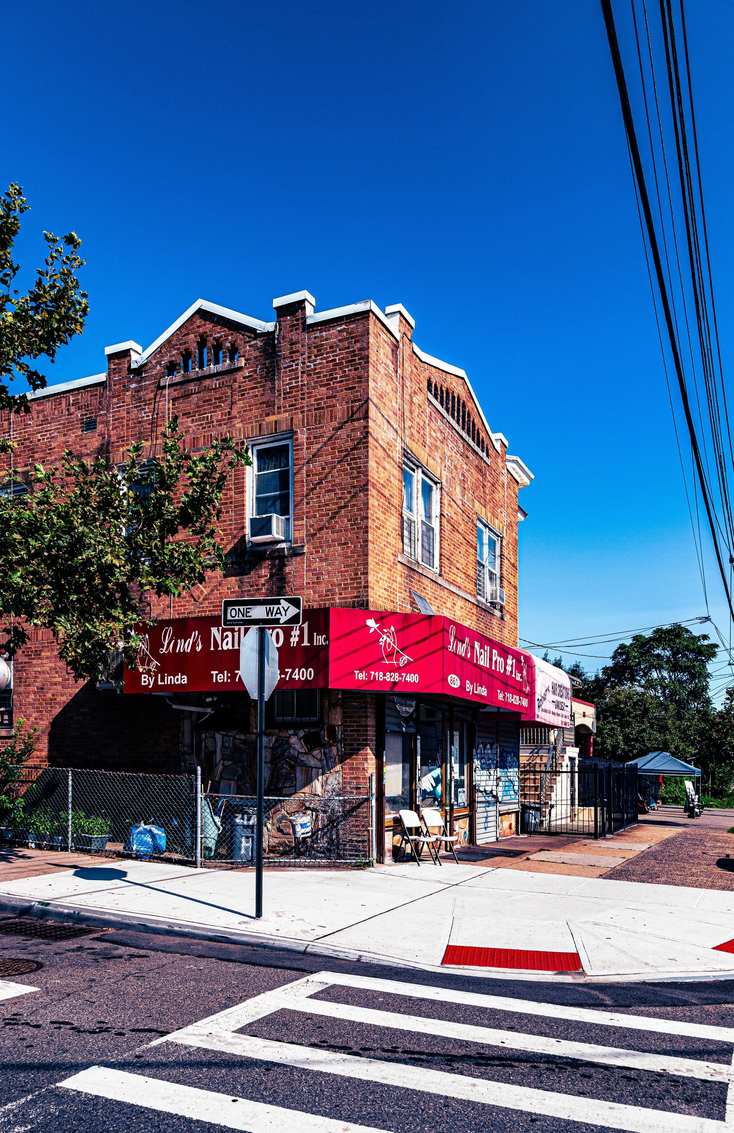
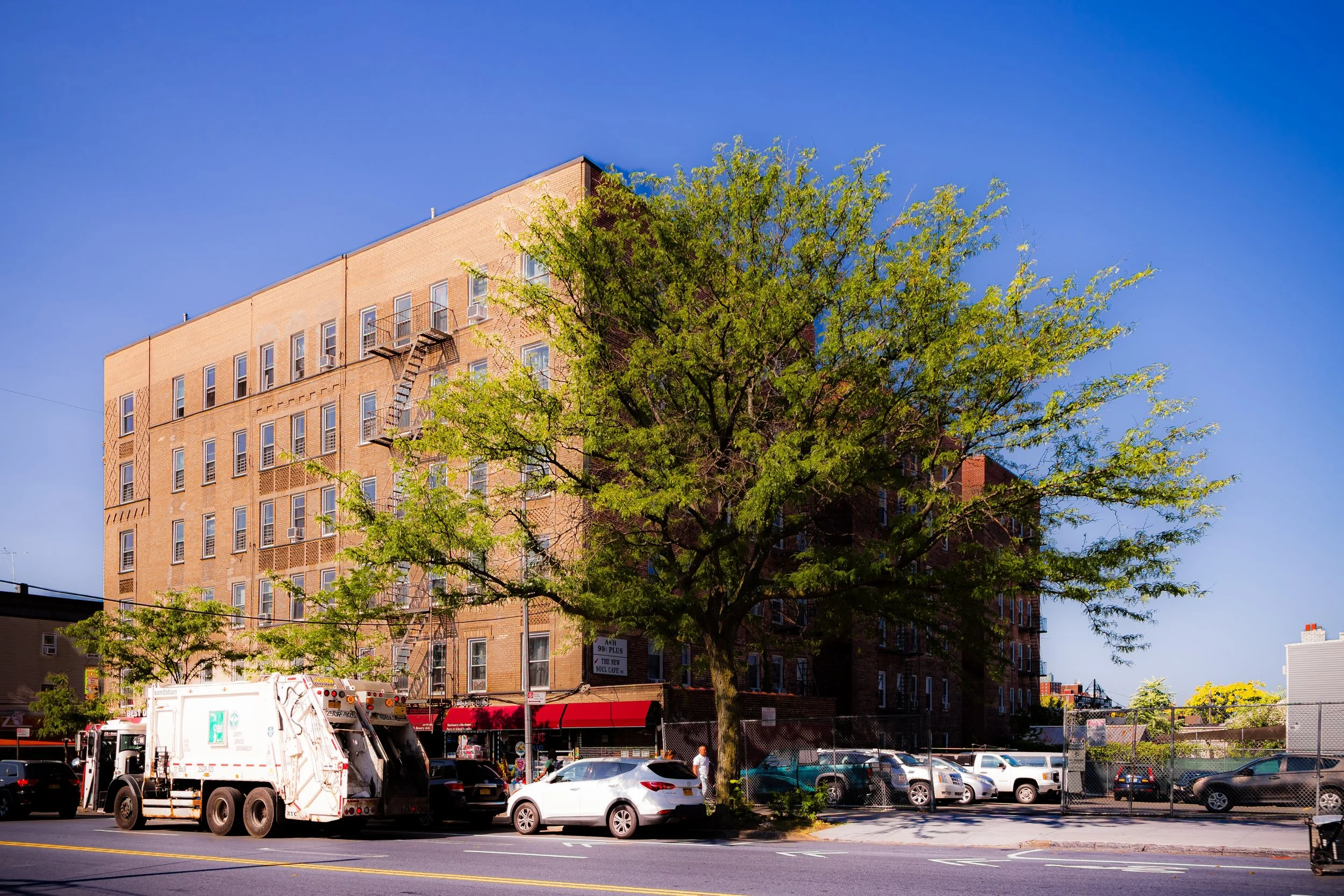
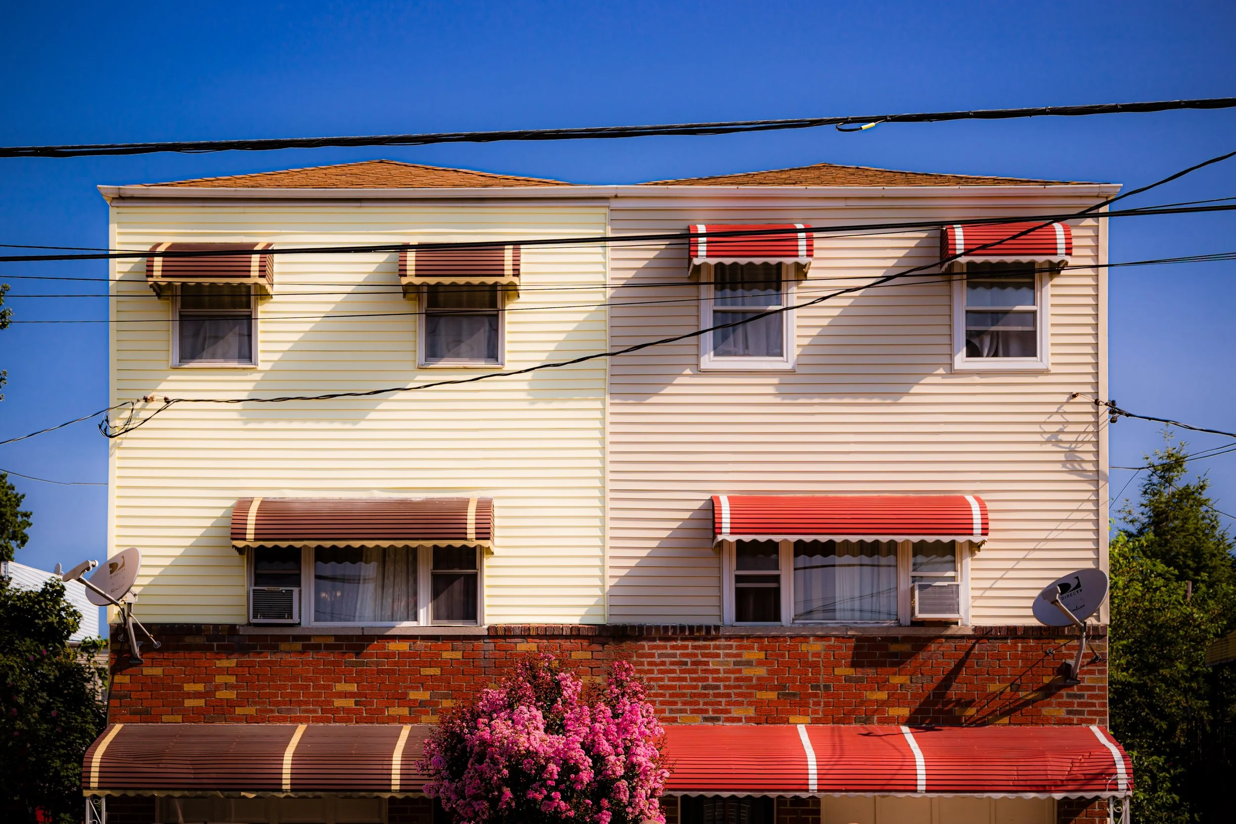
Within its borders, Unionport unfolds as a tapestry of brick rowhouses, two-family homes, postwar apartment buildings, and corner storefronts along Lafayette Avenue, Castle Hill Avenue, and White Plains Road. The 6 train runs just west of the neighborhood, with the Parkchester Station providing direct access to Manhattan. Despite the surrounding expressways, Unionport retains a distinctly residential rhythm—its streets tree-lined, its blocks tightly knit, and its proximity to both Soundview Park and Westchester Creek offering glimpses of greenery and water in an otherwise urban expanse.
Etymology
The name “Unionport” originates from the Unionport Company, a 19th-century real estate and transportation enterprise that sought to unify several small Bronx settlements through a planned ferry and road network along Westchester Creek. The term “Union” reflected both the physical joining of routes and the civic ideal of connecting isolated farming hamlets into a coherent community. The “port,” meanwhile, referred to the small docking facilities and lumber wharves that once dotted the creek’s shoreline, serving sloops and barges trading between the Bronx and Long Island Sound.
By the late 1800s, “Unionport” had entered local maps and postal records as the name for the emerging residential and industrial district east of West Farms—a name that endures, even as the docks that inspired it have long since vanished beneath the city’s grid.
The Neighborhood
Origins through the 19th Century
Before urbanization, the land now comprising Unionport was part of the Town of Westchester, one of the Bronx’s earliest colonial settlements, chartered in 1654. The fertile meadows along Westchester Creek supported farms, mills, and small trading posts that linked the inland Bronx to maritime routes. During the Revolutionary War, the creek’s narrow crossings made the area strategically significant; both American and British forces used its bridges to maneuver between the mainland and the peninsula.
In the 19th century, Unionport emerged as a transitional landscape between rural estates and the industrializing waterfront. The arrival of the Bronx and Westchester Turnpike (later Westchester Avenue) and the extension of streetcar lines in the 1870s–1880s connected the area to the growing urban centers of West Farms and Mott Haven. Developers purchased farmland to create modest subdivisions aimed at the working and middle classes, while industries—sawmills, coal yards, and metalworks—clustered along Westchester Creek.
The Unionport Company, formed in the 1850s, sought to build housing and improve ferry routes to the East River, marketing the area as a convenient residential hub “within sight of the Sound.” Though its plans exceeded its success, the name endured—reflecting both ambition and geography. By the turn of the century, Unionport had become a working-class suburb of New York City, its quiet streets punctuated by factories and depots serving the nearby harbor.
Early 20th Century: From Rural Outpost to Urban Neighborhood
Following the annexation of the Bronx into New York City (1898), Unionport entered a new era of urban development. The introduction of the Interborough Rapid Transit (IRT) Pelham Line (1918), with stations nearby at Parkchester and Castle Hill Avenue, transformed the area from a peripheral settlement into a transit-accessible neighborhood. Rows of brick two- and three-story homes replaced older frame structures, while local institutions—St. Raymond’s Church (founded 1842), P.S. 106, and corner shops along Lafayette Avenue—formed the nucleus of community life.
During the 1920s–1940s, Unionport experienced a housing boom fueled by Bronx-wide expansion. Modest apartment buildings rose along main corridors, catering to Italian-American, Jewish, and later Irish-American families seeking stability and proximity to jobs in nearby industrial zones. The construction of the Bruckner Boulevard and later Bruckner Expressway reinforced the neighborhood’s accessibility but also began the process of physical fragmentation that would define its mid-century landscape.
Nevertheless, the neighborhood retained a small-town texture: bakeries, butchers, and taverns along Lafayette and White Plains Roads catered to generations of families, many of whom owned and maintained their homes for decades.
Unionport Video Coming Soon
Mid–Late 20th Century: Expressways, Resilience, and Renewal
The 1950s–1970s brought dramatic infrastructural change to Unionport. The construction of the Cross Bronx Expressway (1955) and Bruckner Interchange (1961–72) carved through adjacent districts, displacing residents and reshaping the local street grid. Despite the turbulence, Unionport’s core—particularly the triangle bounded by Lafayette Avenue, Castle Hill Avenue, and White Plains Road—remained largely intact.
The nearby construction of Parkchester, the massive Metropolitan Life Insurance housing complex (1940), introduced a new wave of commercial vitality, and many Unionport residents found employment in its shops, maintenance services, and offices. However, like much of the Bronx, Unionport faced the challenges of urban decline in the 1970s: disinvestment, rising vacancy rates, and the gradual departure of long-established families.
Yet the neighborhood never fully succumbed to the devastation that afflicted the South Bronx. Its manageable scale, solid housing stock, and strong network of churches, civic associations, and block organizations helped sustain community cohesion. New residents—primarily Puerto Rican, Dominican, and later West African families—revitalized the area, bringing renewed cultural energy and entrepreneurship to its commercial corridors.
21st Century: Revitalization, Diversity, and Neighborhood Continuity
In the 21st century, Unionport stands as a model of Bronx continuity: a working- and middle-class neighborhood that has evolved without losing its essential character. Its population is among the borough’s most diverse, with Latino, Albanian, African-American, and South Asian families living side by side in a landscape still defined by brick rowhouses and family-owned businesses.
Ongoing investment in Westchester Creek’s waterfront—including environmental cleanup and the proposed expansion of the Bronx River Greenway—has begun to reconnect the neighborhood to its maritime roots. The restoration of Soundview Park and the introduction of the Soundview Ferry Terminal (2018) have further enhanced regional access, drawing attention to the area’s waterfront potential. Meanwhile, Lafayette Avenue and Castle Hill Avenue remain commercial anchors, lined with restaurants, bakeries, and services that reflect the Bronx’s multicultural energy.
Unionport’s proximity to Parkchester continues to shape its identity: residents enjoy the conveniences of a major shopping and transit hub while maintaining a quieter, more residential atmosphere.
Unionport Photo Gallery
Spirit and Legacy
The spirit of Unionport is one of persistence through transformation. From its 19th-century roots as a creekside port to its 21st-century identity as a vibrant urban enclave, the neighborhood has continually adapted without surrendering its human scale or sense of belonging.
Its name—born from the dream of “union”—remains prophetic: Unionport has become precisely what its founders imagined, though in ways they could never have foreseen—a place where cultures, generations, and histories converge in shared space. On summer evenings, when the breeze drifts from Westchester Creek and children play outside along Lafayette Avenue, Unionport feels both timeless and alive—a small port city within the city, united by its endurance and its quiet pride in the Bronx it helped to build.
New York City
Use this custom Google map to explore where every neighborhood in all five boroughs of New York City is located.
The Five Boroughs
One of New York City’s unique qualities is its organization in to 5 boroughs: Manhattan, Brooklyn, Queens, The Bronx, and Staten Island. These boroughs are part pragmatic administrative districts, and part vestiges of the region’s past. Each borough is an entire county in New York State - in fact, Brooklyn is, officially, Kings County, while Staten Island is, officially Richmond County. But that’s not the whole story …
Initially, New York City was located on the southern tip of Manhattan (now the Financial District) that was once the Dutch colony of New Amsterdam. Across the East River, another city was rising: Brooklyn. In time, the city planners realized that unification between the rapidly rising cities would create commercial and industrial opportunities - through streamlined administration of the region.
So powerful was the pull of unification between New York and Brooklyn that three more counties were pulled into the unification: The Bronx, Queens, and Staten Island. And on January 1, 1898, the City of New York unified two cities and three counties into one Greater City of New York - containing the five boroughs we know today.
But because each borough developed differently and distinctly until unification, their neighborhoods likewise uniquely developed. Today, there are nearly 390 neighborhoods, each with their own histories, cultures, cuisines, and personalities - and each with residents who are fiercely proud of their corner of The Big Apple.


