DOUGLAS MANOR
Queens
Geographic Setting
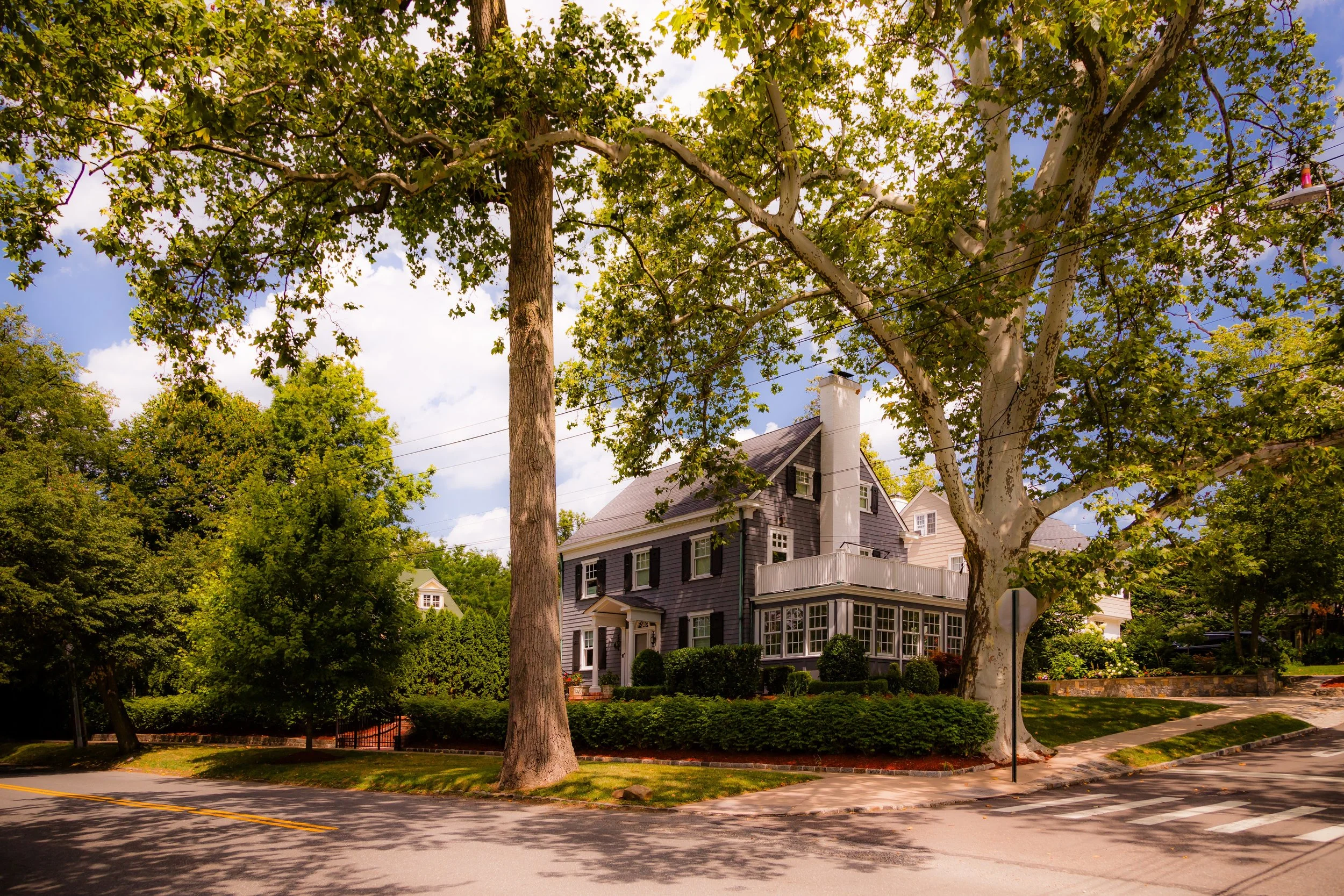
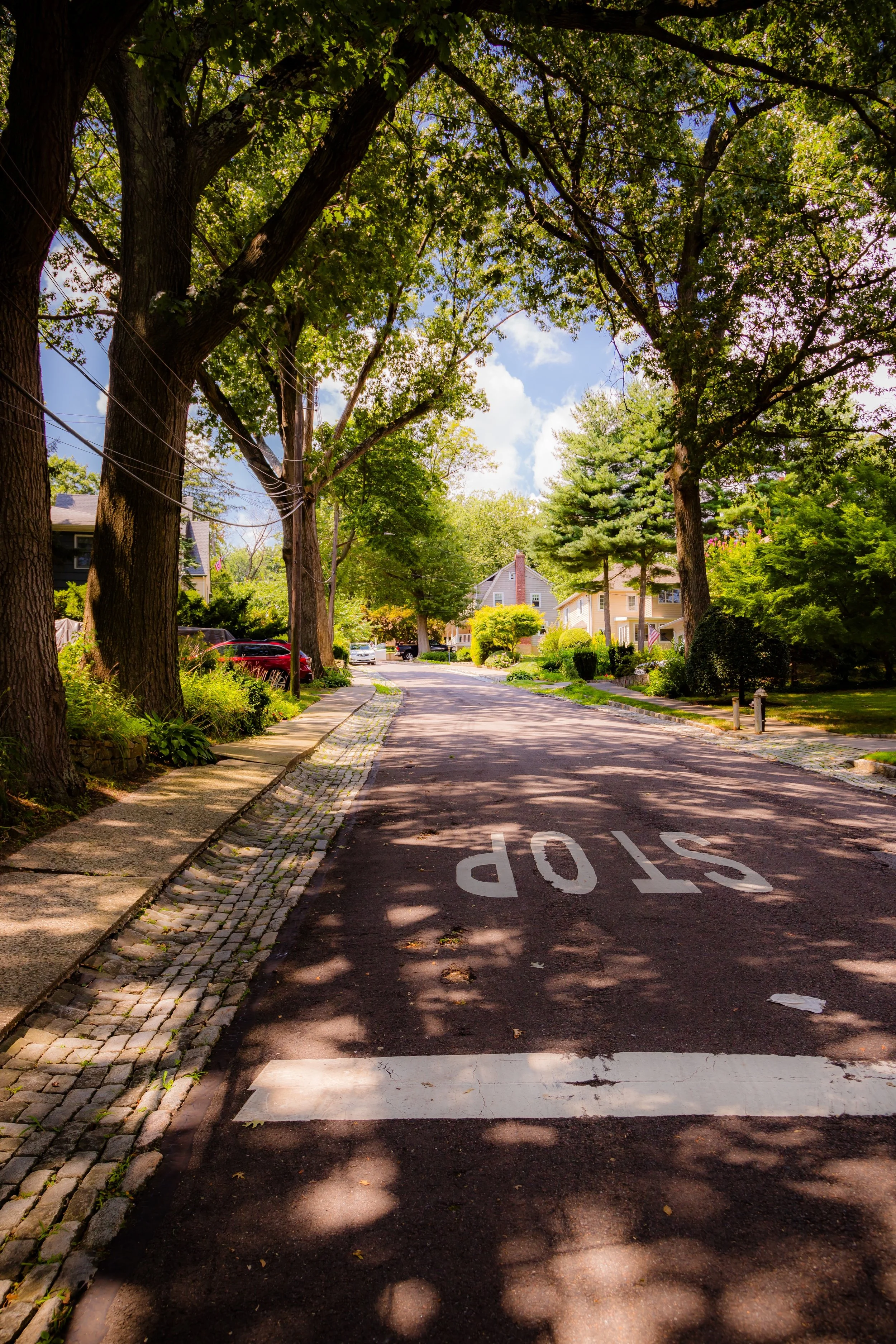
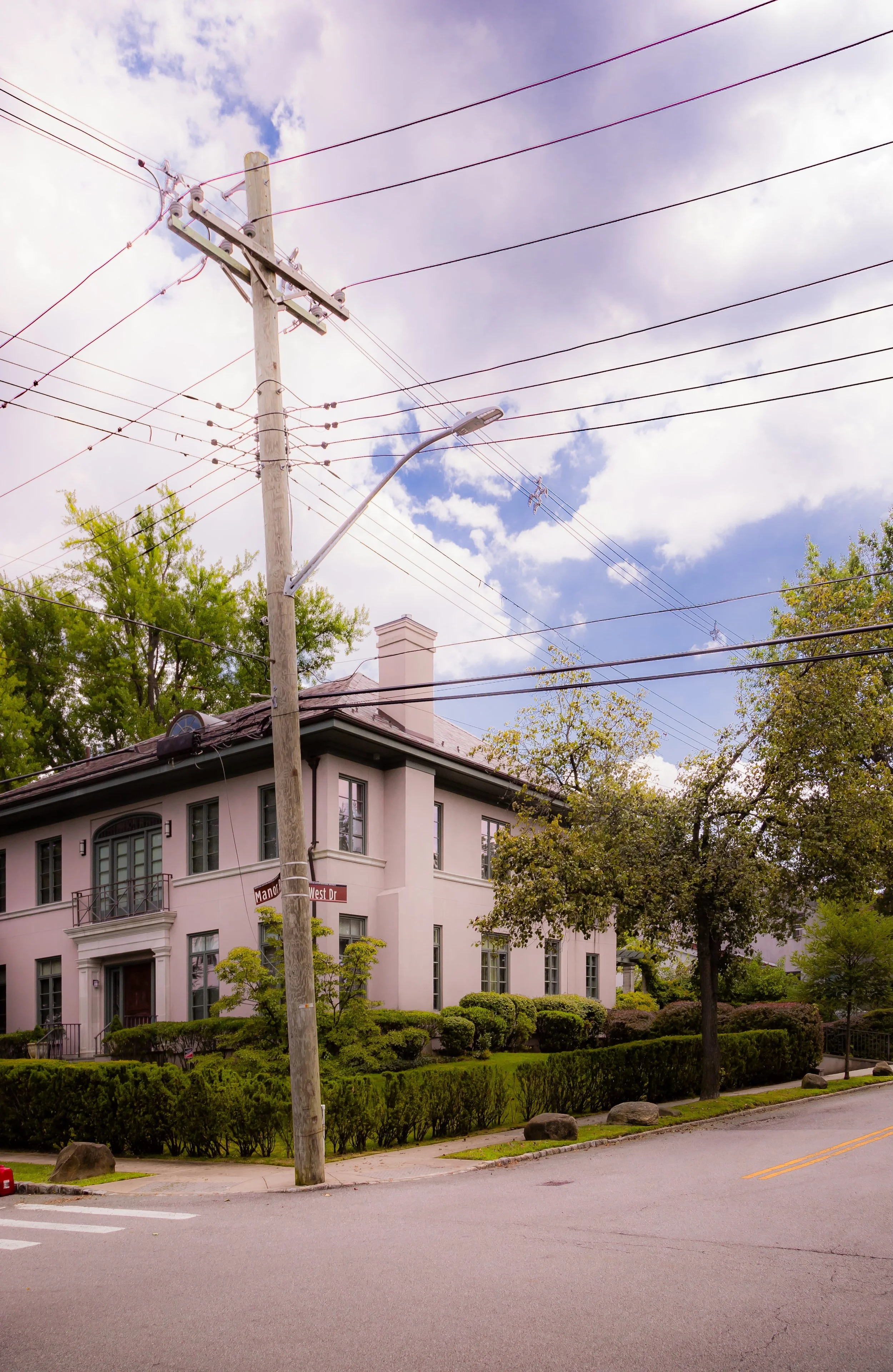
Bounded by Douglas Road to the east, Cherry Street to the south, 235th Street and Melrose Lane to the southwest, and the waters of Little Neck Bay to the west and north, Douglas Manor occupies one of the most picturesque and historically intact waterfront enclaves in New York City. Tucked within the greater neighborhood of Douglaston, it lies at the northeastern edge of Queens—a peninsula of winding roads, towering trees, and early-20th-century homes that open onto sweeping views of the bay and the Throgs Neck Bridge beyond. The neighborhood’s curved streets, shaded lanes, and stately residences stand in sharp contrast to the rigid urban grid that defines much of the city, offering a glimpse of an older suburban ideal shaped by landscape, architecture, and conservation.
The community’s heart is Douglas Road and West Drive, which trace the contours of the shoreline past century-old homes, yacht clubs, and pocket parks. Crescent Street, Arleigh Road, and Manor Road branch inward through a canopy of oaks and maples, leading to small cul-de-sacs that end in views of the water. The Douglaston Club, a local social and recreational landmark housed in the former Van Zandt mansion, overlooks the bay near West Drive and Church Street, while the Douglaston Yacht Squadron anchors the waterfront with its pier and marina. Together they form the civic and social nucleus of a neighborhood defined as much by its geography as by its commitment to preservation.
Etymology and Origins
Douglas Manor derives its name from the Douglas family, Scottish-American landowners who acquired the surrounding territory in the late 19th century. The larger district of Douglaston had its beginnings when William P. Douglas, a wealthy New York businessman and yachtsman, purchased farmland along Little Neck Bay in the 1860s and 1870s. His estate, later subdivided, gave rise to both the Douglas Manor residential development and the commercial core of Douglaston Hill. The word “Manor” was chosen deliberately by early 20th-century developers to evoke a sense of exclusivity and pastoral refinement, echoing English estate communities such as Forest Hills Gardens and Bronxville.
Before the Douglas family’s arrival, the peninsula formed part of the Cornell family farmstead, one of the earliest European settlements in Queens, dating back to the 17th century. The Matinecock people originally inhabited this coastline, fishing and harvesting shellfish in Little Neck Bay and cultivating the surrounding land. Throughout the colonial and early American periods, the area remained agricultural—its meadows, orchards, and shoreline marshes supplying produce to markets in Flushing and Manhattan.
The Neighborhood
Early 20th Century: The Planned Waterfront Suburb
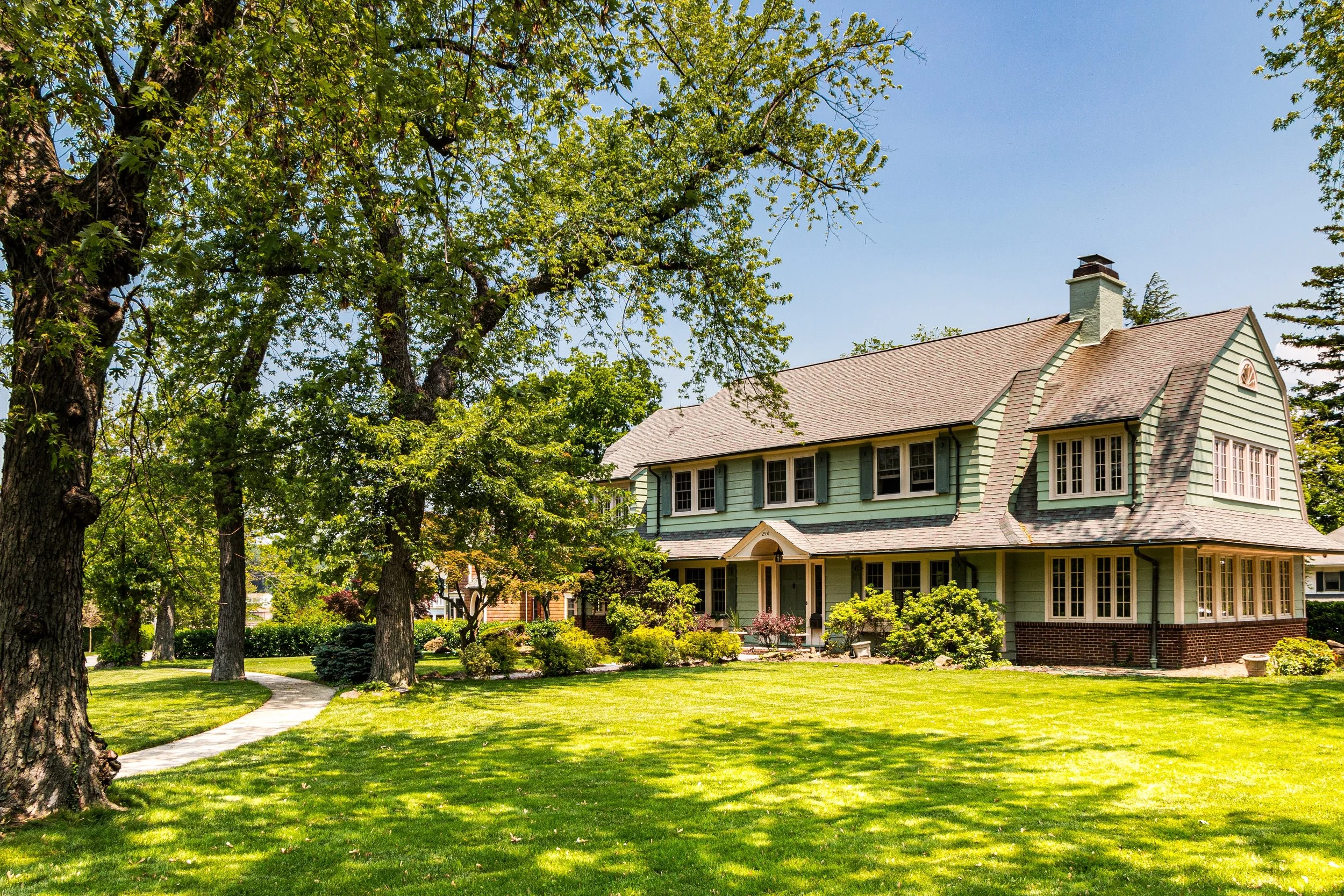
Douglas Manor took its present form in the early 1900s, when the Douglas Land Improvement Company undertook a carefully designed residential development guided by landscape architect Arnold W. Brunner. Brunner’s 1906 plan rejected the rigid Manhattan-style grid in favor of curving, picturesque streets that followed the peninsula’s topography. Generous lot sizes, strict setback requirements, and deed restrictions ensured both privacy and harmony among homes.
The architectural vision of Douglas Manor was distinctly eclectic but unified in scale and craftsmanship. Houses were built primarily between 1906 and 1935, in styles ranging from Colonial Revival, Tudor Revival, and Arts & Crafts to Mediterranean and Dutch Colonial. Prominent architects such as William B. Tubby and Charles Platt contributed designs, many of which still stand with their original details intact—slate roofs, dormers, wraparound porches, and stone chimneys. The waterfront, meanwhile, remained largely open, reserved for community use and scenic views.
From the start, Douglas Manor was envisioned as a refuge from urban congestion—a “country home by the sea” for professionals commuting to Manhattan via the Long Island Rail Road’s Douglaston Station, just a short walk south of the Manor’s border. Advertisements of the era touted “the charm of Long Island with the convenience of the city,” a balance that continues to define the neighborhood’s appeal.
Mid-20th Century: Preservation and Continuity
Unlike many suburban communities that succumbed to overdevelopment in the postwar years, Douglas Manor maintained its historic integrity through strong local governance and community pride. The formation of the Douglas Manor Association (DMA) in the 1920s provided an organized voice for residents committed to preserving the neighborhood’s character. The association enforced covenants, maintained parks and private streets, and organized civic events that fostered a close-knit atmosphere.
During the 1930s–1950s, as much of Queens filled with postwar housing, Douglas Manor’s large lots and architectural restrictions ensured stability and continuity. Families often remained for generations, and social life centered around the Douglaston Club—with its tennis courts, ballroom, and waterfront dining—and the Douglaston Yacht Squadron, which hosted sailing regattas and community gatherings along the bay.
The Manor’s isolation by design—bounded by water on two sides and limited road access—further preserved its distinct identity. Even as urbanization encroached beyond its borders, Douglas Manor remained a haven of quiet, tree-shaded streets, an atmosphere more akin to a New England seaside village than a New York City neighborhood.
Douglas Manor Video Coming Soon
Late 20th Century: Historic District Recognition and Renewal
By the 1970s, local activism ensured that Douglas Manor would receive formal protection. In 1997, the New York City Landmarks Preservation Commission designated the Douglas Manor Historic District, encompassing more than 600 structures and nearly the entire peninsula. The district’s boundaries closely mirror the neighborhood’s original layout, preserving not only its architecture but also its landscape—the winding roads, mature trees, and public shoreline vistas.
The designation recognized Douglas Manor as “an exceptionally cohesive example of early-20th-century suburban planning,” comparable in spirit to Forest Hills Gardens and other model communities of the era. Homeowners, guided by the Douglas Manor Association, have since maintained a strong tradition of architectural stewardship. Restoration projects and design guidelines ensure that renovations respect the original scale and materials, safeguarding the neighborhood’s charm.
Throughout the late 20th and early 21st centuries, Douglas Manor has continued to evolve without losing its essential character. While a few newer homes have been constructed, they remain subject to the same design principles that have governed the area for more than a century.
21st Century: Waterfront Legacy and Community Life
Today, Douglas Manor remains one of the most picturesque and historically intact neighborhoods in New York City—a rare fusion of natural beauty and architectural grace. The waterfront along Little Neck Bay offers stunning views, walking trails, and mooring for sailboats, while the tree-lined interior streets evoke a timeless calm. The community’s proximity to Udalls Cove Park Preserve, a protected wetland ecosystem, reinforces its connection to nature and its role in environmental stewardship.
Residents continue to engage in civic and social life through the Douglas Manor Association, the Douglaston Garden Club, and the Douglaston Yacht Squadron. Annual events such as regattas, block parties, and holiday gatherings strengthen the intergenerational ties that define the neighborhood. Despite being part of the vast New York metropolis, Douglas Manor retains the intimacy of a small coastal village—one where neighbors know one another, traditions endure, and the rhythms of the tide remain part of daily life.
Douglas Manor Photo Gallery
Spirit and Legacy
Douglas Manor’s legacy lies in its harmony of setting, design, and community—a living expression of the early 20th-century ideal that suburban development could coexist with natural beauty. Its curving roads, historic homes, and preserved shoreline stand as a testament to the power of foresight and stewardship.
New York City
Use this custom Google map to explore where every neighborhood in all five boroughs of New York City is located.
The Five Boroughs
One of New York City’s unique qualities is its organization in to 5 boroughs: Manhattan, Brooklyn, Queens, The Bronx, and Staten Island. These boroughs are part pragmatic administrative districts, and part vestiges of the region’s past. Each borough is an entire county in New York State - in fact, Brooklyn is, officially, Kings County, while Staten Island is, officially Richmond County. But that’s not the whole story …
Initially, New York City was located on the southern tip of Manhattan (now the Financial District) that was once the Dutch colony of New Amsterdam. Across the East River, another city was rising: Brooklyn. In time, the city planners realized that unification between the rapidly rising cities would create commercial and industrial opportunities - through streamlined administration of the region.
So powerful was the pull of unification between New York and Brooklyn that three more counties were pulled into the unification: The Bronx, Queens, and Staten Island. And on January 1, 1898, the City of New York unified two cities and three counties into one Greater City of New York - containing the five boroughs we know today.
But because each borough developed differently and distinctly until unification, their neighborhoods likewise uniquely developed. Today, there are nearly 390 neighborhoods, each with their own histories, cultures, cuisines, and personalities - and each with residents who are fiercely proud of their corner of The Big Apple.


