
JEROME PARK
The Bronx
Geographic Setting
Bounded by Mosholu Parkway to the northeast, the Grand Concourse to the east, Bedford Park Boulevard to the south, and the Jerome Park Reservoir to the west, Jerome Park occupies a verdant and elevated section of the northwestern Bronx—a neighborhood defined by graceful streets, institutional landmarks, and the shimmer of open water. The district rises gently between the wooded expanse of Bronx Park to the east and the stone embankments of the reservoir to the west, creating a setting that balances urban architecture with pastoral calm.
The Jerome Park Reservoir, completed in the early 20th century, remains the community’s dominant physical and symbolic feature. Its vast, mirror-like surface, framed by classical balustrades and iron fences, reflects the surrounding trees and towers—a tranquil counterpoint to the busy thoroughfares of Bedford Park Boulevard and the Grand Concourse. Within this boundary lies a dense yet harmonious grid of prewar apartment houses, educational institutions, and cultural landmarks, including Lehman College, DeWitt Clinton High School, and the Bronx High School of Science, all of which have shaped the neighborhood’s intellectual and civic character.
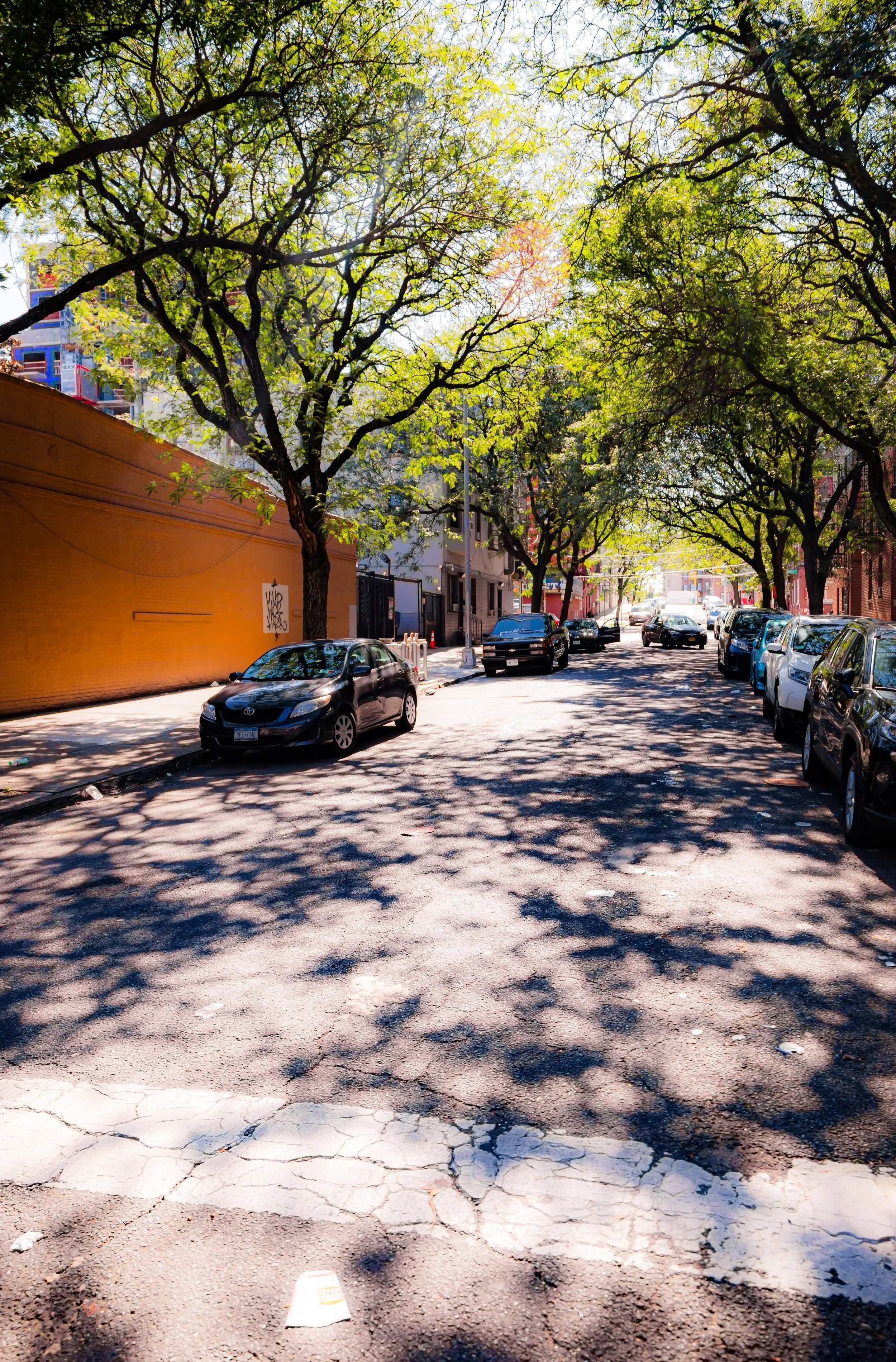
With its tree-lined streets, steep inclines, and proximity to Van Cortlandt Park and Mosholu Parkway, Jerome Park stands as one of the Bronx’s most distinctive hilltop neighborhoods—an intersection of natural beauty, education, and architectural legacy.
Etymology
The name “Jerome Park” honors Leonard Walter Jerome (1817–1891), a flamboyant 19th-century financier, sportsman, and newspaper proprietor—best known today as the grandfather of Winston Churchill. Jerome was a key figure in New York’s Gilded Age society and a patron of horse racing, art, and opera. In 1866, he established the Jerome Park Racetrack on what is now the reservoir site, envisioning an elegant country course for the city’s elite.
“Jerome Park” thus began as a symbol of aristocratic leisure—a name synonymous with refinement and spectacle. Although the racetrack was replaced by public works in the early 20th century, the name endured, evolving from private indulgence to public purpose, mirroring the Bronx’s transformation from suburban retreat to civic heartland.
The Neighborhood
Origins through the 19th Century
Before urbanization, the land that would become Jerome Park lay within the estate-filled countryside of Fordham and Kingsbridge, dotted with farms, wooded ridges, and meadows overlooking the Harlem River Valley. The arrival of the New York and Harlem Railroad (1840s) and the Hudson Line nearby encouraged suburban settlement, but the area retained its rural charm well into the post–Civil War era.
In 1866, Leonard Jerome—along with financier August Belmont Sr.—founded the Jerome Park Racetrack, a lavish oval course that quickly became one of America’s premier sporting venues. It hosted the first Belmont Stakes in 1867 and drew New York’s high society, who arrived by carriage and train for a day of racing and revelry. The surrounding hills sprouted grand villas and inns catering to the racing crowd. For several decades, “Jerome Park” signified not just a place but a lifestyle of elegance, equestrian culture, and social prestige.
The racetrack’s heyday ended in the 1890s, when the city acquired the property for the expansion of the Croton Aqueduct System. Construction of the Jerome Park Reservoir began in 1895 and continued into the early 1900s, transforming the landscape from private recreation to vital civic infrastructure.
Early 20th Century: From Racetrack to Reservoir and Residential Growth
With the completion of the Jerome Park Reservoir in 1906, the neighborhood entered a new era. The massive engineering project, part of the city’s New Croton Aqueduct, supplied millions of gallons of fresh water to New York, symbolizing progress and modernity. Around its perimeter, landscaped promenades and stone walls created a dignified civic environment reminiscent of the City Beautiful movement.
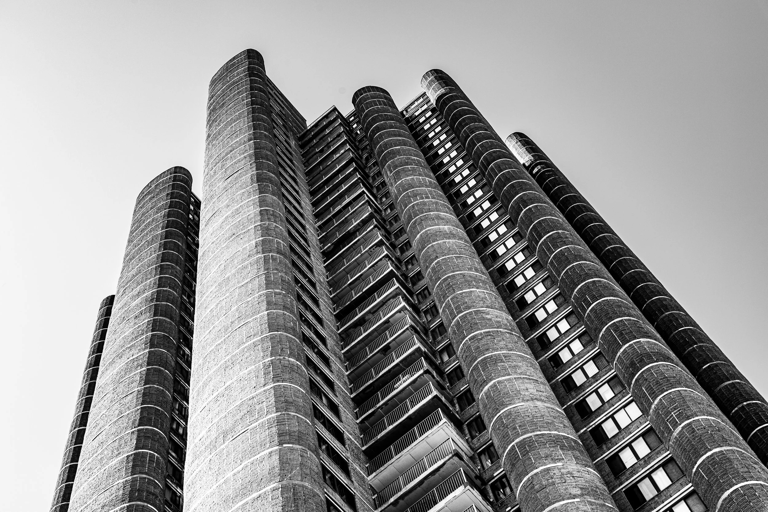
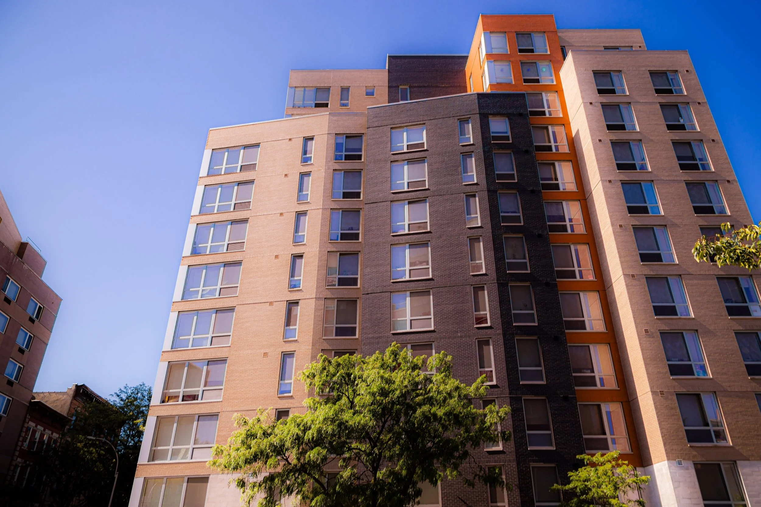
At the same time, the surrounding land—particularly east of Sedgwick Avenue and Jerome Avenue—was subdivided for residential and institutional use. The extension of the IRT Jerome Avenue Line (1917) brought transit access, encouraging the construction of five- and six-story apartment buildings in elegant Art Deco and Tudor Revival styles. Developers marketed these buildings to middle-class families seeking fresh air, green views, and proximity to both Manhattan and the Bronx’s growing network of schools and parks.
The early 20th century also saw the establishment of key institutions that defined Jerome Park’s identity. DeWitt Clinton High School, one of the city’s largest and most storied public schools, opened its monumental building overlooking the reservoir in 1929, followed by Lehman College (originally Hunter College’s Bronx campus, later CUNY Lehman College in 1968) and, nearby, the Bronx High School of Science (1938). These institutions transformed the area into an academic hub, attracting educators, students, and professionals from across the city.
Jerome Park Video Coming Soon
Mid–Late 20th Century: Urban Change and Academic Anchors
The postwar decades brought both challenges and continuity. As the Bronx experienced demographic shifts in the 1950s–1970s, Jerome Park’s educational institutions provided stability amid broader urban change. While neighboring areas suffered from disinvestment and population loss, Jerome Park remained relatively intact, supported by the presence of Lehman College, DeWitt Clinton High School, and Bronx Science—all of which continued to draw students citywide.
The Grand Concourse, once dubbed “the Champs-Élysées of the Bronx,” framed the neighborhood’s eastern edge, lined with elegant Art Deco apartment houses that retained much of their original architectural integrity. However, the construction of the Major Deegan Expressway (completed 1956) and subsequent automobile dominance disrupted nearby connections, increasing noise and traffic while isolating the reservoir from direct public access.
Community activism grew during this period. Residents advocated for better maintenance of the reservoir’s perimeter and the preservation of surrounding parkland, emphasizing the area’s importance as a green and civic space. The creation of Lehman College in 1968—in the aftermath of CUNY’s system-wide expansion and student protests for greater inclusion—cemented the neighborhood’s reputation as a bastion of education and upward mobility within the Bronx.
21st Century: Preservation, Education, and Renewal
Today, Jerome Park remains a stable, educated, and civically engaged community within the Bronx. The Jerome Park Reservoir—still a critical component of New York City’s water supply—has been the focus of extensive environmental restoration and public-access campaigns. Occasional “reservoir walks” and community open days have reconnected residents to this extraordinary landscape, blending historic infrastructure with environmental stewardship.
The surrounding educational institutions continue to anchor the neighborhood’s life. Lehman College has expanded into a vibrant liberal arts and research campus, while DeWitt Clinton High School and Bronx Science maintain strong academic traditions. The nearby Mosholu Parkway greenway, part of the Bronx’s great necklace of parks conceived by Frederick Law Olmsted Jr., provides a lush recreational corridor linking Van Cortlandt Park to the New York Botanical Garden.
Architecturally, Jerome Park retains its early 20th-century charm: Art Deco facades, stone terraces, and tree-lined boulevards define its character. New housing cooperatives and condo conversions have brought modest renewal without erasing the area’s historical continuity. The community remains proud of its identity as a quiet, intellectual enclave—one where the city’s grandeur and the Bronx’s humanity coexist in delicate balance.
Jerome Park Photo Gallery
Spirit and Legacy
The spirit of Jerome Park is one of transformation with purpose. From the opulent racetrack of Leonard Jerome’s imagination to a cornerstone of New York’s water system, from farmland to educational campus, it has always served the public good in evolving forms. Its hills hold the layers of Bronx history—ambition, resilience, and civic pride—woven together by the enduring presence of the reservoir that defines its heart.
New York City
Use this custom Google map to explore where every neighborhood in all five boroughs of New York City is located.
The Five Boroughs
One of New York City’s unique qualities is its organization in to 5 boroughs: Manhattan, Brooklyn, Queens, The Bronx, and Staten Island. These boroughs are part pragmatic administrative districts, and part vestiges of the region’s past. Each borough is an entire county in New York State - in fact, Brooklyn is, officially, Kings County, while Staten Island is, officially Richmond County. But that’s not the whole story …
Initially, New York City was located on the southern tip of Manhattan (now the Financial District) that was once the Dutch colony of New Amsterdam. Across the East River, another city was rising: Brooklyn. In time, the city planners realized that unification between the rapidly rising cities would create commercial and industrial opportunities - through streamlined administration of the region.
So powerful was the pull of unification between New York and Brooklyn that three more counties were pulled into the unification: The Bronx, Queens, and Staten Island. And on January 1, 1898, the City of New York unified two cities and three counties into one Greater City of New York - containing the five boroughs we know today.
But because each borough developed differently and distinctly until unification, their neighborhoods likewise uniquely developed. Today, there are nearly 390 neighborhoods, each with their own histories, cultures, cuisines, and personalities - and each with residents who are fiercely proud of their corner of The Big Apple.


