TOMPKINSVILLE
Staten Island
Geographic Setting
Bounded, moving clockwise, by the Narrows to the northeast, Clinton Street to the northwest, St. Paul’s Avenue to the southwest, Cebra Avenue to the west, Victory Boulevard to the northwest, Woodstock Avenue and Glen Avenue to the north, Brighton Avenue and Jersey Street to the northeast, then Victory Boulevard and the Narrows to the east, Tompkinsville lies at the geographic and historical crossroads of Staten Island’s North Shore. Between St. George to the north and Stapleton to the south, Tompkinsville occupies the central stretch of the island’s original harborfront, where Staten Island first began to urbanize in the 19th century.
The neighborhood rises sharply from the waterfront along Bay Street, climbing through a maze of leafy hills and winding roads to the high ridges of Cebra and St. Paul’s Avenues. At the base, the historic waterfront once teemed with shipyards, ferry docks, and warehouses; inland, handsome rowhouses and churches recall the prosperity of the late 19th century. Today, Tompkinsville remains both gateway and anchor—a diverse, evolving district that links Staten Island’s civic core to its working waterfront, its history reflected in every street that climbs from the harbor to the hill.
Etymology
Tompkinsville takes its name from Daniel D. Tompkins (1774–1825), a native Staten Islander who served as Governor of New York (1807–1817) and Vice President of the United States under James Monroe (1817–1825). A reform-minded statesman, Tompkins envisioned the transformation of his home island into a thriving maritime and civic center. In 1815, he established a ferry line between Staten Island and Manhattan, founding a small harbor settlement near today’s Bay Street that would bear his name.
The name Tompkinsville thus embodies both place and purpose: a tribute to civic idealism and economic foresight. From its earliest days, it symbolized Staten Island’s aspiration to connect itself—physically, economically, and culturally—to the broader metropolis across the harbor.
The Neighborhood
Origins through the 19th Century
Tompkinsville’s roots lie in Staten Island’s early maritime and industrial expansion. Before its founding, the area consisted of farmland and tidal marshes belonging to the Dutch and English families who settled the North Shore in the 1600s. The deep-water anchorage along the Narrows made it an ideal location for a ferry landing, and in 1815, Daniel D. Tompkins launched the Staten Island Ferry, establishing a direct link to Whitehall in Manhattan. Around this landing grew a modest but rapidly developing village centered on trade, shipbuilding, and local commerce.
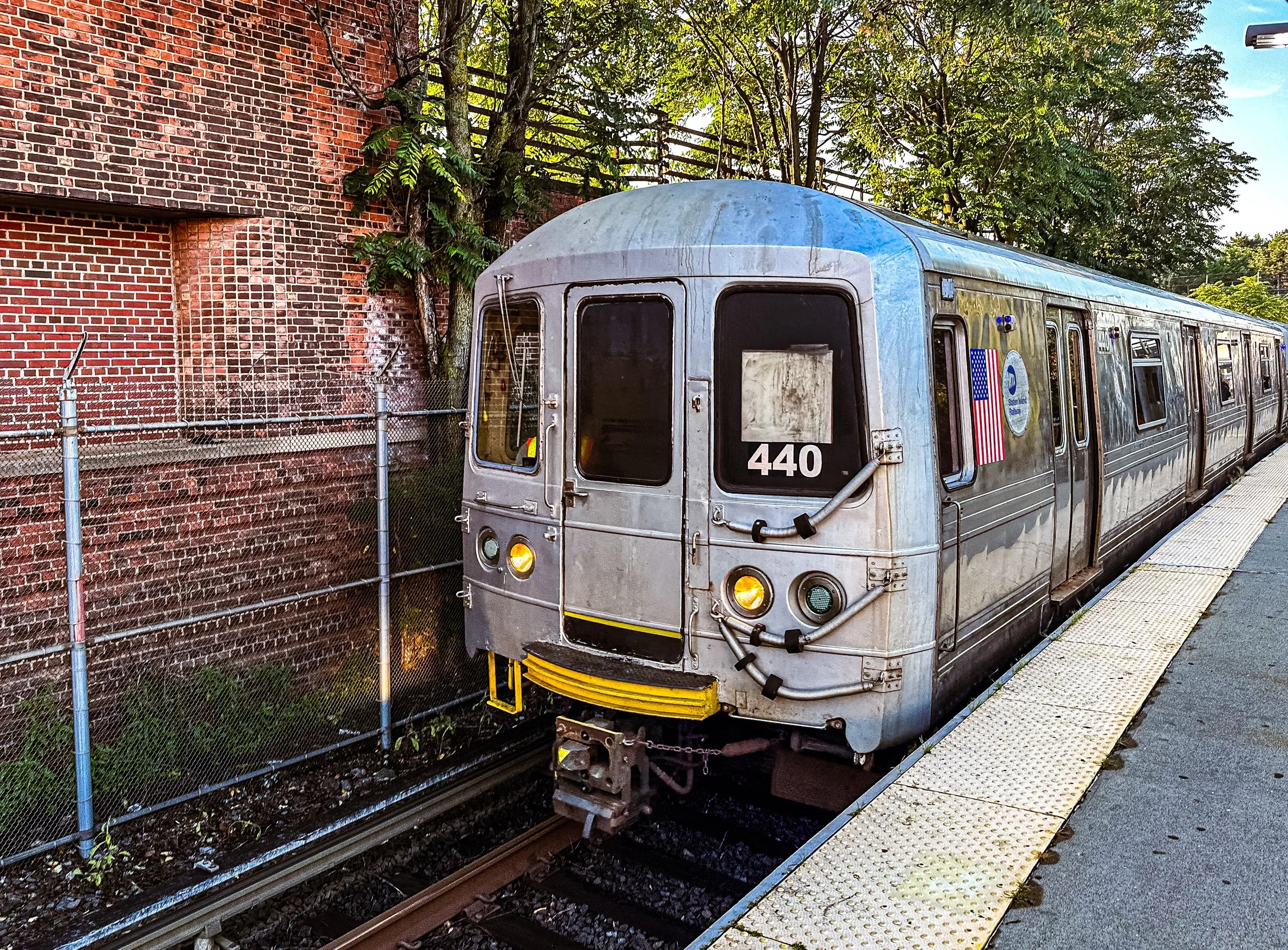
By the mid-19th century, Tompkinsville had become Staten Island’s principal port and industrial hub. The waterfront bristled with shipyards, dry docks, and warehouses, while the upland hills attracted affluent merchants and sea captains who built elegant homes overlooking the harbor. In 1849, the U.S. Lighthouse Depot (later the U.S. Coast Guard Base) was established on Bay Street, supplying and maintaining navigational aids for lighthouses along the entire Atlantic coast—a testament to the area’s strategic maritime importance.
The Richmond County Courthouse (1837) and a cluster of civic buildings near Victory Boulevard marked Tompkinsville as an emerging administrative center, rivaling St. George before the borough’s consolidation. By the 1870s, Bay Street had evolved into one of Staten Island’s most important commercial corridors, lined with taverns, groceries, workshops, and boardinghouses that served both sailors and longshoremen. The neighborhood’s population swelled with immigrants—Irish, German, Italian—whose labor and craftsmanship sustained its industries. The construction of churches, including St. Paul’s Memorial Church (1866) and Trinity Lutheran, reflected this growing diversity and civic pride.
Early 20th Century: Maritime Vitality and Civic Growth
In the early 20th century, Tompkinsville flourished as a maritime powerhouse. Its waterfront bustled with activity from the U.S. Lighthouse Depot, shipbuilding operations, and the Whitehall-Tompkinsville Ferry, which remained a key commuter route until replaced by the St. George terminal in the 1880s. The establishment of Tappen Park (1907)—a triangular green framed by Bay Street and Water Street—created a civic focal point for the neighborhood, offering open space and hosting community gatherings and markets.
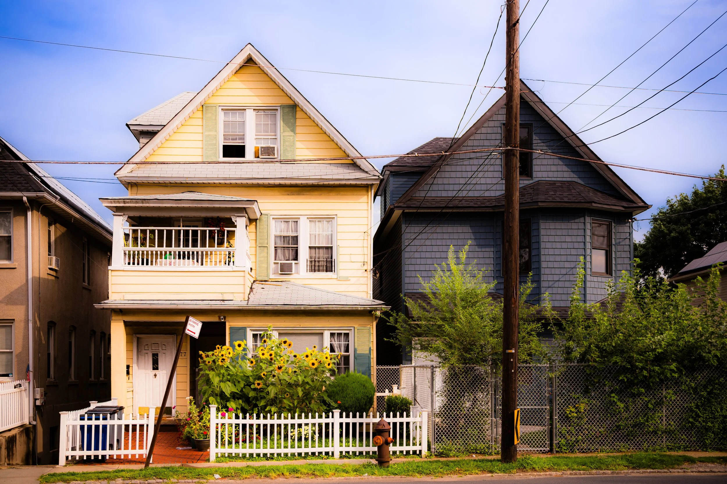
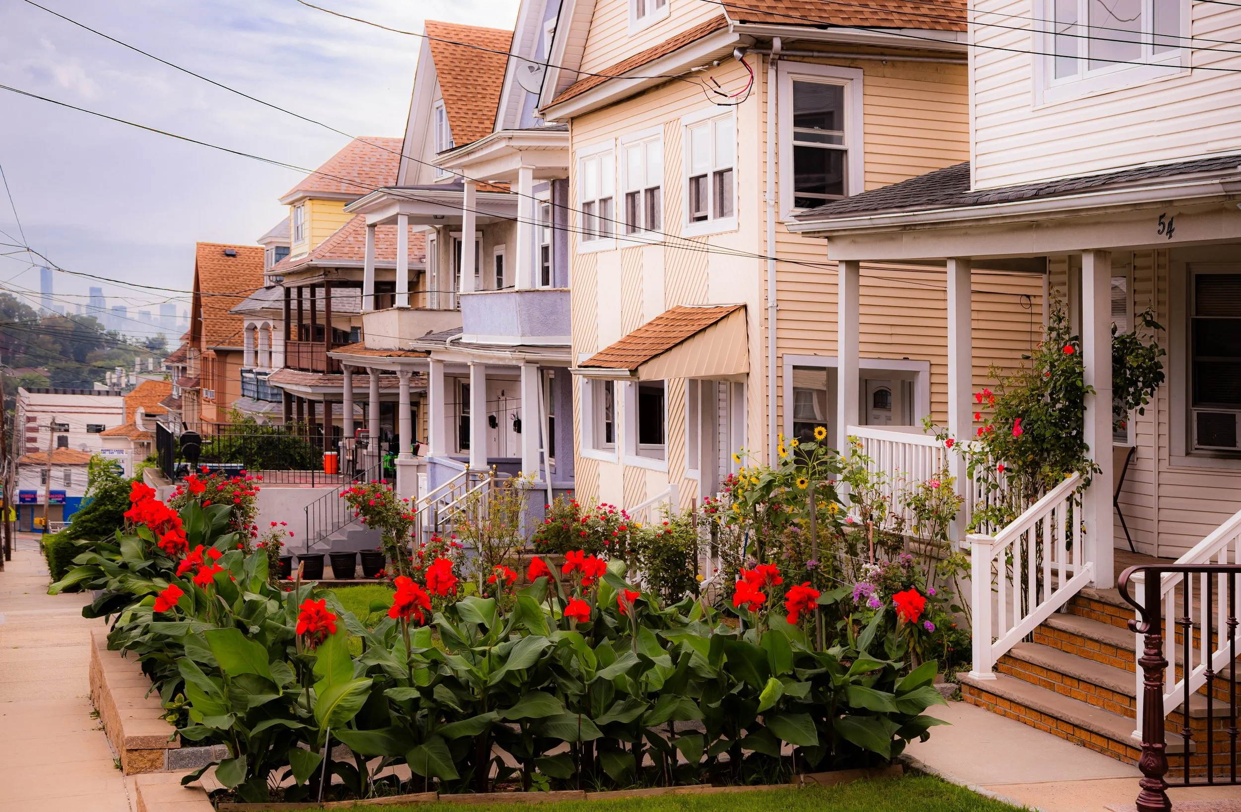
Residential development climbed the hillsides west of Bay Street, where rows of stately Victorian and Edwardian homes, some with bay windows and wraparound porches, overlooked the harbor. The streetcar and later the Staten Island Railway connected Tompkinsville to Stapleton, Clifton, and St. George, reinforcing its role as a transportation corridor. Schools, fraternal lodges, and small businesses flourished along Bay and Victory Boulevards, serving a population that blended working-class industriousness with middle-class ambition.
The area’s economic lifeblood, however, remained the waterfront. The Lighthouse Depot expanded its operations, employing hundreds and fostering a sense of civic identity tied to the sea. When World Wars I and II arrived, Tompkinsville became a hub for naval logistics and repair. Its shipyards contributed to wartime production, and its piers hosted fleets of merchant and military vessels. The sight of sailors crowding Bay Street’s taverns and diners became emblematic of the neighborhood’s harborfront character.

Tompkinsville Video Coming Soon
Mid–Late 20th Century: Decline, Resilience, and Transformation
The mid-20th century brought upheaval to Tompkinsville, as industrial decline and suburban migration reshaped Staten Island’s economy. The gradual closure of shipyards and the Lighthouse Depot (1966) ended the area’s maritime dominance. The construction of the Verrazzano-Narrows Bridge (1964) redirected traffic and commerce toward the island’s interior, leaving much of the North Shore waterfront underused and neglected. Many of the grand homes on the hills fell into disrepair, and Bay Street’s once-bustling commercial strip faced decades of decline.
Yet even amid hardship, Tompkinsville retained its sense of identity and community. Its population diversified dramatically during the postwar era, welcoming new residents from Puerto Rico, the Dominican Republic, and West Africa. Churches, mosques, and cultural organizations reflected this changing fabric, while small businesses—grocers, tailors, restaurants—infused the area with new life. The neighborhood’s mix of architectural styles and elevations preserved its visual richness even as its economy faltered.
In the 1980s and 1990s, artists and activists began rediscovering Tompkinsville’s potential. Affordable rents and proximity to the ferry attracted creatives and young professionals, who transformed vacant storefronts into galleries and cafés. Community groups launched cleanup efforts at Tappen Park and along Bay Street, while historic preservationists worked to protect surviving 19th-century homes and civic structures. These grassroots movements laid the groundwork for the neighborhood’s ongoing renaissance.
21st Century: Revival on the Harbor
In the 21st century, Tompkinsville has reemerged as one of Staten Island’s most vibrant and dynamic neighborhoods. The Bay Street Corridor revitalization initiative, stretching from St. George through Tompkinsville to Stapleton, has brought new infrastructure, housing, and cultural investment. Historic buildings have been adapted into apartments and creative spaces, while new mixed-use developments respect the area’s human scale.
Tappen Park remains the community’s green heart, surrounded by small restaurants, art studios, and the Staten Island MakerSpace, a hub for innovation housed in a converted warehouse. Murals and public art now enliven Bay Street, reflecting the neighborhood’s growing identity as a center of multicultural creativity. The proximity to the Staten Island Ferry and Empire Outlets has renewed commercial vitality, while the hillsides above still shelter quiet, leafy residential blocks with views of the harbor.
Cultural diversity remains Tompkinsville’s defining feature. West African markets, Caribbean cafés, and South Asian shops coexist with long-established Italian bakeries and American diners, creating one of the richest tapestries of community life on Staten Island. The Tompkinsville Park Farmers Market and neighborhood festivals celebrate this blend, linking the area’s maritime roots to its modern global energy.
The waterfront—once an industrial zone—has become a site of renewal and environmental awareness. Plans for expanded public access, green infrastructure, and climate resilience projects aim to reconnect residents with the harbor that first gave Tompkinsville its reason for being.
Tompkinsville Photo Gallery
Spirit and Legacy
The spirit of Tompkinsville lies in its dual identity: a place of deep history and constant reinvention. From Daniel D. Tompkins’s visionary ferry landing to today’s multicultural streetscapes, it has always been a neighborhood defined by movement—of ships, of people, of ideas. Its legacy endures in the echoes of its shipyards, the hum of its markets, and the enduring sense of possibility that rises from its hills.
Tompkinsville is the story of Staten Island in miniature: colonial outpost turned industrial engine, urban village reborn as creative crossroads. It remains the beating heart of the North Shore—where the island’s past meets its future, and where the harbor light still glints off the same waters that first carried Daniel Tompkins’s ferry two centuries ago.
New York City
Use this custom Google map to explore where every neighborhood in all five boroughs of New York City is located.
The Five Boroughs
One of New York City’s unique qualities is its organization in to 5 boroughs: Manhattan, Brooklyn, Queens, The Bronx, and Staten Island. These boroughs are part pragmatic administrative districts, and part vestiges of the region’s past. Each borough is an entire county in New York State - in fact, Brooklyn is, officially, Kings County, while Staten Island is, officially Richmond County. But that’s not the whole story …
Initially, New York City was located on the southern tip of Manhattan (now the Financial District) that was once the Dutch colony of New Amsterdam. Across the East River, another city was rising: Brooklyn. In time, the city planners realized that unification between the rapidly rising cities would create commercial and industrial opportunities - through streamlined administration of the region.
So powerful was the pull of unification between New York and Brooklyn that three more counties were pulled into the unification: The Bronx, Queens, and Staten Island. And on January 1, 1898, the City of New York unified two cities and three counties into one Greater City of New York - containing the five boroughs we know today.
But because each borough developed differently and distinctly until unification, their neighborhoods likewise uniquely developed. Today, there are nearly 390 neighborhoods, each with their own histories, cultures, cuisines, and personalities - and each with residents who are fiercely proud of their corner of The Big Apple.


